
please remember you can click on a photo to see a larger version & highlighted text are links to additional information
Our Backyard
I first heard about this location from a longtime friend who worked for the U.S. Forest Service. It has been on our list for years. Although close to home – fifty miles – it is a bit out of the way and is a close to two hour drive from here. Recently, I found that the USGS published a paper on five saline springs (including the one documented in this story), all close to our home – The Saltiest Springs in the Sierra Nevada. (It’s kind of cool, we know a few of the people mentioned in the acknowledgements in the research paper, including our friend.) What interested us most was the evidence of long-time use of these springs by Native Americans.
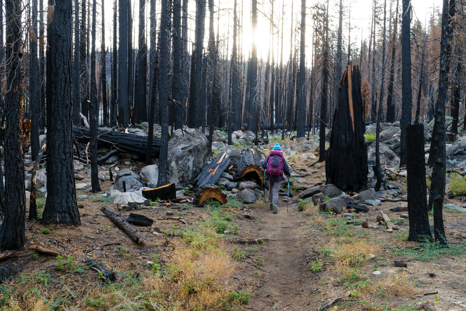
We left before dawn on a recent Sunday morning. Most of this drive is through the burn scar of last year’s massive Caldor Fire.
We were ready to begin the 12-mile round trip hike before 0900 hrs.
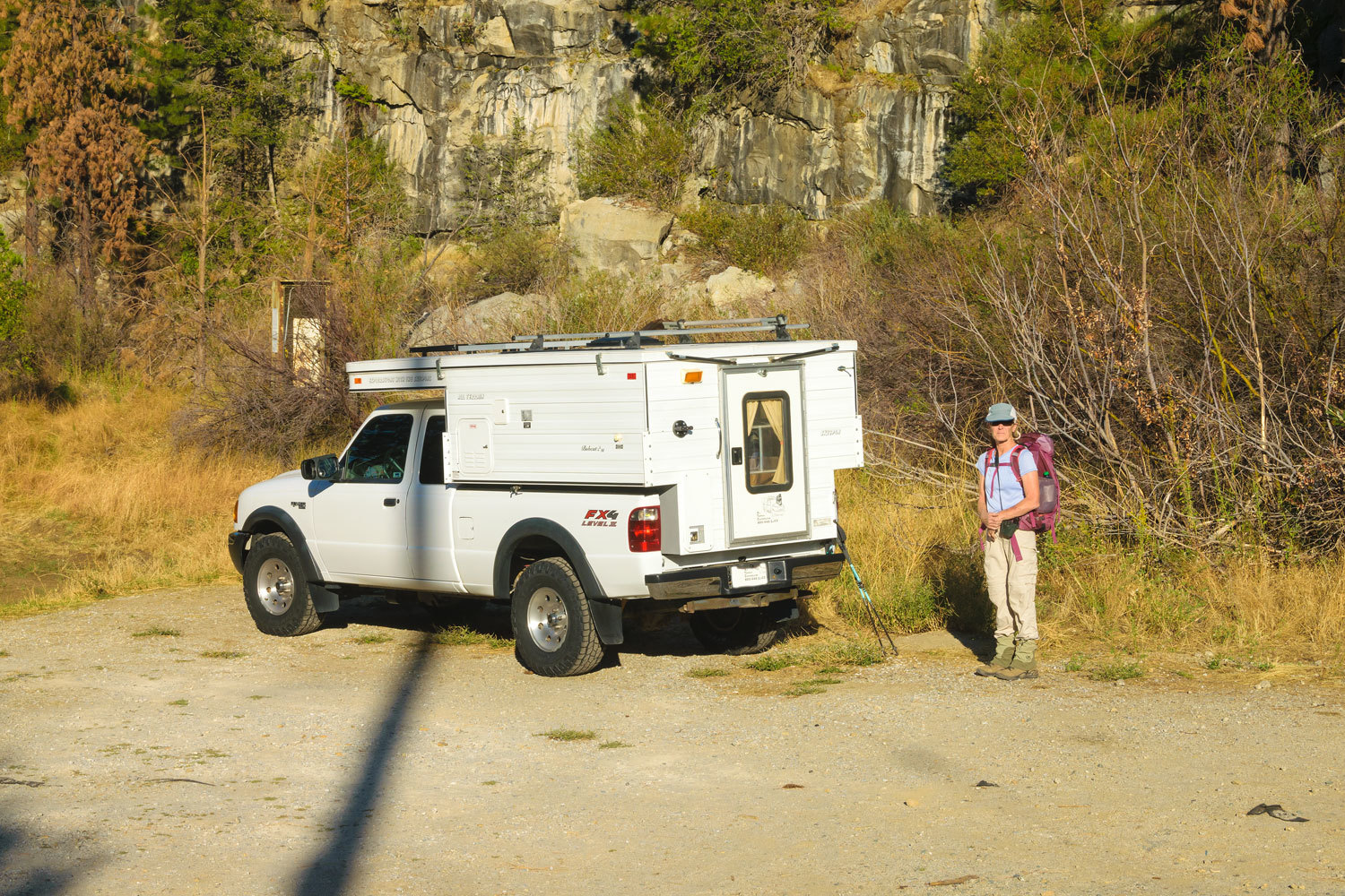
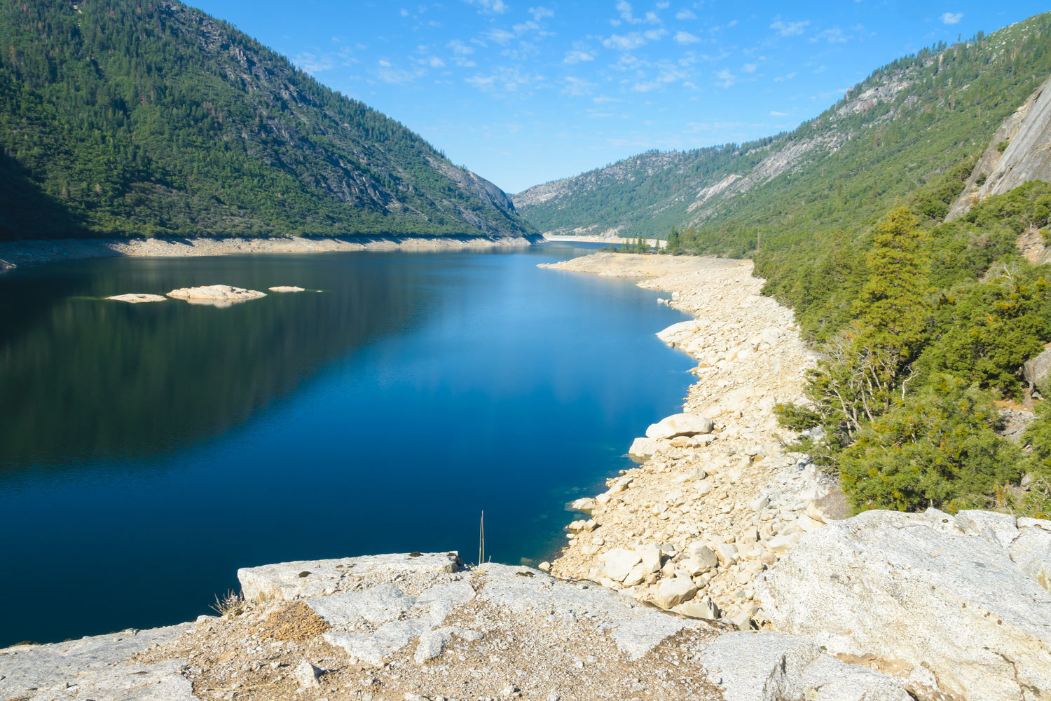
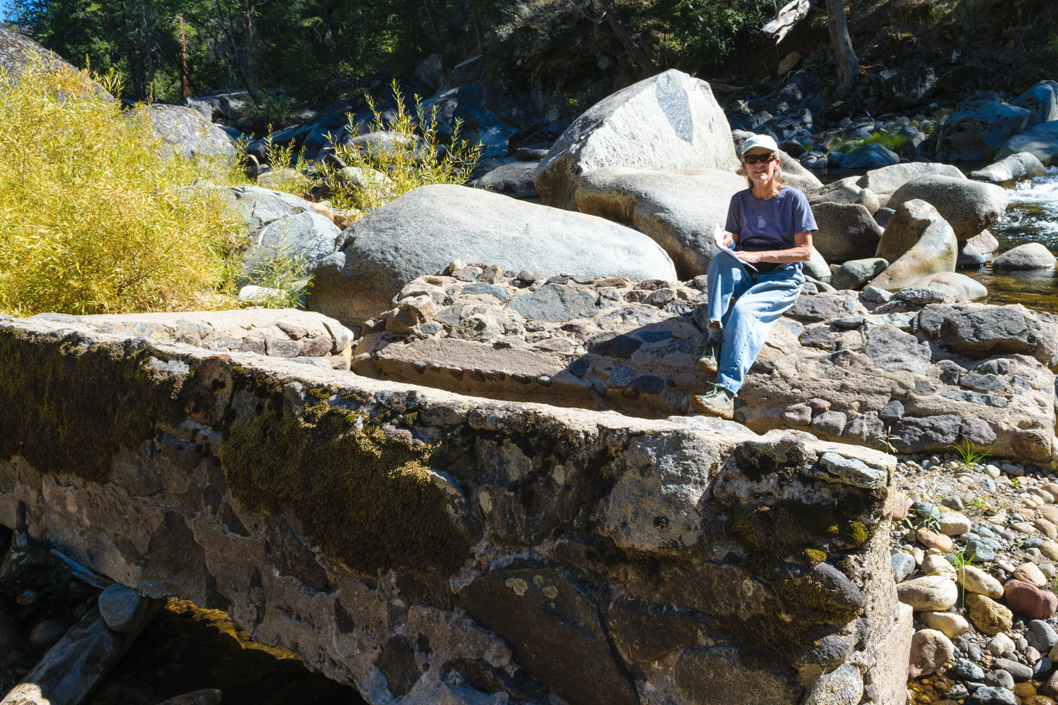
The hike began at the Salt Springs Reservoir dam.
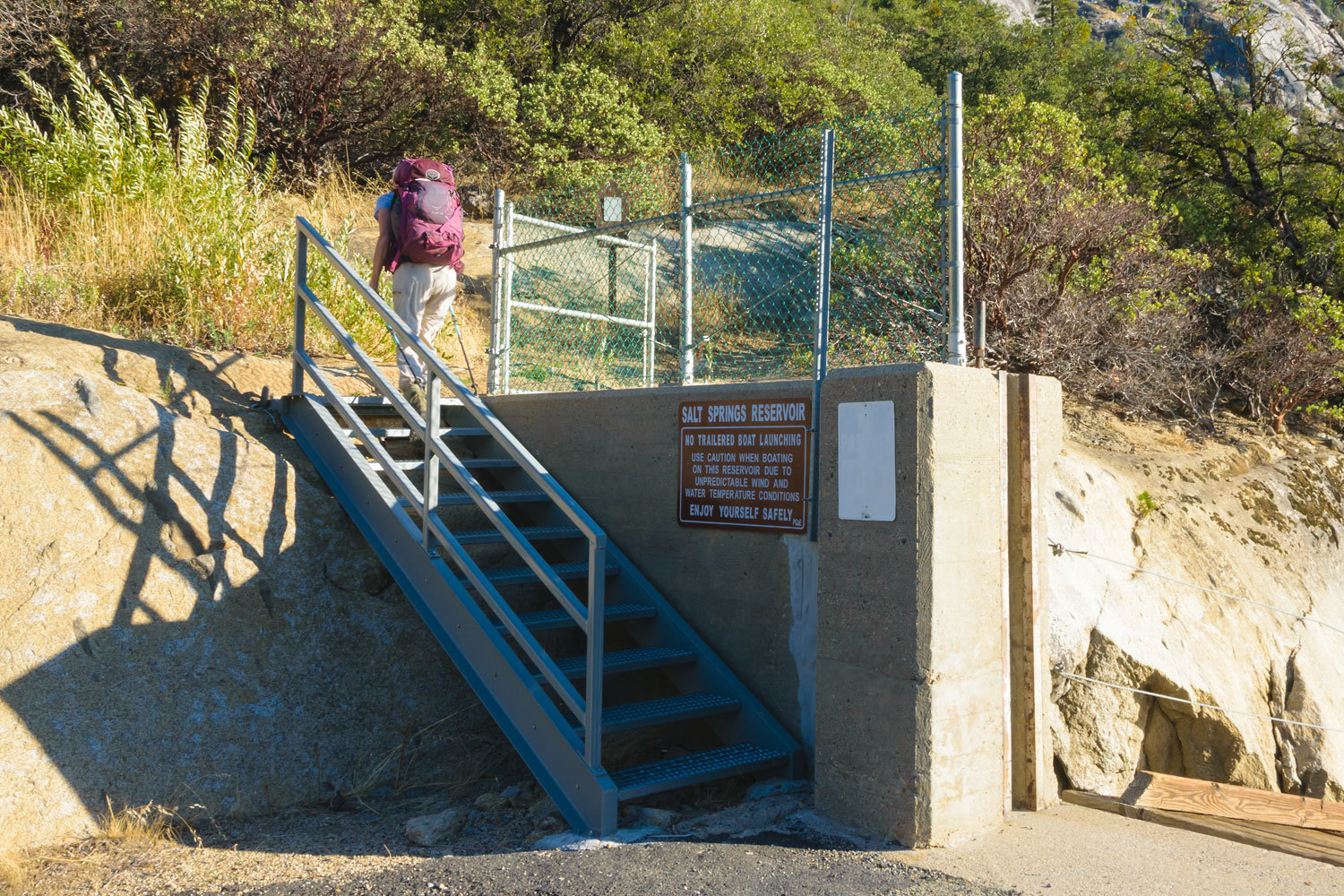
The dam was constructed in 1931 and is part of Pacific Gas & Electric’s Mokelumne River Project that includes reservoirs and powerhouses along the length of the Mokelumne River.
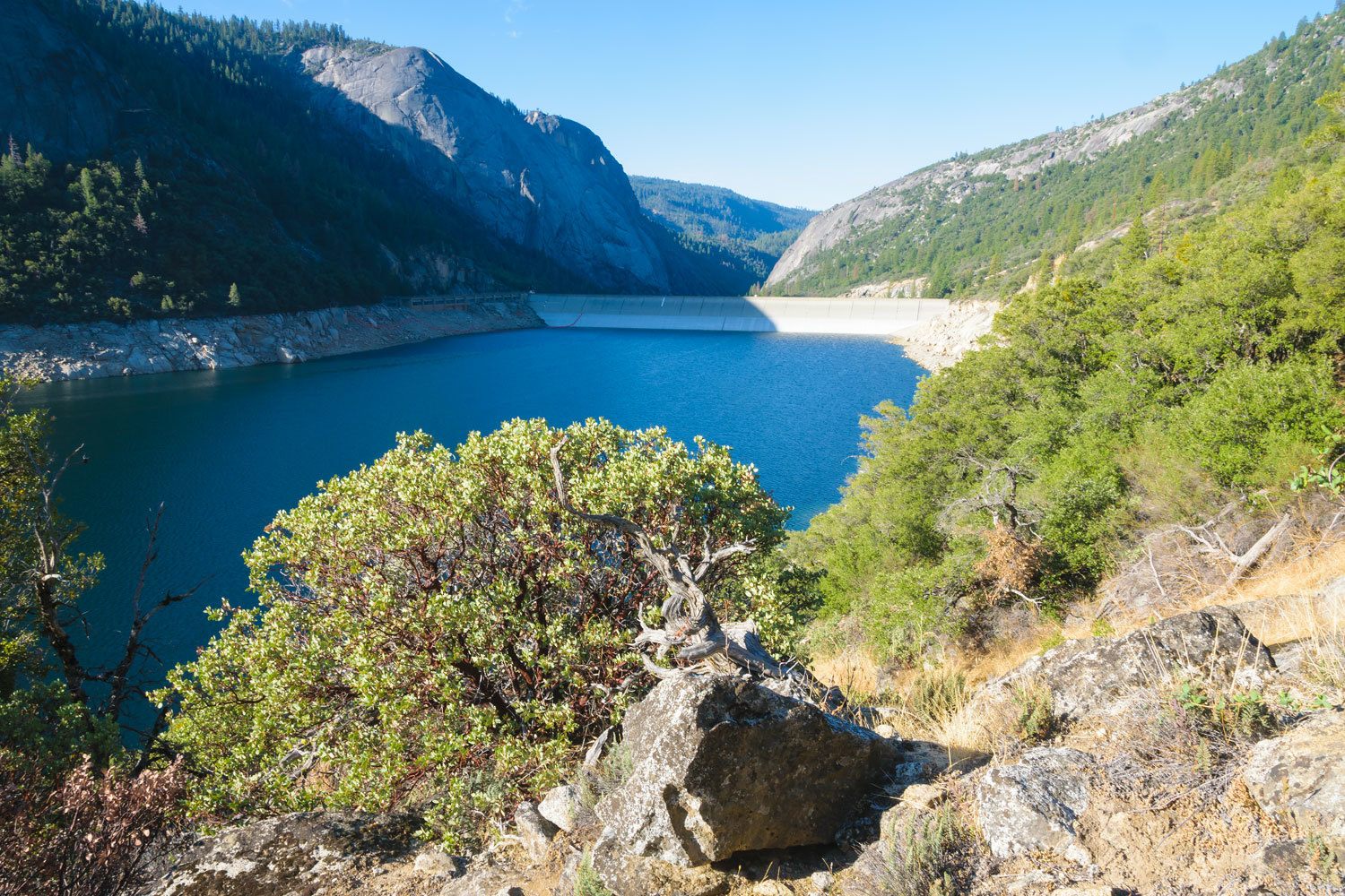
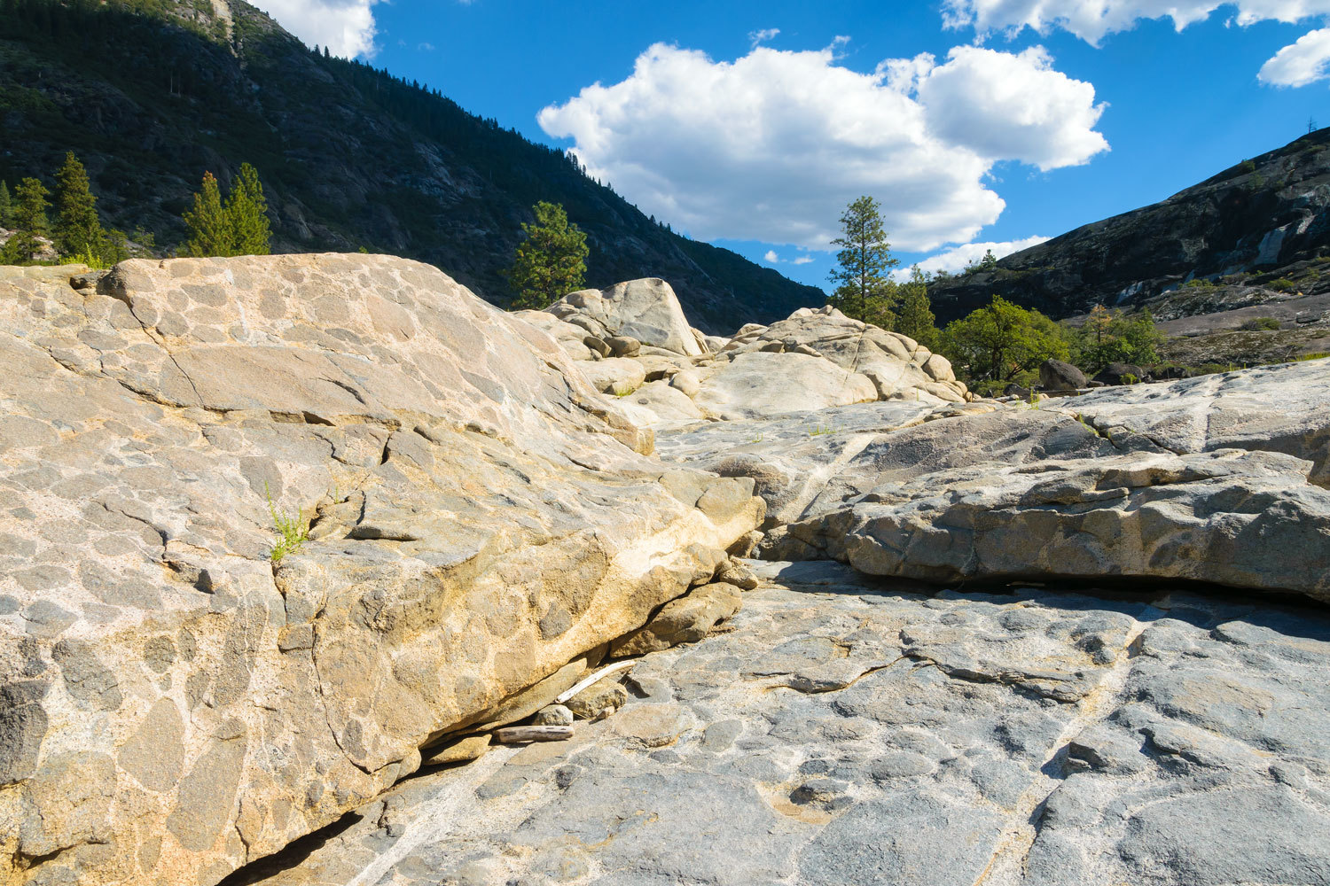
The trail traverses the north side of the reservoir in the steep walled canyon. Here is a view back downstream.
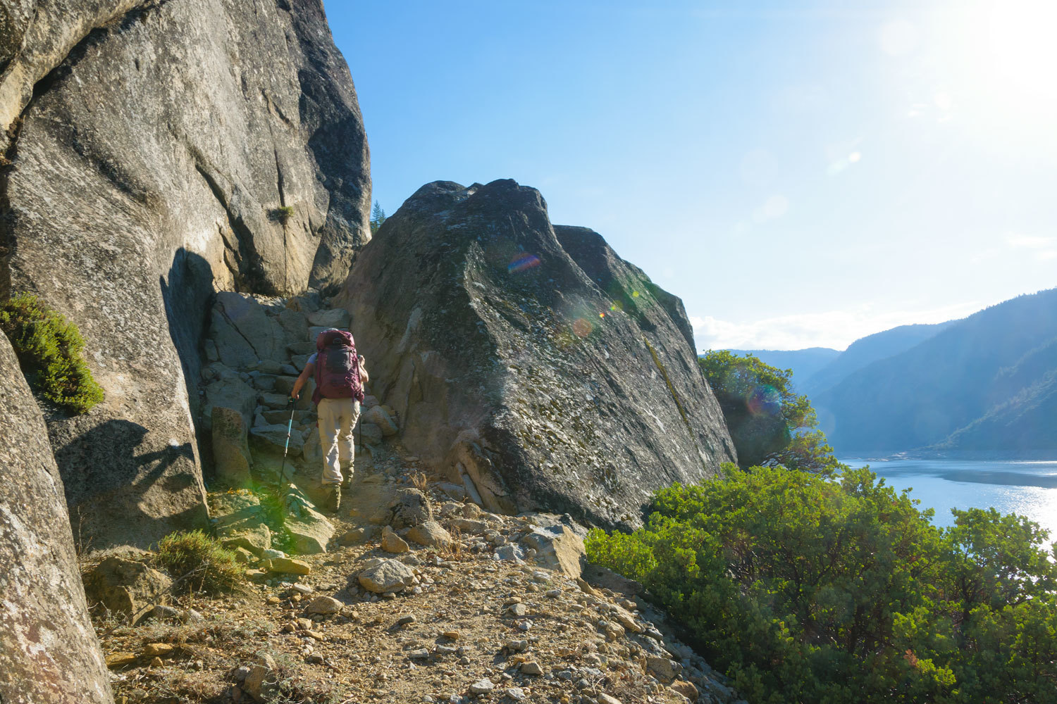
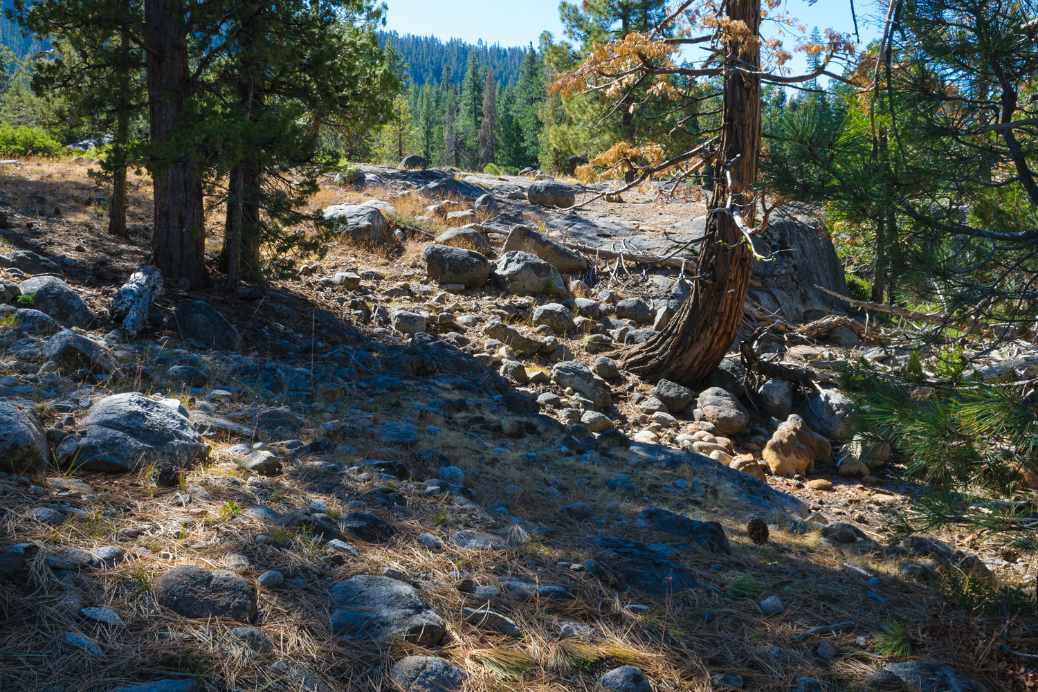
This is low elevation (for us) and the landscape is manzanita, chaparral, live oak woodland, and occasional pine and cedar. The trail gets little use and is a near constant up and down as it maneuvers around steep granite outcrops.
Our many years of drought in the West is evident; reservoirs with large bath tub rings.
Honestly, this was a miserable hike. Tiny gnats were ever present and hard to tolerate. They were in our eyes, noses, mouths, and ears. We stopped and applied bug spray. It made no difference. We hiked and constantly swatted – at least attempted to – the little bastards away.
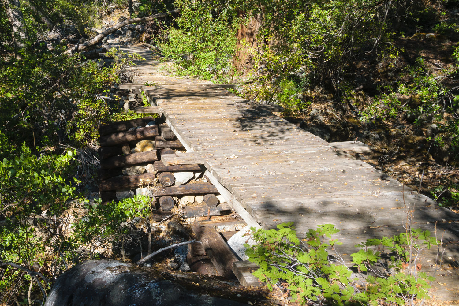
The trail crosses several steep side canyons with a variety of bridge types.
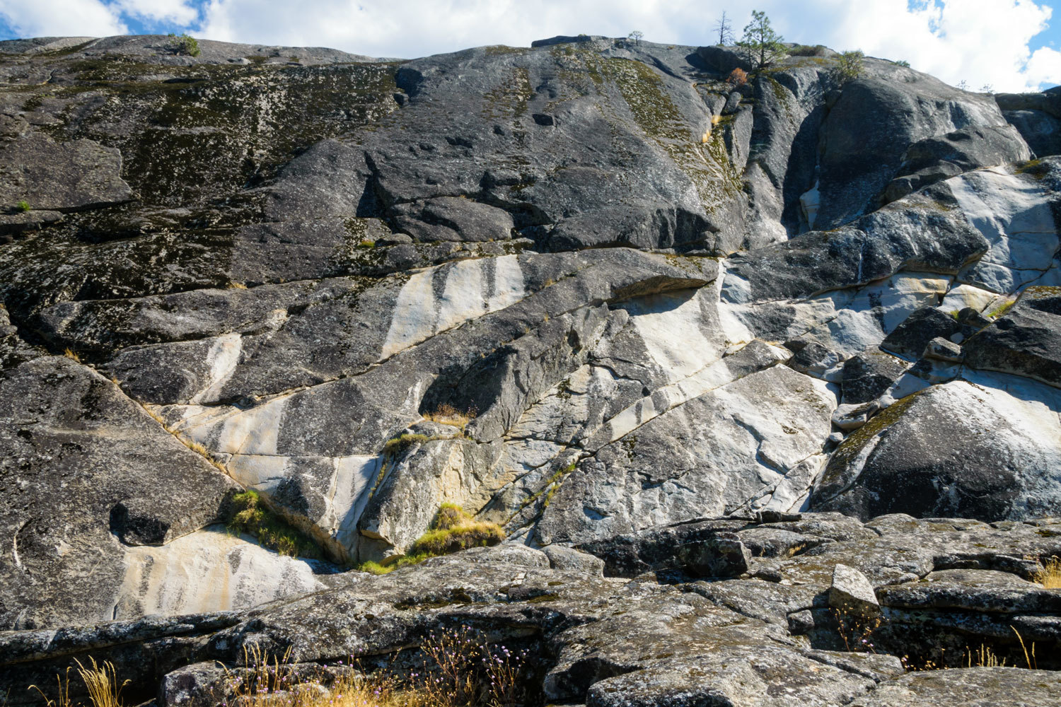
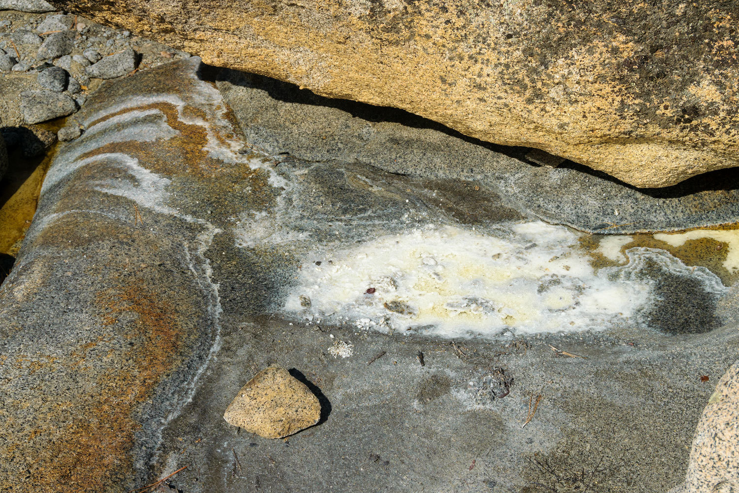
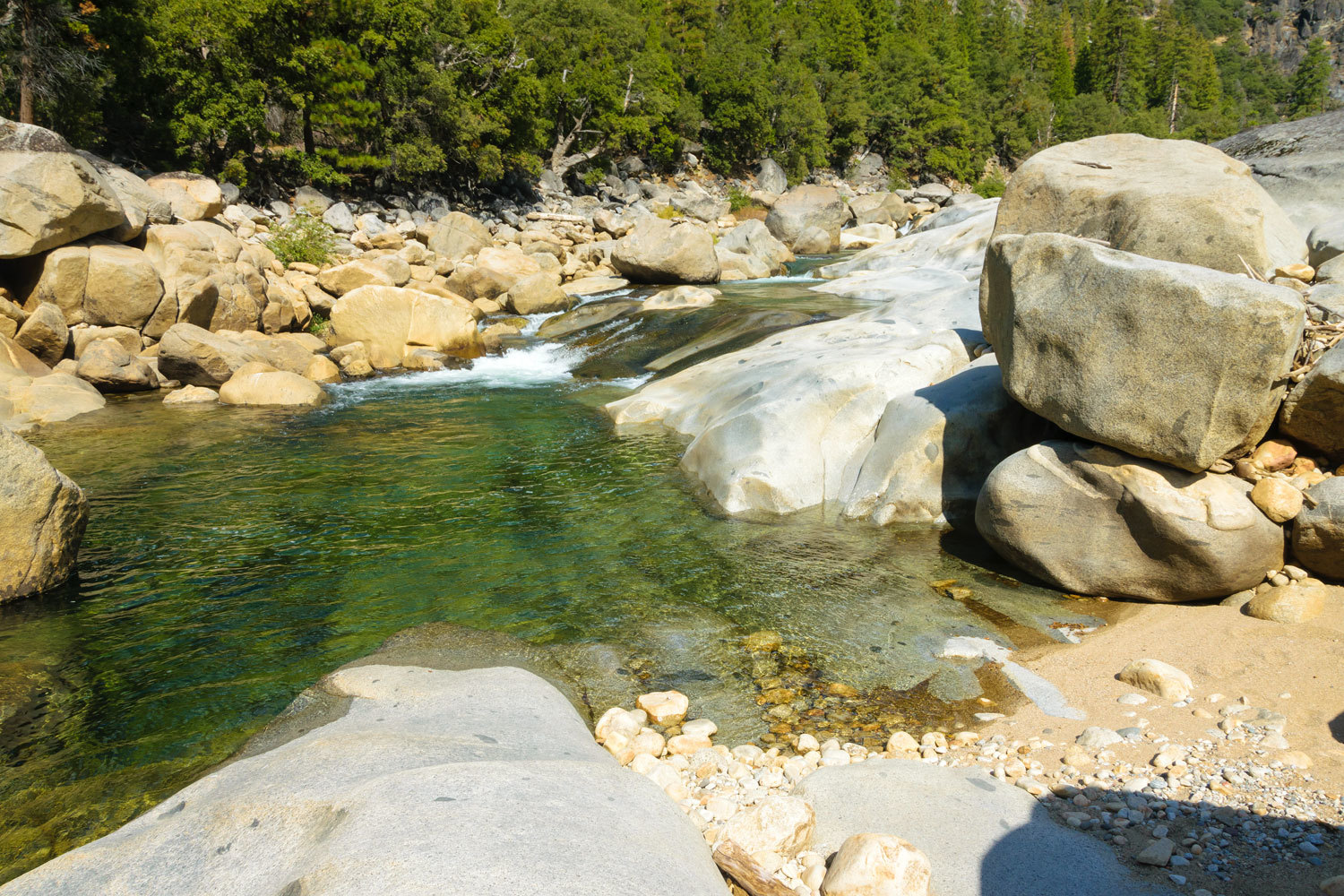
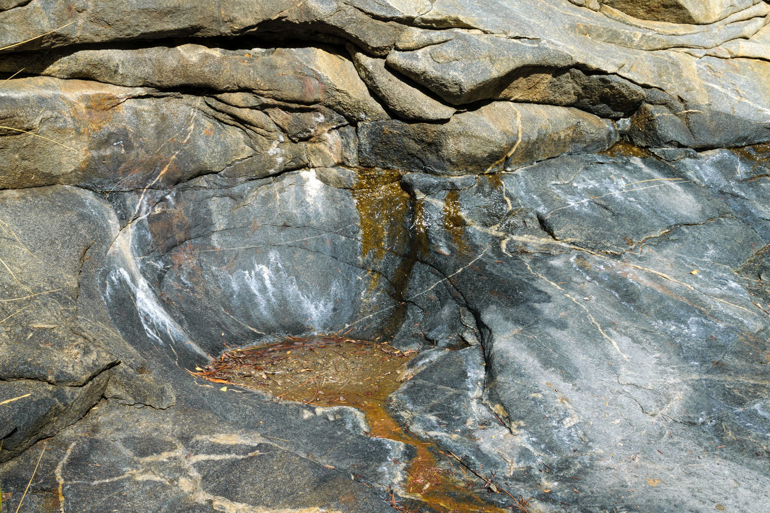
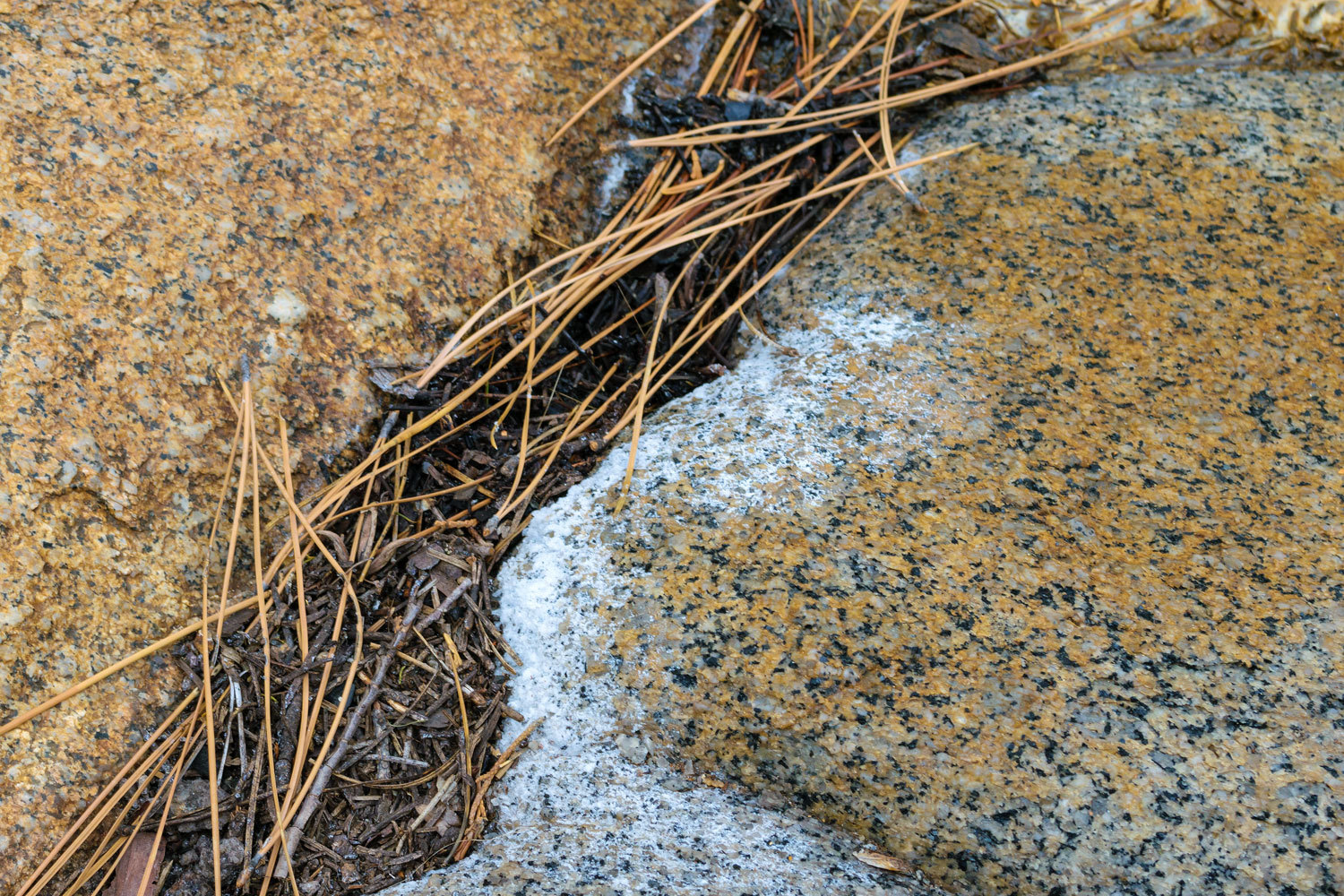
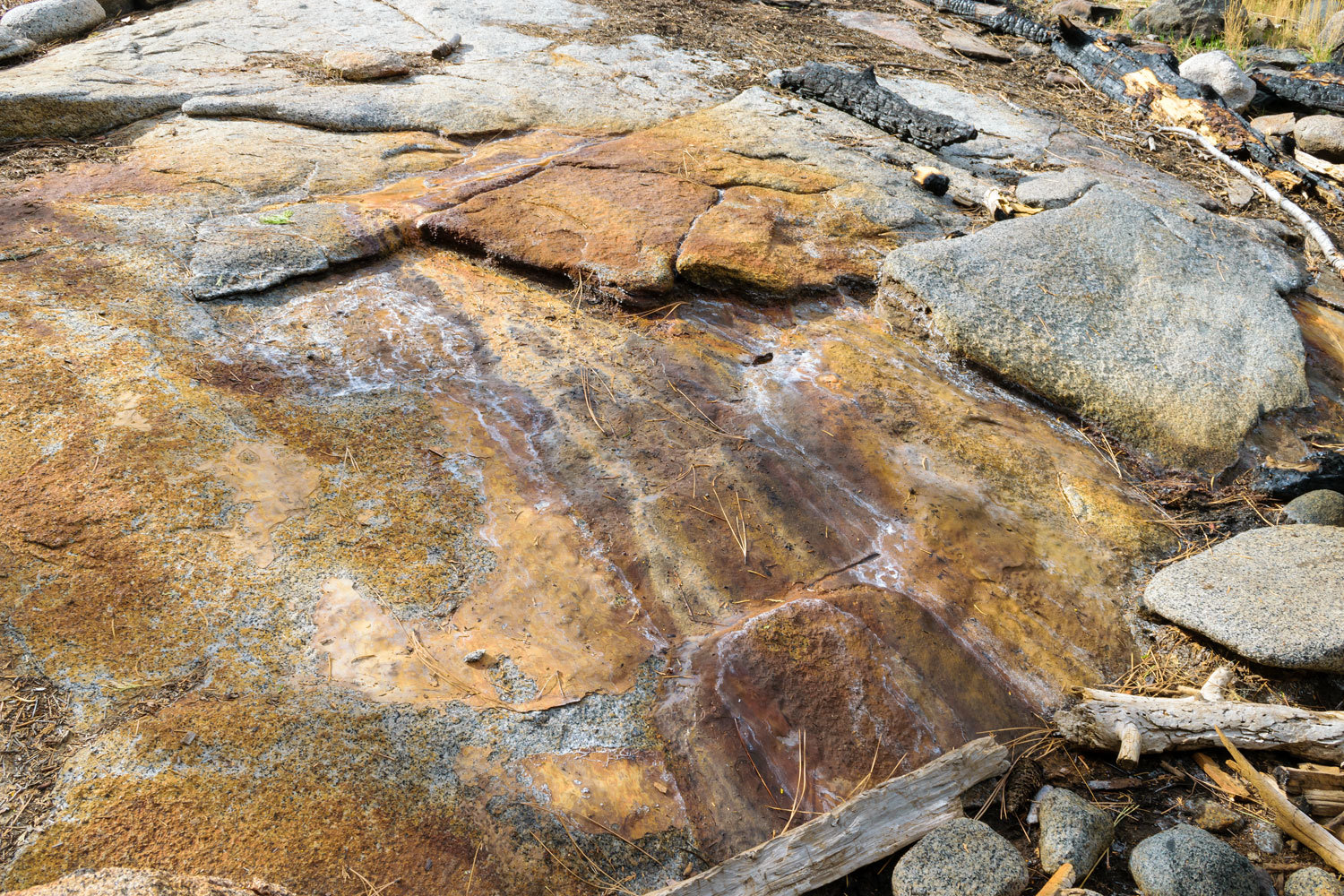
The reservoir is narrow and five miles long. At the upper end of the reservoir on a large granite outcrop, we saw flow lines on the granite bleached by mineral rich water, a definite clue.

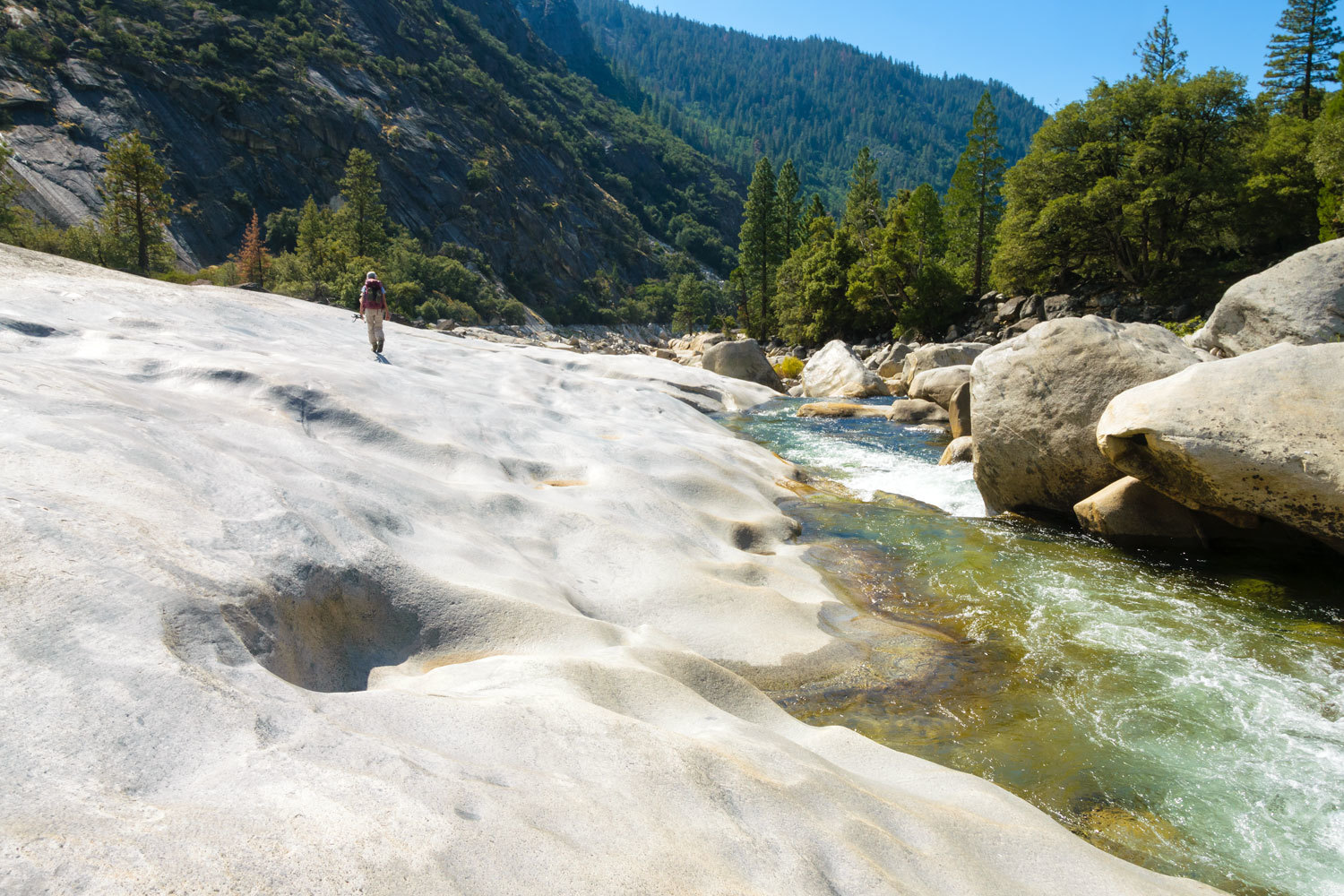
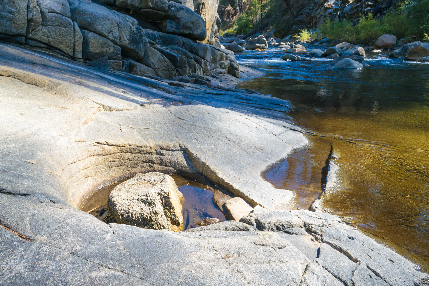
Our first task was finding a safe place to cross the Mokelumne River. The water was clear and deep and the river magnificent in the scoured granite bedrock.
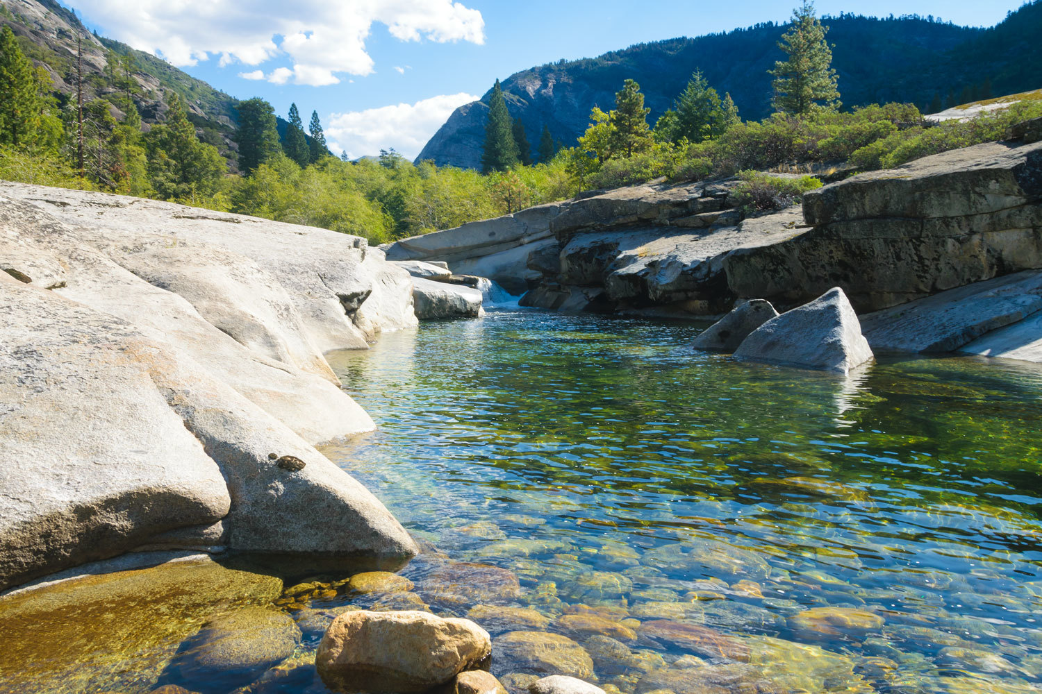
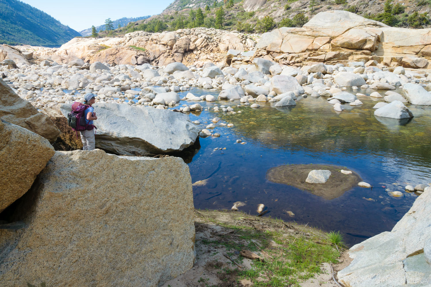
Finding no safe place here to wade across, we returned downstream to where the river widened in the broad plain of the dry edge of the reservoir and found a place – waist deep – to cross safely. We carried wading sandals with us for this task. One large chunk of granite caught our attention.
We worked our way back upstream to a large flat area at the base of the cliffs with the bleached water tracks. This looked like the perfect place for a habitation site. Evidence showed that it was.
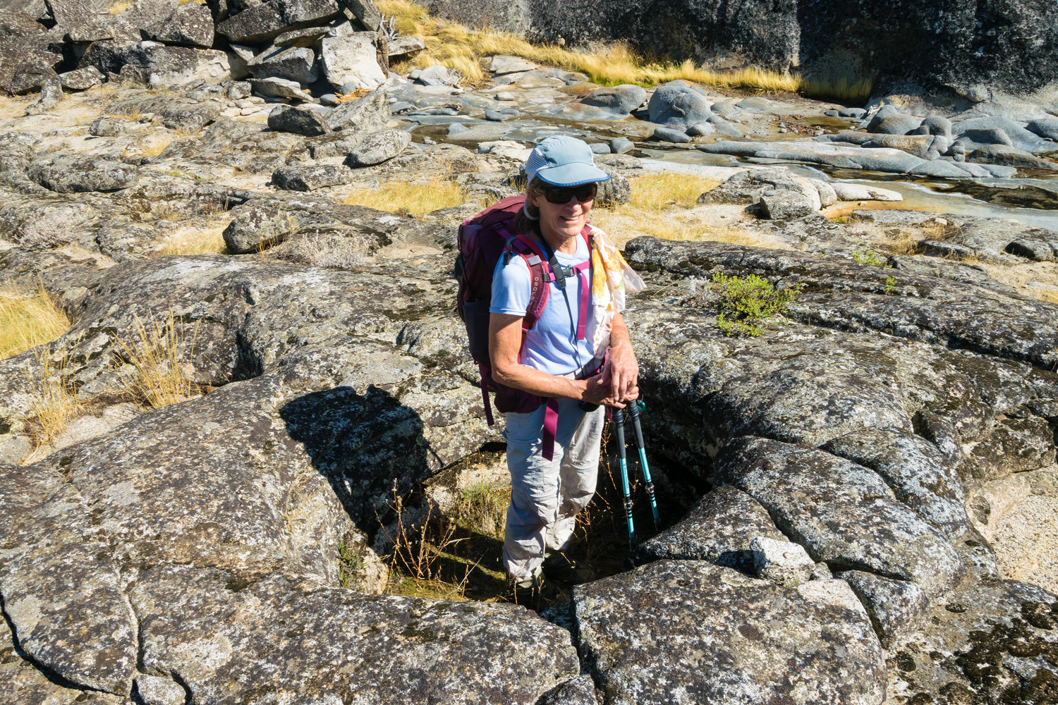
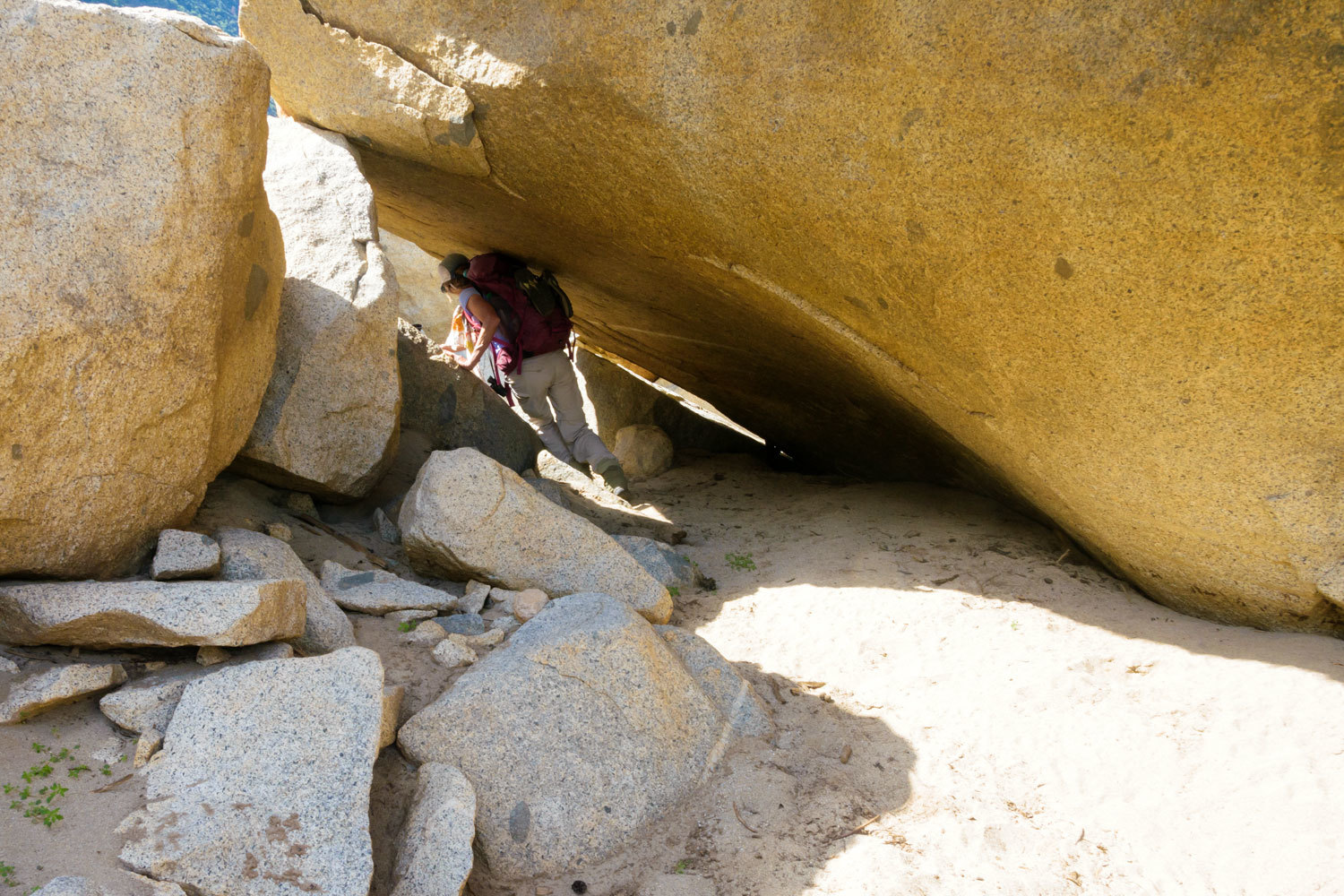
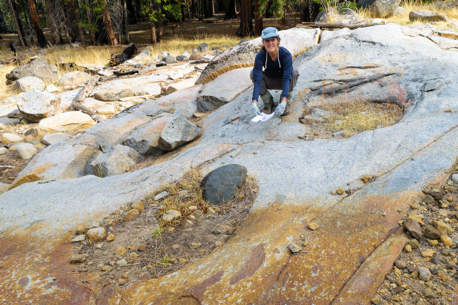
We climbed the granite and made our way up to the terrace along the base of the cliffs.
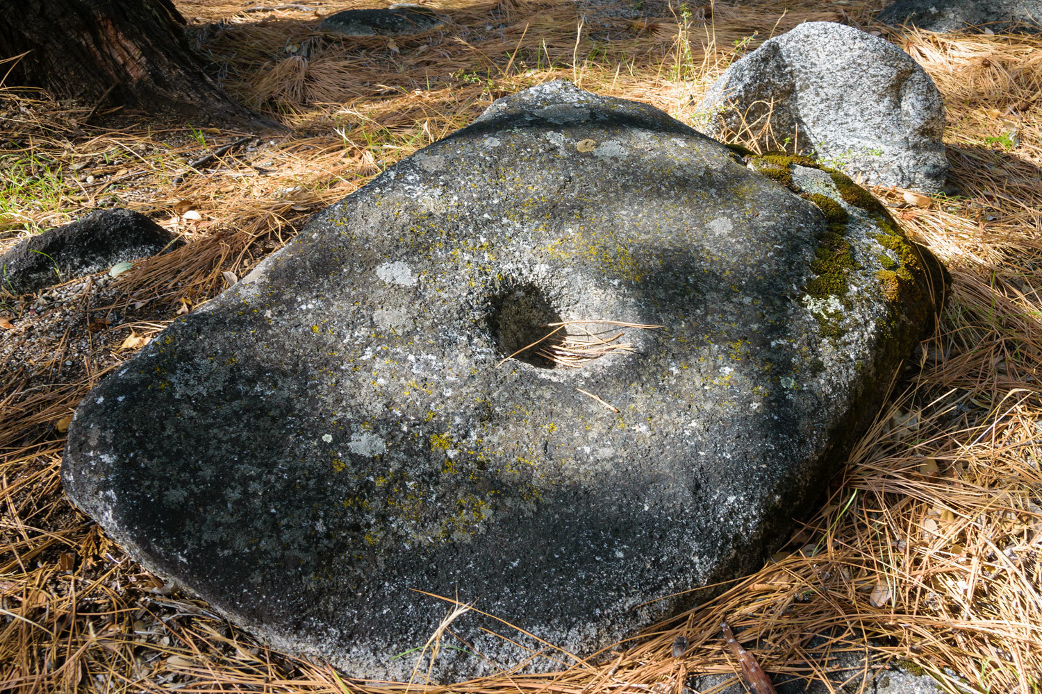
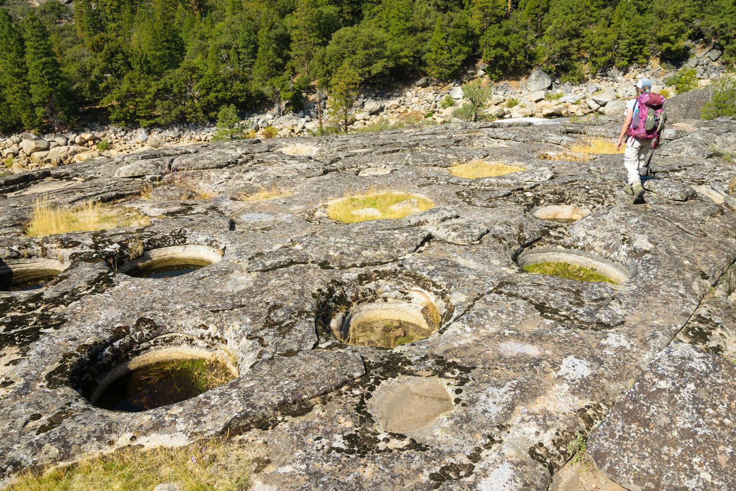
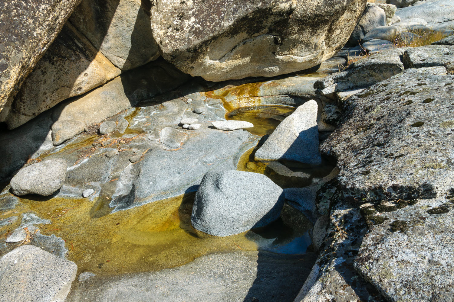
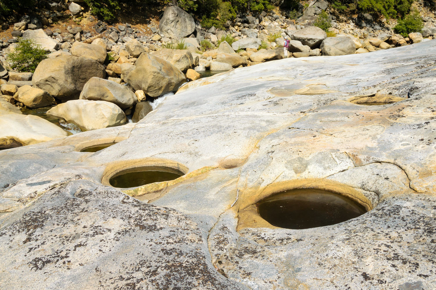
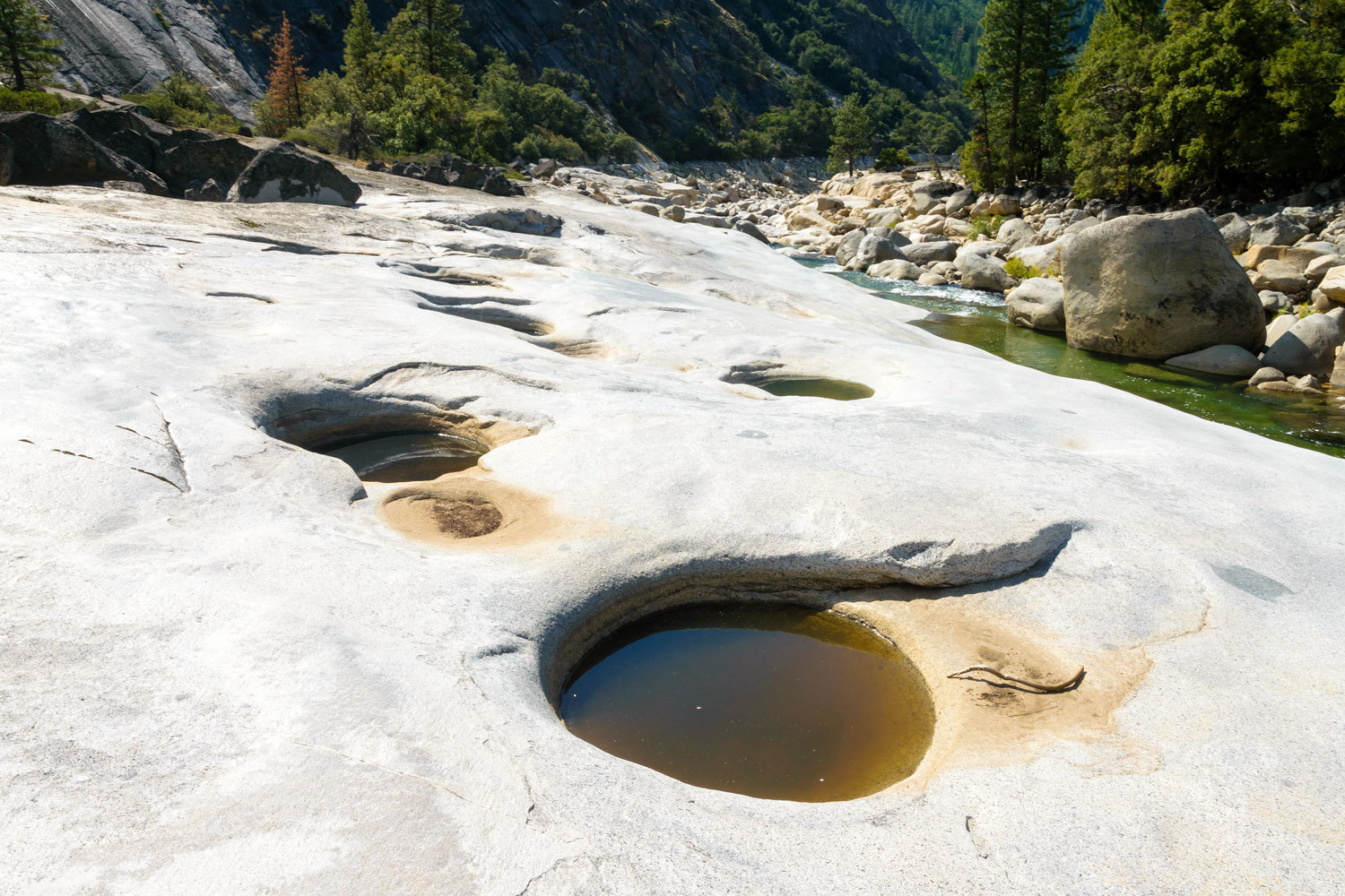
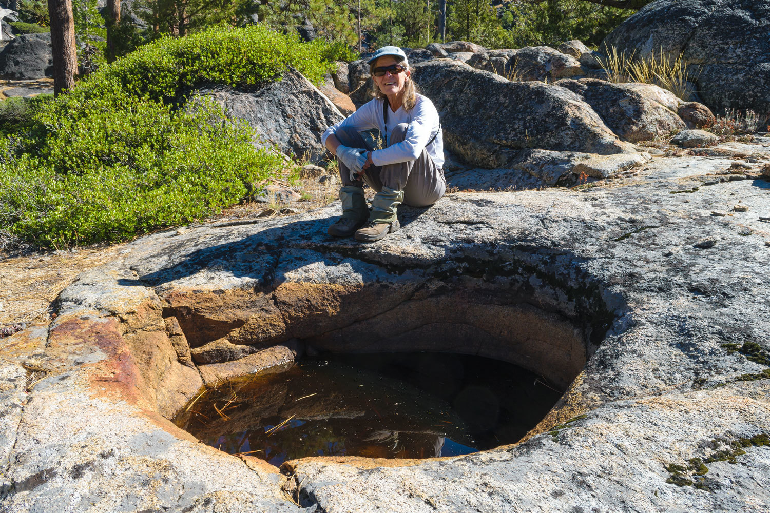
We came upon the first salt evaporation basins excavated by hand in granite possibly thousands of years ago.

These excavated basins average over a meter in width and 70 cm deep. They were filled with saline water from the salt spring and then left to allow the water to evaporate and leave crystalline salt for harvest. The USGS paper states a sizable seasonal population of indigenous people – Miwoks – were established here 3000 years ago. My sister-in-law is Miwok and serves in a leadership role with the Ione Band of Miwok Indians.
Here is an additional newspaper article on this site - Stone Basins May Be Miwok Salt Factories
This was salt gathering on an industrial scale. This is possibly the largest Native American salt gathering site in North America.
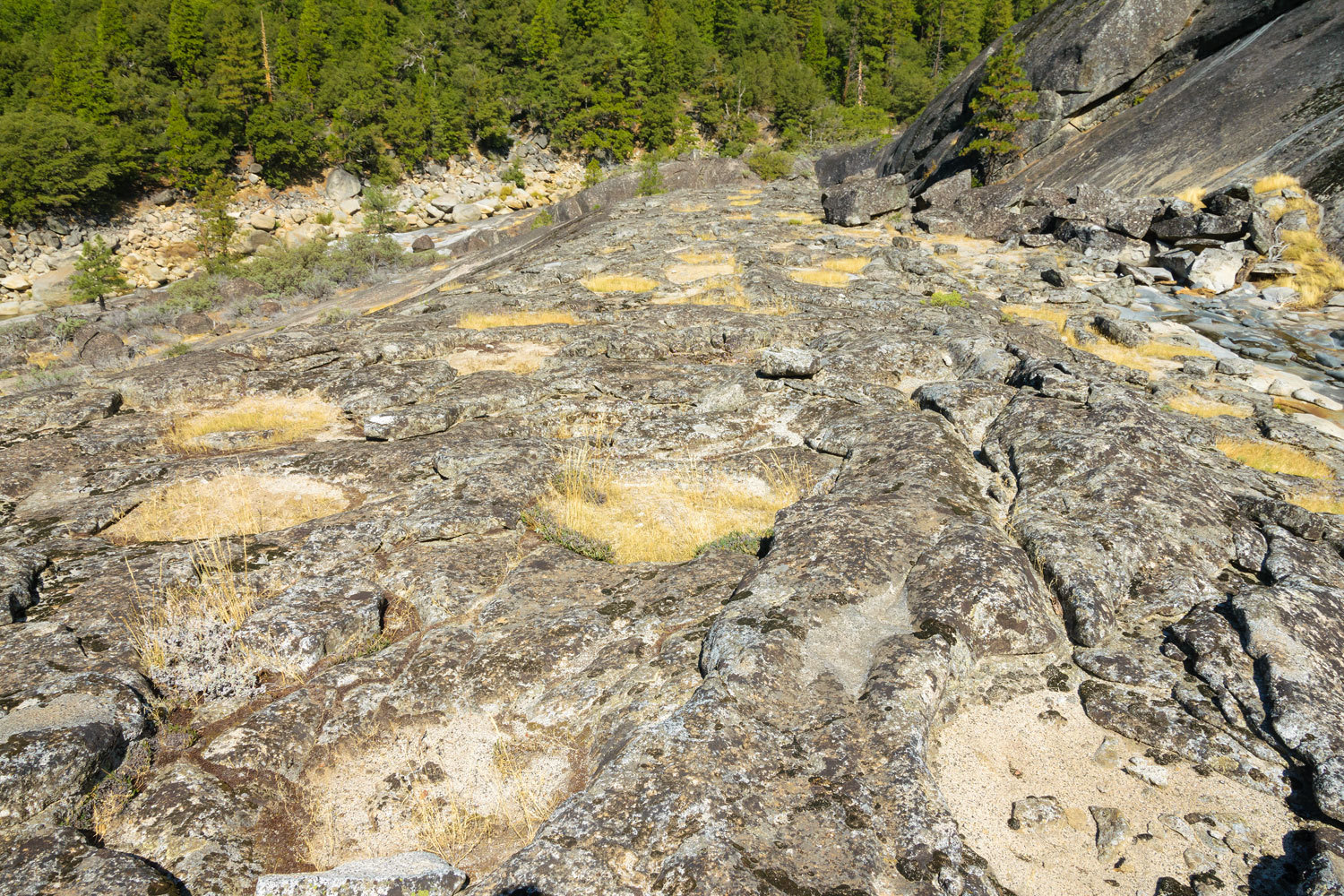

The text states there are 369 salt evaporation basins here. It is thought the excavation process began with fires to heat and fracture the granite and was then ground down by hand with stones. The amount of effort involved and the size of this site is staggering.
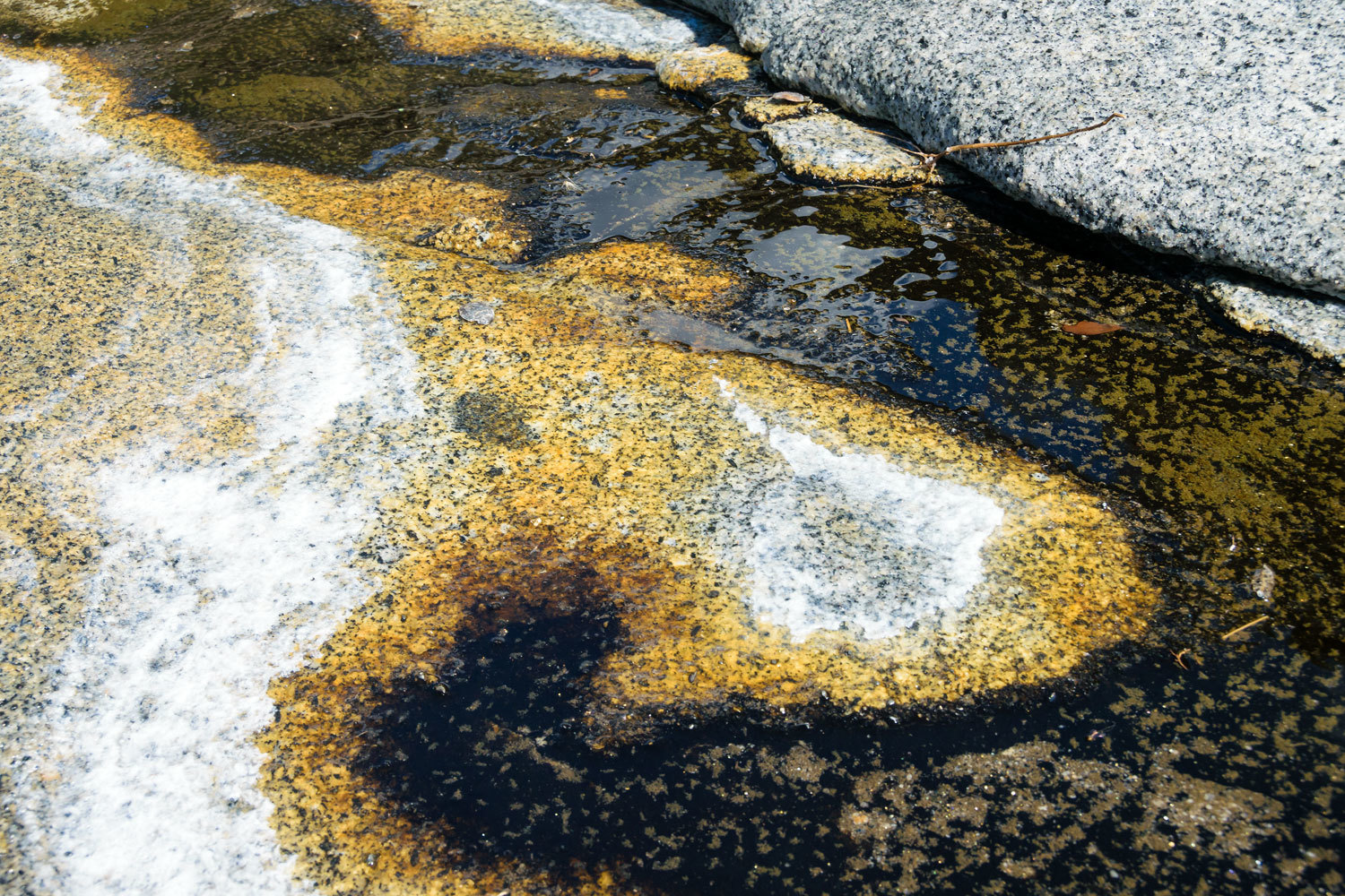
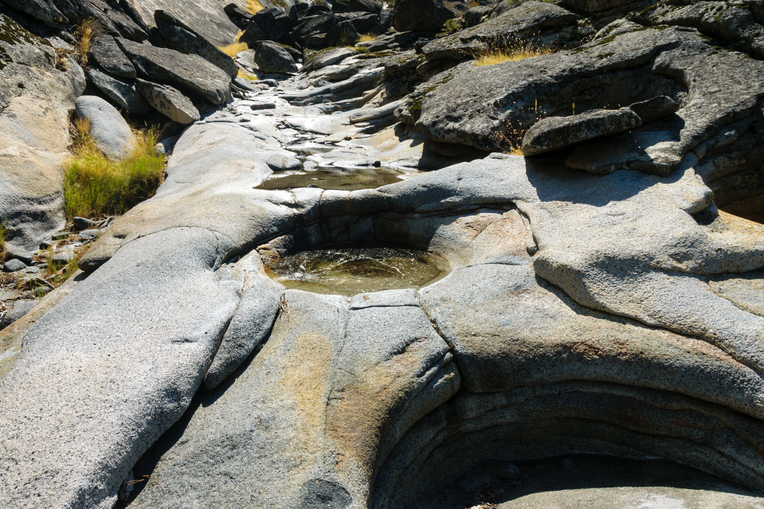
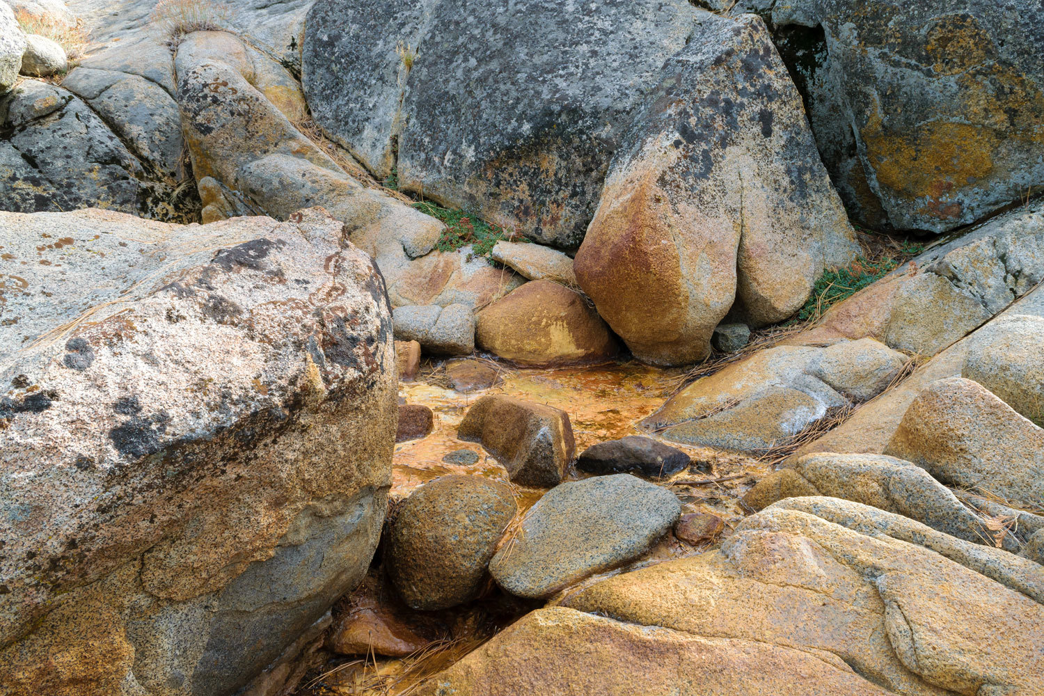
Salt water still flows from the fractures in the granite. The USGS paper has a fascinating section on the possible origins of the saline water in the “Saltiest springs in the Sierra Nevada.”
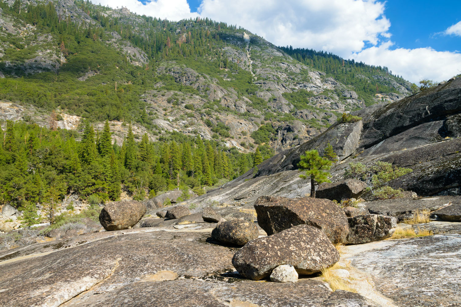
We continued our exploration of the area.
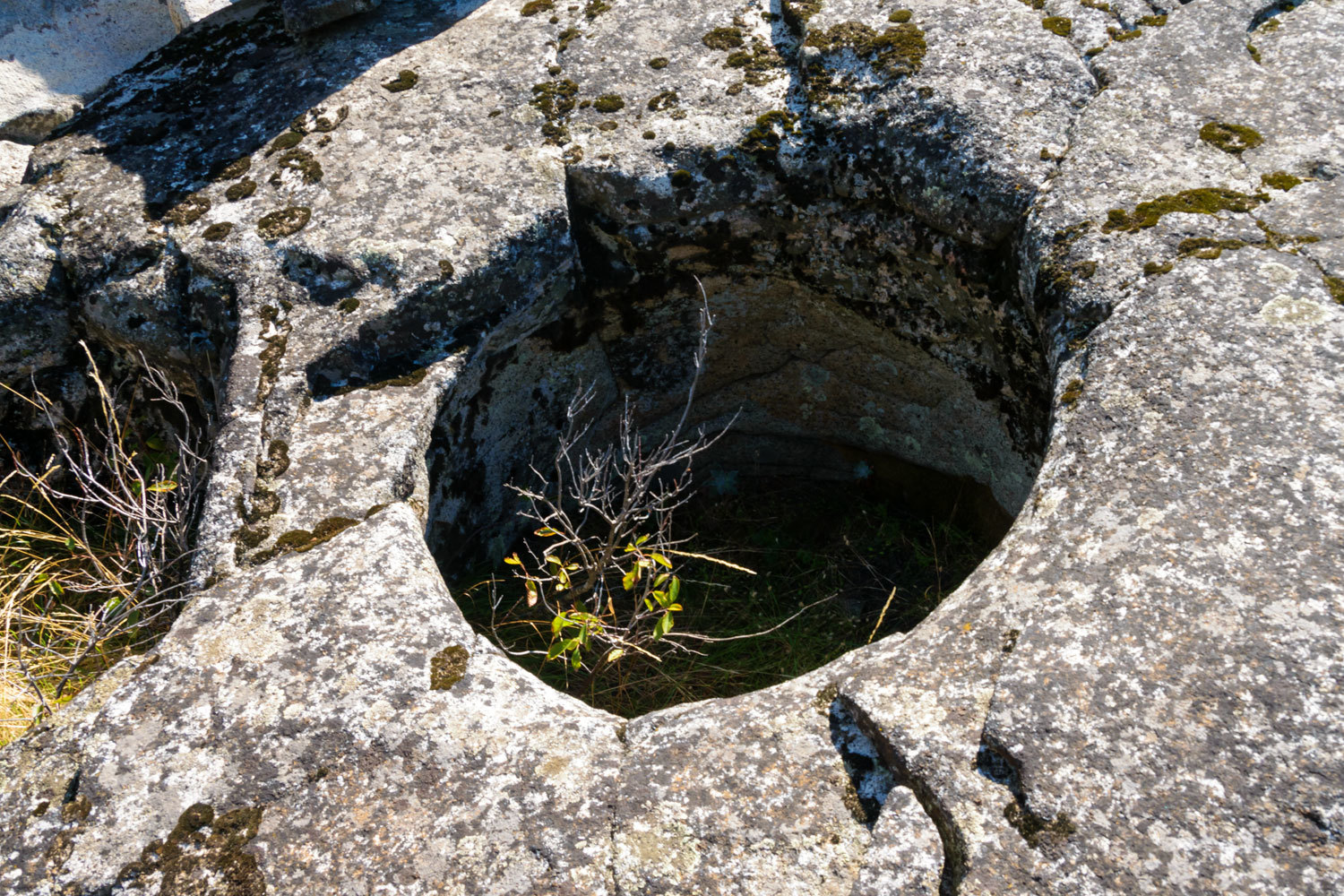
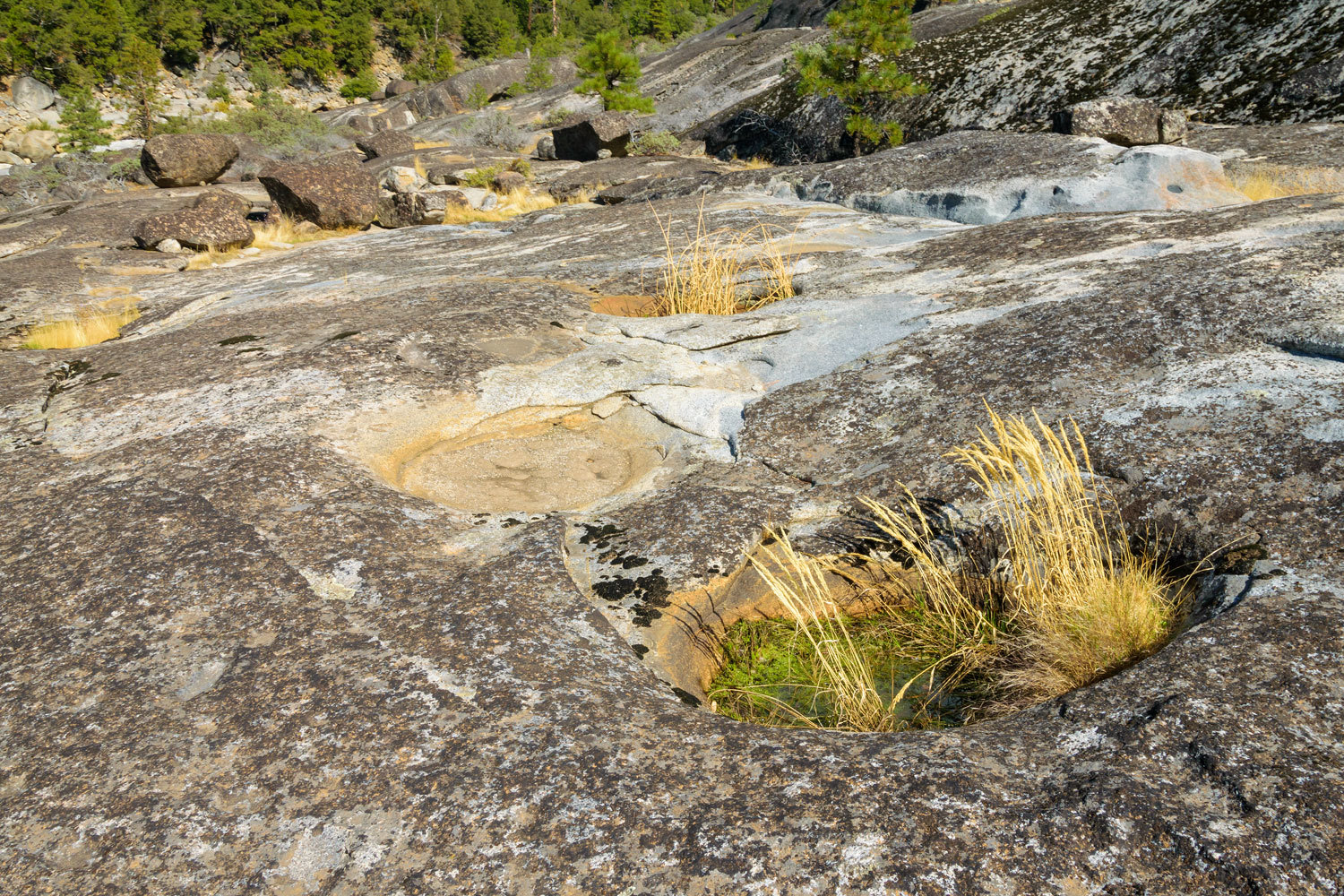
Please note in the above photo the basin under the huge boulder.
This basin must have been excavated prior to the boulder landing here, probably
breaking off from the cliff above.
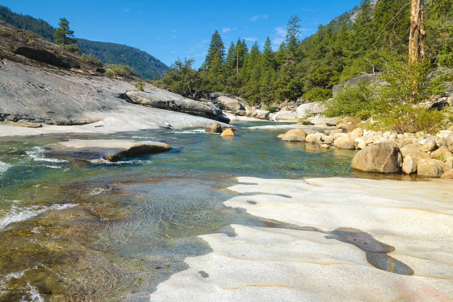
Basins are also present in the bedrock along the river. This is above the high-water line of the reservoir but in the floodplain of the river during spring snowmelt.
This is a spectacular place, both culturally and geologically.
We worked our way back downstream to our previous wading location. Nothing about this hike and landscape was easy. This is something we do not often say.
I had problems with the autofocus motor in my camera lens as the day progressed. It failed completely as I attempted to photograph Julie crossing the Mokelumne on our hike back to the trailhead. Since my retinal detachment repair in my left eye and surgery on the macula in the right, it is impossible for me to accurately focus manually with the viewfinder. Although I dearly love photography, it now has unique challenges for me. But there is no way I am stopping. A new lens is on its way here.
Since finding the USGS paper, I’ve put much time in with detective work. I believe I’ve figured out where the other salt springs are located and it will definitely take a lot of work to reach them. Are we up to the task? I expect we’ll keep you posted.
Addition:
The research and sleuthing skills paid off and we have now located and visited the four other salt springs mentioned in the USGS report.
Indian Springs
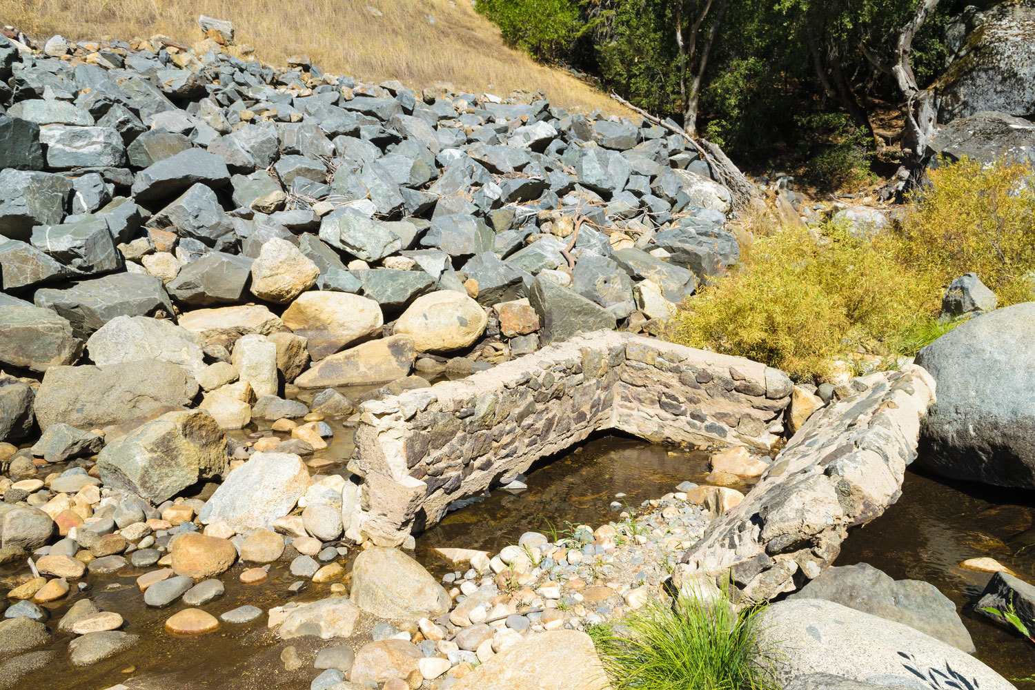
This site is along highway 50 in the South Fork of the American River canyon. Stopping along this busy traffic corridor is close to death defying. There is little shoulder along the highway and the drop down to the river is steep and treacherous. Very little remains at this site due to highway construction. If there were Native American salt evaporation basins, nothing now is evident. Salt water still flows out from beneath a piled boulder slope. In the 1920’s and 30’s a resort hotel was at this location to “take the cure” with the medicinal waters. I suspect the advertisements were similar to “it’ll make a blind man see and a lame man run!” The ruins of a soaking tub from the resort remain along the river.
White Hall Springs
Visiting this site along highway 50 was also death defying. Salt water issues from horizontal fractures in the granite.

Several excavated basins are present along the edge of the river. Several are submerged due to water releases from dams upriver that keep the river at a higher level than in the pre-European invasion times.

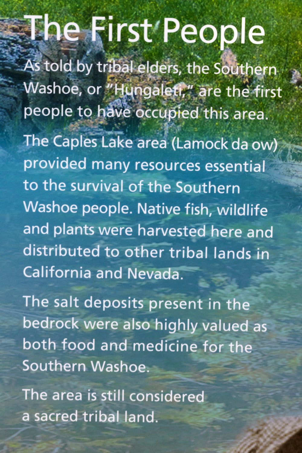
Fo Owa Spring
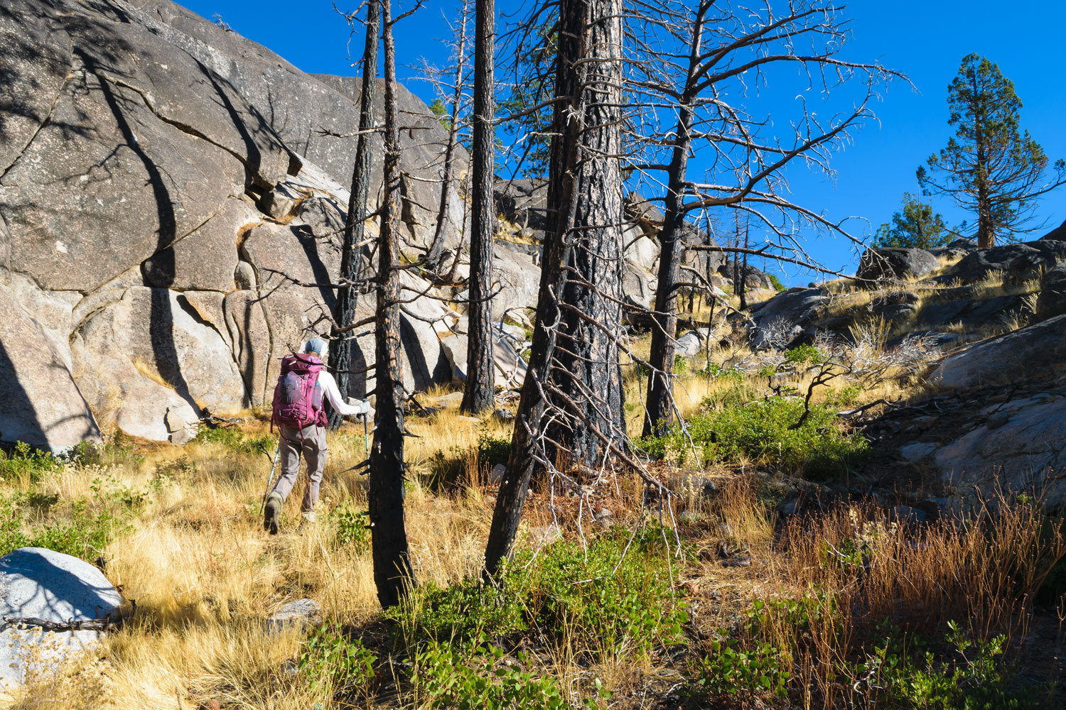
This was a 12 hike round trip hike – with cross country travel – to locate this spring. Much of the area was burned in last year’s Caldor Fire.

A sign at the trailhead identifies this area as being used by the Washoe People.
Along the way we discovered flakes of obsidian from ancient point and tool making.

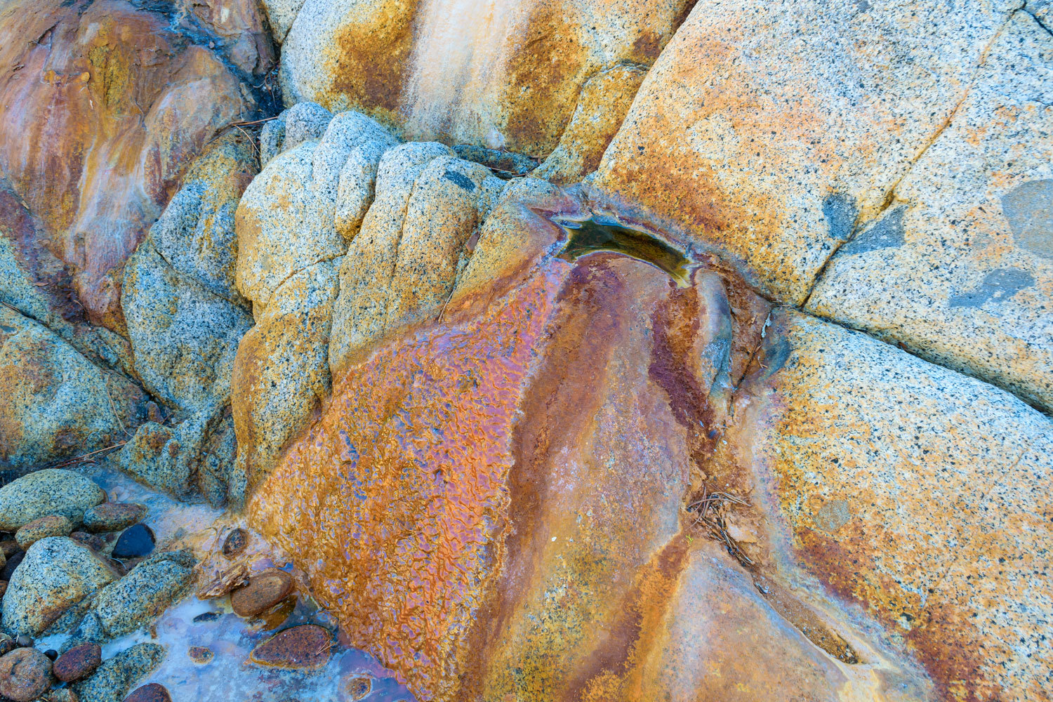
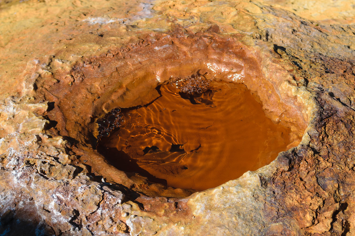
Fo Owa Spring issues from two travertine mounds about 100 yards apart.
The west spring’s travertine mound is atop granite and water no longer issues from the small vent on top.
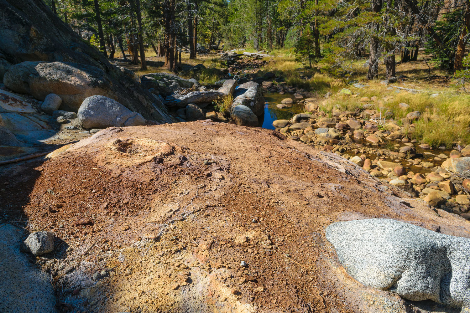
The water comes out from fractures in the granite below.
The water tastes quite salty with other mineral tastes.
The east spring’s travertine mound covers a granite slope and its waters discolor the water in the unnamed creek that runs below.

There are two vents atop the travertine that flow gas charged water.

There is one large hand excavated salt basin about 50 yards upslope and to the south of the west spring.
The route up to the basin would have been easy to carry water up.
This day we also spent quite some time searching for the fouth spring – Unabi Marmota – without success. But on our hike out I noticed terrain features that offered hints. Adding those hints to my research at home, I was convinced we’d have success with another hike into the area.
Unabi Marmota Spring
We got an early start just as the sun rose.
We found a wide still section of creek to wade.

We reached a wide-open area with granite stained by mineral rich waters. We had found the spring.

Salty water issues from several fractures around the site. Salt lines the flow paths. This was the nicest tasting salt of all the spring sites. There was very minor travertine build present at some locations.

There are six salt evaporation basins.


There were also the remains of a stacked stone structure.
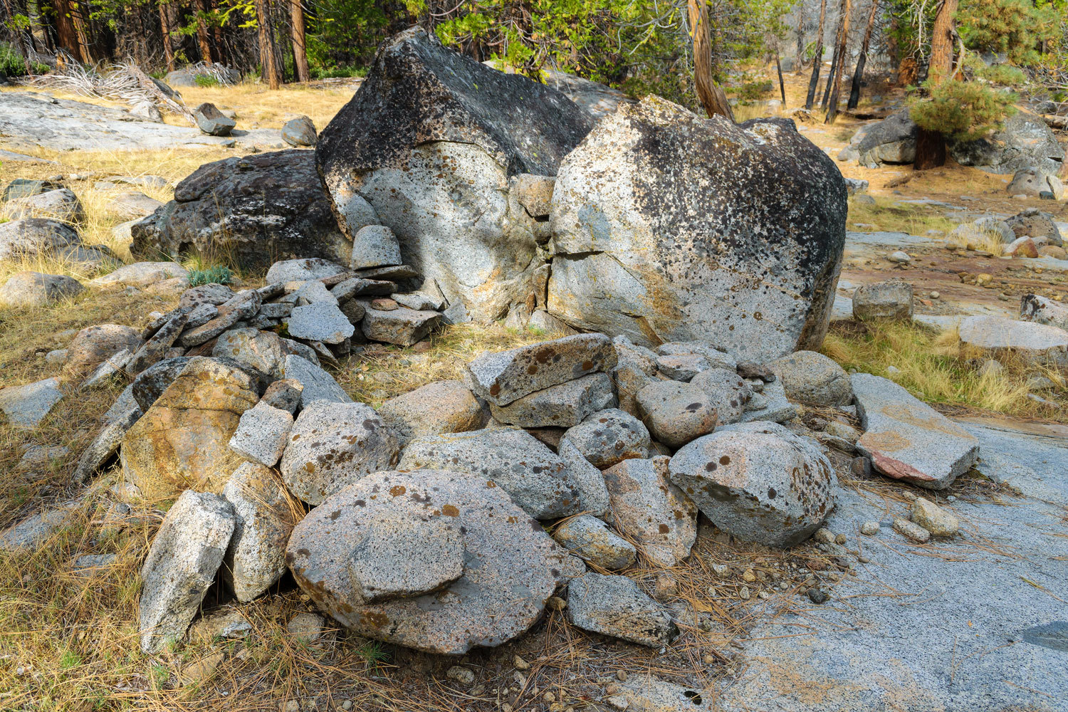
We wonder if this was possibly for storing salt harvested here.
It was an excellent and fun endeavor to figure out and then find the locations of these salt springs.
Thanks for doing the research and effort to see (and allow us to see) these fantastic remnants of Miwok technology! Much appreciated!
ReplyDeleteThanks Mr. Sage, we're glad you enjoyed this!
DeleteAlways fascinating trips. Enjoy the history. Thanks for sharing. JD
DeleteFascinating. If you guys say it wasn't an easy hike, I get scared.
ReplyDeleteThanks Deb! This was not an easy hike.
DeleteThat is an amazing place. But did you taste the water to see how salty it is?
ReplyDeleteThanks Taku! Yes, we sampled the saltiness of all the springs.
DeleteSounds like an epic adventure and I too am a bit turned off by the difficultly of the hike not to mention the annoying gnats! We drove the Mormon Emigrant Trail last week for the first time since the Caldor fire and it was quite the eye-opening and discouraging experience. So much lost...
ReplyDeleteThanks daverave! We drove Mormon Emigrant Trail/ Iron Mountain Road to reach the trailheads for most of these hikes. The burn scar from the Caldor Fire is haunting to see.
DeleteThanks again for sharing your adventure, I find this reall interesting!
ReplyDeleteDid you take yer flyrod?
We sure found it interesting Mr. Sage. No fly rod. We were covering ground and making time.
Delete