
please remember you can click on a photo to see a larger version & highlighted text are links to additional information
Thirty-nine Years
The Lady asked for three things to celebrate our thirty-ninth wedding anniversary – a stone corral, a stone house, and a high alpine lake. She’s worth it. She gets most everything she asks for.
We left home mid afternoon on Friday. After stopping for a quick dinner at Walker Burger in Walker, California, we continued on as the daylight waned until reaching “Ted’s Camp” at 9100 ft., off of the Virginia Lakes Road.
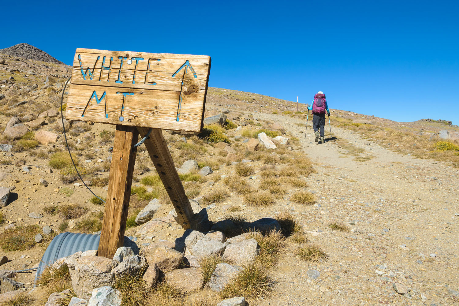
The next morning - our 39th anniversary - we continued south on highway 395 toward the Lady’s first desired hike high up in the White Mountains. It is a long drive out to the end of the White Mountain Road (some of the historic information is not correct in this link), and we arrived about 1400 hrs. Deciding to make use of the remaining daylight, we started the hike out to the Stone Corral.
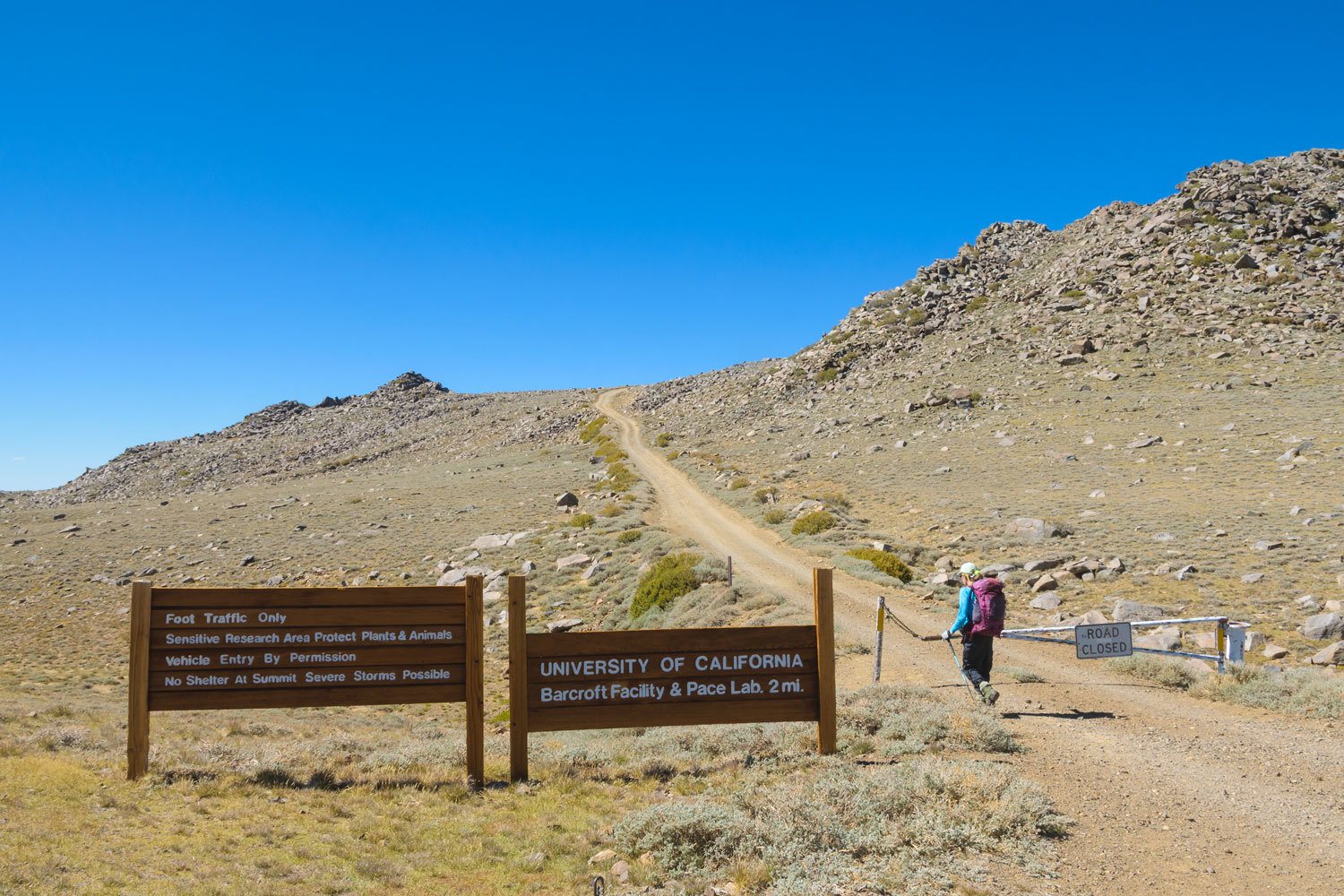
We took one last look back at the trailhead that sits at 11,700 feet. We are above tree line here.
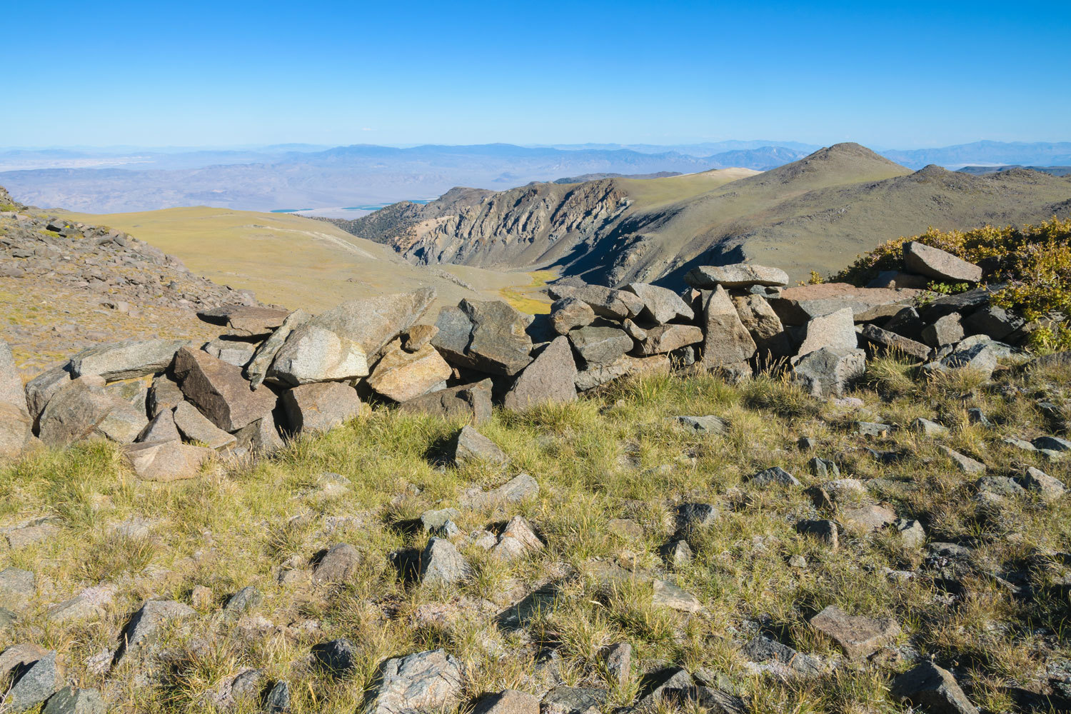
We knew nothing about the history of the Stone Corral. It was a tiny landmark on the Mount Barcroft, CA 7.5 USGS topo map that had caught our eye northeast of the White Mountain Research Center. We were turned away on our previous attempt in August 2021 by a thunderstorm. Today the skies were clear.
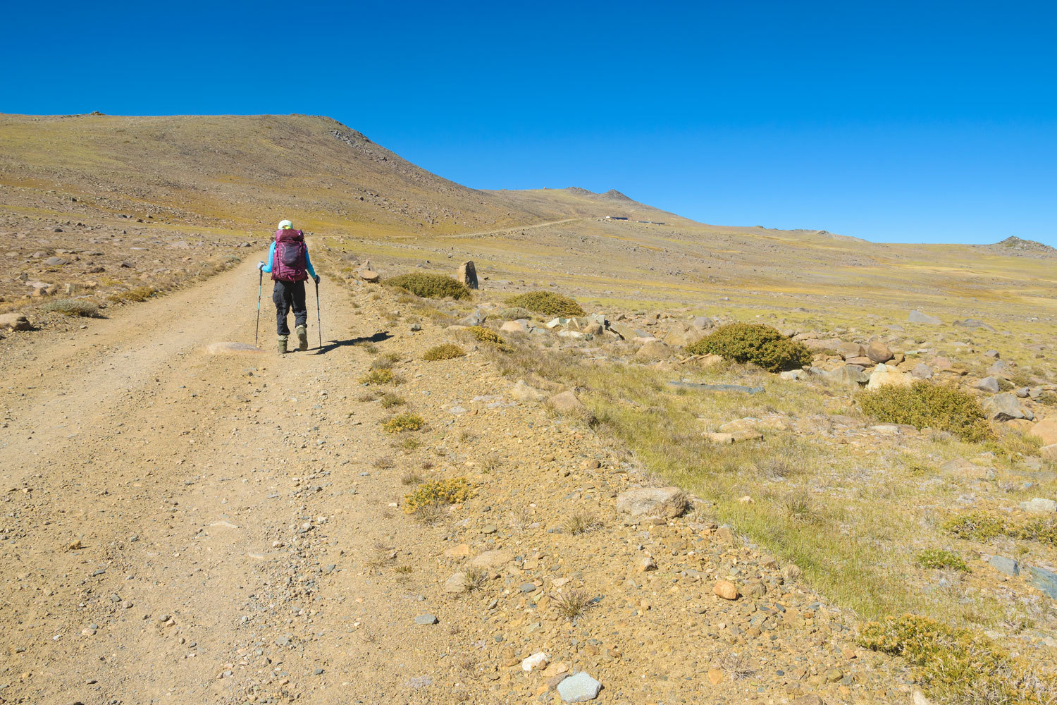
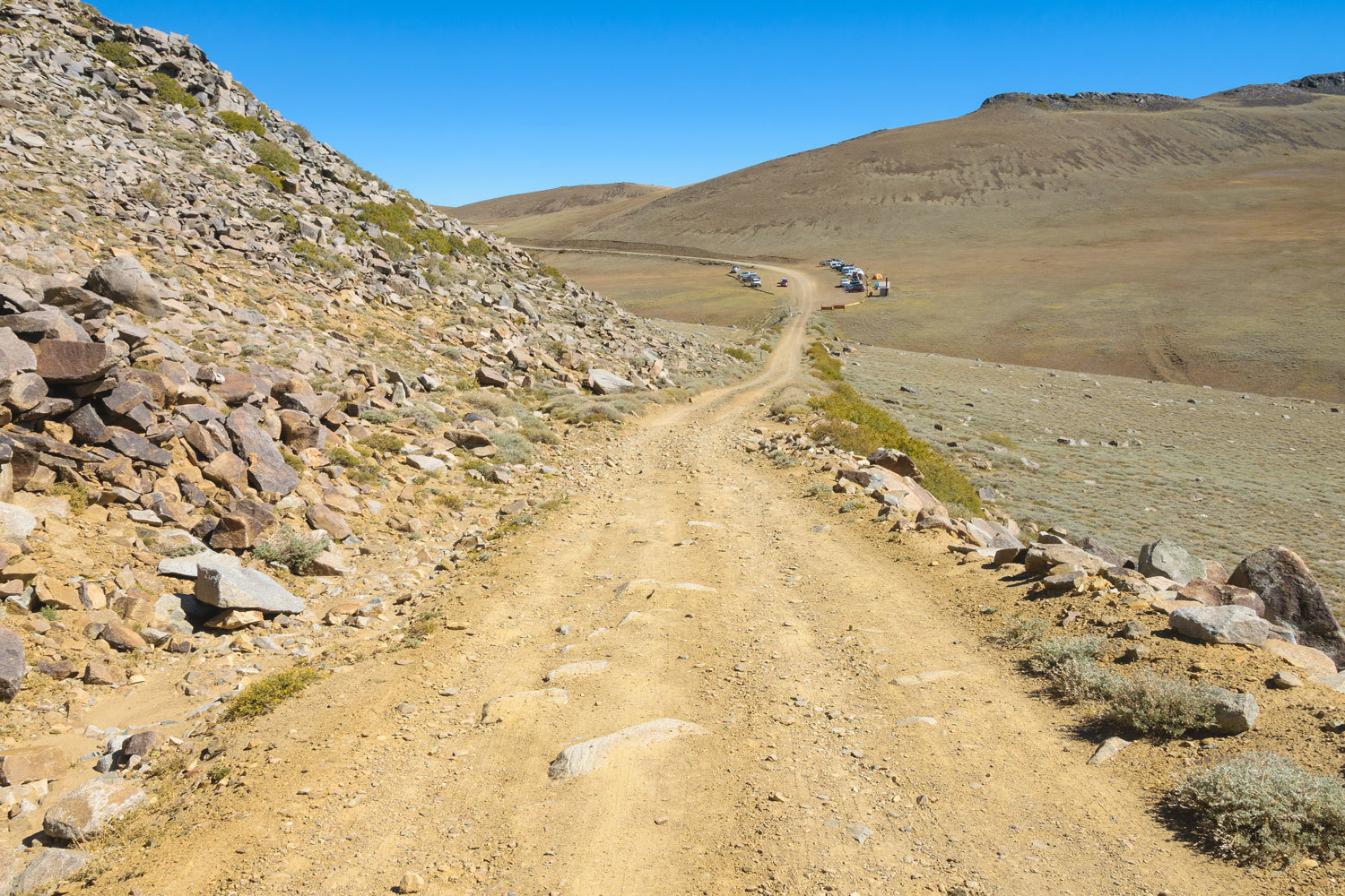
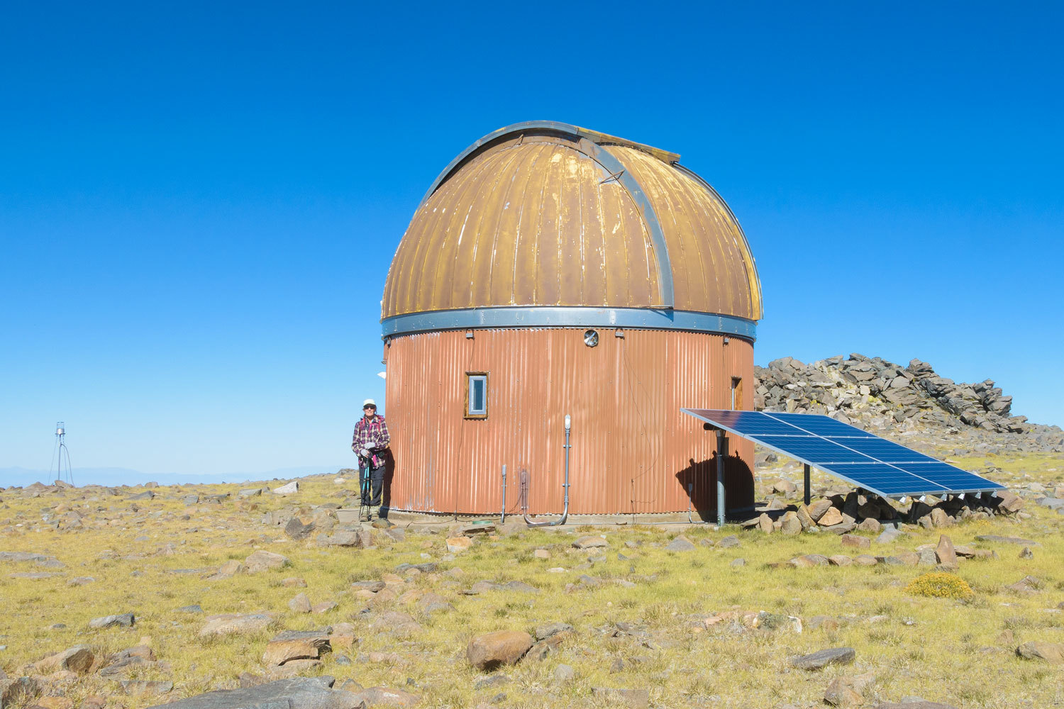
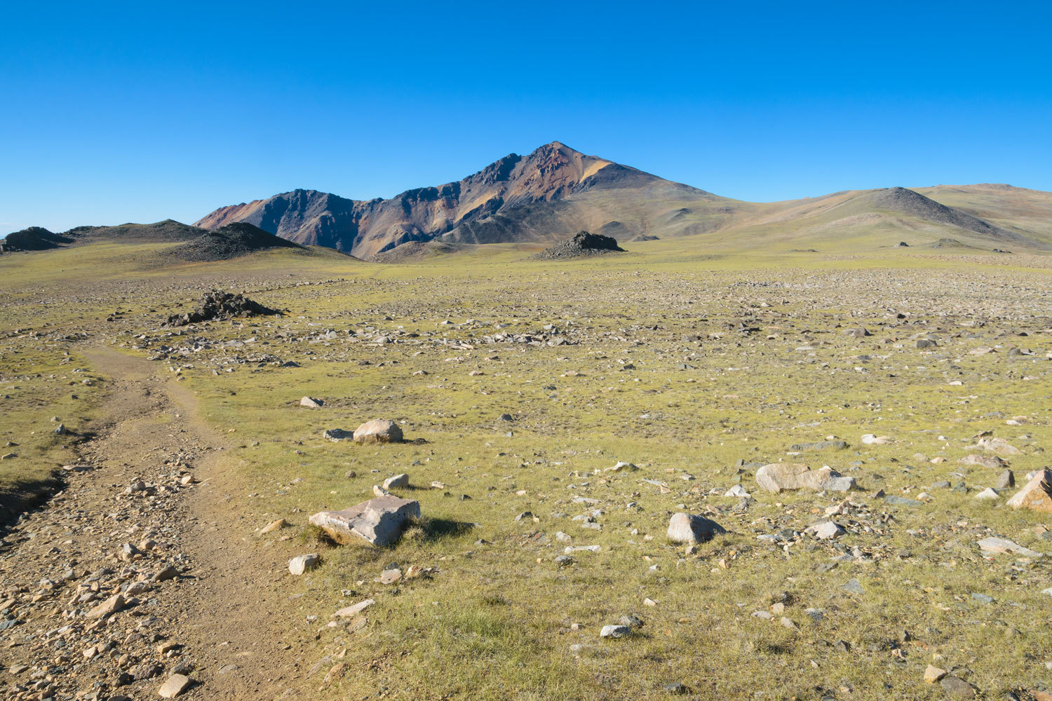
The Research Station sits at 12,500 ft. We spend quite a bit of time at higher elevations and are pleased we feel at home up this high. This is also the hiking route to California’s third highest point, White Mountain Peak. The route through the facility is well marked.
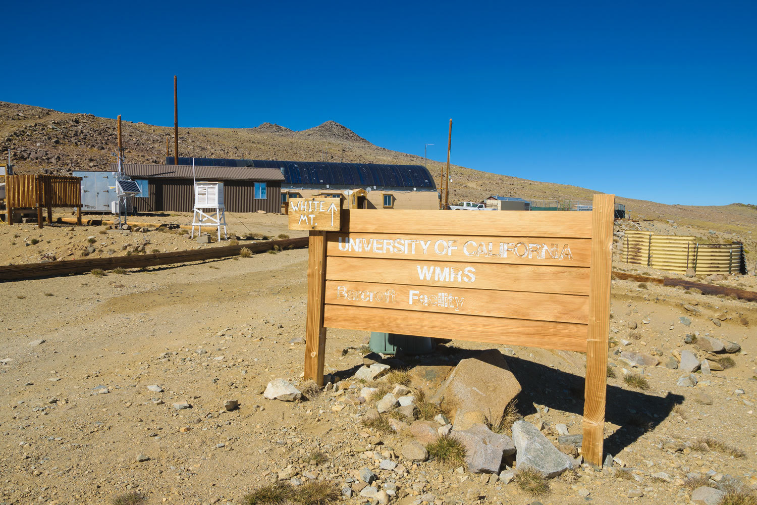
In the 1960’s and 70’s high altitude research using Pig-tailed Macaques was conducted at the station for NASA. I found a most interesting research paper written by a UC Davis anthropology professor after finding a monkey skull in the White Mountains. Here’s the link – The Monkey Skull.
We continued up the trail and reached the observatory.
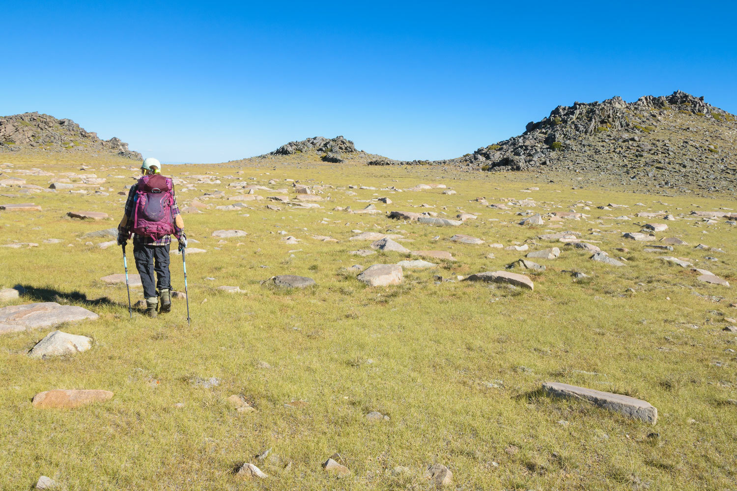
This is where we left the trail and plotted a route cross country to reach the spot on the map labeled “stone corral”.
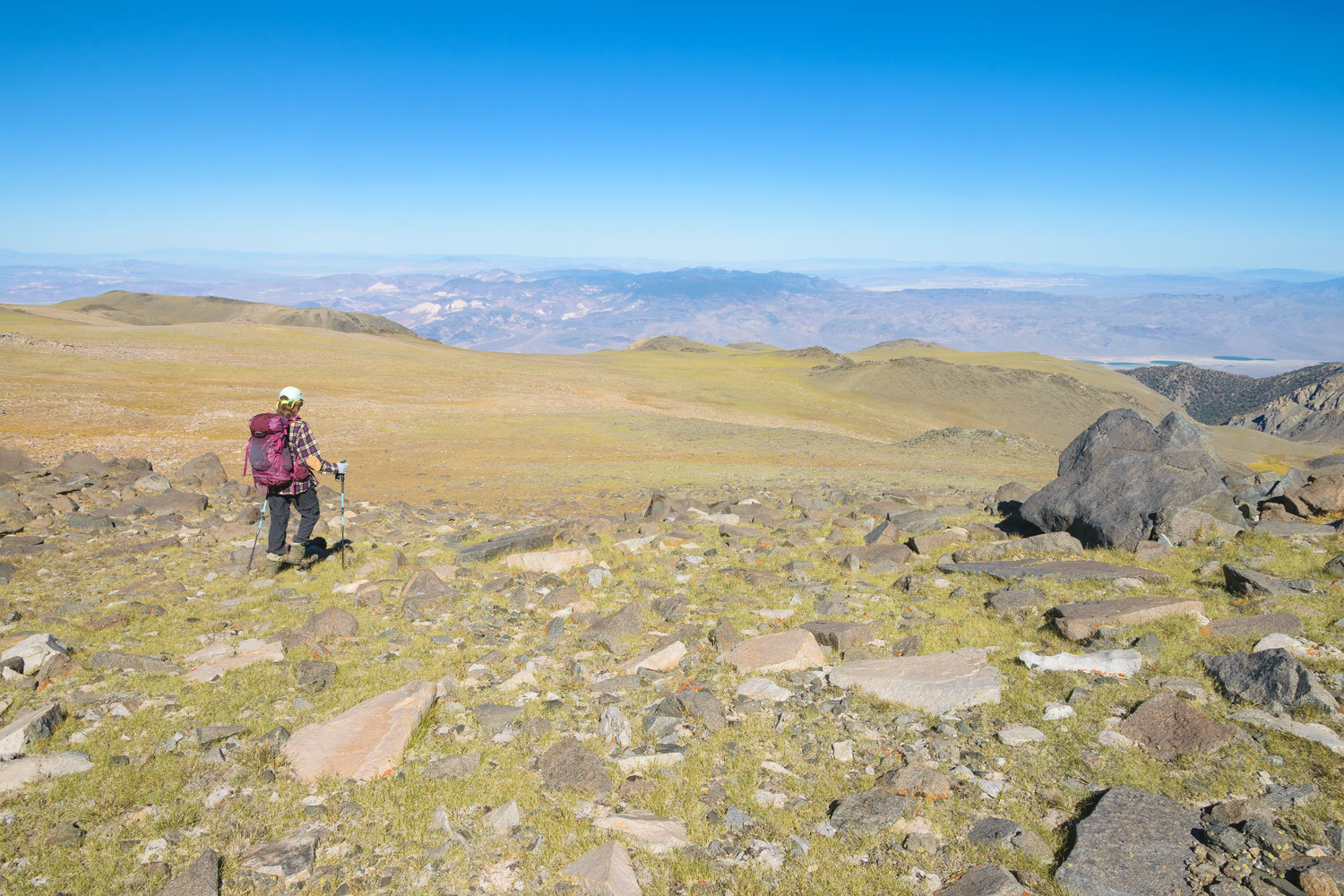
White Mountain Peak was prominent to the north. Yes, we’ve been to the top.
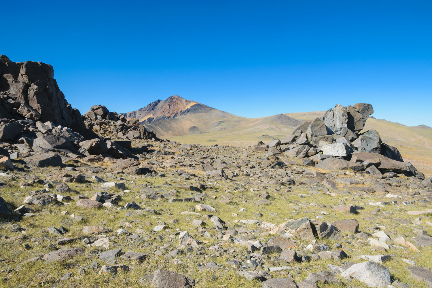
The Lady constantly jokes that White Mountain Peak is the darkest colored mountain in the White Mountain Range.
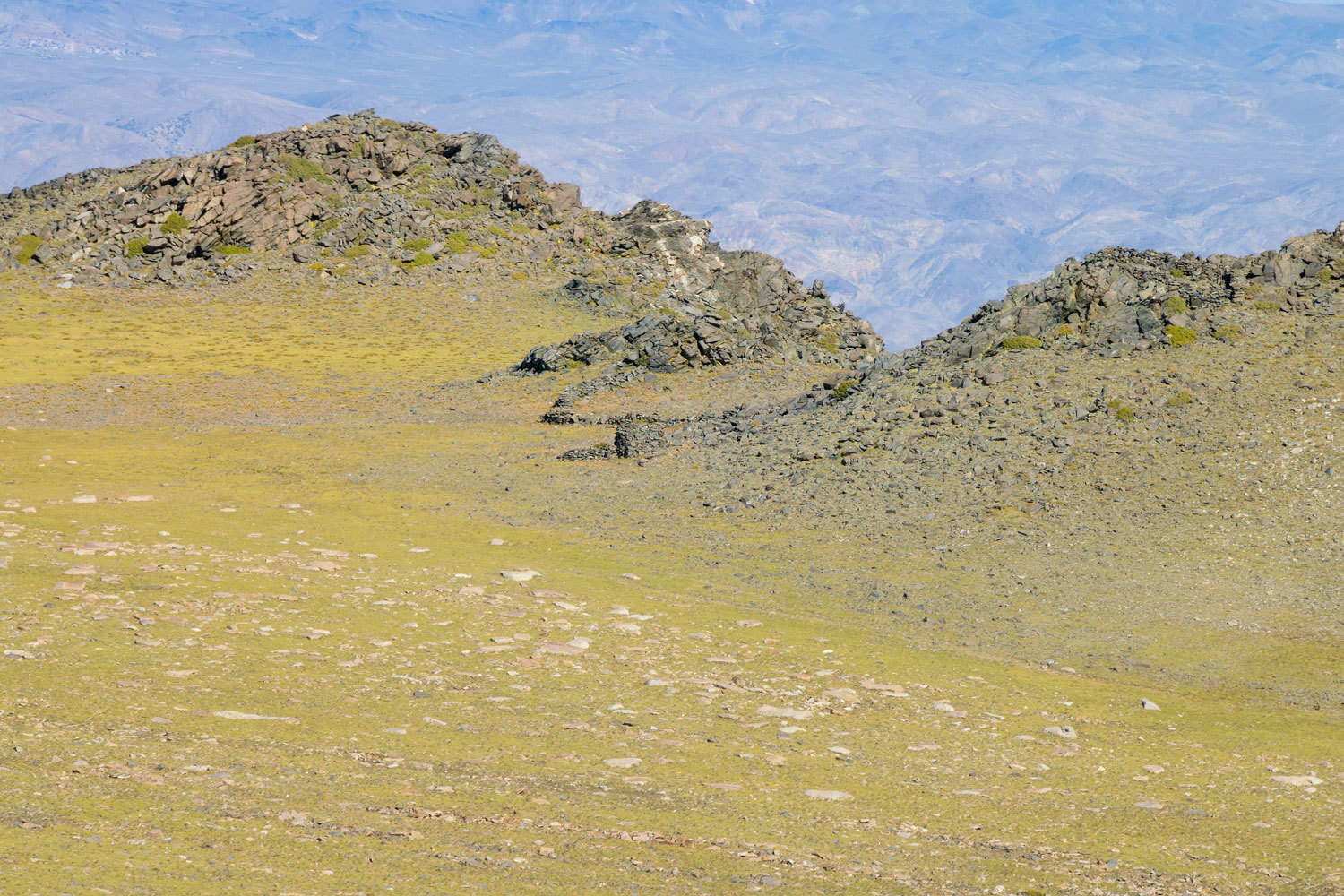
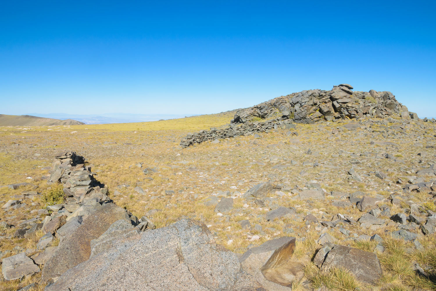
Here’s a telephoto shot of our objective – the Stone Corral.
The Lady led the way and we quickly grew near.
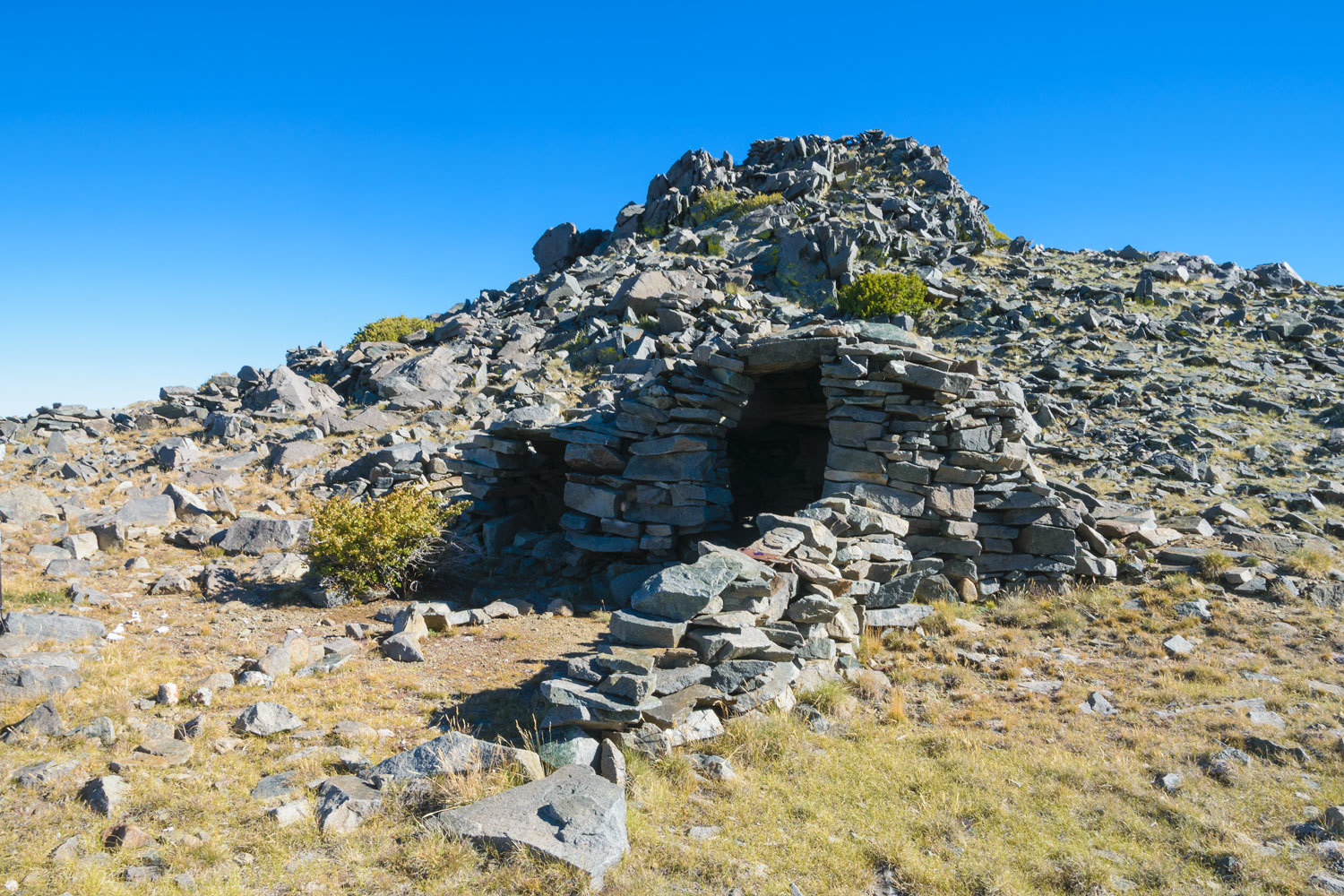
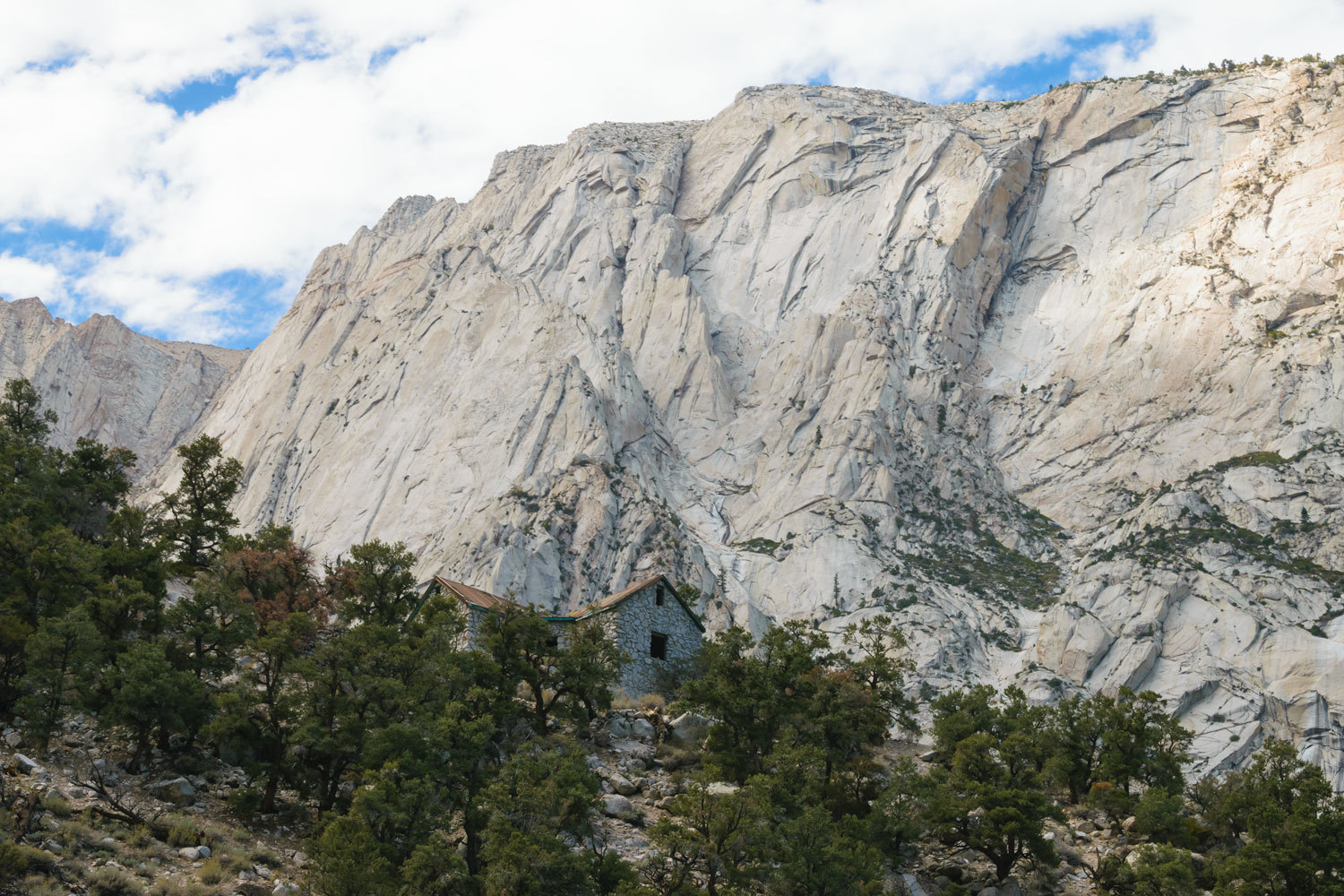
We were surprised and pleased to find a stacked stone shelter at the corral.
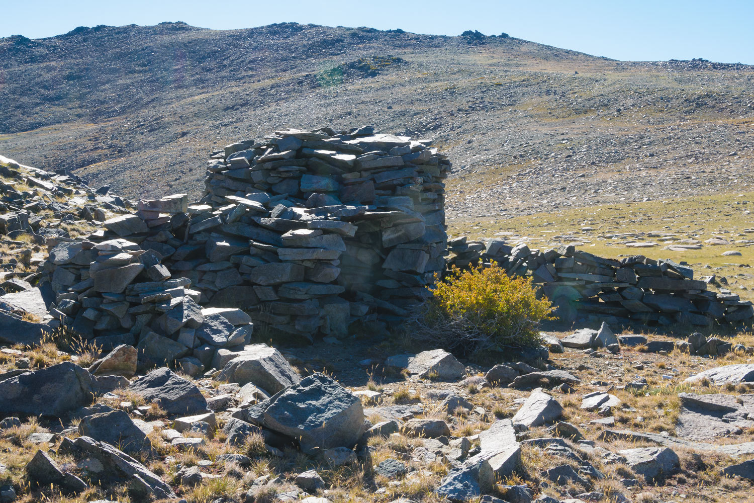
We suspected that the corral was associated with sheep grazing. In the early 1900’s sheep were herded from their wintering areas near Lancaster in southern California, across the Mojave Desert, up through the Owens Valley, and on to high elevations in the Sierras and White Mountains. Here’s a link to a gentleman researching the remains of stone shepherd’s huts and wind breaks in the White Mountains – Surveying Stone Shepherd’s Huts.
Inside the hut was a stone fireplace.
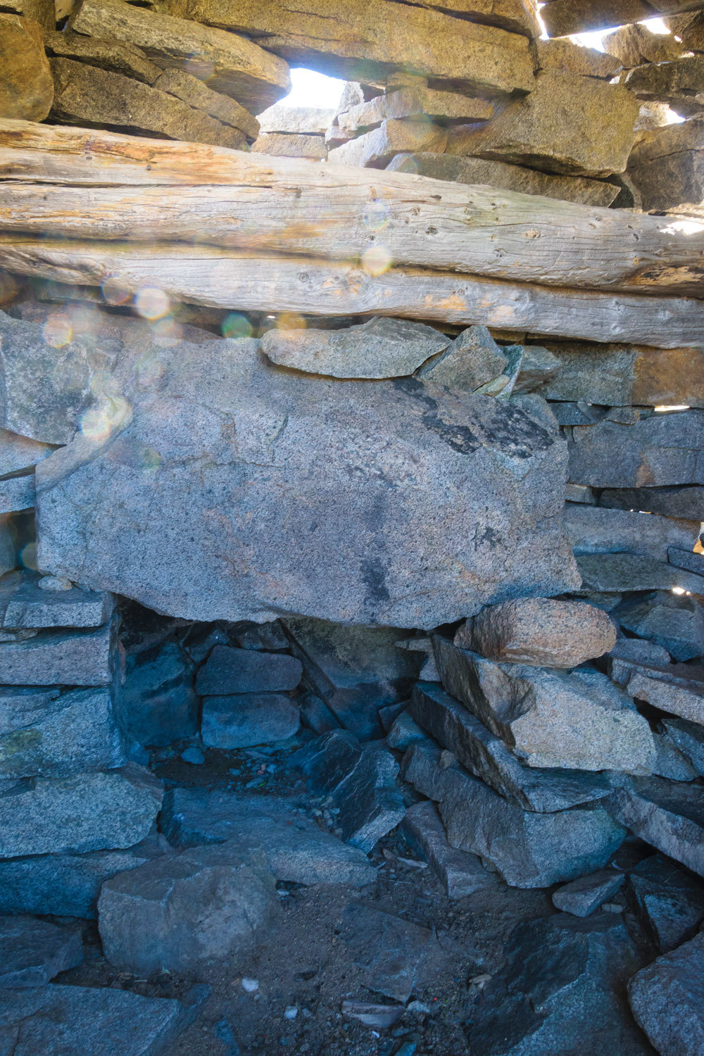
This begs the question – what did the shepherd bring in to burn at this spot well above tree line?
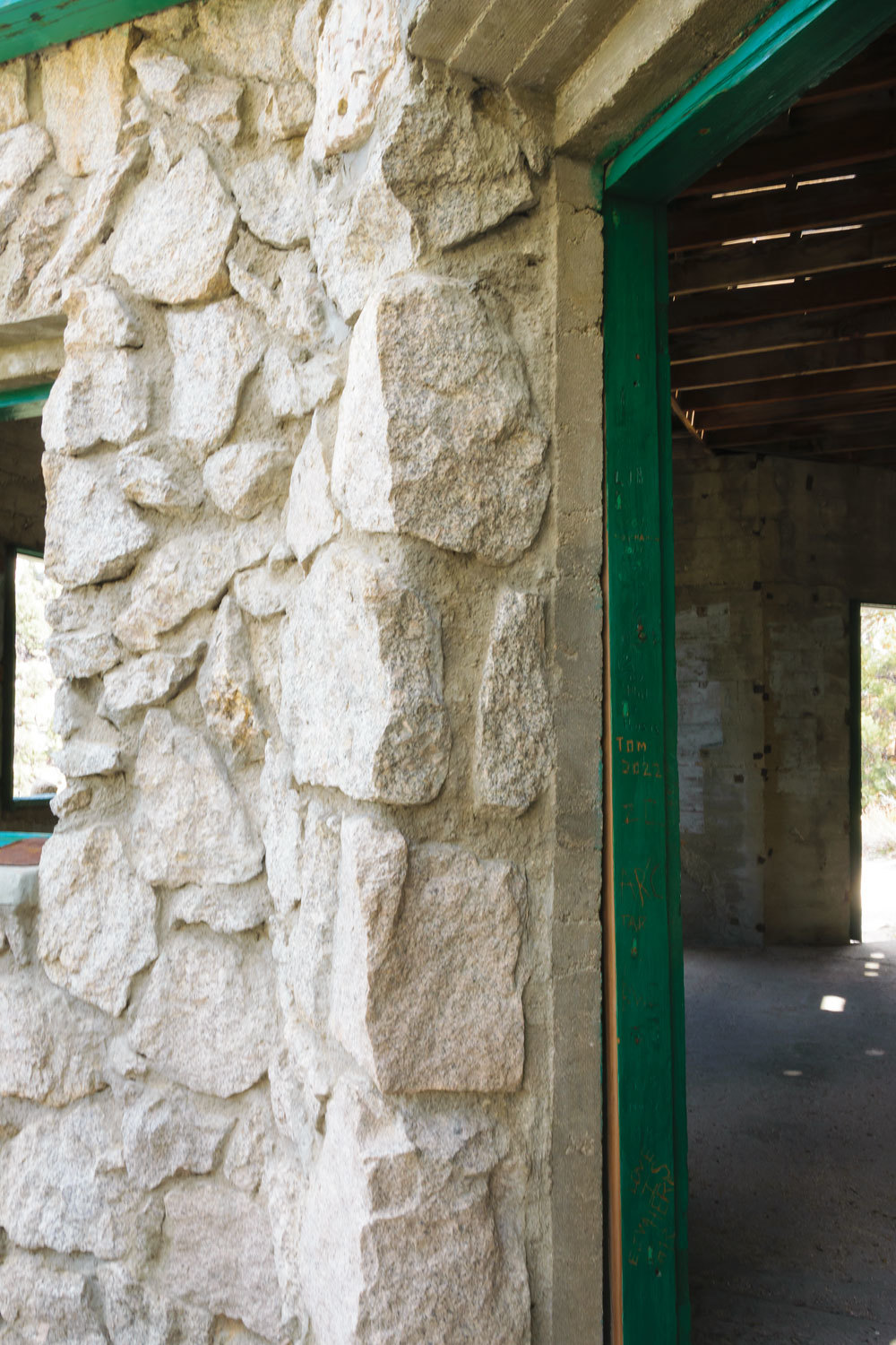
There was also an inscription on a support timber. Please pardon this being slightly out of focus. It was dark inside the hut.
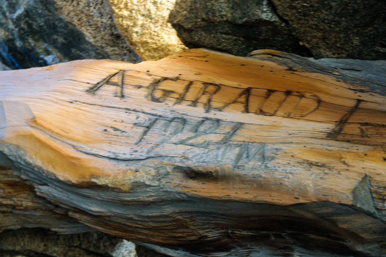
The Giraud inscription is mentioned in the link above. I also
discovered that Alfred Giraud followed his brother to California from their home
in France to raise sheep. Giraud wrote a short book – My First Winter in California – in 1966. Alfred Giraud's brother Peter was the inspiration for the character "Little Pete" in Mary Austin's classic novel "The Flock."
Note – a big thank you to our friend The Sagebrush Reconnoiterer for help with this research.
The corral is doing well after 100 years in this extreme high elevation environment.
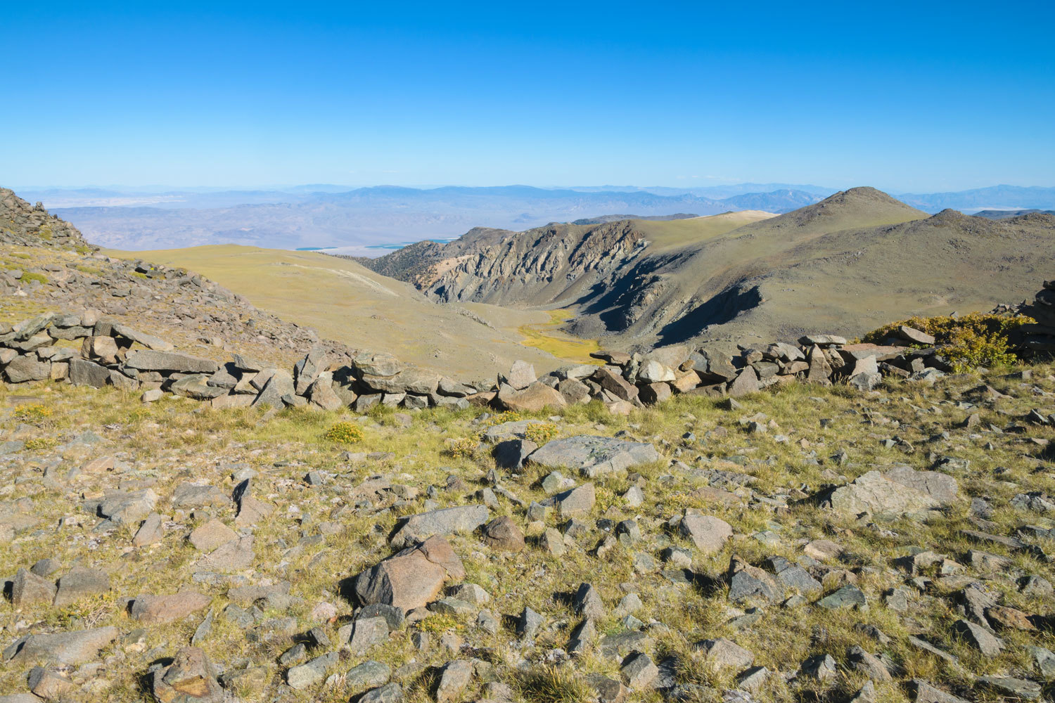
It was 1645 hrs. when we intersected back with the main trail. We took a last look to the north at White Mountain Peak before heading back to the truck, a little under three miles away from this point.
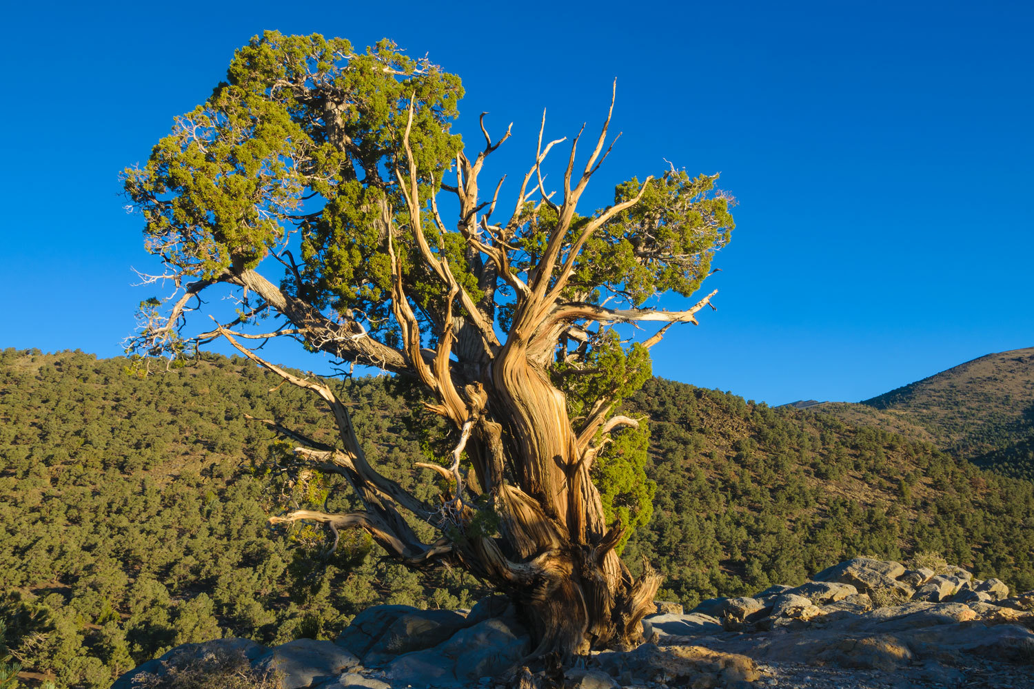
We reached the truck within an hour and started out in search of a high campsite – a large group was camped at road’s end. After slowly crawling out a faint and rocky dirt road, alas, we found the site occupied. We returned to the main, severely wash boarded, road and headed south. We were now racing the remaining daylight, something we rarely and do not like doing. We struck out at the other possible site and then remembered, damn, this was a Saturday night. We resigned ourselves that we’d need to drive out as far as our “sure thing” dispersed site. We reached it just as headlights were truly needed to find our way. After a quick dinner, we relaxed and enjoyed the night sky before we hoisted ourselves up into our bunk for sleep. The next morning, with our mugs of Peets Coffee, we climbed up to “coffee point” with its lone juniper.
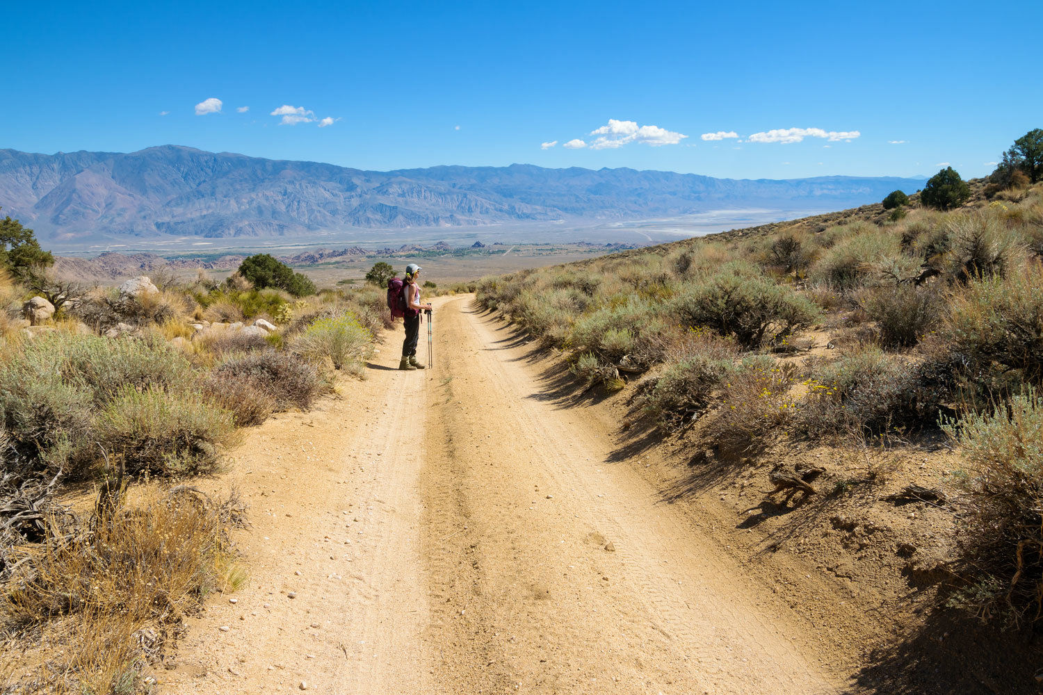
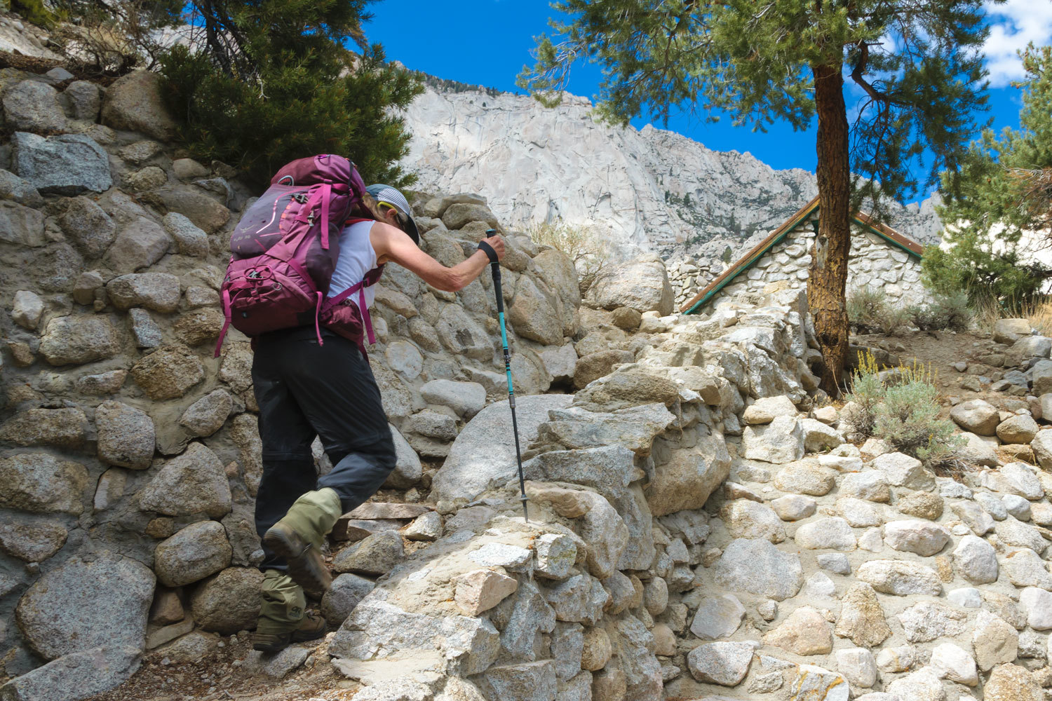
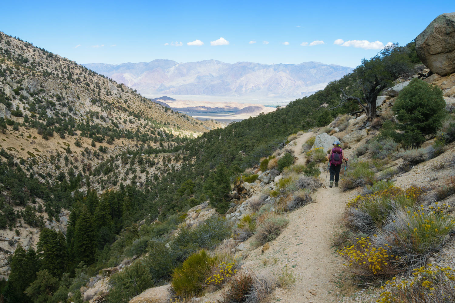
With the stone corral found and visited, next on the anniversary list was the stone house. We returned to highway 395 and turned south to Lone Pine. The trailhead is seldom used and difficult to find. Our excellent maps did their job. Just down from the trailhead was an excellent dispersed campsite. We moved in, claimed it, and got ready to hike. It was noon and it was hot, in the upper eighties. The old road is blocked off at the trailhead. We took a look back down into the Owens Valley.
The climb did not let up as we hiked up the canyon.
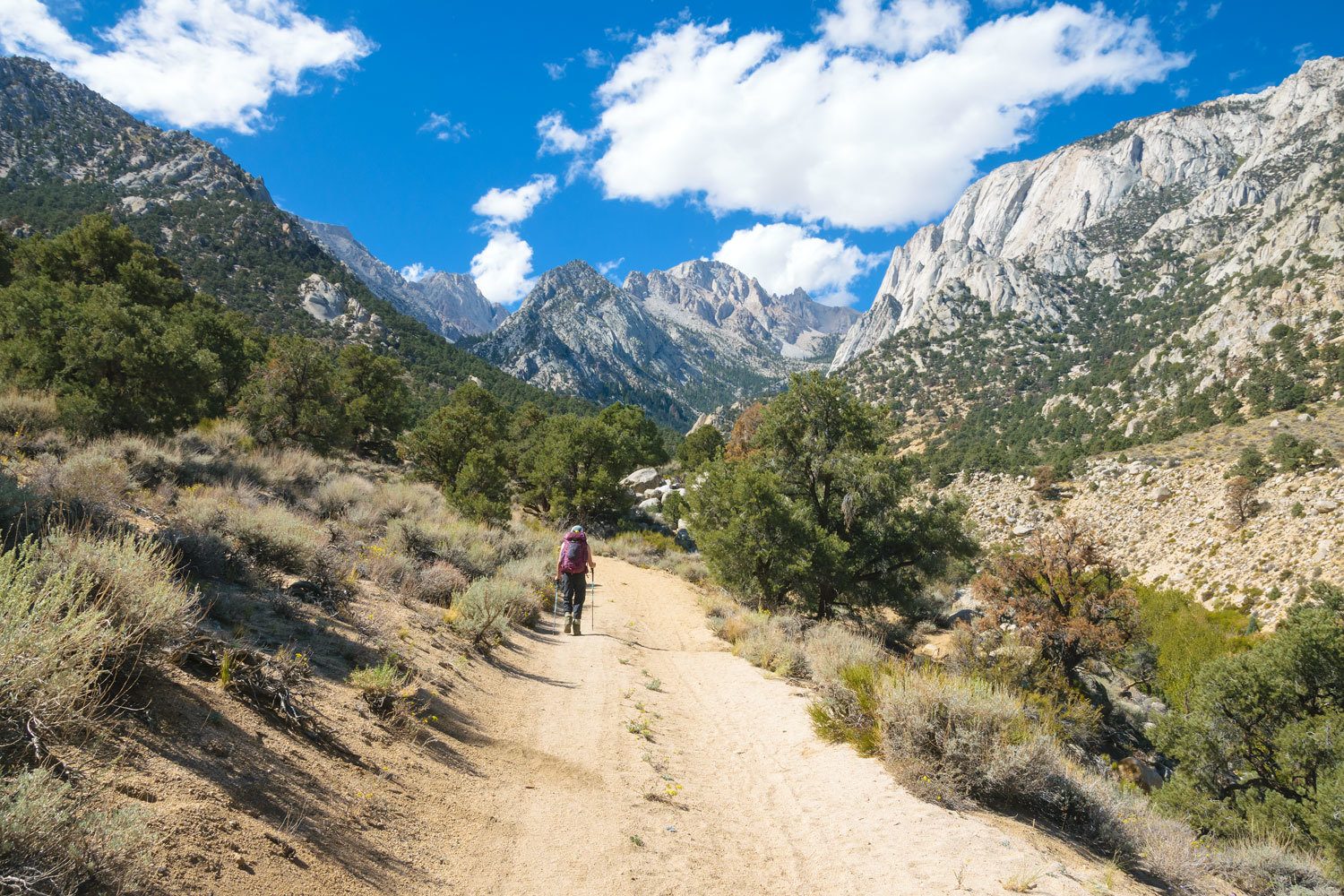
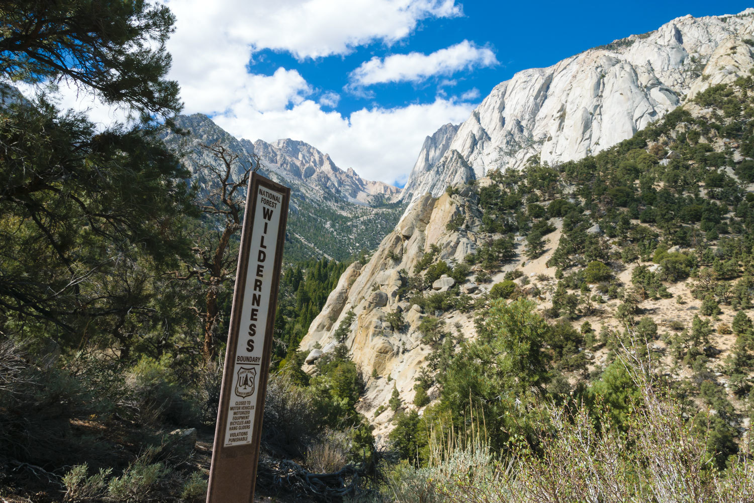
The road turned to trail as we entered the John Muir Wilderness.
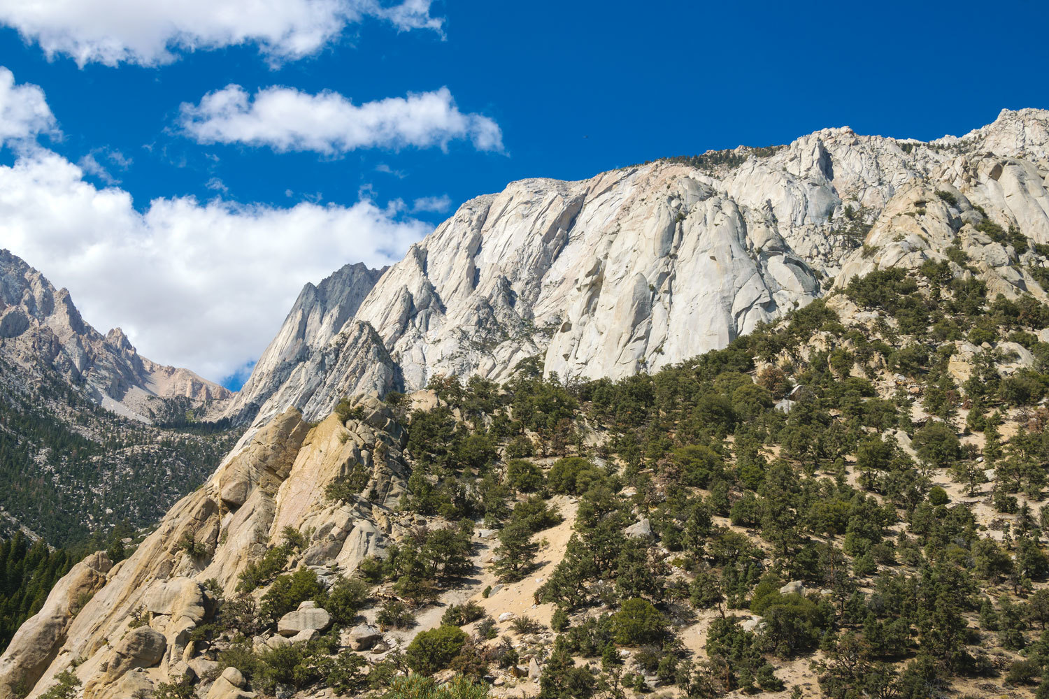
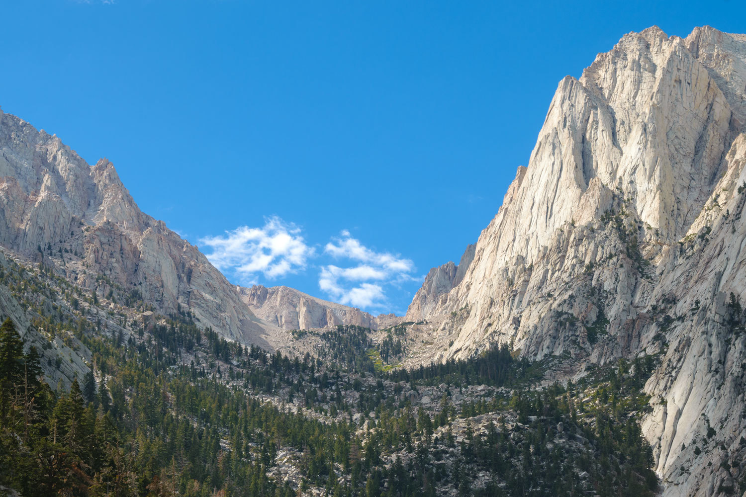
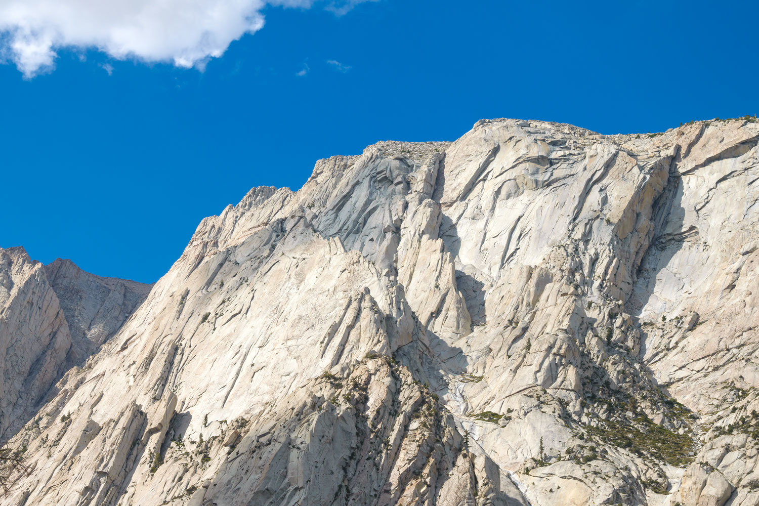
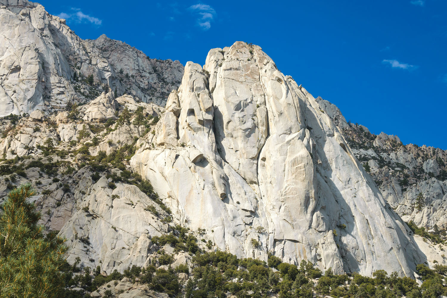
The soaring granite that leads up the flanks of Lone Pine Peak is outstanding.
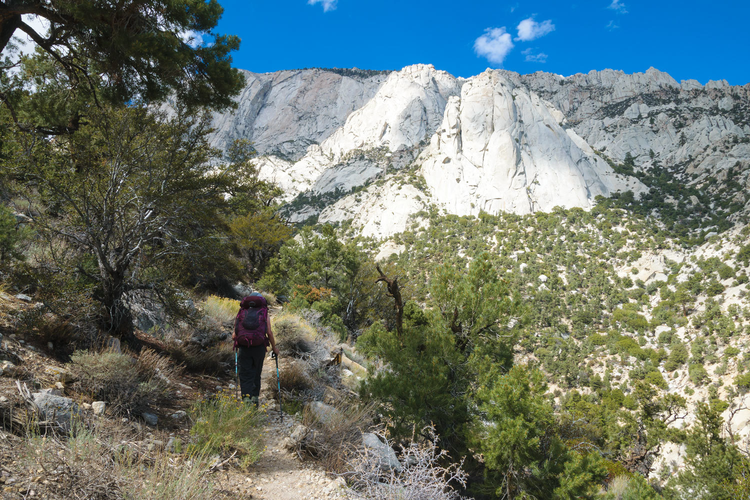
We turned up the south fork of the creek and our destination came into view – a telephoto shot.
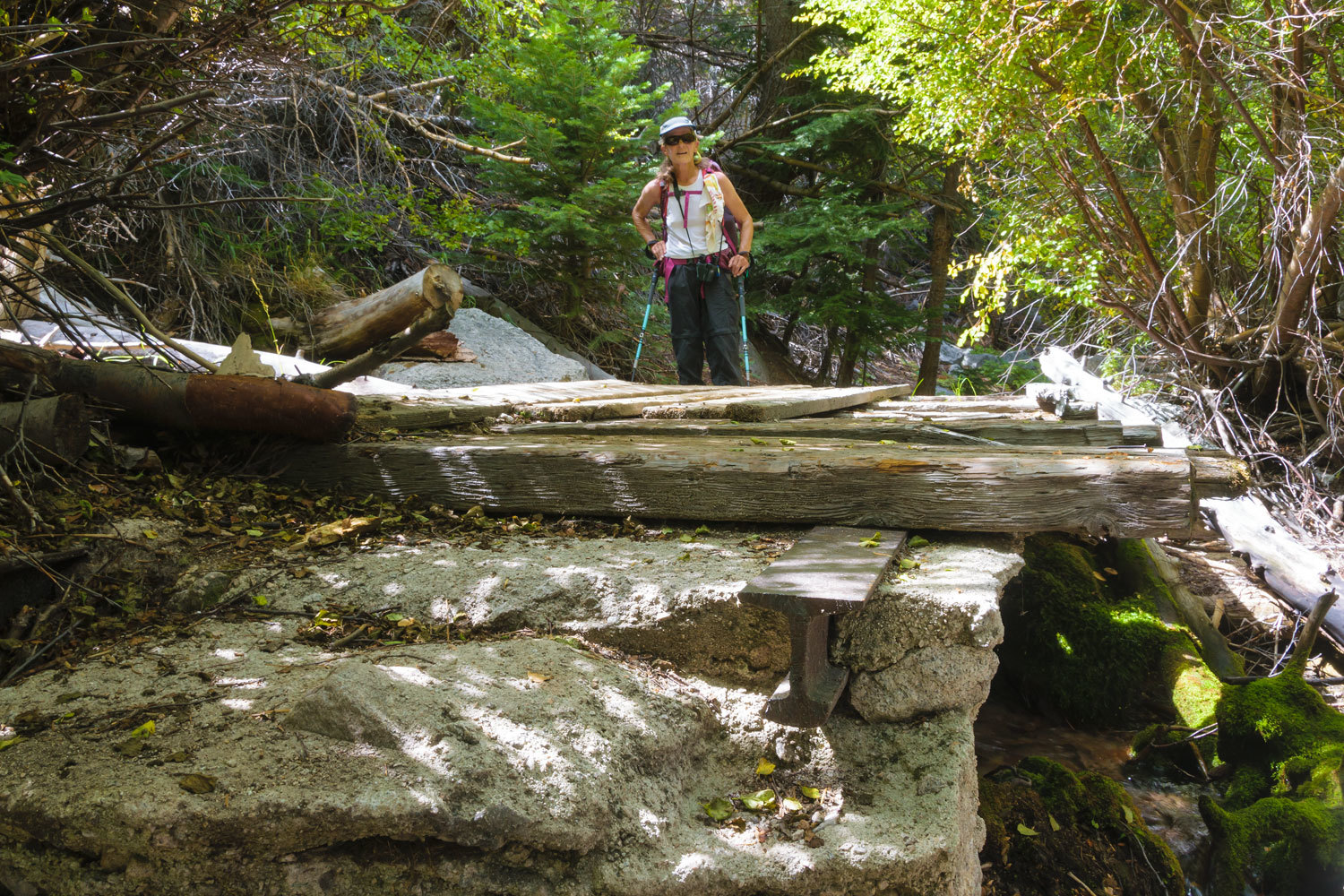
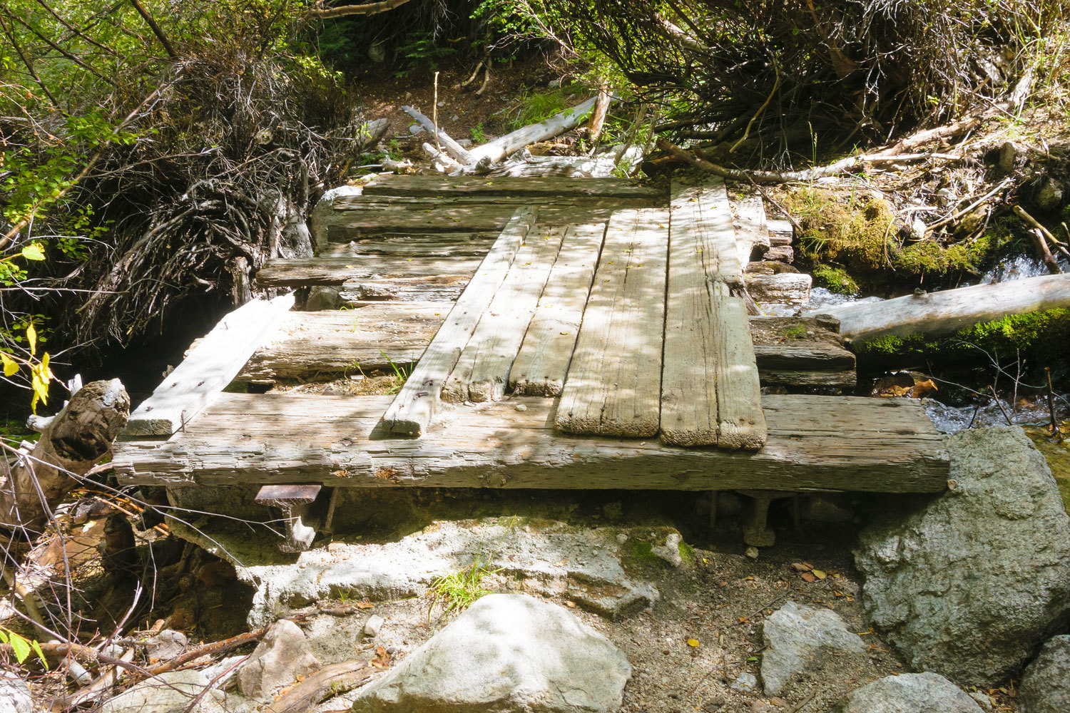
Ruins of a stout bridge remain at the crossing of the south fork.
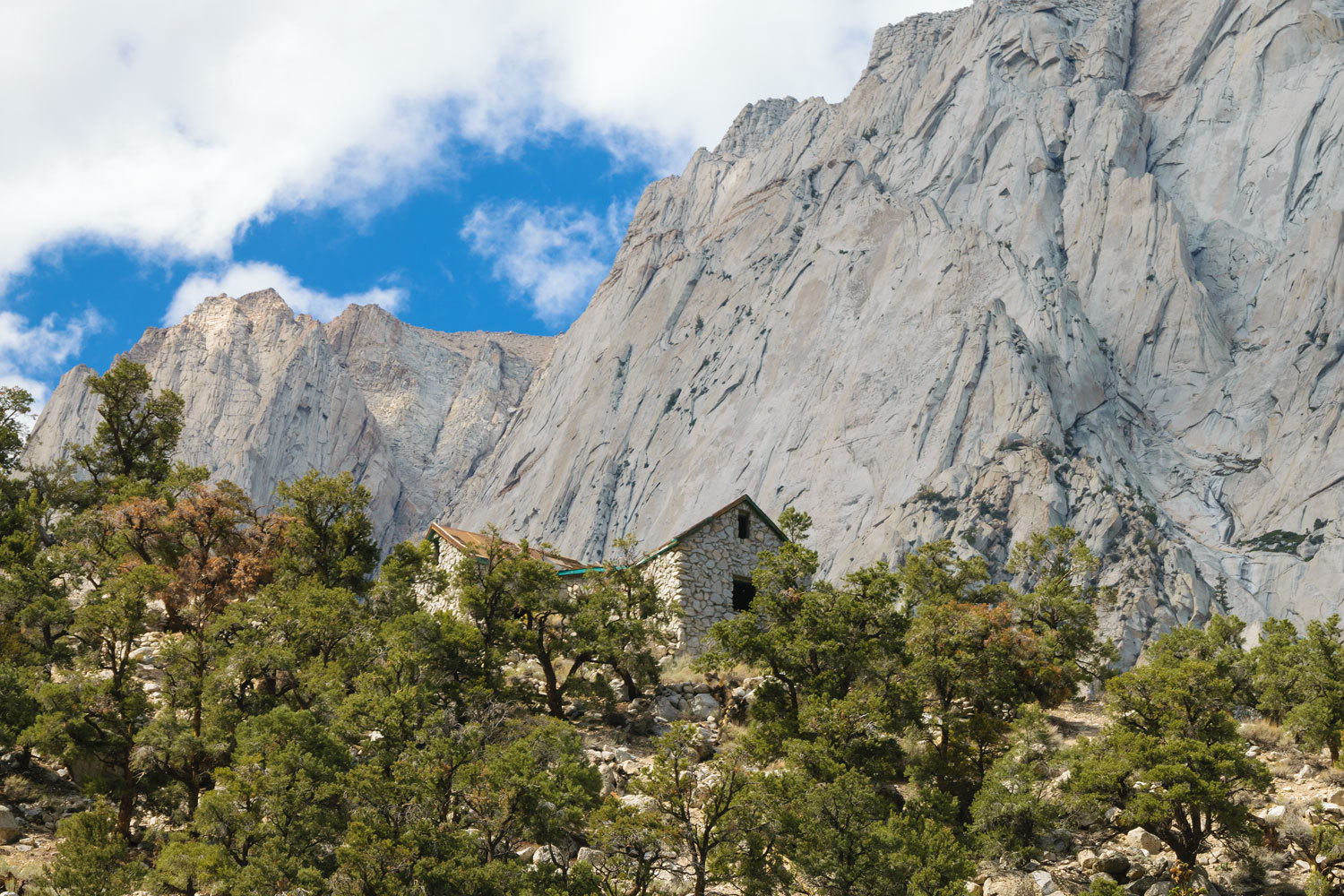
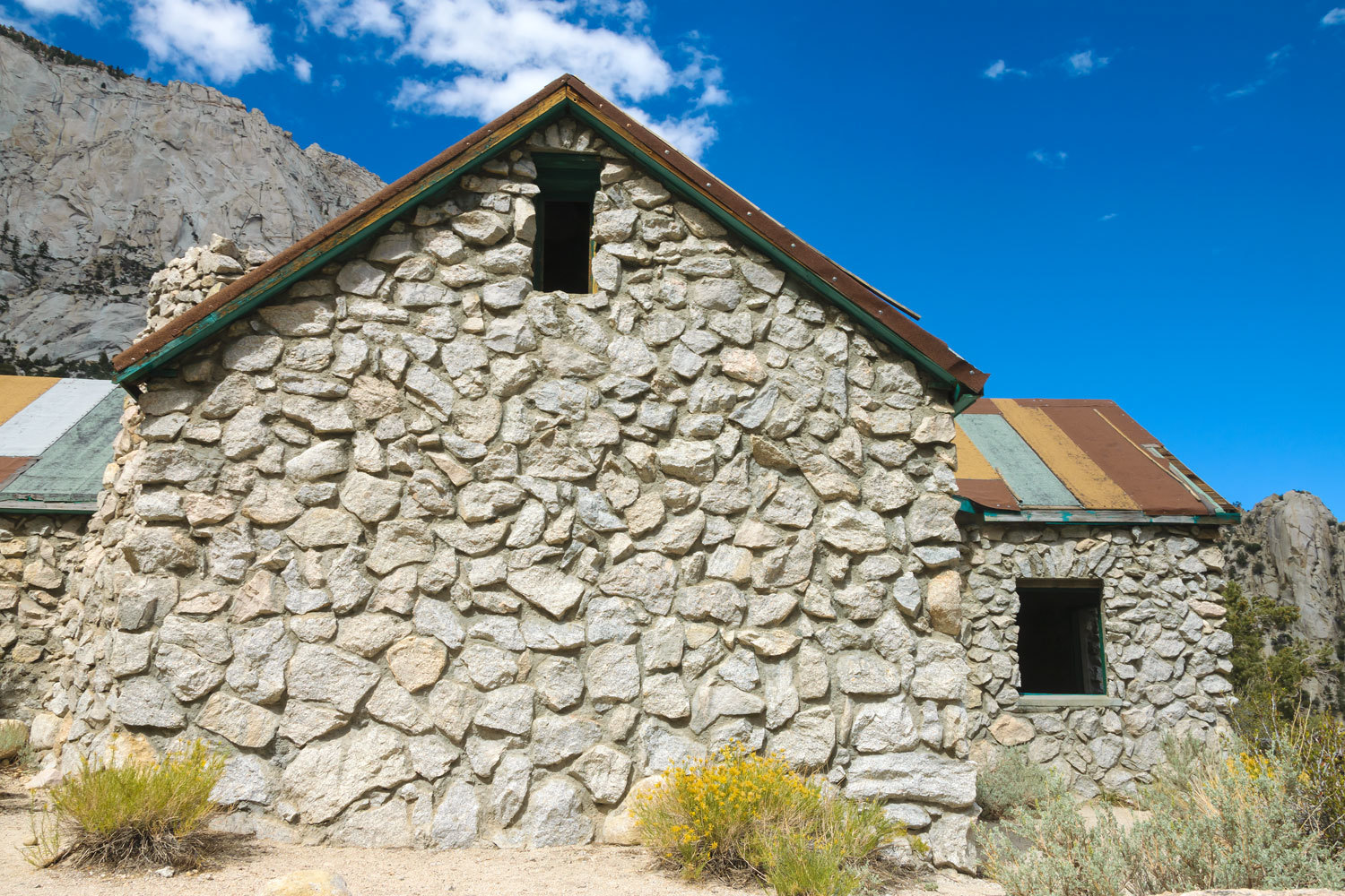
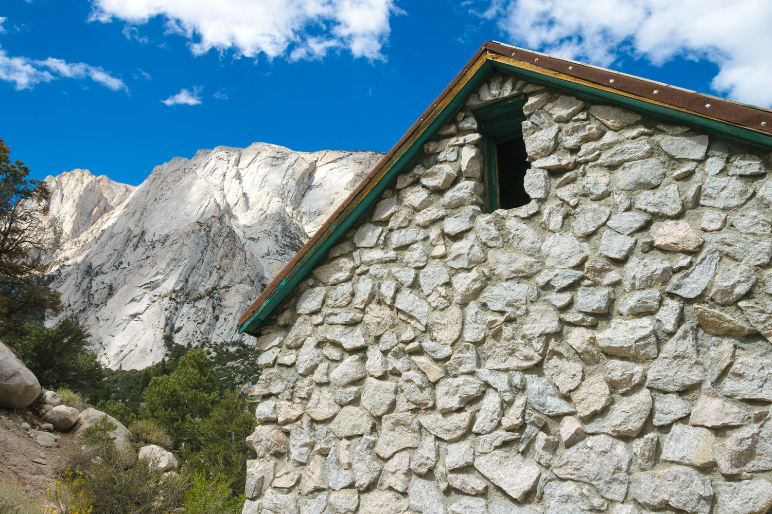
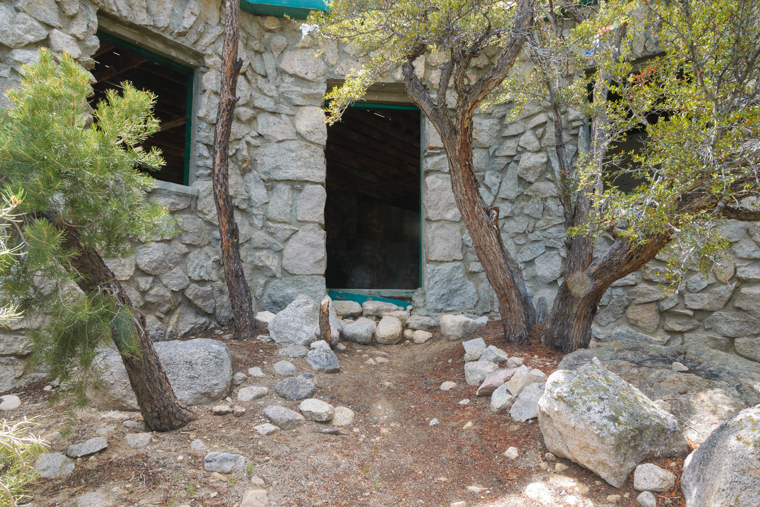
A short way further up the trail and we arrived.
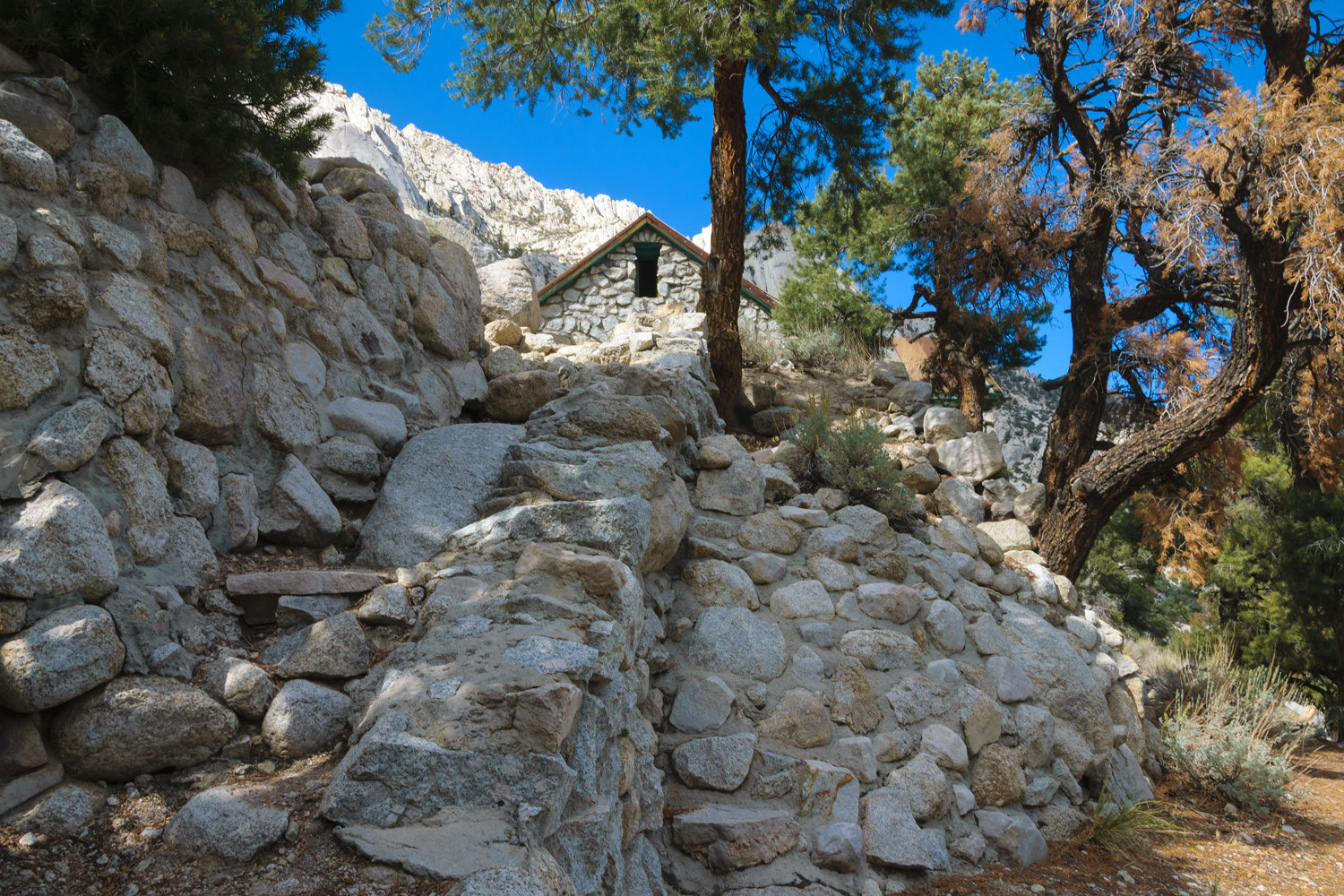
The concrete stairs are now long gone.
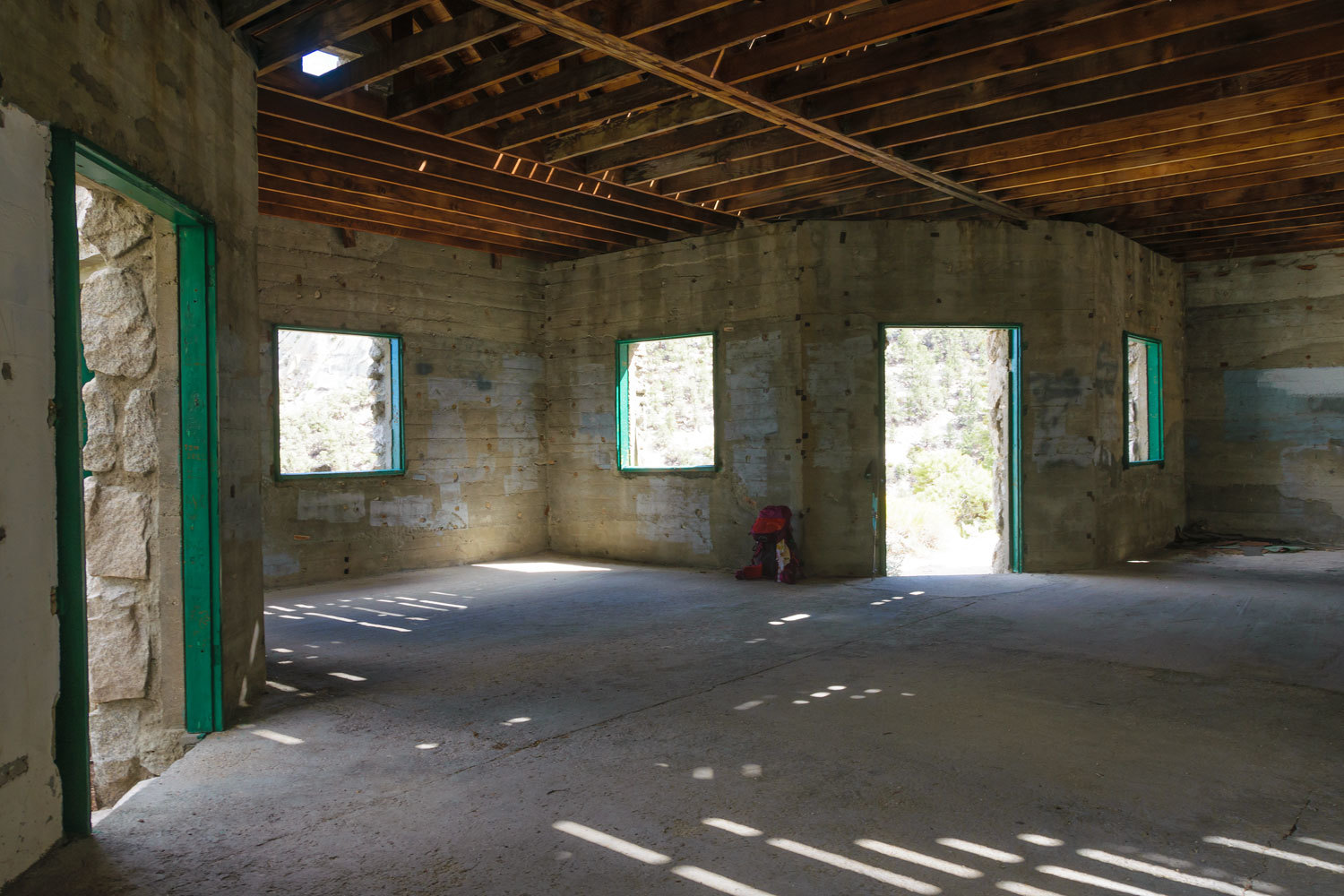
Franklin Merrell-Wolfe (1887-1985) was a twentieth century American “philosopher, mathematician, and sage”. His beliefs appear to have been drawn from tenets of Hinduism and Yoga. In 1930 he and his wife, Sherifa, (and followers) began building the Ashrama on U.S. Forest Service land under a special use permit to build a “summer school”. Building continued slowly for 20 years and ended in 1950 – before the windows and doors were installed -when Sherifa could no longer make the trip up to the building. The special use permit was canceled in 1963 and in 1964 everything became the property of the Forest Service. In 1964 the area was included inside the boundary of the new John Muir Wilderness. There were discussions about removing it but it is deemed wiser to just allow it to decay and turn back into dust.
Franklin Merrell-Wolfe continues to have a small following.
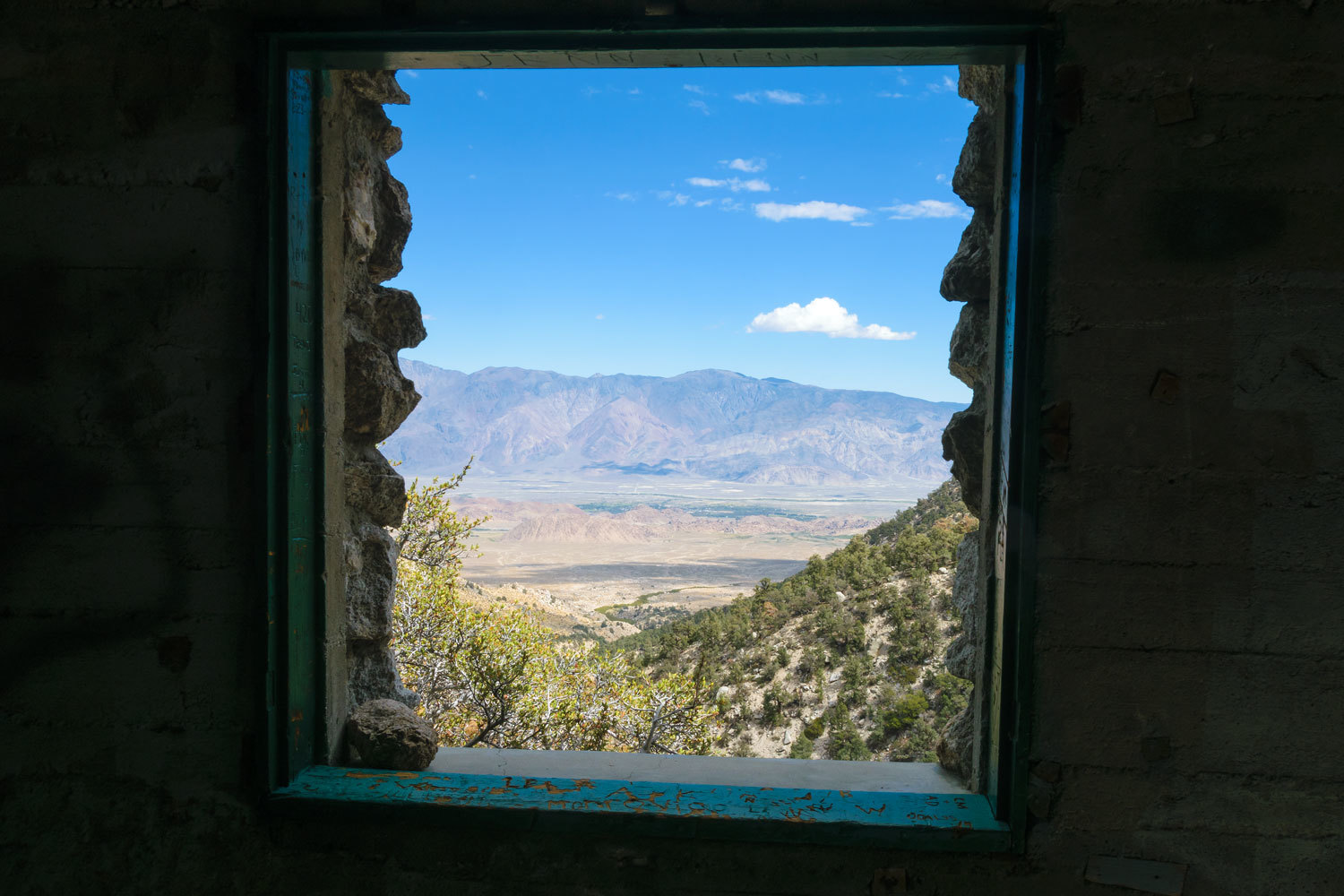
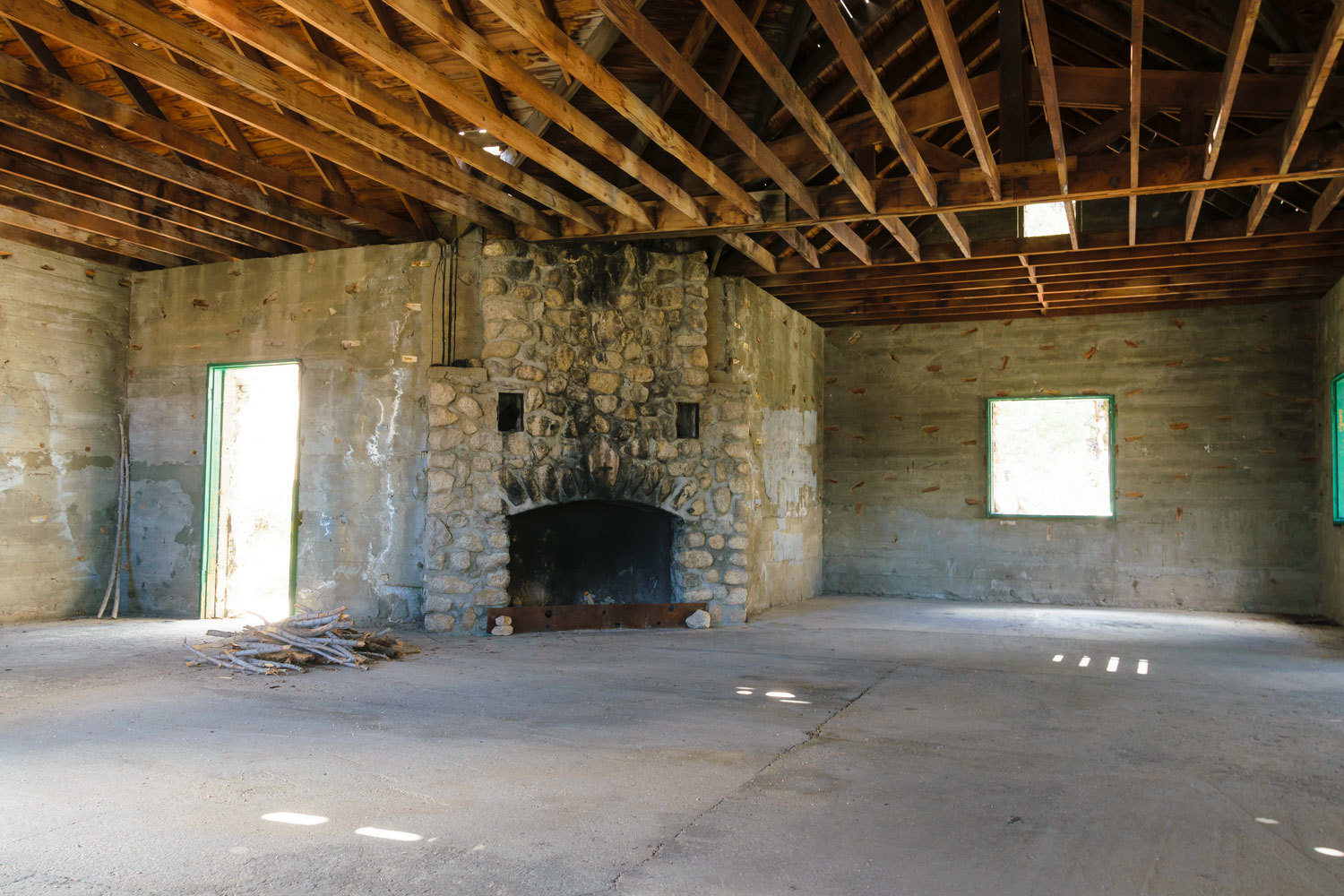
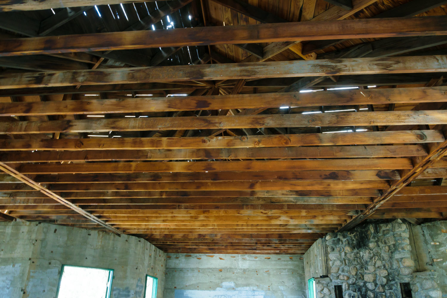
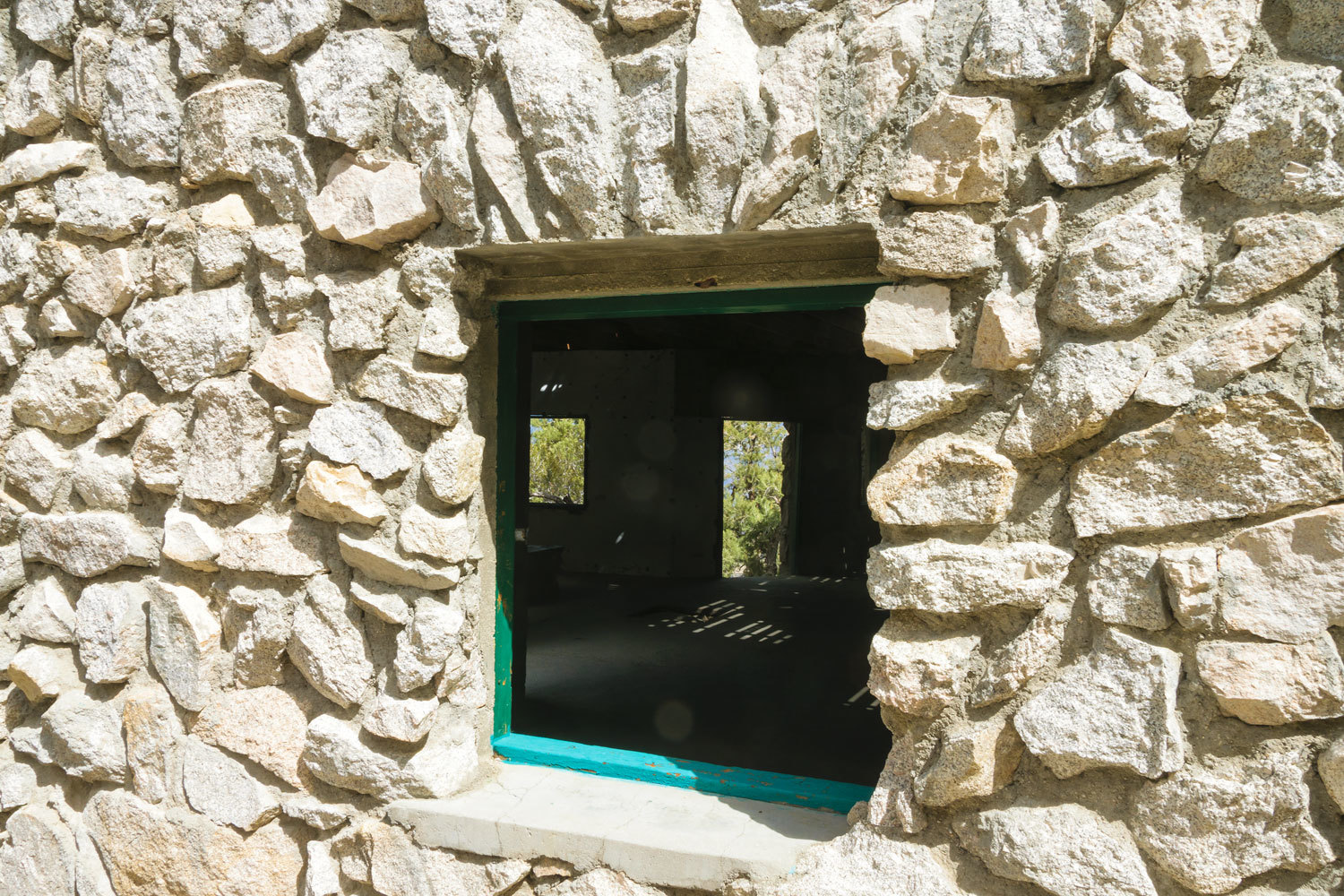
Here is what remains.
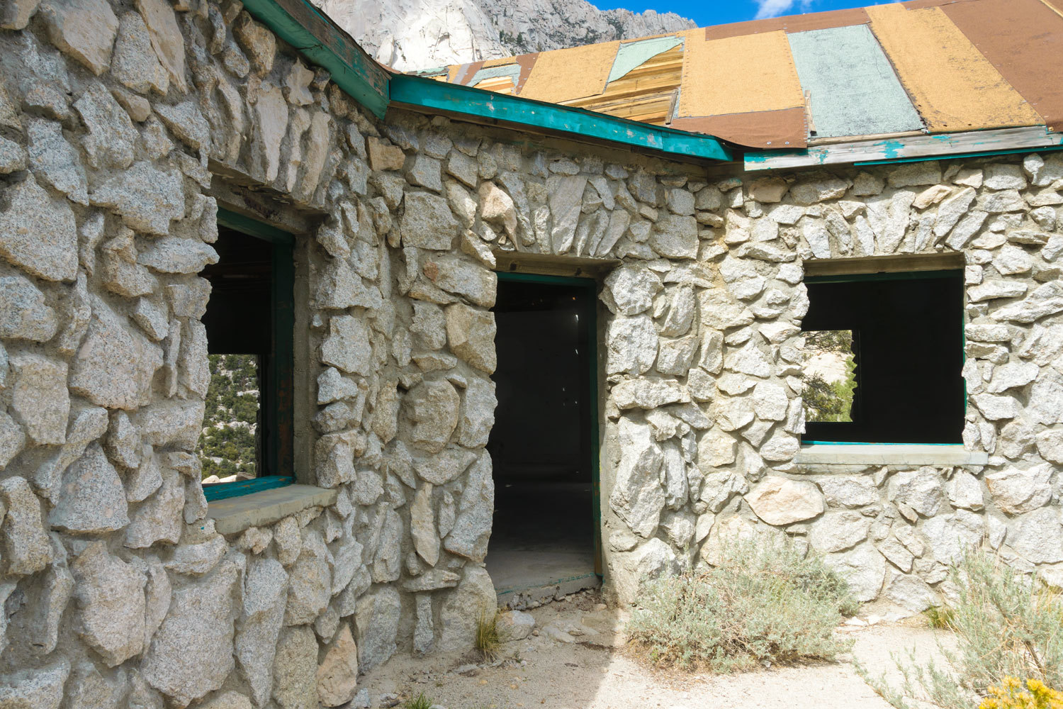
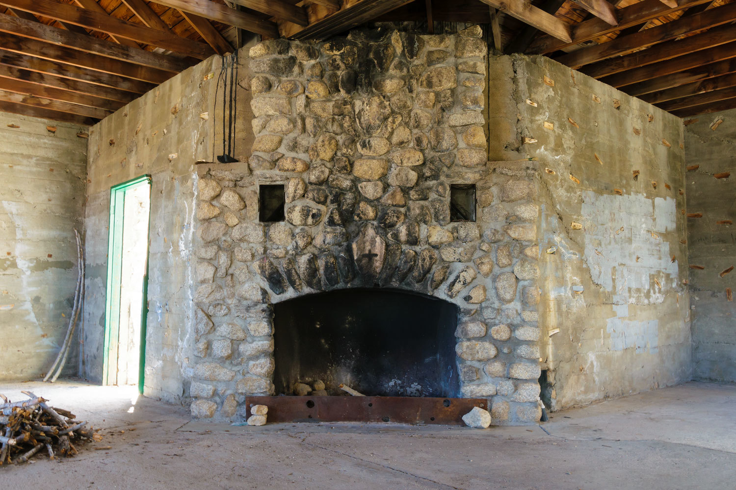
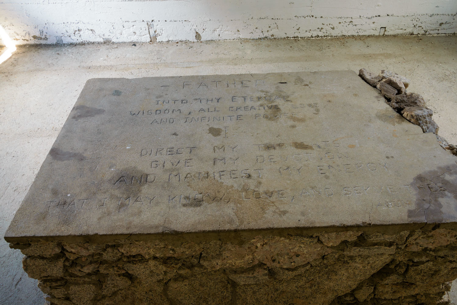
Sometime in the 1960’s or 70’s an unknown person chiseled a christian style saying into the top of the altar.
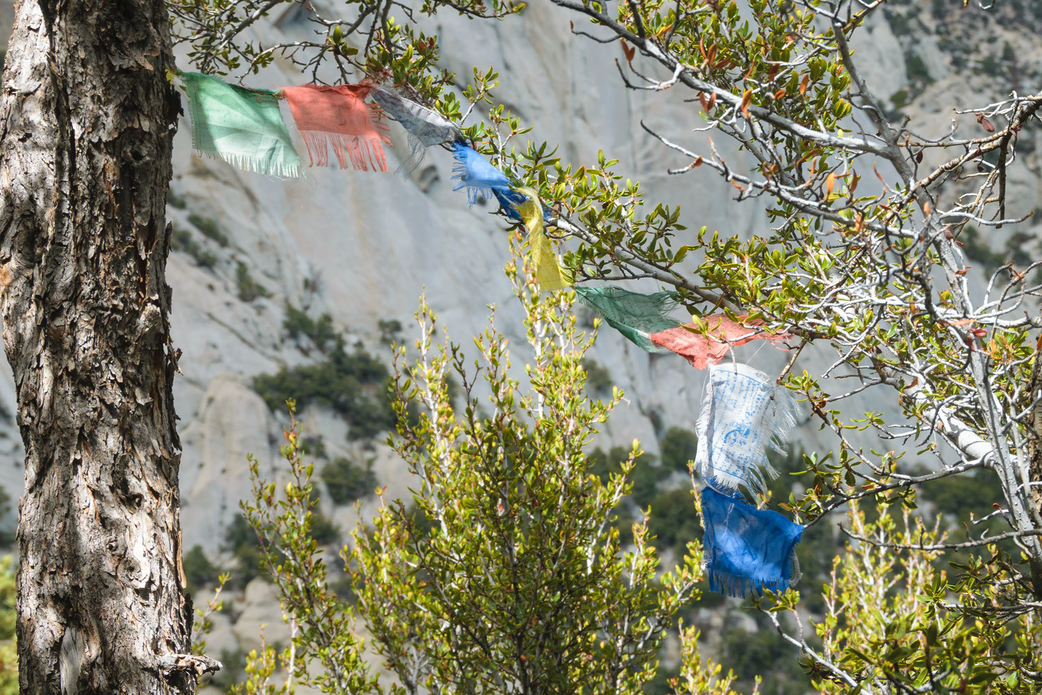
Outside a battered set of Tibetan prayer flags catch the wind.
It appears the walls are poured concrete and faced with granite rock.
For a moment the clouds cleared in the main canyon above.
The building is two miles up from the trailhead. We started back down and stopped to take a last look at this curiosity surrounded by soaring Sierra granite.
Our adventure continues, please click here for - Part Two
Beautiful! Thank you for letting me tag along.
ReplyDeleteThanks Mr. Sage!
DeleteYou have good taste in many things, I am impressed with the coffee choice, "Peets". My go to as well! Thanks for sharing your travels.
ReplyDeleteYou are welcome and Peets is worth waking up for.
DeleteI enjoyed your trip as always...
ReplyDeleteThanks David!
Delete