please remember you can click on a photo to see a larger version
Our
continuing exploration of the real west.
“I wonder if
I can get information about Forest Road 017. It runs from the Reese River
Valley up to Ophir Summit on the west side of the Toiyabe Range”. I was talking
on the phone with staff at the Forest Service Austin Ranger District Office in
Austin, Nevada.
“Oh, it’s a
maintained road on the west side up to the top. We maintain it, but only up to
the summit. We don’t recommend anybody drive the road on the east side.” The
woman was helpful in answering my questions.
“Yes, I’ve
been up the road on the east side. That’s the reason for me calling about the
condition on the west side.”
I
appreciated her good attitude toward helping the public. I thanked her for her
help.
After our
trip into Nevada over the July 4th holiday and discovering the trailhead into
the Arc Dome Wilderness at Columbine Campground, the Lady mentioned, several
times, about doing a trip to climb the Arc Dome, the Toiyabe Range’s highest
peak. The Labor Day holiday weekend gave us that opportunity. Ophir Summit was
going to be a bonus.
We launched
right after work on Friday afternoon. Our friend Ted helped us with directions
to his “Green Mountain” boondock site outside of Fallon, Nevada. We turned off
onto the dirt and the Lady grabbed the directions we had printed off of an
email from Ted. After finding intersection after intersection just as Ted
described, the Lady continued with the directions.
“Okay,
here’s the 90 degree corner, now we go two tenths of a mile to a “Y”.
“Here we
go,” I said.
“These
directions are incredible!” The Lady was pleased.
“I bet we
could calibrate our odometer using these directions, they are that good!” I
added.
“Incredible!
I guess this is how he must have earned the ‘Magellan’ nickname!” the Lady
exclaimed as we arrived at Ted's “fantastic flat spot” with a view of the
lights of Fallon - just as described.
Late the
next morning, after a stop in Austin to top off with gas, found us back at
Columbine Campground on Stewart Creek on the west slope of Nevada’s longest
mountain range, the Toiyabes.
This tiny
campground was half full. We grabbed the same campsite we had over the Fourth
of July holiday.
We quickly
had the camper popped up and the set up chores completed. We decided to head
into the Arc Dome Wilderness Area and explore along the crest of the Toiyabe
Range.
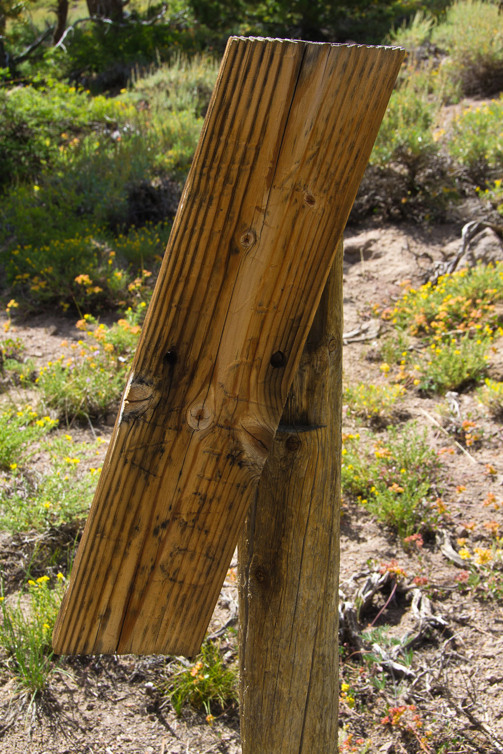
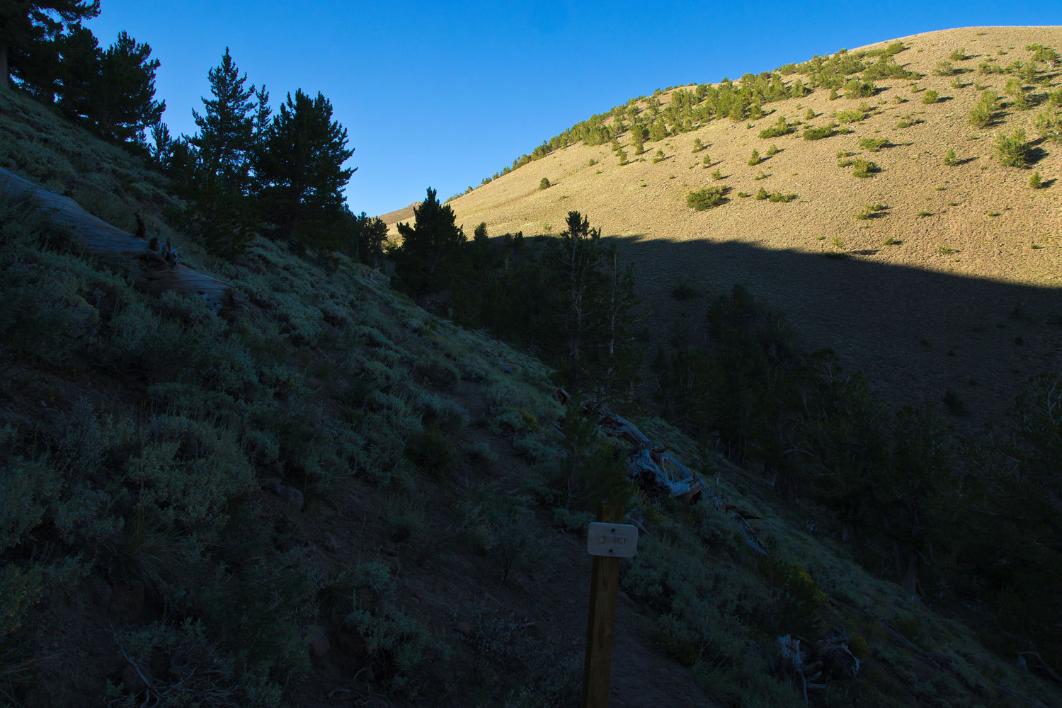
Old trail
signs greeted us along the route.
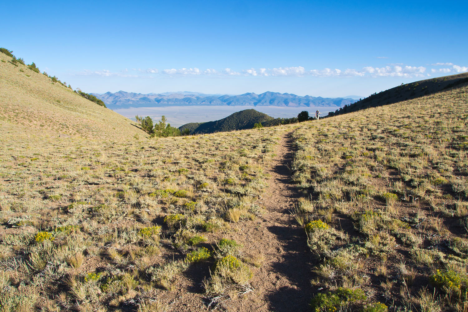
It’s about
three and a half to four miles up to the crest, in places a broad slanting
alpine plateau above timberline.
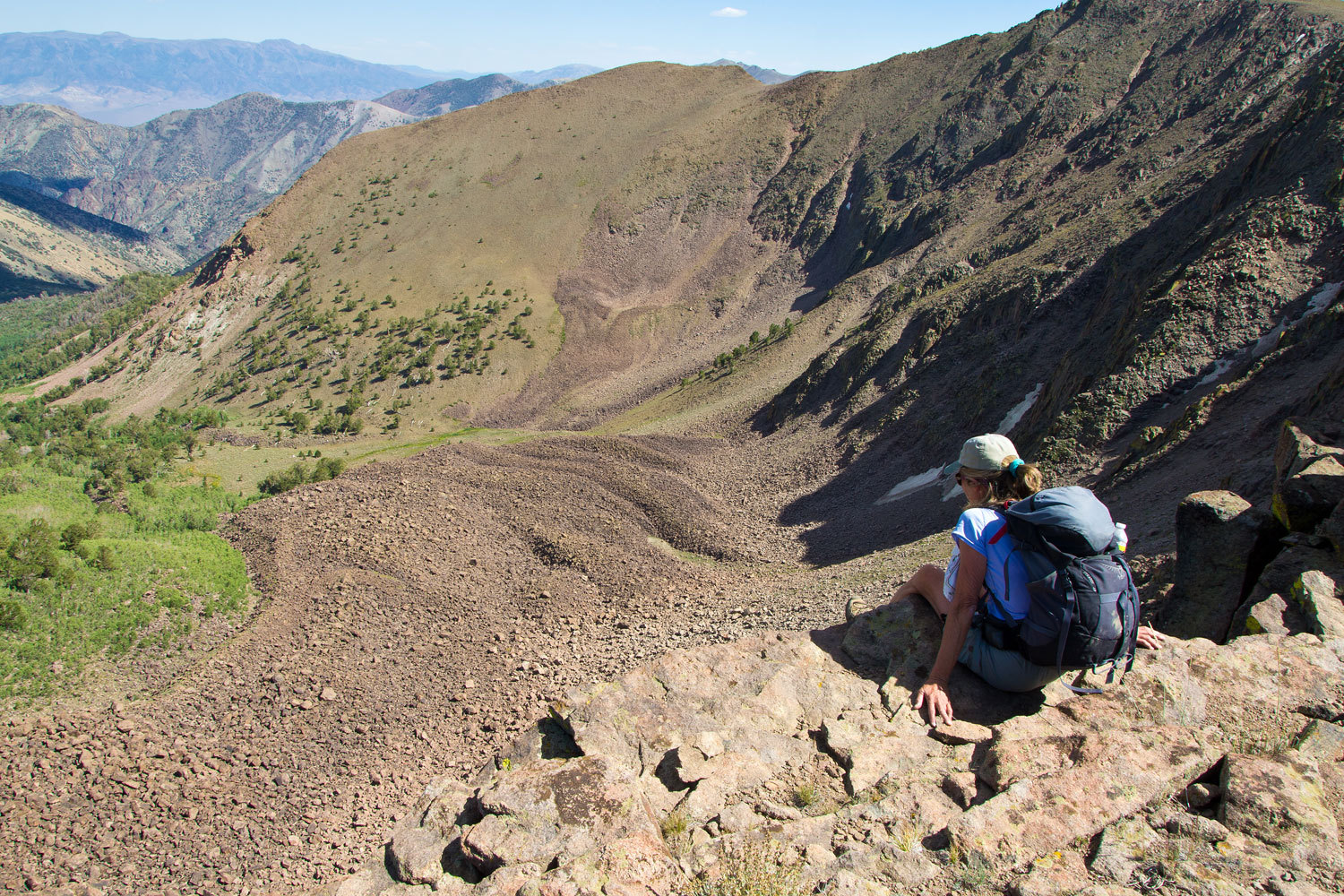
Very similar
to the broad summit plateau of Mount Jefferson to the east in the Toquima
Range, this plateau was also cut into on the east side by glaciers that carved
out spectacular cirques.
There were
also ancient Native American hunting blinds for taking bighorn sheep.
We wandered
cross country up on top and did an eight mile loop, taking another route back
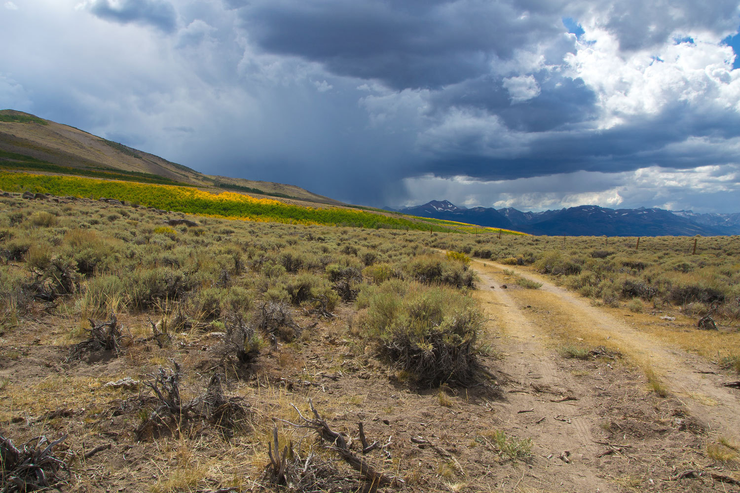
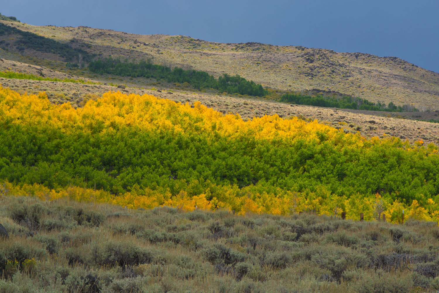
down to the campground. We dropped back into the Stewart Creek drainage.
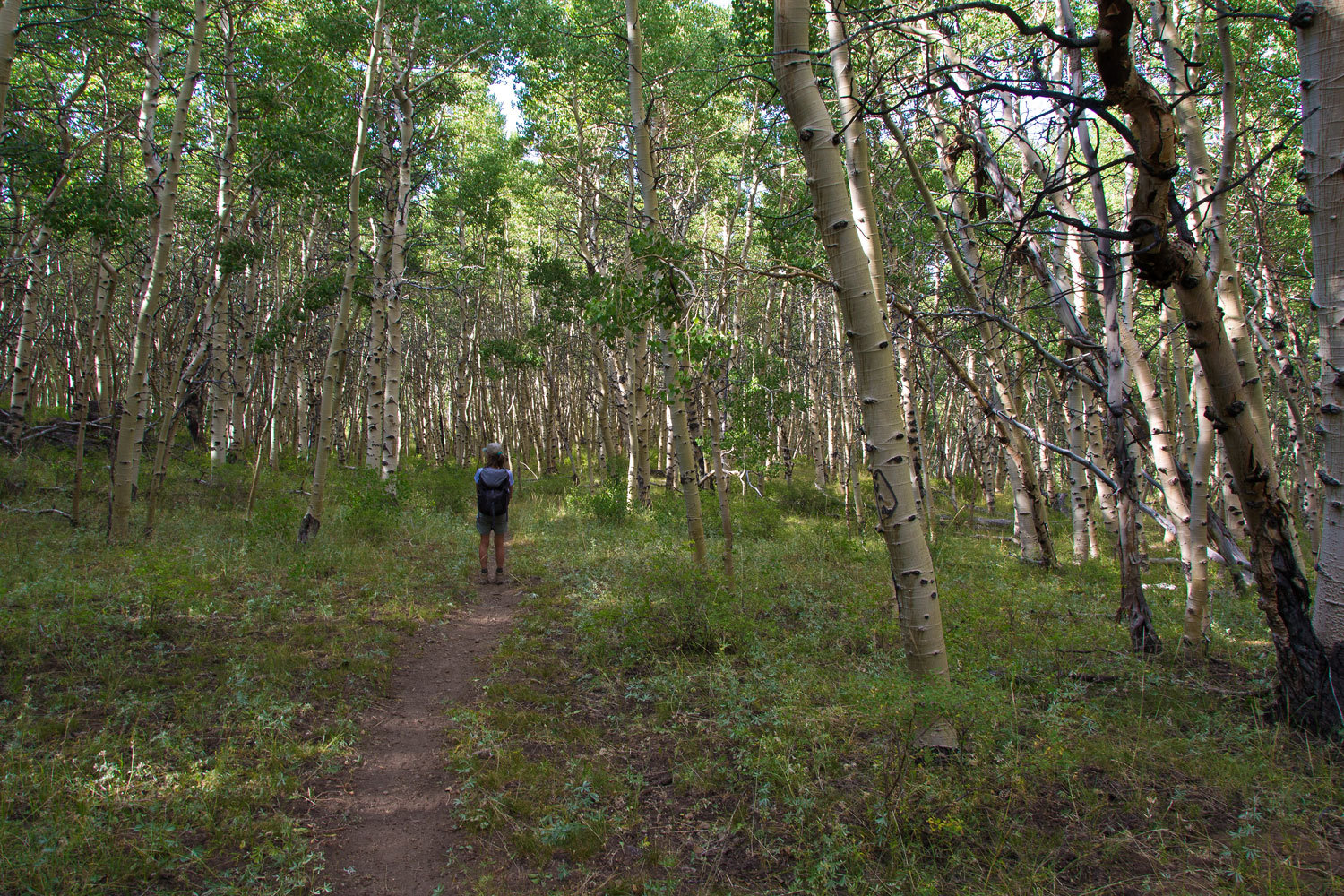
As we neared
camp we entered a vast grove of aspens. We did not see another person all
afternoon as we hiked.
Yes, this is
Nevada. This is the heart of the Great Basin.
After our
early evening shower and dinner, we wandered down from the campground into the
open sage to walk, relax, and enjoy the end of another special day.
We headed
back to camp as the light faded.
Tomorrow –
to the top of the Toiyabe Range.
This was a
day to really have some fun. We enjoy traveling in our truck and camper,
exploring and poking around new places, but nothing seems to fulfill something
deep inside us like walking through primitive, seemingly untouched land,
especially high country. Something about walking away from civilization
………..it’s like walking through the door into a majestic theater, full of
anticipation to see your all time favorite movie. Although what we have found
beyond that door – out there - far surpasses any movie we could ever imagine.
We have been so lucky to have seen and visited so many wonderful places. It
gets addicting. We want to keep stepping through that door. It is where we feel
at home.
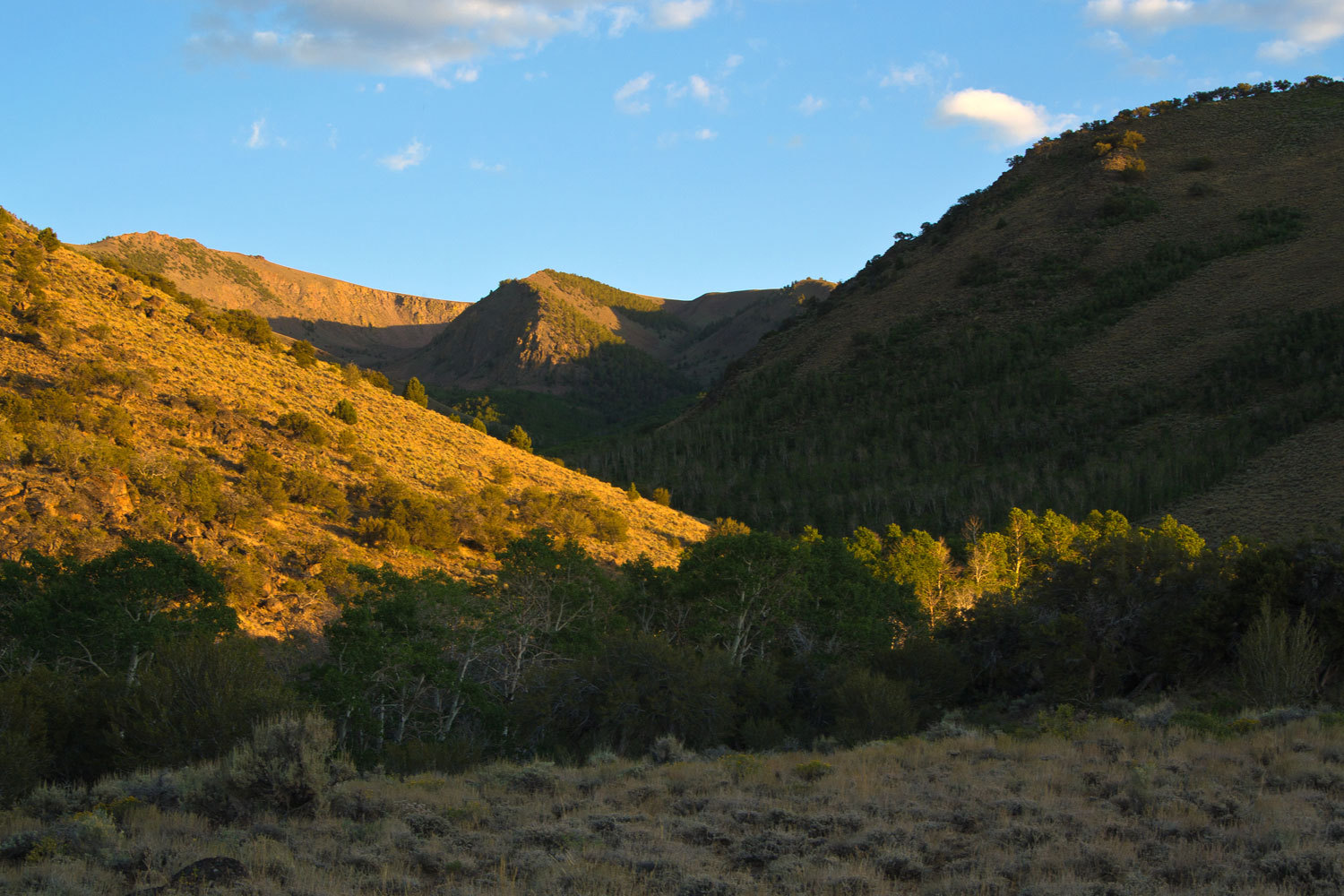
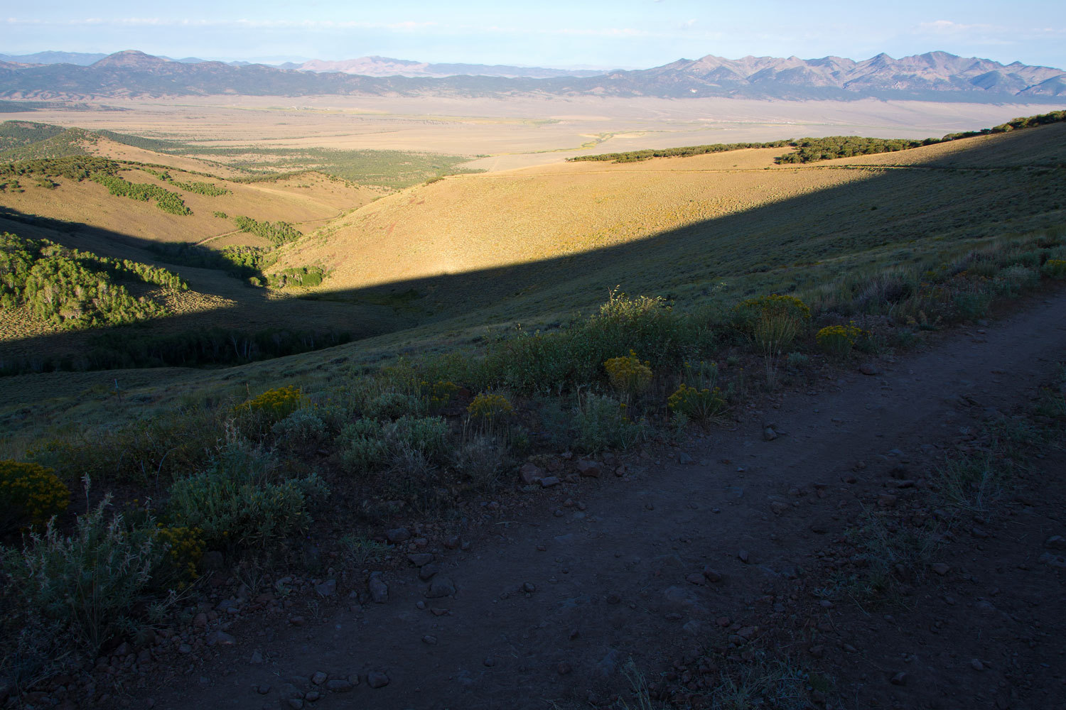
Here we
were, early the next morning high in the Toiyabes, looking down as the rising
sun lit up the Reese River Valley below.
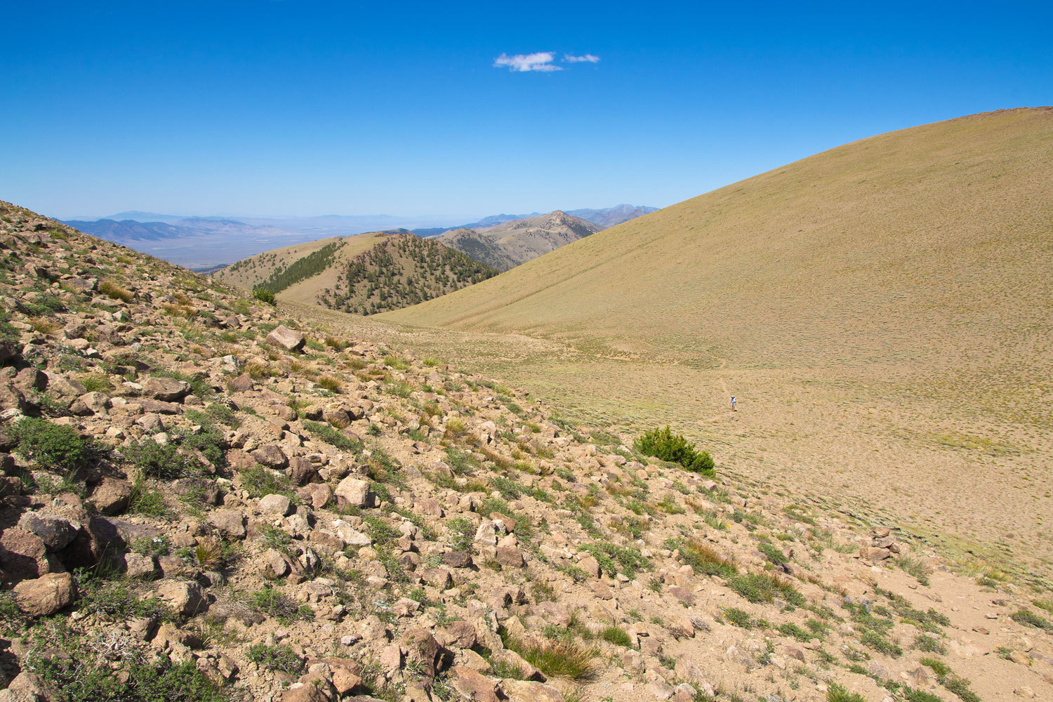
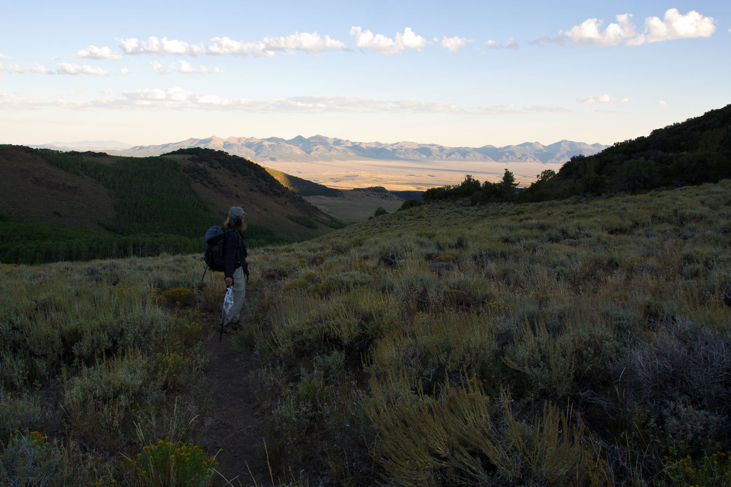
We climbed
up toward the crest, heading for the sunlight.
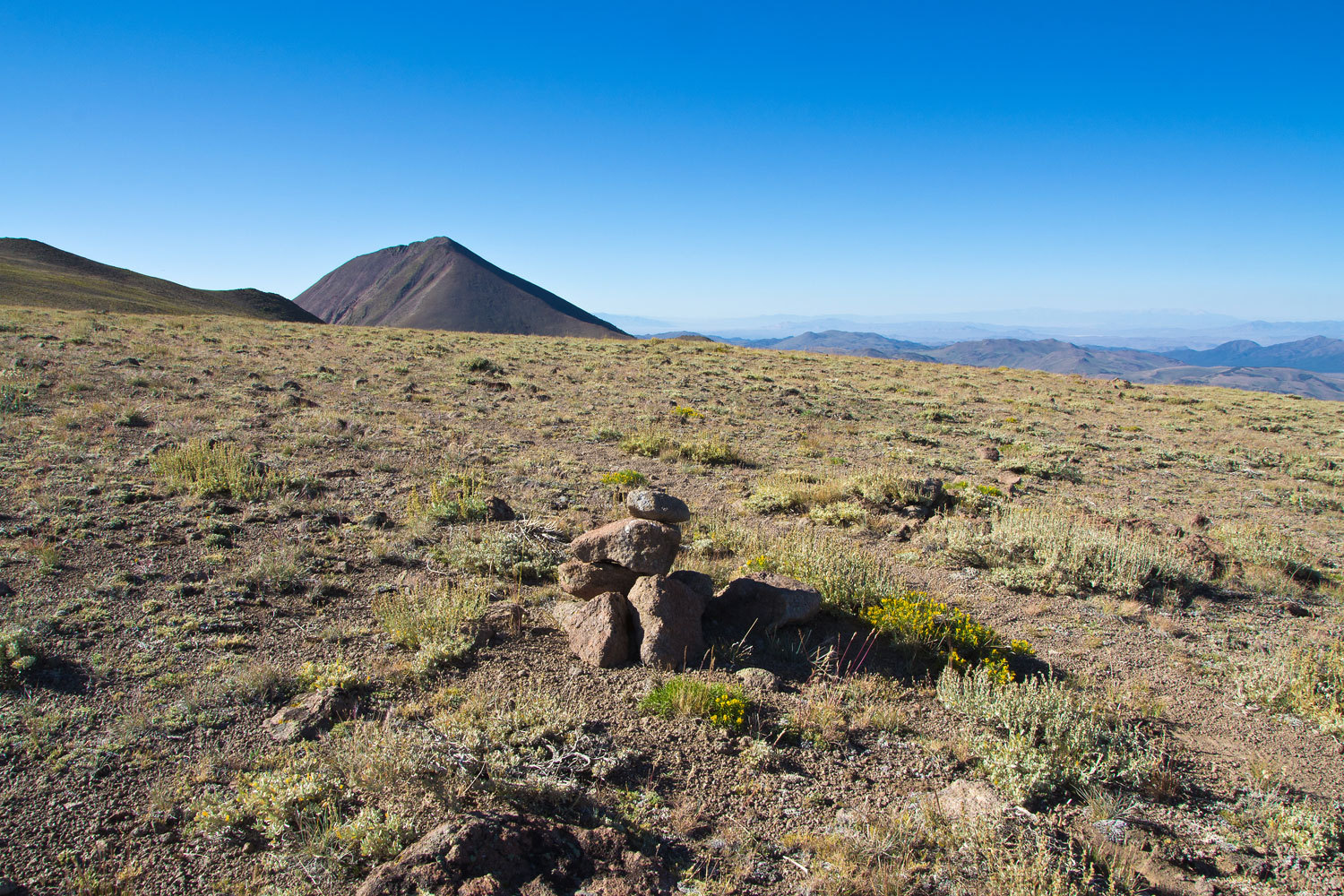
We stopped
for a break on the plateau, snacked and drank water, and got our first real
view of the Arc Dome to the south.
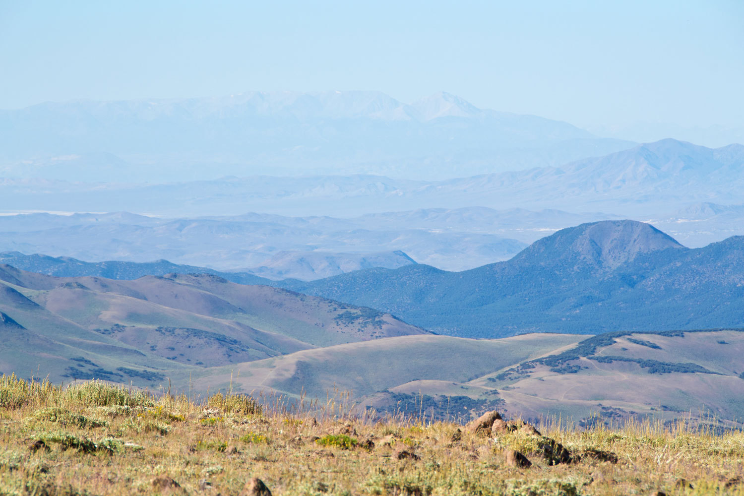
The sky was
nice but far from the clarity we sometimes experience out here. Still, we were
able to make out the north end of the White Mountains with the distinctive Drop
Off and Montgomery Peak over 90 miles away.
As we
continued south we saw we had a little bit of a drop and Arc Dome was actually
a separate and quite distinctive peak.
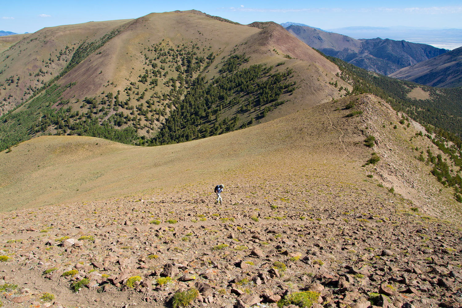
The
switchbacks up the steep north shoulder were quite comfortable and fun.
You do feel
like you are on top of the world.
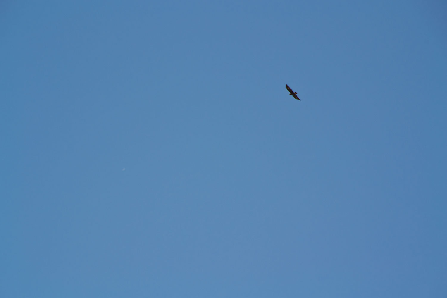
Earlier in
the morning we had seen one golden eagle moving to the north. As we relaxed on
the summit, a pair came into view moving toward and just above us. We were
treated to a marvelous display of flying skill. One circled around and tucked
its wings and dove off to the northeast. The second entered the updraft coming
up the east face of the Arc Dome and hovered there, still, wings and tail wide.
It was carried straight up and soon was just a speck against the sky. To be an
eagle!
There are
interesting ruins on the top of Arc Dome. I suspect from around World War Two
times. A quick search on the Internet did not turn anything up. I may try to
talk with a forest archeologist. It has piqued my curiosity.
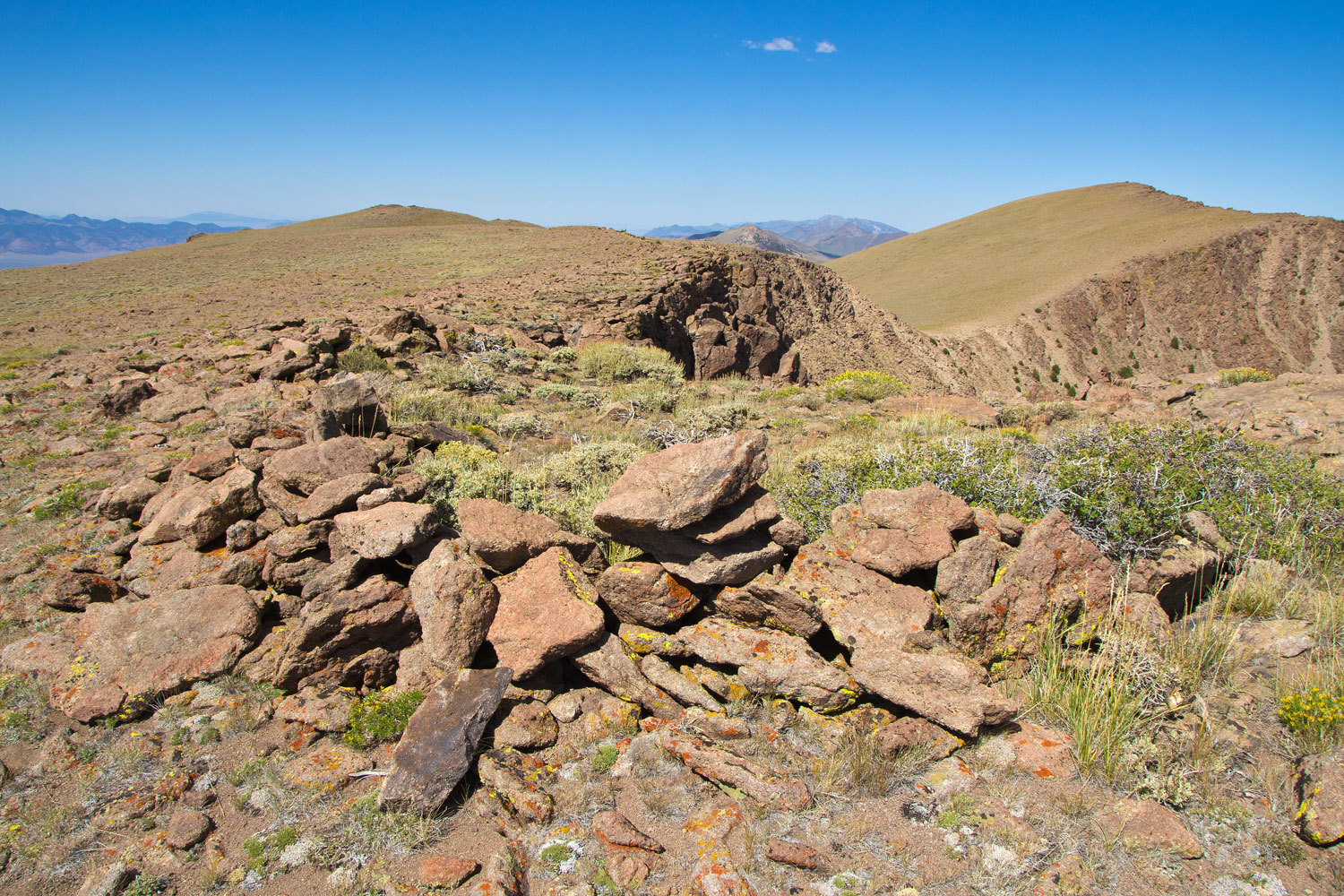
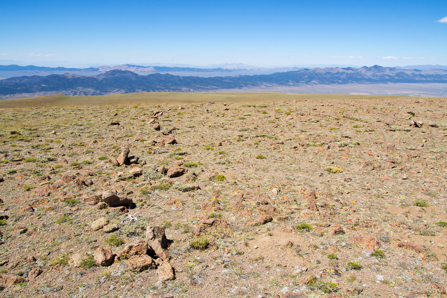
As we moved
back to the north we lingered as we walked across the broad plateau. A long
line of rocks caught our eyes.
The
temperature was probably in the low 70’s up here with a bit of wind. We were on
top of the world in a wonderful place. No one else was up here; another day of
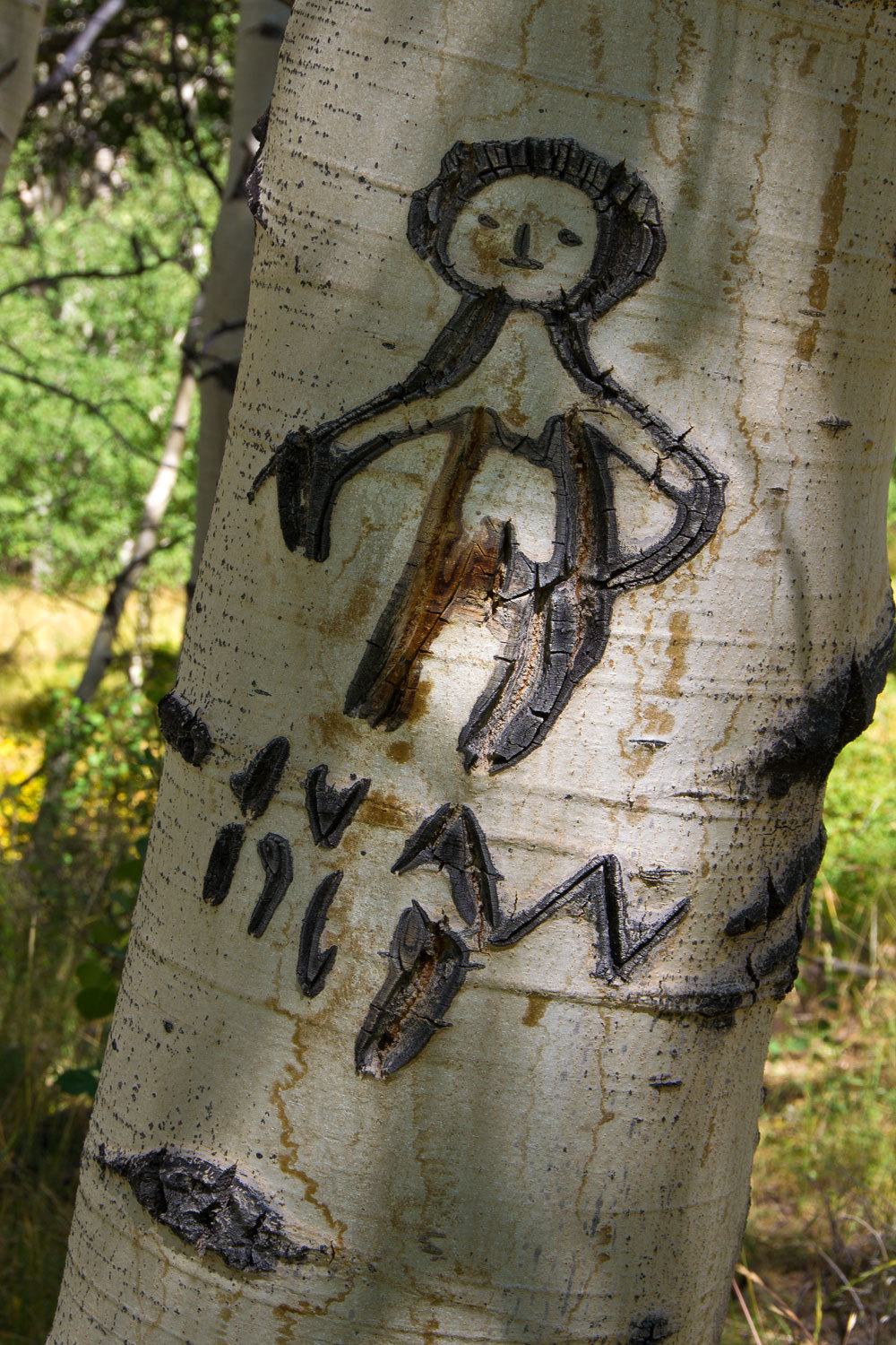
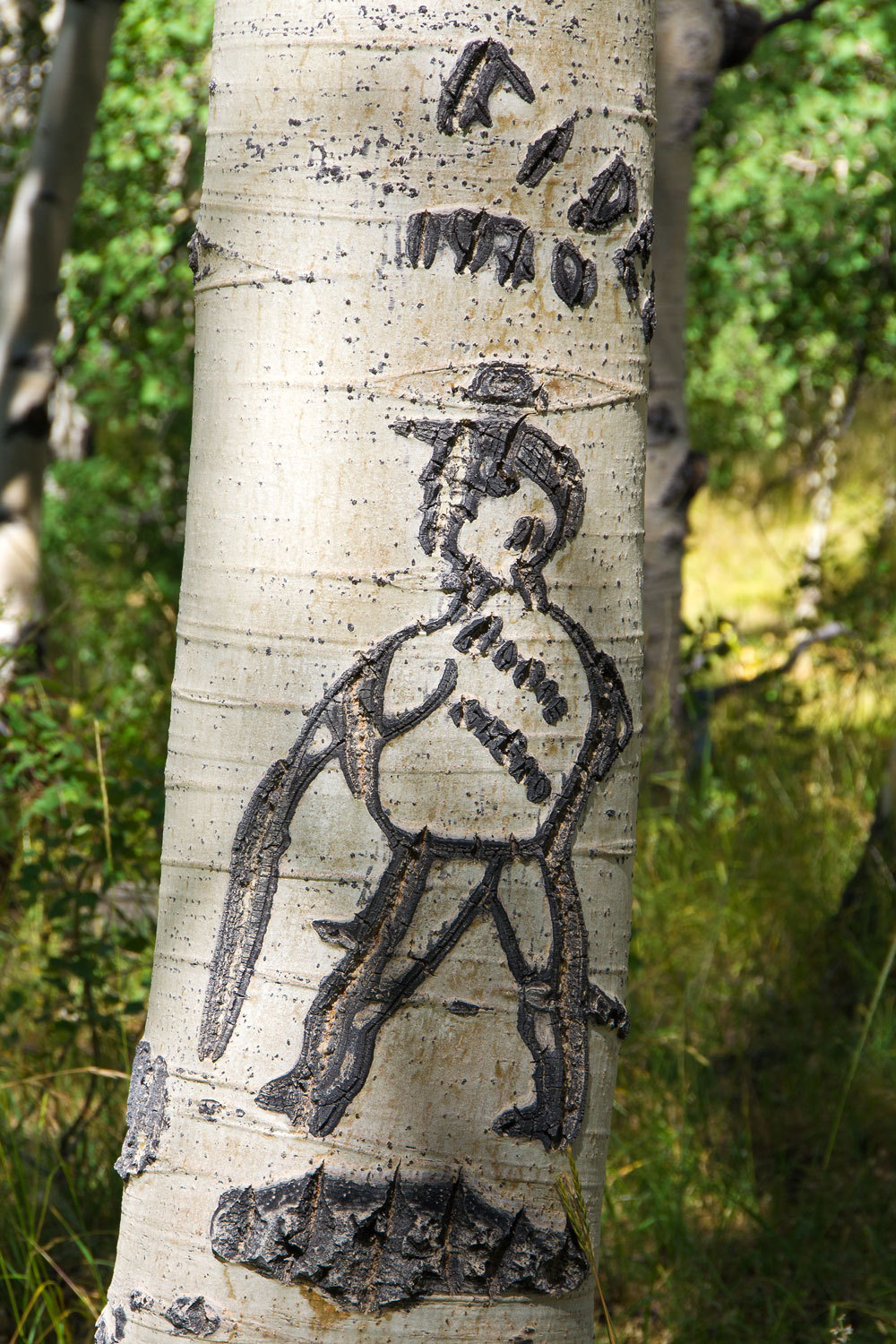
not seeing another person. We headed back down to lower elevations and spent
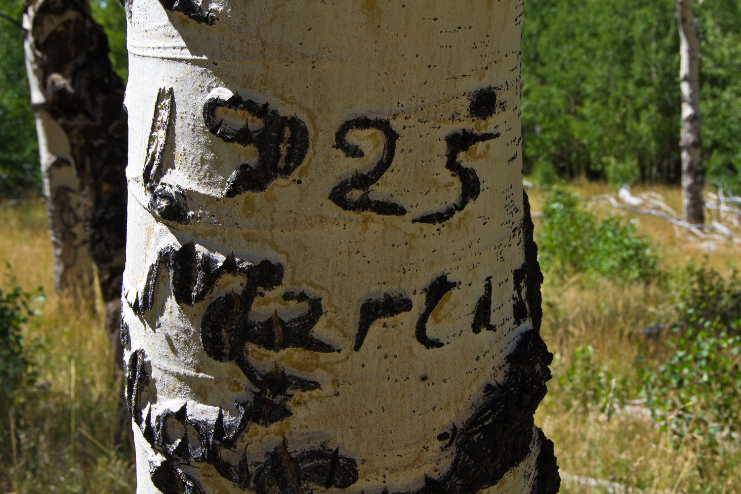
some time in a grove of large aspens and
enjoyed the graffiti.
On this trip
we had found what we had come for – solitude, high alpine terrain, seen where
glaciers had been, and the Lady had touched the top of the Toiyabes – 11,773
feet.
We got back to Columbine Campground around mid
afternoon. One group had left, replaced by an FWC on a Toyota. Was this one of
you out there? We pulled the boots off and relaxed.
“Do you want
to just stay here or move and check out Ophir Summit?” the Lady asked. She was
looking comfortable in her chair.
“Well, let’s
sit a bit. We have lots of daylight left and Ophir’s not far but it’s probably
a steep slow road up to the top.” My chair was feeling comfortable to me too.
“In a few minutes let’s drop the top and head over. I expect the views and
sunset and sunrise to be amazing from there. I bet we’ll be glad we go up
there.”
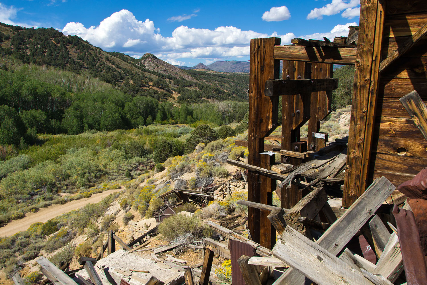
On that trip
we had driven up to the ghost town of Ophir – and about snow line – camped and
had hiked from there up to the Toiyabe crest. The road is very rough up to
Ophir and disintegrates from there on up. Still, we remembered the views we had
of this high trailhead, and wondered if someday we would drive up to this spot.


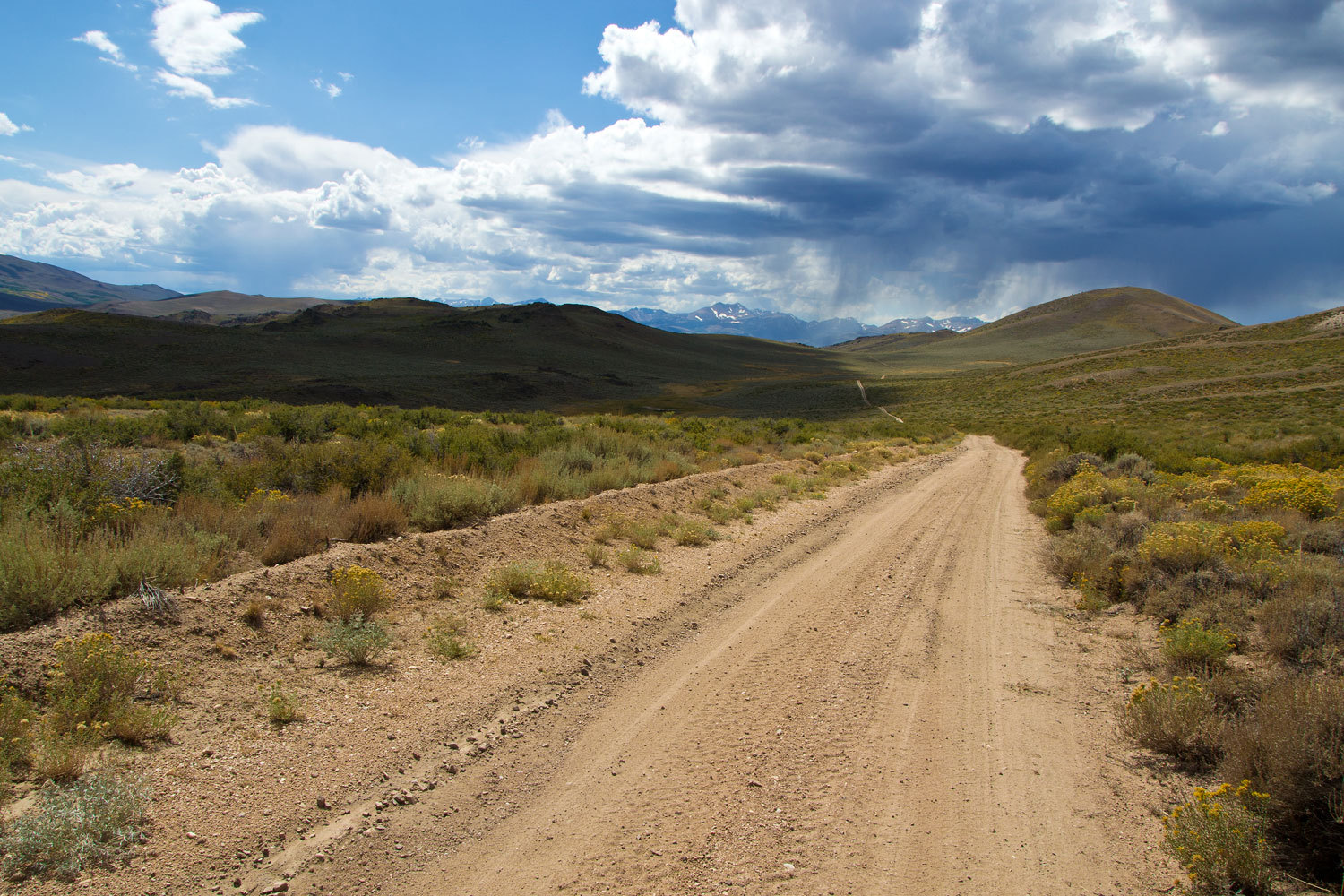
It is ten
miles to the top from the Reese River Valley road. Six miles is the approach up
the alluvial fan to the mountain block. From here the road climbs for four
miles to the summit. It is an edge of the mountain, shelf road these last four
miles. A sign at the bottom says narrow steep road ahead. It’s right. It is
narrow with possible turnouts to deal with oncoming vehicles almost
nonexistent. The only advantage is that in most places the line of sight is a
mile or more and you might be able to plan how to pass a vehicle. The road is
in good shape and mostly smooth dirt. The views are incredible and it is a spectacular
road. We will be back. This was a fun drive.
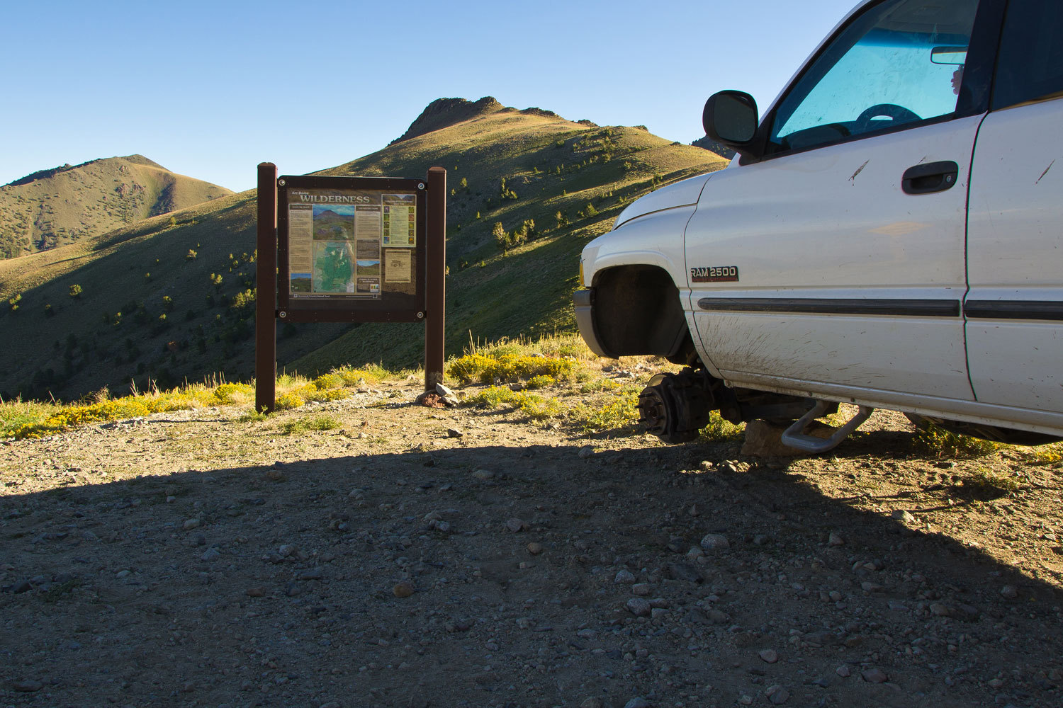
We did not
meet another vehicle. From far below we saw a tiny white speck at the top. We
were concerned this vehicle might start down as we were coming up. Turns out,
this truck wasn’t going anywhere.
Somebody had
had a really bad day. Two alloy rims with Firestone tires on the passenger
side. No spare tire under the truck. A steel rim with a Michelin on the
driver’s side back, no tire on the driver’s front, and the front differential
lowered onto a rock. It wasn’t too hard to piece together the story. We
wondered when and if someone would return.
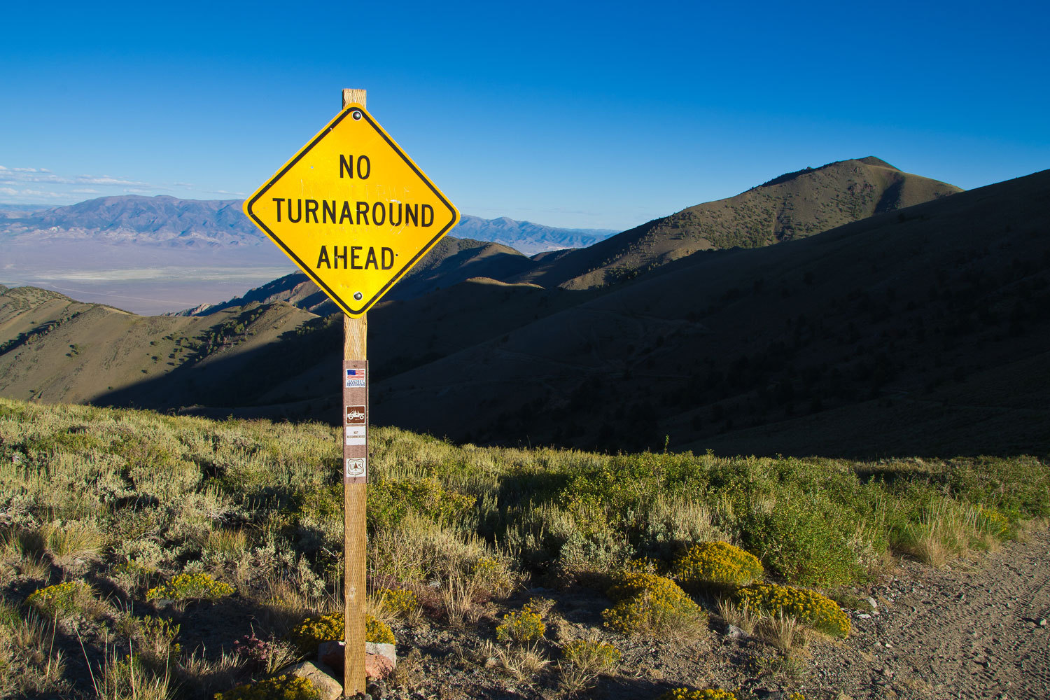
There is a
sign for east bound travelers.
Under the
jeep symbol on the post it reads, “Not Recommended.” There were a few ATV
tracks on the road down the east side.
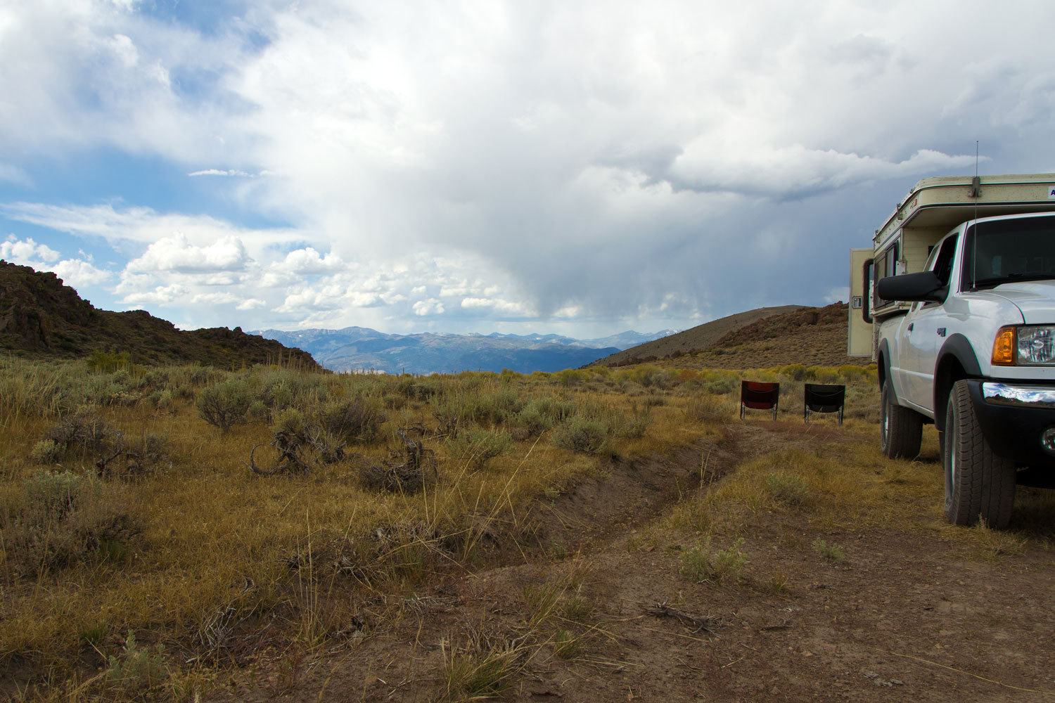
We were
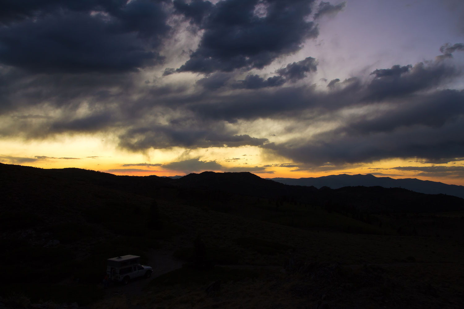
alone. It was around 5 pm. There was a nice flat spot. It was warm in the sun
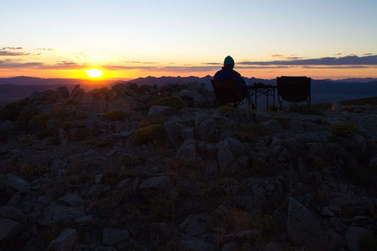
with little wind. We set up camp.
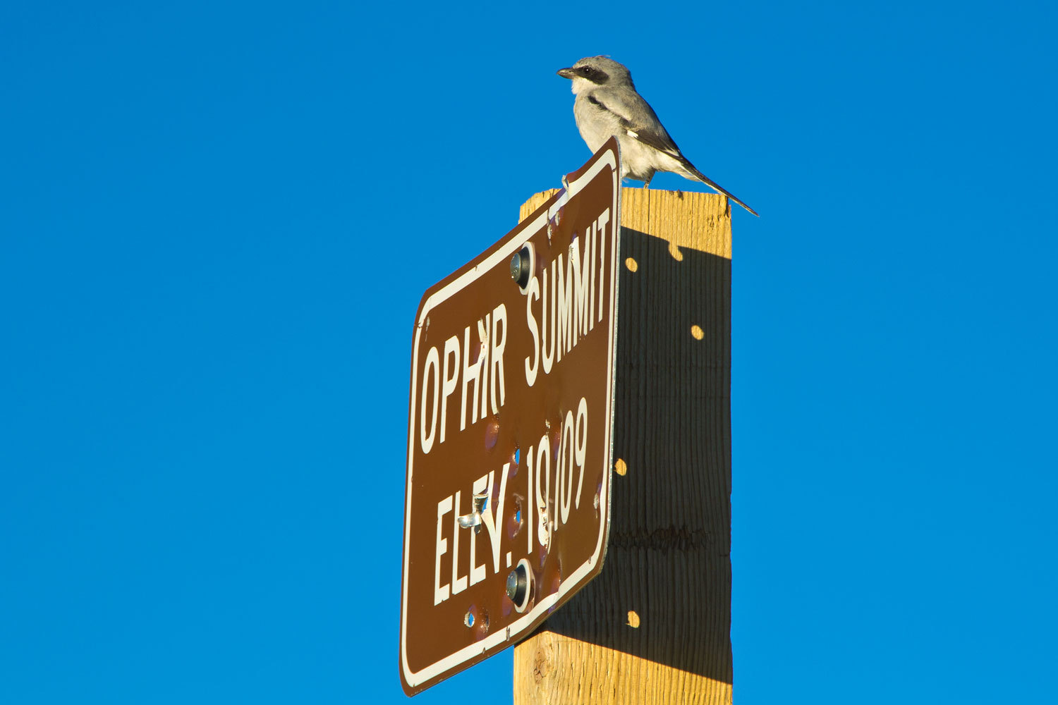
The light,
the views, everything was just right for a remote camp. We sat in our chairs
beside a makeshift rock wind shelter and enjoyed dinner. We were joined by a
grey robin sized bird. From its perch on the summit sign it would spot large
insects and then just nail them on the ground. Dinner safely in its beak it
would fly to the top of the rock wall within three feet of the Lady, and devour
its meal.
“It’s
joining us for supper!” the Lady said. “You have to get a picture of it so we
can identify it when we get home. We have to start carrying the Sibley book
with us!”
I had my
assignment. We came up with Loggerhead Shrike.
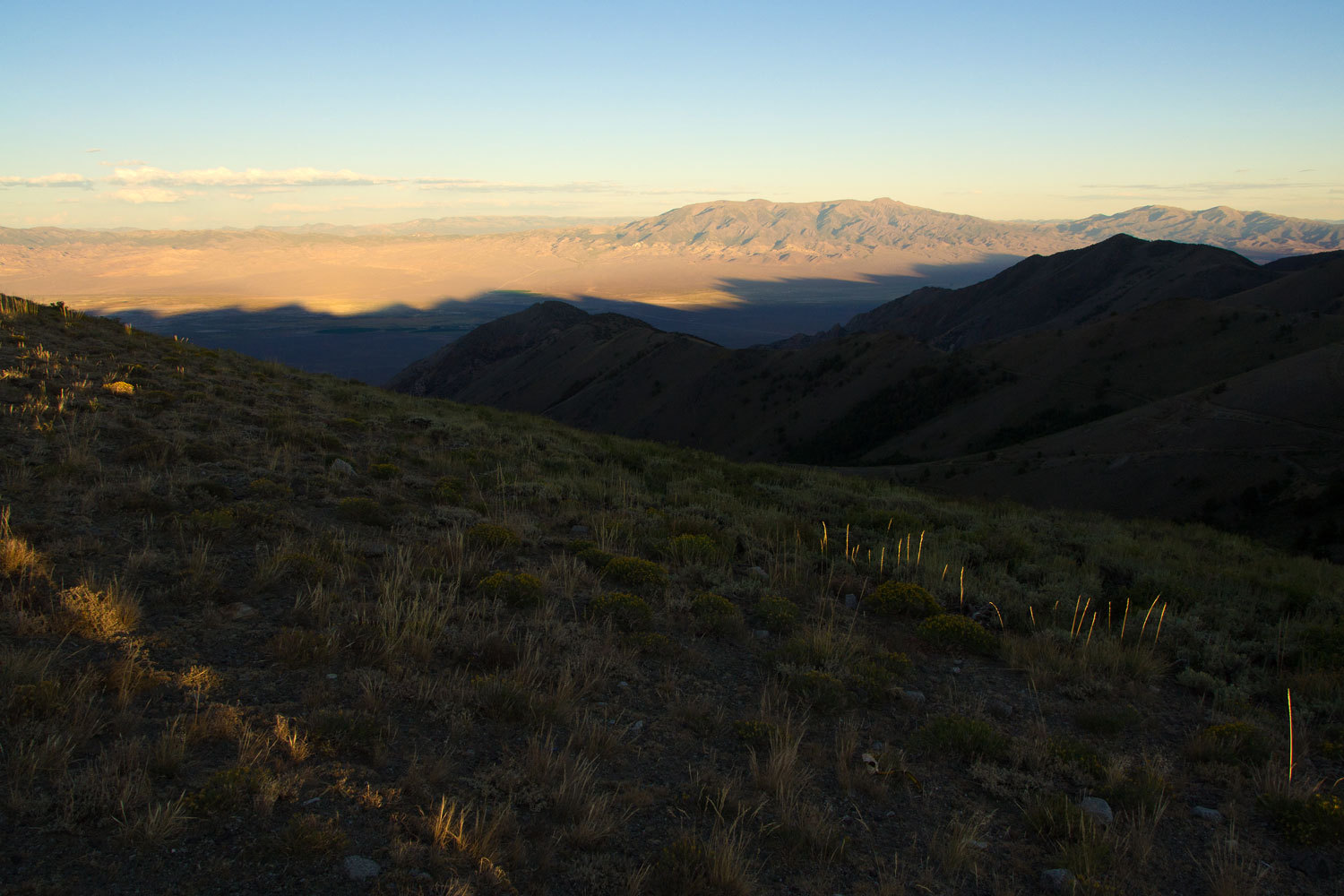
We watched
the shadow of the Toiyabes creep across the Smokey Valley and toward the Mount
Jefferson massif as the sun dropped in the west.
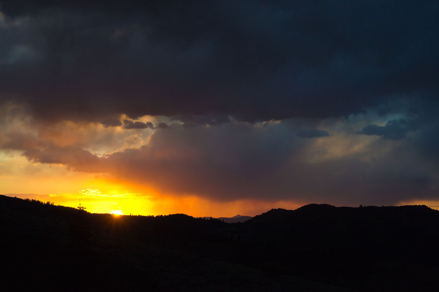
The sunset
could hardly have been better.
As the sun
sank it illuminated roll after roll of Nevada’s mountain ranges.
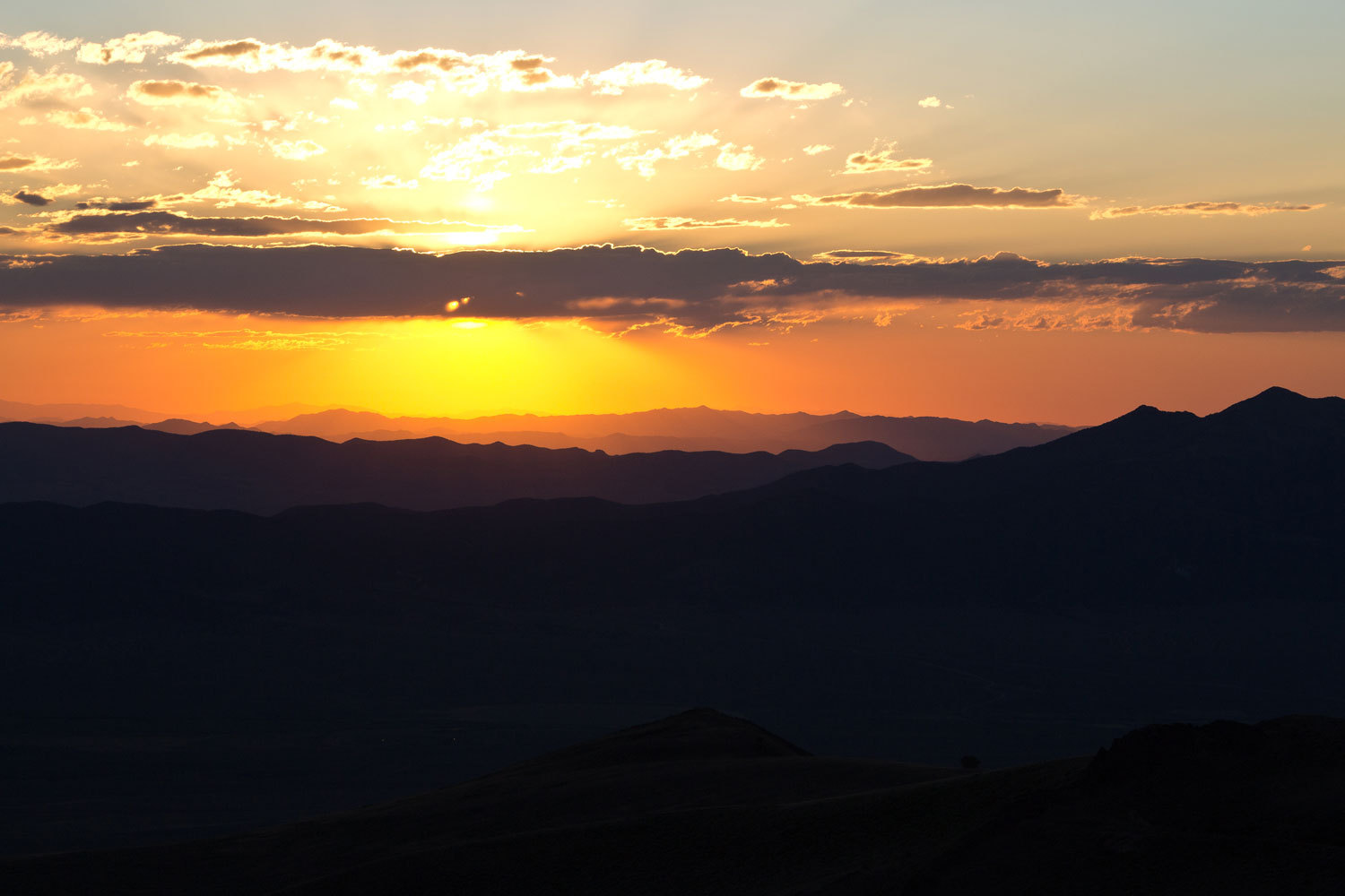
As the last
colors were fading in the west the Lady asked if I could capture the red over
the Shoshone Range with the lights of the Yomba Reservation below.
What an
evening! There’s one thing that makes a camp spot perfect for the Lady, when
the coyote’s song breaks the silence of the night. This was one of those
perfect spots. The coyotes sang as we dropped off to sleep.
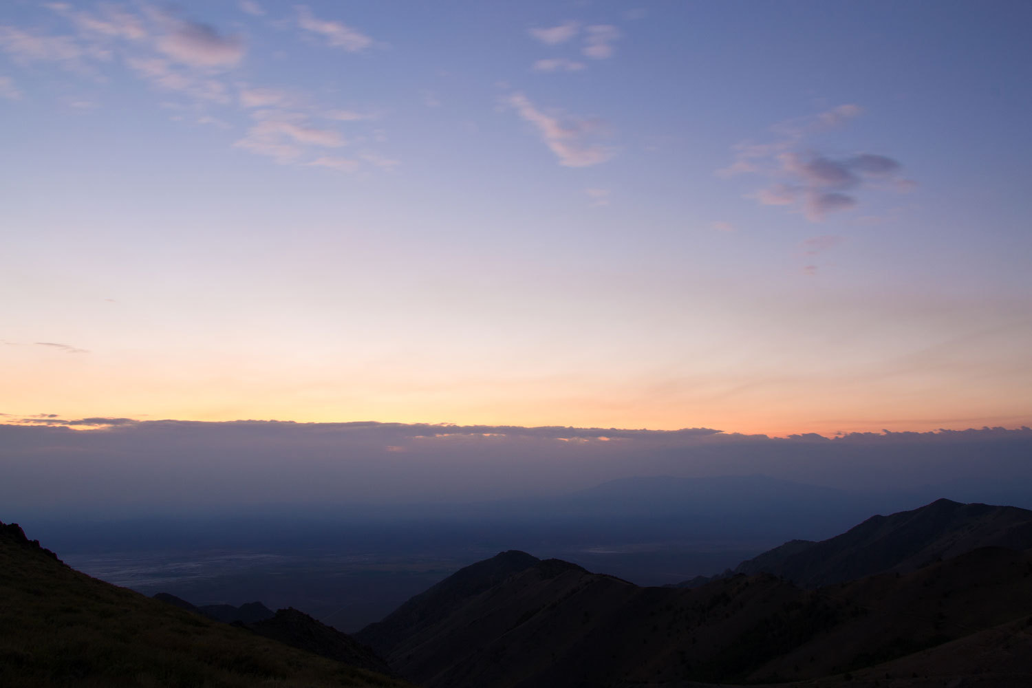
In the
morning there was a bank of clouds over the Toquima Range.
There was a
bit of a wind out of the west, enough to drive us inside for breakfast. We
packed up, dropped the top, and I was doing outside chores when I saw the truck
round the last corner about a half mile down the west side. It was about 7:30.
"Truck’s
coming up,” I told the Lady.
“Really,
must be people bringing up tires,” the Lady replied.
“Yup,
there’s a tire riding high on the cargo shelf over the camper shell.”
The Lady
finished her fussing inside the camper and I waited for the truck to pull up.
“You gonna
get your truck up and running?” I asked as what looked like a father and son
climbed out of a matching white Dodge.
“Yeah,” the
son answered as he scrambled up on the rack and started untying the tire. “All
we thought about driving up was that we sure didn’t want this tire flying off
this truck!” he added.
The Lady had
joined us. “Whose truck is it?” she asked.
“Mine,” the
older gentleman answered.
“We saw your
truck and thought what a bummer! Did you have to hike out to get help?”
‘No, we had
two trucks up here.”
The younger
man had the tire untied.
“Let me help
with that,” I said as I moved alongside the truck with the older guy.
“No, we got
it,” the older guy said.
“Yeah, but
it never hurts to have help,” I said.
The younger
man lowered the tire into our hands until we had all the weight.
The older
guy said with a grin, “You know these big tires are a lot lighter when they
have air in them!”
I laughed as
we set the tire on the ground. “That’s a good one! I’m going to use that line
sometime.”
Our truck
was running to warm up the cab. “You guys got it from here?" I asked.
Yeah, we got
it,” the young man answered.
I moved to
our truck.
“Hey,” the
older guy said, “What are you guys doing up here? Are you hunting?
“Naw. We’ve
been hiking and looking around. We went to the top of Arc Dome yesterday and in
the afternoon we thought this would be a great spot to spend the night.”
“You spent
the night up here?” the young man asked as he looked surprised.
“Yeah, it
was a great night. The views are great and the sky just looks huge from up
here.”
“Wow, cool!”
the young guy smiled.
“We’re
heading down the road. You two the only ones coming up?” I asked.
“Yup, the road
should be clear for you.”
We headed
down.
This is the
bottom half of the shelf road. Yes, that’s it further down the canyon on the
left.
We headed
home marveling that we again had such a great time in the Great Basin. As we
turned north on the Reese River Valley Road, the Lady said, “You know I’d be
fine with never spending another night in a motel. I love our camper.”