
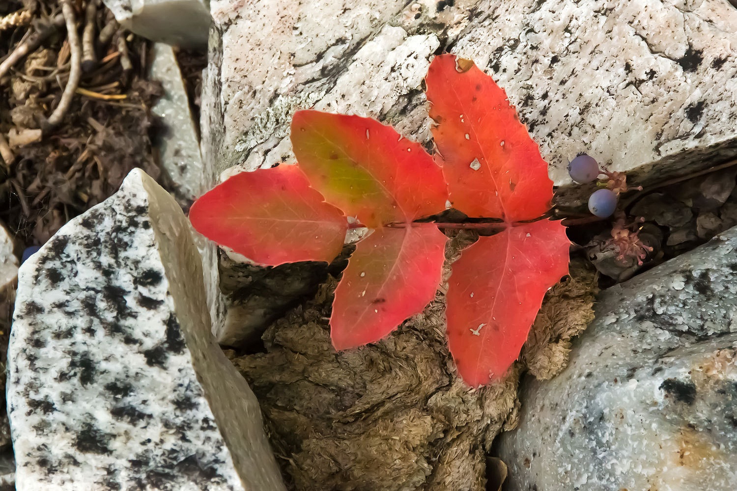
please remember you can click on a photo to see a larger version
The Lady’s trip journal said it perfectly –
“August 7th,
my feller got the call at about 1 pm to schedule his upcoming surgery so we decided we could
take off late afternoon! I thought we were heading back to the east side of the
Sierra but at the top of our road he asked, ‘Do you want to go to Great Basin?’
Surprised but game, I answered ‘Sure’ so off we went to get gas and sandwiches
and headed to Austin and Bob Scott Campground. We figured we would get there by
10 pm and we did—and we skirted a wild fire that was burning during all the
lightning!”


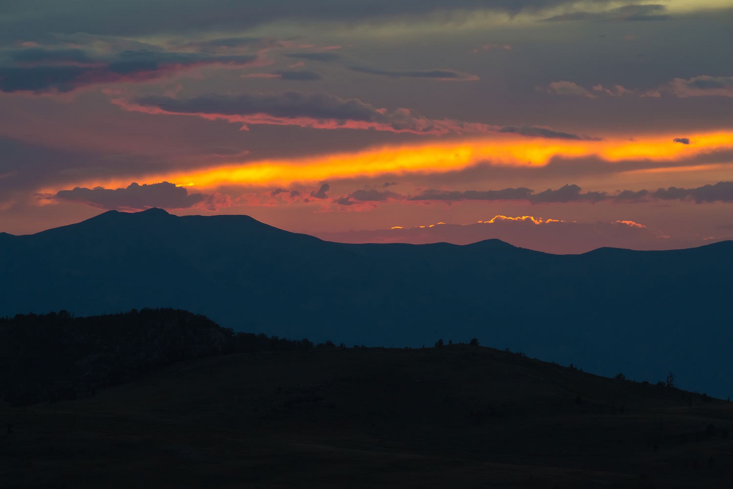
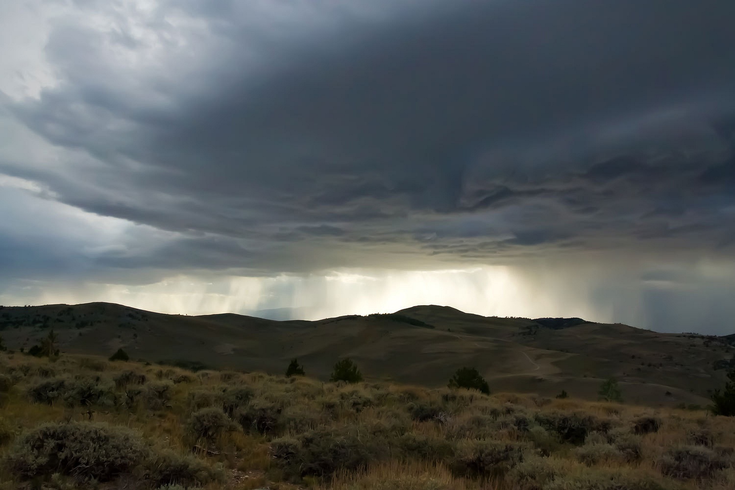
It was a
night drive to remember, east across Nevada on Highway 50 - "The Loneliest Road
in America.” It had turned dark and cooled down. Our windows were open. The
smell of smoke grew as we closed in on flame topped ridges. As we climbed New
Pass Summit, flames were on our left and thunder and lightning pounded the
ridges on our right with blinding flashes. Climbing east out of Austin, the view back showed a long
line of fire south of town, red in the night. It was a powerful sight.
We pulled
into Bob Scott Campground on the top of the Toiyabes and were surprised to find
its nine sites filled on a Tuesday evening. We slipped into the unused group
site and settled in.
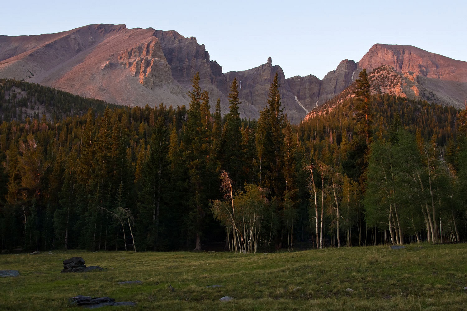
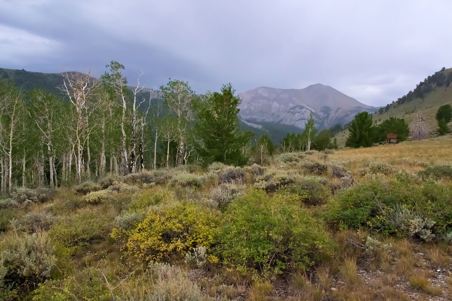
Late the next morning
found us high in Great Basin National Park.
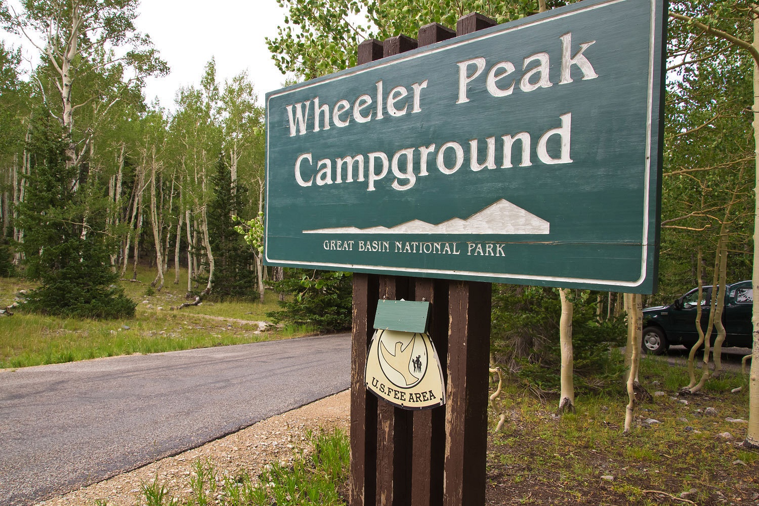
This
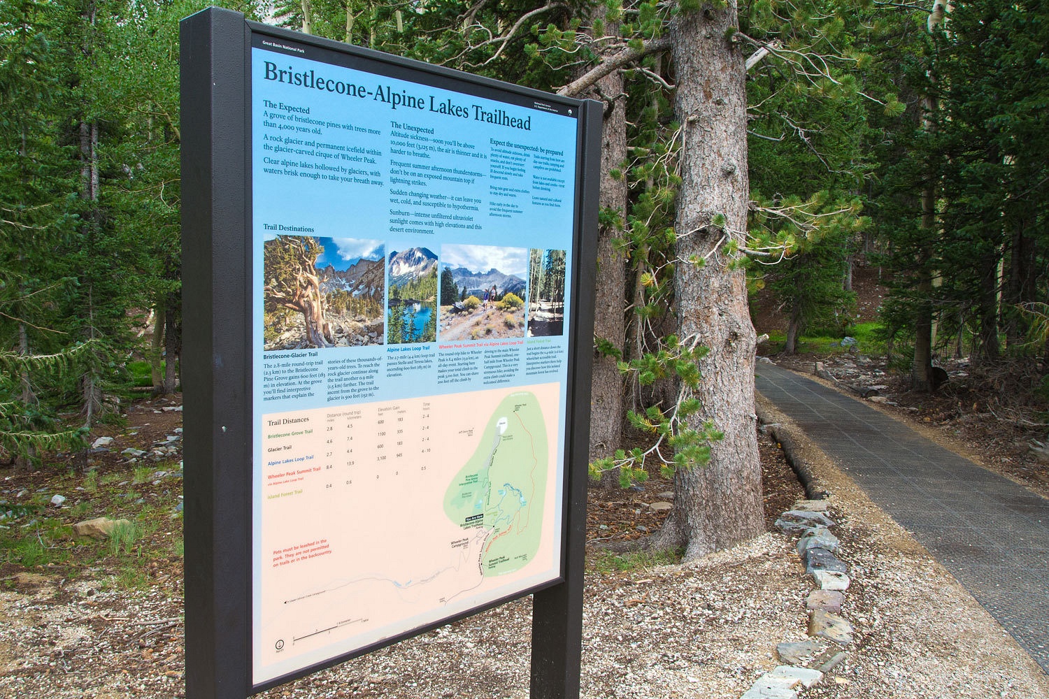
campground sits at 10,000 feet. The sites encircle a high meadow. There is a trailhead for the various trails
that radiate out from here – to the summit of Wheeler Peak, the Bristlecone Trail,
the Alpine Lakes Trail, or the Glacier Trail that leads to Nevada’s only
glacier.
This is
probably what called me here, caused me to ask the Lady that question, and we
turned left instead of right. With a recent pathology report indicating melanoma and now an upcoming lymph node biopsy surgery scheduled to see if it has spread, I wanted quiet, peace, to walk among the oldest
trees, and to feel the cold from a glacier.
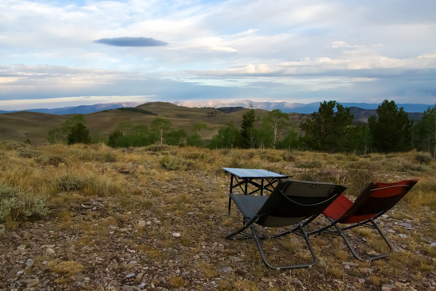
With camp
set up, site 25, a favorite, we pulled out our chairs, enjoyed lunch, and watched
the thunderstorm grow overhead. Soon big, hard raindrops hit and we climbed up
into the bunk with the soothing sound of rain on the roof and the smell of storm outside. We awoke three and a
half hours later.
We stretched
our legs and walked around the slowly filling campground, hand in hand. A
fellow from the San Francisco bay area walked out from his camp site to talk
with us. He had spent the night before at Spencer’s Hot Springs. He was curious
what kind of raptors had landed near him there. We figured they were Northern
Harriers. He hoped to acclimatize to the elevation and go to the top of Wheeler
Peak, Nevada’s second highest, in the morning. He told us of smoking dope in
Redwood National Park and walking up to an elk, “Wow! I didn’t know a deer
could get that big!”
He asked us what
we had planned in the Park.
“We’re going
to head up tonight to the rock glacier, take a nice walk.” I said.
He seemed to
take a while to ponder on what I had said.
We wished
him a good evening and as we walked along the Lady asked me, “We’re going to
hike up tonight? That’ll be cool!”
“Yup, there
won’t be another soul up there. We will be alone. We can enjoy the place and
the night.”


We slowly made our way down the mountain.


The last
person was coming down, wrapped in a rain poncho, as we started up. Storm
clouds hung down in the east over the Snake Valley.
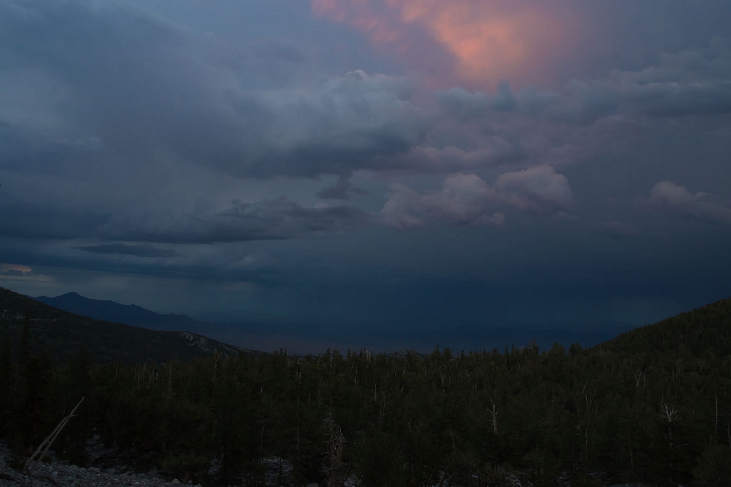
With the
night descended around us, we were among the bristlecone.
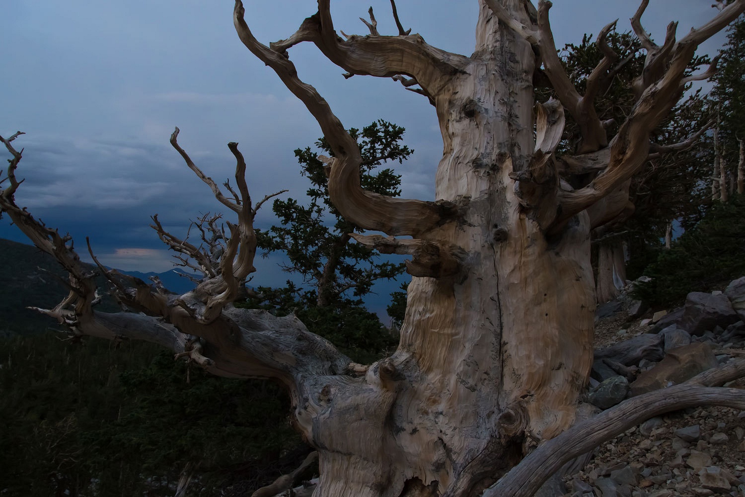
We continued
up into the cirque, out of the timber, into the talus, and to the foot of the
glacier.

The only sound
was our footsteps, the wind, our breathing, and our heartbeats.
This is what
I had wanted.
The Lady
followed me back down the trail in the dark. We enjoy letting our eyes adjust, our
headlamps off, our senses heightened. We know we are home. This is the world we
are connected to.
We slowly made our way down the mountain.
Sleep came
easily, as did morning.
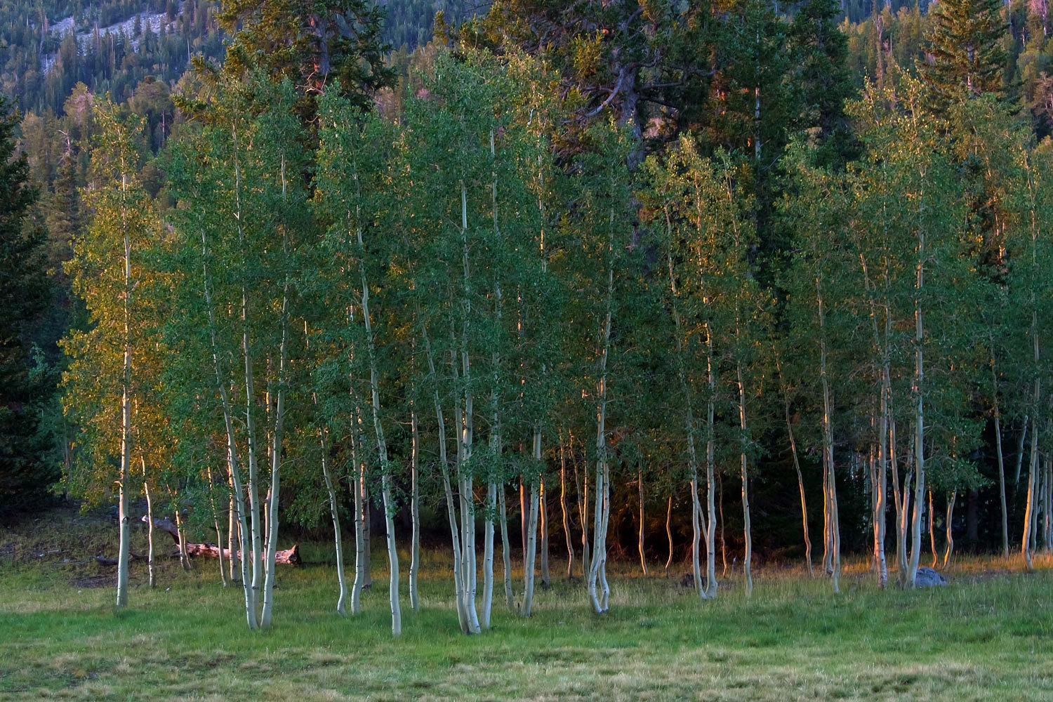
We stood
together and watched first light hit the Wheeler cirque and stream through the
aspen.
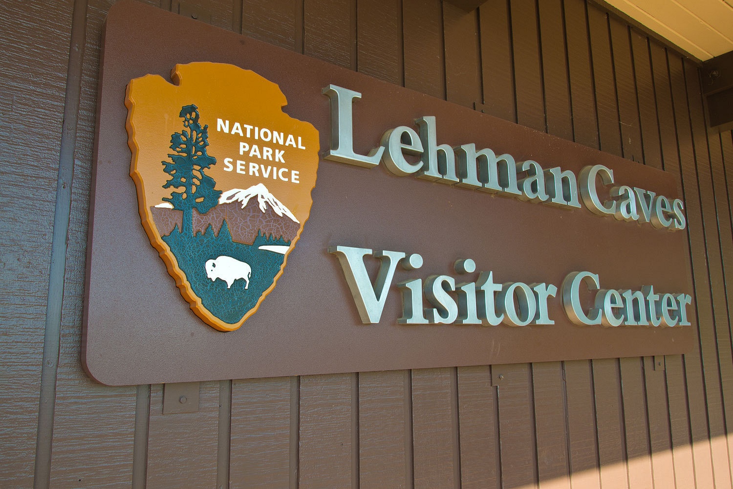
We packed up
and headed down to the visitors Center.
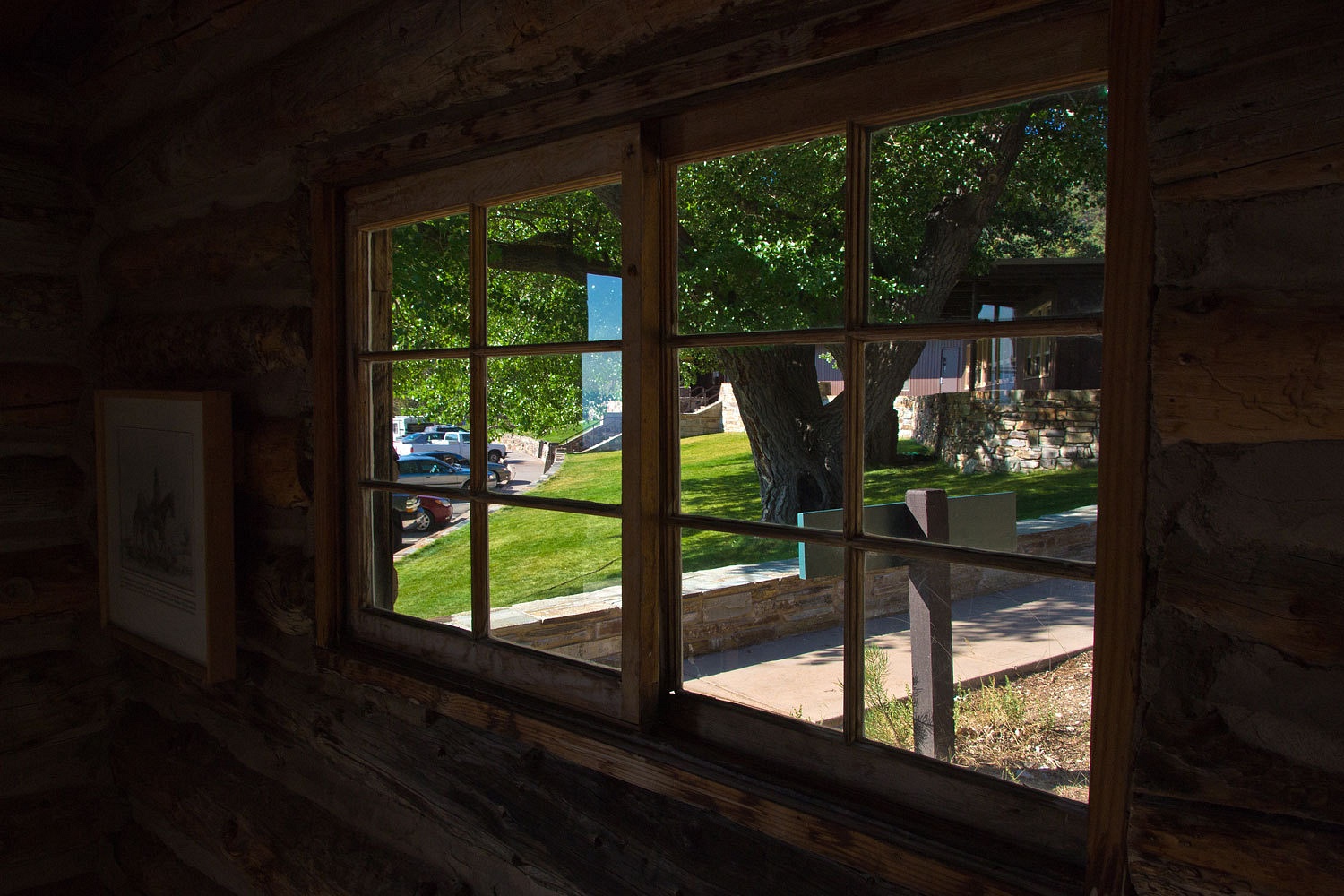
We explored
the remains of the old cave resort.
It had been
three years since our last visit here and a couple of more since our last cave
tour.
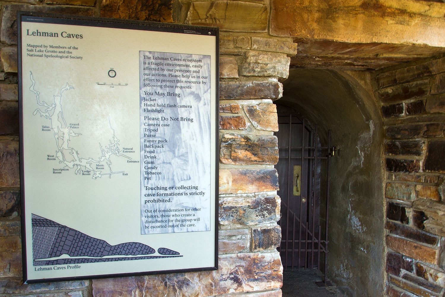
The cave tour is well worth doing.
Many times where there is one cave, there are also others such as Model Cave.
Many times where there is one cave, there are also others such as Model Cave.
From here, we were
headed for a remote area in the south end of the Park. On the way we wanted to
find a little publicized spot.
There are no
road signs that will lead you here. The Lady’s sharp eyes spotted the sign, up
against the cliff, through a gap in the brush along the dirt road.
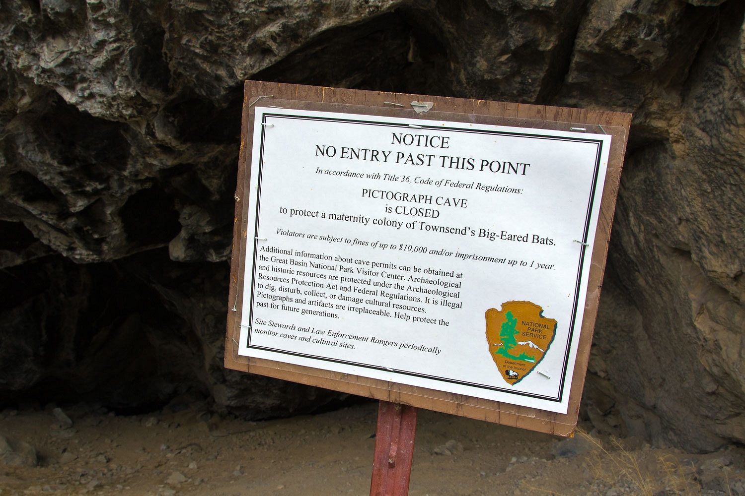
This is the
Pictograph Cave.
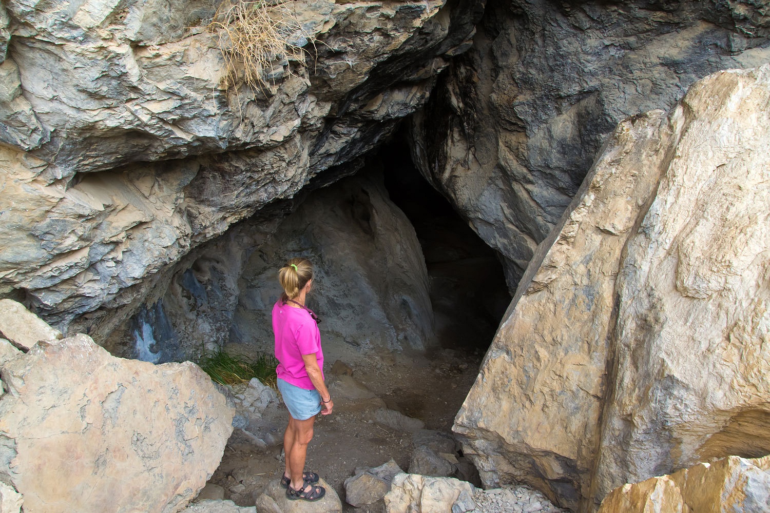
Although it
sure looks tempting to venture in, we did heed the sign and ask that if you
find this place, please do so also. No need to go inside anyway because the
ancient rock art is along the outside cliff face. And no need to disturb the
wonderful creatures inside.
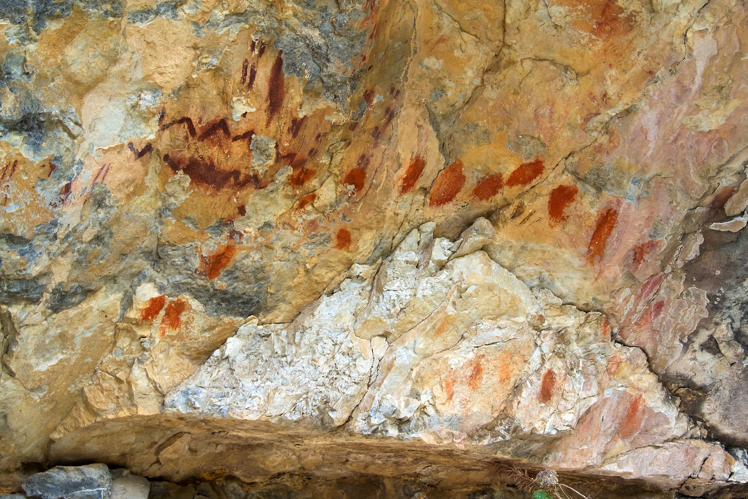
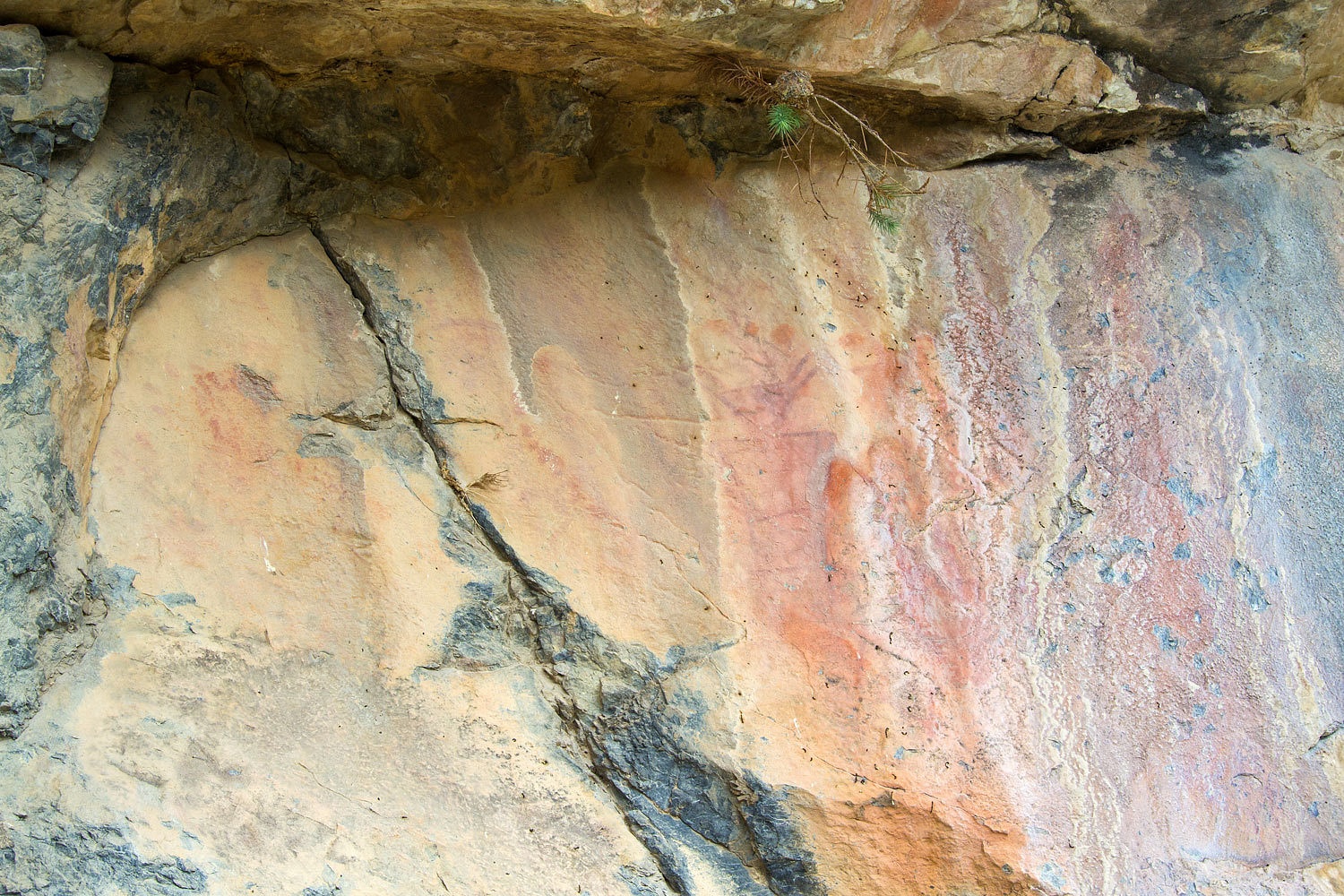
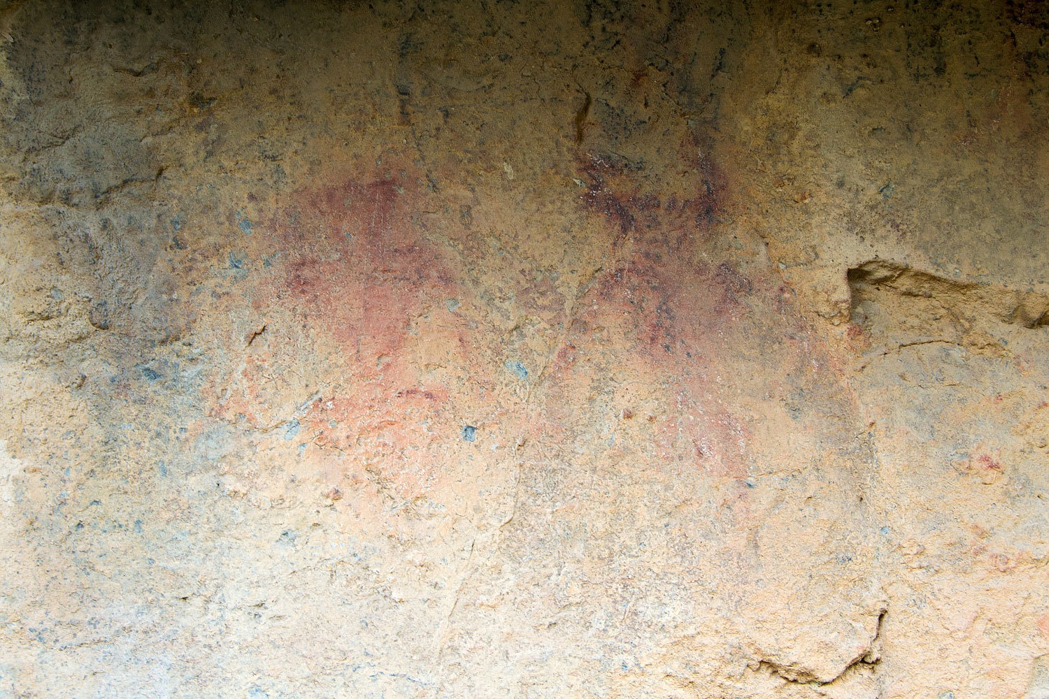
The art work
is very similar to rock art in the eastern Great Basin. This is the furthest west
I have seen this style. I usually do not post photos or call attention to
places like this. In this instance I discovered a YouTube video put out by the
National Park Service. It gives a nice message at the end.
Great Basin National Park also has several other YouTube videos up for viewing.
Great Basin National Park also has several other YouTube videos up for viewing.
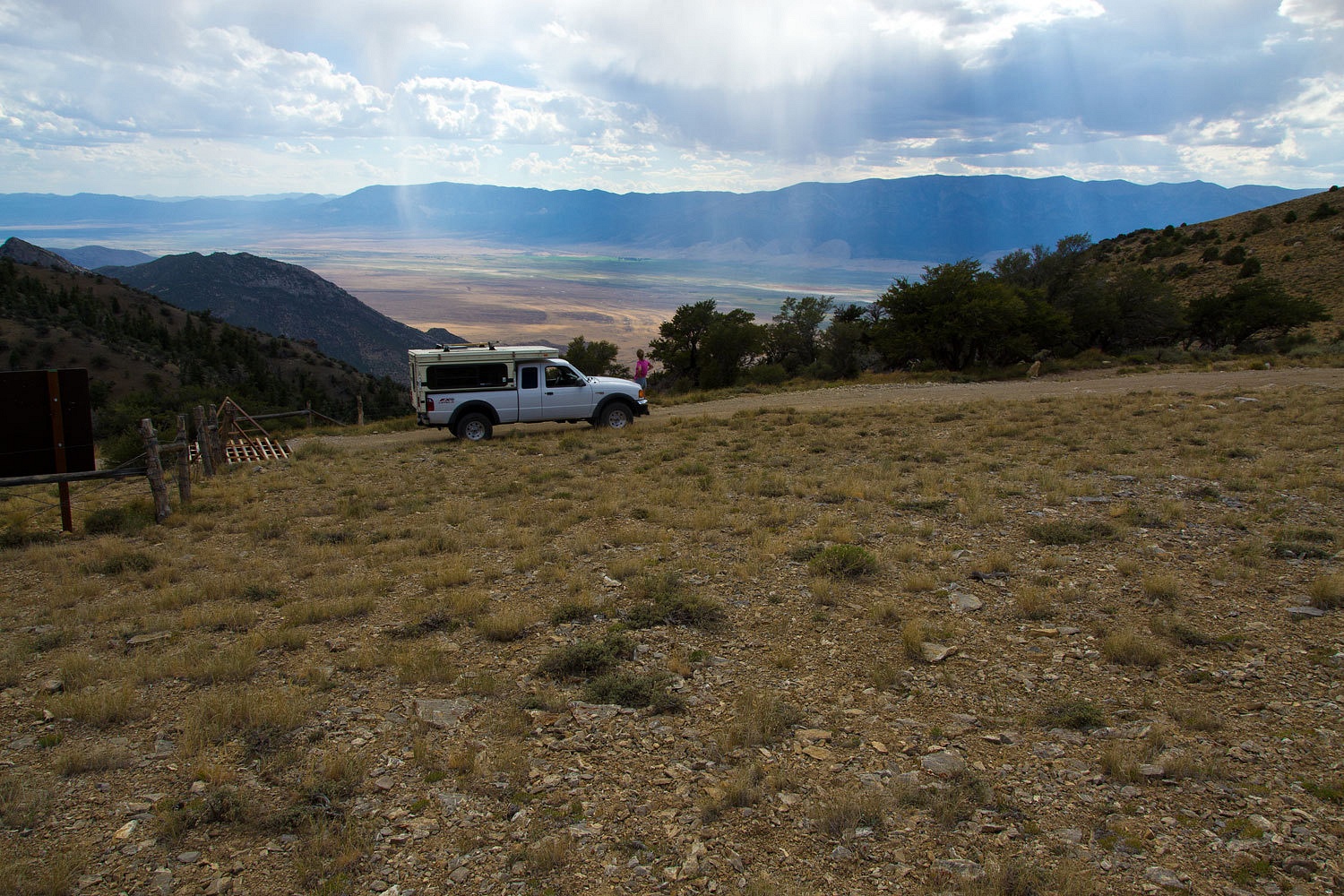
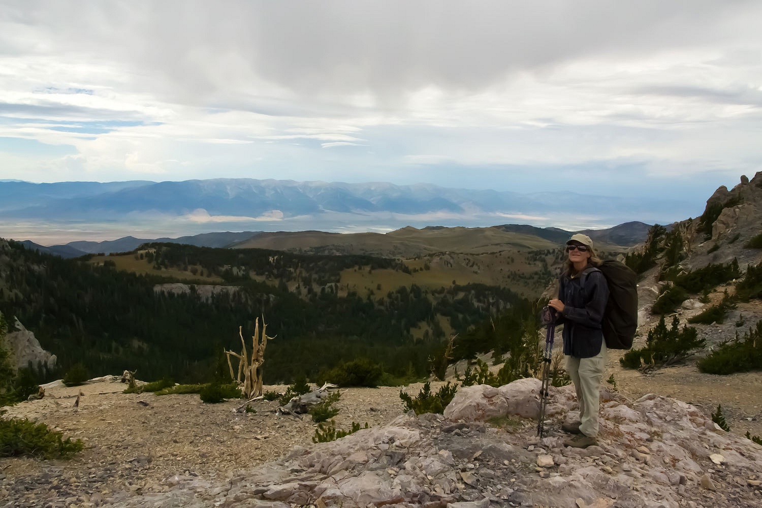
We headed
toward Garrison, Utah and found the Snake Creek Road. This dirt road leads back
up into the Snake Range, Great Basin National Park, and to the trailhead for
Johnson Lake which sits just below the crest. Dispersed camping is allowed at spots along
the road. We found the trailhead but also found a large camp set up with
several vehicles with plates from all over the United States. There were ice
chests, stacks of white five gallon buckets, and a case of Miller’s High Life
cooling in the creek. We guessed a base camp for a university research project.
Too many people for us. We found a short spur road into Shoshone Creek with a
nice campsite. To closed in and claustrophobic for our tastes and we figured if
we ventured up to Johnson Lake and the extensive high mining camp ruins, we
would be running into all these folks busy with their project. We had a great
Plan B up our sleeves. This area we could put away and save in our adventure bank.


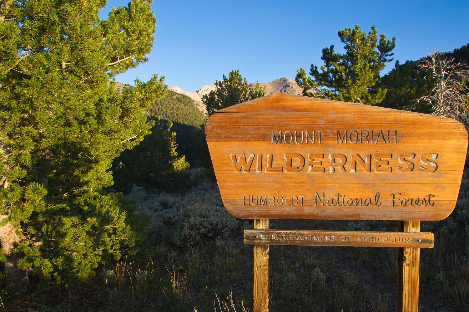
It is about
30 miles from Baker, but a world apart in terms of remoteness. We had visited
the area before, the northern Snake Range and the magnificent Mount Moriah
Wilderness. Most people access from the east side of the range, either via Hendrys
Creek or Hampton Creek. We prefer coming in from the west, up from Spring
Valley. It is a long, steep in places, four wheel drive road, but it puts you
at 10,000 feet at the Big Canyon Trailhead and only a two mile hike to the
Moriah Table.
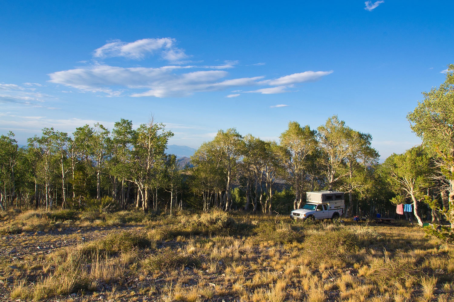
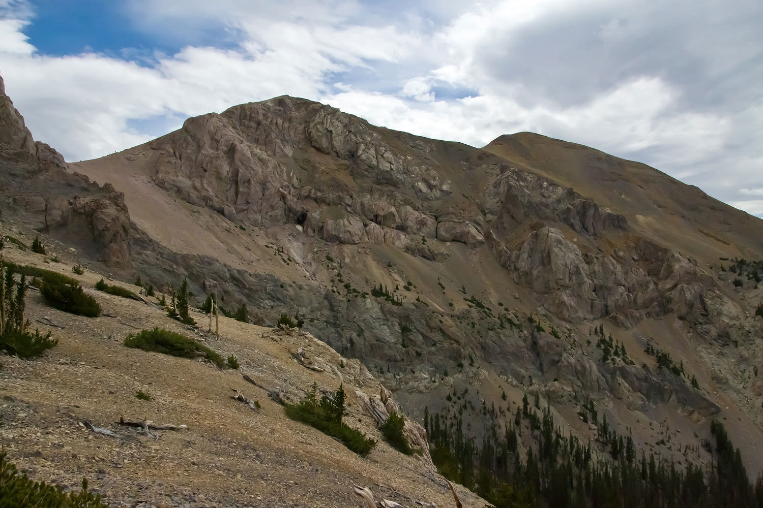
A long
series of switch backs put us on top of a rolling shoulder of the Snake Range.
Spring Valley was far below.
We continued
a rolling climb along the plateau and were rewarded with a view of Mount
Moriah.

We reached
the trailhead after a long time in low range.
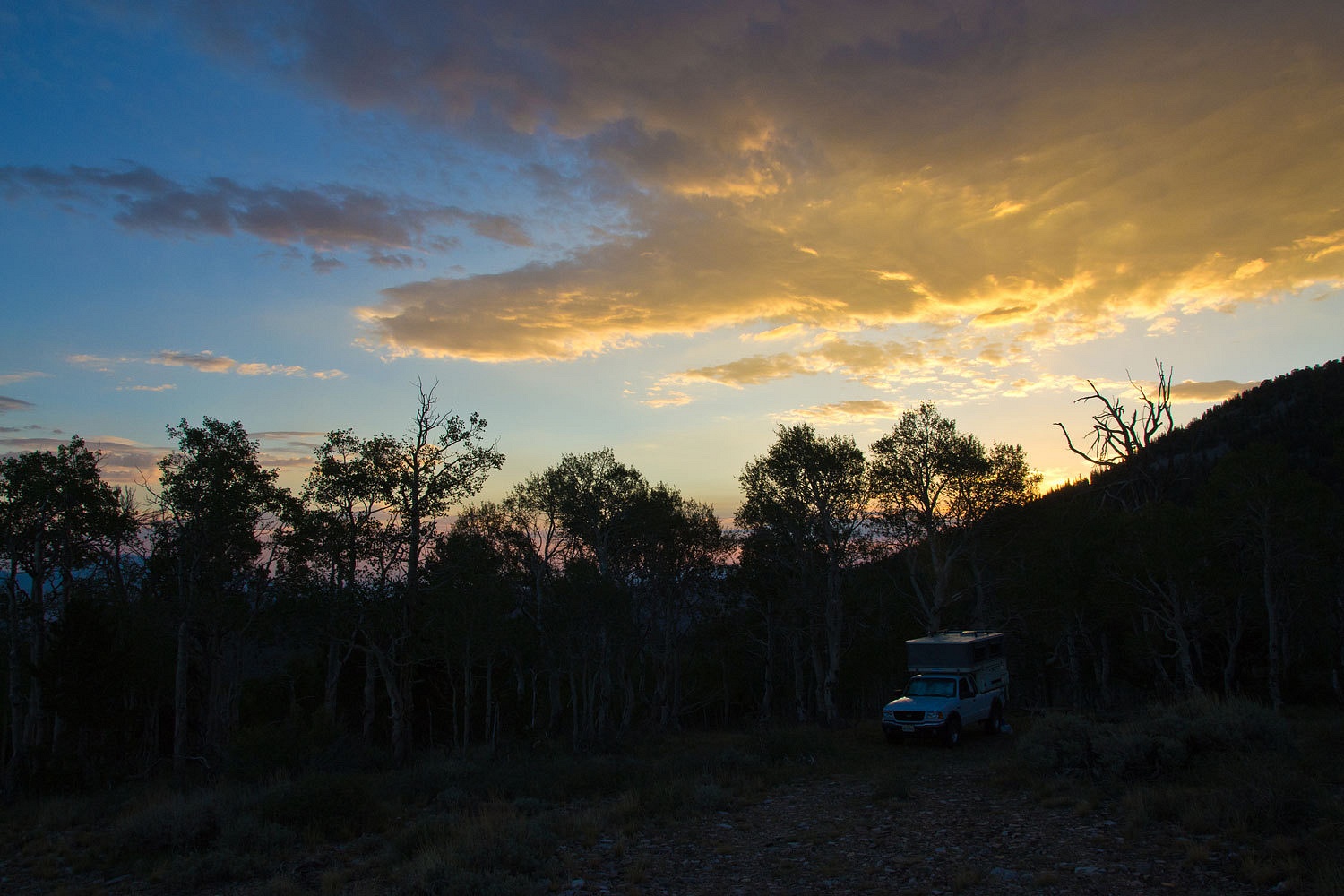
We set up
our camp just off of the ridge.
This is a spectacular
place to watch the day end……………..
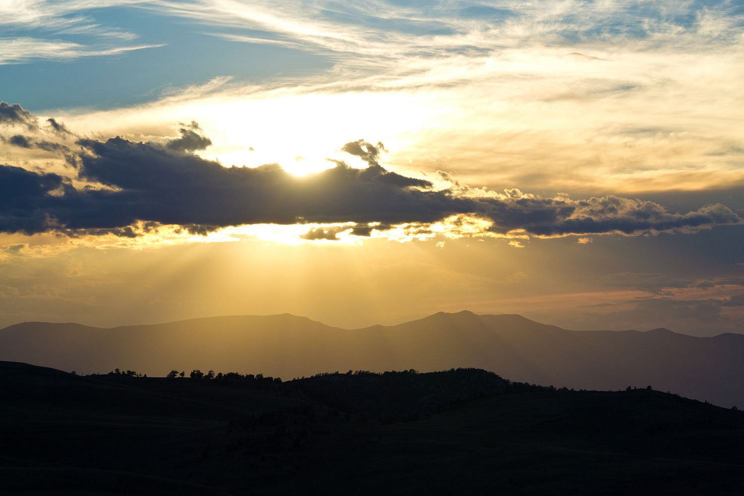
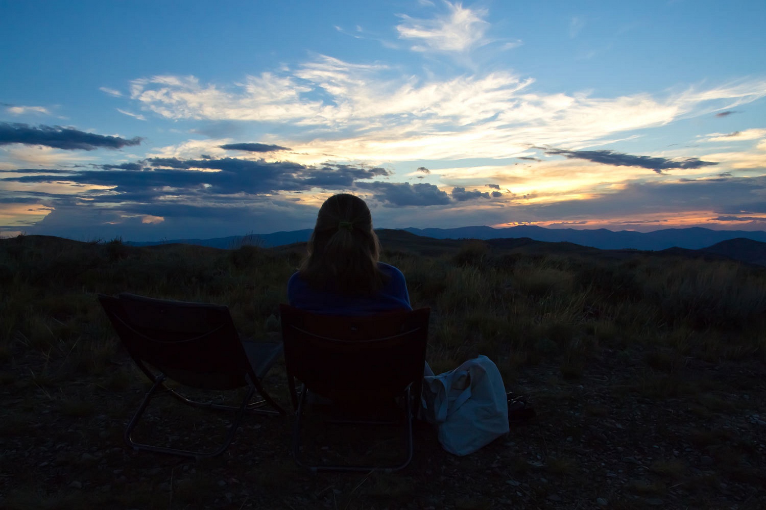
…………………………and
to watch the stars fill the sky and lightning play against the distant Schell
Creek Range.
The Lady has
a secret bond with Bighorn Sheep. I swear she does. It started on Milwaukee
Pass high in Colorado’s Sangre de Cristo Range. She leaves me while I fly fish for
cutthroat at a high lake. She wants to explore the high off trail pass, well
over 13,000 feet. I suggest she take the camera. She returns with a tale of
finding a large group of Bighorn bedded down on the other side.
“They just
let me sit down alongside them. Later they got up and let me follow along with
them. The big ram stayed between me and the group as we walked. I told him I was
okay.”
As we sat
and watched the sunset this evening, she trained her “see mores” up on the
slopes of Mount Moriah.
“There’s a
large bunch of animals grazing in the last sunlight on the steep west facing slopes of
Moriah, just down from the summit. I think they’re Bighorn.” She handed me the binoculars.
“I count 24.
Looks like ewes and lambs.”
She had come
upon two groups of Bighorn the last time she had led us on the way to the top
of Mount Moriah.


The next
morning started off well enough.
The Lady
talked me into cooking up a batch of buckwheat pancakes. She loves pancakes.
We were
heading up the trail by 8 am. It was obvious a rain squall was moving right at
us down from Moriah.
So close to
the truck, such an incentive to not getting soaked.
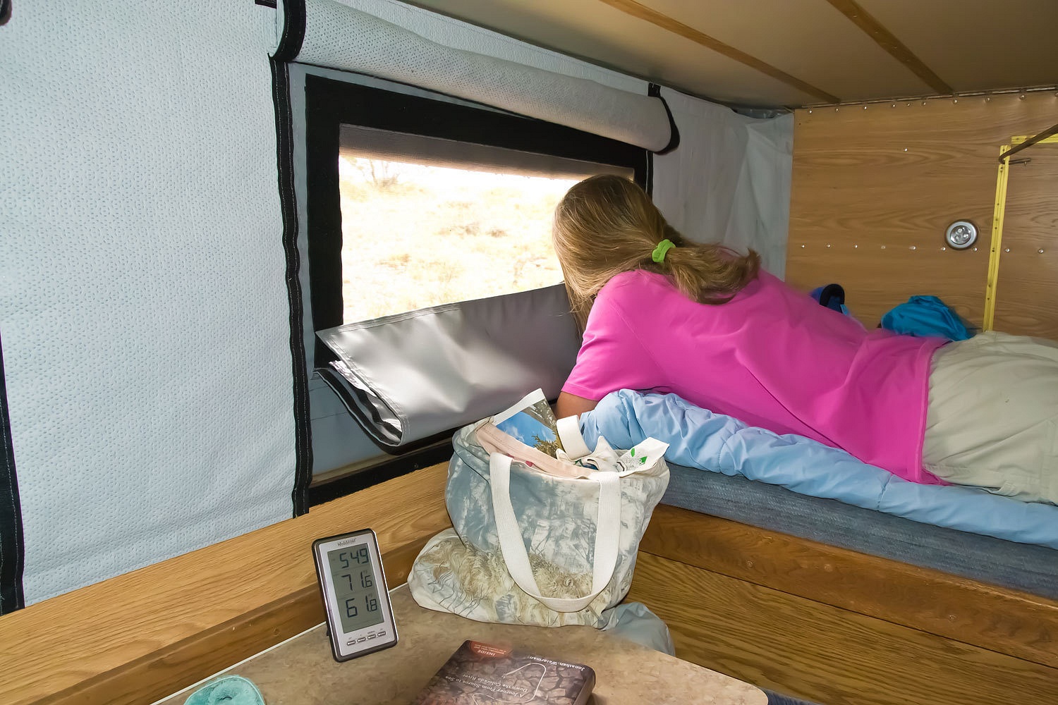
We climbed
back up into the bunk. The Lady was glued to the window.
“It’ll pass.
We’ll be able to get up on the Table!”
We tried
again at 10:30. We made it a hundred yards further before retreating. This time
a scramble game. The Lady gets mad if she is holding the Q and a U never turns
up. We thought about lunch but really weren’t hungry. We hadn’t done much. We
popped up some pop corn. It let up enough to sit outside in our chairs.
“Let’s put
our rain flies on our packs and get going. This might be the break we’ve been
waiting for,” I said. It was one o’clock.
The trail
drops into Big Creek Canyon, climbs along the creek, and then heads up, in
steep switch backs, up the east wall of the canyon. At one high switch back the
Lady stopped me. She was looking across the canyon to a high grassy slope just
below the ridge line.
“Those can’t
be sheep. Look at all of them! They look as big as horses. Let me get the see
mores.” She dug under her rain fly. I dug the camera out of my pack.
“They’re
elk! Cows and calves. Look at all of them!” She handed me the see mores.
I counted over thirty.
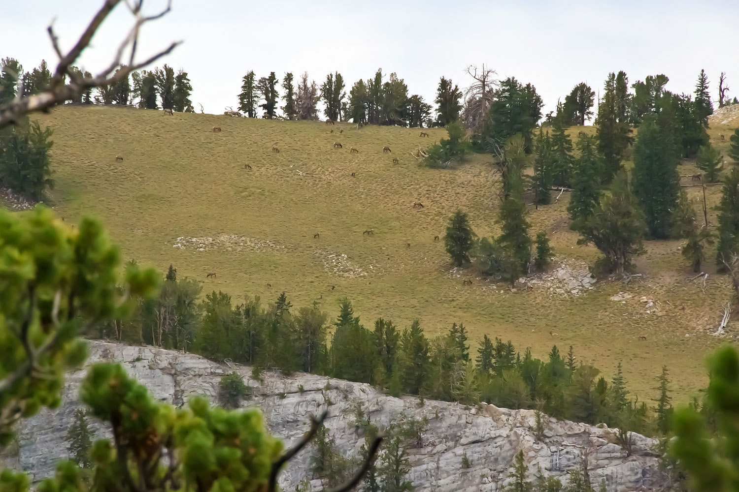
A small rain
shower put us under a bristlecone. We watched the elk until it passed, the sky
now clear enough to venture up and out on the Moriah Table, one of the most
wonderful places we have visited. It is a broad high plateau sitting at 11,000
feet above sea level.
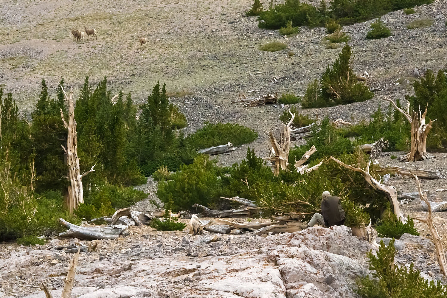
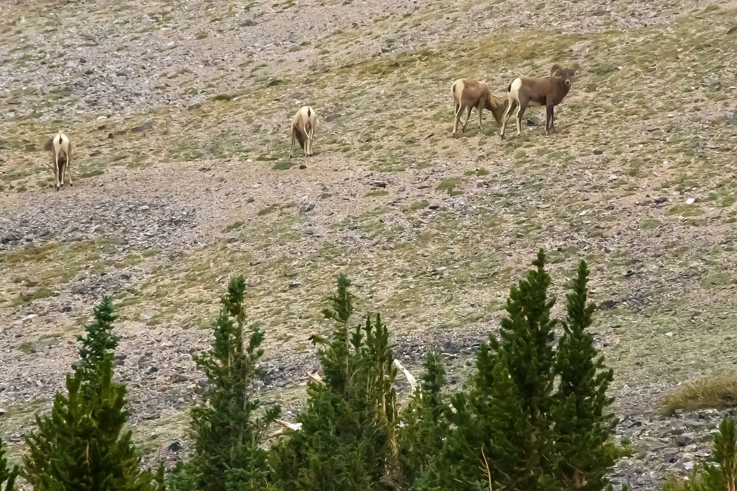
First we climbed up to a saddle looking into the northwest facing cirque. The Lady moved
out on a point.
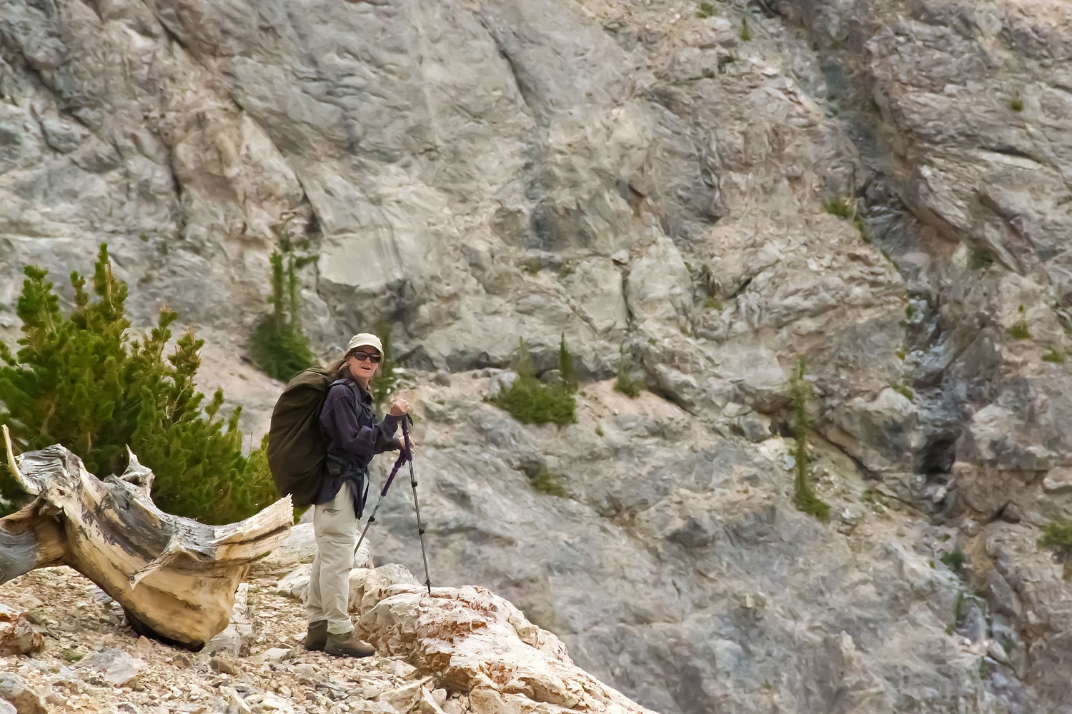
I spotted
the four rams as the Lady moved back up to the saddle.
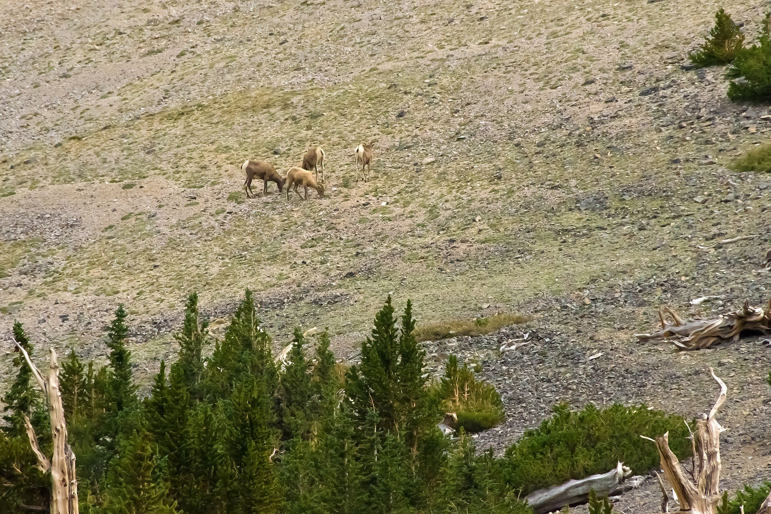
I signaled
for the Lady to go high.

The Bighorn
watched as she moved into position.

She sat and
watched them with her see mores. They were undisturbed.
The Lady
said goodbye to her gentlemen friends…………………
….……………………..and
we set out to explore the Moriah Table stretched out below us.

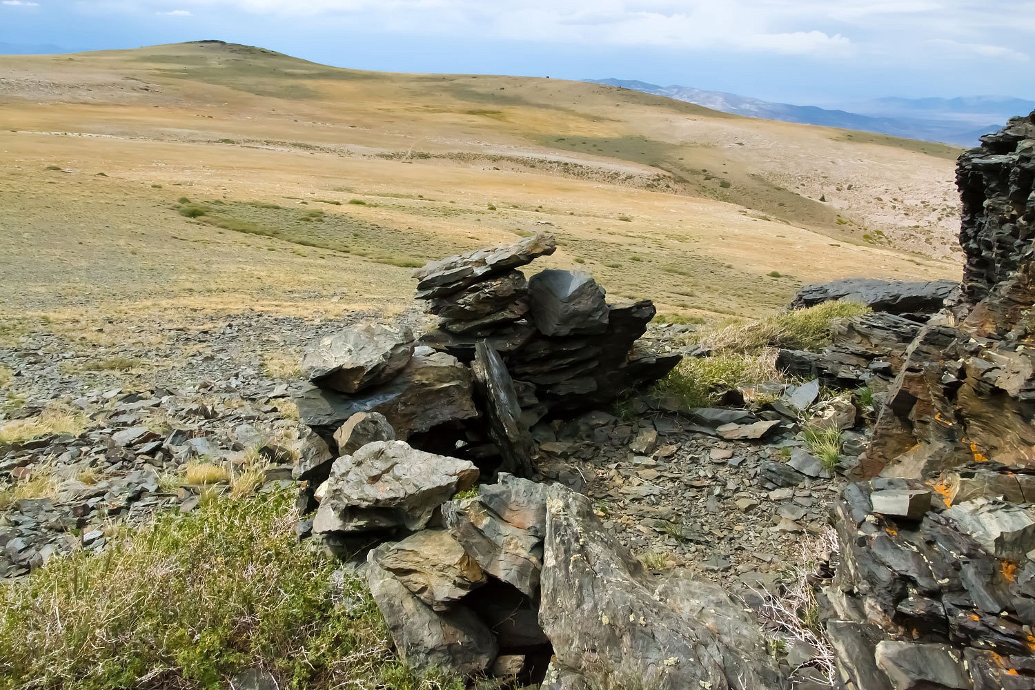
We found ancient
hunting blinds.
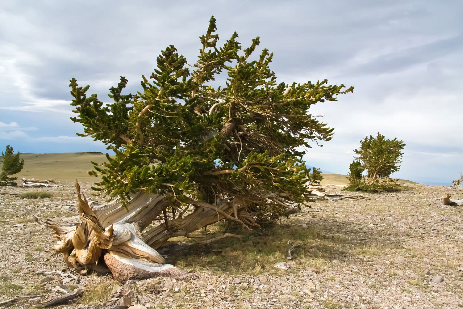
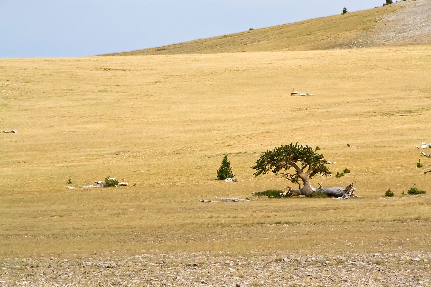
We walked
among scattered bristlecone pines making their living in a land of savage
winds.
It was time
to head down……………………………..
…………………………….into
the canyon below.
We had been
watching the next storm moving northeast across Spring Valley. Our timing was
good as we returned to camp.
The storm
hit. The Lady wanted a break in the storm for her warm shower. She was glued to
the window.
An hour and
a half later the storm seemed to pause. I went outside. The wind had shifted
180° and was now blowing up out of the east. I could see what was happening.
“Grab the
warm water and the towels. We have about 3 minutes. We have to be quick!”
Clothes off,
we poured water over each other and got our showers done. We climbed back into the
camper as the first lightning bolt hit. The thunder was less than a two count
behind.
The Lady
asked what I had seen when I went out.
“Felt more
than saw,” I said. “It was the wind. The storm hit the main ridge line and
started sucking air up from the east. It is obviously building high, straight
up above us. I bet it is a huge thunderhead to see. This is going to be a big
one and it is right over us.”
There were
two storms; they hammered us with hardly a break in between. Most of the
lightning strikes were on the higher ridge on the other side of Big Creek. The
flashes and blasts of thunder shook the ground. It poured rain for five hours.
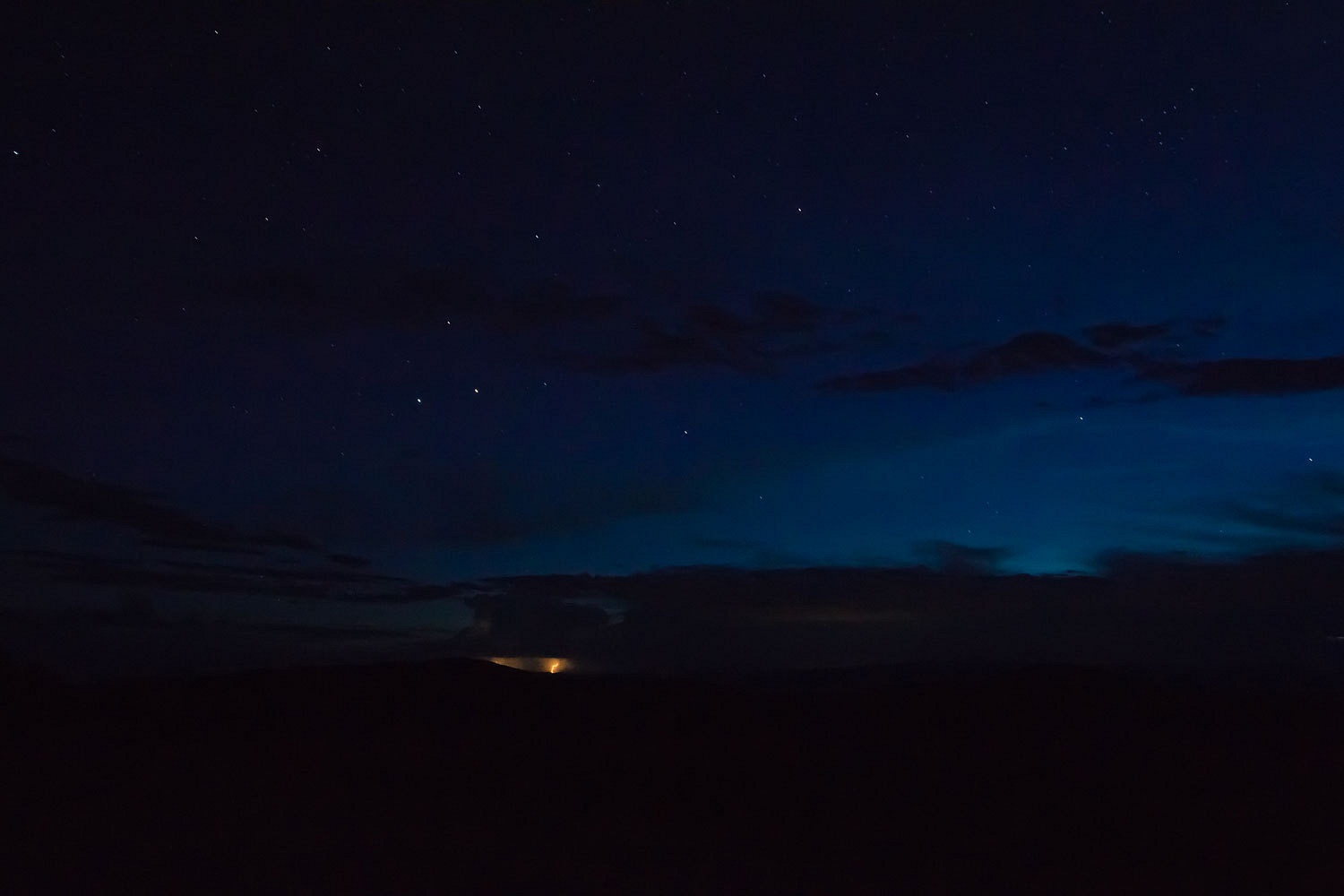
We woke in
the middle of the night. We both needed a quick visit outside. Stars, we were
happy to see stars. We climbed back inside and got settled in bed.
“That was
the hardest wind I have ever felt!” the Lady said.
“When?”
“During the
storm. It sounded like a freight train roaring down on us. It lasted five
minutes. I’m sure, if we were up on the ridge, it would have blown the truck
over!” She looked at me hard.
“I must have
slept right through it. I missed it.” I hadn’t felt a thing. I had slept like a
baby through the storm.
Morning came
the way mountain mornings should.
We had a
couple of slimy spots to deal with on our drive out. Near the top of the switch
backs we met Joe and Carl. They were looking at us from the opposite side of
the two blow down trees across the road. We used our bow saw and worked
together to get the trees moved.


We made a
short side trip over to the Ward Charcoal Ovens.
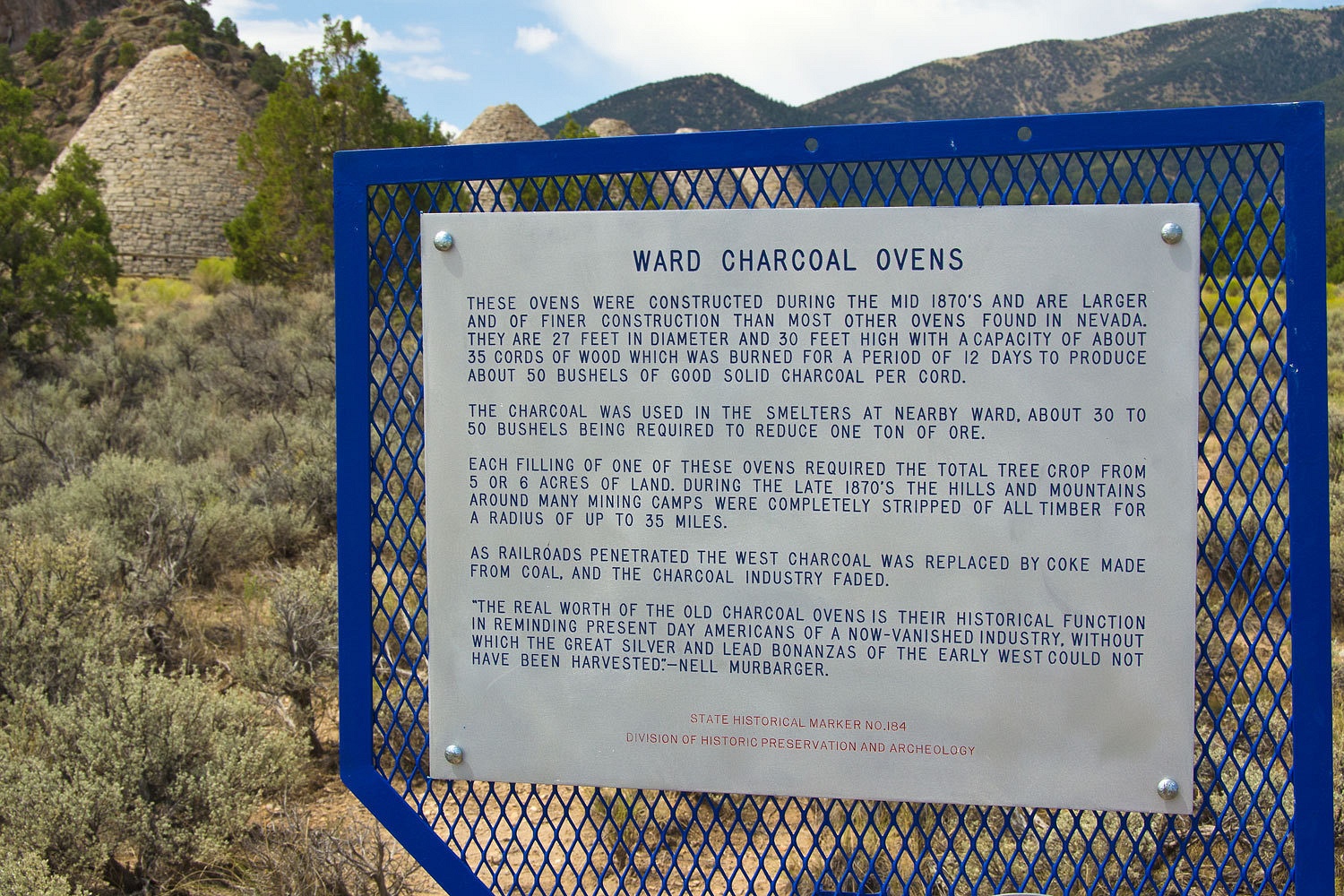
The Native
Americans throughout the Great Basin depended on pinyon pine nut stores to last
through the winters. It was a staple crop for them. It is unimaginable the
impact the destruction of the surrounding woodlands to feed these charcoal
ovens had on them. We came in and turned their world upside down. And on top of that, we called them the savages.
Mid
afternoon, we were in Eureka. The gallery was open. We make it a point to stop in
and chat with Trish and Deon.You should too.
Our big
question for today was about a new wildflower for us that we had seen along the
graded margin of East Spring Valley Road. What was it? Was it an invasive?
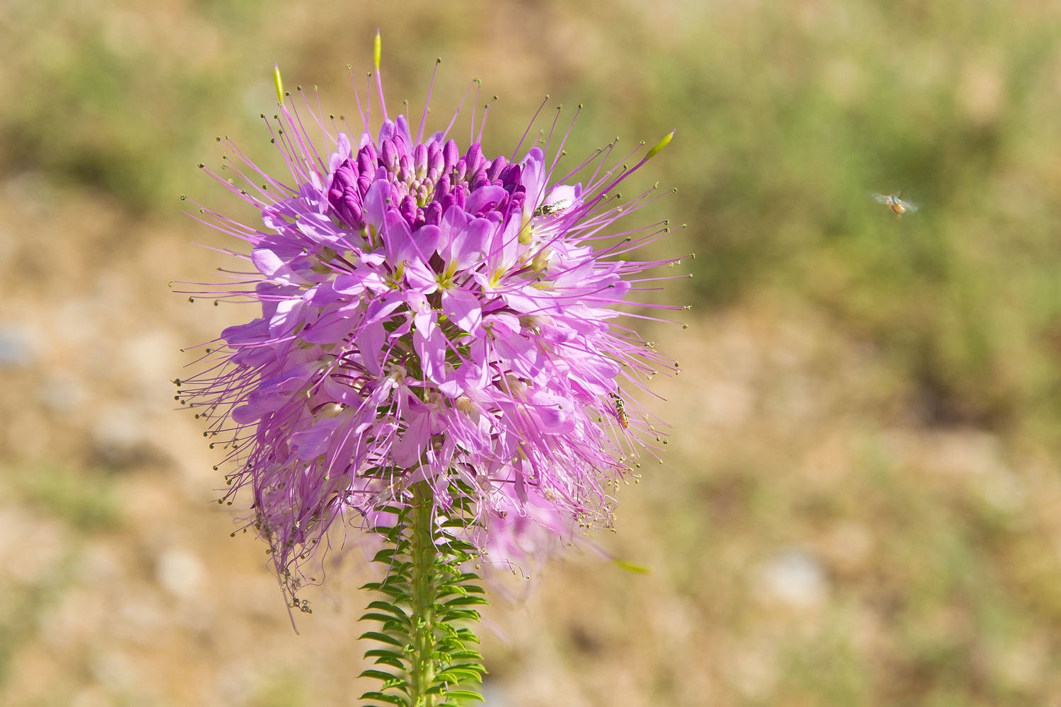
Trish found
it in her Great Basin Wildflower book and identified it as a Pink Bee, a native plant. It is
similar to the Rocky Mountain Bee Plant.


Where to
spend our last night? With all the rain, we were concerned about backcountry
gumbo. With the continuing storms, some of our favorite high points were
probably not wise places to be.
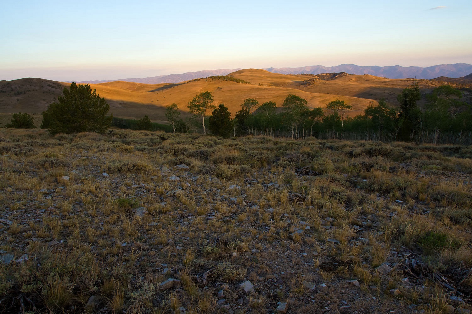
We continued
west on Highway 50. The temperature was cool with the storms. We pulled into
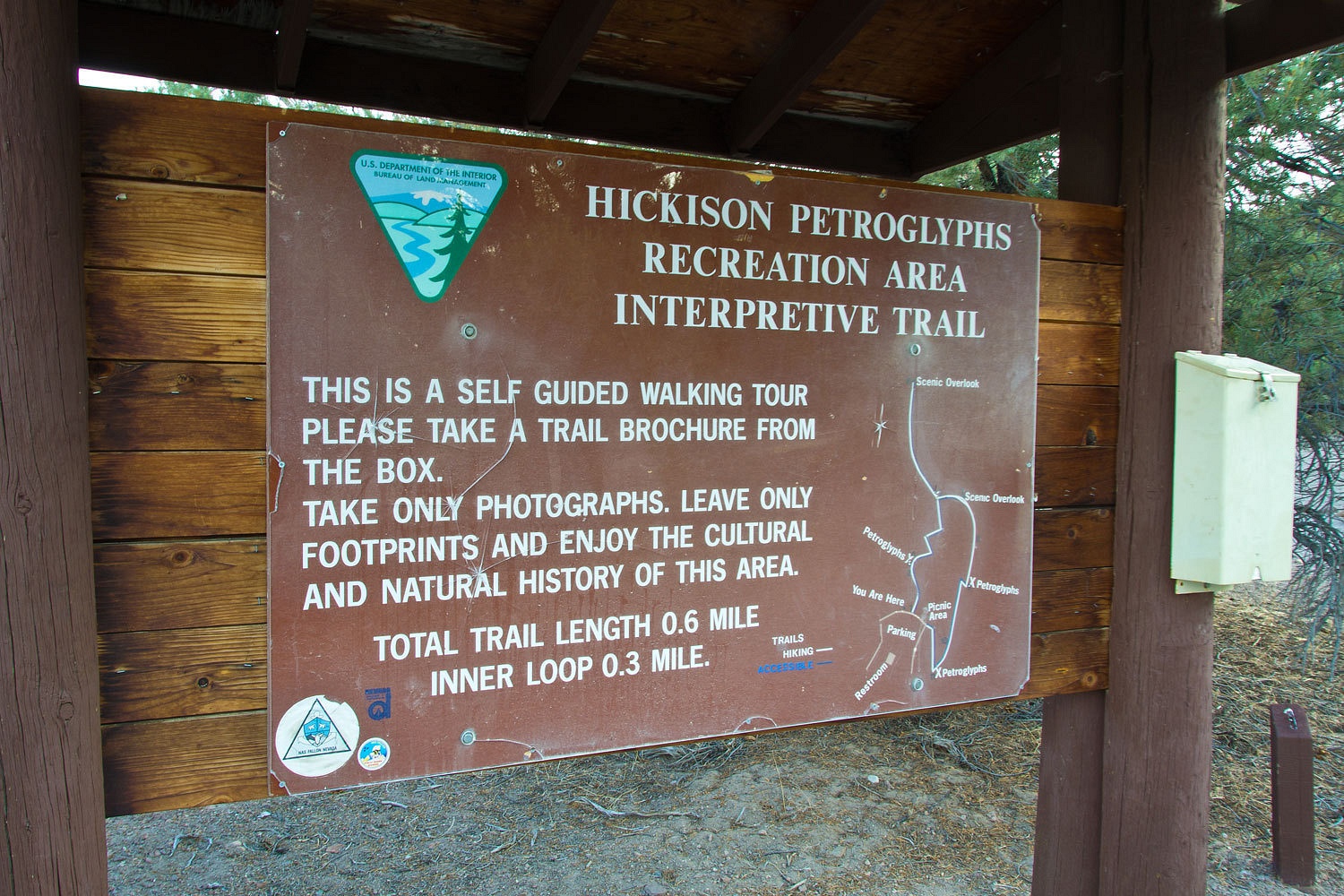
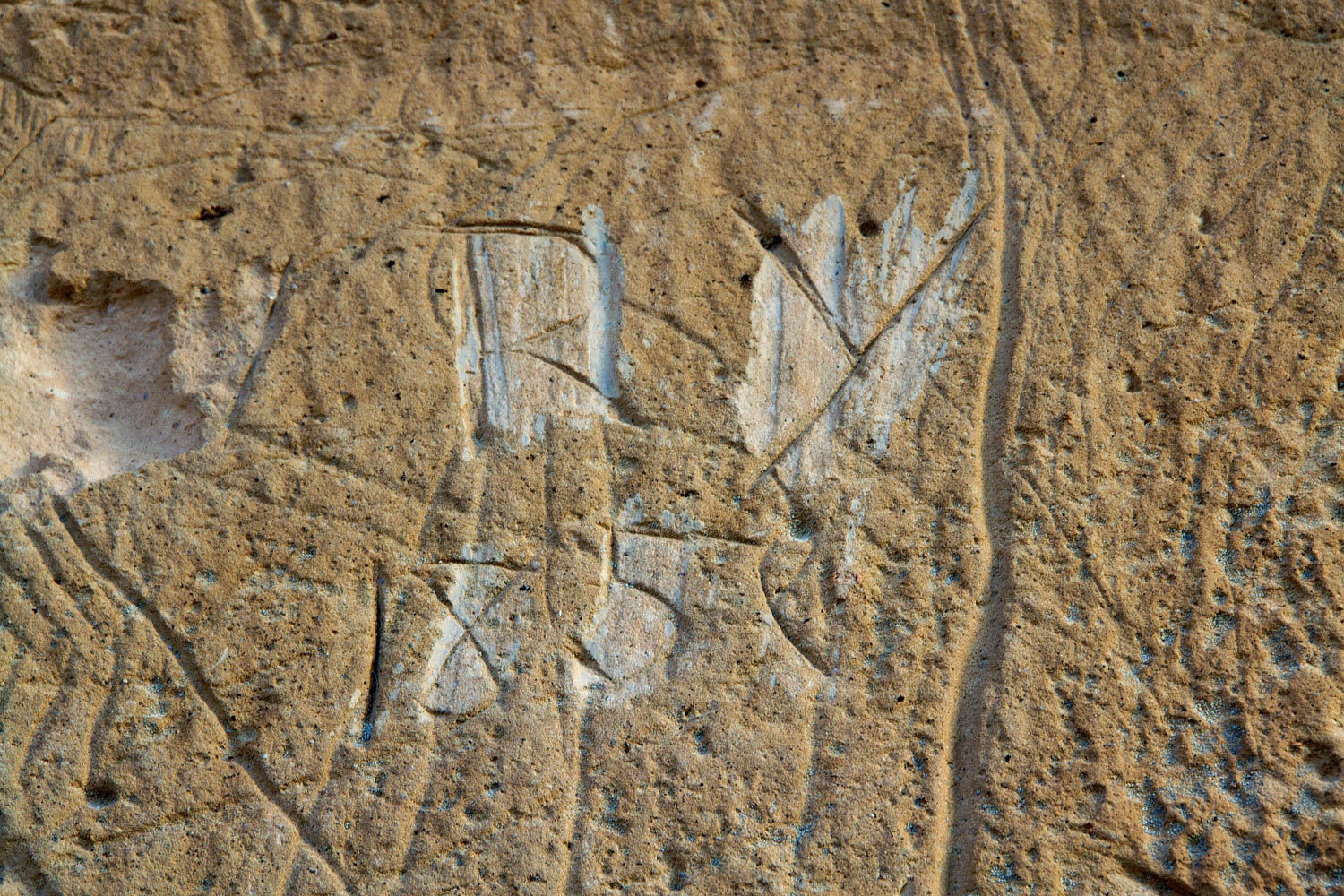
the free BLM campground at the Hickison Petroglyphs Site.

There is
also more recent graffiti from one of the members of Captain James Simpson’s 1859
expedition to establish an overland stage route. This also became the route for
the Pony Express.
Our last sunrise
on the road did not disappoint us.
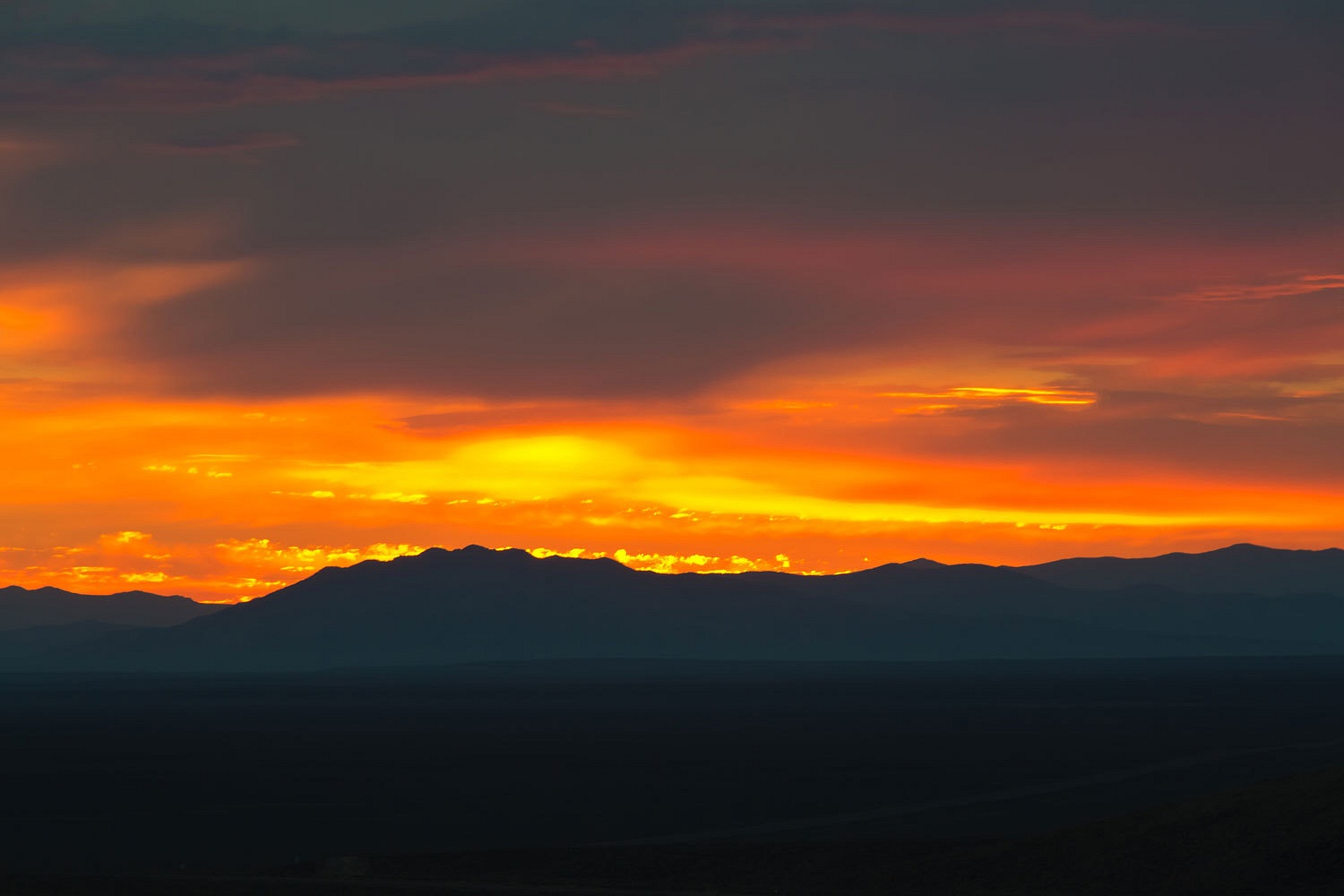
We watched
as a lonely set of headlights approached from the east on the "Loneliest Road."
This had
been another great trip and adventure for us. We were glad we had turned left.