
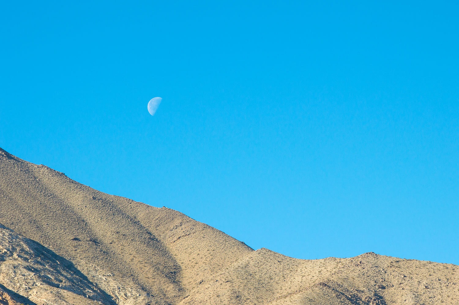
The first day
of the new year was another gorgeous morning in Death Valley National Park.
You can see
why we like this spot so much.
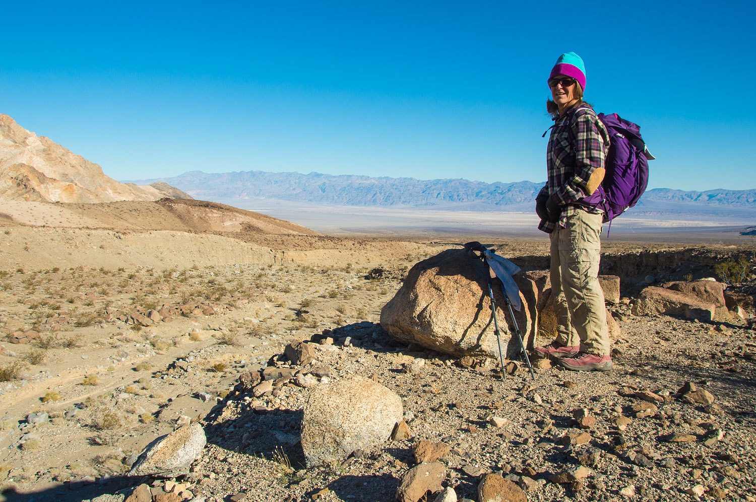
After a
special breakfast I cooked for the Lady - yes, I am not without skills - we headed
north following the old trail.
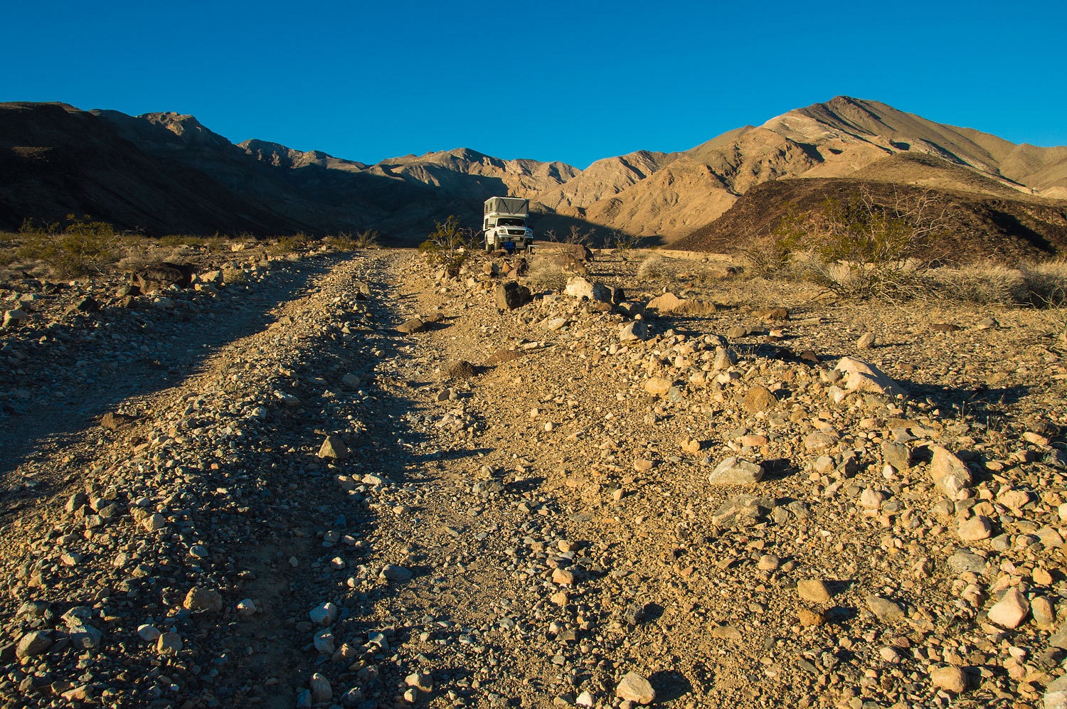
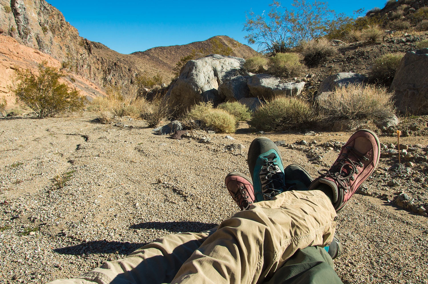
From camp we
could see where it climbed out of the opposite side of the broad LeMoigne
Canyon wash. The trail bed is fainter here but still fairly easy to follow.
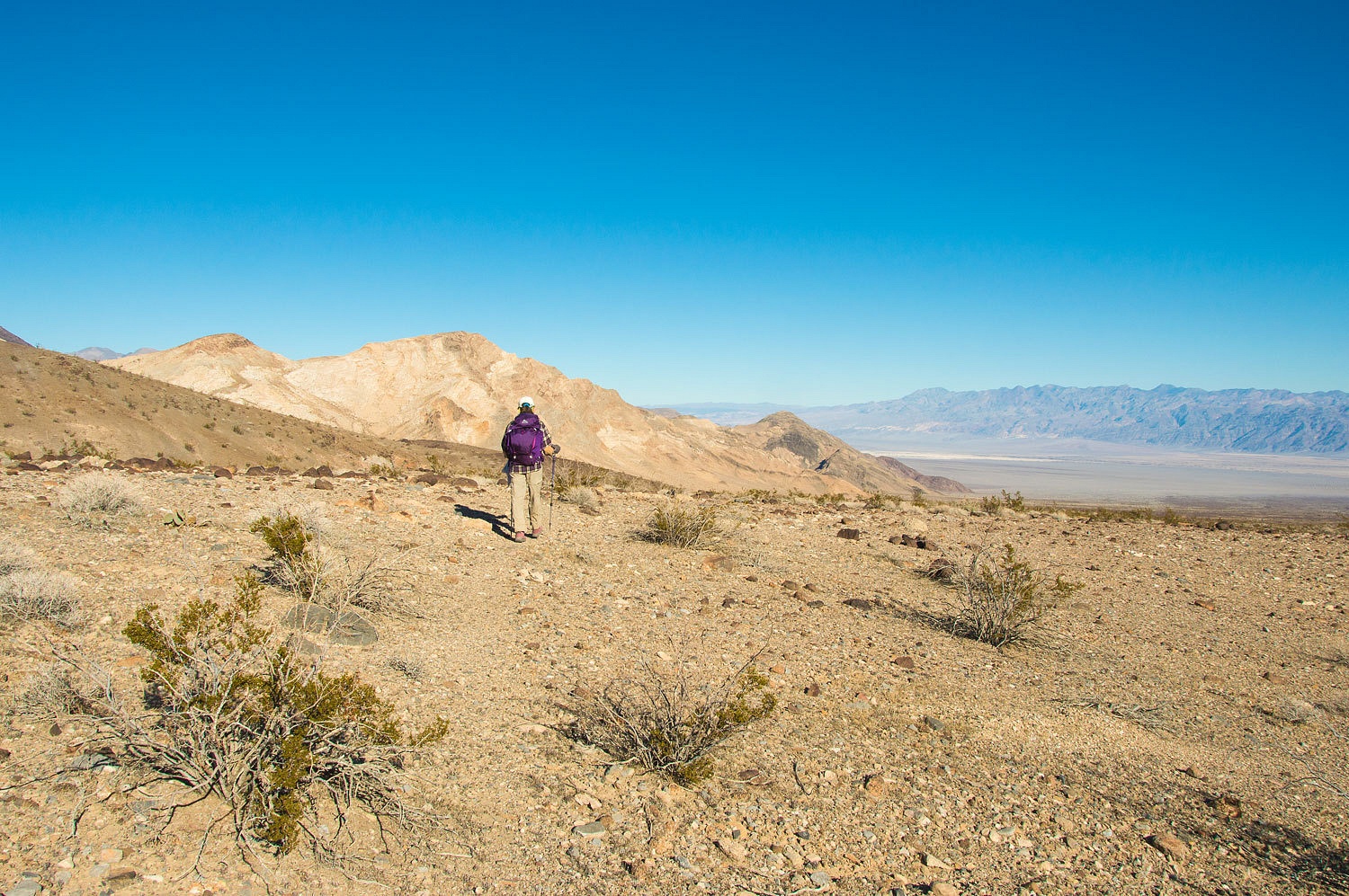
The trail
provided a commanding view of Death Valley and the Grapevine Mountains to the
east.
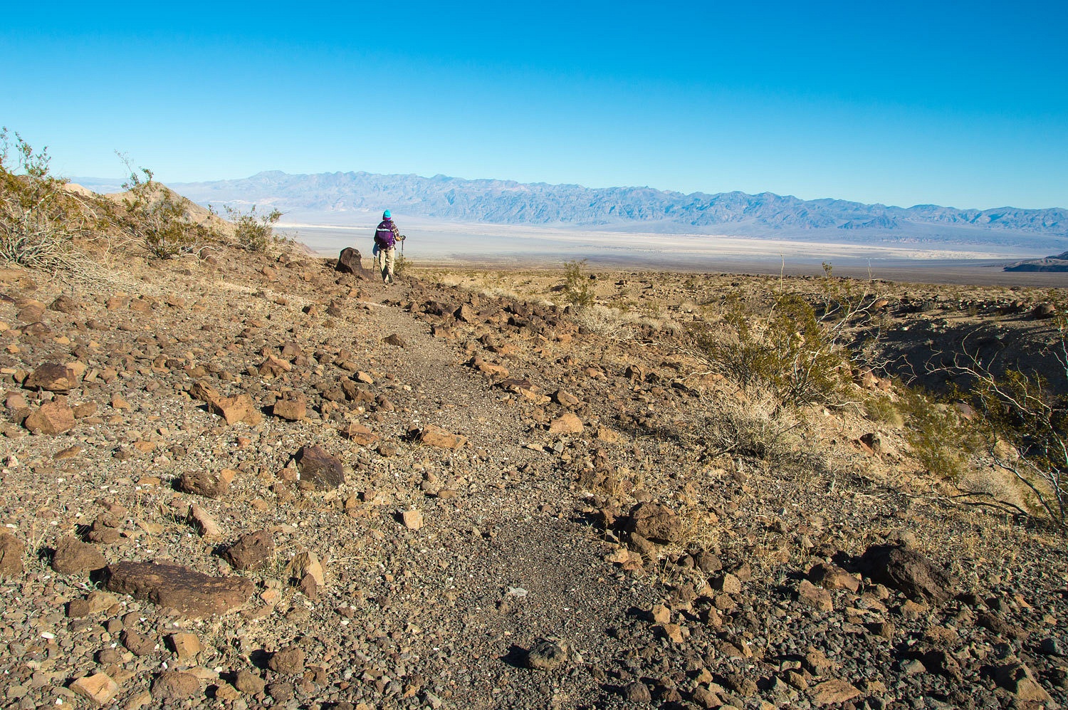
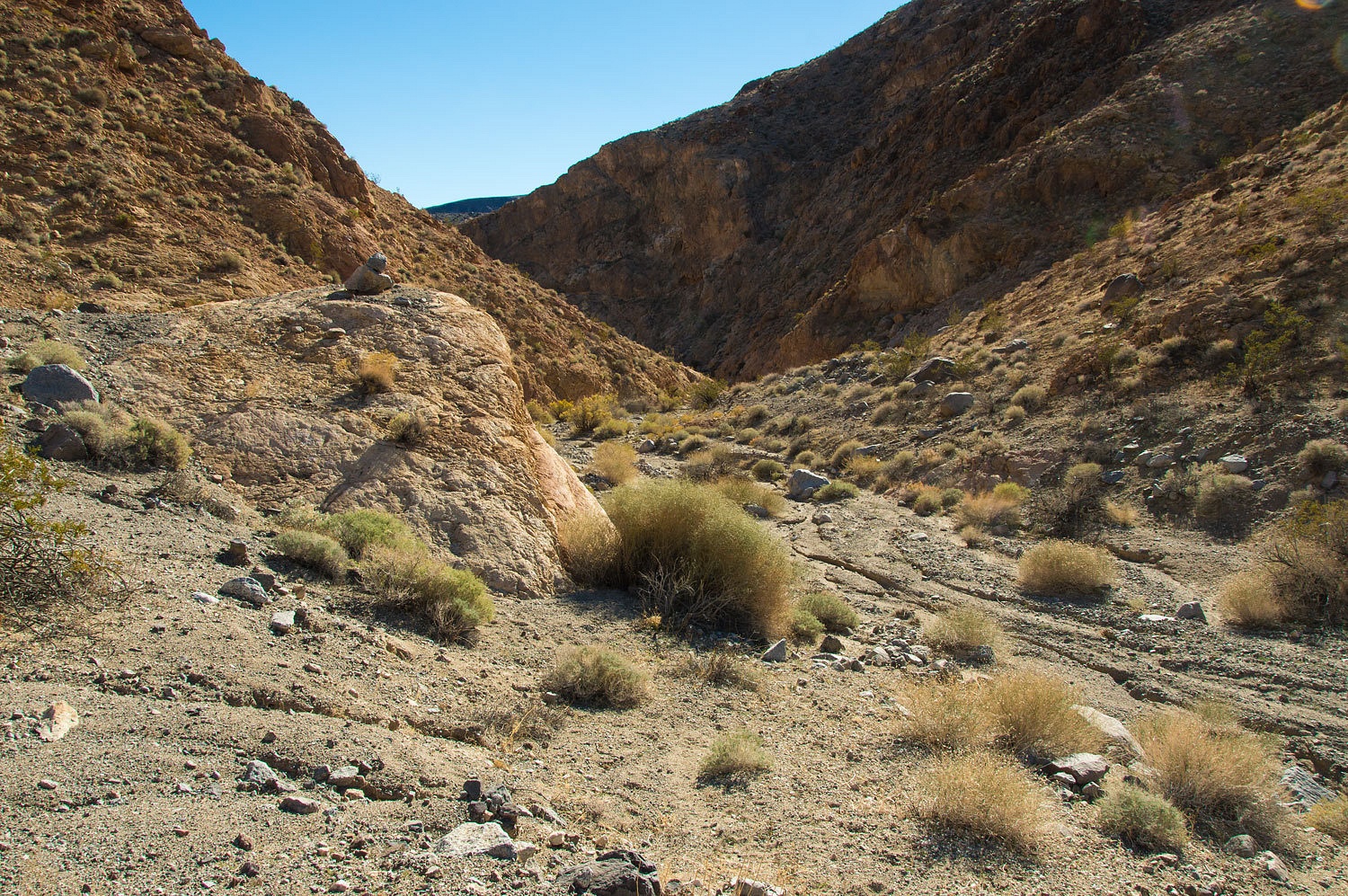
The trail
did a wide arch around the toe of the mountain and then dropped into the wash
of the next major canyon to the north.
We took a
break here, consulted the topo map, and scanned the opposite side of the wash
with the Lady's "see mores" for evidence of where and if the trail climbed
out.
We saw no
evidence of a trail, but far across we spotted a large stacked cairn on top of
a boulder. We spent an hour or so searching the bajada on the other side of the
wash for evidence of a trail that continued along the edge of the mountain. We
found a few cairns but no evident trail bed as we had been following. In our judgment,
we decided the trail does not continue along the mountain front. We turned
around and entered the canyon.
The first
thing we found were lovely "belly" flowers, small plants and flowers
you need to get on your belly to see.


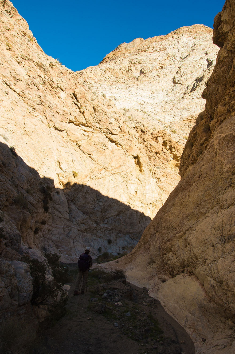
After a half
mile or so, the canyon narrowed.
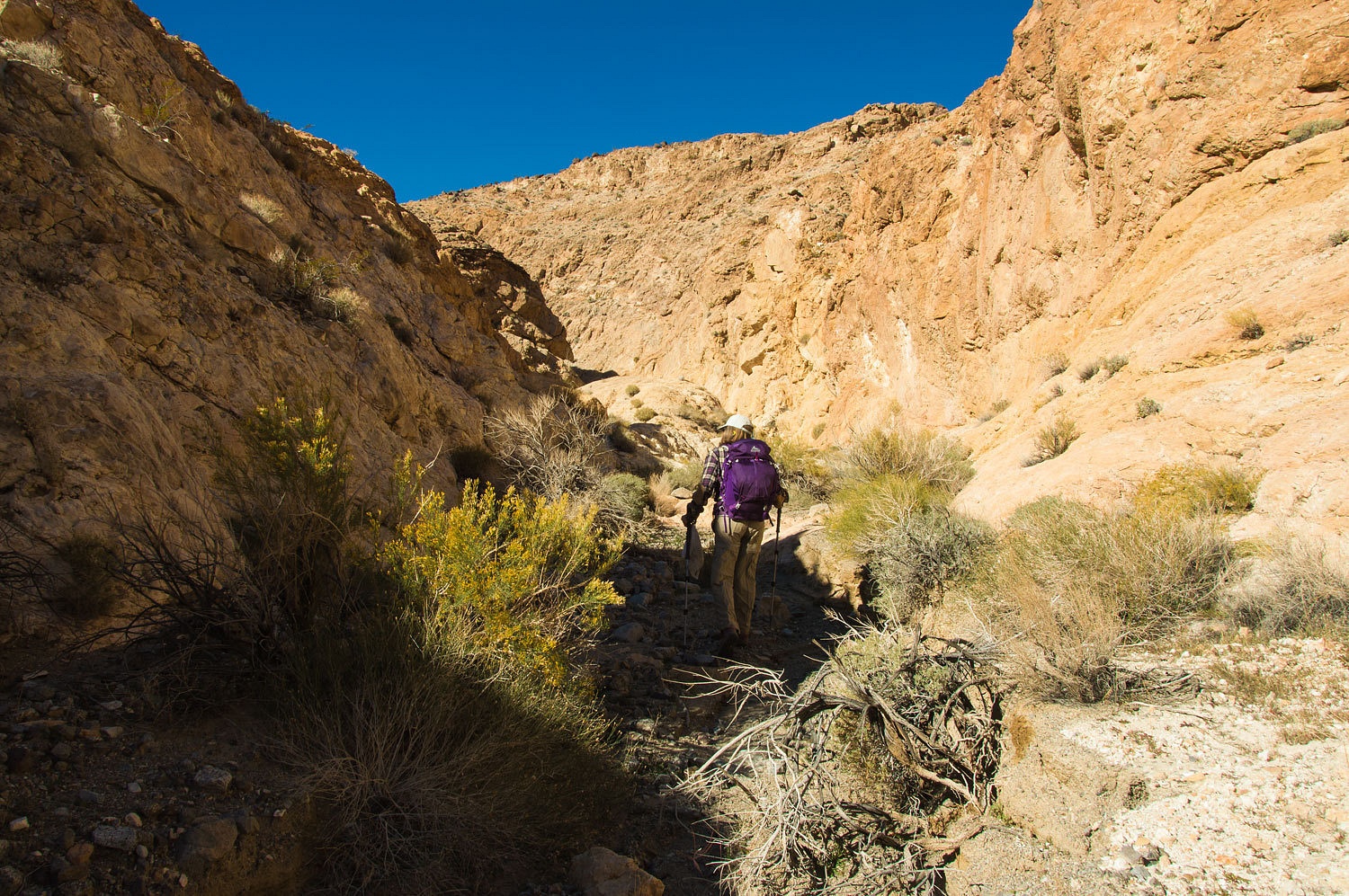
It continued
to narrow and we were on bedrock with a beautiful, slick pour over.
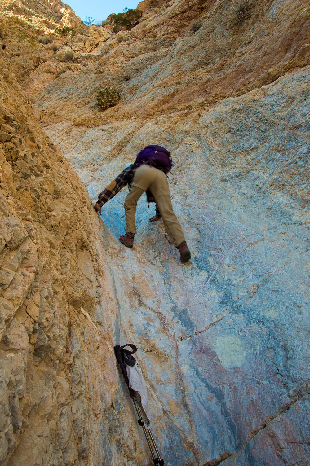
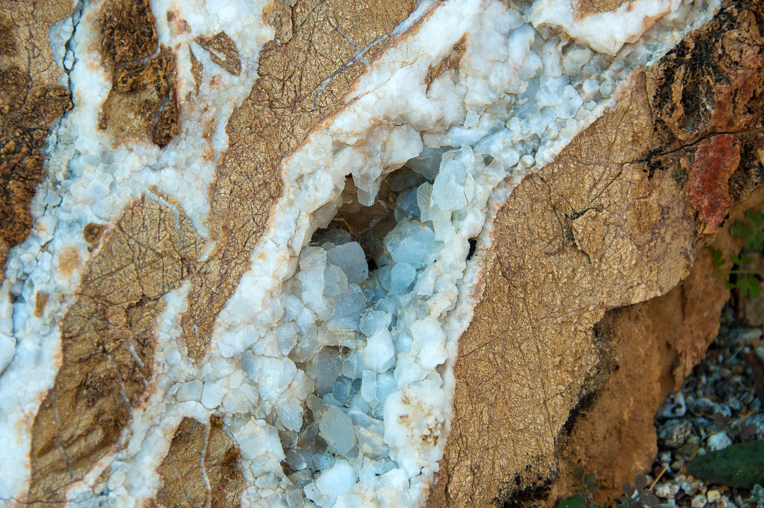
The
highlight of these narrows was the rock.
The canyon
broadened and we were back in the sun. We took a water and snack break.
You should
notice the large cairn on the rock. We wondered if this was marking the
continuation of the trail. Was this the route over the top with a drop down the
other side to Cottonwood Springs? The map indicated it was possible, but that
slick pour over was something horses and mules wouldn't climb. We found no sign
of a trail bypass.
We continued
up canyon. The gradient lessened and the terrain opened up. This part of the
canyon would be easy to ascend and we could see the distant pass over the top.
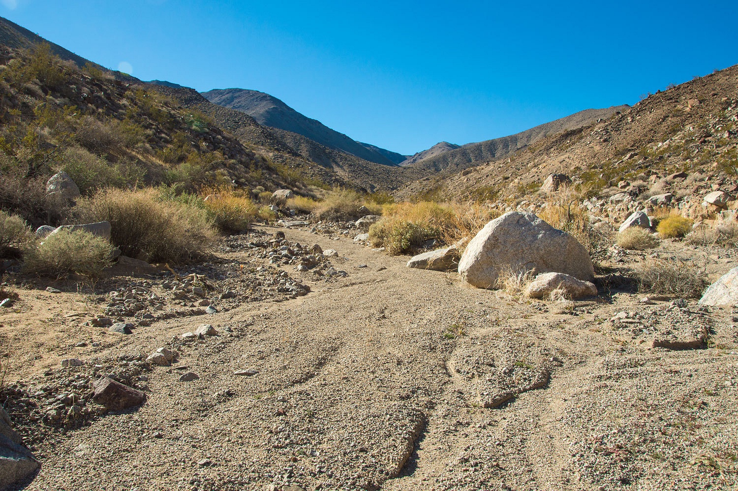
We saw no
real evidence of a trail. We took a break here and studied the map and terrain.
This was the
warmest day of our trip. I was going without long john bottoms but had them in
my pack. The Lady leaned against a boulder in the sun and stretched out. I joined
her. "This is the life!" the Lady said with a full measure of
contentment.
We turned
around and reentered the narrows. Again, the rock was the highlight. The Lady
loved the blue.
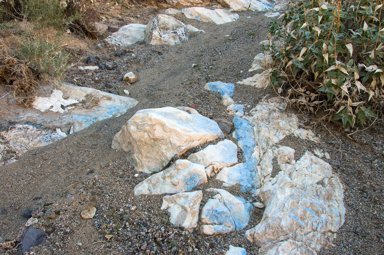
I loved the
swirls and folds.
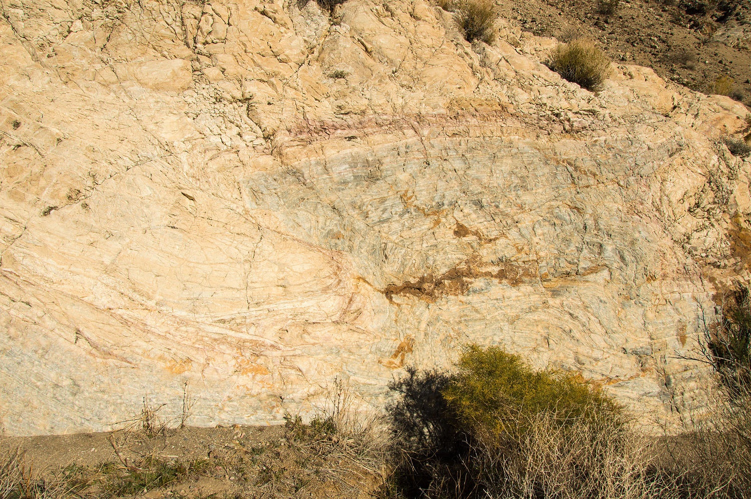
We both
loved the "marble slide".
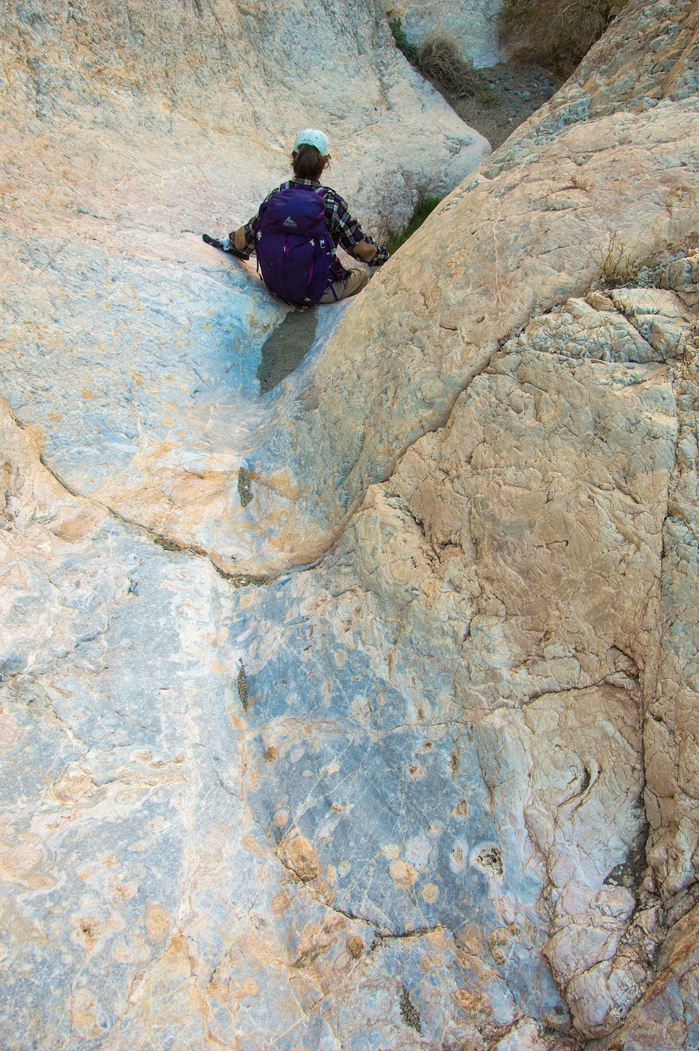
I was captivated by the beautiful patterns in the rock.

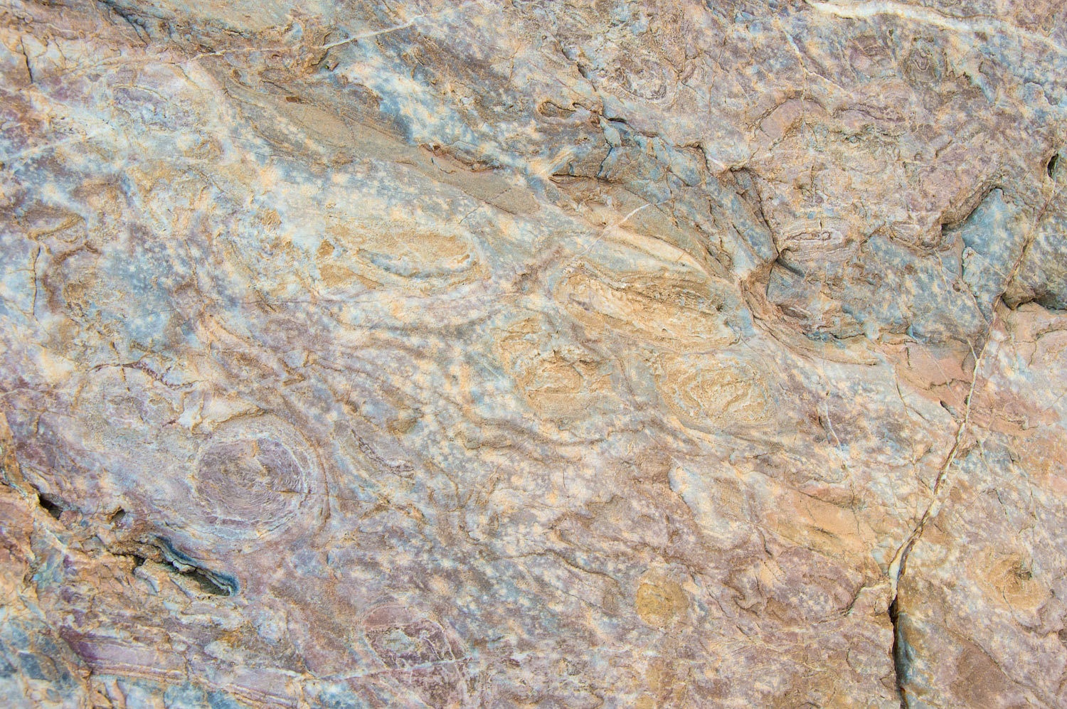
This was a wonderful canyon here in the narrows.
Interesting
rock continued to stop us.
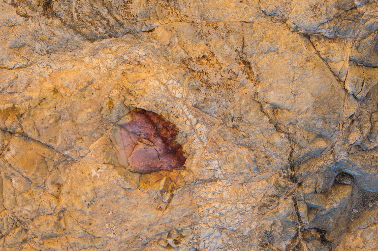
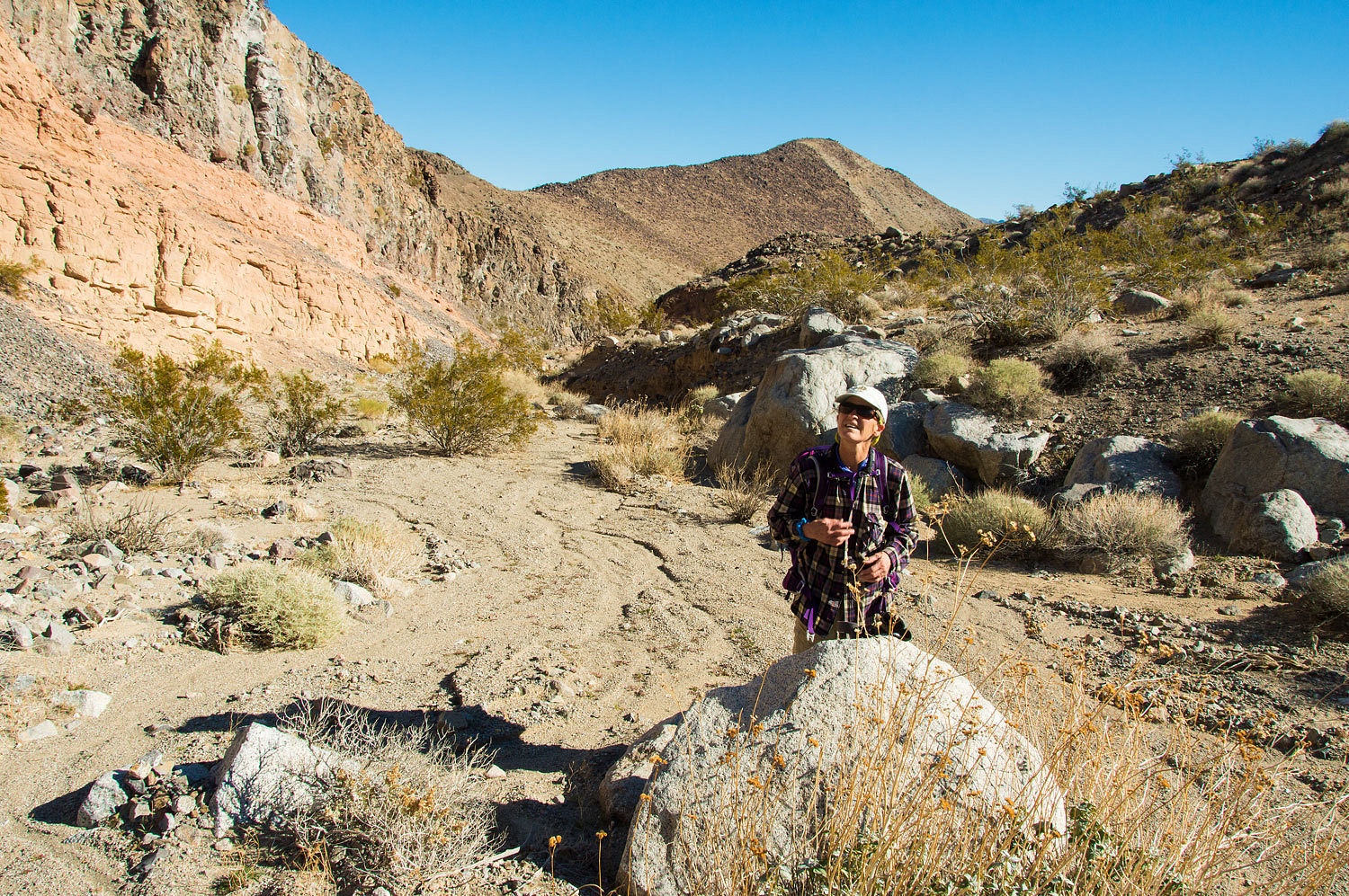
The canyon
started to open up into its broad wash below.

As we exited
the mouth of the canyon I took a photo of the mountain side to the north.

I was far
from convinced that this canyon could be the route to the Cottonwood Water
indicated by that enameled sign. If the trail did continue along the mountain
front all the way to the mouth of Cottonwood Canyon and then traveled all the
way up to the springs, that is many many miles farther than the 12 miles
indicated. That did not fit. I remembered an article written in 1949 about a
pack trip in the Cottonwood Mountains I had read. I will reread the article to
gather more details and possible hints.
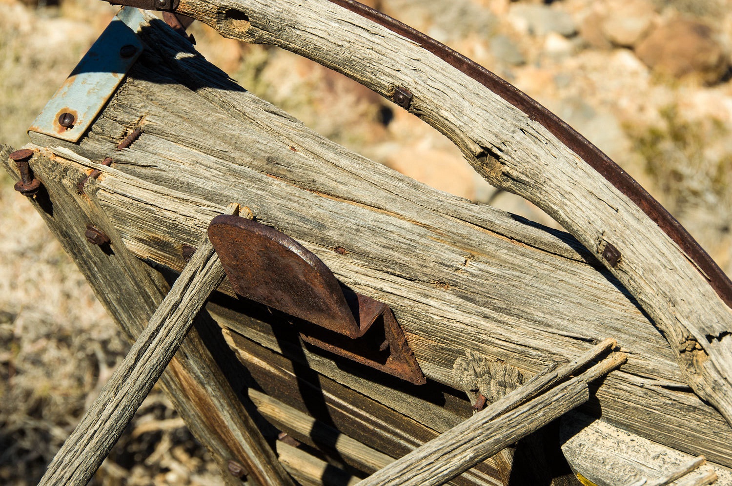
It was early
afternoon and we enjoyed our walk back to LeMoigne Canyon. We took a detour to visit an old friend, Jean
LeMoigne's wagon we had found a year ago after much research and four attempts.

We reached
camp mid afternoon. Our track traps indicated four people had walked by and headed
up LeMoigne Canyon. There were no tracks indicating they had returned. Two
people were wearing the same brand shoe with identical sole patterns, one quite
smaller than the other. Our bet was a male female couple. We just got our boots
off and settled in our chairs when we heard voices up the wash. This was Tim
and Tatum from San Diego. Their friends, Nate and Sarah from Salt Lake City with
the matching shoes were a bit behind. These were delightful, interested, and enthusiastic
young people on their first visit to Death Valley. They had camped a couple of
miles below us, as far as they wanted to drive their vehicle. They were disappointed
in the information offered at the visitor center so we took time to fill them
in on guide books, websites, and personal suggestions on what to see on their
next visit.
We were
again alone as they headed down the road. It was a wonderfully lazy and relaxed
afternoon and evening watching the light work across the expanse below us.

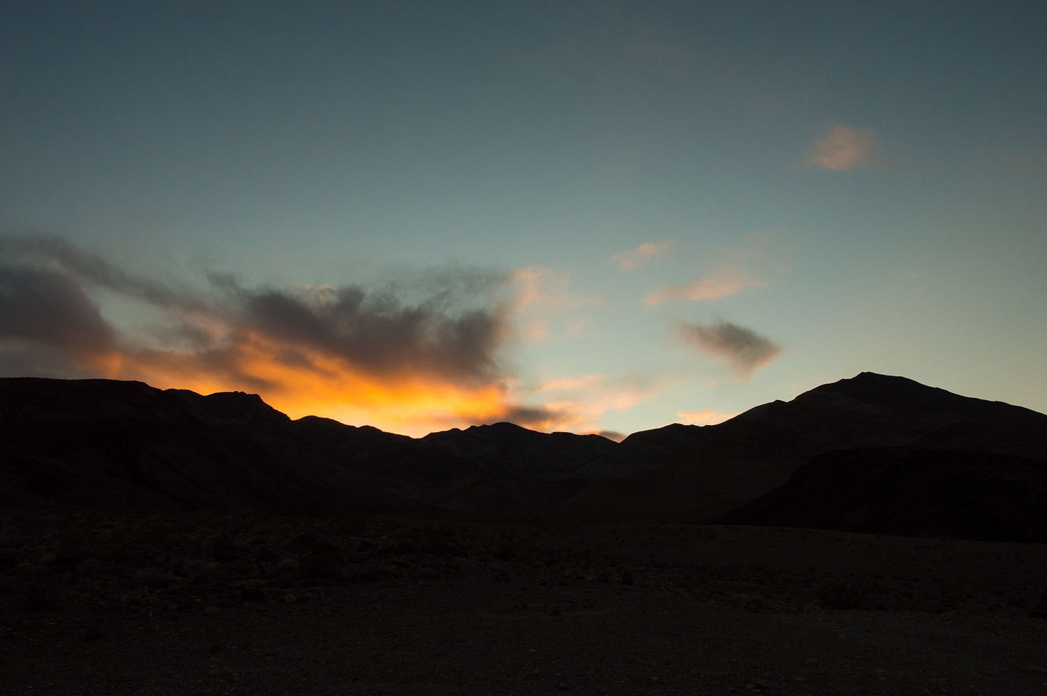
A few clouds
to the west added color at sunset.
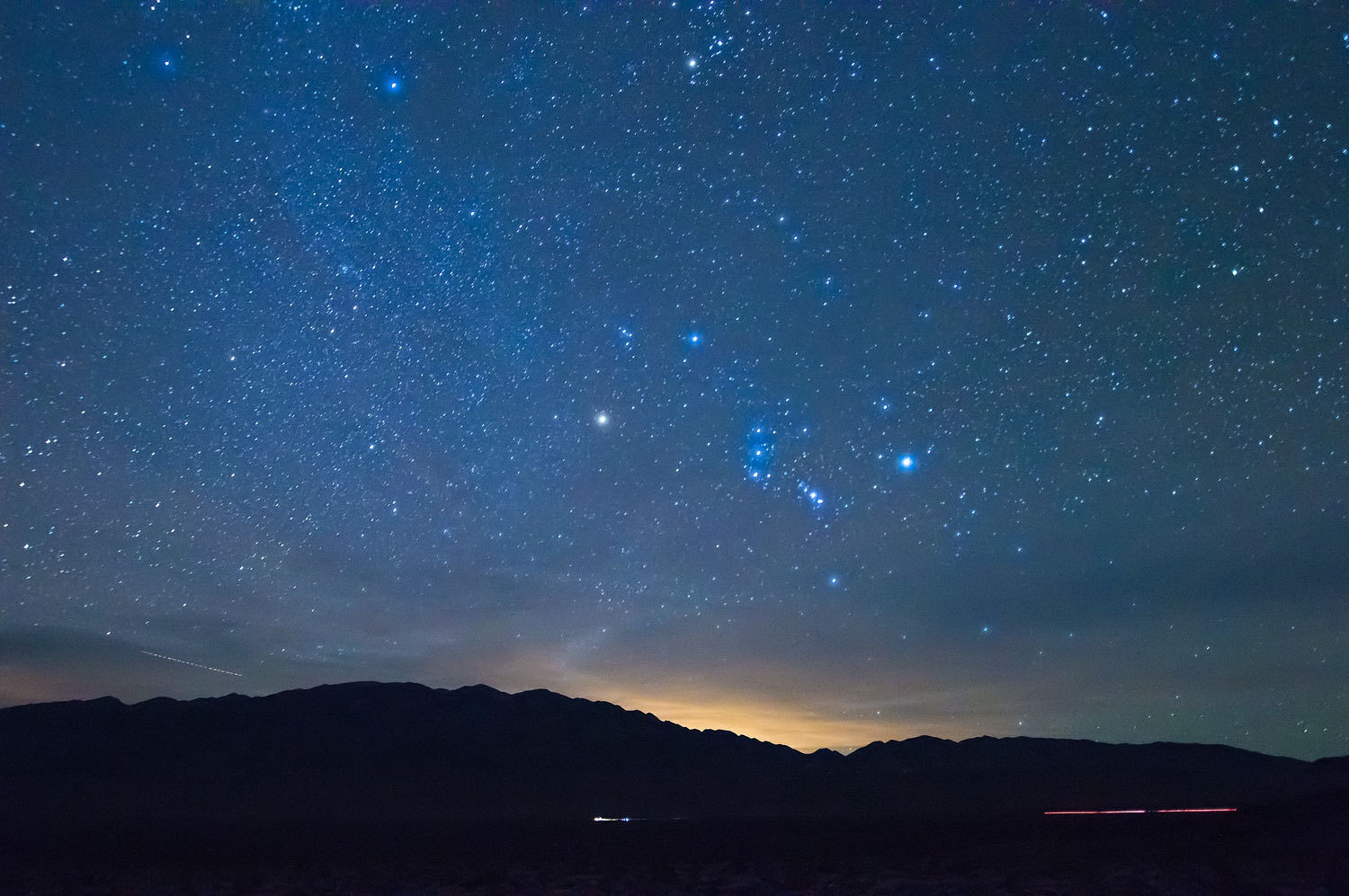
The night
sky and stars were incredible. How can we not be in love with this place?
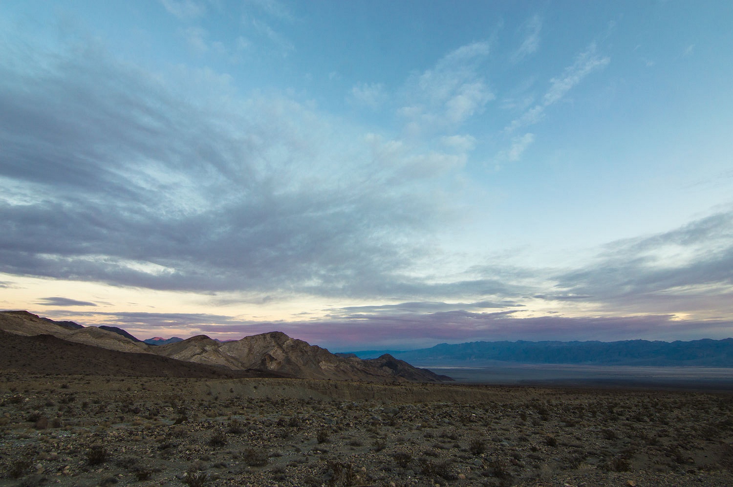
More clouds
in the morning added color to first light.

It was time
to pack up and head home and once again say, "Good bye Death Valley."
Addendum -
I reread the article mentioned above and also
searched Digonnet's Hiking Death Valley for bits of information concerning the
route to "Cottonwood Water." Digonnet makes one mention that the
route went up the North Fork of LeMoigne Canyon and then dropped over and
descended a branch of Cottonwood to Cottonwood Springs. Although not explicitly
stating so, this is the probable route (done in reverse direction) taken by the
pack trip in 1949. I followed up on a hint I received and searched for the old
1951 USGS 15' quads for Marble Canyon and Panamint Butte. These maps have
the old trails indicated, what a find! The route did go up the North Fork of
LeMoigne Canyon and on to Cottonwood Springs. In addition, the route from
Cottonwood Springs and over Hunter Mountain (the route to Keeler) is also
shown. I was surprised though, that the old Emigrant Canyon and Stovepipe Wells
15' quads do not show the old indian trail we walked out on the bajada. My
search continues for old maps as the adventure of old trails continues.
If you are
interested in the 1949 article, I will provide the link as it is interesting
reading. Just be aware you will download the entire magazine file (not
outrageously large) but can save it as a .pdf file for future research. As a
side note, this is the story of a pack trip the publisher of Desert Magazine
took with the owner of Stovepipe Wells resort, George Putnam. Putnam was an author
and explorer and part of the GP Putnam Sons publishing business. He was also
the husband and widower of Amelia Earhart. Mr. Putnam fell ill at Stovepipe
Wells in late 1949 and died in early 1950.
Here is the
link - Desert Magazine December 1949 - go to "Panamint Pack Trip" starting
on page 13.