
please remember you can click on a photo to see a larger version & highlighted text are links to additional information
Far too many things, that I'll free you from reading about, delayed our departure for this trip. After hitting the road Friday morning, we woke Saturday morning at what we call "Whitney View Camp."
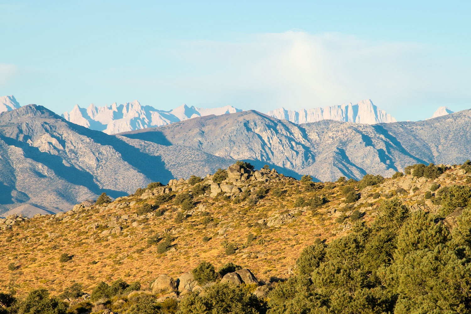
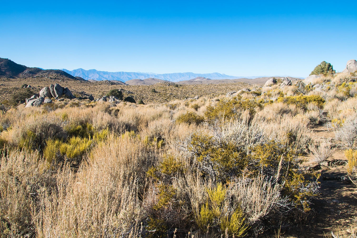
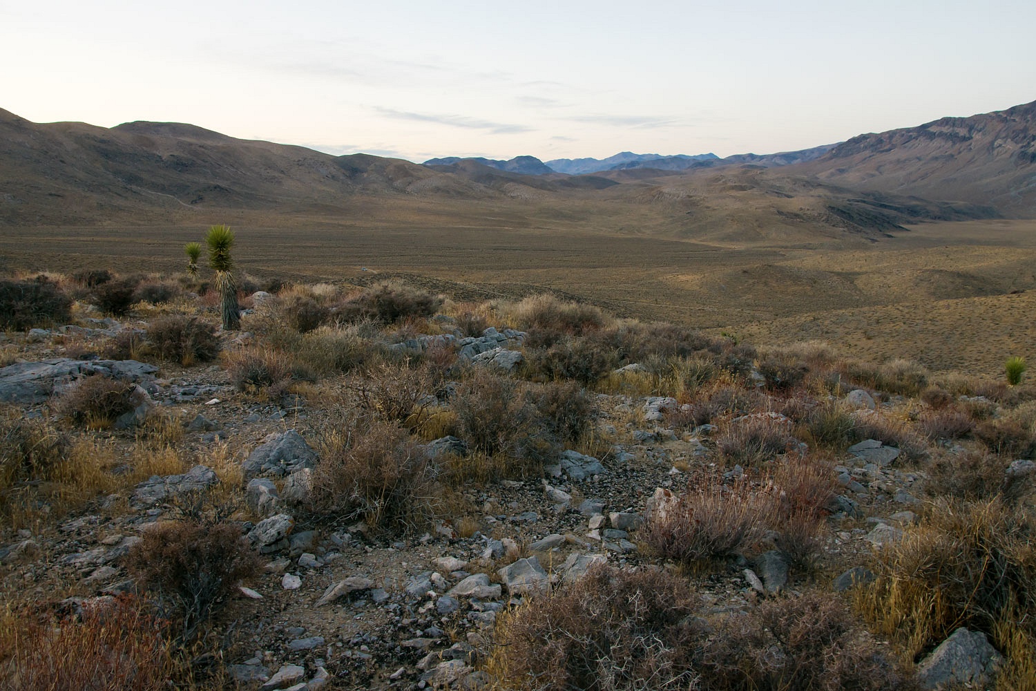
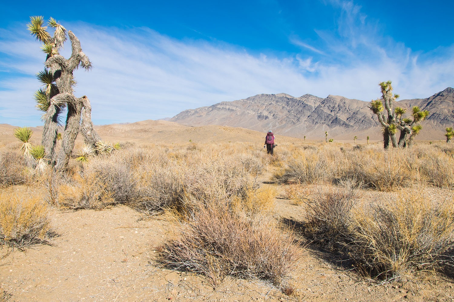
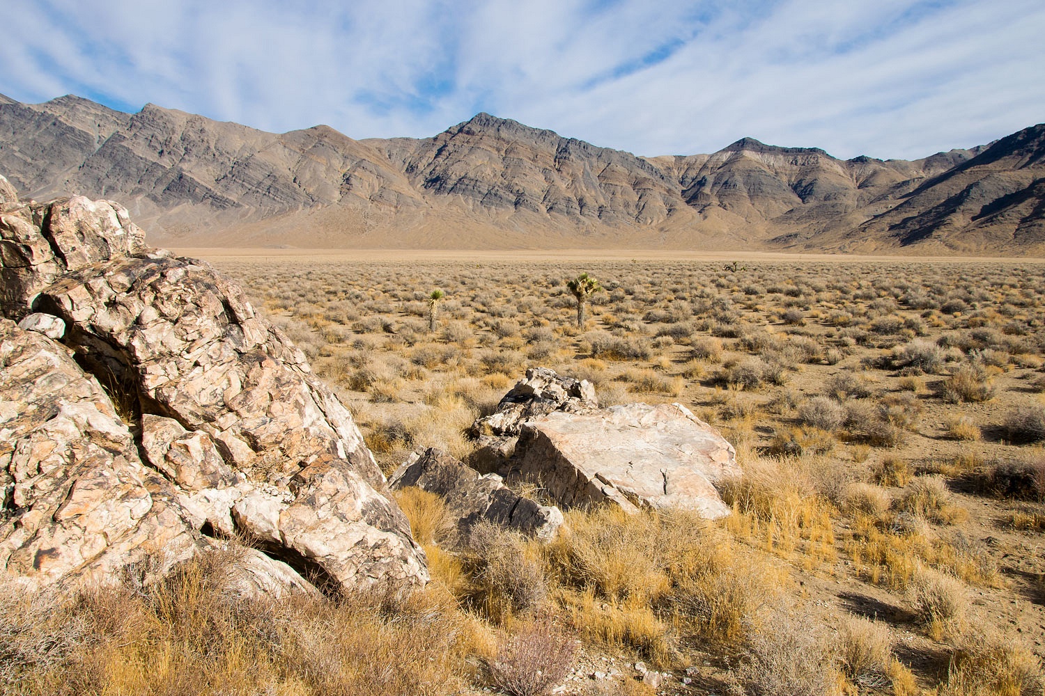
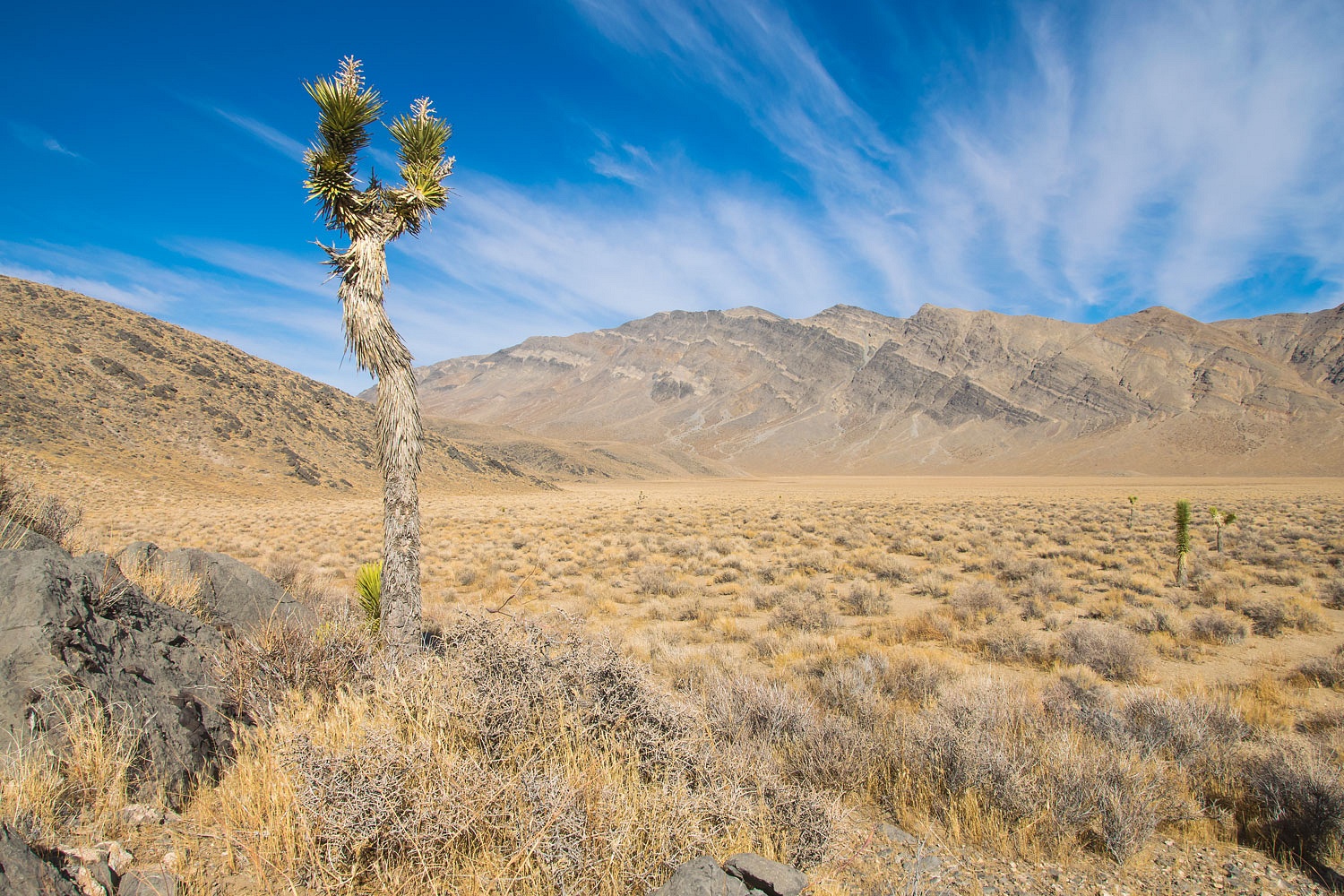
It had been a few years since our last trip on Hunter Mountain Road. We were anxious to return to this remote portion of the National Park. The opportunities for exploration are excellent out here as well as the opportunity for solitude. Solitude was getting an A+ as we encountered no other vehicles on Hunter Mountain Road on Friday and no vehicles drove past our comfortable small campsite during the night or next morning.
There was an ancient rock art site on our list to locate. The shadowed canyon bottom was frigid with patches of hard crusty snow.
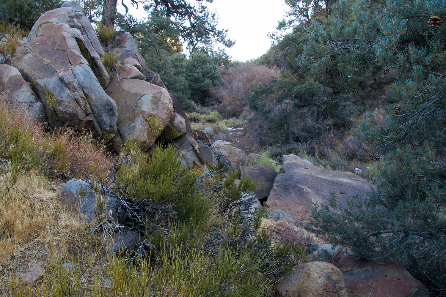
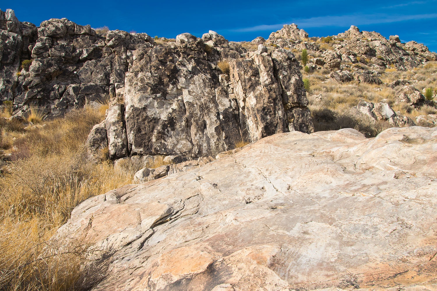
This site is centered around a grinding slick work station.
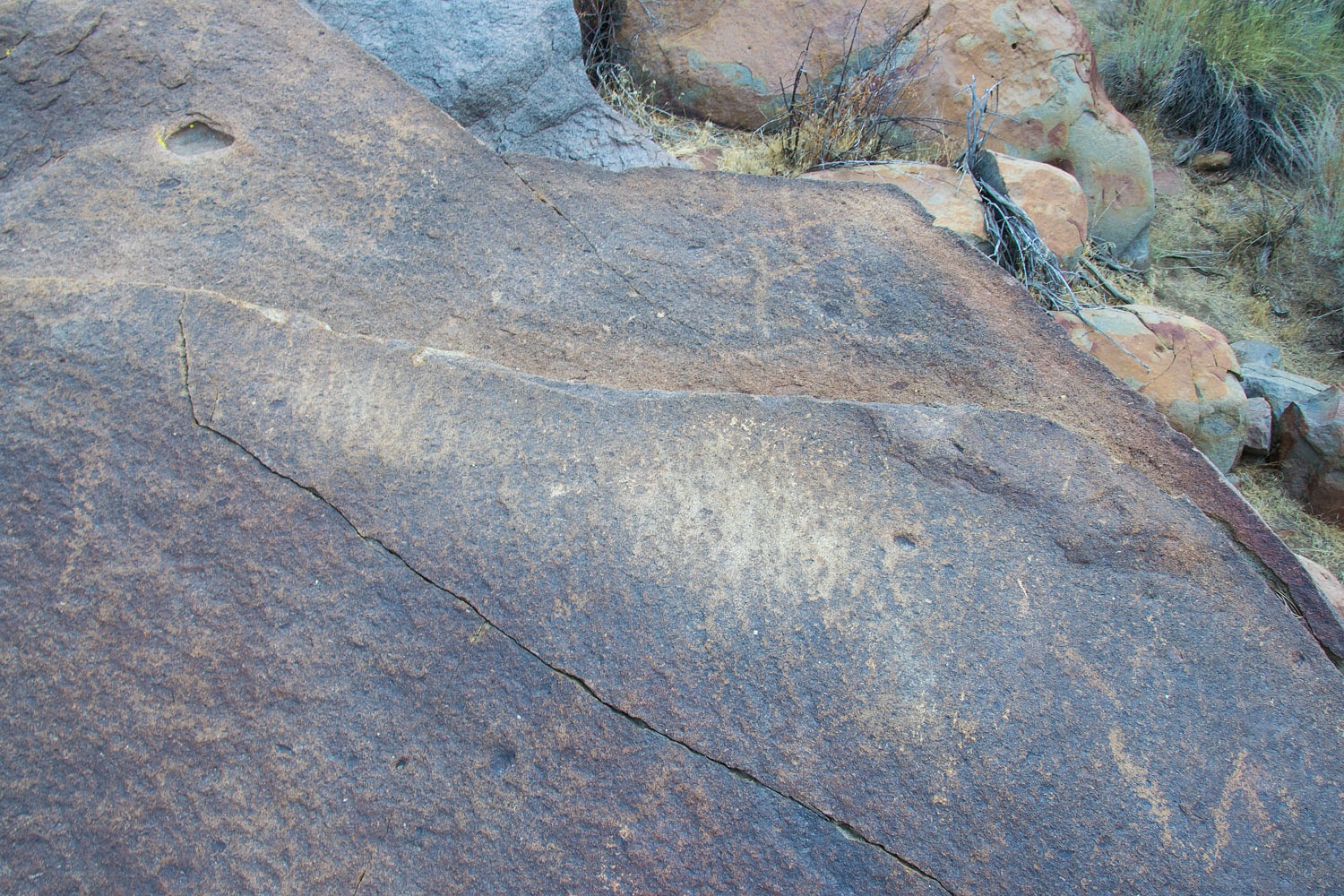
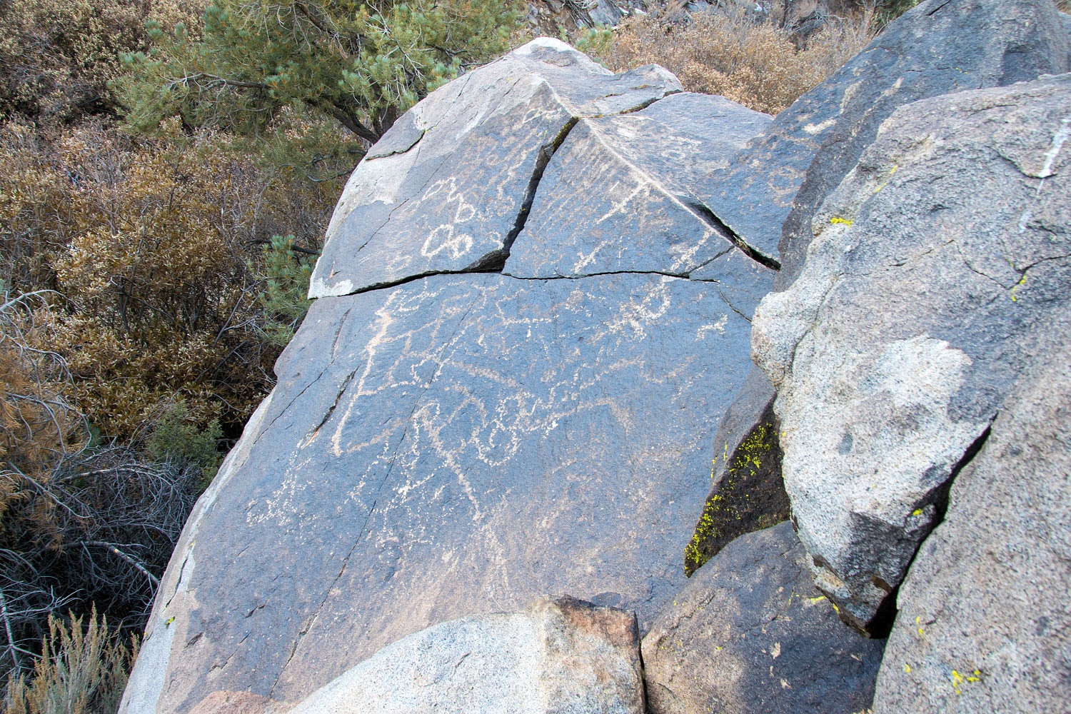
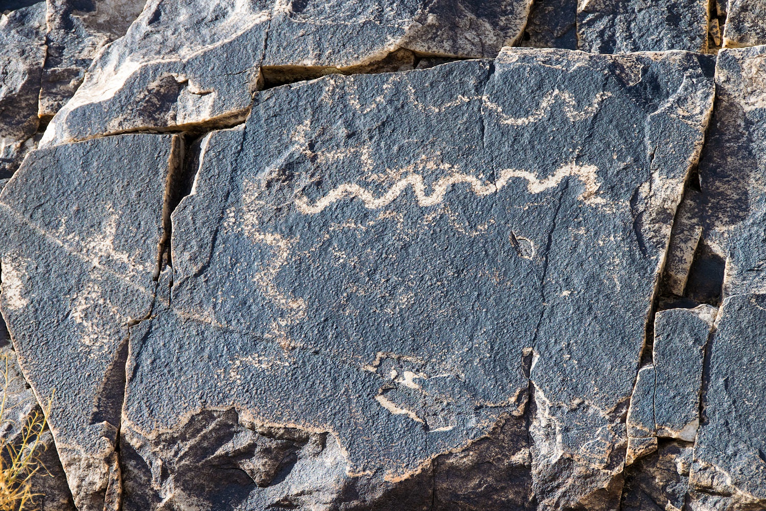
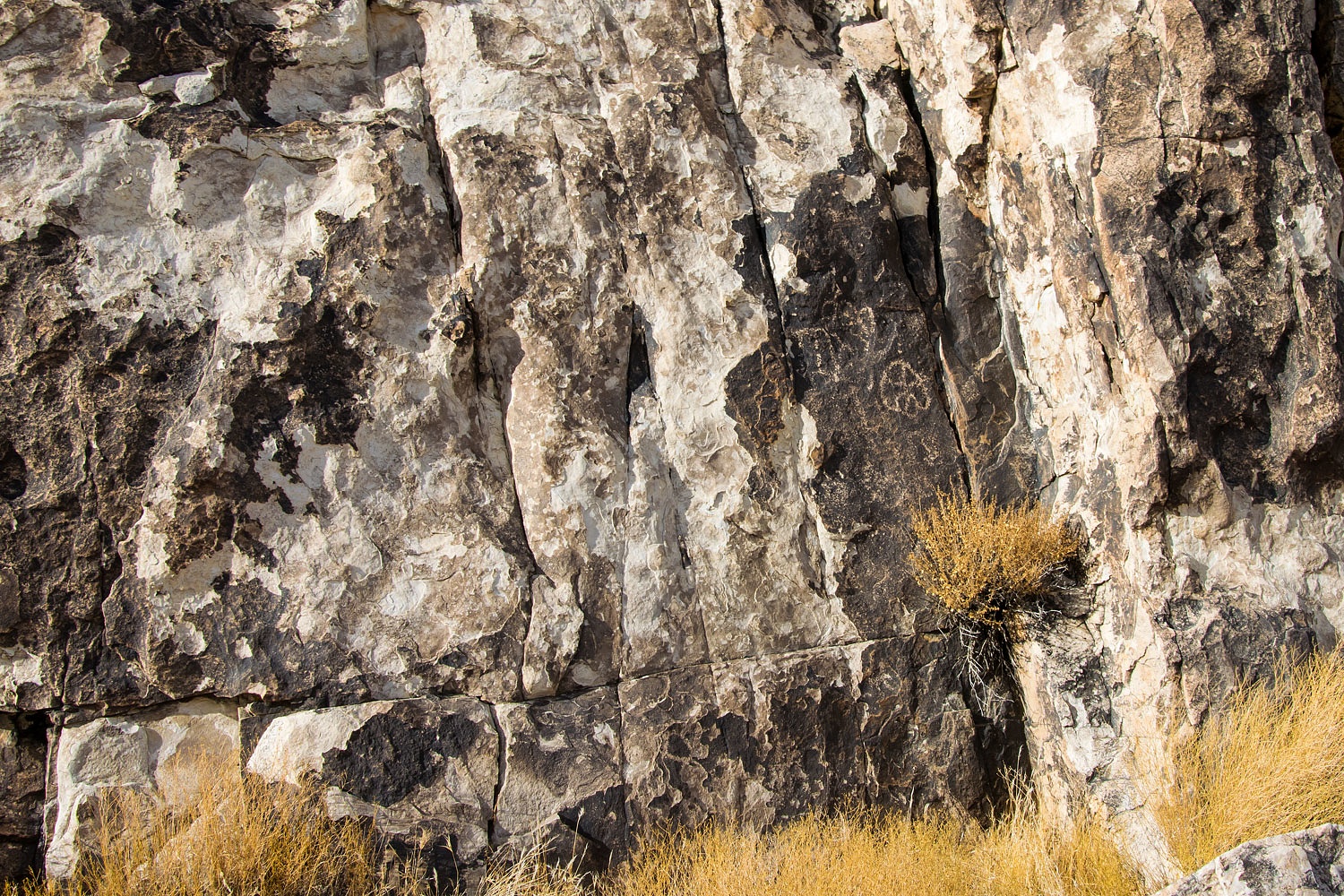
The petroglyphs are impressive.
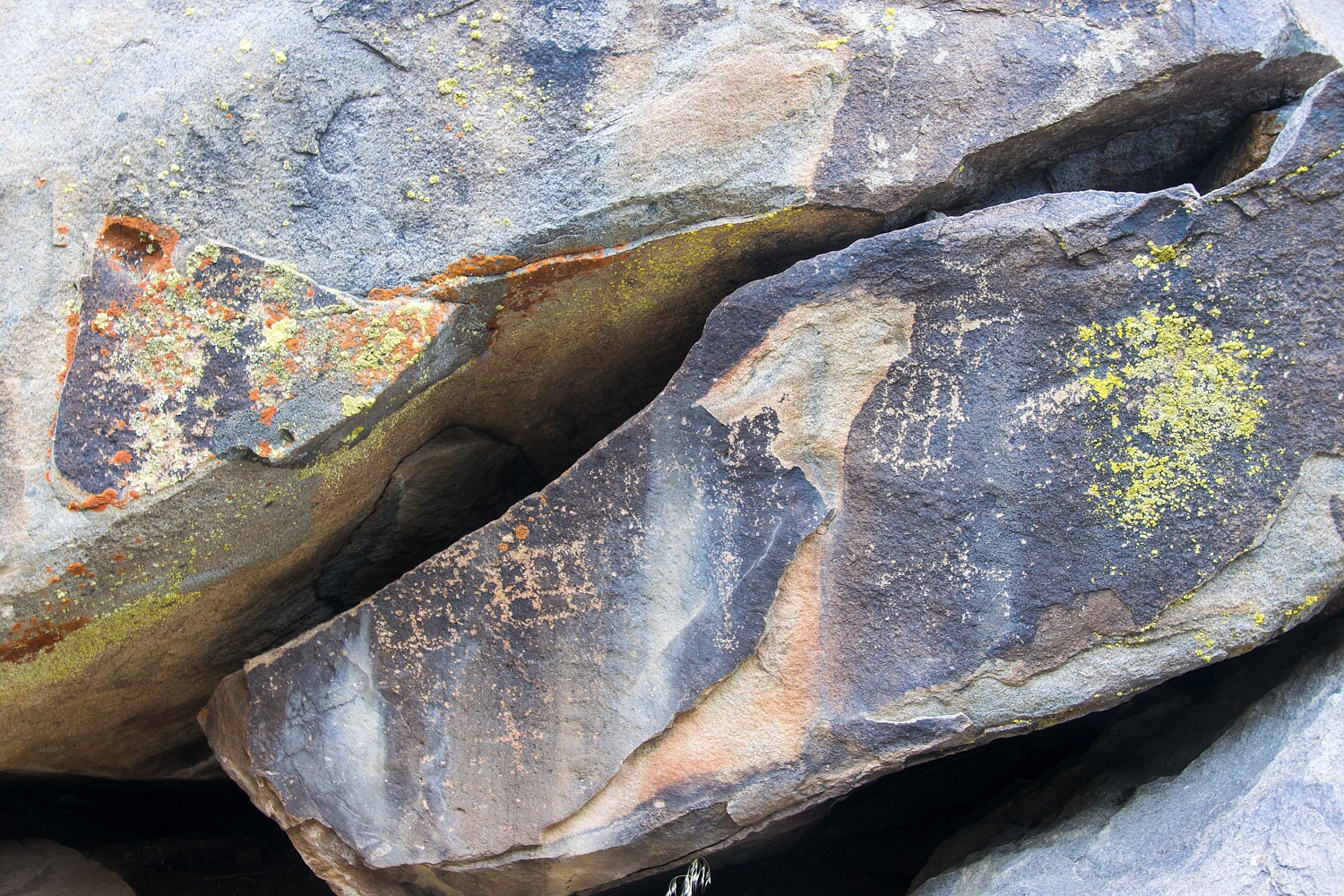
We found a classic Coso style sheep panel.
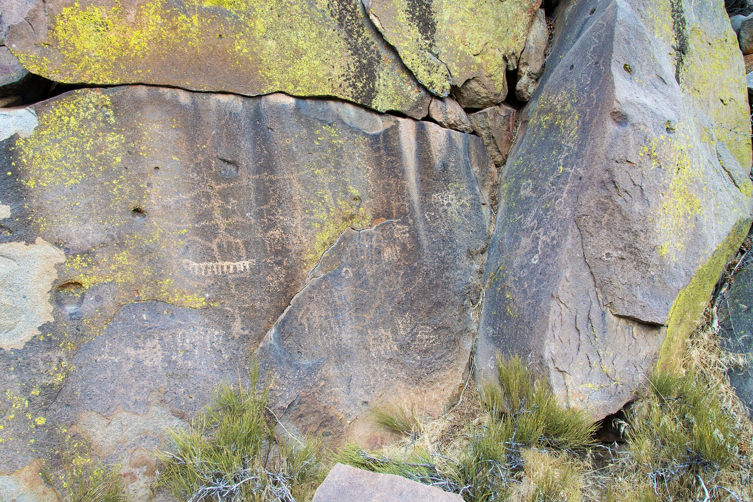
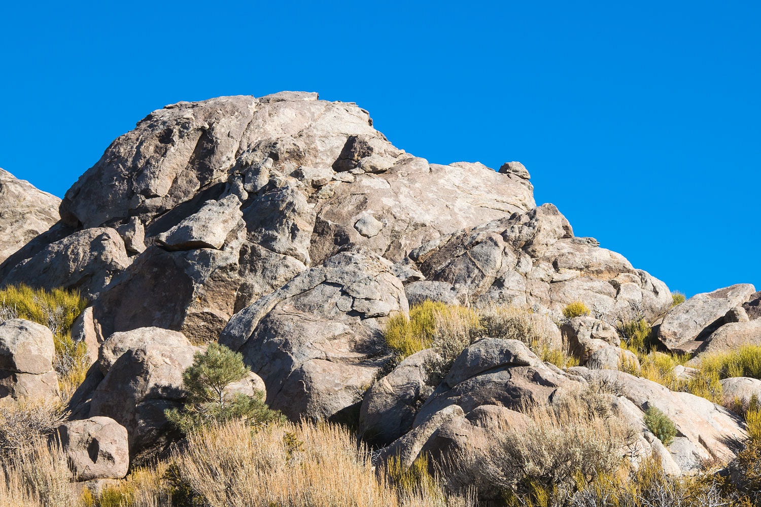
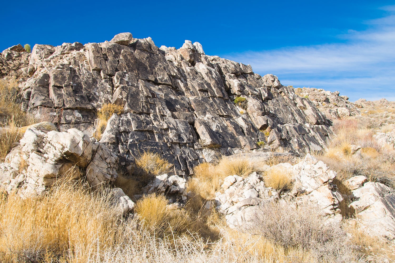
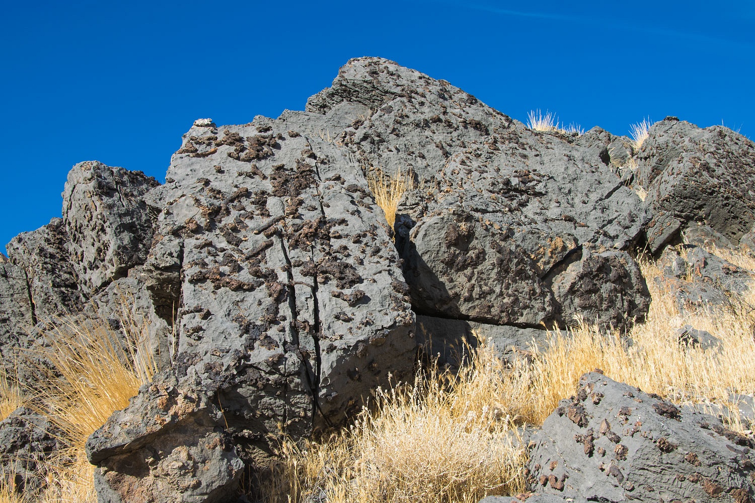
This photo shows the top of an rhyolite outcropping adorned with petroglyphs. Note how the rock is now fractured. It makes us wonder how long before this tumbles to the ground and is no more.
On several past trips we have searched for remaining desert sign posts - signs that were mandated by the California Legislature in the early 1900's. Most marked the way to water. Here is a link to one of our trips tracing old trails and looking for these old desert sign posts - Chasing History - Death Valley - Spring Break 2016.
On this cold Saturday morning we were pleased to find the remains of the sign post that was placed at Jackass Springs around 1906. The enameled sign has been missing for years. I believe our friend, The Sagebrush Reconnoiterer, provided us with a photo of the missing sign displayed at one time in the window of a building in Keeler. I'll try to find that old photo.
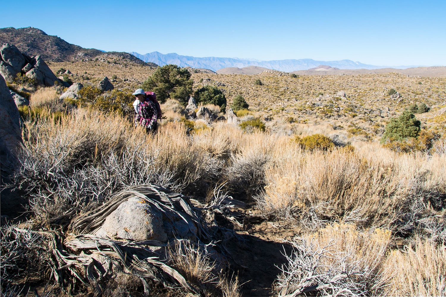
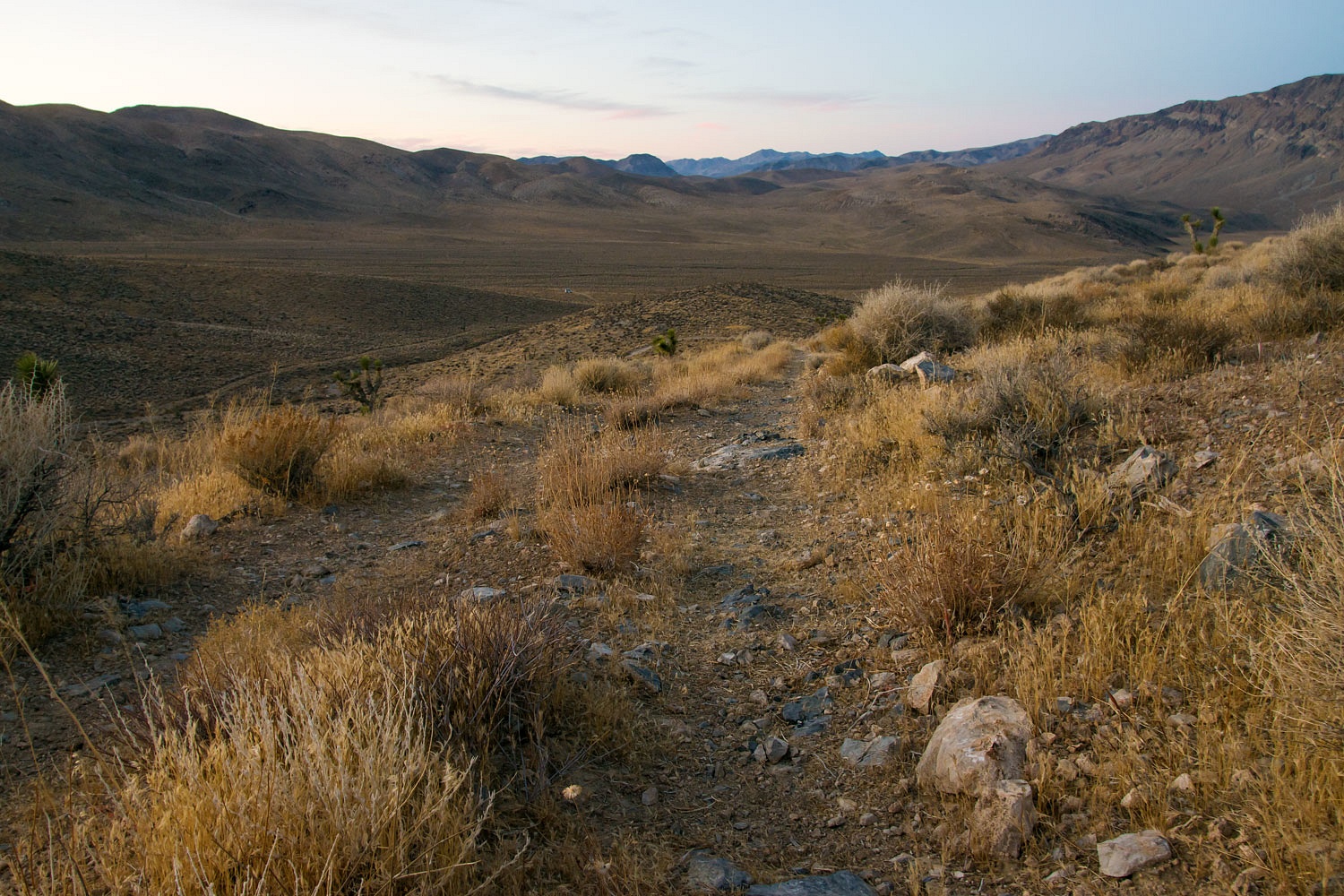
We have explored sections of the old trail (I've heard it called the Keeler Trail) that ran from Emigrant (above Stovepipe)) to Keeler on the shores of Owens Lake. We've hiked the route up the North Fork of LeMoigne Canyon to the top of the Cottonwood Mountains, and we've hiked the section in upper Cottonwood Canyon. We took some time this Saturday morning to see if we could find any evidence of the trail in the area from Hunter Springs to the top of Cottonwood Canyon.
Although the terrain is rolling, it is rough and slow going with thick brush and rocks. It is the kind of country where to travel a mile it takes three or four miles to get the job done.
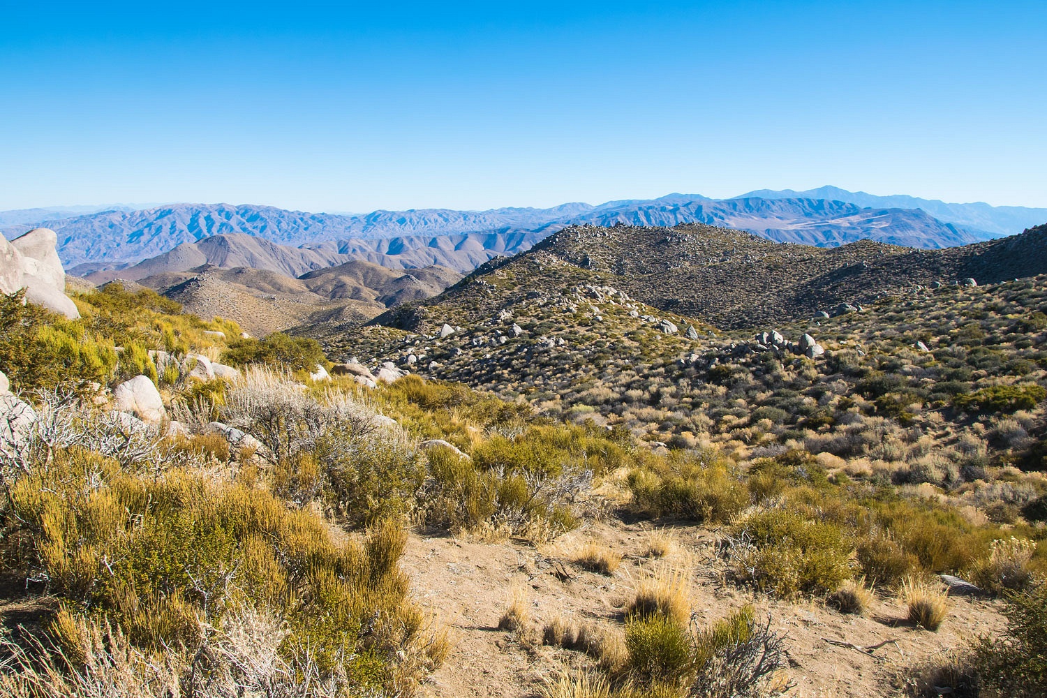
Here is a photo view looking down toward Cottonwood Canyon.
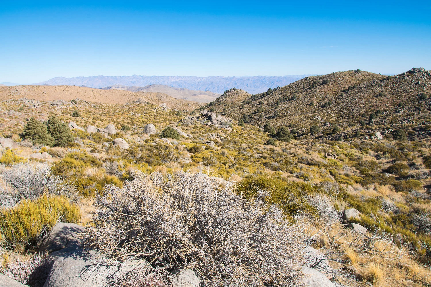
I believe the trail ran down the drainage on the opposite side of the ridge on the right in the above photo. We had some hiking to do to get over into that area. To keep ourselves oriented in new territory we picked a visible landmark to continue to note our relationship to as we hiked. The easy one out here was what we dubbed "Snoopy Rock."
We never encountered any obvious footbed of the old trail in this area. Moving through and around the brush continued to take effort.
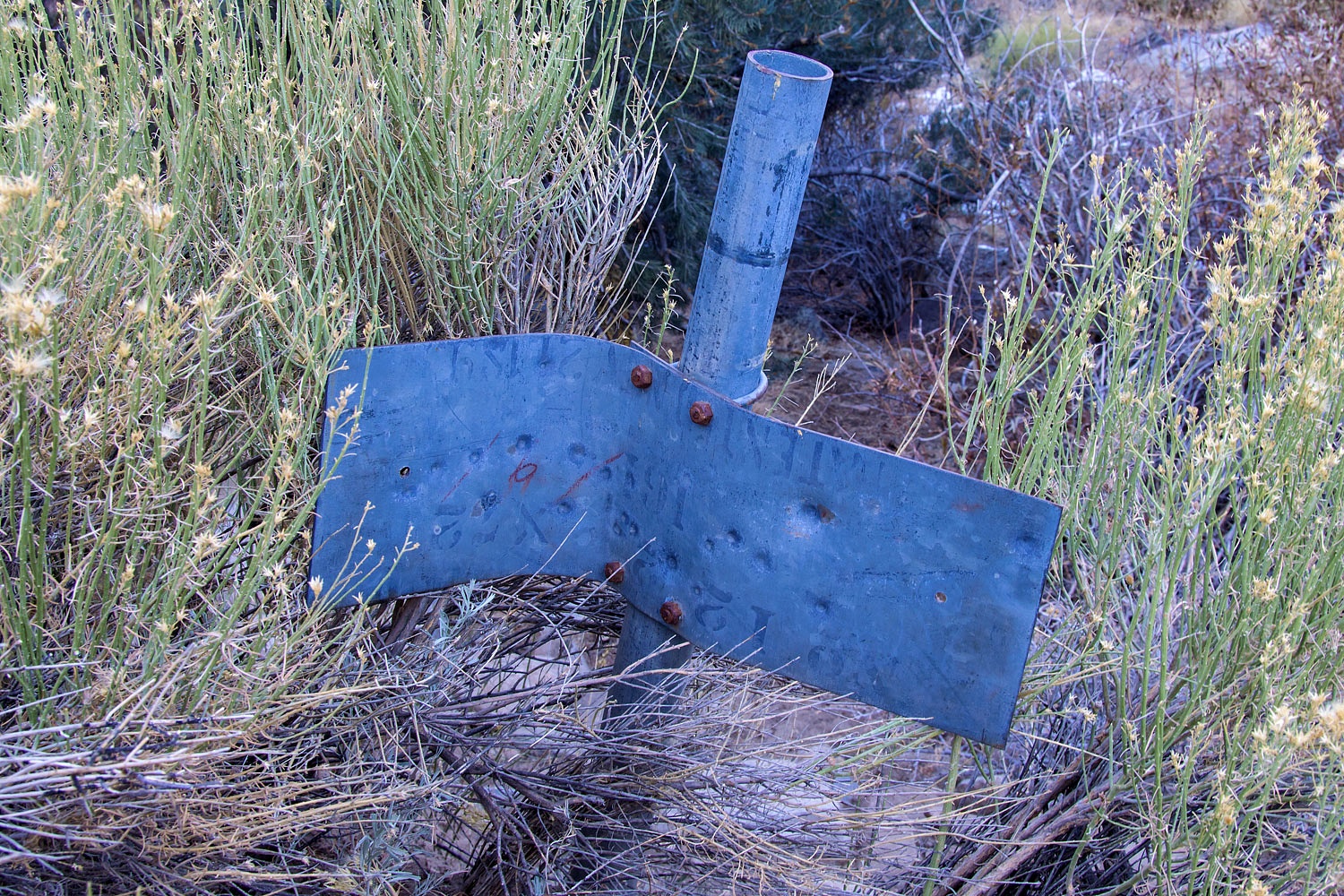
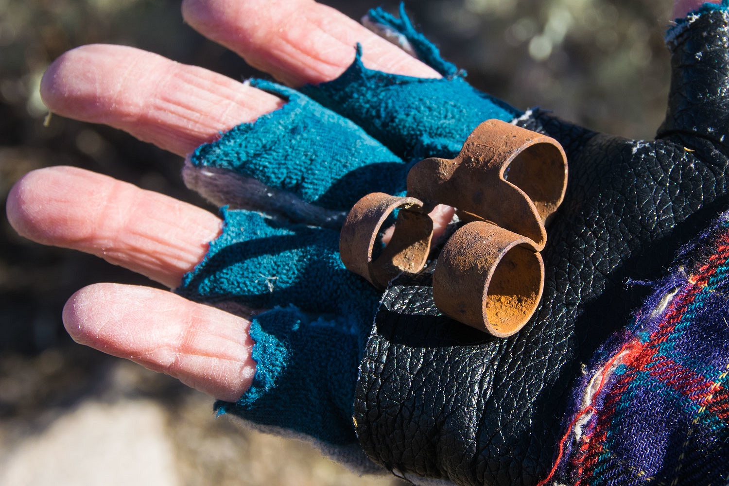
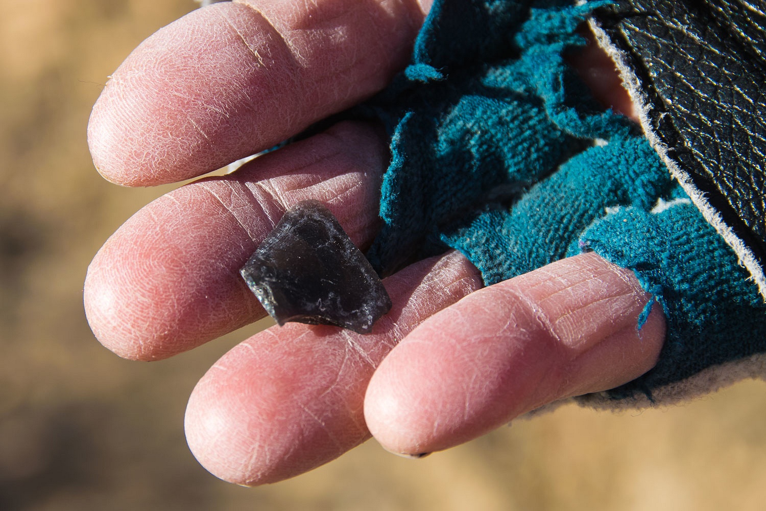
We also searched for any artifacts that would point to the existence of an old trail. This is all we found - and of course, it remains where we found it. Can someone identify this, please? It looks so familiar to me but the old brain's not putting out an answer.
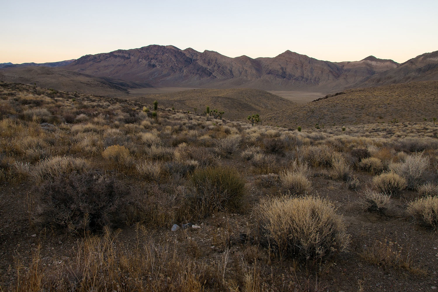
Here is the area I believe the old trail runs down to reach Cottonwood Canyon. It is complicated country.
We turned around at this highpoint and returned to our waiting truck.
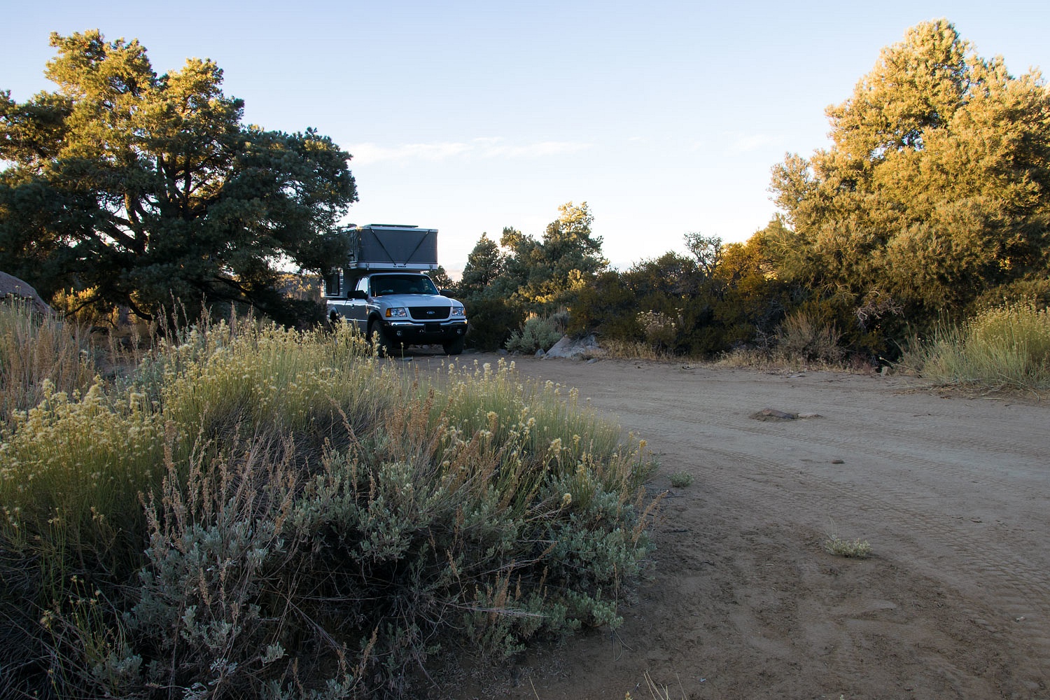
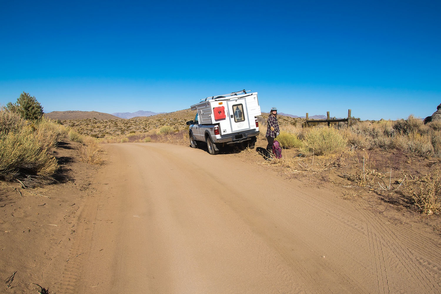
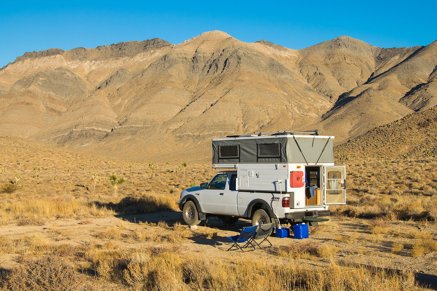
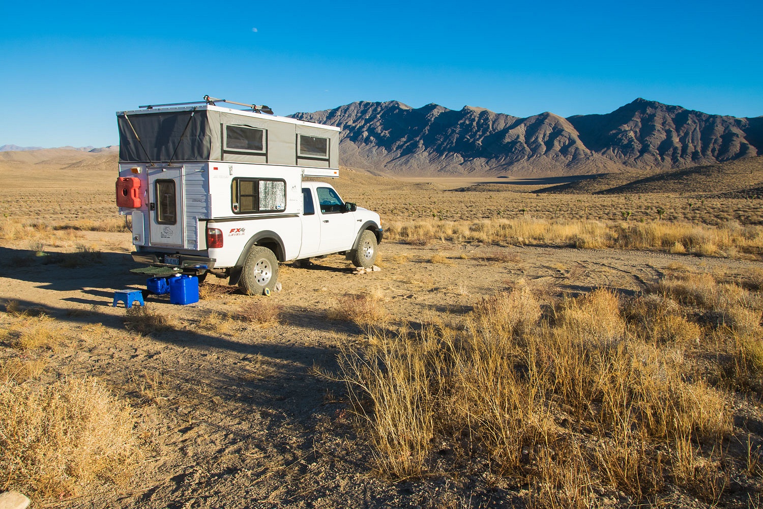
The winter solstice is fast approaching. Daylight is short. We prefer to have camp set up with enough daylight remaining for chores and such. It gets cold when the sun drops from view. All the campsites on this trip we've used before. The one for tonight was remote and special to us.
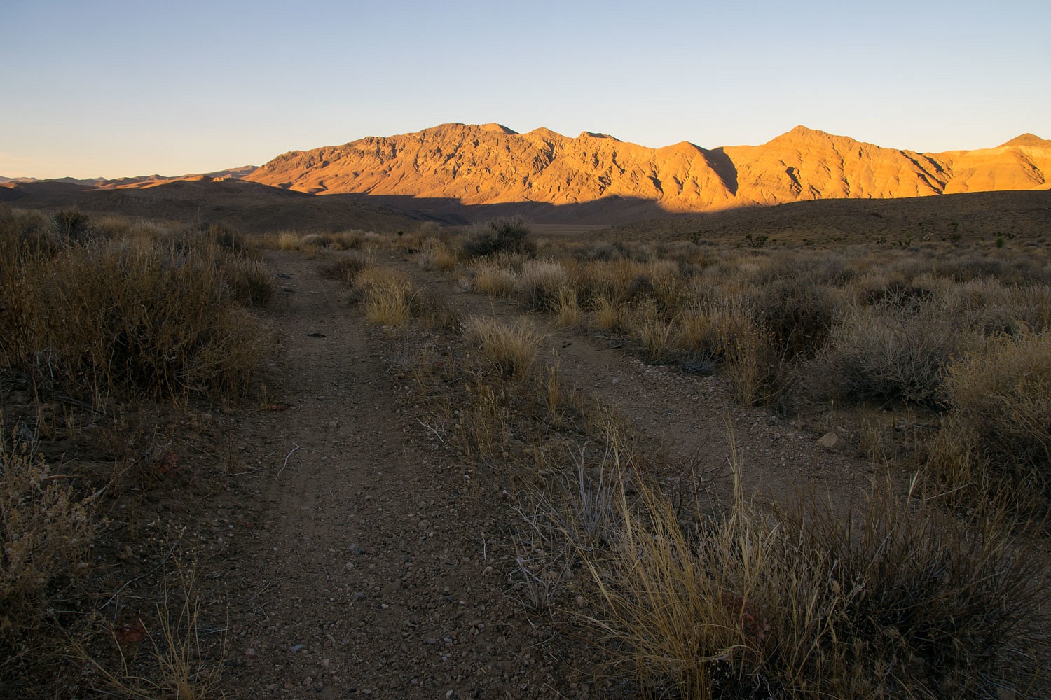
Afternoon coffee was ready just in time to watch last light on the Cottonwood Mountains as we walked.
We continued to climb as the day came to its end. Up is always the Lady's preferred direction of travel.
There was only a slight breeze - rare for Death Valley. It would be a cold night. We worked our way back to the truck and camper, just left of center in the photo below.
It dropped to 20° overnight. Although we've been in colder overnight temperatures, as morning approached we were both cold. It was just one of those nights. We lingered in our thick covering of bedding until the sun hit the truck. And then we basked in the sun's warmth.
Death Valley is a very unique National Park because of its remote vastness, opportunities for travel on backcountry roads, and dispersed camping (where allowed). The rules are straight forward and I'm the kind of guy who believes that when rules are followed it helps assure our future use and enjoyment. I also know the rules are in place to protect the Park. Two rules are simple, no off road driving and no campfires. When I find yet another fire ring to break down and clean up ashes and trash from, it ticks me off. When I find new tire tracks off road down a wash, especially crushing flora and fauna, it ticks me off.
Enough said?
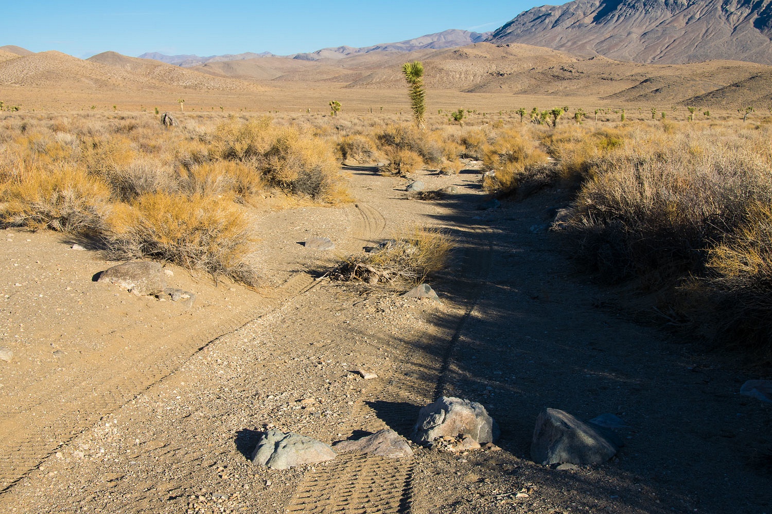
We packed up camp. We had a hike to
enjoy, a revisit to a very special place. The sun felt so wonderful. Have I mentioned that?
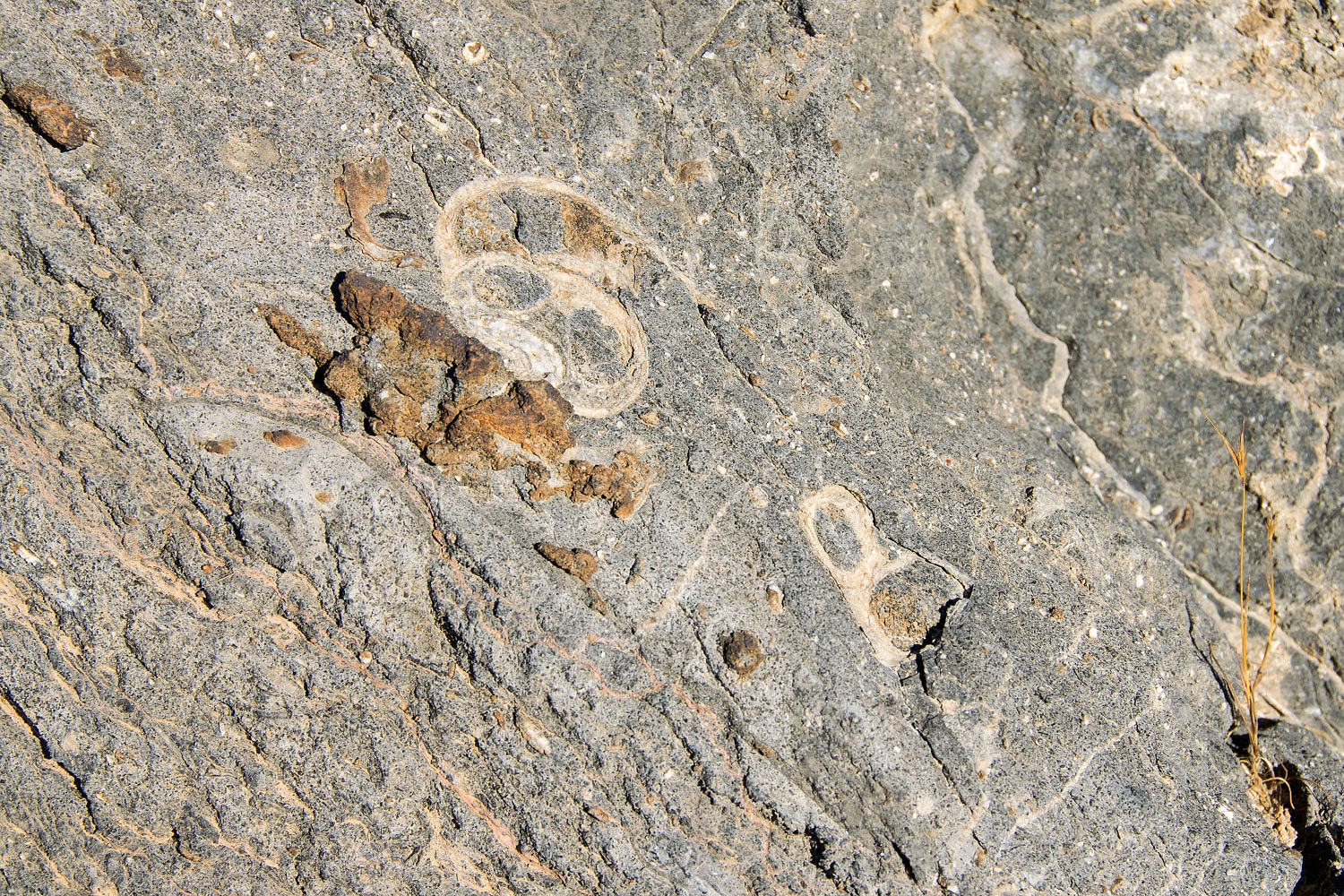
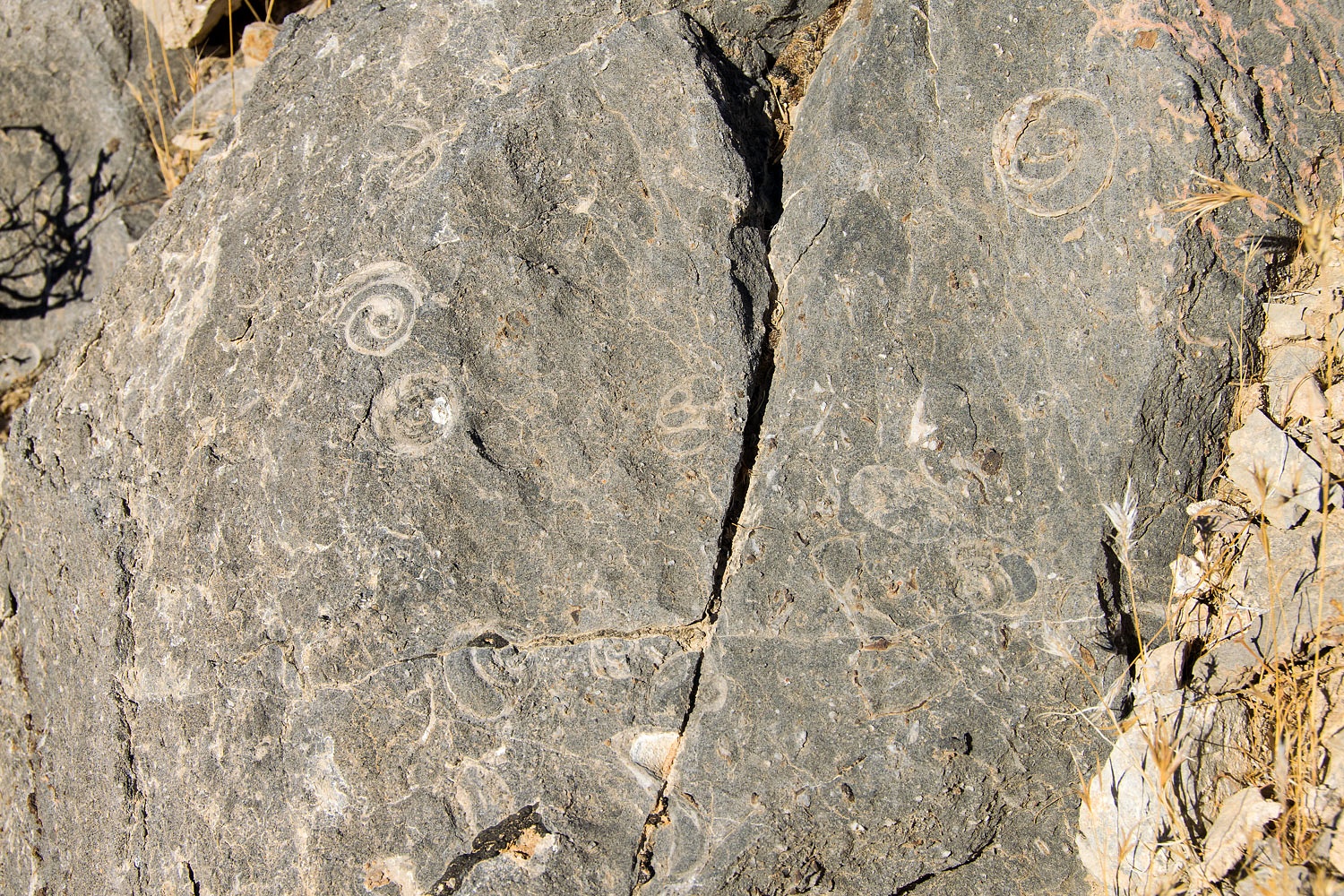
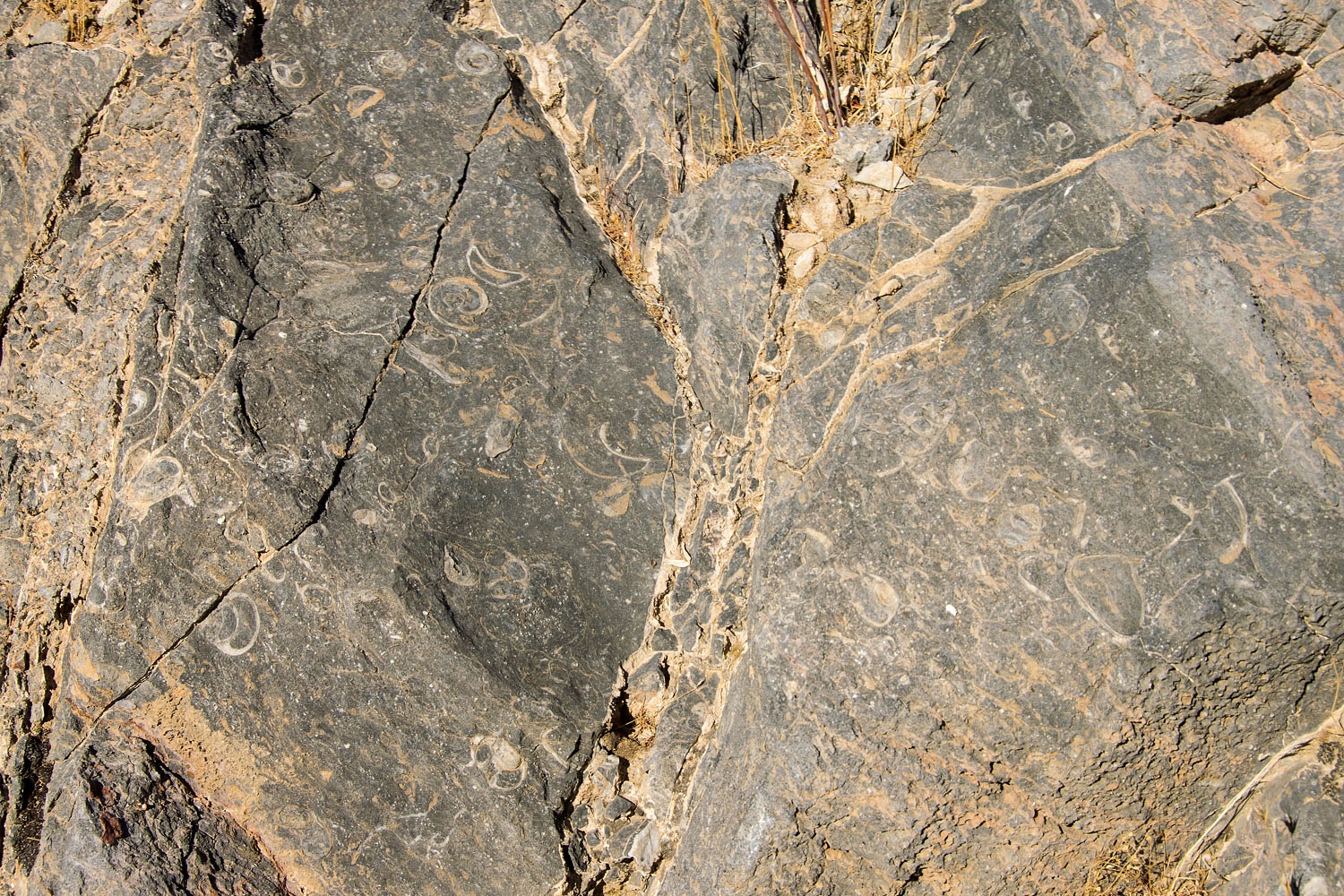
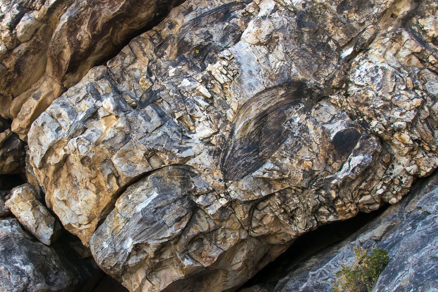
Our first stop was an outcrop of limestone containing an abundance of fossils.
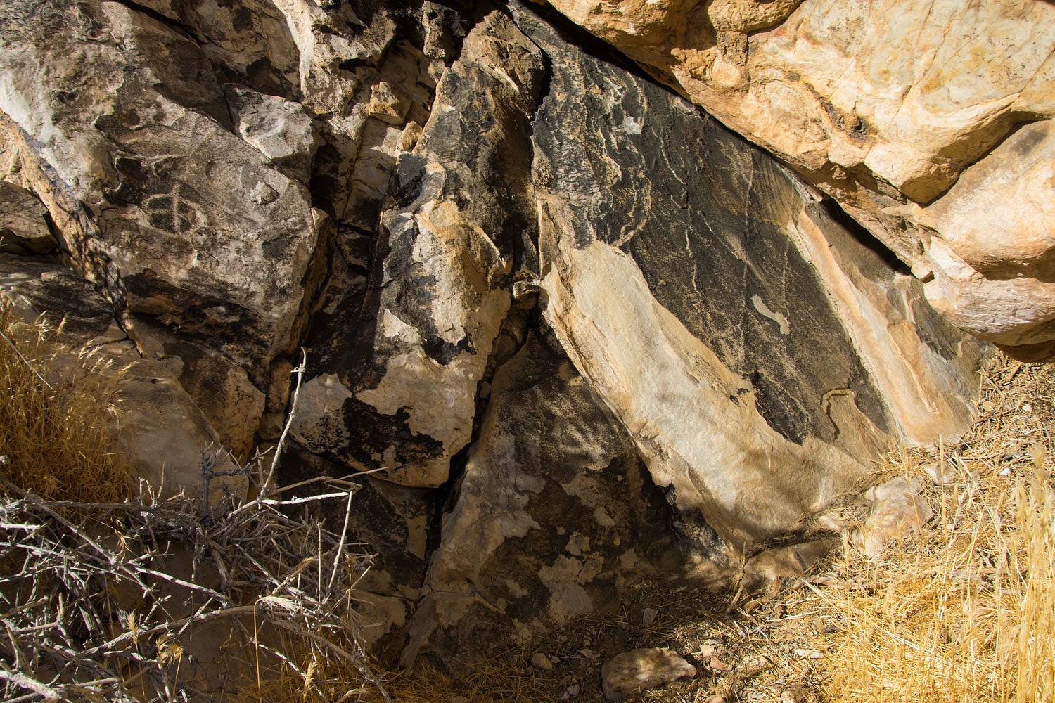
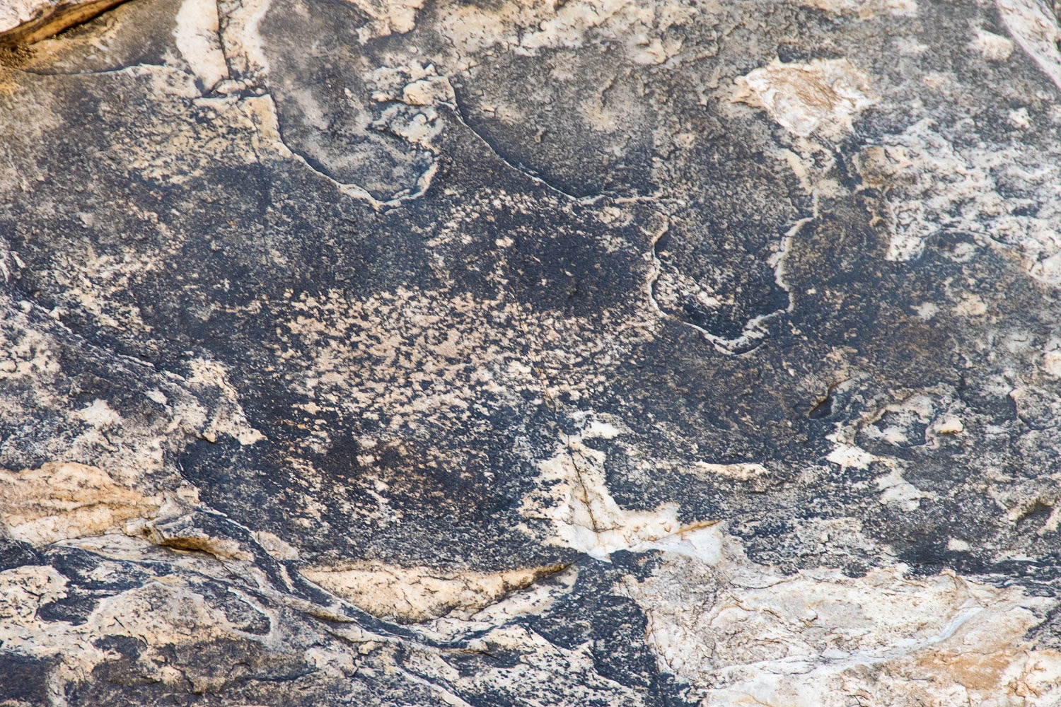
Our next stop was an outcrop of what I believe is quartzite. It develops a dark layer of desert varnish.
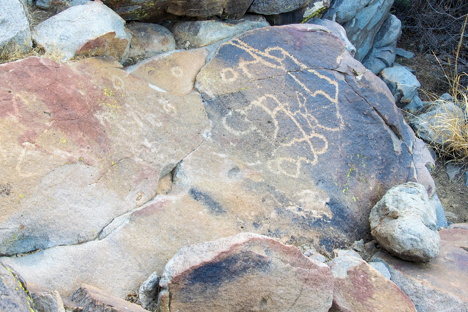
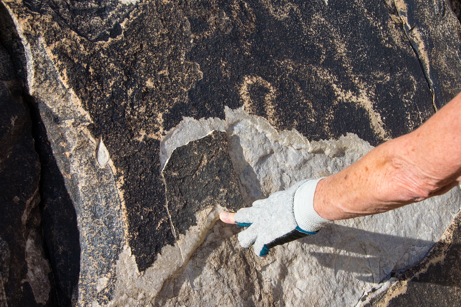
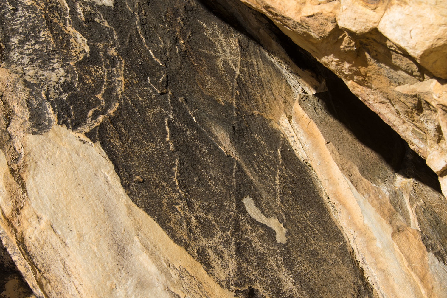
The layer of varnish makes a great canvas for petroglyphs.
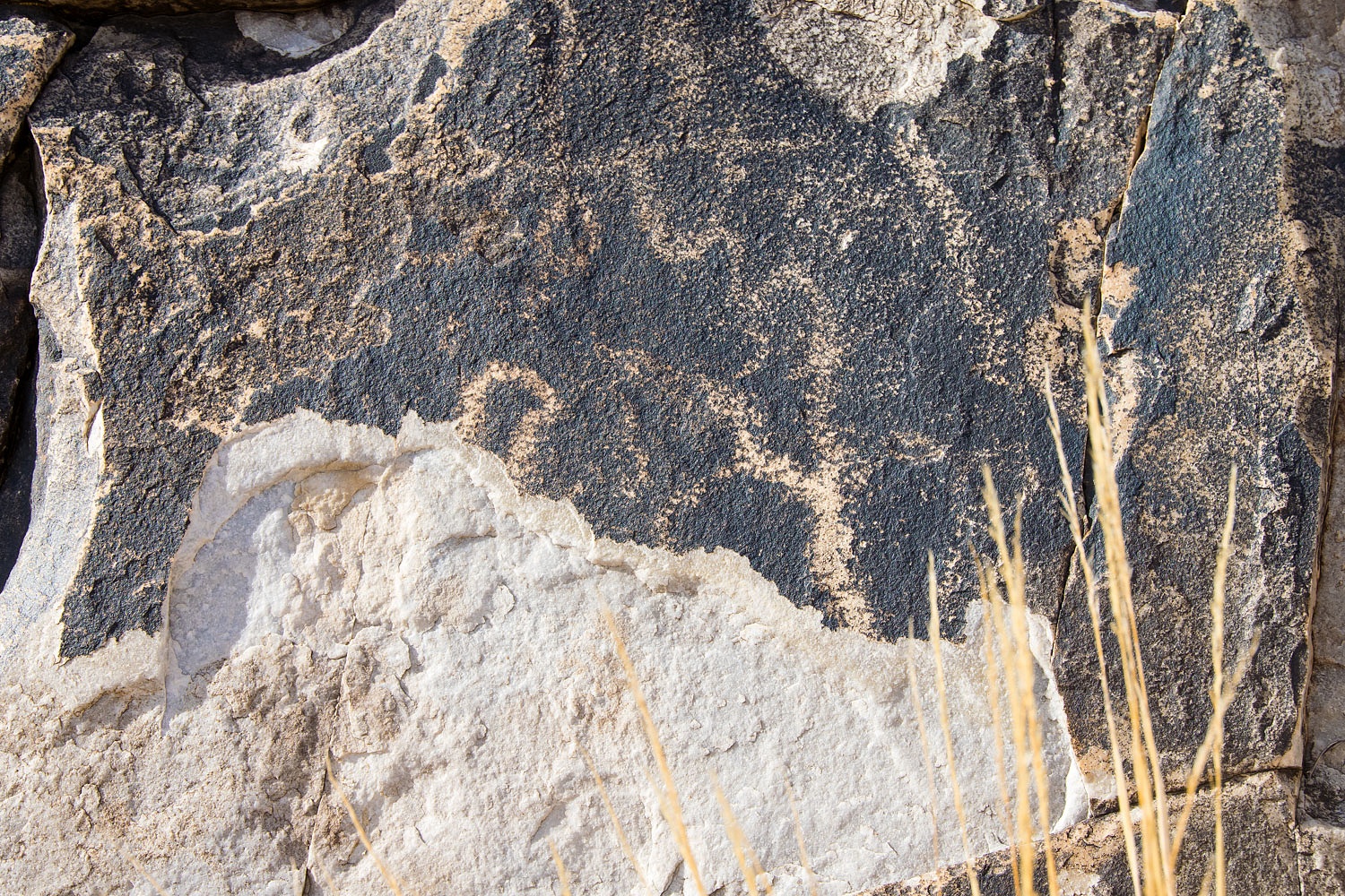
Large sections of this rock has flaked off.
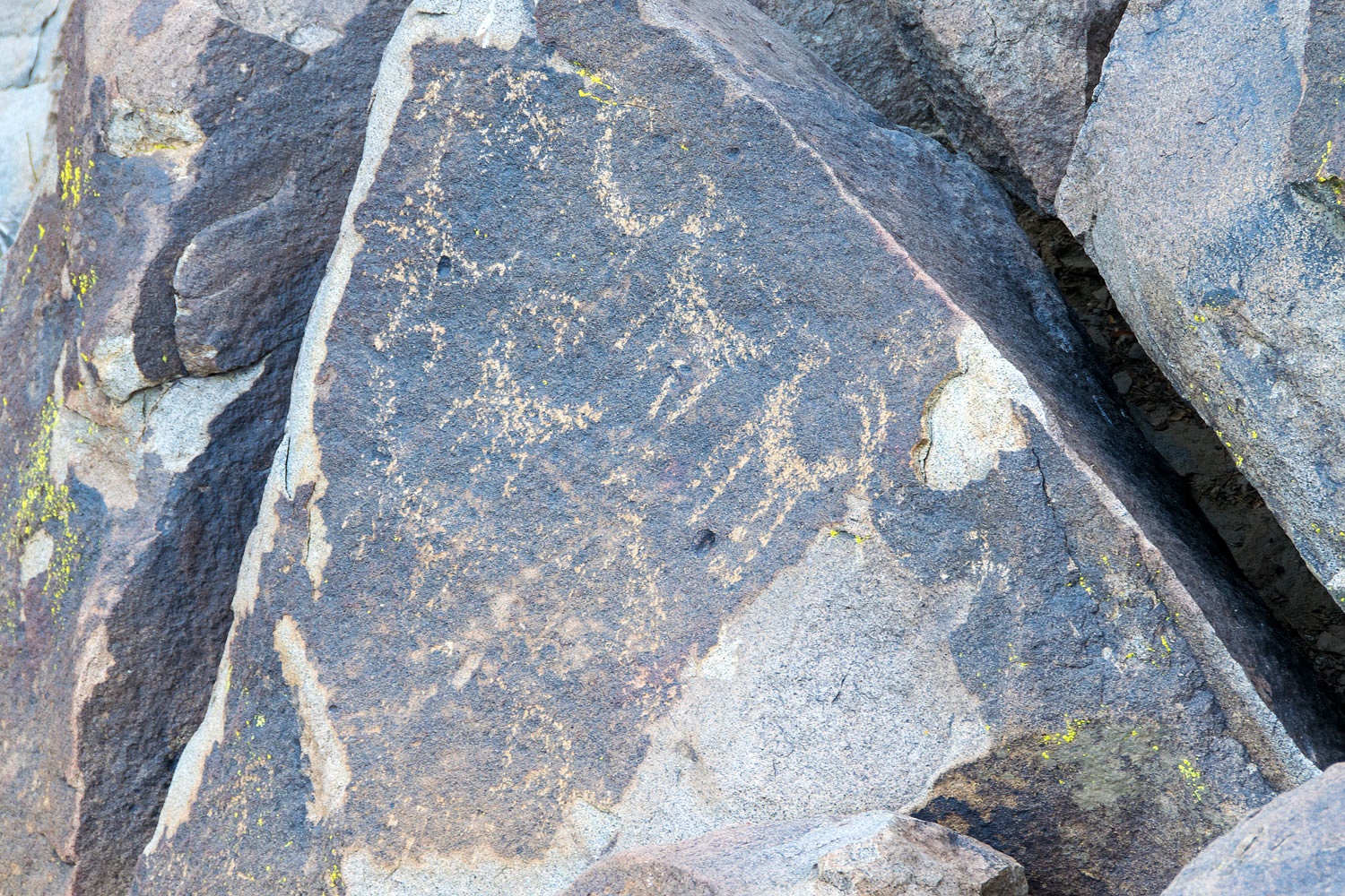
The ancient artwork on another
outcropping was near a large flat boulder. It was warm in the morning sun. It
provided a nice place to sit and work. We could imagine people gathering here.
Julie found a flake of obsidian.
A panel was tucked away in a clef in another outcrop.
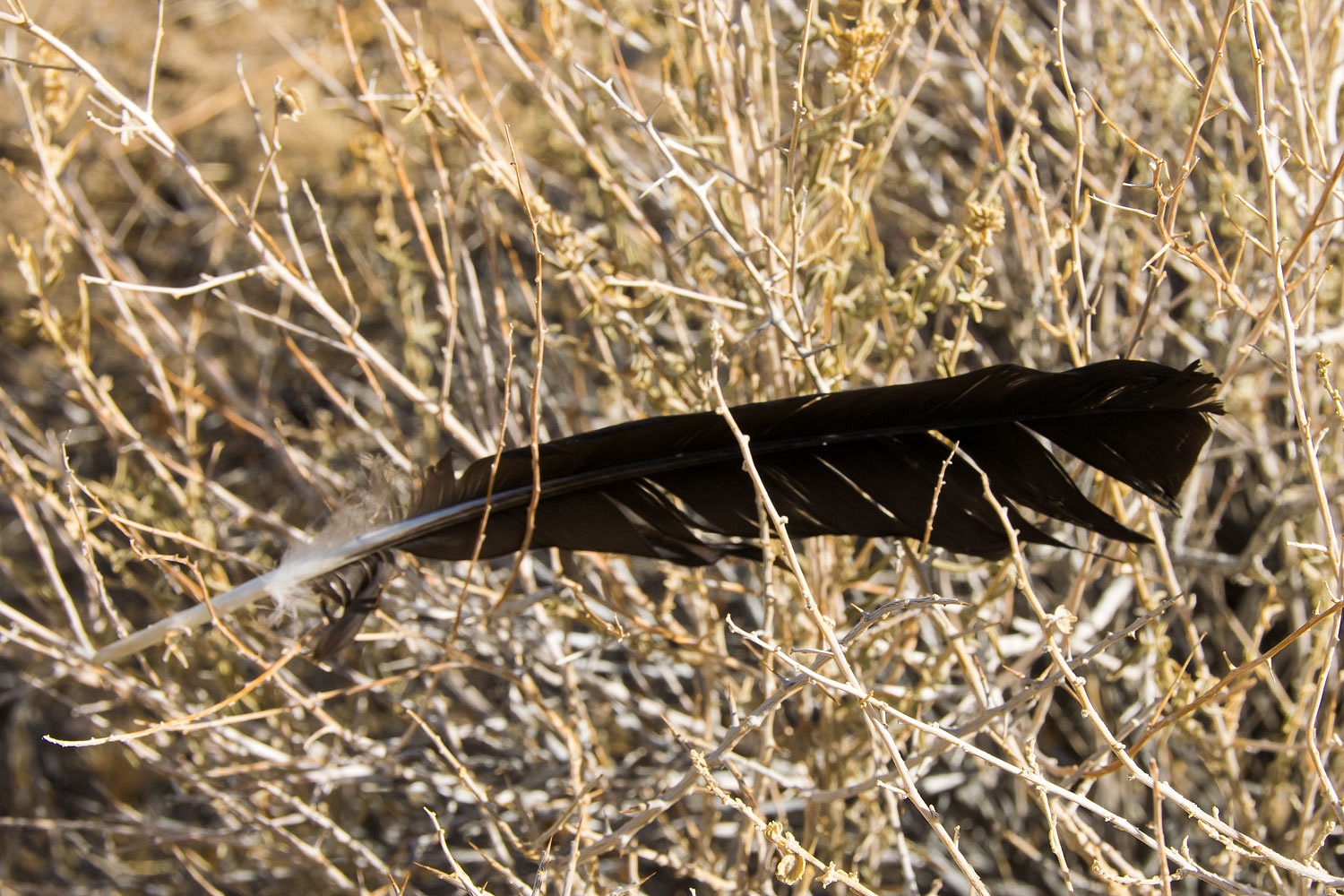
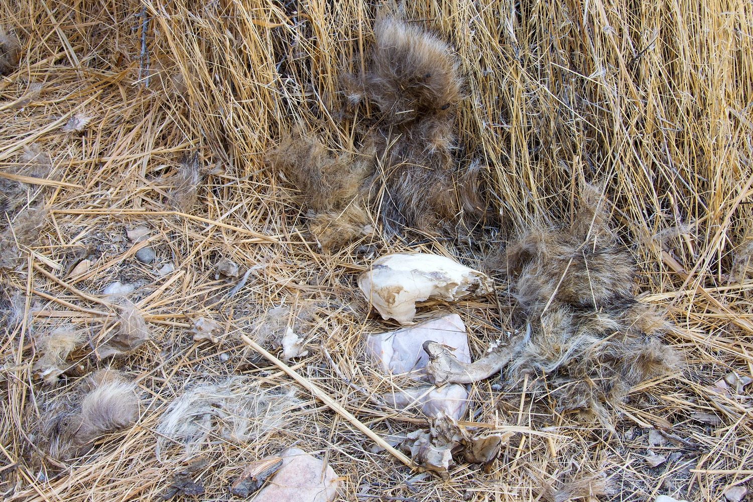
We came upon a puzzle that brought up the question, what predator kills ravens? Large raven flight feathers were caught in the top of brush.
We located the pile of body feathers.
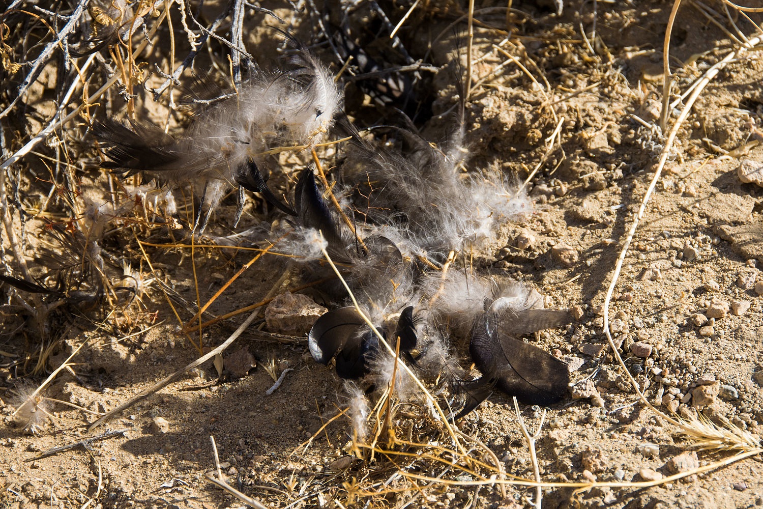
Our best guess is attack from above. It was taken out by a large raptor. I can't imagine eating raven being any better than eating crow.
Around the corner were remains of another body.
It was a small canine type skull, half a mandible, a few vertebrae, a rib, and a great deal of fur.
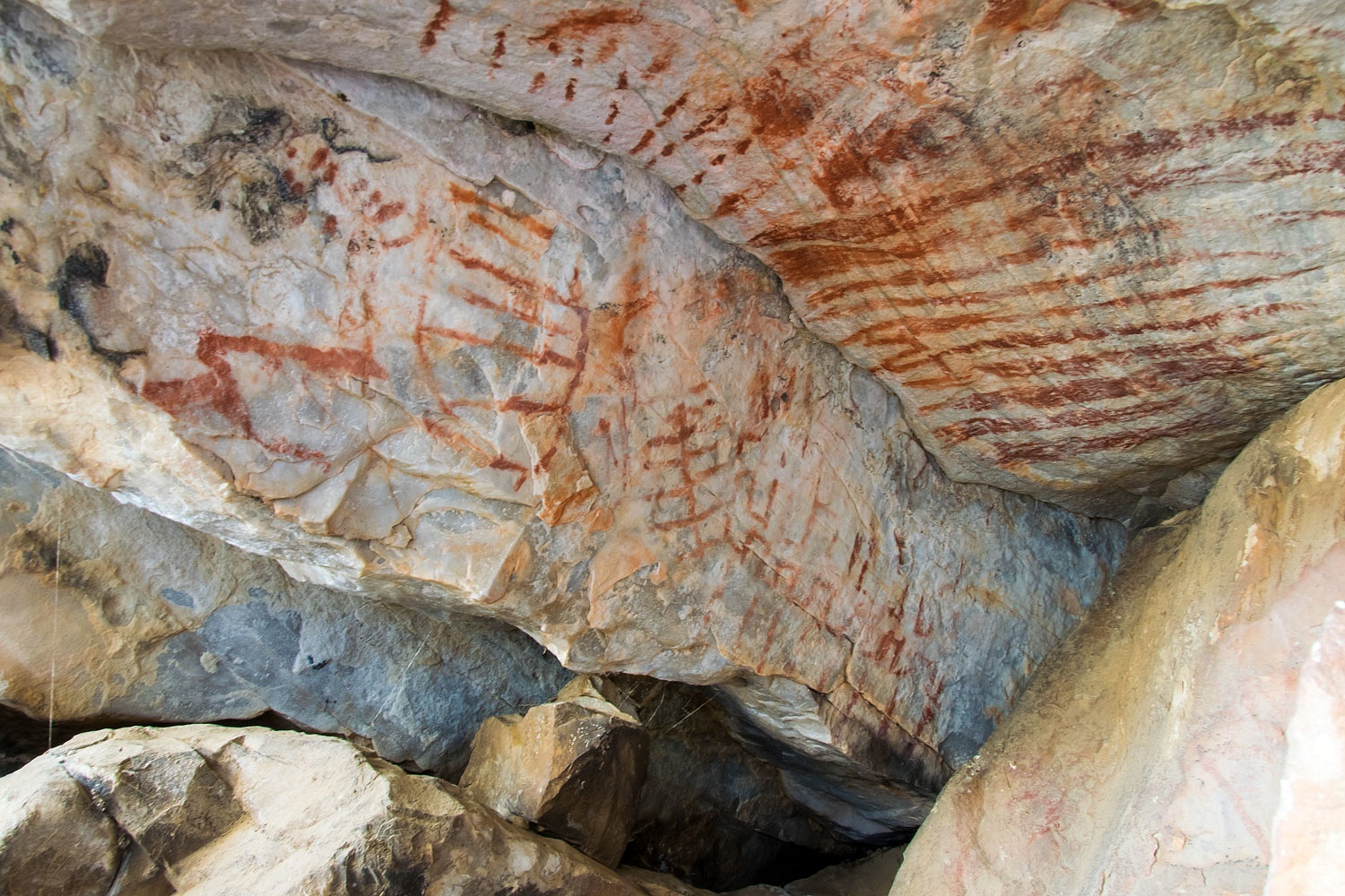
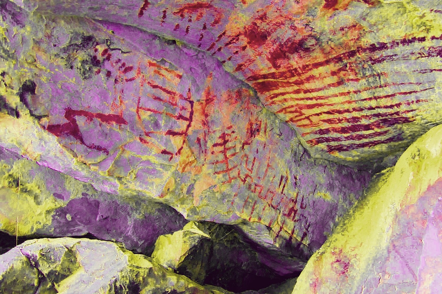
Keeping an eye to the sky above, we moved on to revisit a small shelter filled with pictographs.

I am learning to use DStretch, a false/vibrant color enhancement tool to bring out details in fainted pictographs. The second photos below are DStretch images.
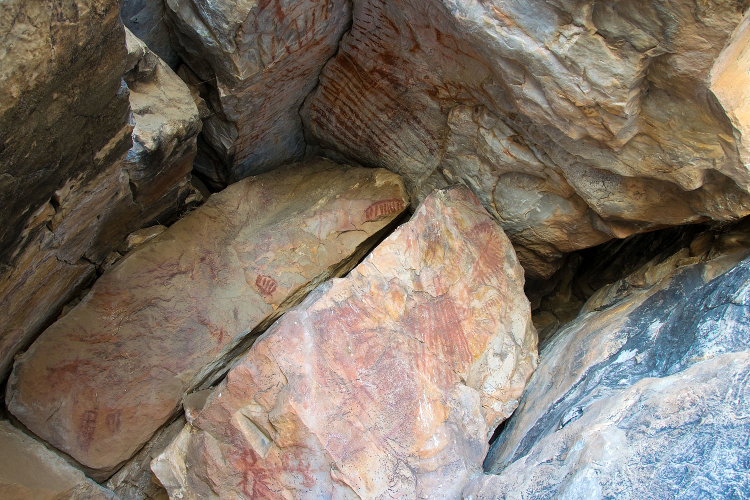
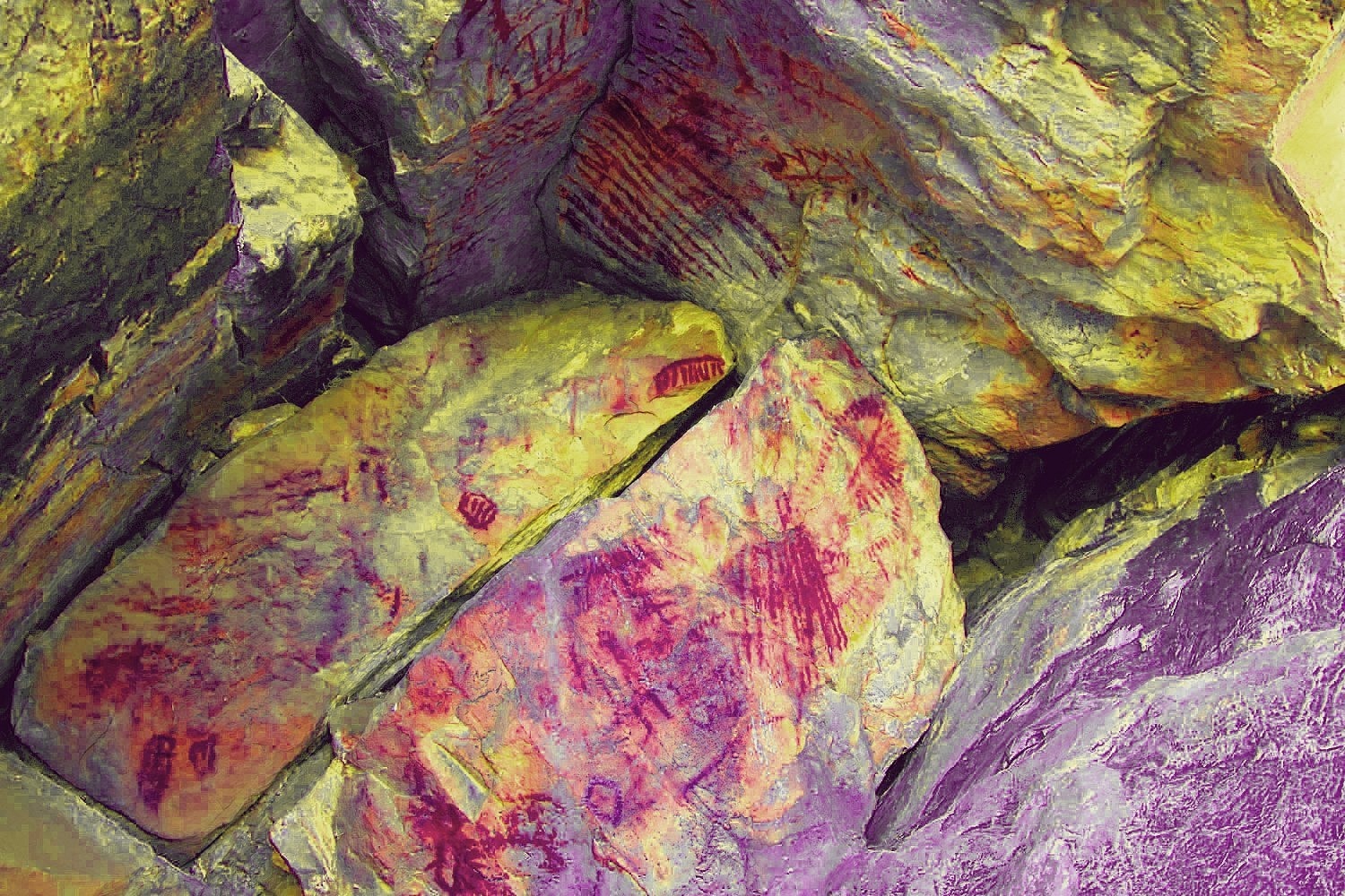
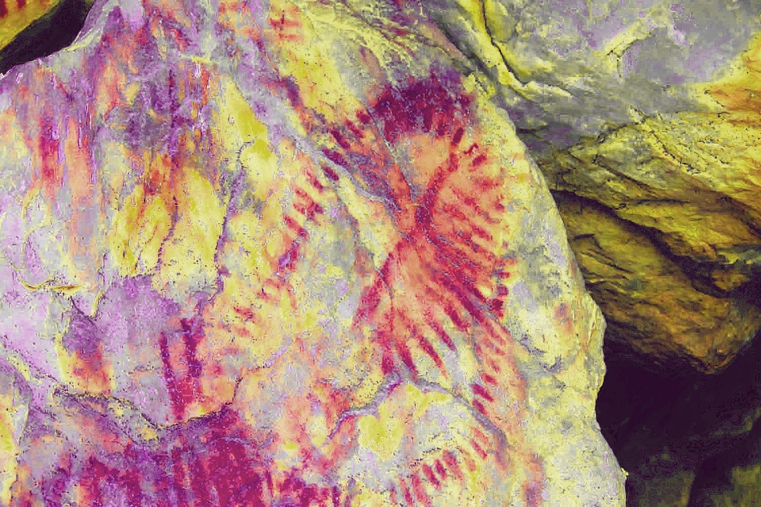

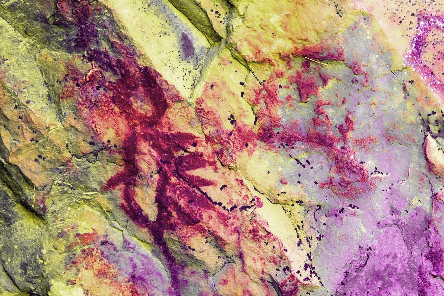
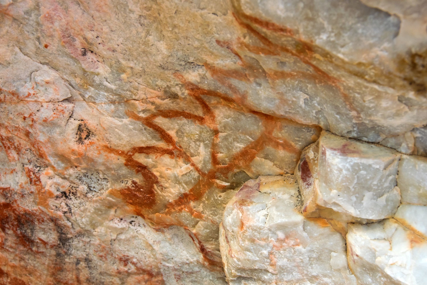

I wonder if the eyes in the rock above the shelter held importance to the site? We sure found the patterns interesting.
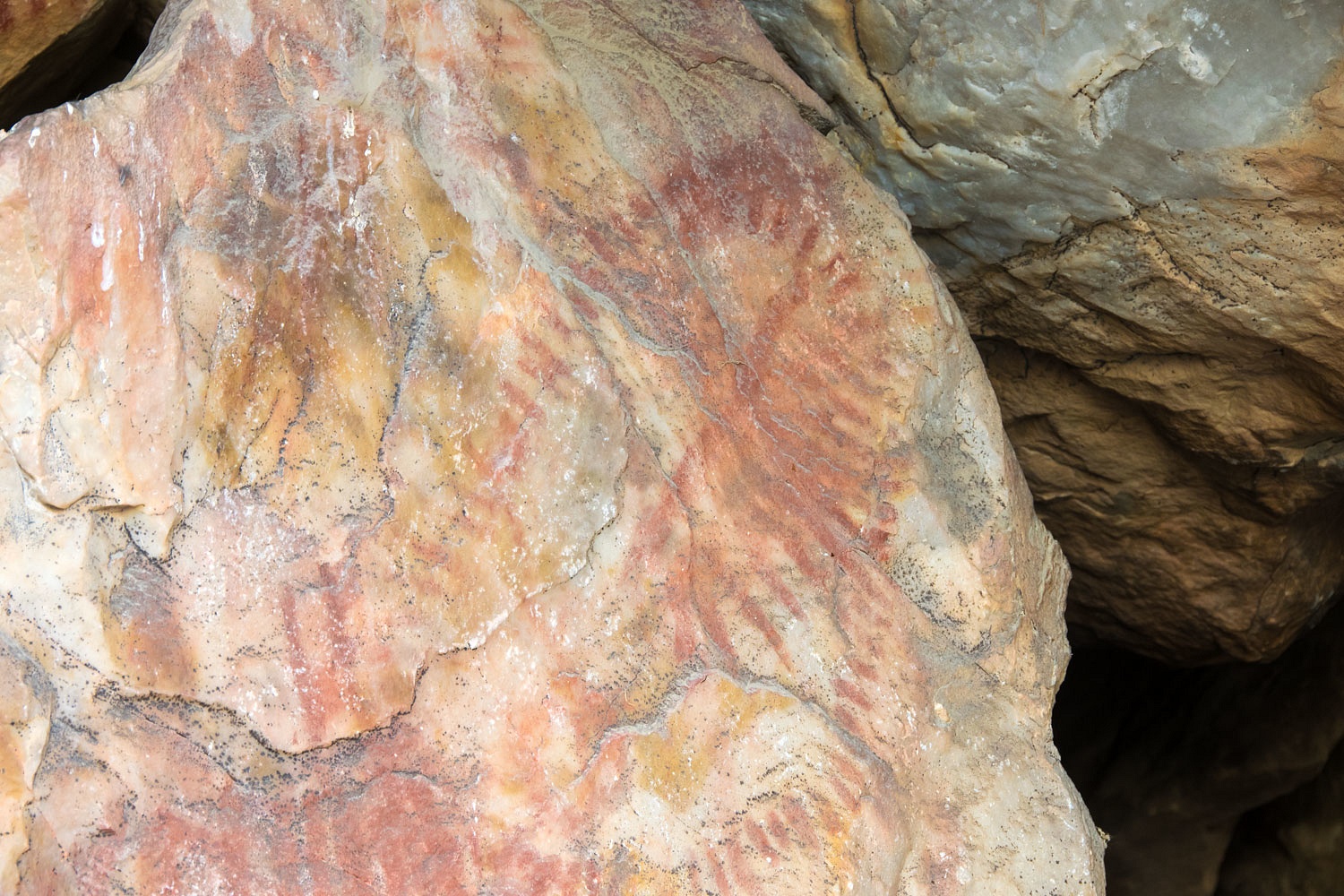
We discovered a few petroglyphs we had not seen on previous visits, including this nice bighorn sheep.
We moved back into the zone of limestone. The rock looked to be covered with petrified clumps of algae.
We had a wonderful time hiking into and exploring this remote area of the National Park. Although it was nice in the sun, I don't believe the temperature rose above 45°.
It was time to hike out to the truck and move on. What were we up to next?
The adventure continues in the Part Two - Click Here.
Belted ammunition link. Looks like .50 caliber.
ReplyDeleteThanks so much! Several others have also confirmed the ID. It is an artifact not associated with the use of the old trail.
DeleteSki, you probably already know this, but I think that some of those fossils are ammonites.
ReplyDeleteThanks for sharing the information Dan!
DeleteMonte, wonderful TR. The pictographs and geology are mind blowing!
ReplyDeleteThanks Steve! Death Valley offers so much.
Delete"We also searched for any artifacts that would point to the existence of an old trail. This is all we found" -- we've found several of those, which we conjecture may be hinges. One was at the old Burned Wagons sign. Deb would remember the others. Steve
ReplyDelete