
"We are looking for street signs!" the Lady explained.
This was Tuesday late afternoon as we were returning to camp down Cottonwood Canyon. We were talking with a group of young UC Berkeley students doing the popular Cottonwood to Marble backpacking loop.
"Not quite street signs," I added. "more like guide posts but they sure look like street signs."
The young people, four men and a woman, were genuinely curious and asked "why" and "who". I immediately liked these kids and filled them in with what I knew.
In 1905 the
California Legislature appropriated $5000 for the purchase of "Desert Guide
Posts" to help provide for the safety of travelers in the deserts of the
"southern counties". These sign posts were purchased and then provided to the
counties for placement. I found this announcement of the project in the 27 March
1905 issue of the Los Angeles Herald -
I also found a notice in the Appendix to the Journals of the Senate and Assembly of the State of California-
Guideposts For The Desert Sections of California
stating that an advertisement was posted in the 3 August 1905 San Francisco Chronicle inviting bids on manufacturing the signposts. With a low bid of $6.25 per complete post and sign, the contract was awarded to a firm called Jenkins and Wells. Included in the notice is the number of signs provided to each county.
Pacific Sign and Enameling Company had the second highest bid at $8.75. Since the signs we found were manufactured by Pacific Sign, at sometime they must have received part or all of the contract.
I also found an article in the 23 August 1908 Los Angeles Herald -
Guide Posts on Desert Wanted
stating that only half the appropriated funds so far had been spent and the counties "neglect their part in the matter," but includes that Inyo County reported to the state they had erected all 100 guide posts they received.
With this research, I believe I had the answer to the "why" and "who" questions. "Why" was for the safety of desert travelers and "who" was both the State of California and the local counties. I should also add a "when" answer, in the neighborhood of 1906. I found this research effort fascinating. It could be an interesting project to find papers in Inyo County's archives (many times held by a county historical society) reporting on the placement of these signs in the Death Valley region.
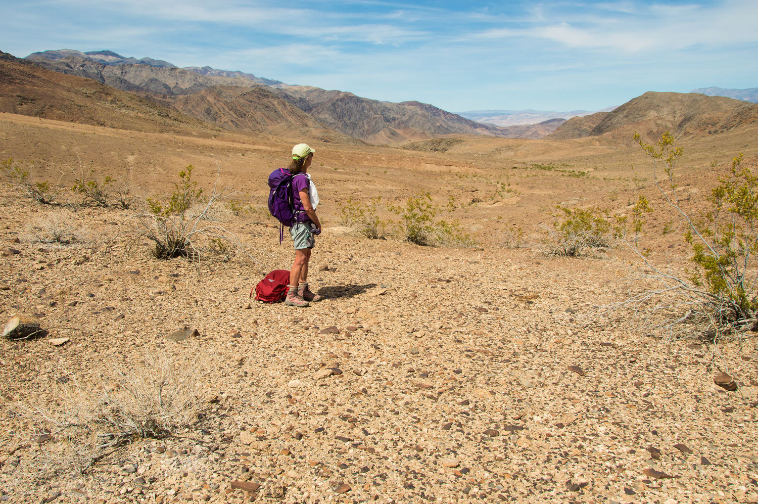
Armed with this information, our goal for today (Wednesday) was to walk more of the historic route and find two "Desert Guide Posts" I had heard were still standing along it - chasing history!
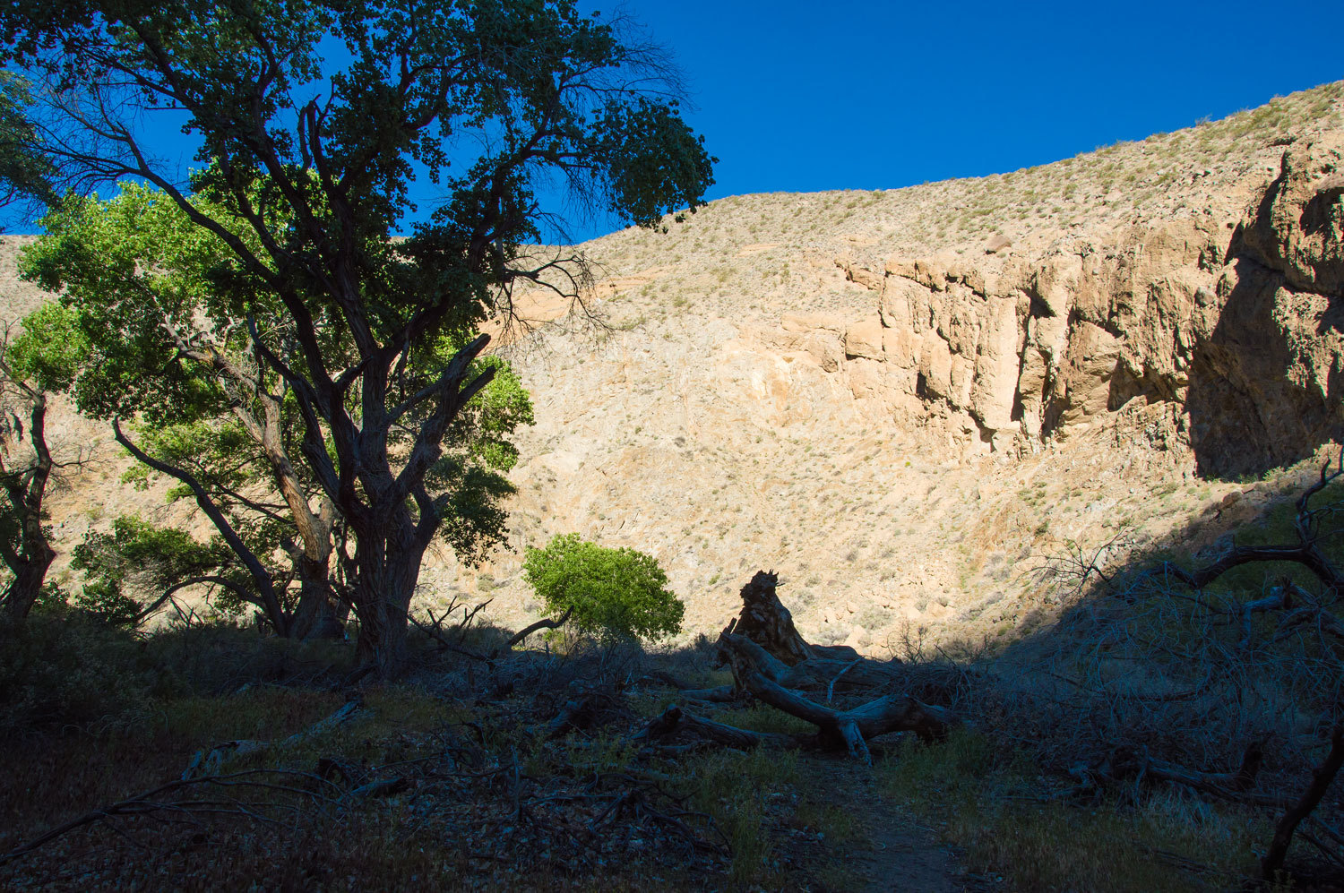
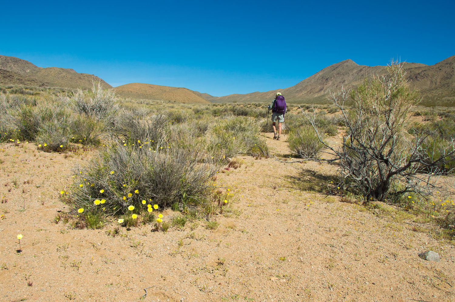
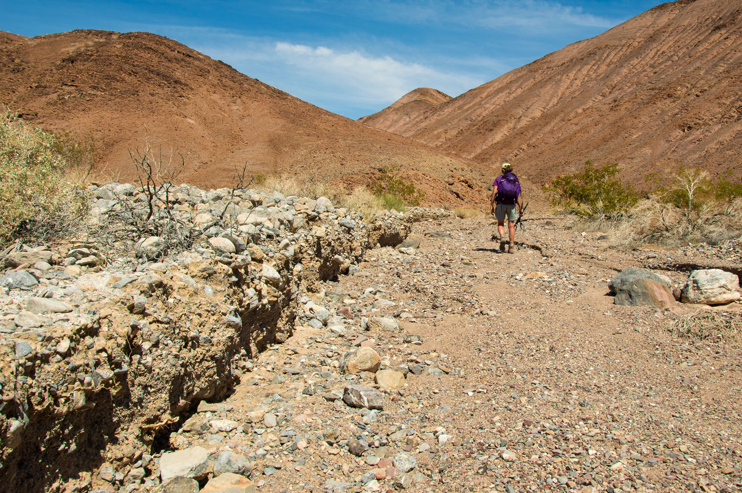
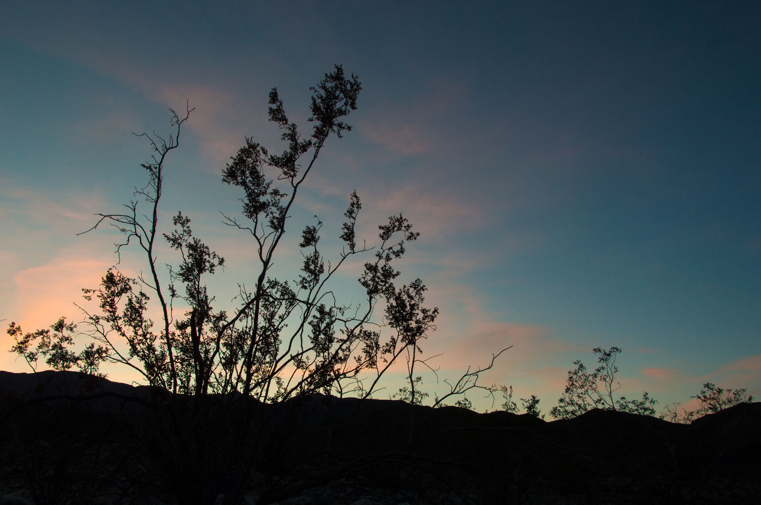
It was a joy to hike back up Cottonwood Canyon in the early morning.
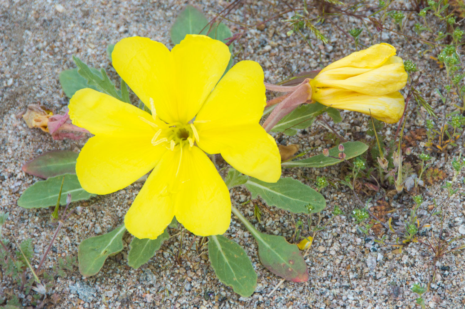
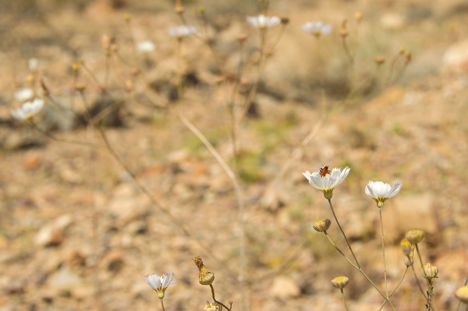
A new flower was out. It blooms in the night and then quickly fades in the day. It was abundant in sections of the canyon. It is a member of the evening primrose family but I have yet found an exact match as to its species.
Below the upper Cottonwood spring we found flowing water this morning.
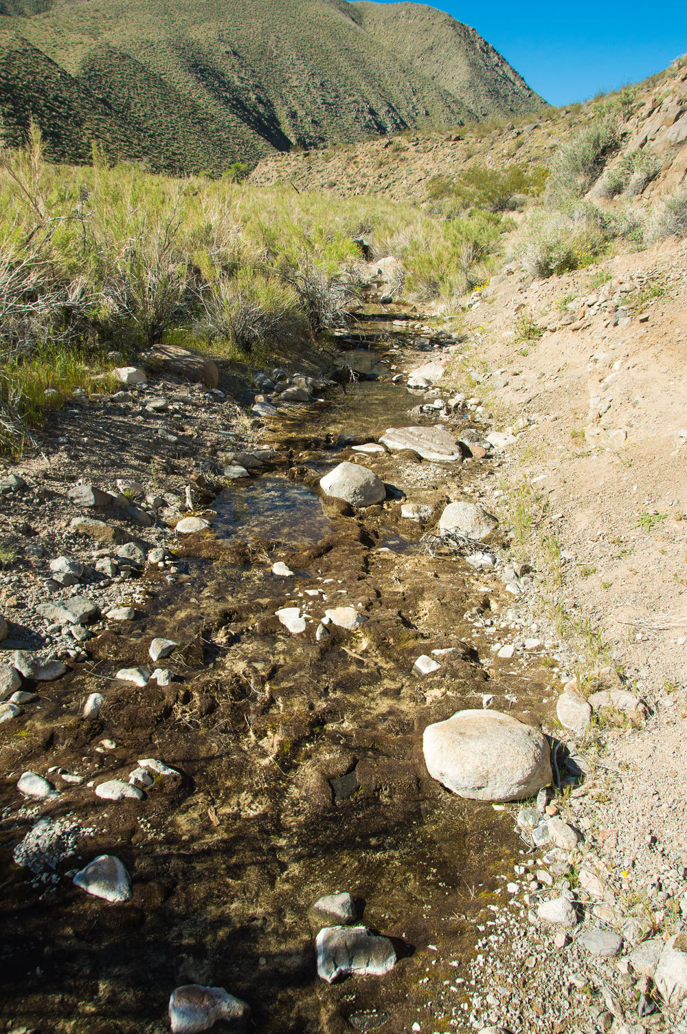
This section was bone dry the previous afternoon. We were curious as to the cause and speculated it was due to the falling metabolism and less drawing up of water by the large cottonwood trees in the overnight hours.
edit: thanks to our friend Foy for this information -
The hydrologists would call this "evapotraspiration-driven diurnal groundwater/streamflow fluctuation"
At the upper end of the spring the canyon narrows dramatically and becomes a gorge. You can hear flowing water below. The trail becomes steep and rocky.

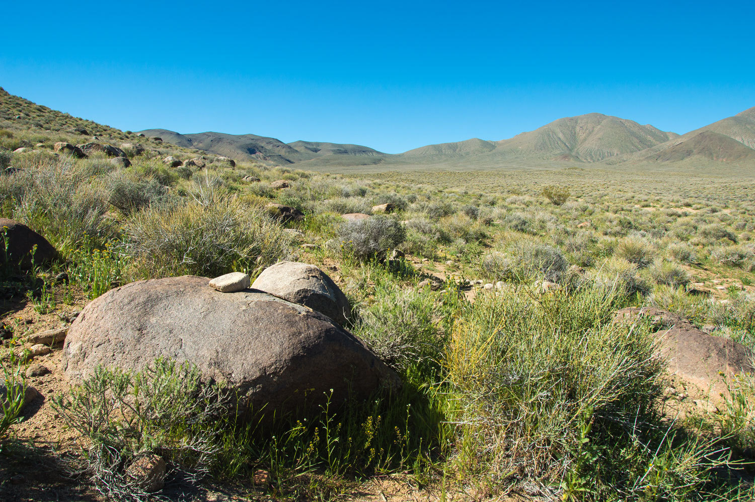
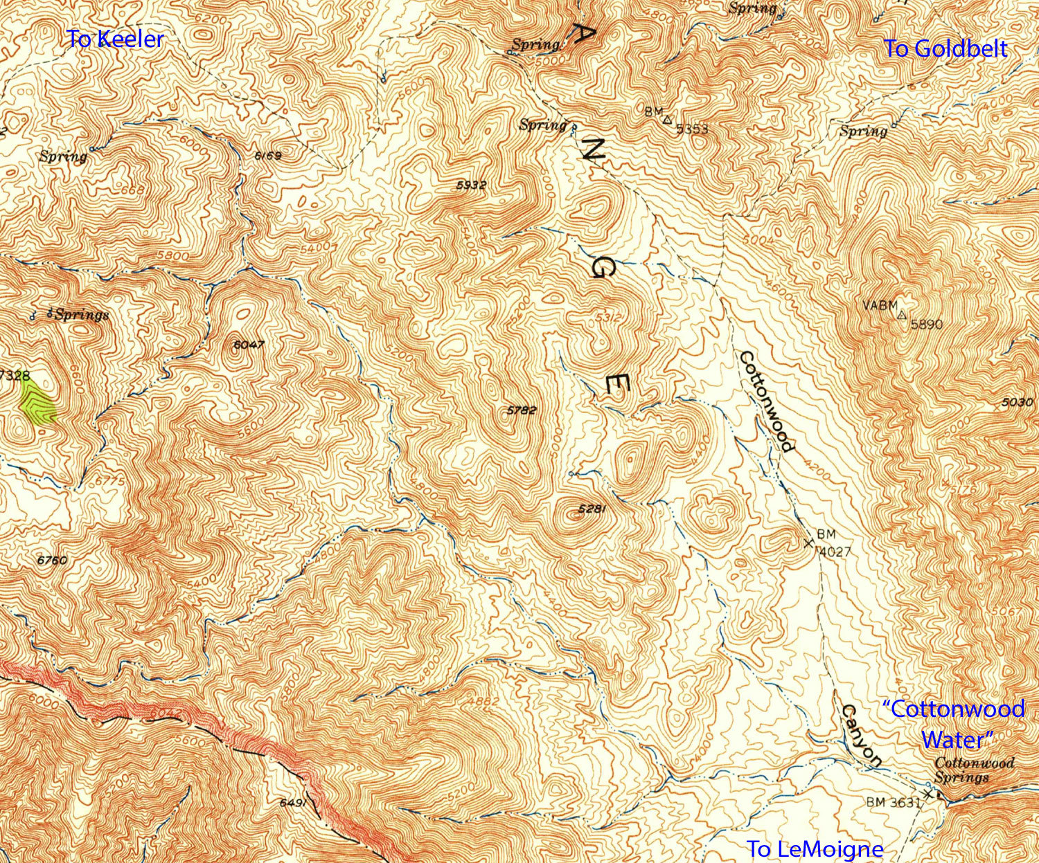
The landscape opens up above "Cottonwood Water". We explored and looked to the south up the south branch of Cottonwood. This is the completion of the route up LeMoigne Canyon we hiked on Sunday. The historic trail passes over and around the saddle in the center of the ridgeline.
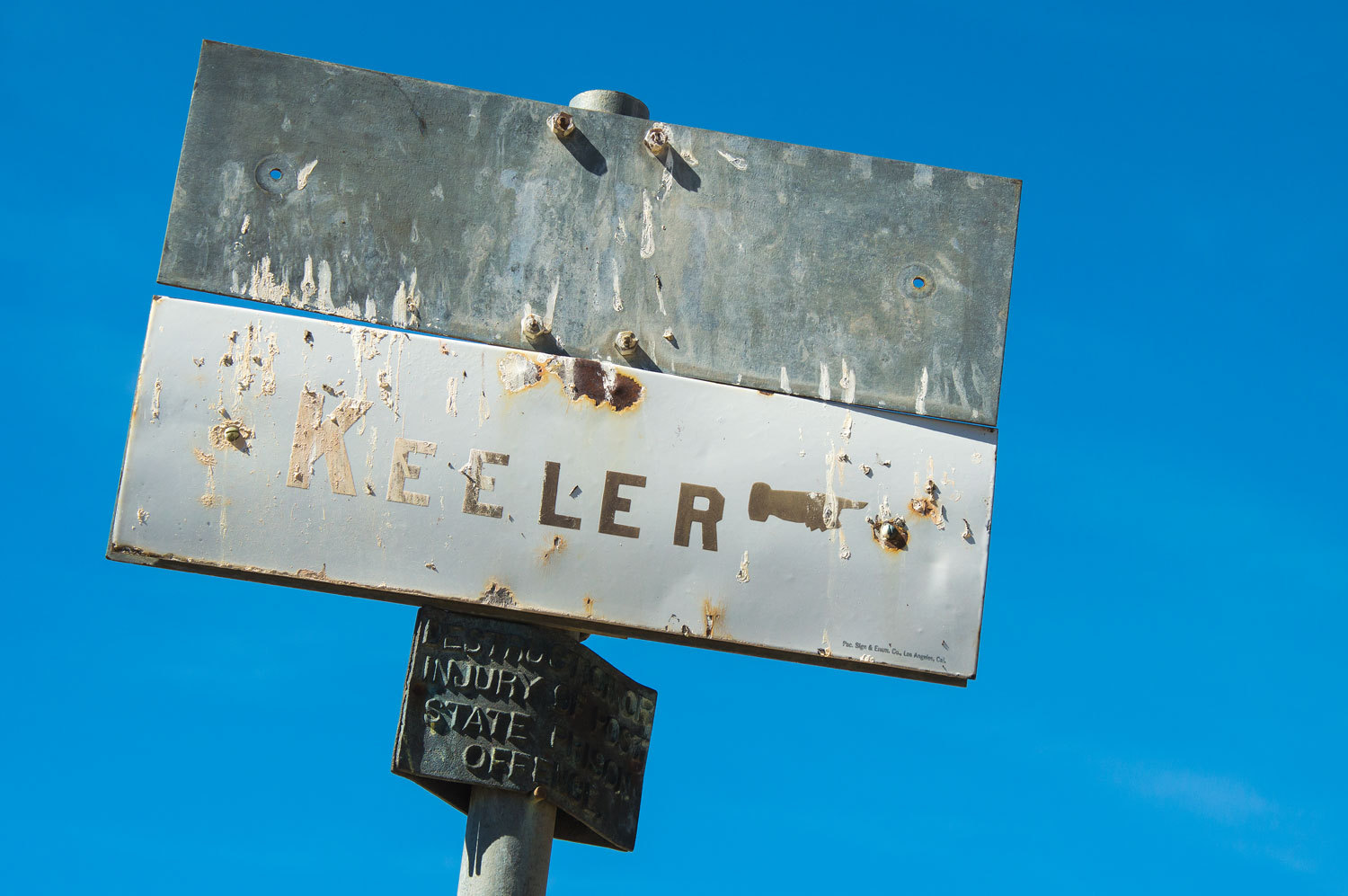
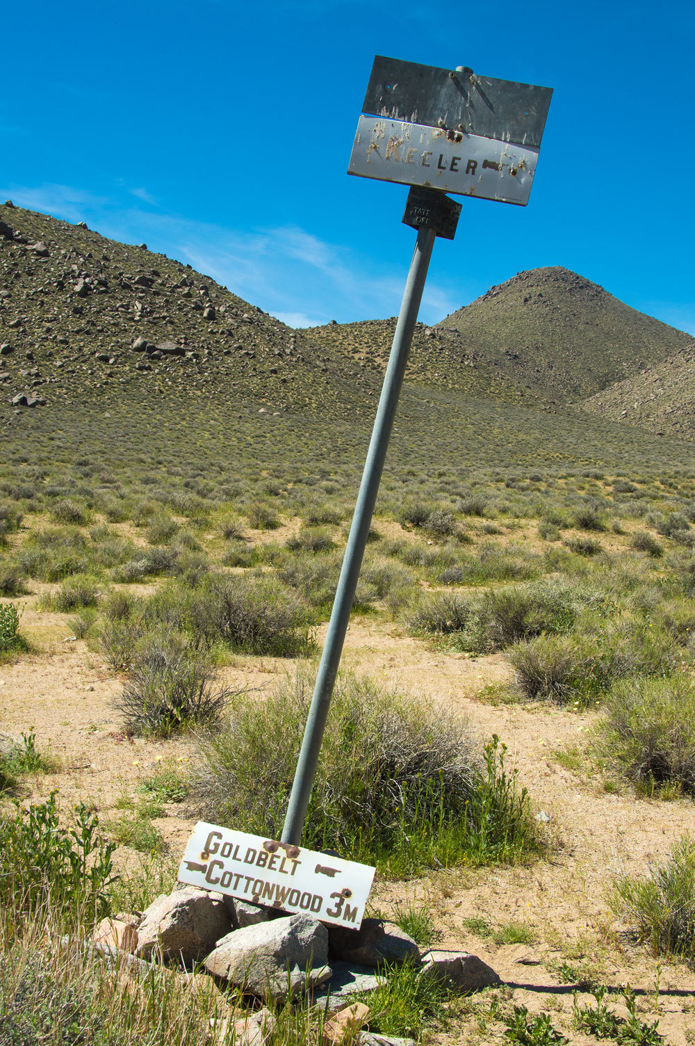
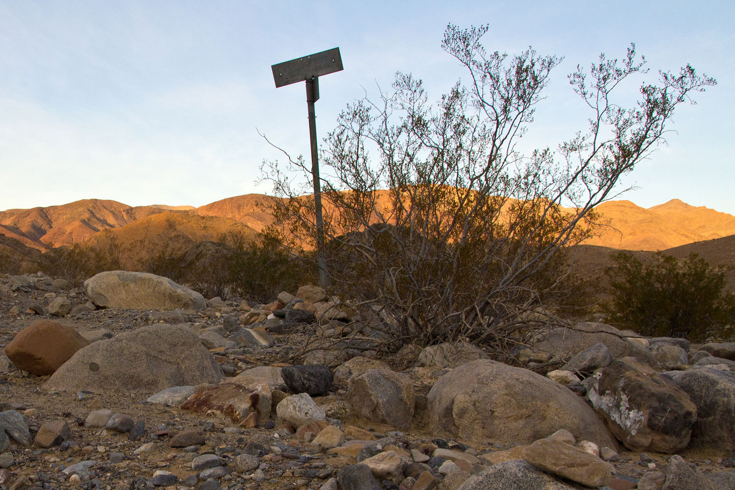
Approximately a half mile above "Cottonwood Water" we came to our first desert guide post.
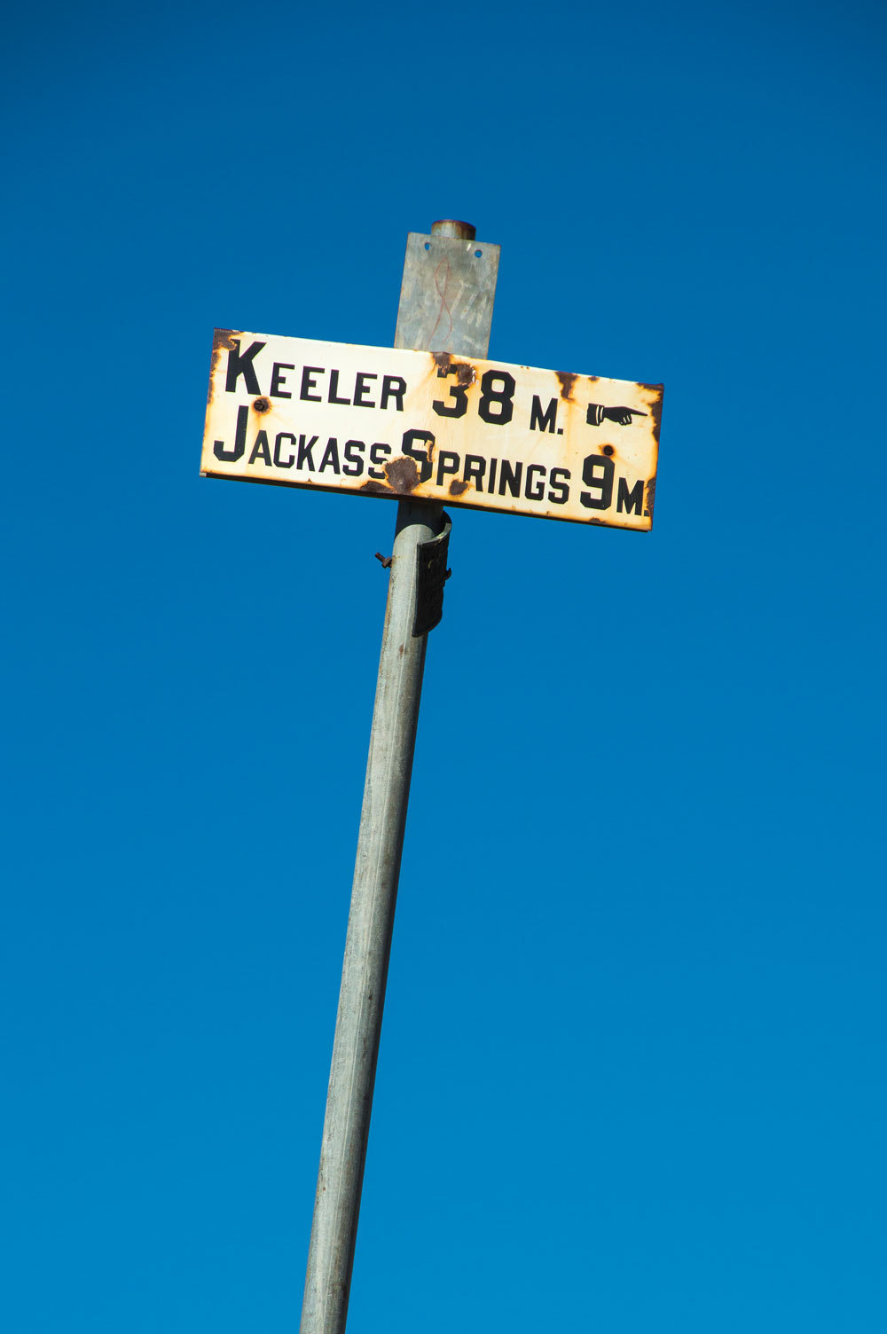

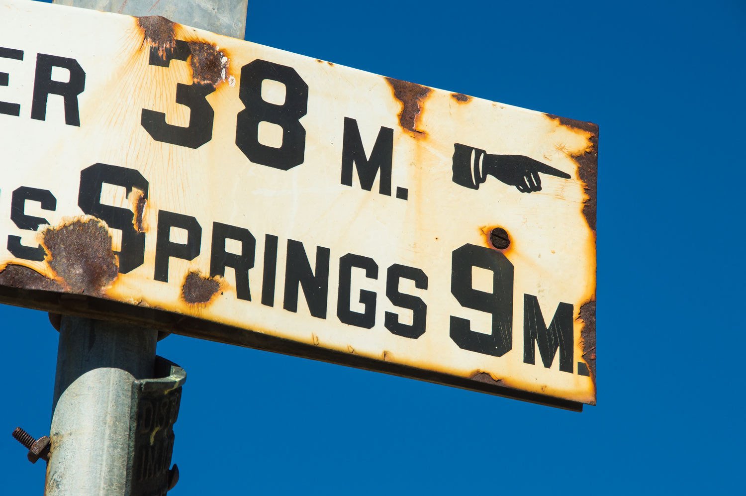
Keeler was a town and port on the east side of Owens Lake. Jackass Springs is to the east of Hunter Mountain on the route to Keeler. Here is a portion of the old 15' USGS quad showing the trail.
We continued up the north branch of Cottonwood on the route to Keeler. The flowers remained incredible.
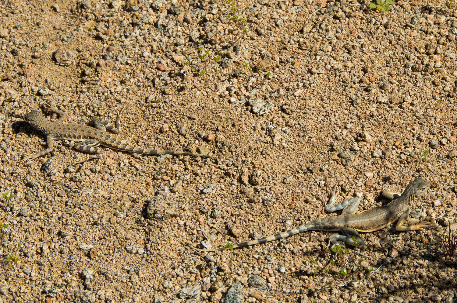
As were the zebra-tailed lizards.
A couple more miles and we reached our next prize.
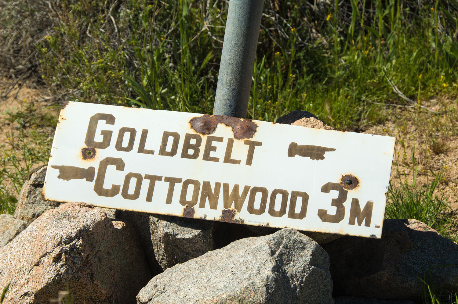
Refer back to the map. About a mile above this sign the route to Goldbelt (at the head of Marble Canyon) branches off to the right. The Goldbelt sign has been off its backing plate for several years as shown by old photos I've found. It remains here because of its distance from motor vehicle access.
Construction details are important as it gives evidence that two nearby signs posted along roads also date back to 1906 but are missing the historic porcelain sign covers and other parts.
Here is the sign at the historic trail intersection at the mouth of Lemoigne Canyon.
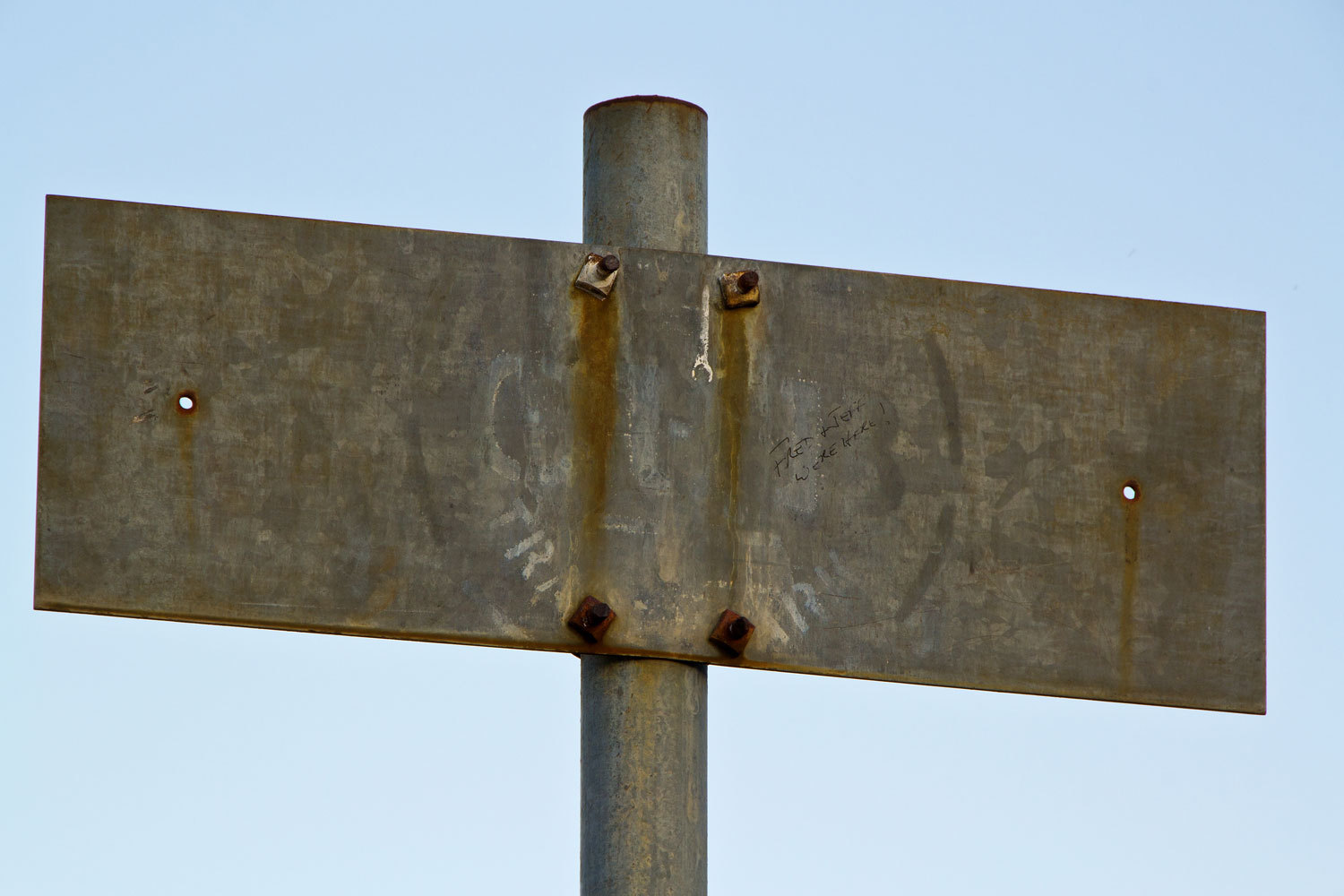
And the well known sign at the intersection of Cottonwood and Marble Canyon.
We were 7.5 miles from camp and it was time to turn around. We spoke with the "Mesquite Boys" doing the Cottonwood/ Marble loop, two retired gentlemen from Mesquite, Nevada who work as volunteers surveying the springs and water holes in Gold Butte.
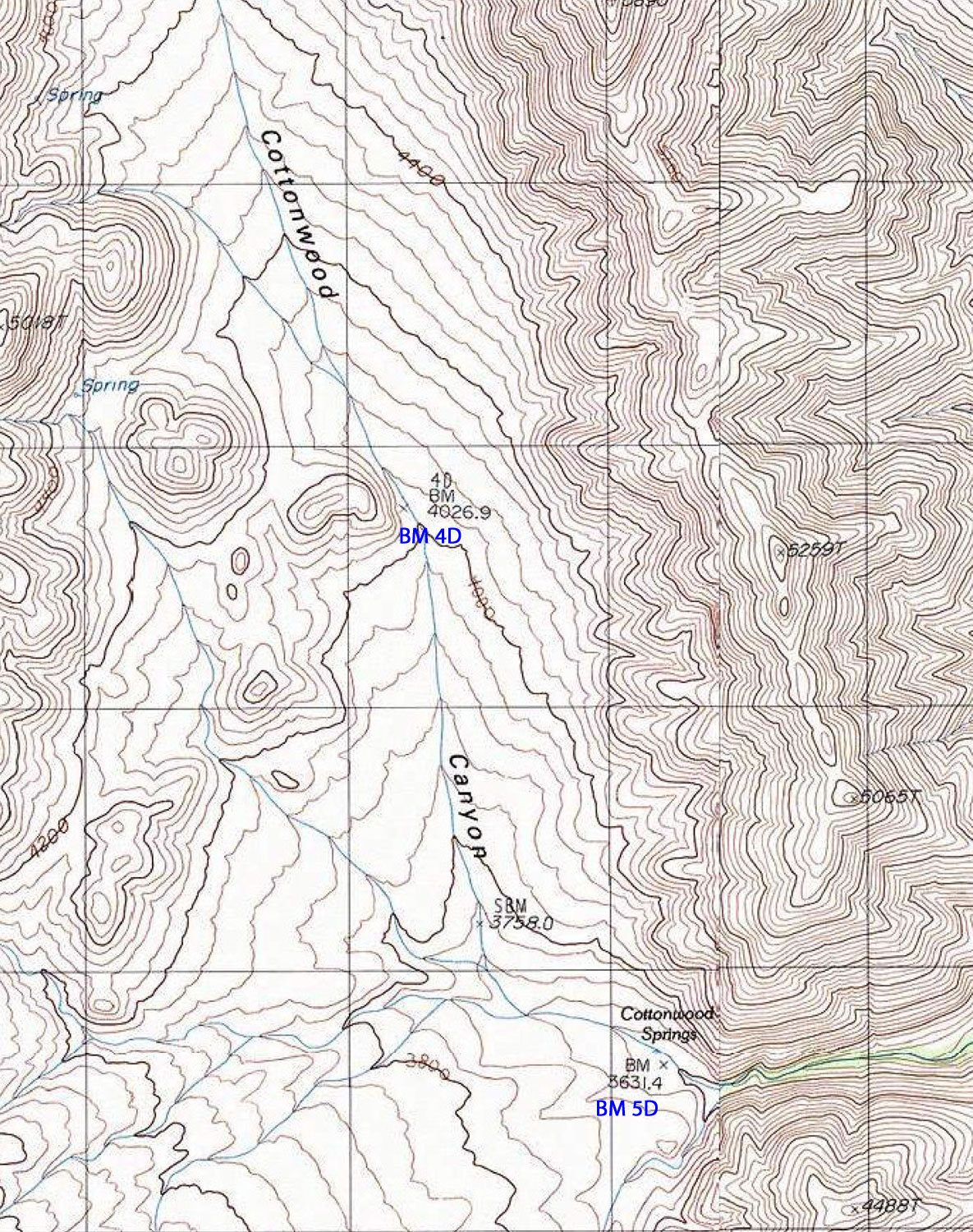
We enjoy practicing our map and compass skills. As we relaxed the Lady studied our map and saw two bench marks indicated. "Let's find them on our way back!" she said. We figure if we can find small brass discs only a few inches across out in the wilds, our navigation skills are good.
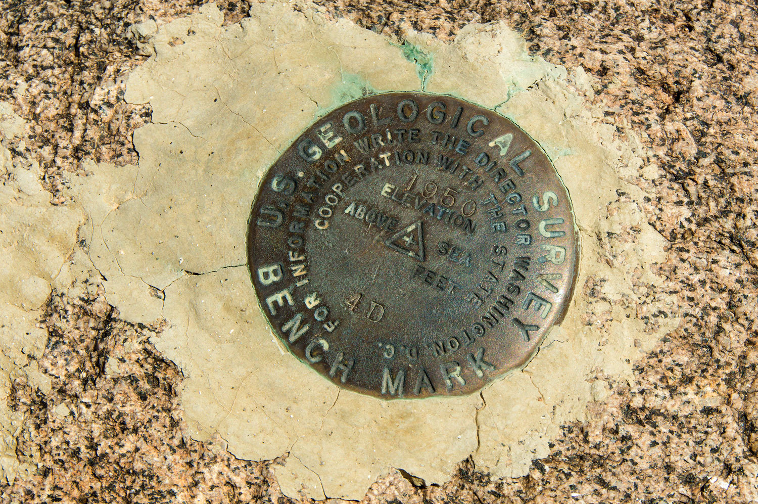
We headed back down to the Cottonwood Springs and our next BM.

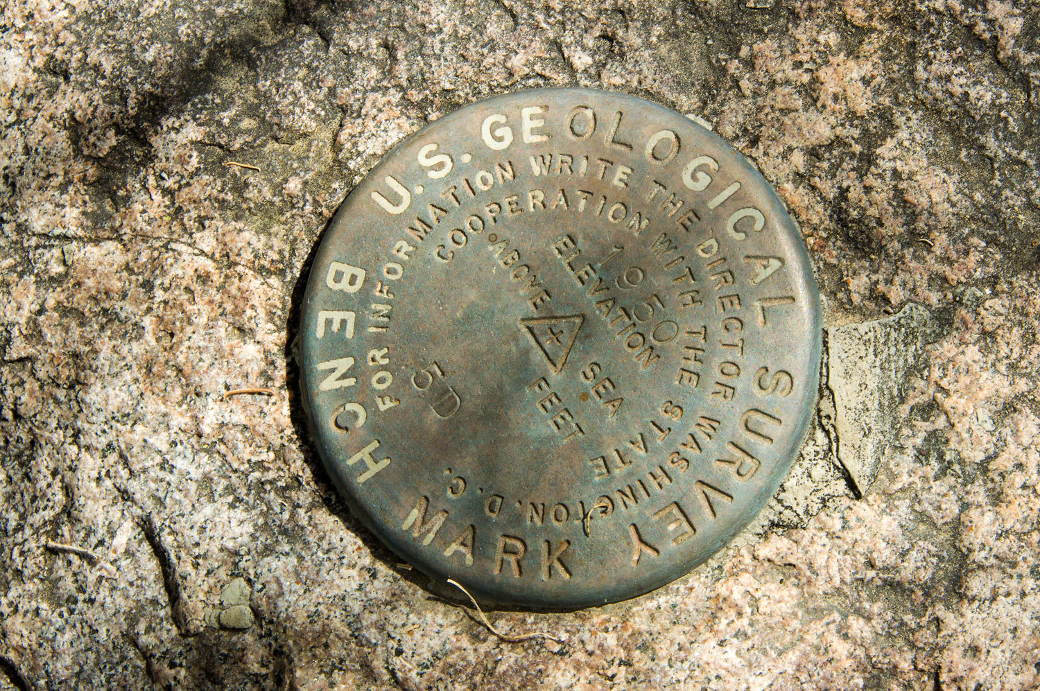
5D took a little searching as it was completely covered by brush. The Lady held the branches aside for the photo.
We also spoke with the Berkeley kids a couple more times. They were busy with breakfast at their camp at the upper springs when we passed in the morning and they were heading to the pass over into Deadhorse Canyon as we were returning back down.
We made it a leisurely hike back down through the spring complex.

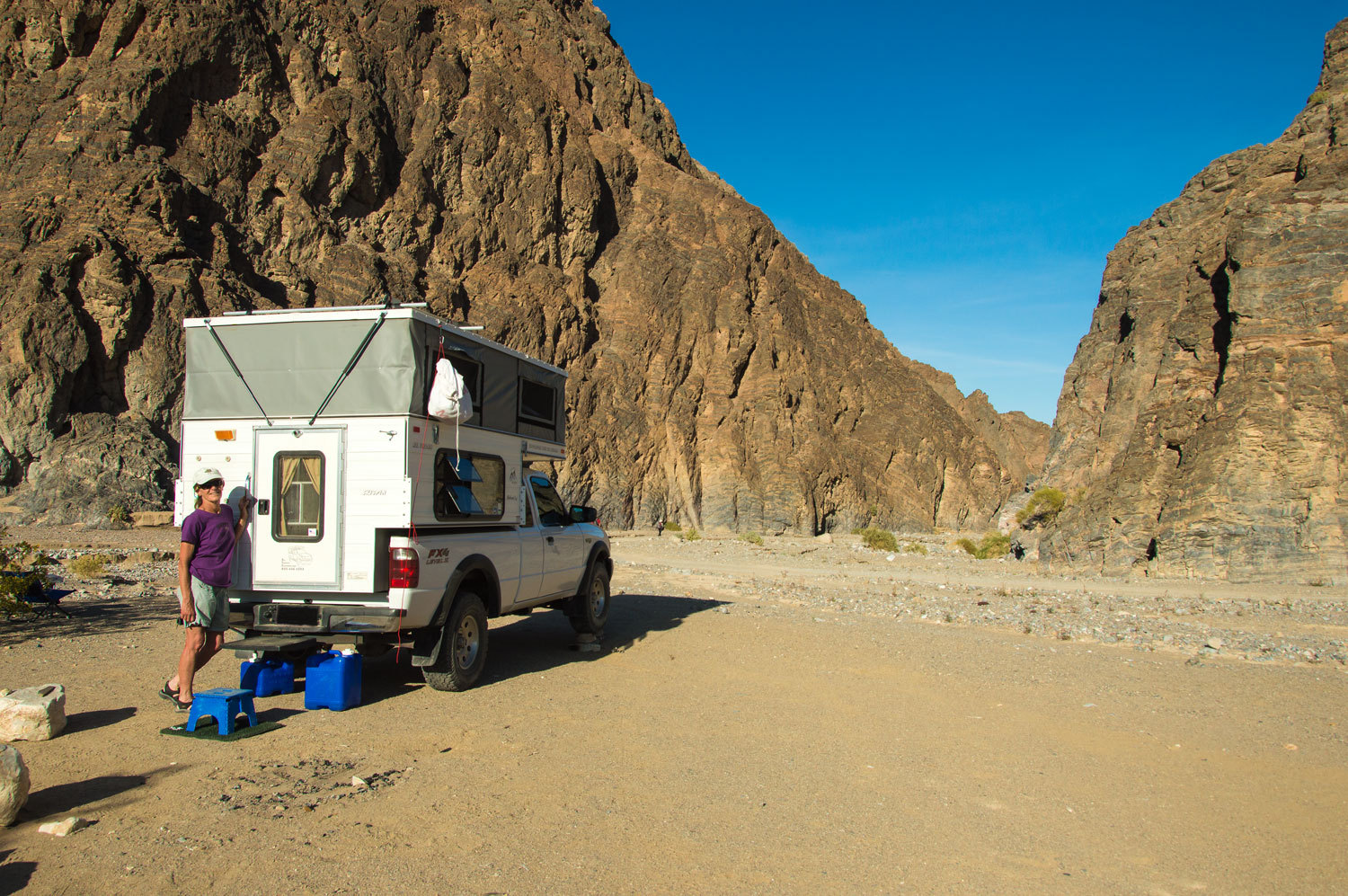
After another peaceful desert night at our camp near the end of Cottonwood Road, Thursday morning we drove down to the top of the first Cottonwood - Marble Canyon narrows and set up camp. Two young men were joining us early Friday morning for a long cross country hike in search of an unnamed canyon. We spent Thursday afternoon scoping out the first part of our planned route.
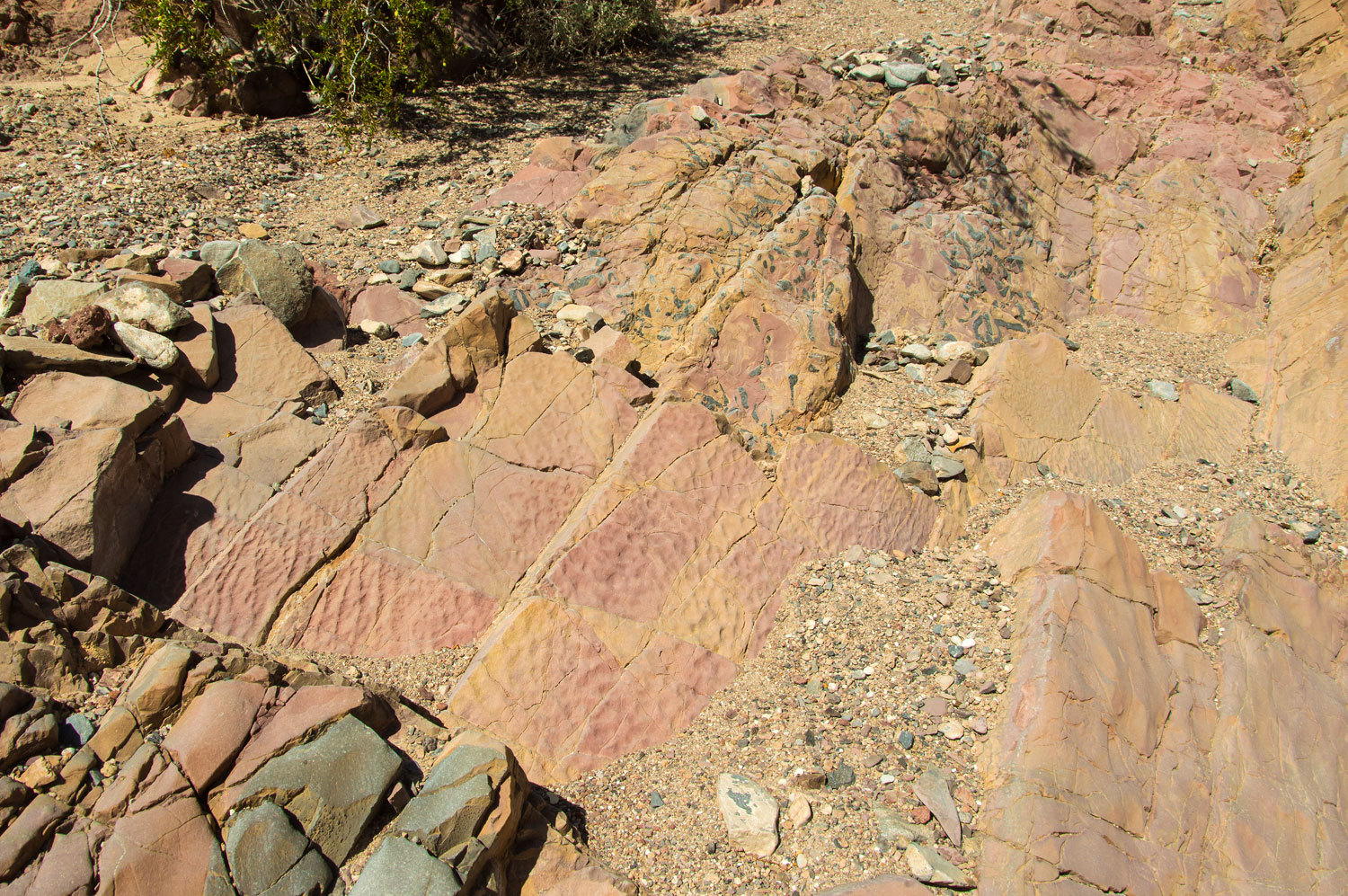
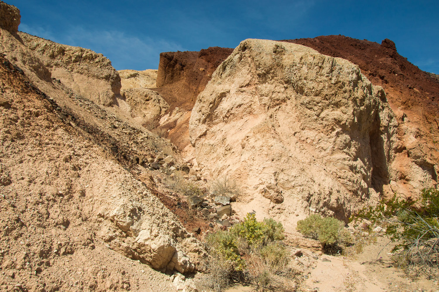
The geology in this part of the Cottonwood Mountains was exciting.
Ascending one small canyon we found colorful fossilized ripples in mud made by flowing water.
Then we encountered outcroppings of volcanics.
We reached our highpoint, a pass where we could look north at tomorrow's route.
Looking back to the south we were amazed to see the snow covered crest of the Panamint Mountains and 11,049 foot Telescope Peak, DVNP's highpoint.

Floating gravel ghosts hovered over the washes as we hiked back to camp.
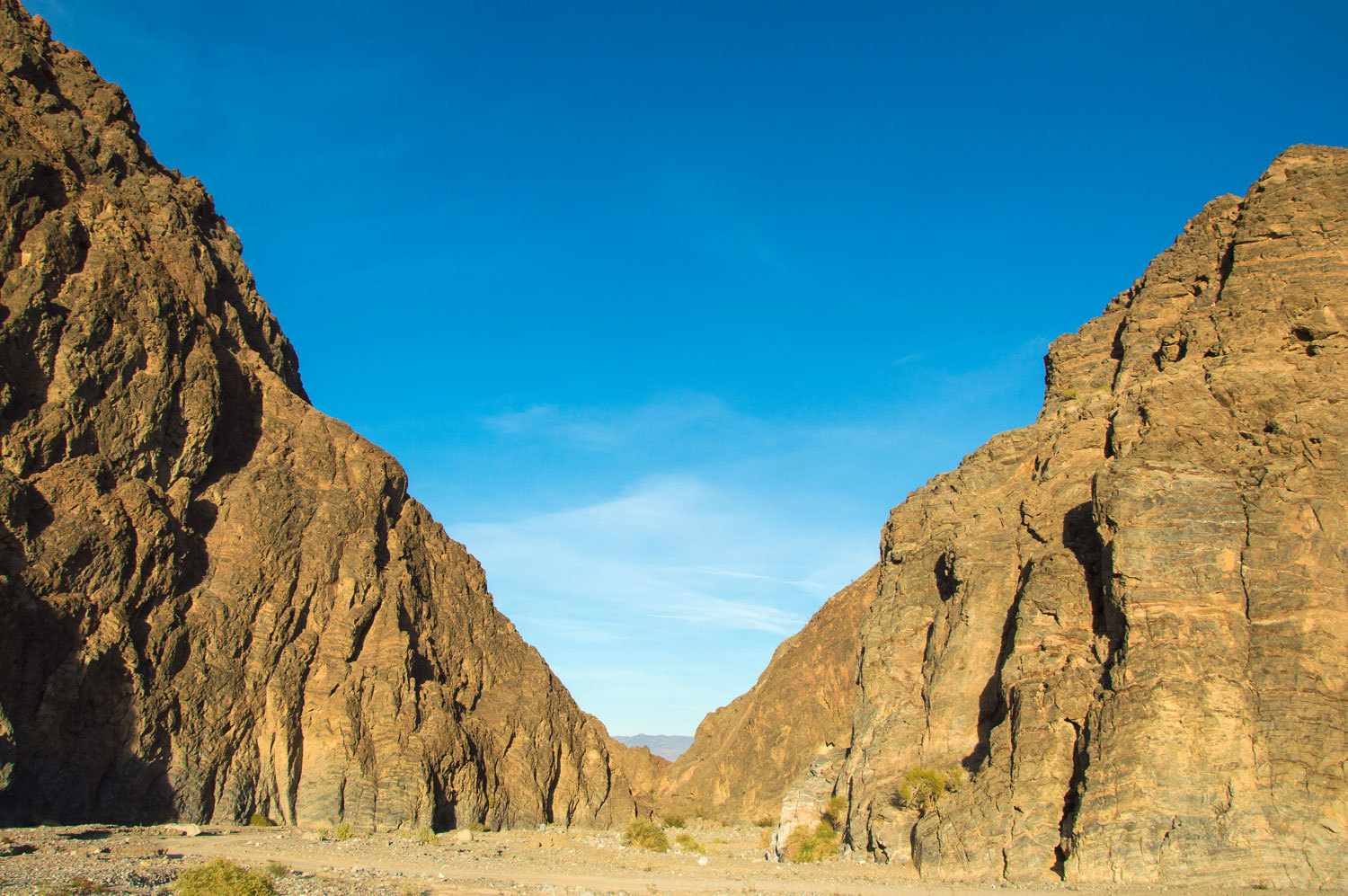
The soaring cliffs were our landmark that we were close to camp.

Surprised and very pleased with the lack of neighbors, the evening was spectacular.

Friday morning was warm and calm and beautiful, fitting for the start of one of our most special days spent in Death Valley National Park.

Wow, how many times have I reached a hopeful H2O in an afternoon to find it dry? This could be a key understanding: "evapotraspiration-driven diurnal groundwater/streamflow fluctuation". I look forward to paying attention to, and observing, this. Thank You
ReplyDeleteP.s. I once did a loop backpack that connected your recent explorations of Unnamed Cottonwood Canyons-->Lower Ctned-->Marble-->Ctnwd Spr-->N Fk Lemoigne from Emigrant RS. Wonderful expansion of the popular loop. Sincerely, John