
It was a
sign that brought us back to Death Valley National Park for the Lady's Spring
Break from teaching school. Not a sign from god, although some of our church
going brethren may argue otherwise. It was a street sign, a street sign without
a street, an odd curiosity. We had come upon the sign twice while hiking what
is called the old indian trail between Emigrant Canyon and LeMoigne Canyon.
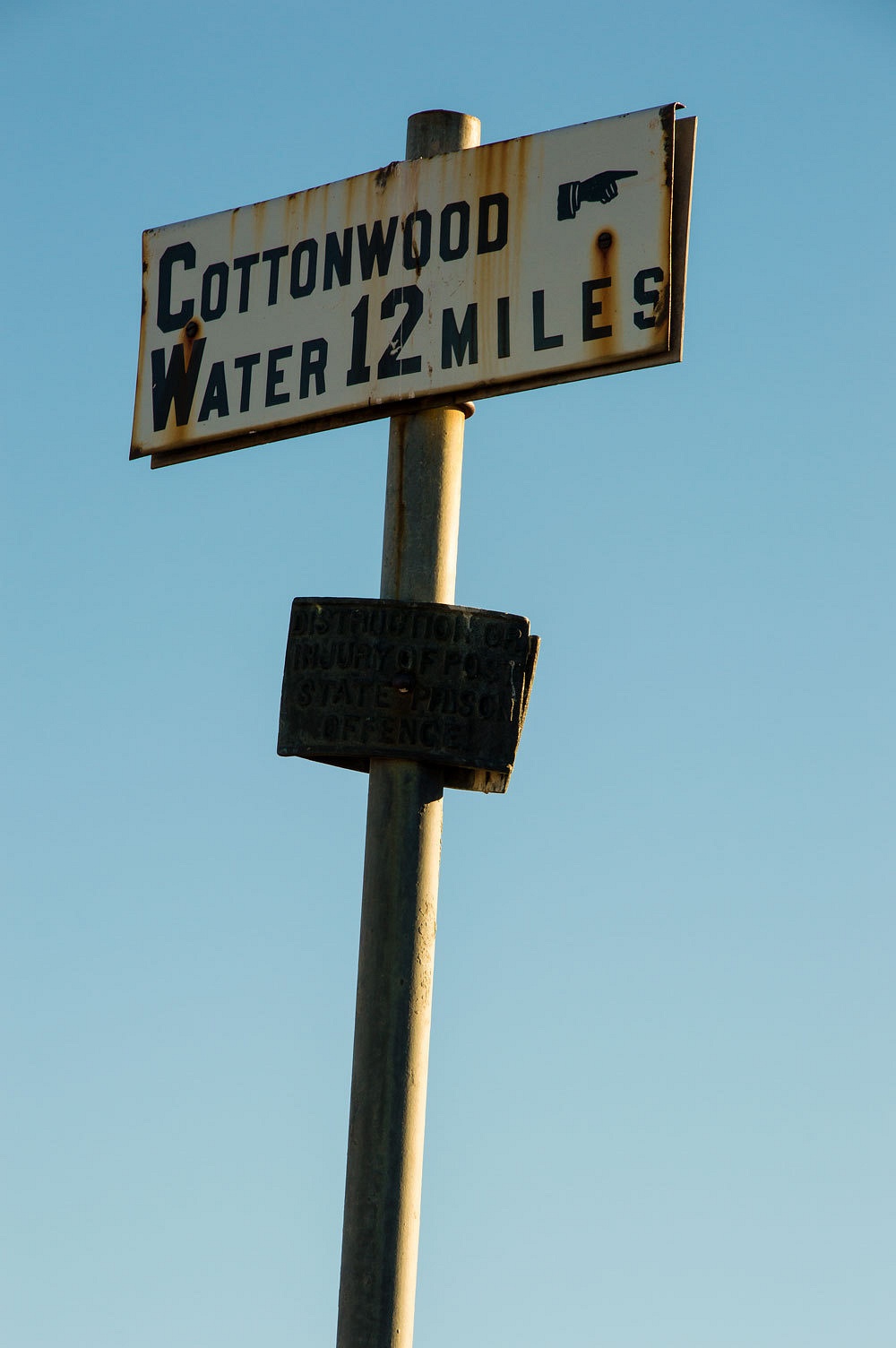
A NPS plaque added to the post tells this
story.................................
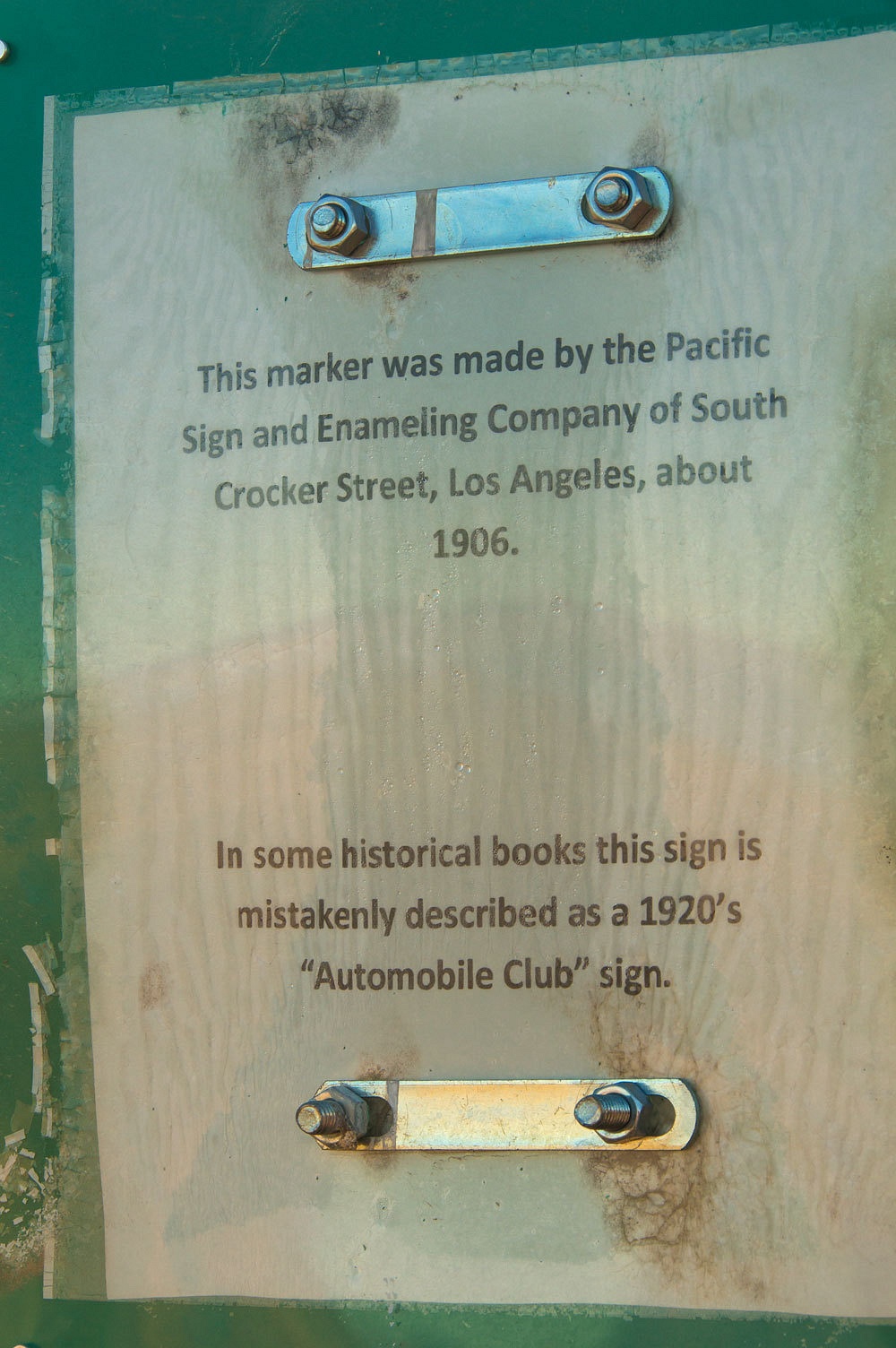
.........................it
says who made it in 1906 and it says it is not a "automobile club"
sign from the 1920's but leaves out the why and who. Why is it here out in Death Valley and who put it here?
It was a
sign that brought us back to Death Valley and we were going to see if we could
answer the "why" and "who" questions and maybe even find a
couple more of these signs.


Does this pique
your curiosity also? Well, then get comfortable, relax, and let's get on with
the tale.
The Lady was
back up the hill and home soon after school was out Friday afternoon, chomping at
the bit, pawing the ground, ready to go. The truck and camper had been packed
since Wednesday. We grabbed a quick dinner at Walker's Mountain View BBQ and
then settled in at a secluded campsite outside of Bridgeport that is good for
one night while traveling. We woke to an outside temperature of 24°, enjoyed
morning coffee, and continued down 395. During a quick stop in Bishop, I scored
at Wilson's Eastside finding a favorite casual hiking shoe in my size on sale. I
couldn't pass it up.
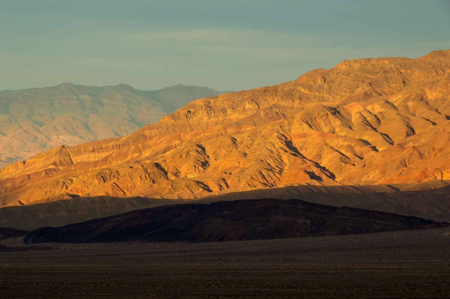
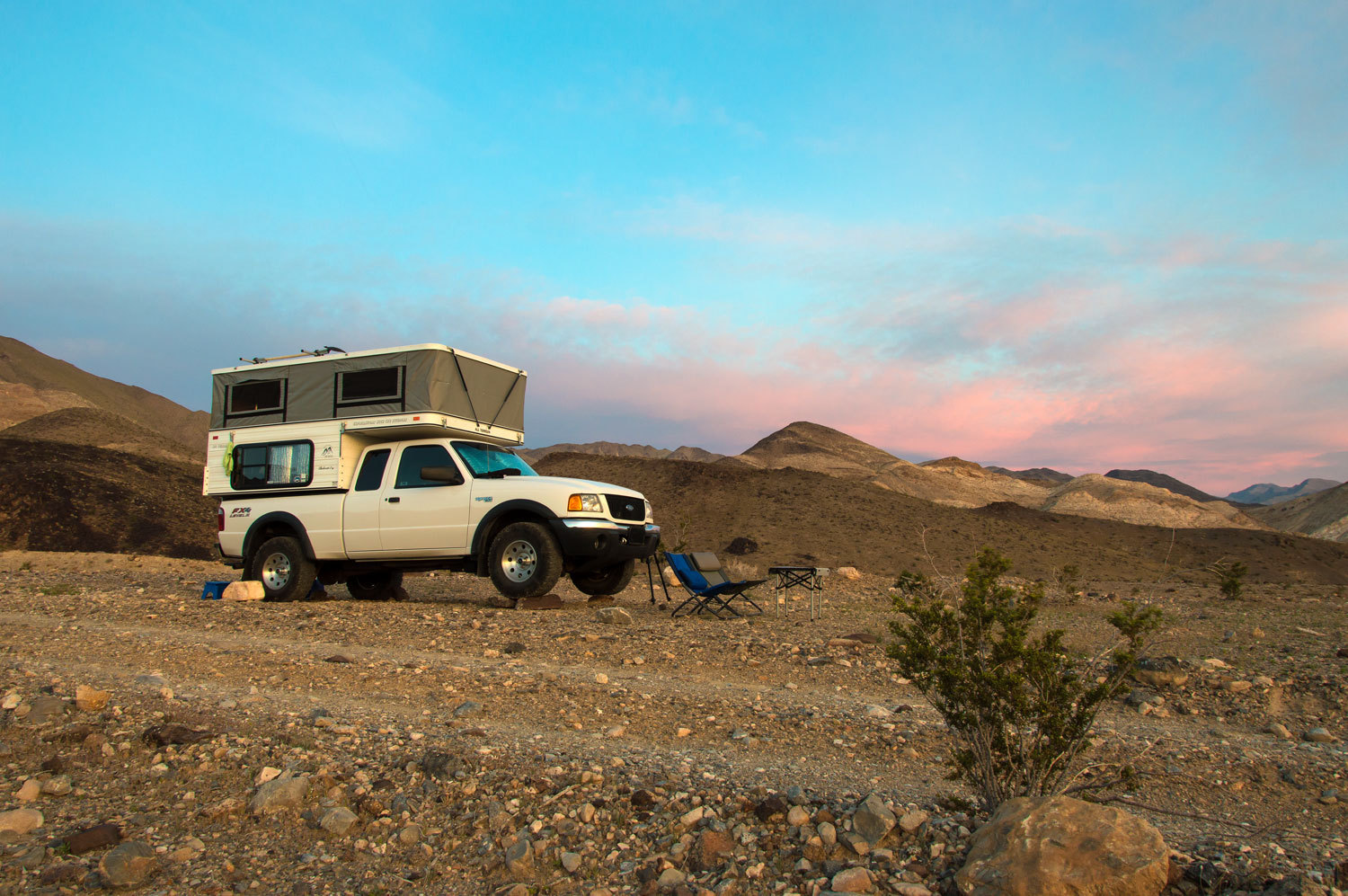
Mid
afternoon found us, once again, at one of our favorite Death Valley camp
locations near the end of LeMoigne Canyon Road. Relaxing while setting up and
getting settled, the heat was a surprise. We changed into lighter clothes.
There was no
one else in the area even with the reported crowds due to the wildflower
"Super Bloom" this spring. We walked up Lemoigne Canyon and found the
wildflowers in spectacular display.
Our first
evening in Death Valley was all we could have wished for. We had it all,
solitude, a beautiful desert evening, only a hint of a breeze, our cozy little
home, and each other.
We woke to
an overnight low of 57°, quite a change from home and Bridgeport. We slept with
all the windows and the door open, the breeze and silence deeply satisfying. With
our bellies full of goat meal, a good, decent, hardy breakfast for us, we were
ready to hit the trail, get on with chasing history.
The current
roads in Death Valley did not exist back in 1906. The route of highway 190 down from
Townes Pass had its beginnings as the Eichbaum Toll Road, completed in 1926, to
the planned Stovepipe Wells Hotel. The LeMoigne Canyon road dates from the mid
1920's, put in in an attempt to cash in on LeMoigne's mine holdings after his
death in 1919.
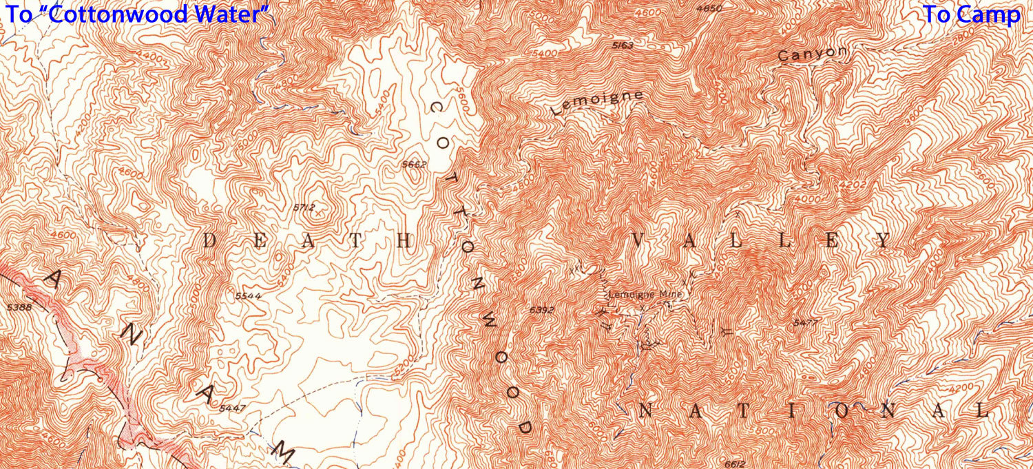
This sign
that intrigues us is on the old route, a trail that had its beginnings as an
old indian route to water holes and springs. How did it get to "Cottonwood
Water" in the direction the elegant finger points? Hints in Digonnet's
Hiking Death Valley provided clues that led to the 1952 15' USGS topographic
maps for this area. It turned out that some of the old routes were still marked
as trails on these old quads including the route up LeMoigne Canyon (north fork) to
the crest of the Cottonwood Mountains and down to "Cottonwood Water".
We love old
maps and old trails. We set off on an adventure..........................
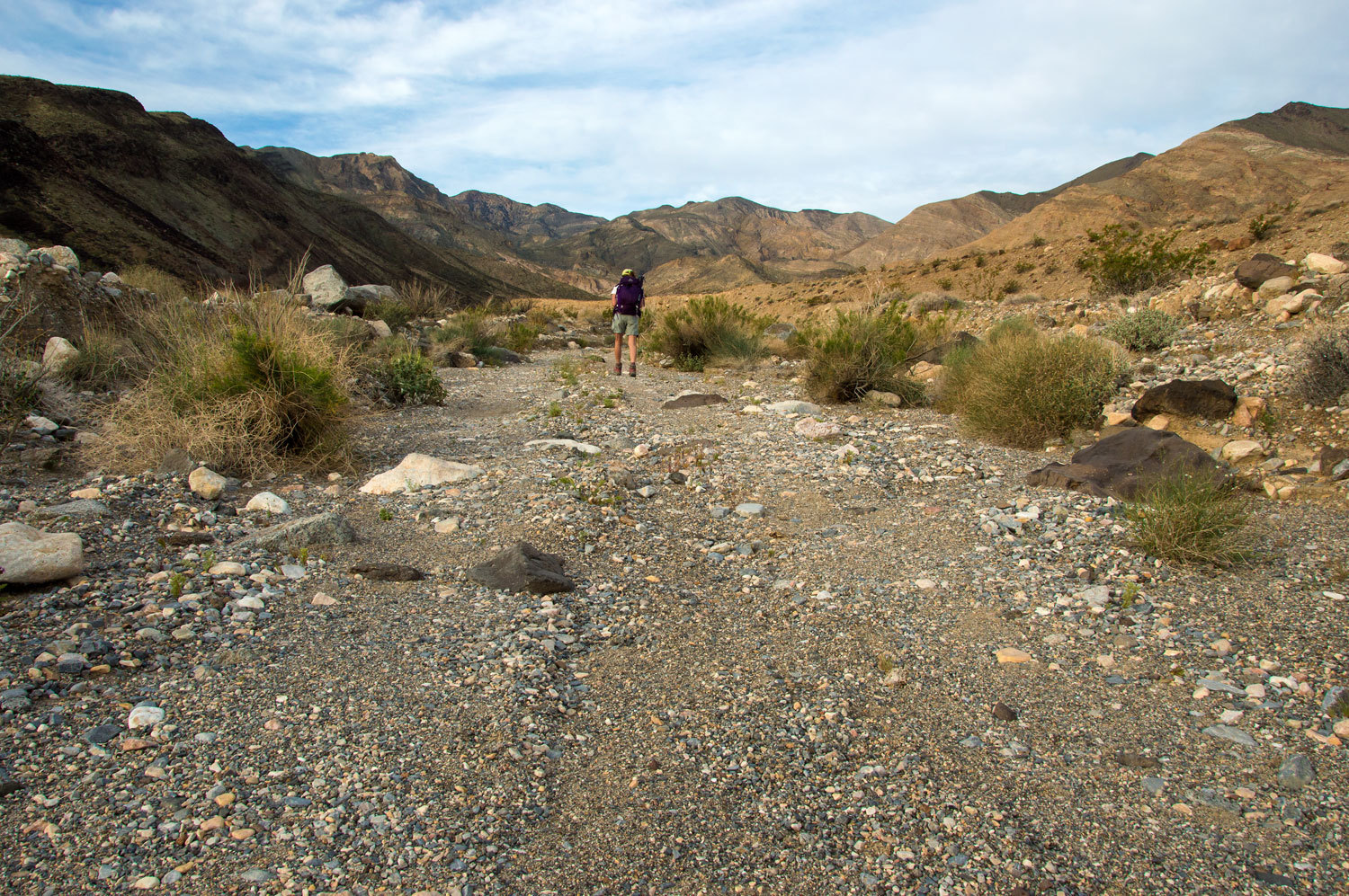


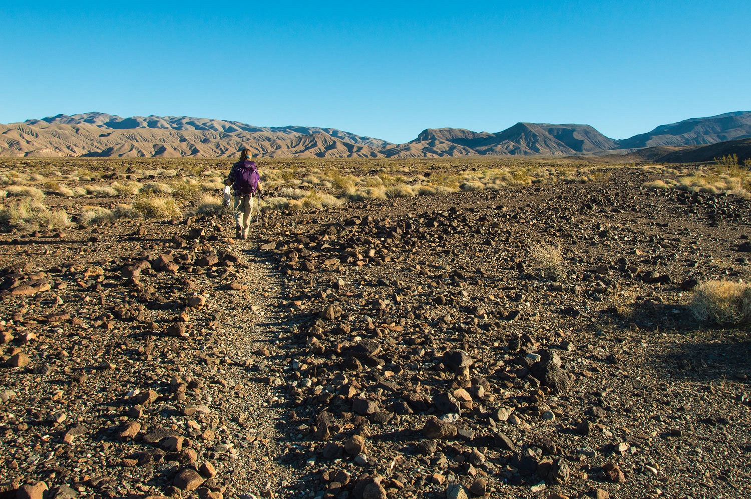
Just past
our campsite the road descends into the wash. In our time of visiting here we
have seen the effects of two flood events. The road in the wash is obliterated
and then slowly brought back by vehicles working a way back up. With little
use, plant life, especially with this wet winter, is taking over the route.
This year the road was covered with flowers. It would be a shame to drive on
them.
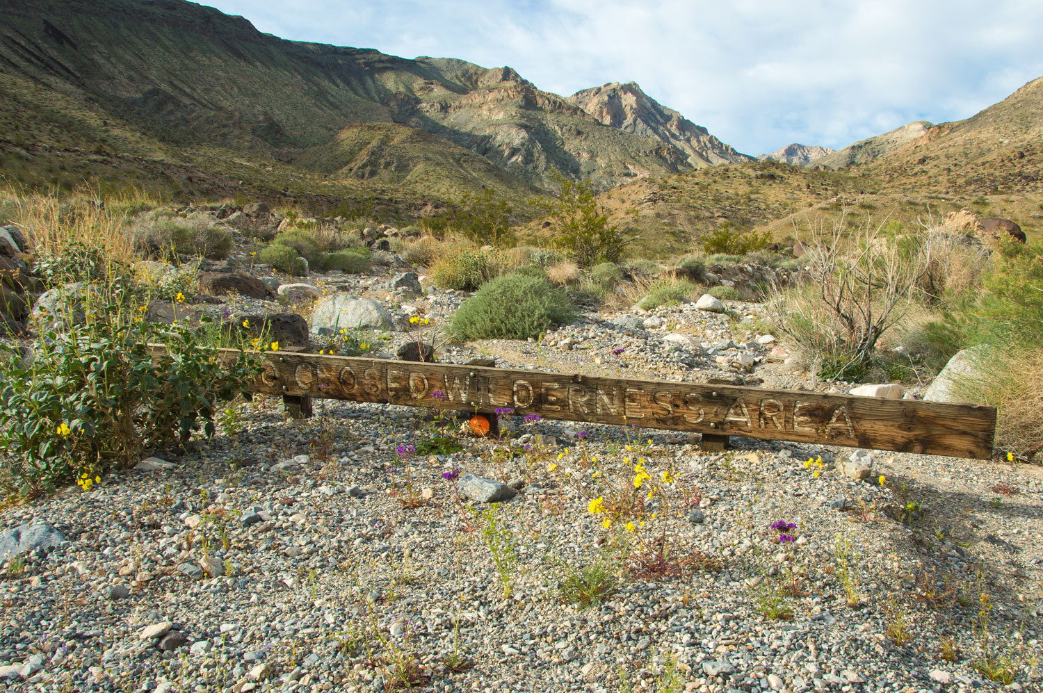
The sign at road's end about 1.5 miles up from camp is almost covered now
from debris flows.
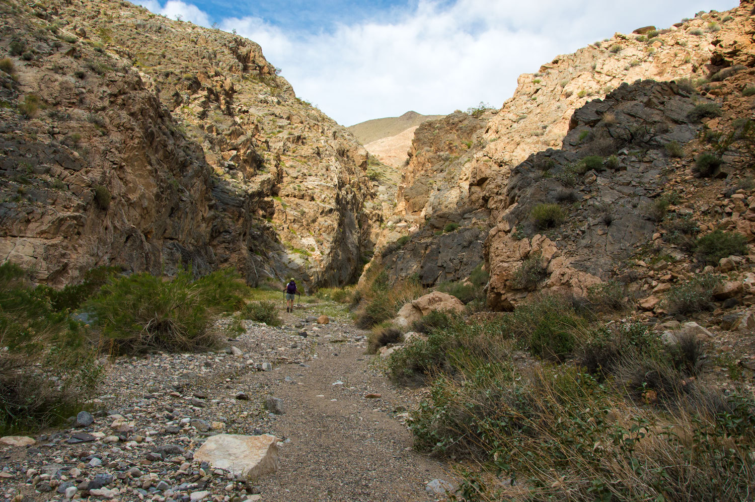
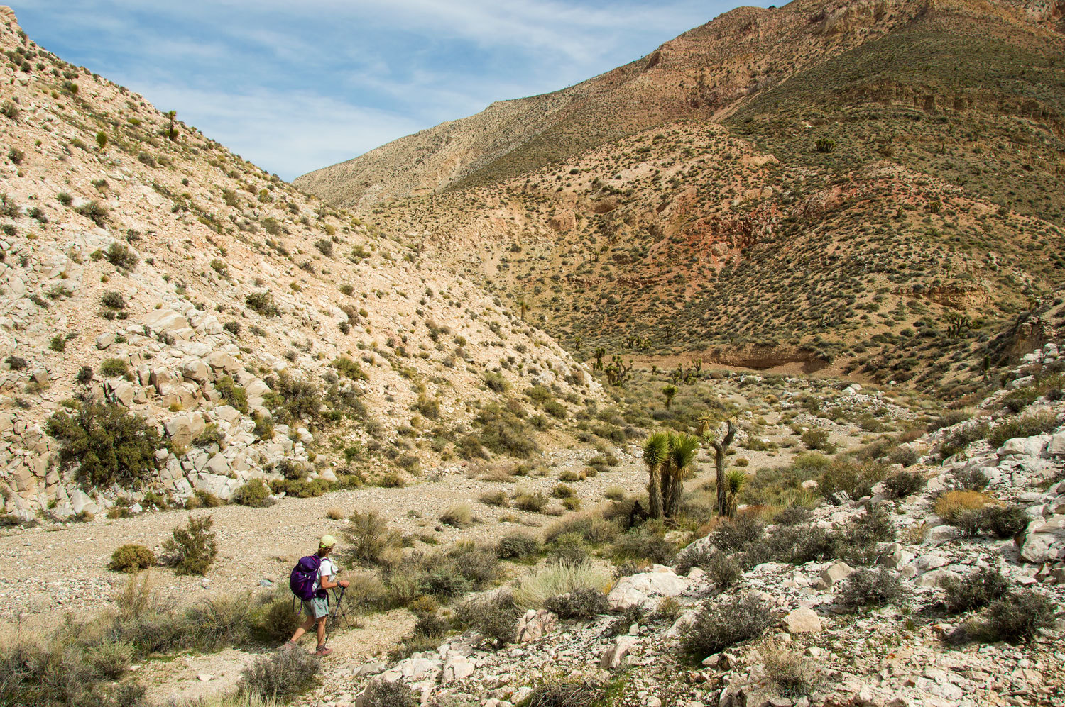
We continued
up canyon. In the cool of the morning the fragrance of the flowers hung in the
canyon, an intoxicating mix from all the various sources. We darted from plant
to plant and flower to flower and never could identify a single source, the
perfume was so swirled together. It was an incredible and unexpected sensory addition
to our hike.
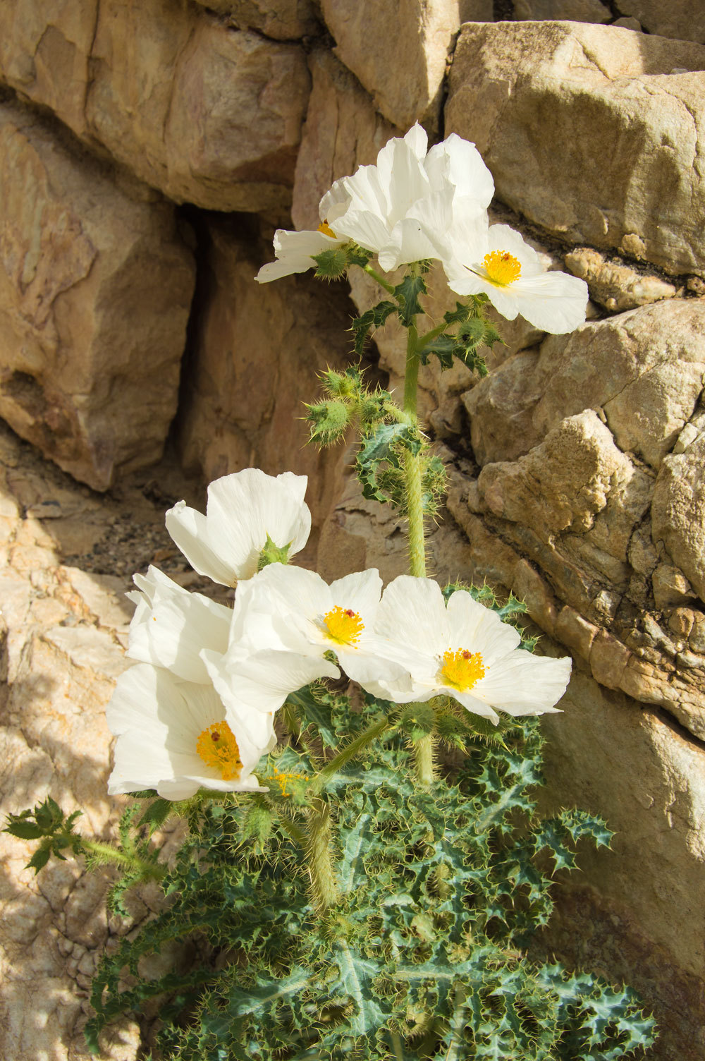
This was the
only Pricklypoppy we saw this trip. It was growing out of a small crack in
the canyon wall.
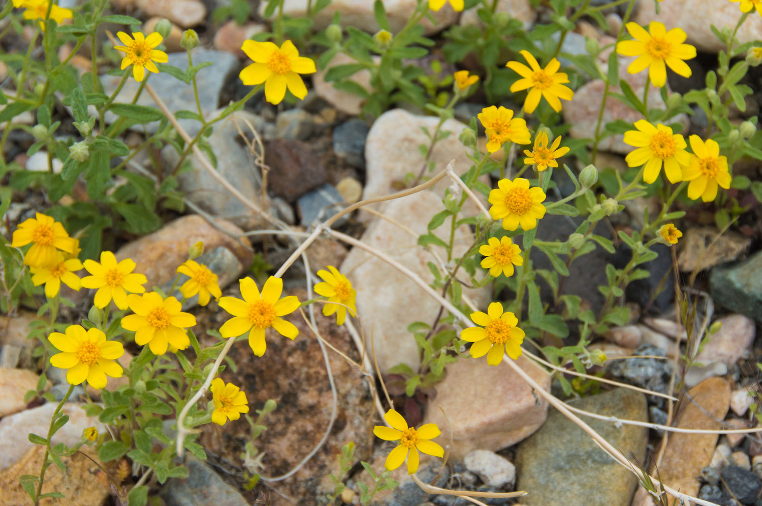
Easterbonnets,
appropriately, in places carpeted the canyon bottom.
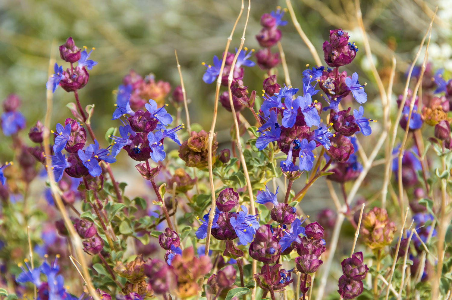
The Lady was thrilled to find Purple Sage with its powerful scent when touched. It is a member
of the mint family and not related to sagebrush.
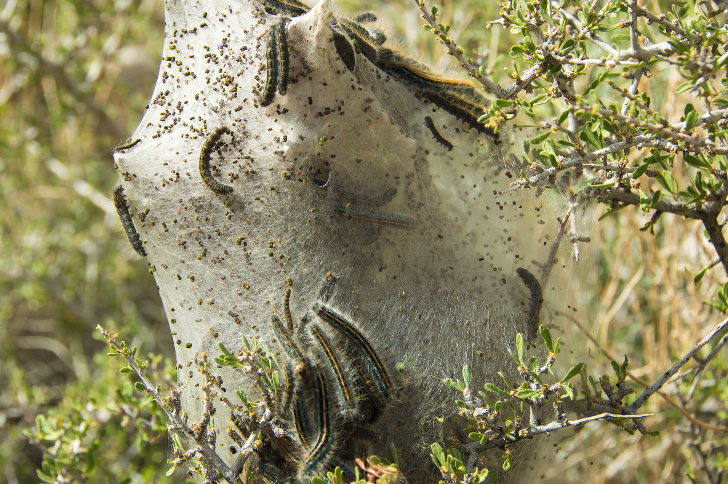
In one area
we found numerous colonies of tent caterpillars.
We continued
our climb up the North Fork of LeMoigne Canyon.
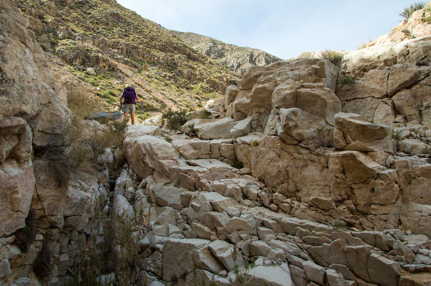
We were
surprised to find and climb a 12 foot high pour over that was impassable for
stock animals.
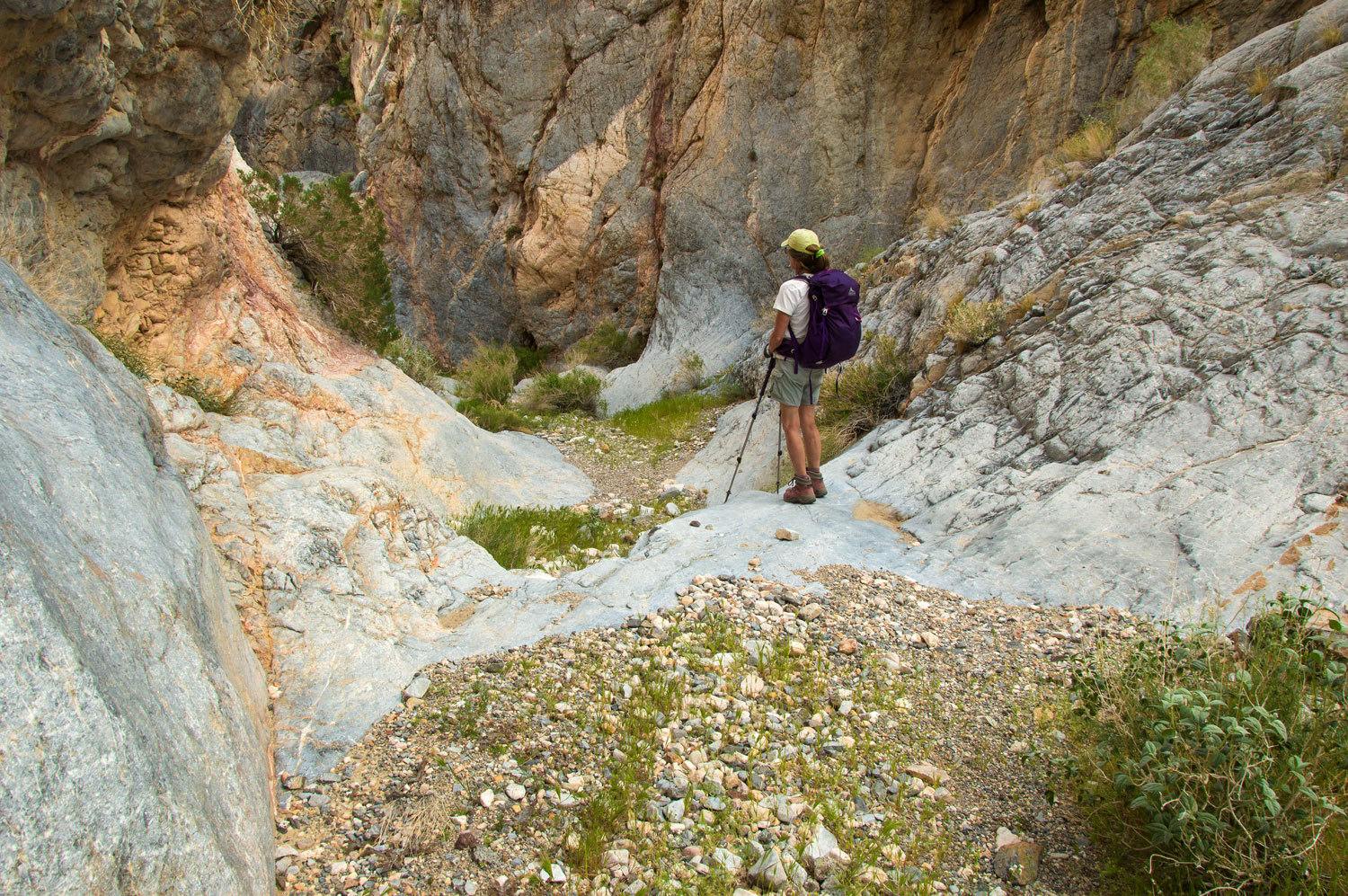
On our way
down canyon in the afternoon we searched for and found faint remnants of a trail bypassing
this obstacle. Although overgrown with scrubs, it was definitely a trail and pretty cool
to find after so many years of no use.
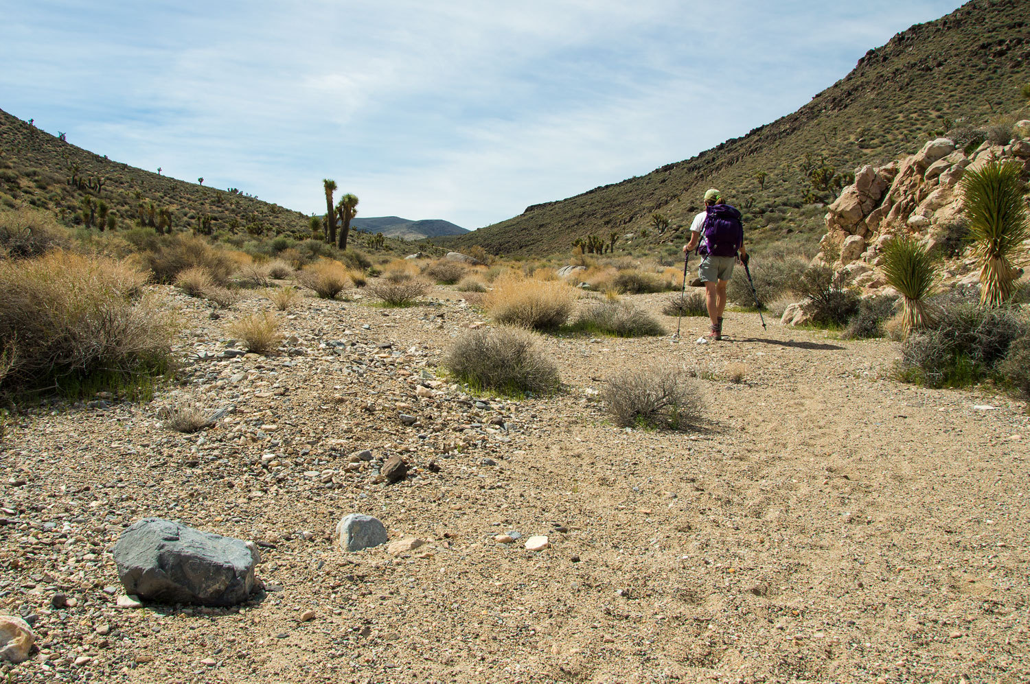
After many
miles of climbing the gradient finally lessened and the terrain opened up.
Look at your
topographic maps for this area. It is interesting to note that these east side canyons, the North Fork
LeMoigne Canyon and the south branch of Cottonwood, cut through the Cottonwood
Mountains to the west side of the range. There are high peaks in the Cottonwoods
to the east of the tops of these watersheds.
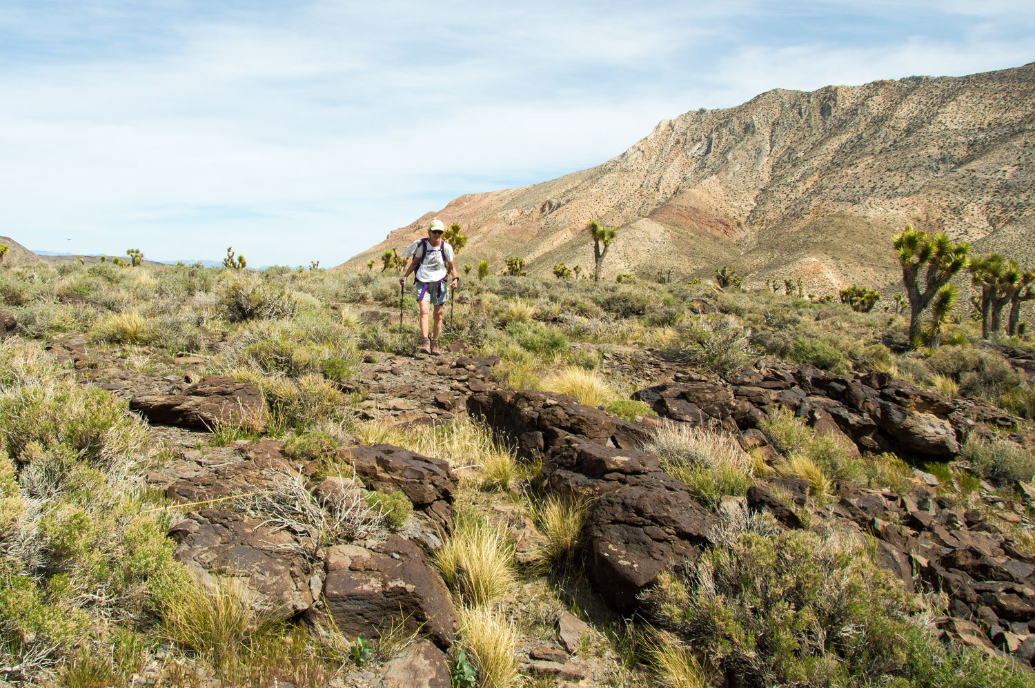
In a forest
of Joshua Trees we reached the crest of the Cottonwood Mountains.
The flats
ahead of us is the divide between LeMoigne Canyon and the Cottonwood Canyon
drainage, the route of the old trail to "Cottonwood Water". We were
pleased to see the snowy high peaks of the Sierra Nevada far to the west.
This was our stopping point. It was 12:45 pm and our turnaround time was 1:00
pm. This would put us back at camp at 5:00 pm with a round trip of around 16
miles with substantial elevation gain and loss, a good first day adventure. In
the coming days from the Cottonwood Canyon side we would look up to this area.
Remember, we were chasing history!
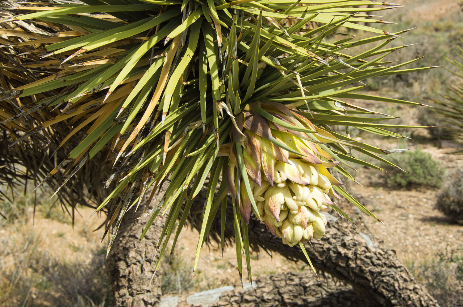
Around
us were Joshua Trees in bloom.
We did a
cross country circle to the north across the crest and descended a subsidiary
canyon back into LeMoigne Canyon. Reentering the main canyon, we were surprised
at the grade we had been climbing all morning.
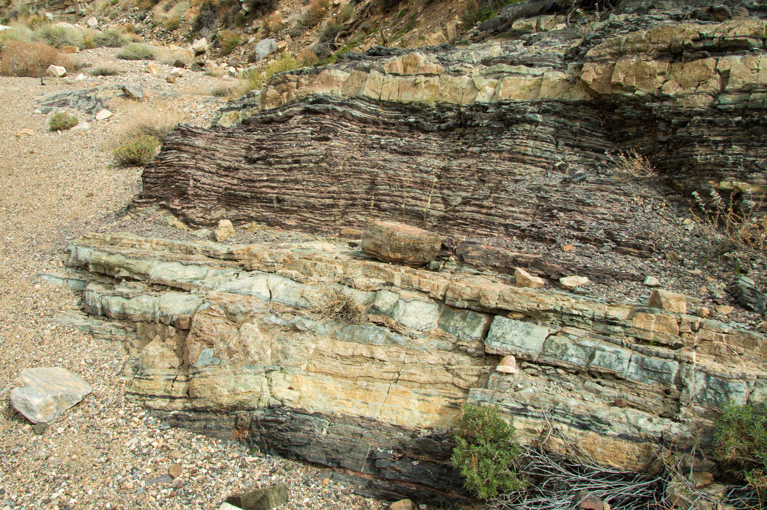
Geology was,
of course, all around us and we found this spot perfect for a break and to
ponder the passage of time. And, to feel pretty darn insignificant.
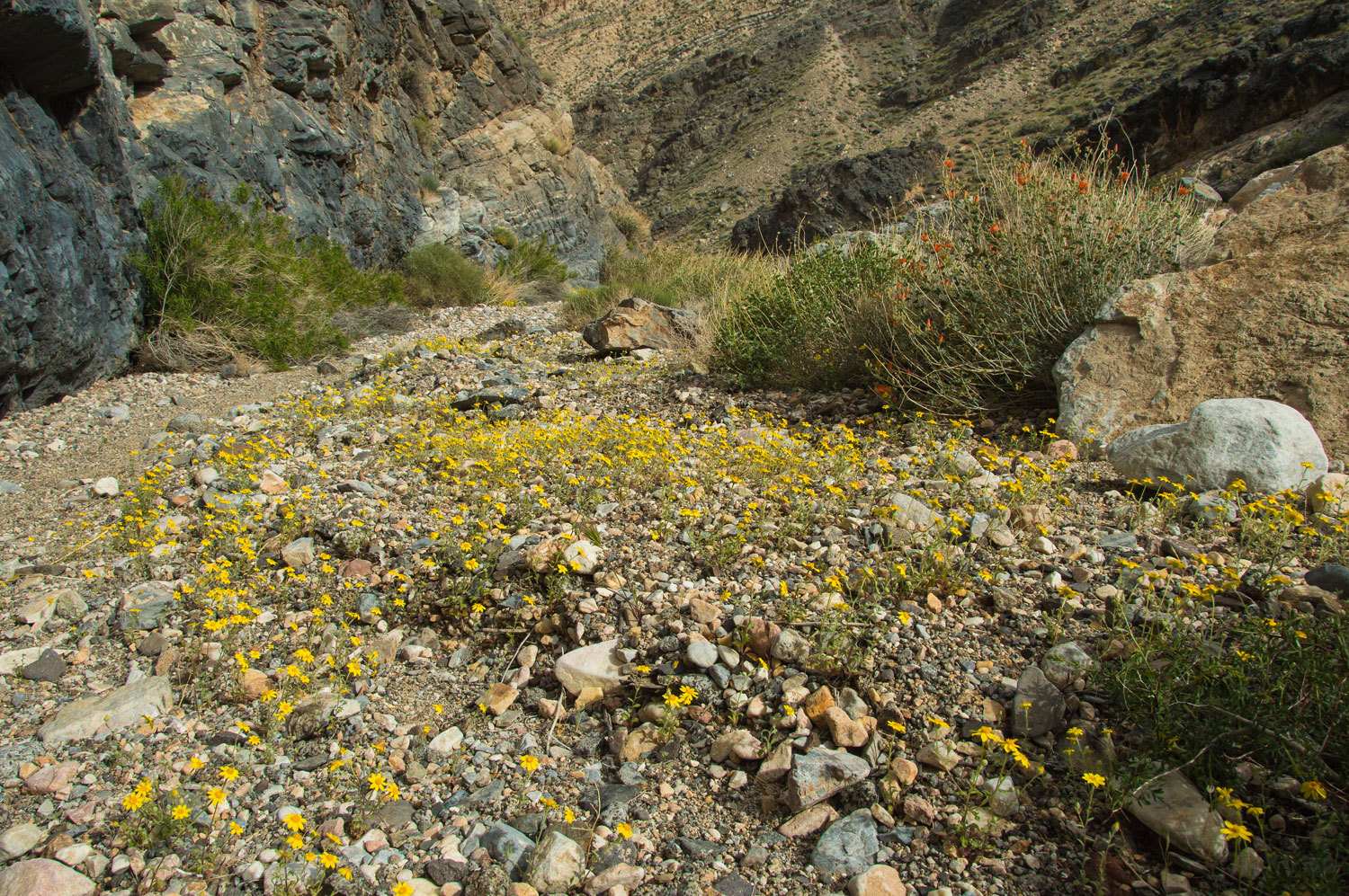
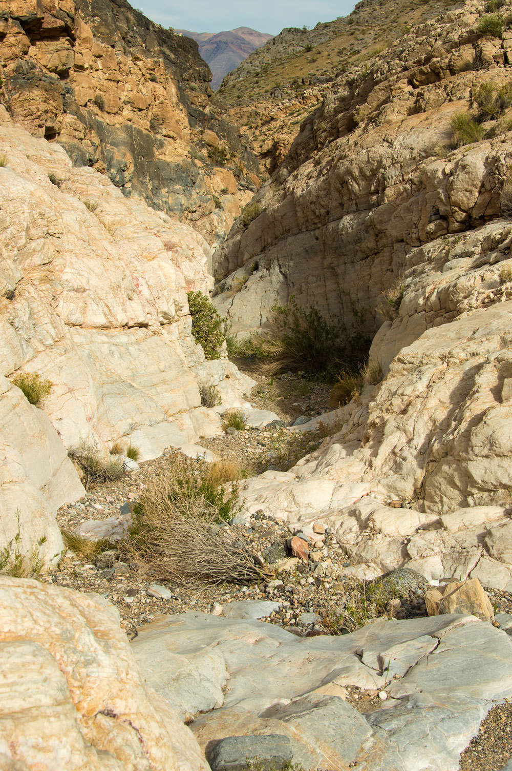
The canyon
continued to delight us.
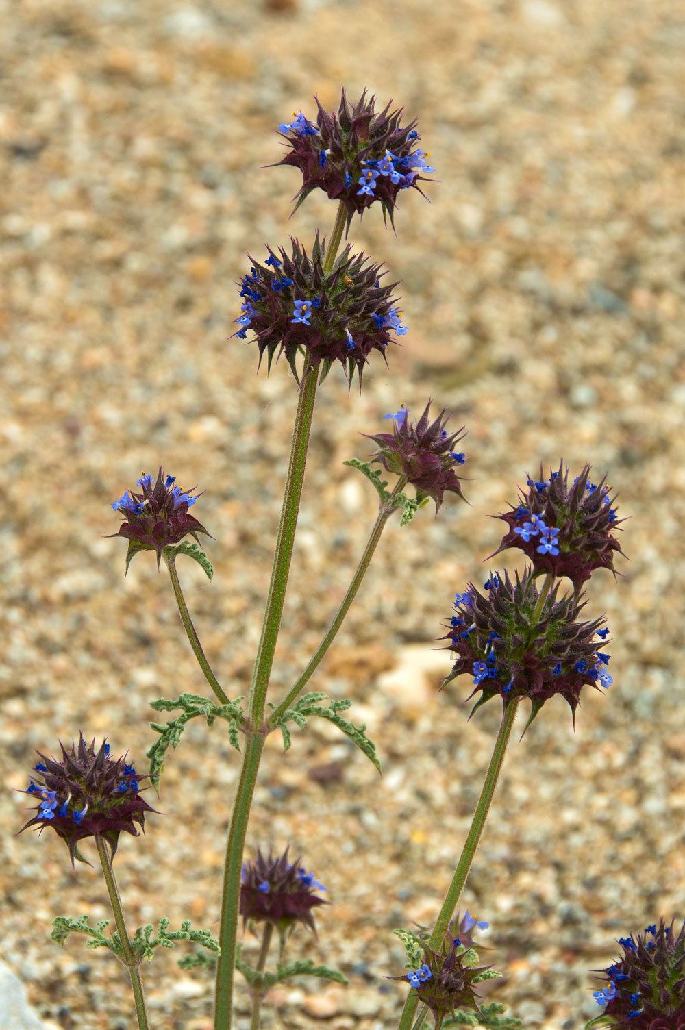
And the
flowers continued showing off.
Desert Globemallow growing in the canyon wall.
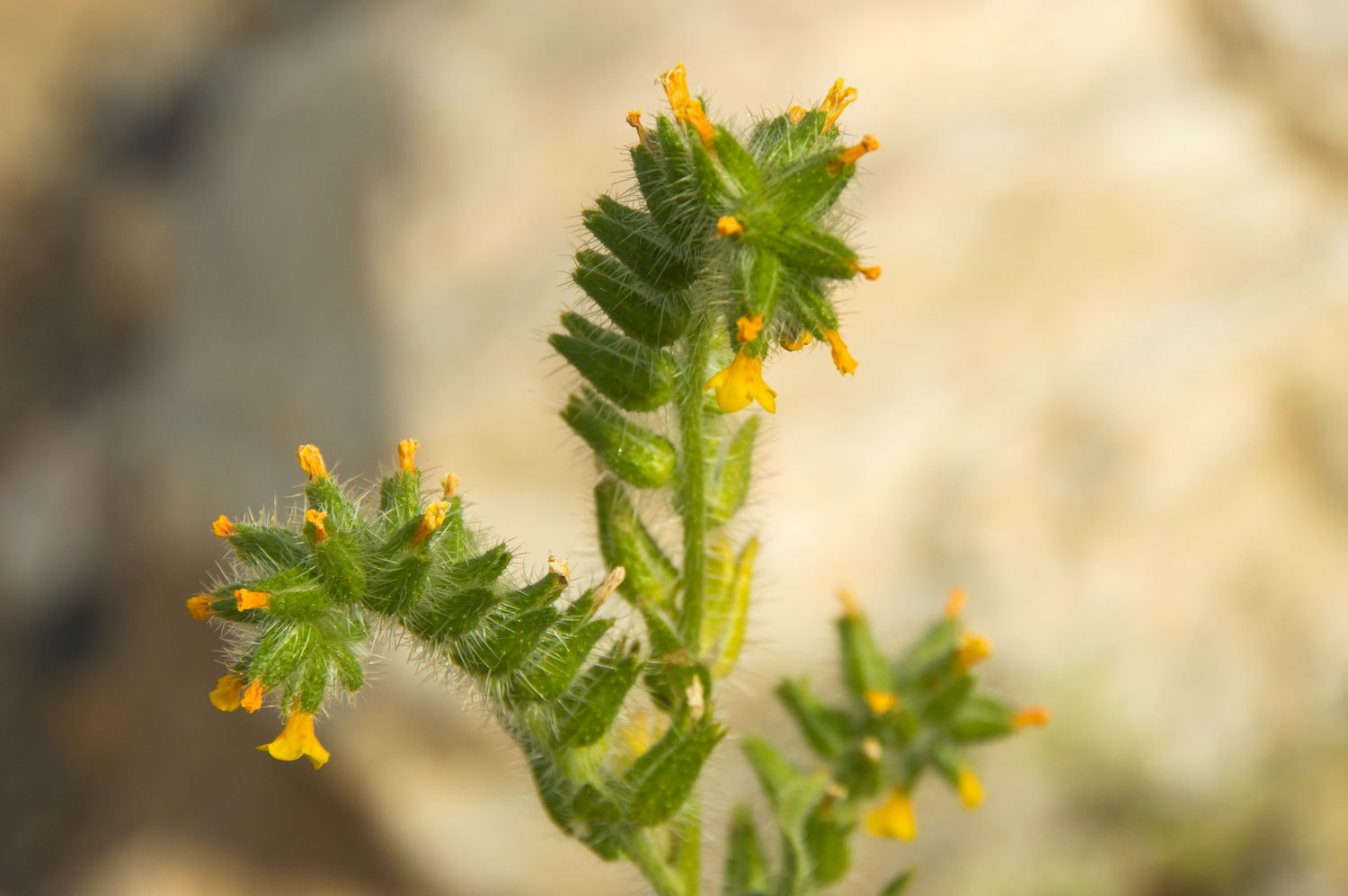
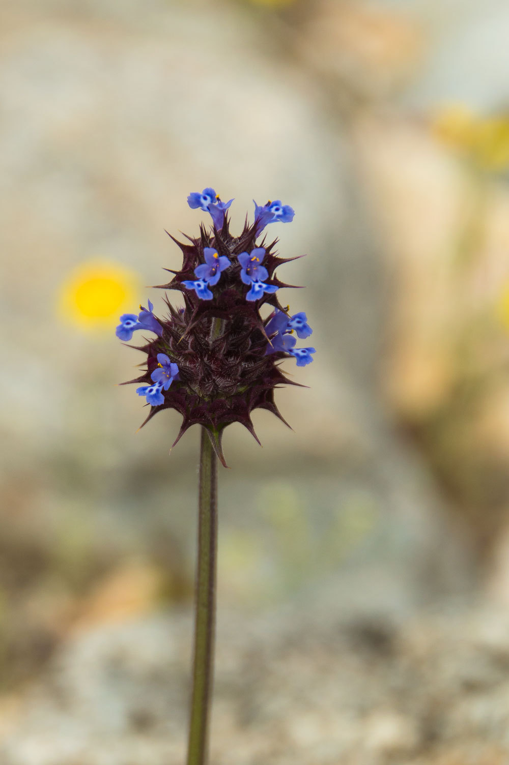
Chia was a
new flower discovery for us.
This was a marvelous
canyon to spend time in and well worth the effort.
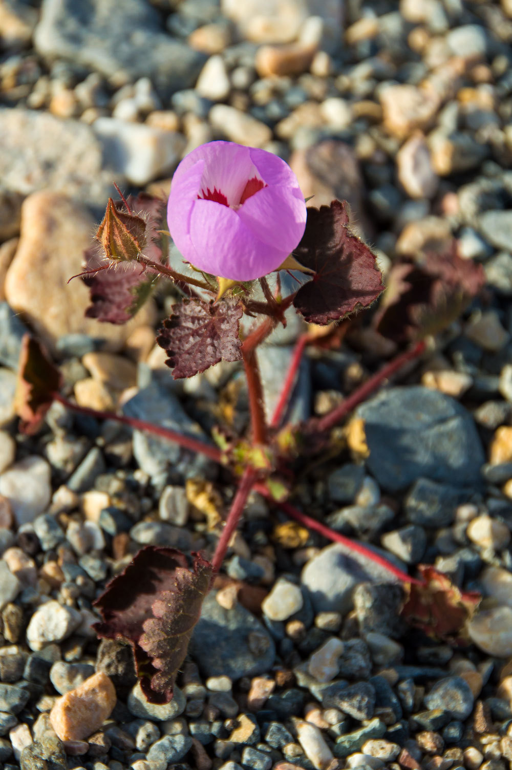
As we neared
camp we discovered our first Desert Fivespot of the trip, the Lady's favorite
Death Valley flower.
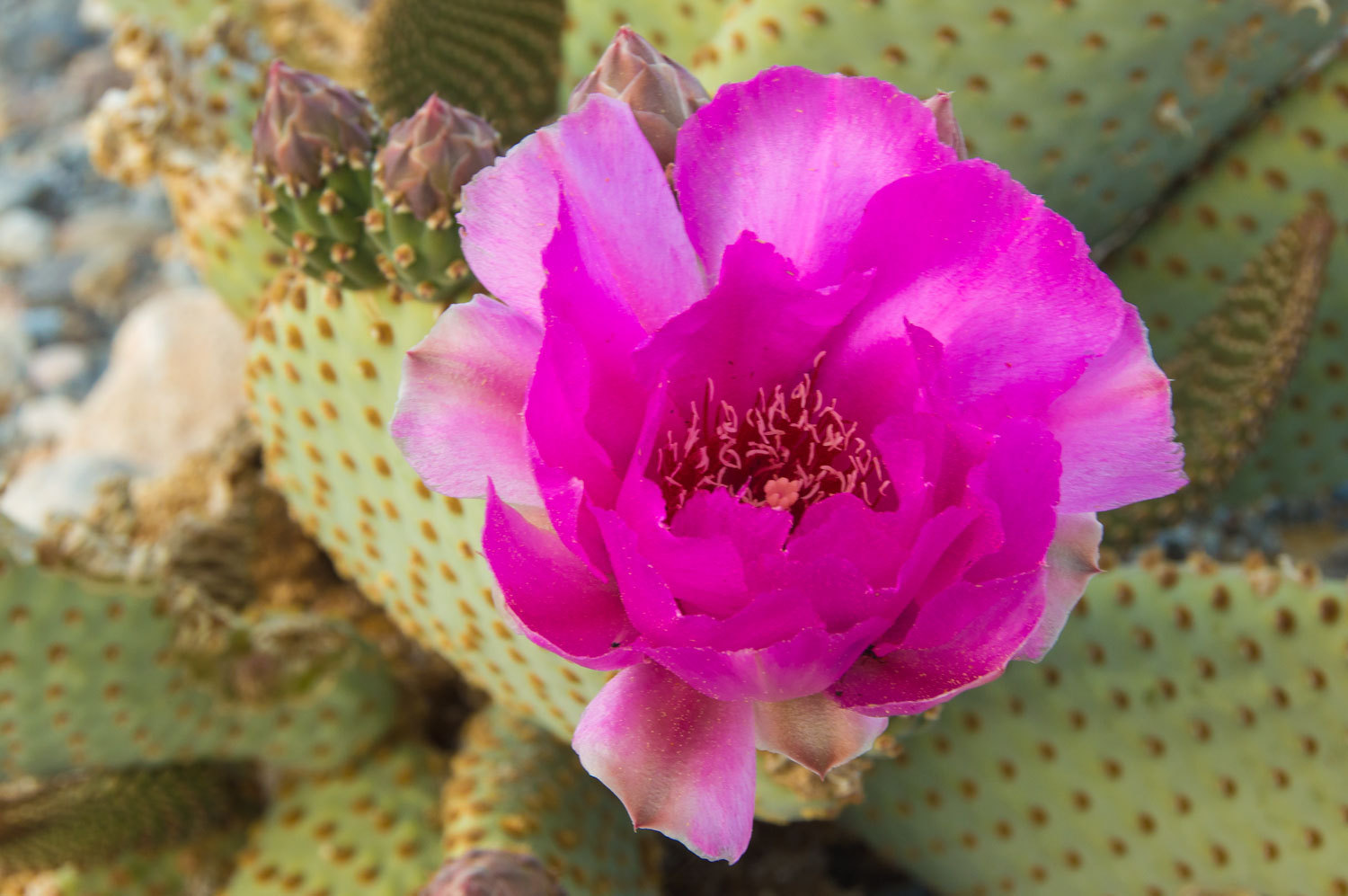
Brilliant in
the broad wash north of camp was a flowering Beavertail.
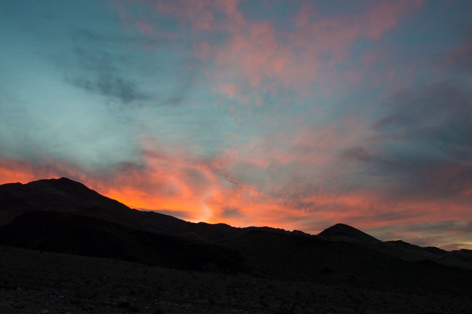
It had been
a wonderful day for us. We had walked a portion of a long forgotten route, saw part
of the way indicated by that pointing porcelain finger on that sign that
brought us back to Death Valley. As the evening light colored the sky, we
couldn't help but see wind driven lenticular shape to the clouds.
Would the
desert wind blow?
Our
adventure continues in Part Two - Please Click Here
No comments:
Post a Comment