
please remember you can click on a photo to see a larger version
The Fourth of July
It was after 5 am. The ravens hadn't come by,
making their morning rounds. It was quiet outside. I rolled over. The Lady had
already done her big stretch and wiggles.
"Why is it so warm?" I asked. The
thermometer read the outside temperature as 54°. It was the same inside. Down
to around 40°, all the windows are always open if wind isn't bringing rain
inside. "Yesterday morning was 46°," I added.
"Clouds," the Lady said. "It
is full on cloudy."
She was right. Outside with our coffee we
saw the small cottontails and one large black-tailed jack rabbit were grazing
the overgrown parking area, the same as yesterday morning.

It was going to rain today. How wet did we
want to get? The rain began as soon as we finished breakfast. Our hiking
clothes and packs were ready. We would wait it out.

Two scrabble games later and it was still
raining. At 11:30 am we decided on Plan C. We would pack up and drive out of
the canyon to get a broader view of the sky and maybe head to Eureka for gas
and see about entering Little Fish Lake Valley from the north and look at a
trailhead on the east side of the Monitor Range. That's if our continued
monitoring of the weather made that a go. This was a rainstorm, not passing
thunderstorms.
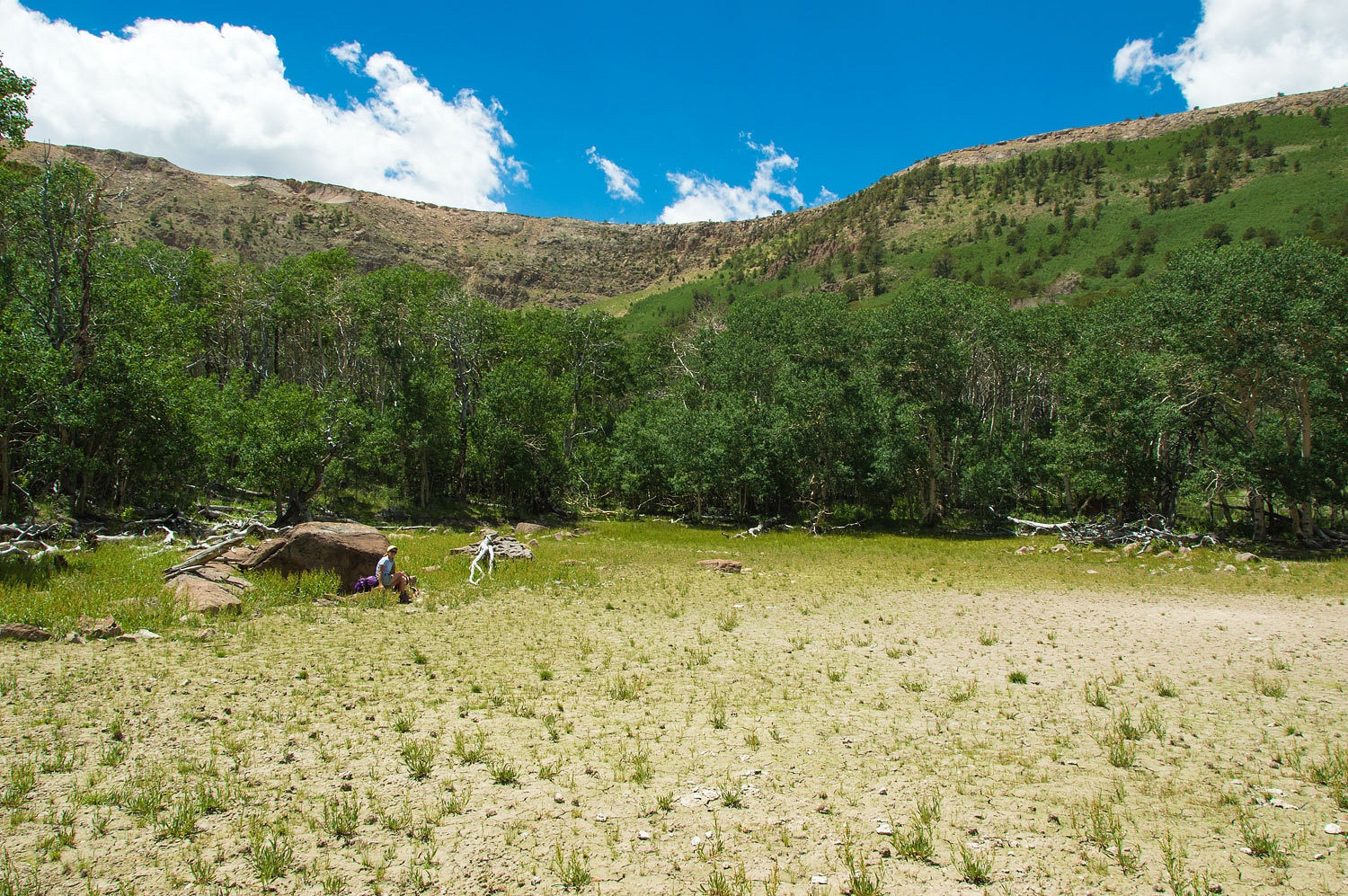
There was one great benefit to rain in the
middle of Nevada on the Fourth of July. Unbelievably, we found one of our
favorite places empty and all ours.
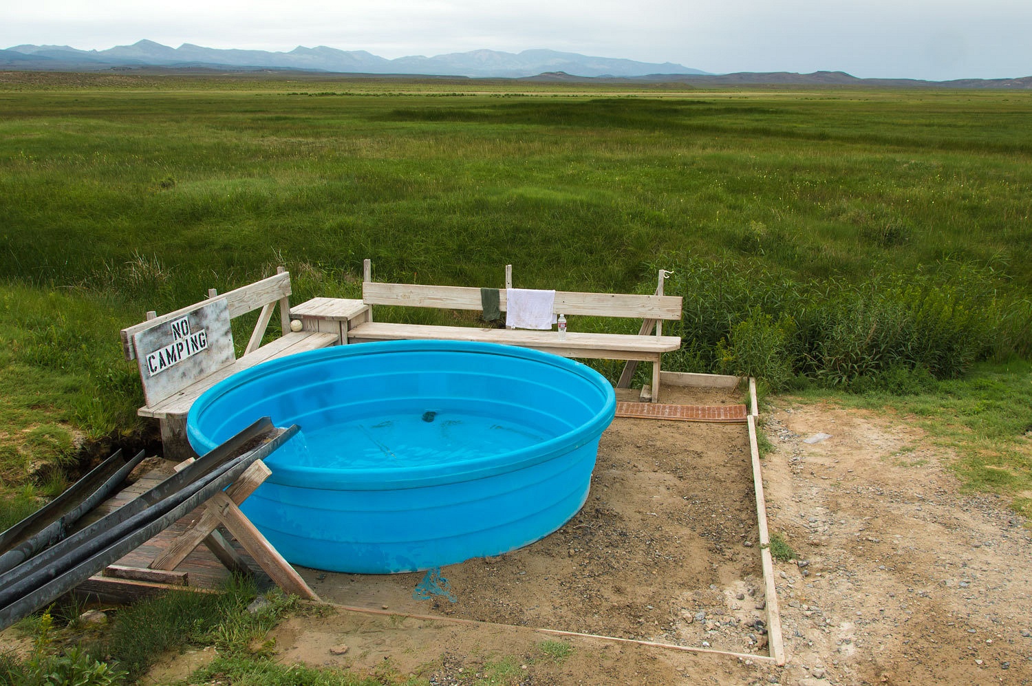
Talk about decadence and the ultimate in
relaxation - solitude, a beautiful setting, a gentle cold rain, and perfect hot
spring water. I need say no more.
The Independence Day parade had just ended
in Eureka. The rain had stopped earlier and folks were still sitting in chairs
along highway 50 (main street) and visiting with their neighbors. It was a glimpse
at old time small town Americana. The fire department had the barbeques going
out front. All the guys were standing around and there must not be any open alcohol
container laws in Eureka. It was an eye opening sea of bottles and cans in
downtown. We filled up the truck with gas. A large family group was picking up
their chairs on the edge of the gas station parking. Two big, big bellied guys
were struggling with the largest Yeti cooler I had ever seen. The chore was to
hoist it up on the end gate of a pickup and slide it in the bed. The cooler did
not want to leave the ground. I wondered how many of them it took to off load
the fully loaded cooler earlier in the day, without damaging the precious
contents. And, where was the help now? My initial urge was to run over and
help, then I thought of offering the suggestion, "Hey fellas, why not just
sit back and drink a few more dozen of those cold ones? That would make the
cooler lighter." I stuck with the third piece of the Cowboy Code, "Never
miss an opportunity to keep yer mouth shut."
We left Eureka alive and headed back west on
highway 50.
The cloud deck was heavy and rain was
evident in many places. I offered the suggestion, "Well, why don't we head
down the east side of the Monitor Range? Let's watch the roads, how wet they
are, and keep the gumbo factor in mind. If the weather lightens, let's go up
Clear Creek." We turned south off of 50 onto Antelope Valley Road. This
graded dirt road - that gets more and more "less improved" as the
distance from 50 increases - runs the length of Antelope Valley, crawls over a
low pass of connected high valleys, and then enters the north end of Little
Fish Lake Valley. In 65 miles of driving after leaving 50, we did not see
another vehicle on the Fourth of July. This drive was a wonderful Great Basin
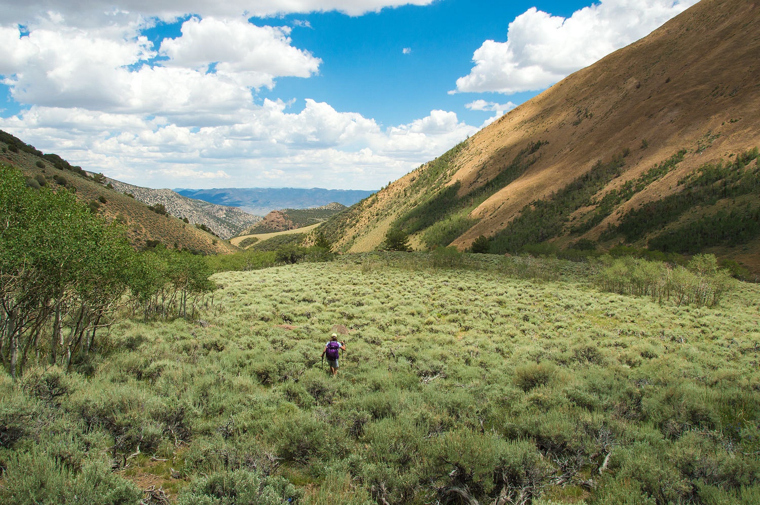
experience. Little Fish Lake Valley is a broad and open sage brush steppe
bordering the eastern escarpment of the Monitor Range. Find a rolling hill high
spot to spend the night in clear weather. It could be breathtaking. This place
has glorious potential, but it is a long ways from anywhere.
The roads did not quite correspond with what
was shown on the Tonopah District USFS map, but the Lady did a great job as
navigator and we found the small, unsigned (everything was unsigned) two track leading
up into the Clear Creek drainage. The sky was clearing. We headed up.
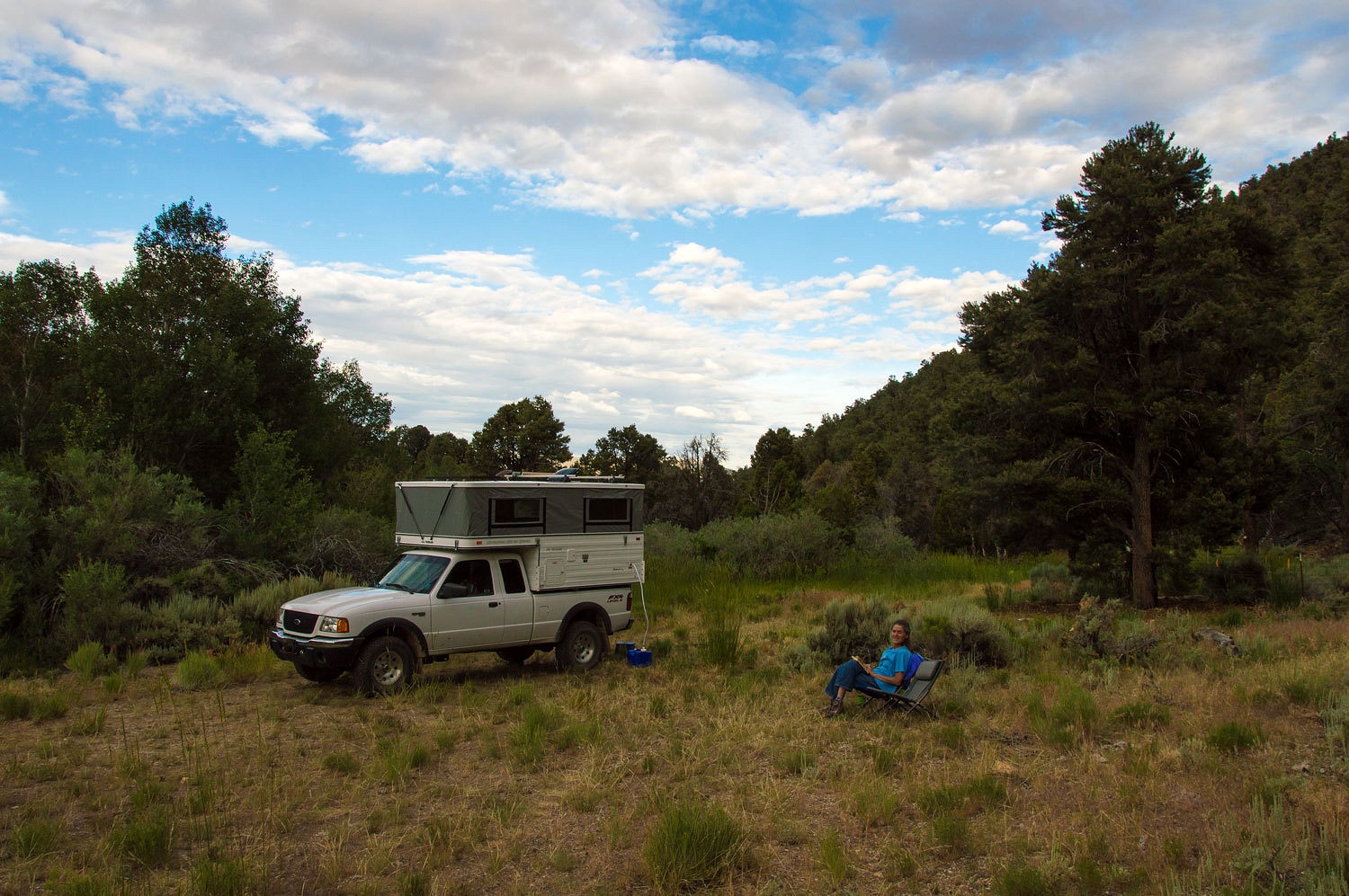
We set up camp at the end of the road.
We had a surprise on our way up the Clear
Creek Road - people. At the mouth of the canyon was a thrillcraft camp with one
large camping trailer and four pickups. The people all appeared to be inside. I
didn't look so see if a tv satellite dish was responsible because instantly a
pack of dogs ran at us. One fellow came out and escalated the pandemonium by
screaming at the uncontrollable dogs. The dogs obviously did not care or
respond in any way to his screaming. The man only added to the noise. One dog
gave chase and did pretty well at keeping up for a half mile or so.
A small camp trailer was tucked into thick
trees near the end of the road. A large dog announced our presence. A woman in
a housecoat exited. We waved and said hello. She screamed at her dog. Her dog
appeared to have attended the same obedience school as the dogs down the road.
Needless to say, we were apprehensive about
settling down in this neighborhood but after doing some scouting, we determined
there was enough distance between us and there were no tracks on the road or
trail that indicated anyone had been up this high.
With the decision made and the favorable
change in the weather, we settled in. We explored up the canyon before dark and
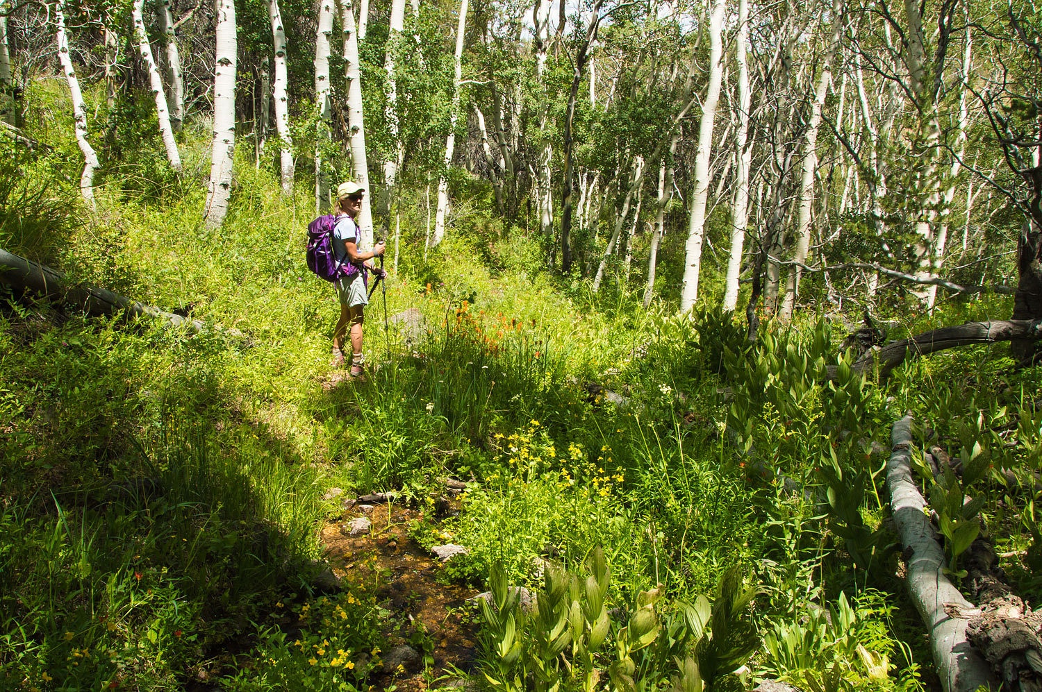
located the trail. Nothing was signed or marked. The air was wonderful and the
sky beautiful.

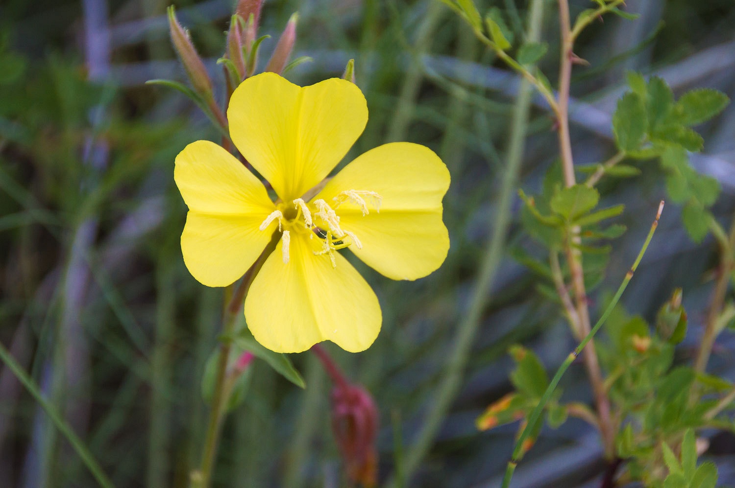
The riparian area along the still flowing,
tiny Clear Creek was a tangle of willows and wild rose. We were surprised to
see evening primrose among this vegetation.
We were ready for the clear skies the next
morning.
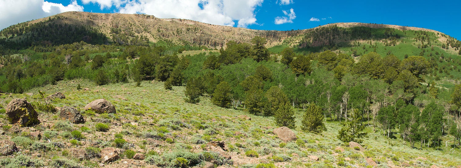
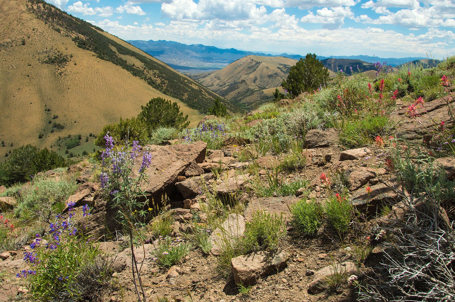
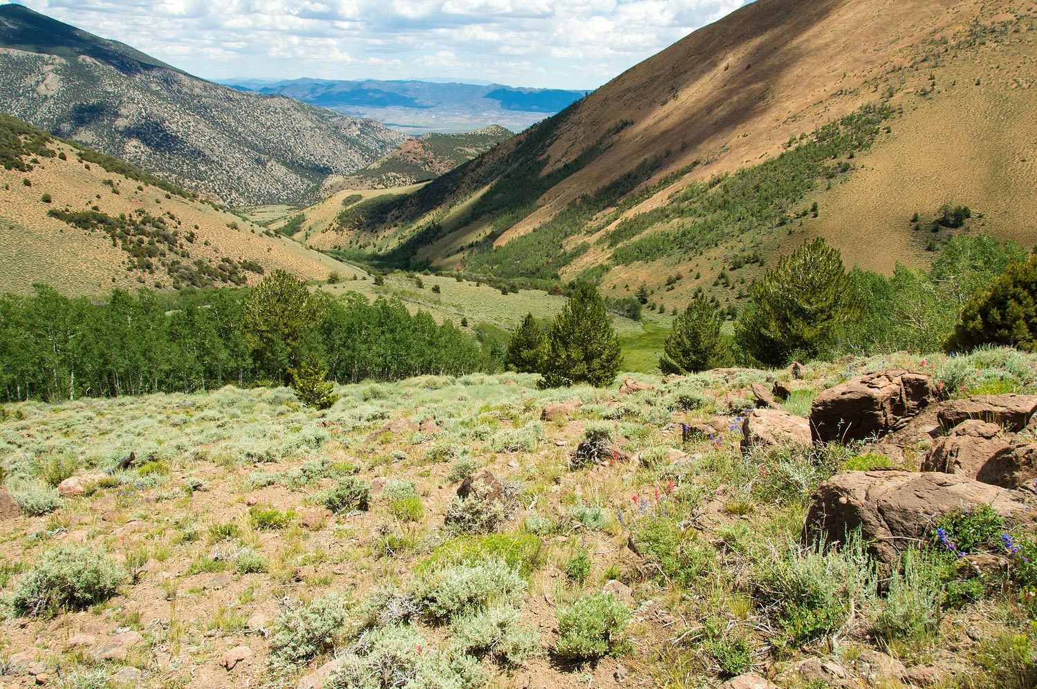
Although the western side of the Monitor's
and the crest appeared to be volcanics, this canyon had cliffs and outcroppings
of limestone.
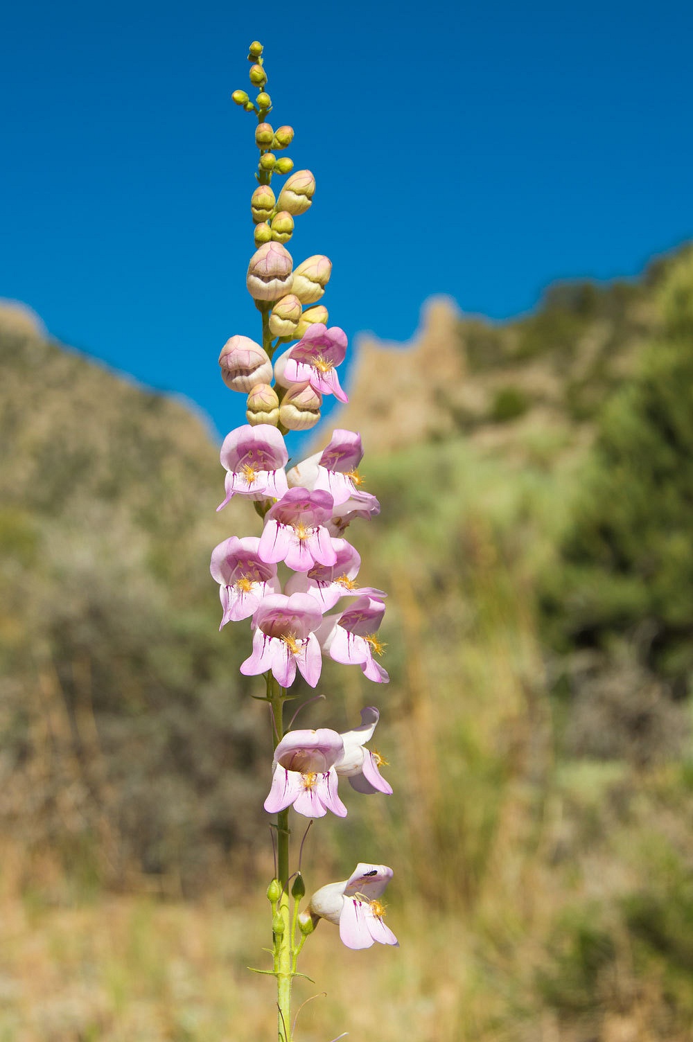
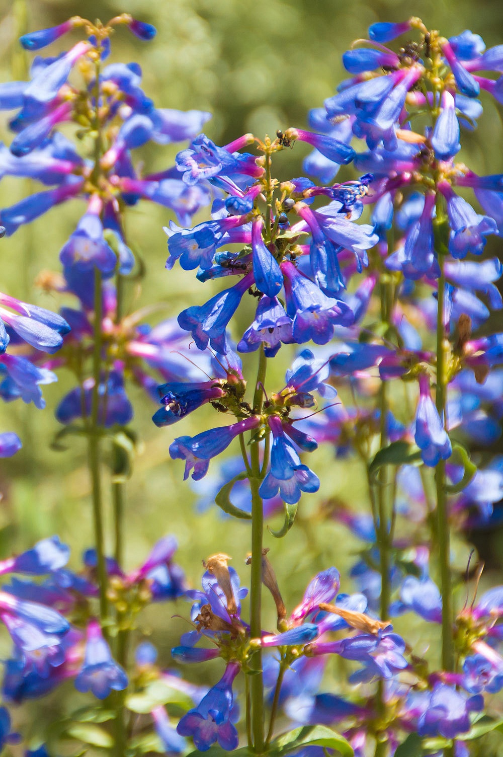
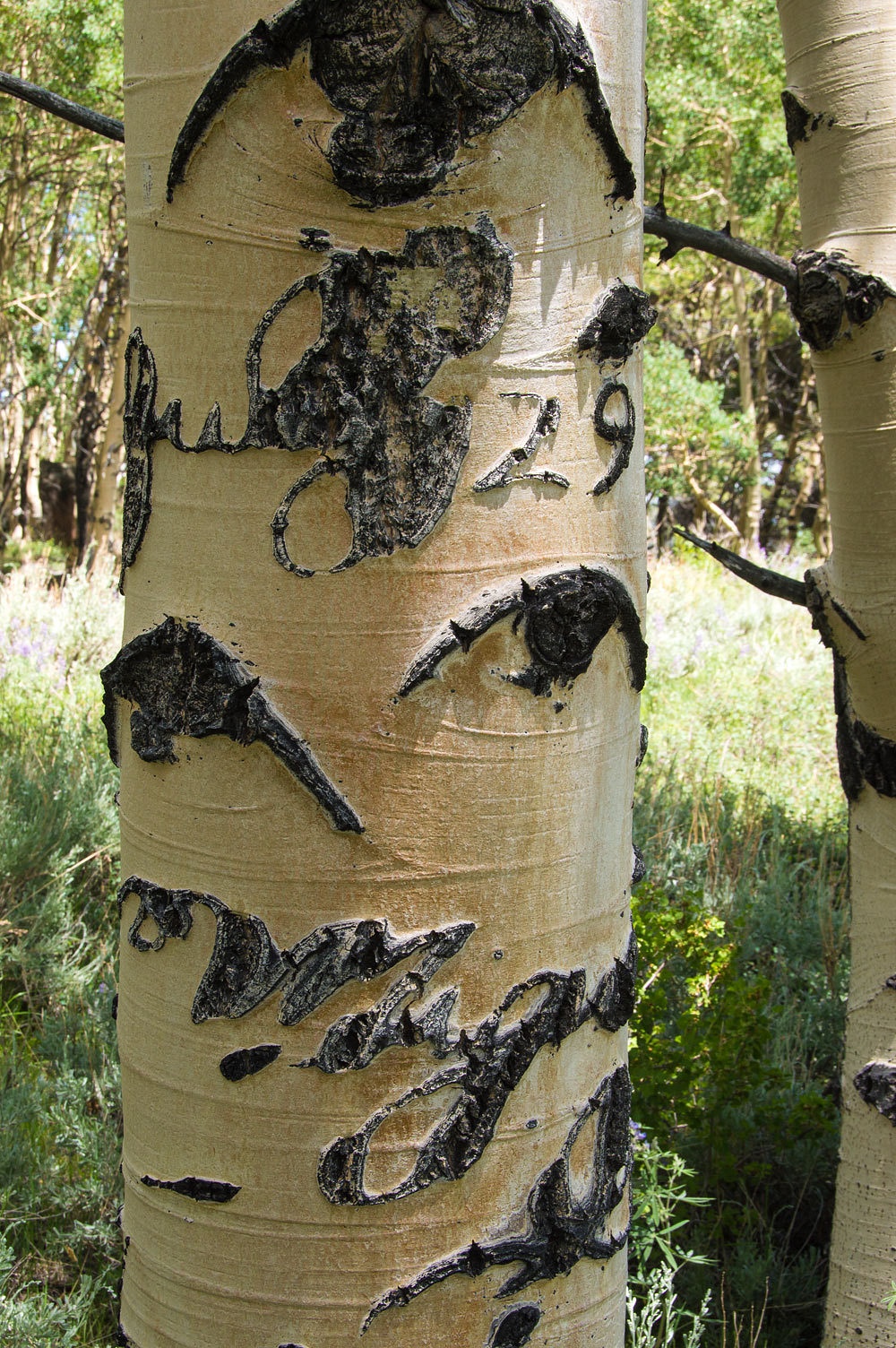
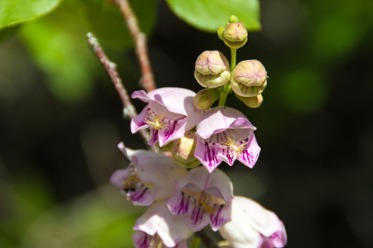
We have not identified this wildflower. Edit: Thank you to highz for identifying this as Palmer's Penstemon.
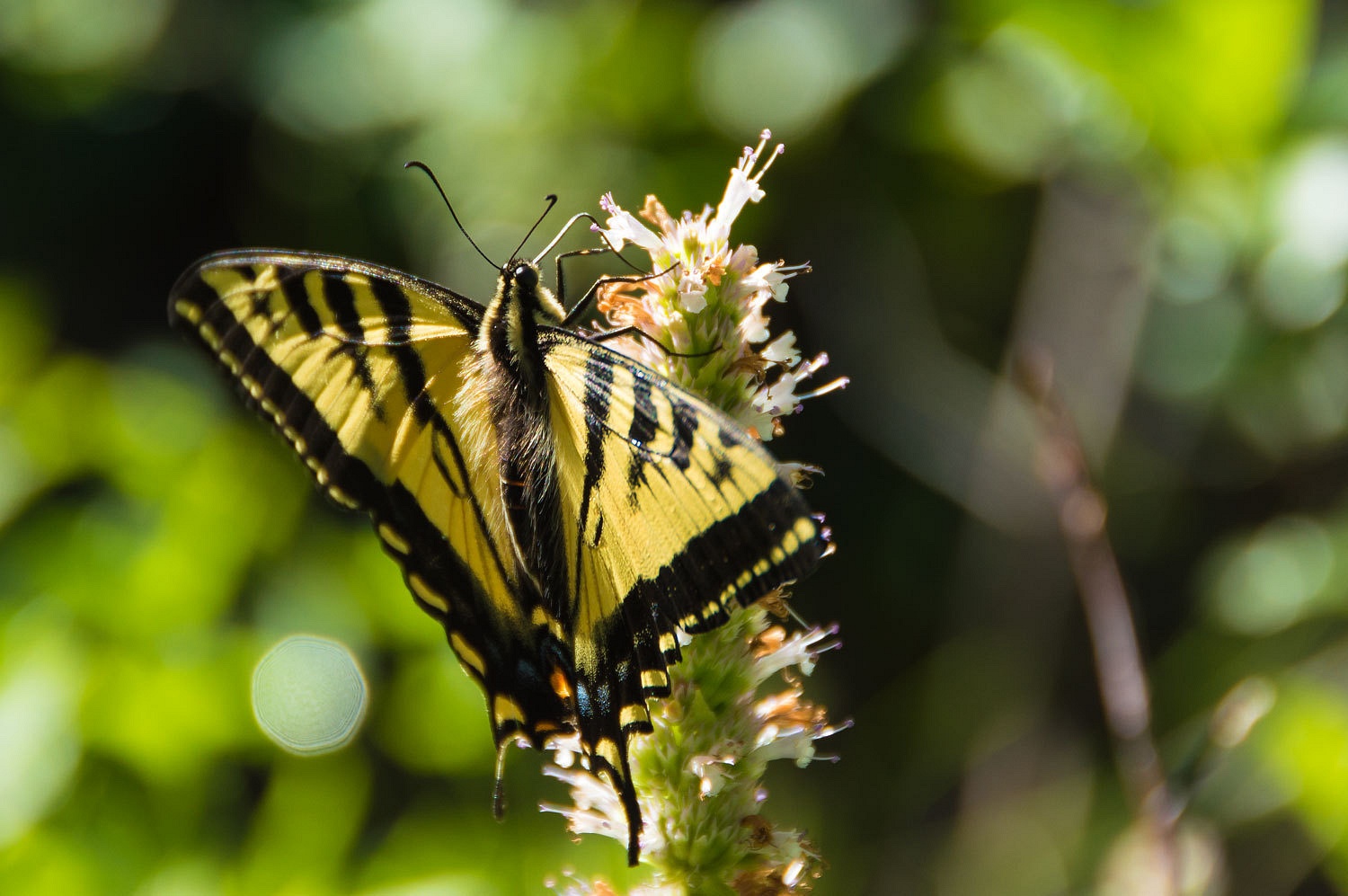
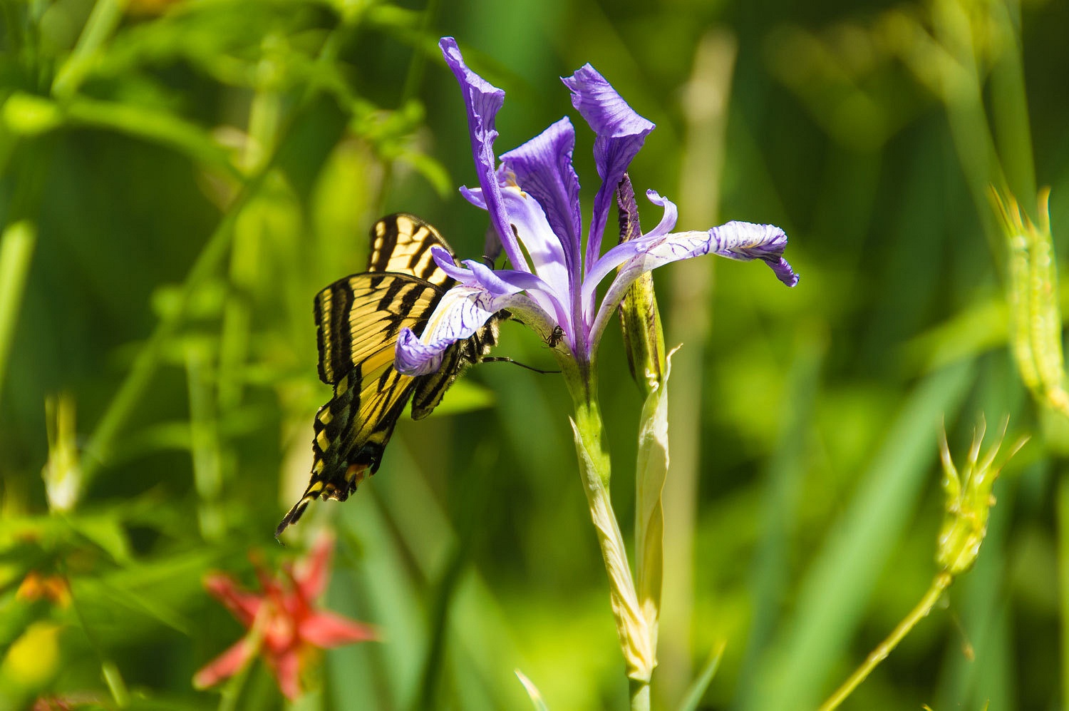
The Lady had to share the horse mint with
the busy swallowtails.
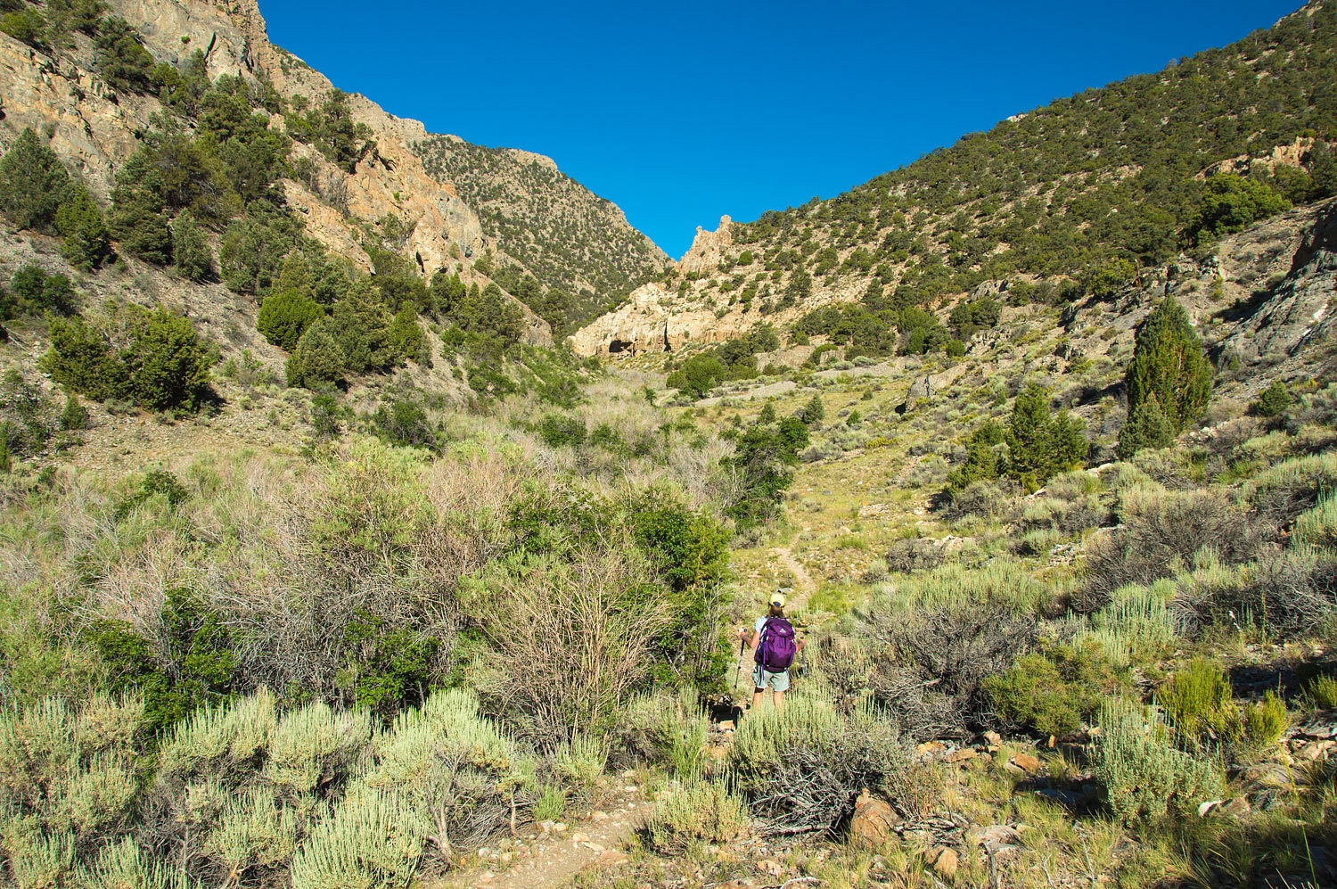
The trail ascended the canyon. We were
surprised to find trailwork had been done. Brush had been cut in areas,
widening the trail for stock. The leaves were brown on the discarded cut slash.
The Danville, NV quad shows a trail up to Clear Lake. We were surprised to find
that the trail disappeared at the fork in the canyon that leads to Clear Lake.
It had been so evident and now was gone. We knew it had to cross a fork of the
creek so we crossed early and then scouted the opposite bank for where the
trail crossed. Deep in the tangle, we found it. It was barely discernible as it
climbed a side ridge, not where the trail on the map ran. This trace gained
elevation and entered mountain mahogany. Here it traversed along the hillside
gaining elevation. It was, once again, neatly cut out and very evident.

It then left Clear Creek and continued up a
different fork and we lost it again at a spring.
We scouted the area and did not find any
trace of the trail to Clear Lake as shown on the USGS quad. We had taught a land
navigation clinic for California Department of Fish & Wildlife the previous
weekend. This looked a great little navigation exercise for the instructors.
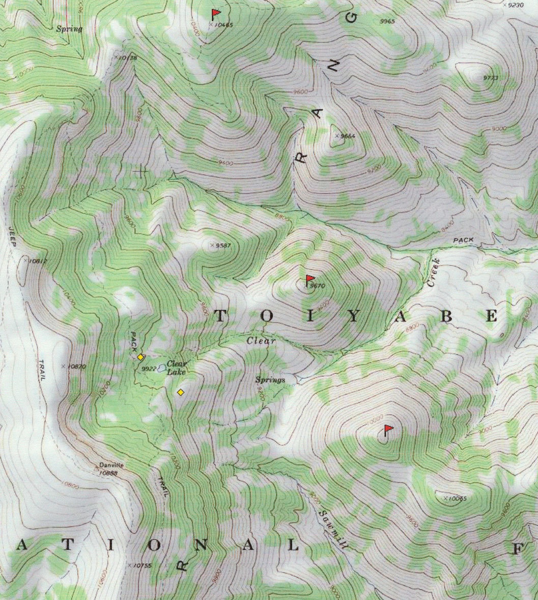
The springs were at 9100 feet elevation,
Clear Lake at 9922. That indicated an 800 foot climb. We had two prominent
points to the east (marked with red flags). One was 10240 feet in elevation and
the other, 9670 feet. We could use these to judge our position and elevation.
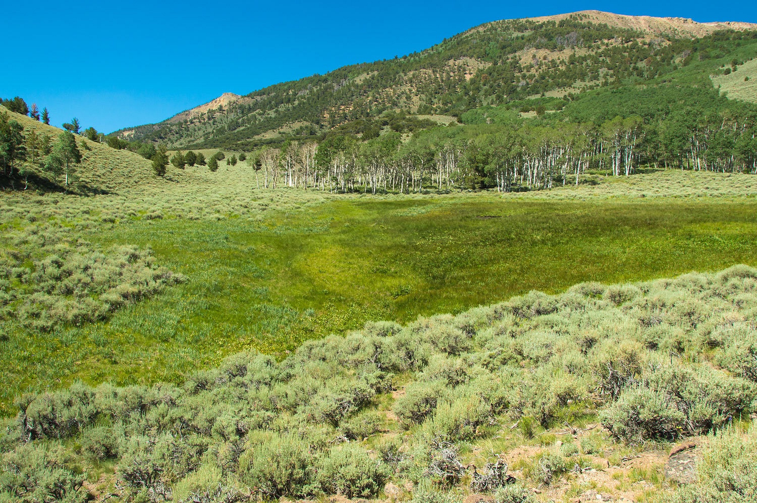
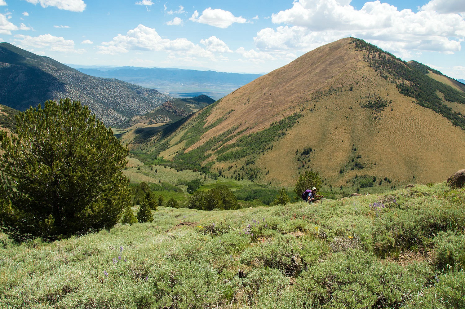
Our highpoint from two days prior was also visible to the north. The terrain was steep and open sage covered rocky slopes gave way to dense groves
of aspen. The mule deer and exploding grouse hung out just inside the aspen.
We reached the top of the slope (the yellow
diamond just south of Clear Lake - and we could look down at the top of 9670). We took in the view of the crest of the Monitor Range to the west.
We continued up until we were almost even
with the top of 10240.
Ahead was aspen, almost impenetrable aspen.
It blocked any possible view of Clear Lake. We decided we would continue west and
then circle to the north to see if we would intersect the pack trails shown on
the map. We found no evidence of the trails and came out on a small point in a
tiny opening (the yellow diamond to the northwest of Clear Lake). Here we
rested, snacked, and hydrated. We also greatly enjoyed the surroundings.
Magnetic declination for this area is
currently 13° east. Always honing your skills, it is amazing how accurate
you can get with putting an "x" on a map. For fun we fired up the
Spot and sent a message home to see where a gps gadget
placed our location ( it matched perfectly). We continued a broader search around
this area for the pack trails indicated on the map and again came up empty. We
returned to our packs, put them on our backs, and headed down in the direction
we determined for Clear Lake.
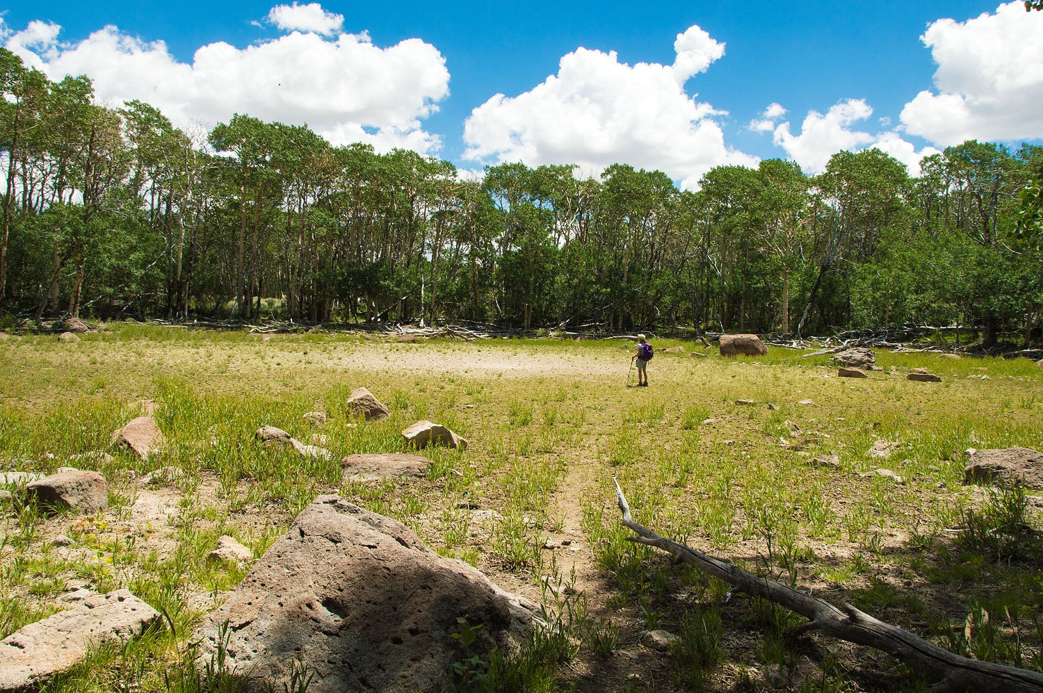
We were surprised there was a trail across
the dry lake bed. On the east side, in the aspen, we found an old campsite.
I ventured down the outlet, Clear Creek, to
look for any sign of a trail along the creek, as indicated by the map. I found
none and figured this would be the steepest descent along with much downfall to deal
with. We decided our search for trails was over and declared our quest for tiny
Clear Lake a success. We traversed downward to the south, dealt with some
thick aspen, and came out on the open slope we had ascended.
The views were magnificent. We took our time,
wondering if and when we would return to this special area. Although we figured
it would be raining by 5 pm, there was no reason at all to hurry.
We again intersected with the tiny, steep Clear
Creek and were in awe of the abundance of life and beauty.

We relaxed back at camp, our neighbors down
the hill had left during the day. The clouds built and our outdoor showers (at
5 pm) were from both the warm water we poured over each other and from the sky.
The Lady found one tick during the post hike check. It had not yet attached.
The thunderstorm passed to the north. Dinner was outside. We sat and quietly
watched night come amid our solitude, the best celebration.
Monday was for our return home. The Lady
enjoyed the morning sun reading while I slaved away cooking a special
breakfast for her.

I was surprised with her selection. No more
Nora Roberts or Danielle Steele? The week before this trip a friend had
recommended the book and dropped off his copy for me to read. The Lady saw it
and said, "I get it first!"
At the base of the Monitors we visited the
ruins of the old Clear Creek Ranch.
Our route home was to the north and over the
Monitor Range via Dobbins Summit. On the east side we stopped and gazed at the Miniature
Grand Canyon, as denoted on the map. I cannot spoil the sense of discovery for
you by posting a photo. I expect Nevada Buckaroo humor is involved.
We had only one last stop before hitting the
road home in earnest.

So many aspects of this trip really tugged
at us. It had been a wonderful trip.
Postscript - Concerning the trail work and improvements in the Clear Creek drainage, I suspect this is done by a outfitter and hunting guide. Sections of the trail are intentionally missing to make it hard to follow. I figure if we had continued up from the springs to the saddle above the Clear Creek and Sawmill drainages we would have found a campsite used during the fall big game season.