
please remember you can click on a photo to see a larger version
The rain
drove us inside. The thunderstorm unleashed its wrath as we drove south from
Topaz Lake on the Eastern Sierra's highway 395. Waves of wind driven rain
pelted us and rocked the truck. Dark clouds swarmed above and punctuated their
presence with bright flashes of lightning. We wouldn't be eating dinner outside
in Walker Burger's nice garden setting.
Walker,
California's Mountain View BBQ was a worthy alternative with their small
cluttered inside dining area. Ramping up for the busy summer season, there were
two new young women working as wait staff. The usual sharing stories and
chatting with the owner will have to wait until quieter times. The Lady enjoys
the grilled chicken sandwich with a side of artichoke rice. As is the norm, I
go for the brisket, smoked for hours and hours - real barbeque - and a side of
fries, the kind of fries best served on a paper towel. Hot and greasy and they slide
down the gullet with terrible ease. This is not our usual dinner, but every so
often it is wicked fun to give into the devil's temptations, especially on a
stormy evening. We would do our best this trip to burn off all this fuel.


We were heading for the center of Nevada.
Our route turned from 395 to 120 east from Mono Lake. As we drove, we watched
the northern end of the White Mountains - The Jump Off, Montgomery Peak,
Boundary Peak - disappear into storm. A black beast was devouring it from the
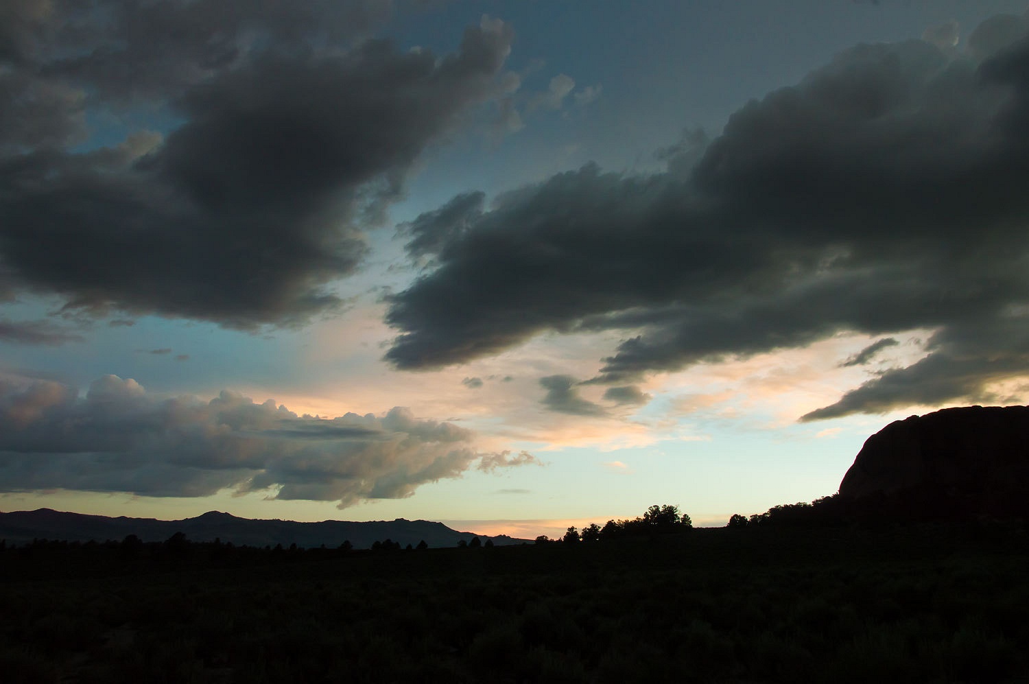
east and working its way toward us. We set up for the night in one of our
favorite dispersed campsites off of 120. This was our fleeting view of sunset
to the west.
Laying in our comfortable bed we watched the
sky continuously brighten up to the north with flashes of lightning. Counting
the seconds from flash to boom, two miles away was the closest strike. The rain
against the roof edged us into sound sleep.
We were repeating our drive east on highway
6 we did over the Memorial Day Weekend into Jack Longstreet country. We left
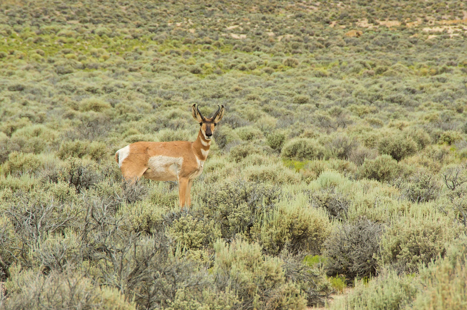
the pavement when we turned north into Stone Cabin Valley. The critters were
waiting for us.
Feral horses.
Pronghorn.
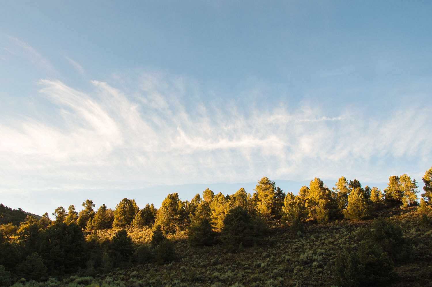
This trip we wanted to stay on the Monitor
Range's east side and connect roads up that would take us into Little Fish Lake Valley. Our Tonopah
District USFS map showed an unimproved dirt road (parallel dashed lines labeled 4WD)
up over Eagle Pass. The two track left the sage plain and entered the pinyon
and mountain mahogany as it ascended a sandy gully. We weaved around in tight
turns around the encroaching trees. We pulled both side mirrors in. This was
Nevada Pin Striping in full glory. The Lady followed our progress on the USGS 7.5 quad.
"The quad map has a different description
of the road now," she relayed.
"Yes?"
"Just below the summit it turns into a single
dashed line trail. I think we are on that now," she explained.
"Let's make it up to the pass and
evaluate," I said.
The opposite side of Eagle Pass was a steep
rocky gully, any resemblance to a road had passed. We walked down a ways and
evaluated and made the wise decision.
"Plan B!" we said in unison.
The tight confines of the rugged road adorned
our camper with its first real "character marks", gouges in the aluminum siding.
Plan B was over to the west side via Barley
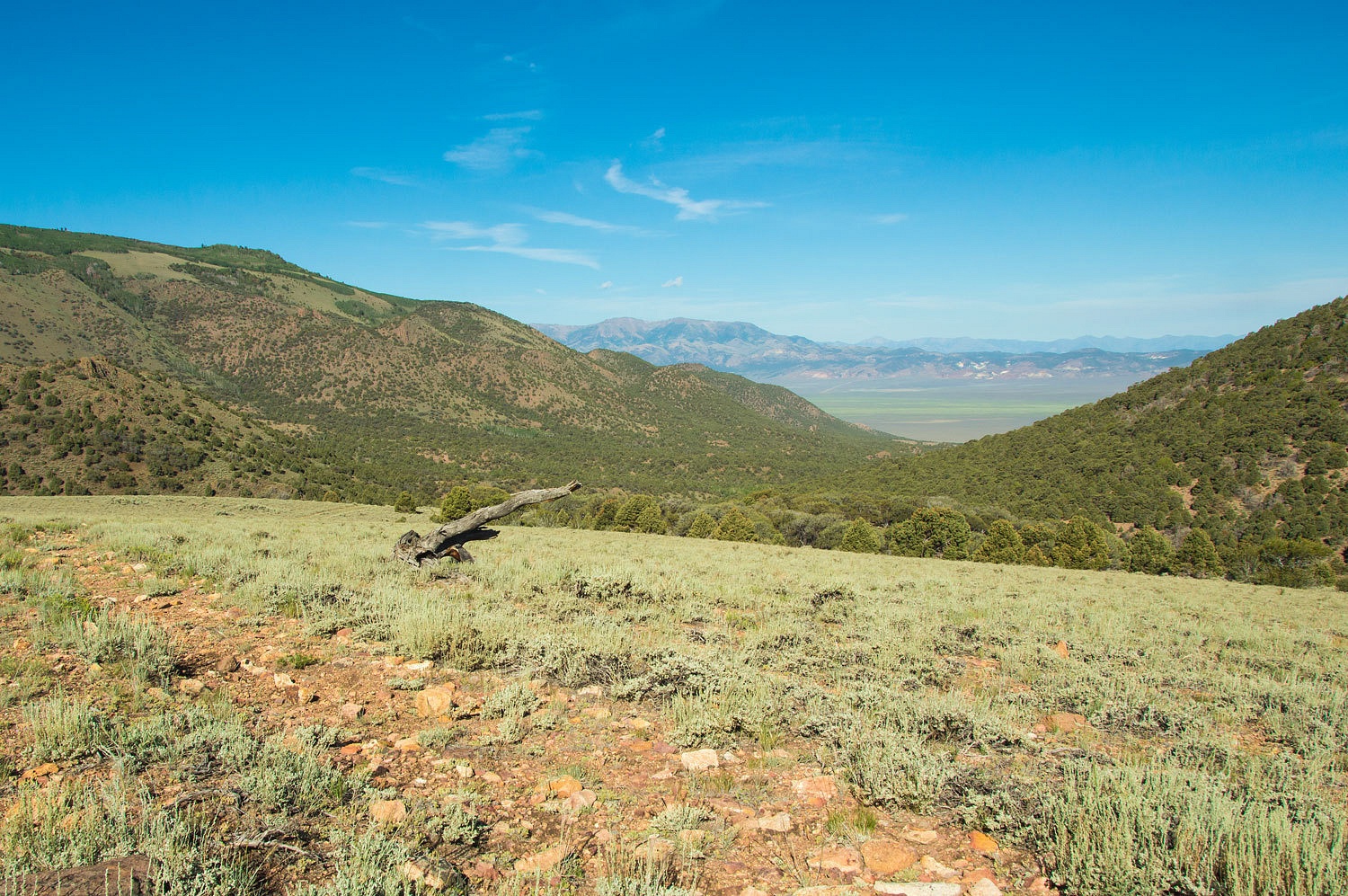
Creek Summit. The Table Mountain Wilderness straddles the crest of the Monitor
Range. Our plan was day hikes into this remote, seldom visited, Nevada treasure.
Several primitive trailheads provide access from various directions. The Barley
Creek trail parallels the summit crest and has probably the most developed
trailhead sporting a CXT toilet and stock area. I believe most of the use comes
in the fall with the big game hunting season. The second largest bull elk taken
in North American was in the Table Mountain Wilderness.
After checking out Barley Creek Trailhead, we made the
decision to head to the Morgan Creek trailhead as this looked like quicker
access to high country. We set up camp along the edge of the empty, primitive,
unsigned, trailhead. Our evening walk was to "Big Park", our happy
habit of finding an open high point where we may see large mammals.
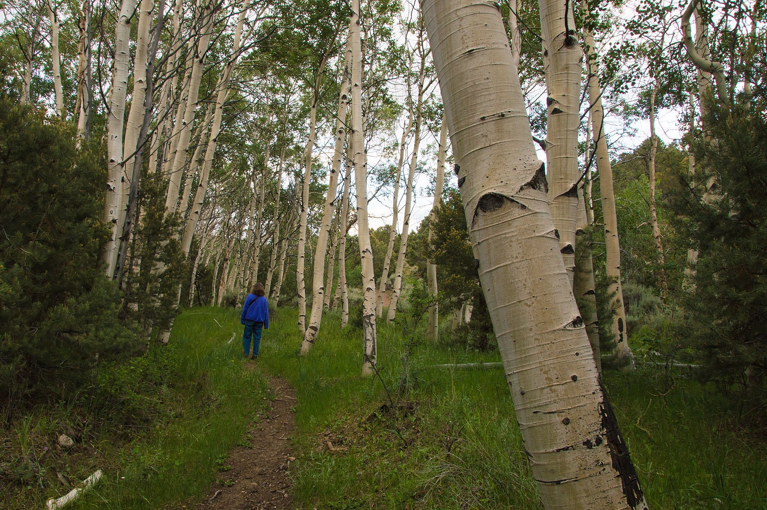
We climbed up through aspen. The Monitor
Range is noted for expansive groves of aspen.
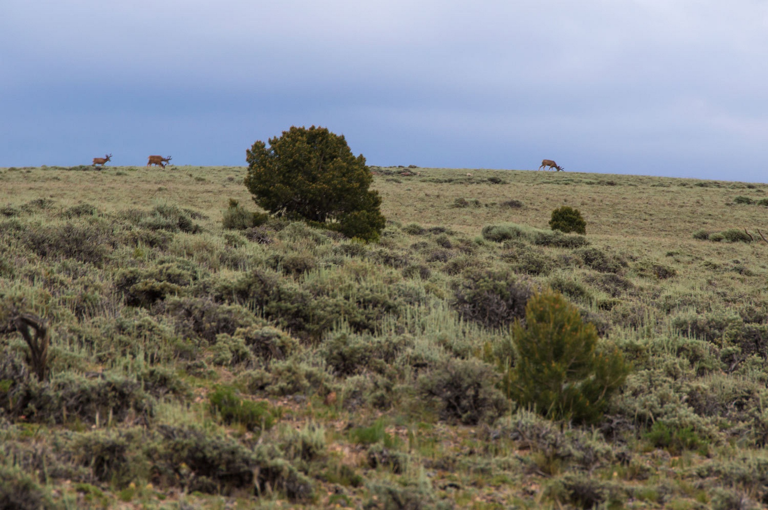
Four huge mule deer bucks moved along the
broad open sage ridge line above us. "Big Park" was working.
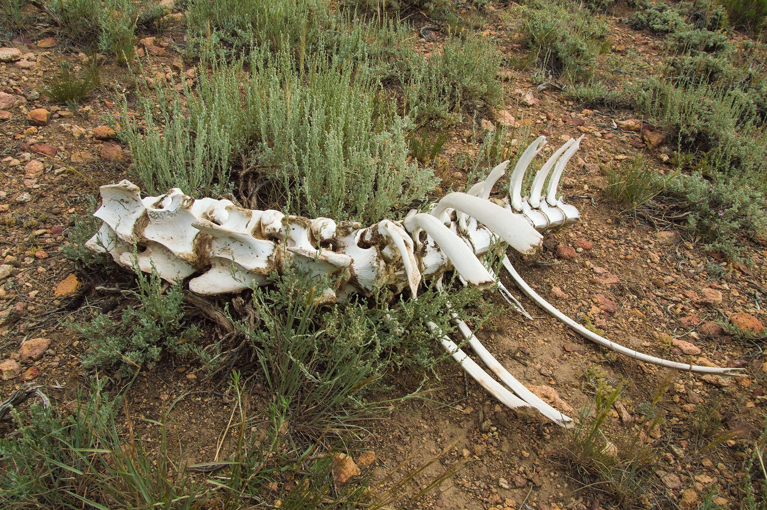
We came upon the remains of an elk and
pondered awhile, wondering if the more massive cervical vertebrae (compared to
the thoracic) indicated a bull. Were they larger to carry the big racks and do
battle for breeding rights in the fall rut?
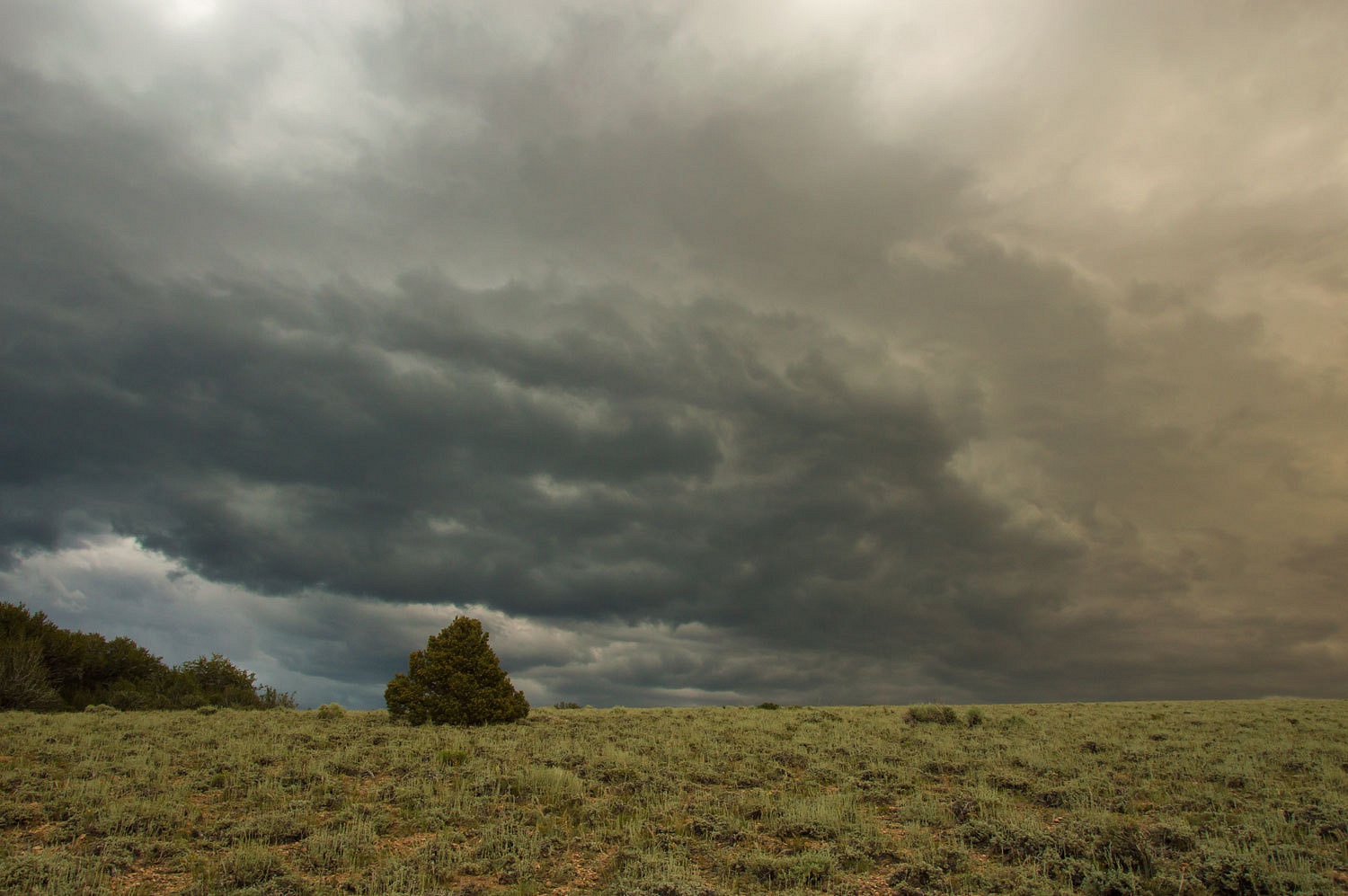
Night was coming as the light dimmed in the
west, fading over the Toquima Range and then the Toiyabe Range further out.
Storm clouds were heavy and producing veils
of rain to the east.
We slowly walked back down toward camp as
the storm developed behind us.
We timed it just right and reached camp at
dark just before the rain. Rain against the roof, again edged us into deep,
peaceful sleep.


Allow me to back up a bit. We were welcomed
into camp at Morgan Creek Trailhead, as we set up, with the alarm call of a
raptor. With the "see mores" we located a large bird in a tree top
just below the ridgeline above, too much of a distance to make an good identification.
Comparing the calls of hawks on our ibird pro app, the match was Cooper's Hawk.
Three ravens were harassing the hawk and it took flight. The harassment
continued until the silly ravens allowed the hawk to get above them. The
Cooper's Hawk then had the sky all to itself.
This area is rich in bird life. The raven's
started in at five am the next morning. Shortly after the robins got going. The morning symphony
was beginning. The calls of flickers filled in from surrounding hill sides. A
hummingbird buzzed by several times. Up the hill was the soft cluck of a blue
grouse. Always in the background were the cries from the nearby clutch of
red-naped sapsucker chicks, safe in their cavity nest. The parents would
silently arrive and the cries would burst to a crescendo and immediately fall
away as they consumed their meal. I enjoyed my coffee and closed my eyes and
listened. The pureness of the music sank into my bones.
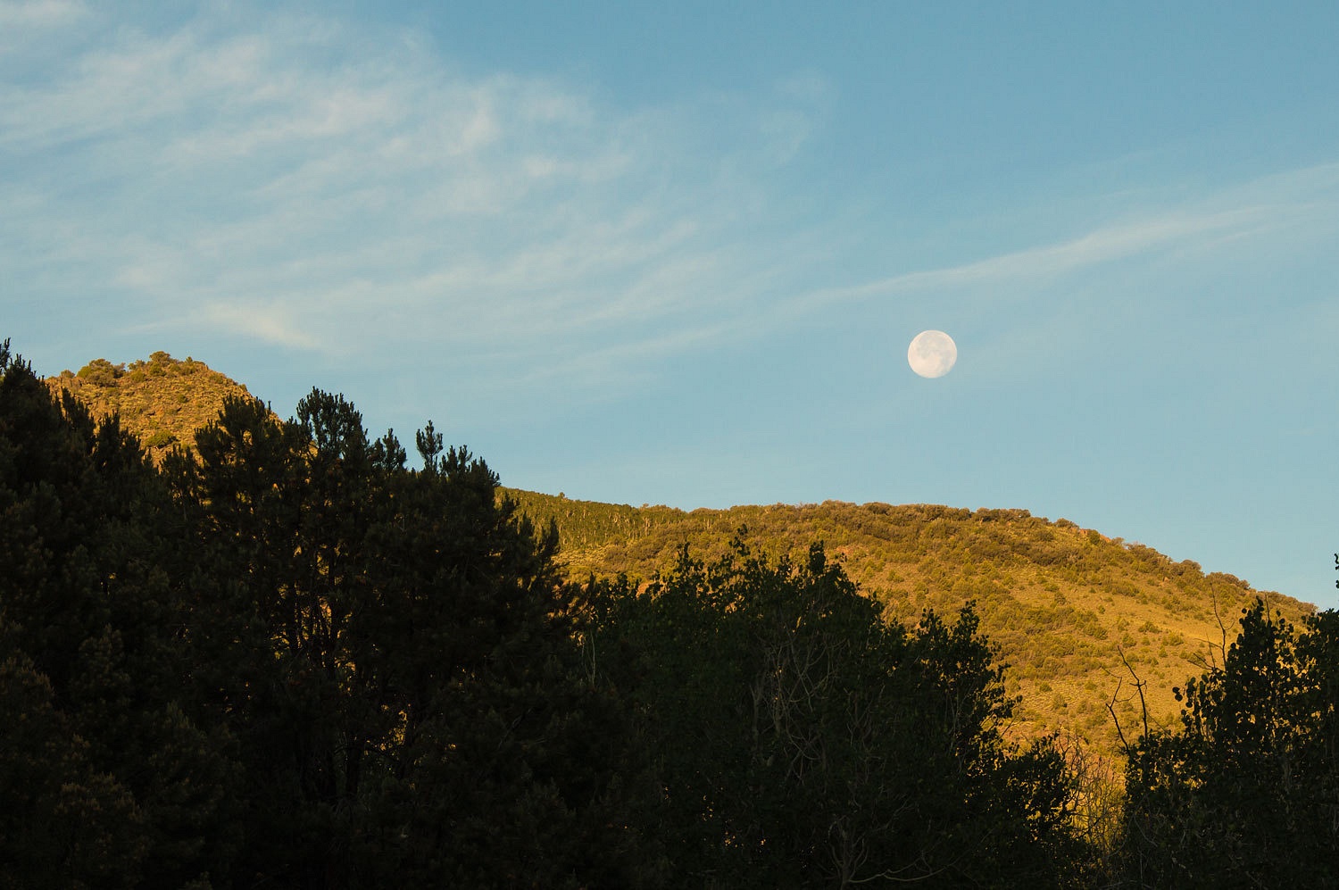
The setting full moon was also our company
this wonderful morning.
The sky was nearly cloudless as the sun
rose.
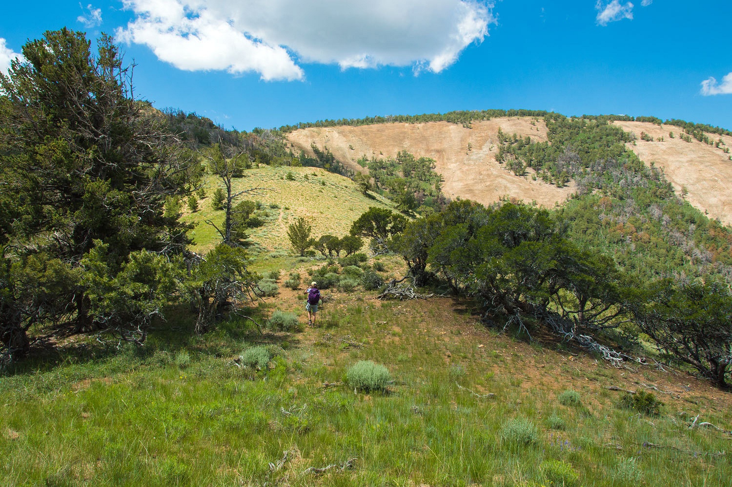
Today we were hiking into the Table Mountain
Wilderness and this is real wilderness. The trailhead was unsigned, as was the
trail. Insofar as navigation or landmarks, we were on our own - just the way
we like it. And, we were completely and
utterly alone. Around the first screen of vegetation, the Wilderness boundary
was marked.
We were soon back up to "Big Park"
from the night before.
"Where are the 'big boys'?" The
Lady wanted to see the big bucks again.
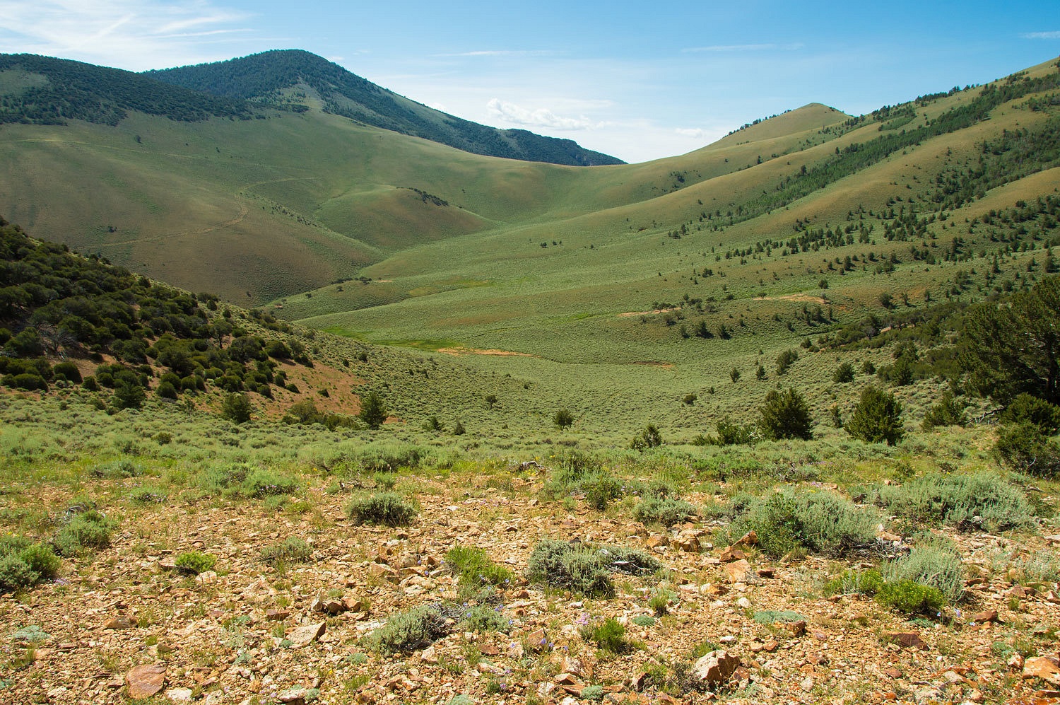
Dropping over the first saddle brought us
into Morgan Basin.
The area was covered with elk sign. This
must be a good early season stop before heading to the mountain tops for the
summer.
Every riparian area held an abundance of wild
rose.
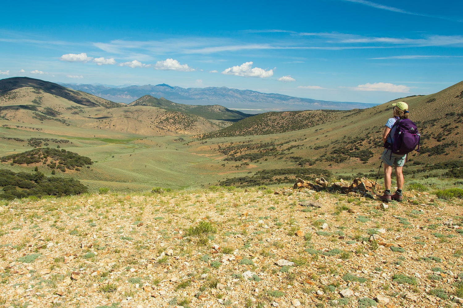
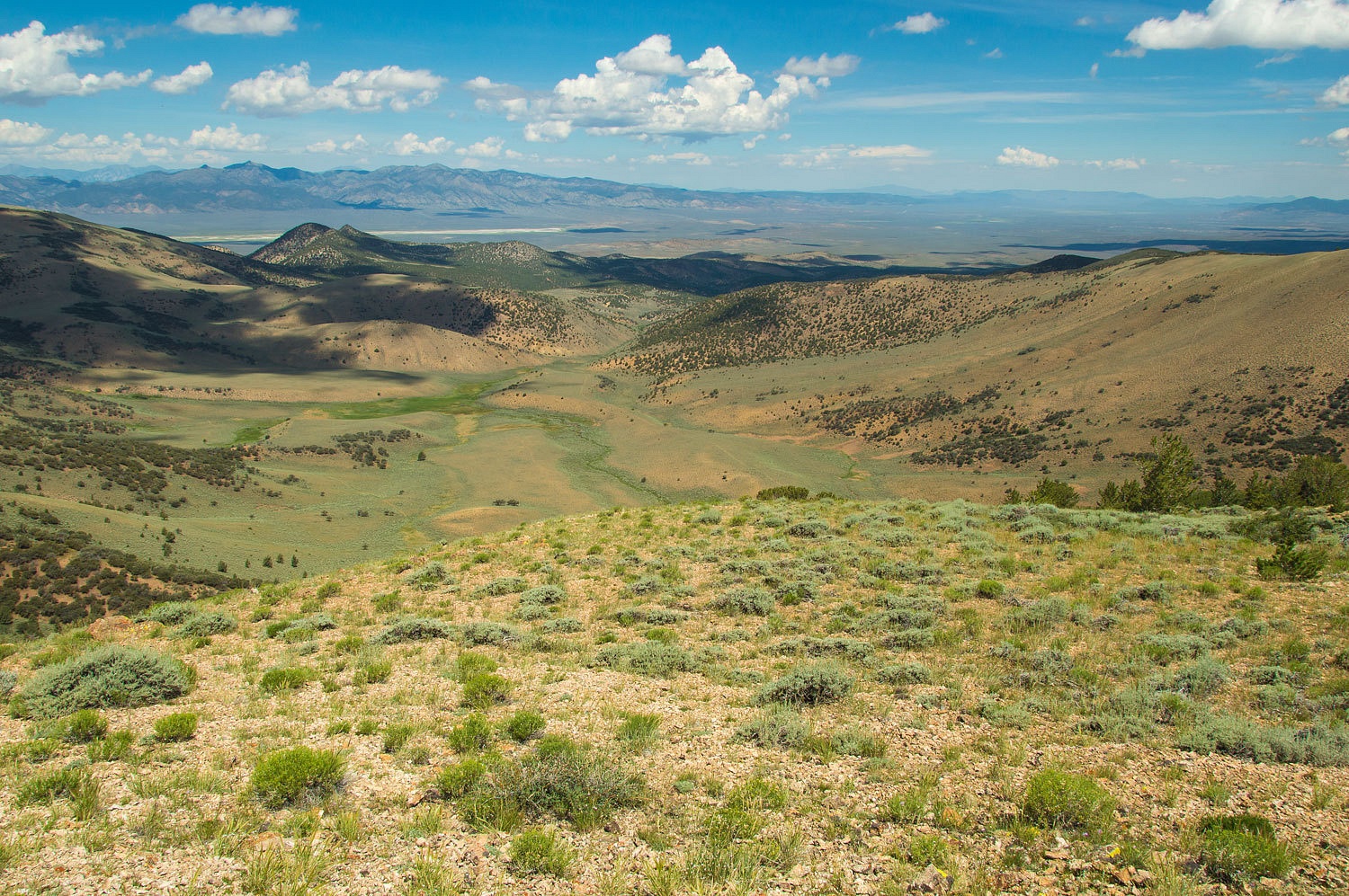
We aimed for the saddle, above, in the crest
of the Monitor Range. Morgan Basin stretched out below us with the Monitor
Valley and the Toquima Range in the distance.
On the opposite side was the Tulle Creek
basin draining the east side of the Monitor Range.
A large blue grouse hen without chicks soft
clucked its way up the ridge as we sat and took in the view.
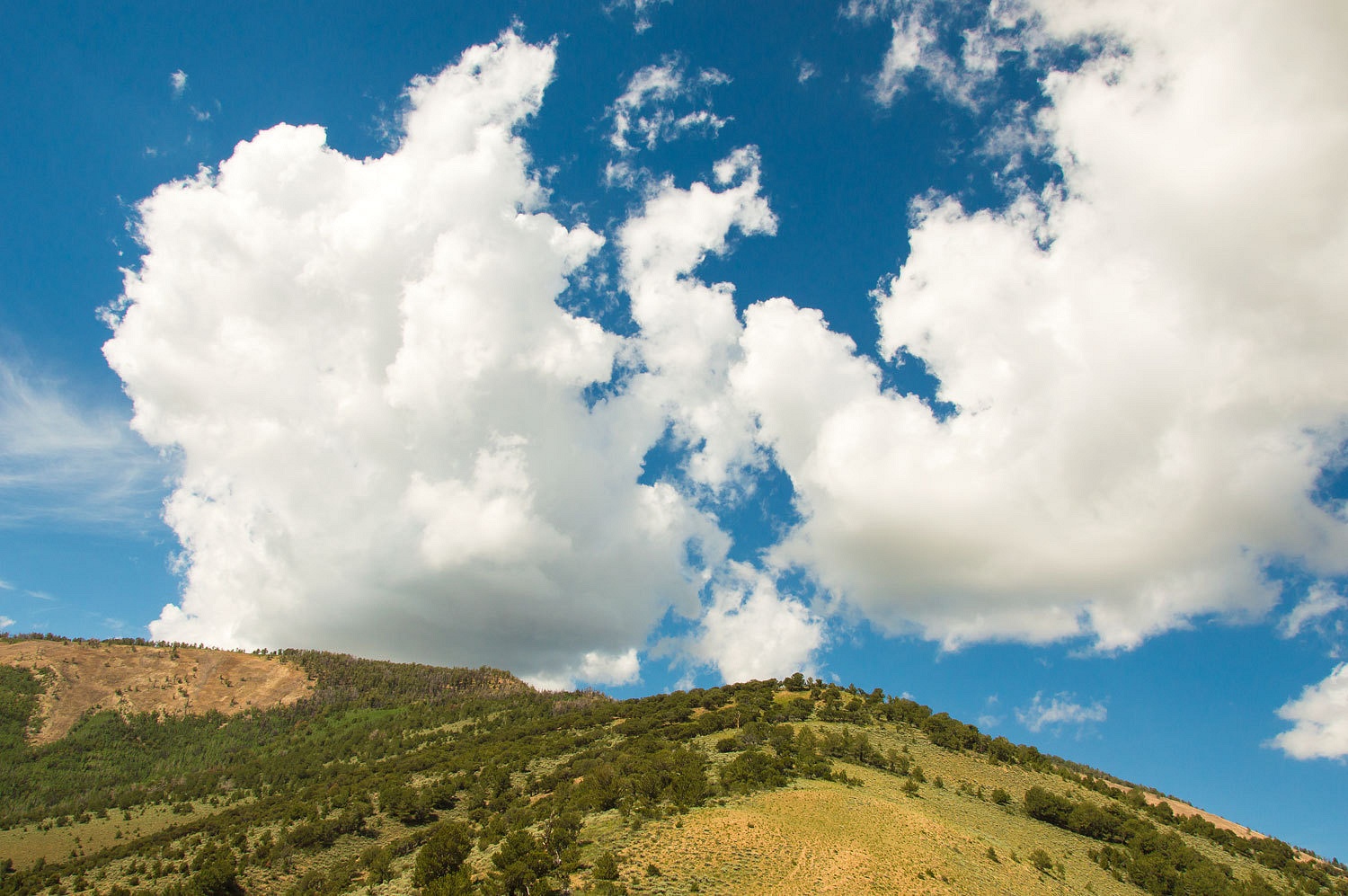
The clouds were also starting to build.
I knew exactly what the Lady wanted. I
thought I'd beat her to it.
I asked, "Want to go to the top?"
I looked up the ridge to the west. "I expect we could climb to the crest
and then follow the ridge to where it makes its turn to the south. From there
we should be able to drop down and make a curve back to the north. It will be
steep as the topo indicates."
"You want to do that?" she asked. "Let's
go!"
The views expanded as we climbed.
Cresting one peak, we dropped into a saddle
and began another climb. The top lay before us, to the far right.
We booed out a few large mule deer does.
They would crash a couple of bounds away and then turn and look at us.
"Exploding grouse" are always a surprise. Almost underfoot, they
finally make their break in a thunderous and sudden explosion of wing beats. We
saw - and experienced - several blue grouse.
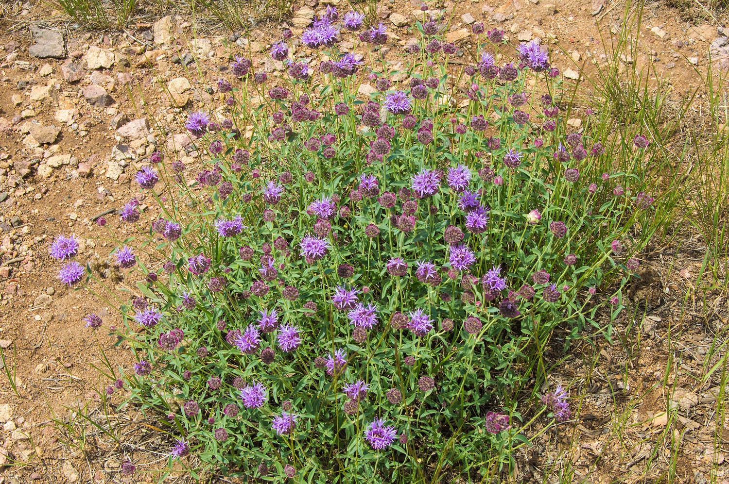
The Lady loves mint. She ran her hands through the leaves, held her
hands to her face, and drank in the scent, close to utter ecstasy. She'd be happy to
remove her clothes and rub it all over her body if her priority was not getting
to the top of the mountain. This is
coyote mint. When we reviewed the day's photos in bed this night, upon seeing
this photo she said, "I wish that was a 'scratch and sniff' picture!"
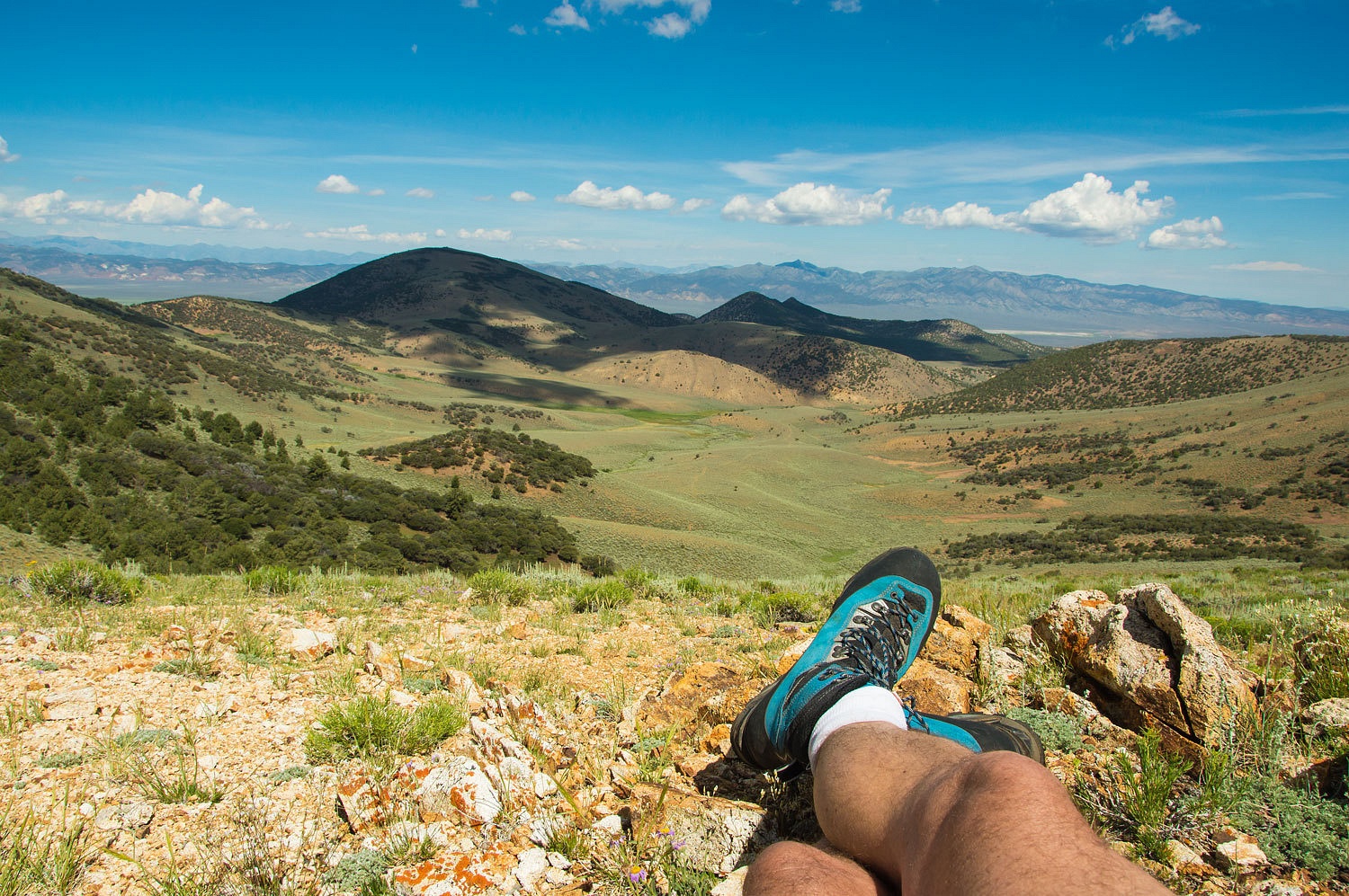
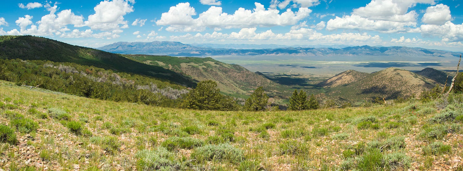
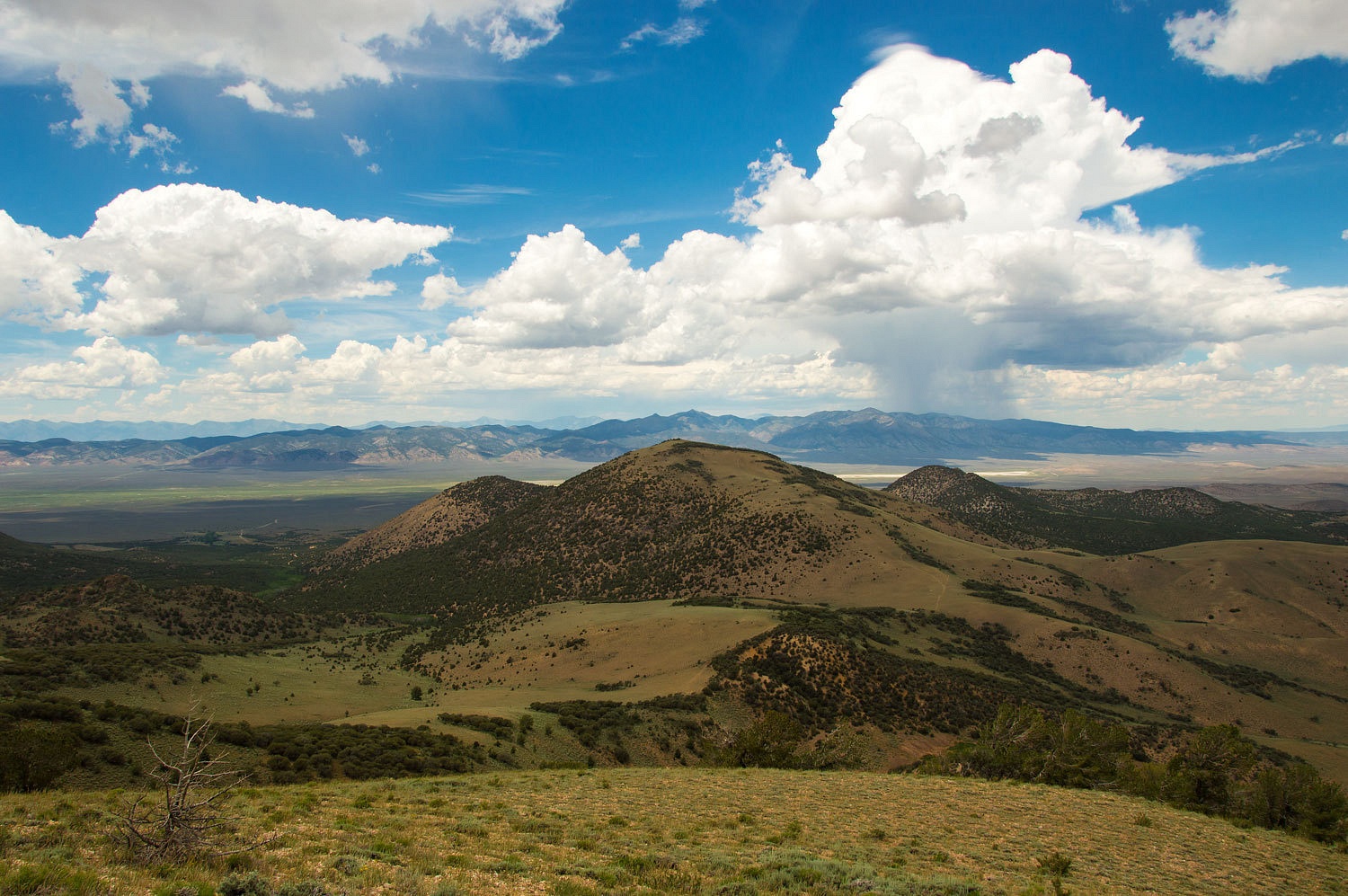
We reached Point 10465, the highpoint of
this section of the Monitor's and looked down Morgan Creek drainage on the west
side. Our camp is down there at the end of the road in the aspen (upper right
quarter).
Along the ridge we found short pieces of a
long forgotten cowboy trail. We also used pieces of game trails. We were up in
the range of the white pine family trees and the hordes of Clark's Nutcrackers.
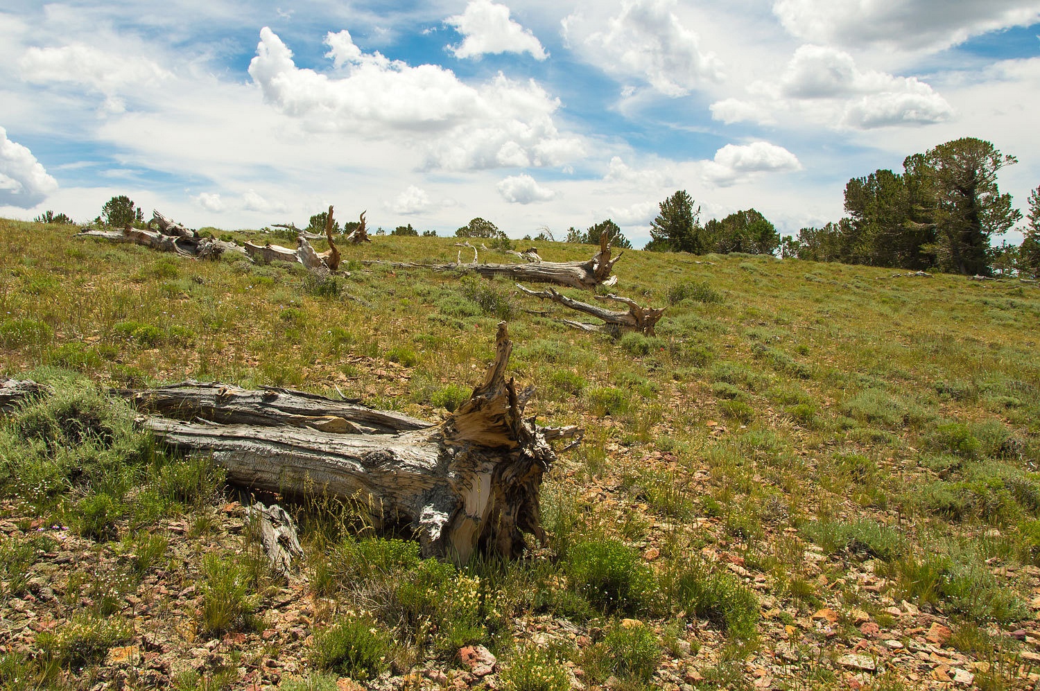
We felt we were constantly being scolded. The aspen groves were almost impenetrable.
It was clear the Monitor Range does not receive the crushing snow load the
Sierra Nevada Range gets.
We sat and enjoyed this place.
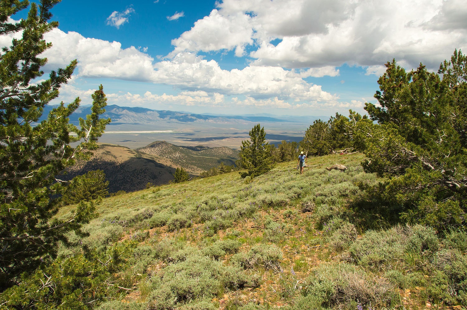
We took a break from our idleness and hiked
to get a view to the south along the flat plateau of the Monitor Range.
Below us was the pass from Morgan Creek
basin over to the Clear Creek drainage on the east side with the east side of
the plateau above.
We planned to make this our route of our
hike the next day - up and over the pass and then continue south along the
range to find the tiny Clear Lake.
It was now mid day and we kept our eyes on
the clouds.
It was time to start down. Moving north from
where we had left and then retreived our packs, we watched a large four point
buck stand up from its bed just 25 yards below us. It had probably been there
all the time we were in the area and had only moved when we came above it. We needed to
descend the steep north slope. Reaching our drop off point, we watched a thunderstorm
over the Toquima Range.
We moved slow and easy on the steep ground
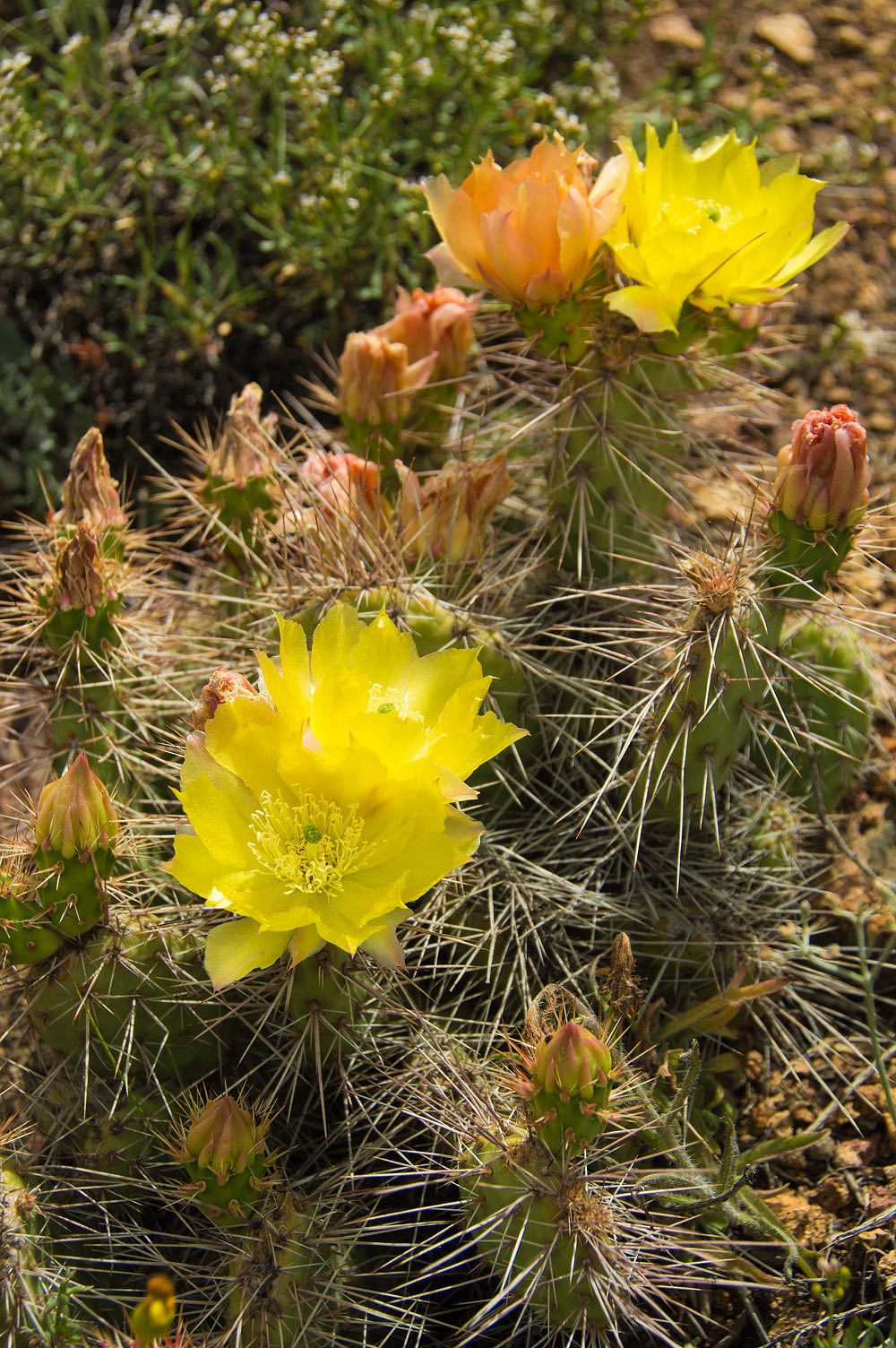
and thoroughly enjoyed traveling through this country. On the lower slopes,
near where we intersected the trail in Morgan Basin, we marveled at the cactus
blooms.
We could not have wished for a better day.
The weather was perfect, the solitude complete, the terrain a delight, a nice navigation exercise, along
with almost continuously interacting with wildlife. We are so lucky to have
days like this.
Our adventure continues in Part Two - please Click Here
No comments:
Post a Comment