
"Have
you heard about Jack Longstreet?" Mom Spider asked one morning on our
winter trip to Death Valley. Devouring everything Death Valley, the Spider's
night time reading on the trip was Lingenfelter's Death Valley & The Amargosa.
"Yes,"
I answered, "I've read a bit about Longstreet. Some people think of him as
a kind of western hero."
"Hero?"
Mom snapped, "I'm up to about nine men he killed in the book! Hardly a
hero!"
I could tell
Mom Spider is not endeared with killers.
"He
outlived them all. He died at 94," I continued during our breakfast
conversation. "I suspect he was like an old time killer in Wyoming John McPhee
mentions in his geology book, Rising from the Plains. The killer was tolerated by the community because
he 'never killed anybody that didn't need killing.'"
This
Memorial Day weekend we were heading back into Nevada and Longstreet country.
Perhaps we would encounter his ghost.
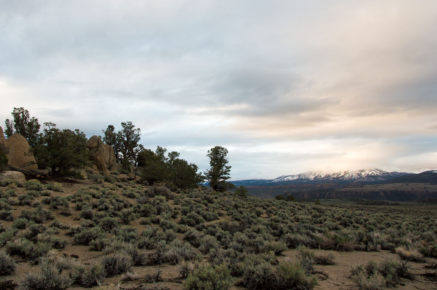
After a
quick dinner Friday evening in Walker, CA on highway 395, the lengthening daylight
as we move toward the summer solstice allowed us to reach a new campsite for us
east of Mono Lake off of highway 120
before nightfall. Next to a granite outcropping, it is a wonderful dispersed
spot.
Rain
splattered on the roof off and on overnight but we woke to a dry but still
cloudy sky. The sun momentarily broke through and lit up cloud enshrouded Glass
Mountain to the south.
We wandered
around the granite as we enjoyed the quiet sunrise.
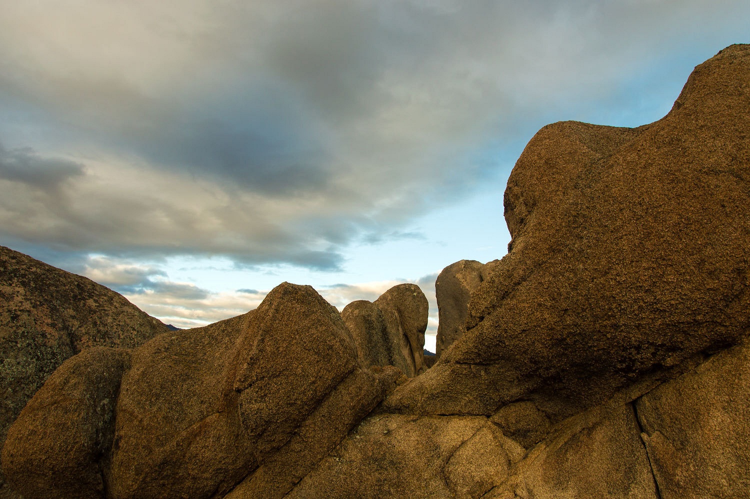
We are
enjoying exploring this area between Mono Lake and Benton that alternates
between granite and volcanics. This morning the delicious scent of wet sage
filled our lungs as the sun worked at eroding the cloud cover.
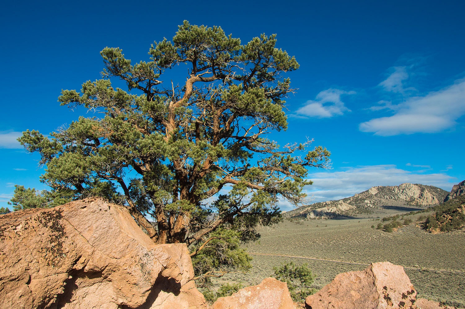
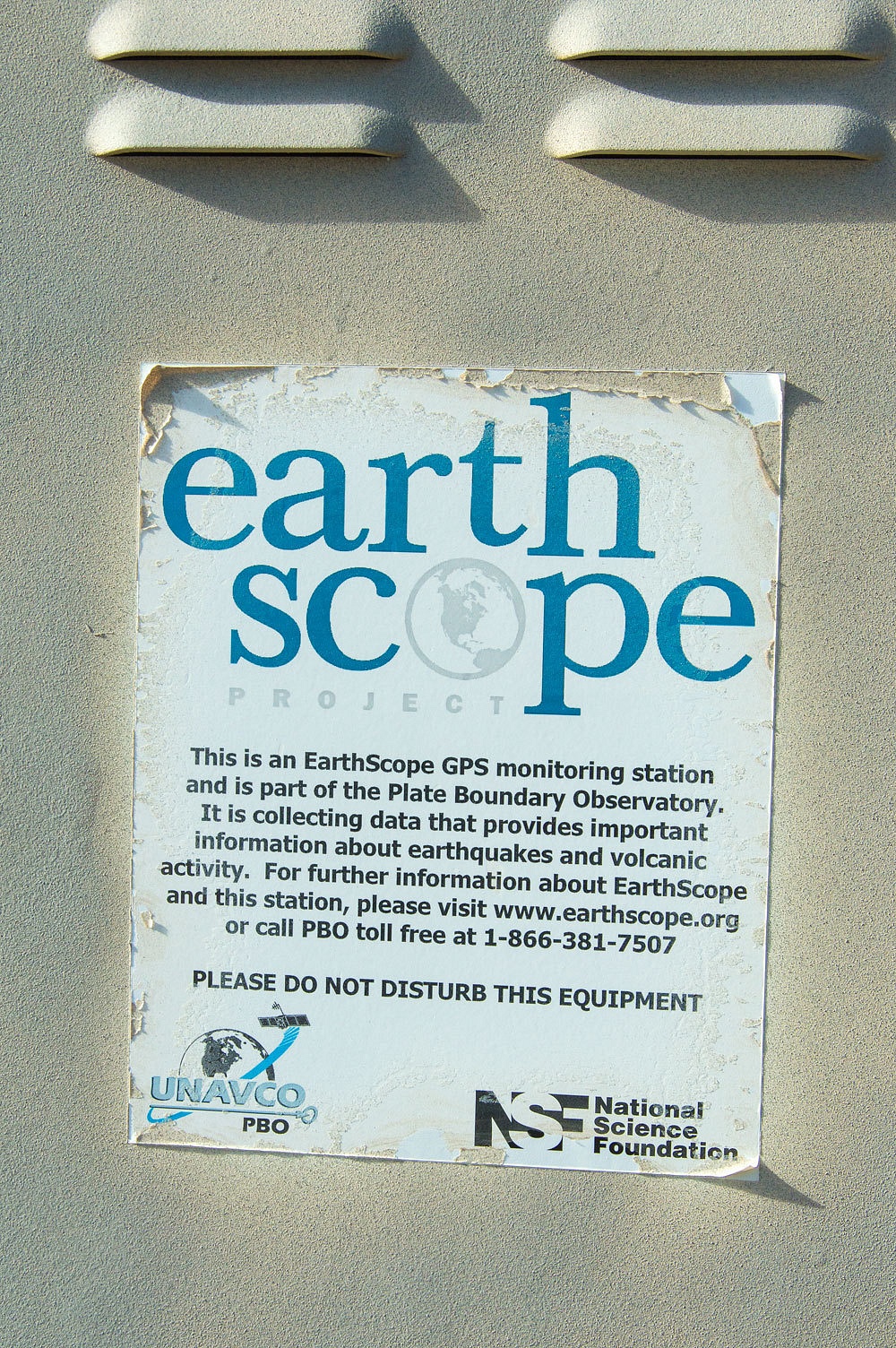
After
recently reading about the EarthScope GPS stations, we were surprised and
excited to discover station P649.
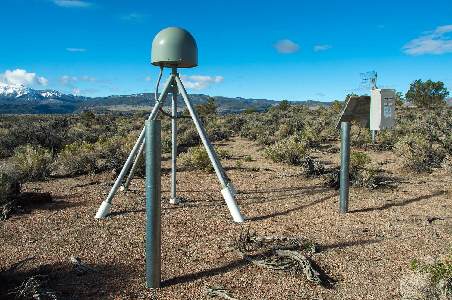
The precise
measurements capable with these stations have determined (among many other
findings) that the North American Continent is moving west at about three
inches a year as it over rides the Pacific Plate.
We had rain
and thunderstorms at home and this weather trend was predicted to continue over
Nevada for the weekend. The road was wet with much standing water alongside as
we approached Tonopah on highway 95. It must have been a good downburst.
Traffic just about disappeared as we headed east. Traveling highway 6 this
holiday weekend, we could count the number of other vehicles we encountered on
one hand. With the storm washed air the skies where glorious and the vistas
seemed without limit. We ran in and out of a couple small storms before we
reached our turn off to the north.
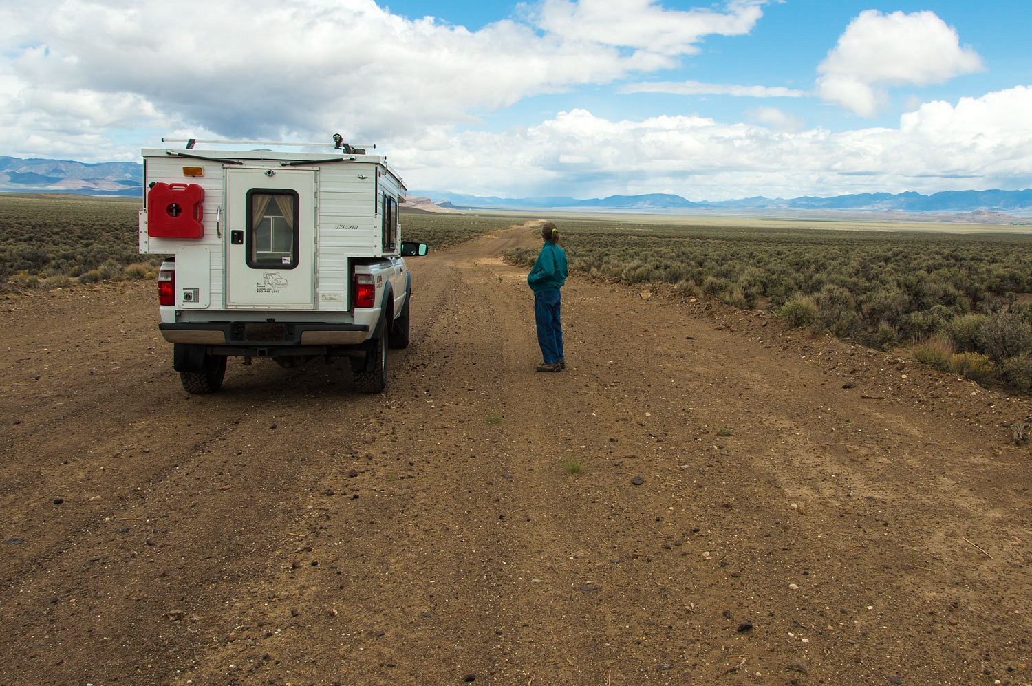
We stopped
and admired the view up Stone Cabin Valley. The Lady was our navigator and
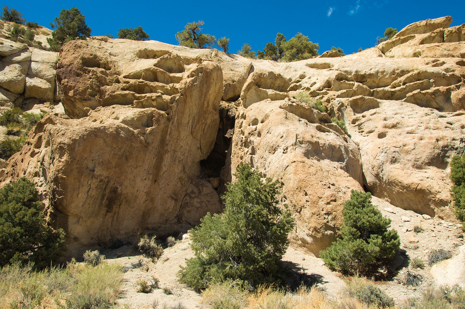
pointed out the landmarks as we drove. We stopped at Point of Rock Spring.
Point of Rock is a large outcropping with numerous possible shelter sites. We
climbed.
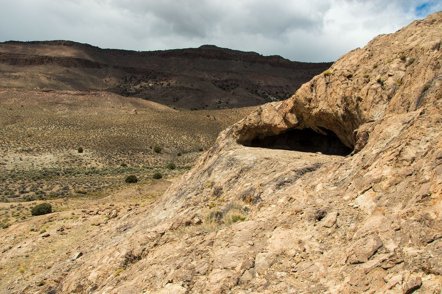
The dominate
shelter held signs of many ancient fires with a blackened roof and a few stone flakes
littered the ground outside.
We admired
the broad view from this high spot.
Our next
stop was one of the main objectives of our exploration - Longstreet's Ranch up
Longstreet Canyon. We continued up the eastern flank of the southern Monitor
Range and located the faint two track heading up to a canyon. There was no sign
and the Forest Road Number was long gone. Our android pad with the Backcountry Navigator
Pro app is a valuable tool to confirm intersections and roads. We have found it
works very well at pinpointing our location on the, very familiar to us, USGS
7.5 topos. We also carry the Forest and BLM maps for road numbers and updates
to roads since the date of the USGS quad. The road was rough with very tight
bends around rocks and trees. In one place it was nearly washed away where we straddled
a narrow gully. We entered the canyon and the road was impassable, so overgrown
that we had to duck under pinyon, junipers, and alders as we hiked the rest of
the way.
We backed
and maneuvered the truck into a small clear spot off the road. It took some
work to extricate it without damage from under the pinyon that finally stopped
forward progress. You have to be careful coming back out against the grain of
the branches.
The storms
that had circled us all day were now coming together under a uniform dark sky. By
our estimation it was a mile and a half to two miles up to the ruins of Jack's
ranch. We decided to change out of our cotton traveling clothes into real clothes.
We booted up and added food and water bottles to our packs. Even on short
hikes, it is good to be prepared. We go nowhere without the ten essentials and
are always ready for an unexpected bivouac.
The rain
drove us under a dense pinyon for shelter after about a half mile. The camera
was stowed in my pack. Raingear went on
us and rainflies went on the packs. This was going to be a wet hike. When the
canyon widened and became a riparian jungle, we figured we were close.
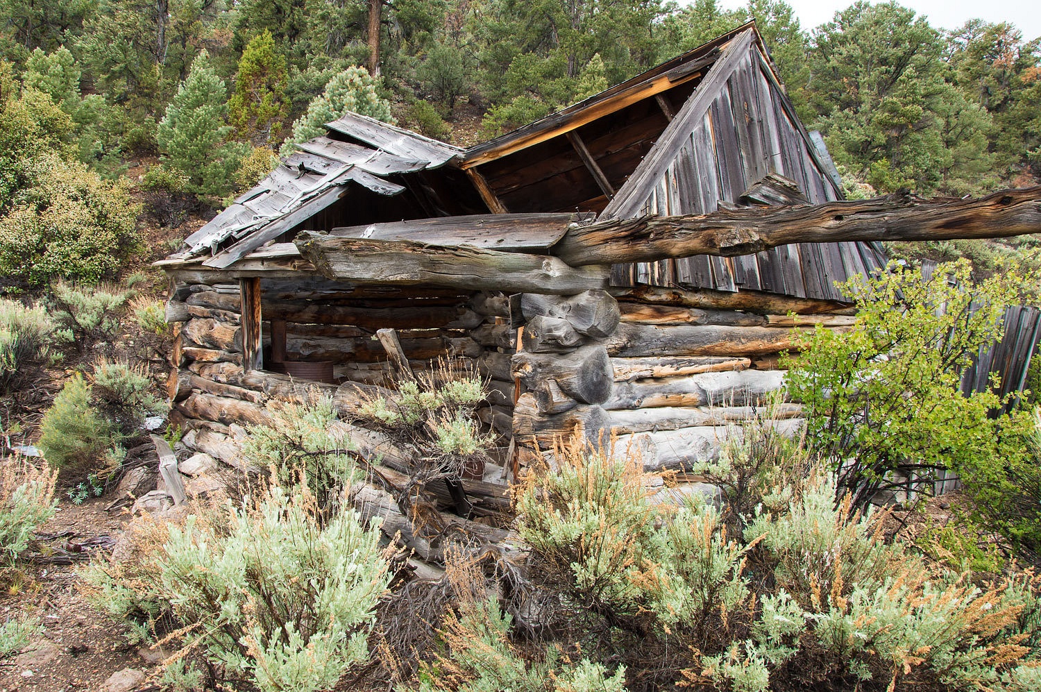
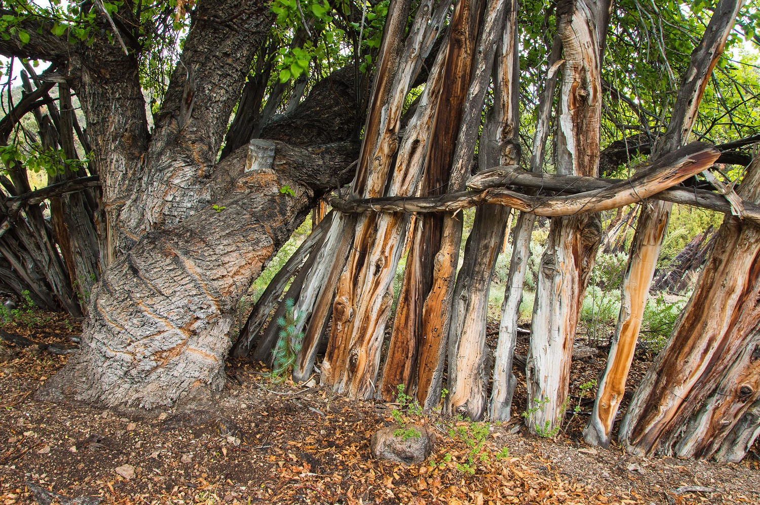
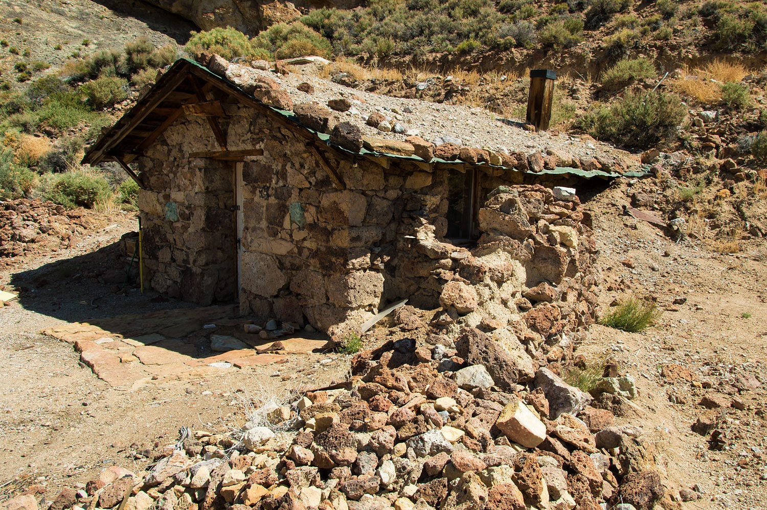
We took
refuge in the remains of Jack Longstreet's shed and watched the rain come down.
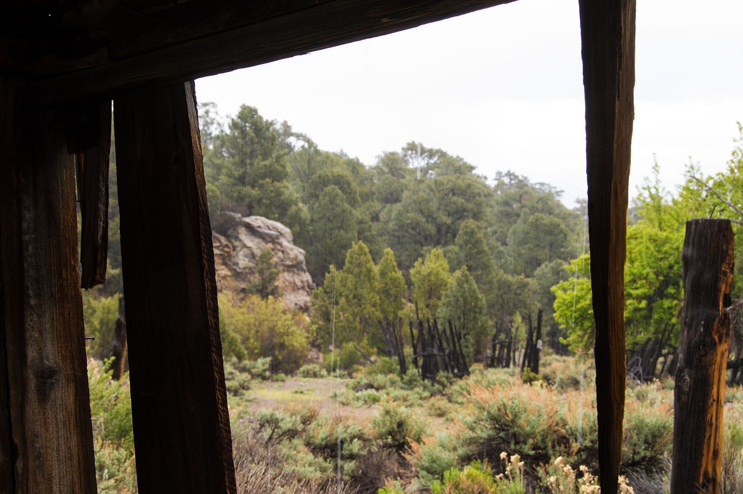
Although
listing badly, the roof was intact and we were dry. We pulled, shook the rain off, and hung our
coats on nails. We put on our wool shirts and gloves. The quiet downtime gave
us an opportunity to listen and reflect. Vertical walls of what appeared to be
volcanic tuft lined the south side of the canyon. Both of us thought,
"What a great place to set up an ambush." We pulled out food and
water and watched it rain.
"Do you
think it matters to ghosts if they get wet?" I asked the Lady.
"Maybe
if they drowned and the rain brings back haunting memories," the Lady
answered. "How did Jack die?" she asked.
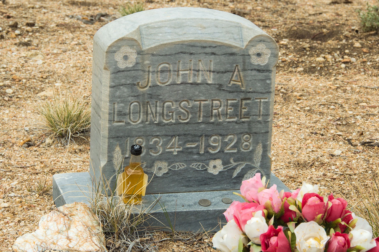
I related
the story that after all the gunslinging he made it to the amazing age of 94
and then, up here, accidentally shot himself, putting a bullet through his armpit
and shoulder. The wound finally slowed the still incredibly athletic old man who, it was said could always jump into the saddle without using stirrups. He died in 1928. He suffered a stroke at this ranch and was discovered outside on the ground after three days in the summer heat. Jack was taken to the hospital
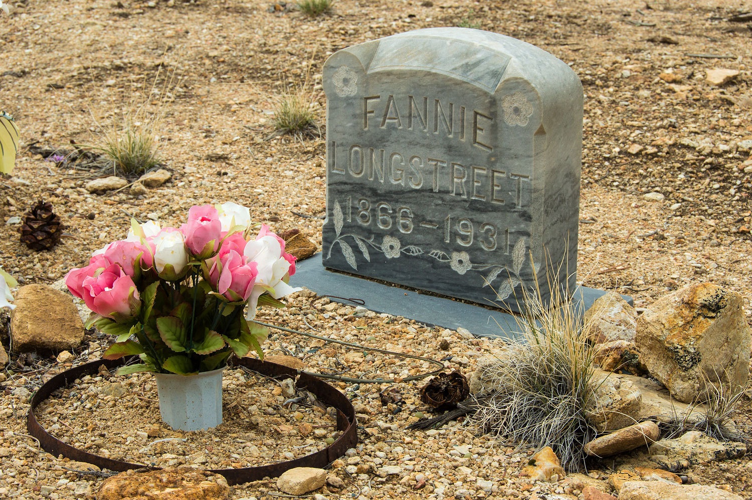
in Tonopah where he died late that night. His
Paiute wife, Fannie lived for three years beyond Jack and died in 1931. The
ranch was abandoned a couple of years later.
The rain
slowed and we explored the area. The cabin was well built but is soon to be
gone, in much poorer condition then in the photos I had found online.
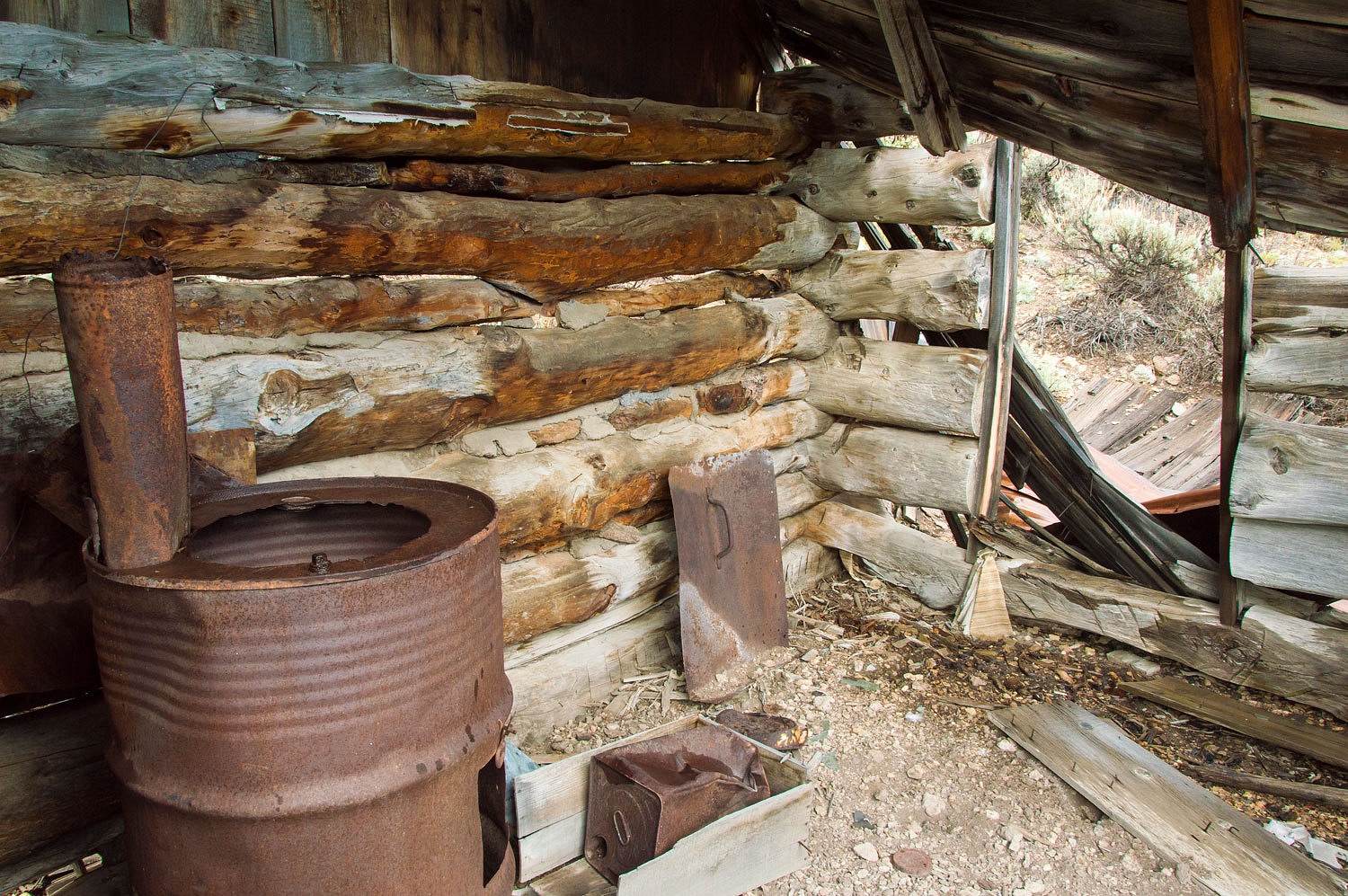
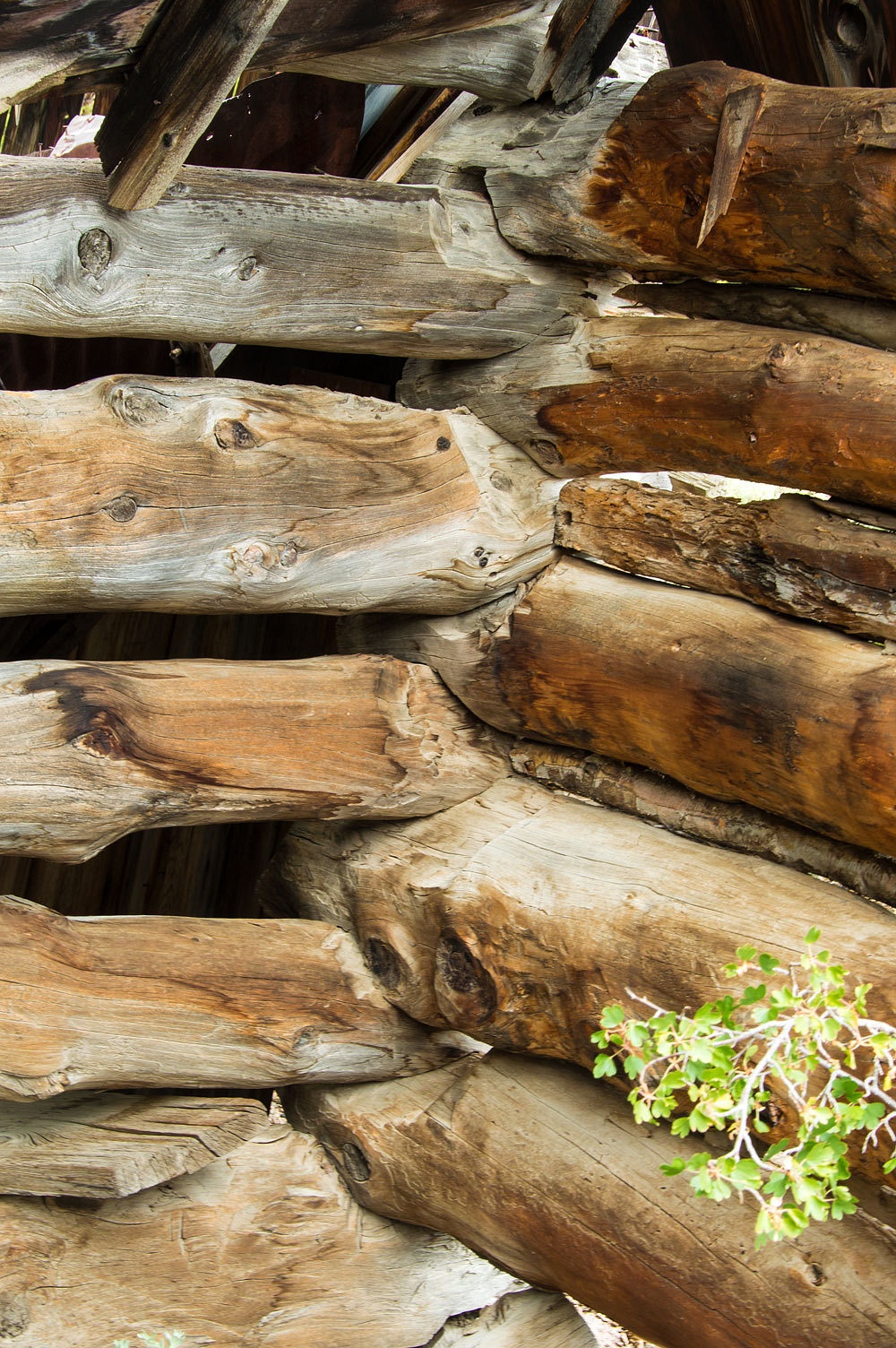

The area is now overgrown with vegetation. It is hard to move about.
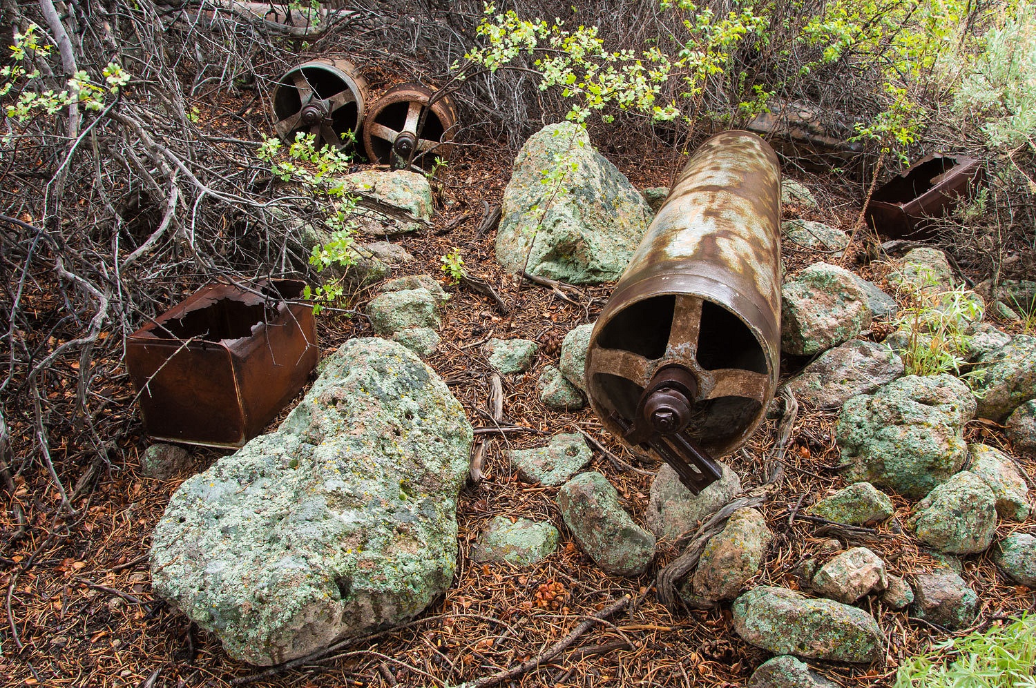
We were
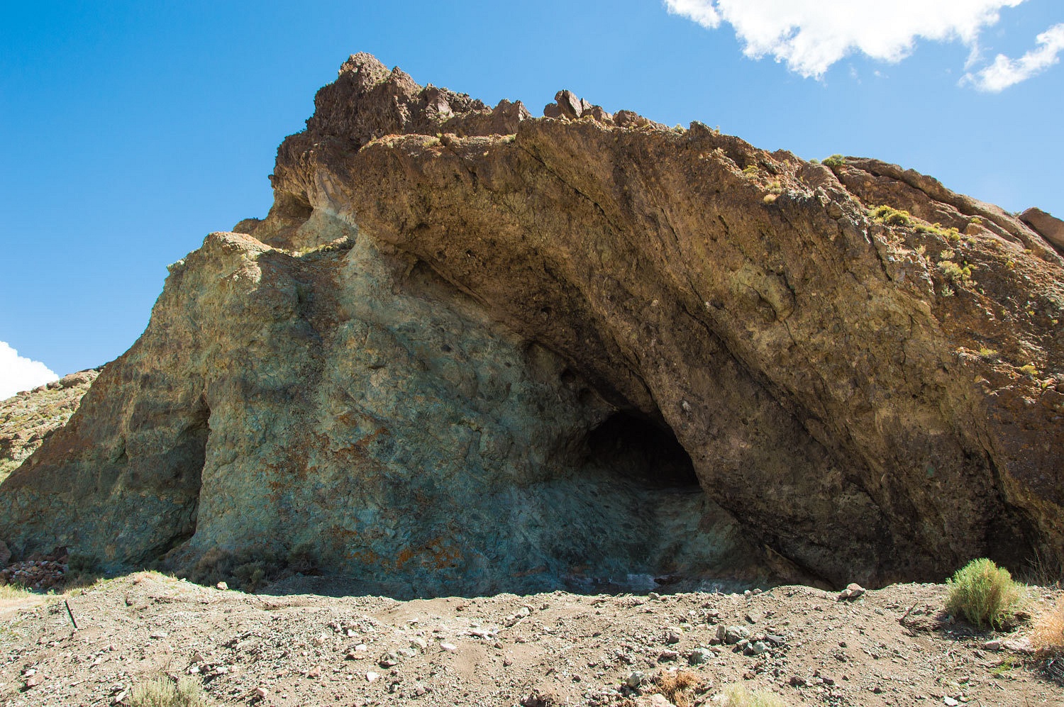
surprised to find a cache of large rollers, most likely for use in mining (Jack
had a mine and stone cabin in the next canyon to the south, Windy Canyon).
The Lady was
intrigued with the construction of the corral.
The rain
stopped and there was a little clearing in the sky down canyon.
"Want
to git while the gittin's good?" I asked the Lady.
"Yup,
it's time to say goodbye to Jack's place," she answered.
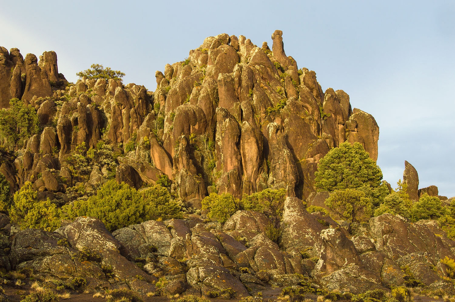
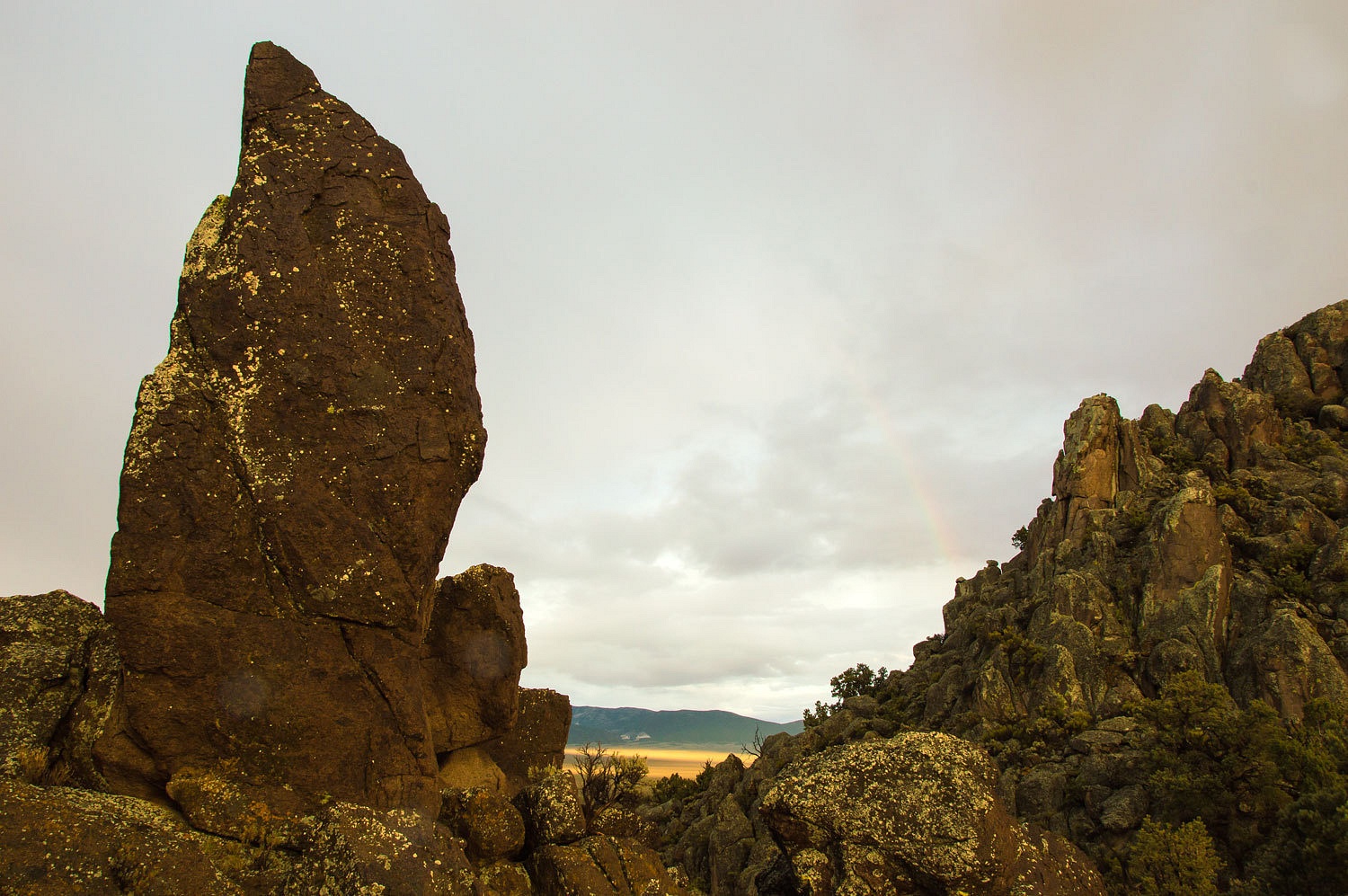
It's a good road across the southern Monitors. There's a lot of history up here including the location of Longstreet's fight with the murderous outlaw Bob Black who also was Jack's brother-in-law. Black received three bullet wounds and died. The killing was ruled self defense and Longstreet was not charged. It was steep over the pass and the downhill grade was gumbo. The main part of one storm had headed south along the western side. We descended into Hunt Canyon and found outcropping of eroding tuft that reminded us of Tent Rocks in New Mexico. We dropped out of the mountains and intersected the road to Belmont. A downpour was just finishing up. We entered Belmont and saw a man walking from his vehicle to his house, the first person and vehicle we had seen since leaving highway 6's pavement. Dirty Dick's saloon was busy, it was evident this was where a bunch of maggot riders were holed up. Dirty Dick must pray for rain.
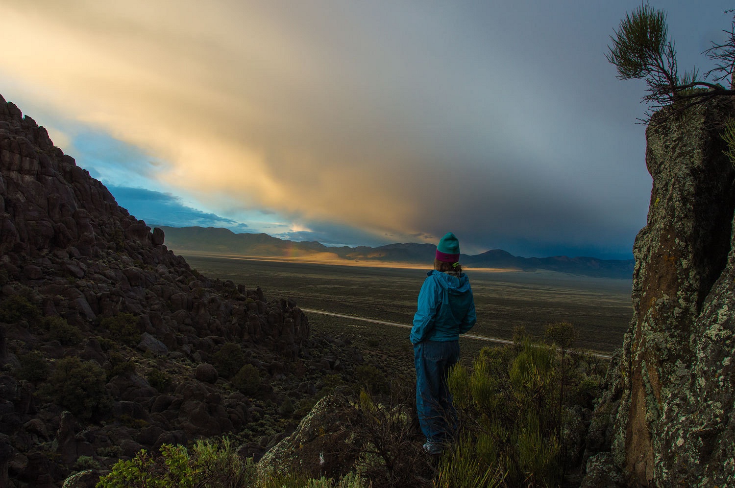


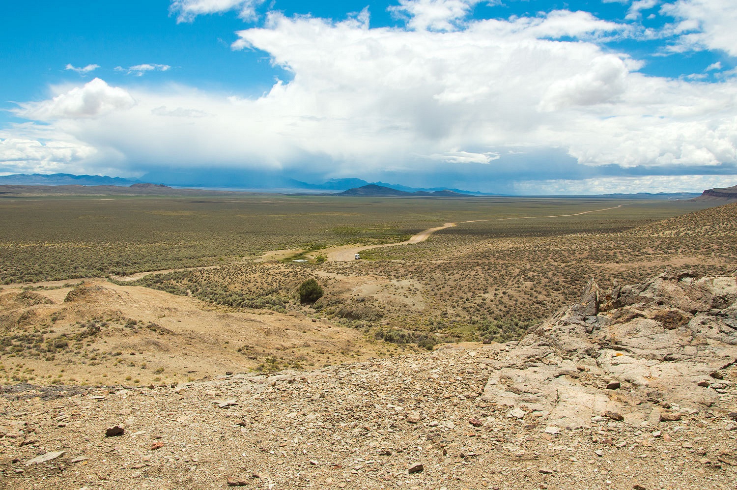
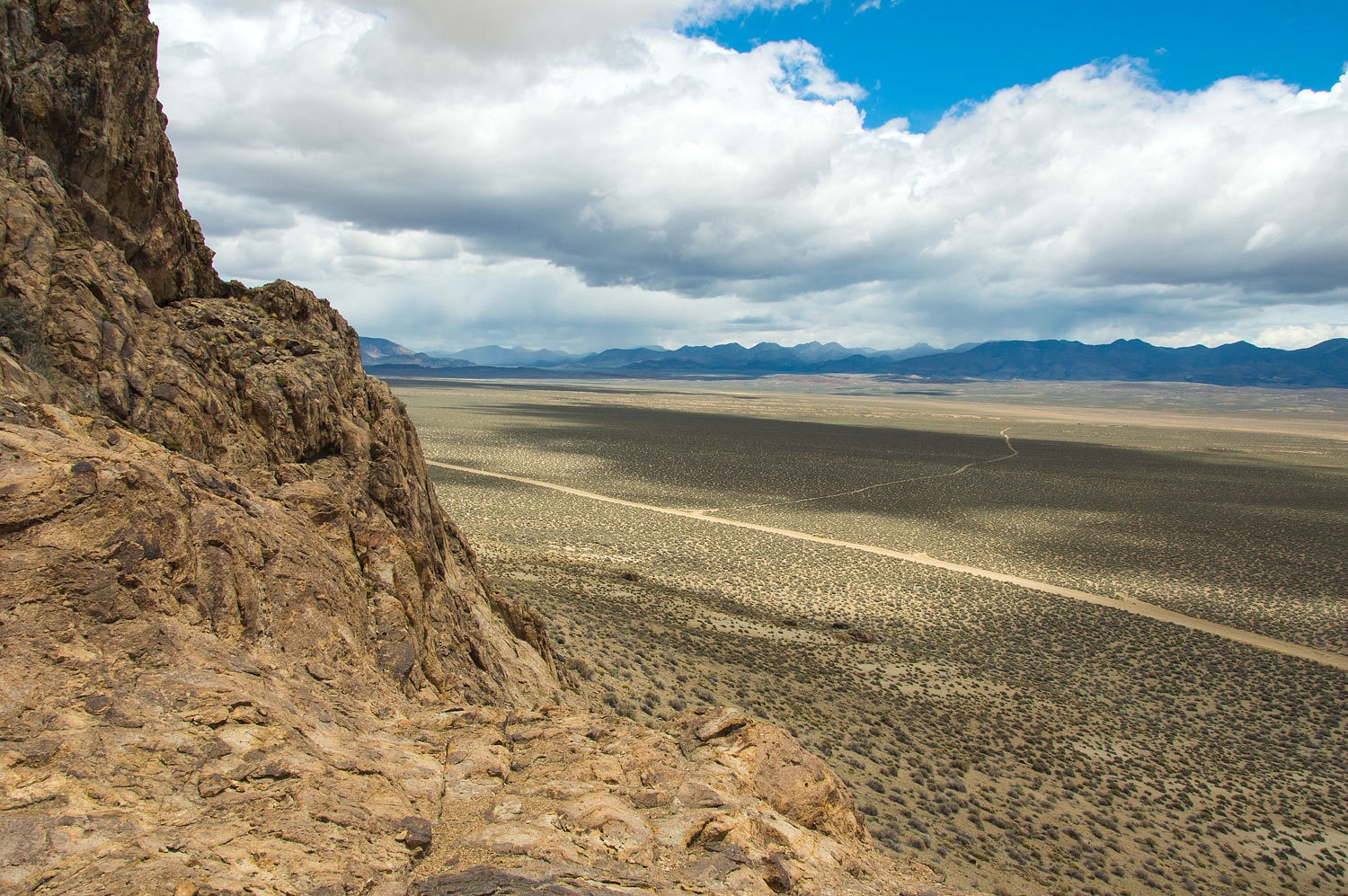
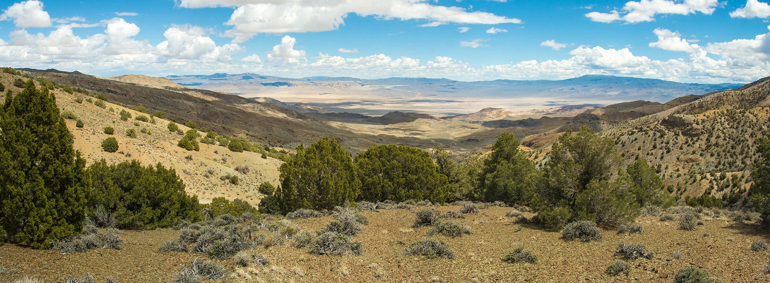
Coyote Road took us up and over the Silver Peak Range. The top of Coyote Pass provided a splendid panorama to the southeast.

The wind was
cold as we descended Longstreet Canyon. We kept the wool shirts on. As the
canyon opened up so did our view of the surrounding sky and it was apparent
we'd be dodging more storms very soon. Back at the truck we began the laborious
trek back down the road. A group of feral horses watched as we slowly worked
our way down, the stallion alert and staying between us and the harem. A shaft
of sunlight broke through and perfectly lit up two pronghorn on the flat below
us. I kept my hands on the steering wheel. Back out on the main road (graded
dirt) we turned north to find McCann Canyon Road to take us up and over the
Monitor Range before the storm at our back caught us.
Longstreet
is a complex character and I think that holds the interest for me. He was
educated, as shown by the letters he wrote Washington DC to protest the
actions of a Superintendent of an Indian reservation - the superintendant was
removed. He must of had a sense of right and wrong. One thing's for sure, he knew
how to survive. People ended up dead before he did, by his guns. And, he just
didn't get away with it, there was law around. A young attorney rose to fame
with his brilliant defense of Longstreet after Longstreet's shootout with the Cliffords
near Silverbow. Longstreet was acquitted. The attorney later was elected a US
Senator. And Longstreet knew horses, people knew you could get good ones from
Jack. And, you could say, horses started his career and marked him forever. As
a young boy he was caught with horse thieves in Texas. The others were hung. He
was judged too young for hanging so his ear was cut off, forever branding a thief.
It's said he always wore his hair long to cover the missing ear.
This is the
best online mini biography of Longstreet I've found - Jack Longstreet, Reluctant Gunfighter - although Zanjani's biography published by the University of Nevada Press is the best place to go
for information.
It's a good road across the southern Monitors. There's a lot of history up here including the location of Longstreet's fight with the murderous outlaw Bob Black who also was Jack's brother-in-law. Black received three bullet wounds and died. The killing was ruled self defense and Longstreet was not charged. It was steep over the pass and the downhill grade was gumbo. The main part of one storm had headed south along the western side. We descended into Hunt Canyon and found outcropping of eroding tuft that reminded us of Tent Rocks in New Mexico. We dropped out of the mountains and intersected the road to Belmont. A downpour was just finishing up. We entered Belmont and saw a man walking from his vehicle to his house, the first person and vehicle we had seen since leaving highway 6's pavement. Dirty Dick's saloon was busy, it was evident this was where a bunch of maggot riders were holed up. Dirty Dick must pray for rain.
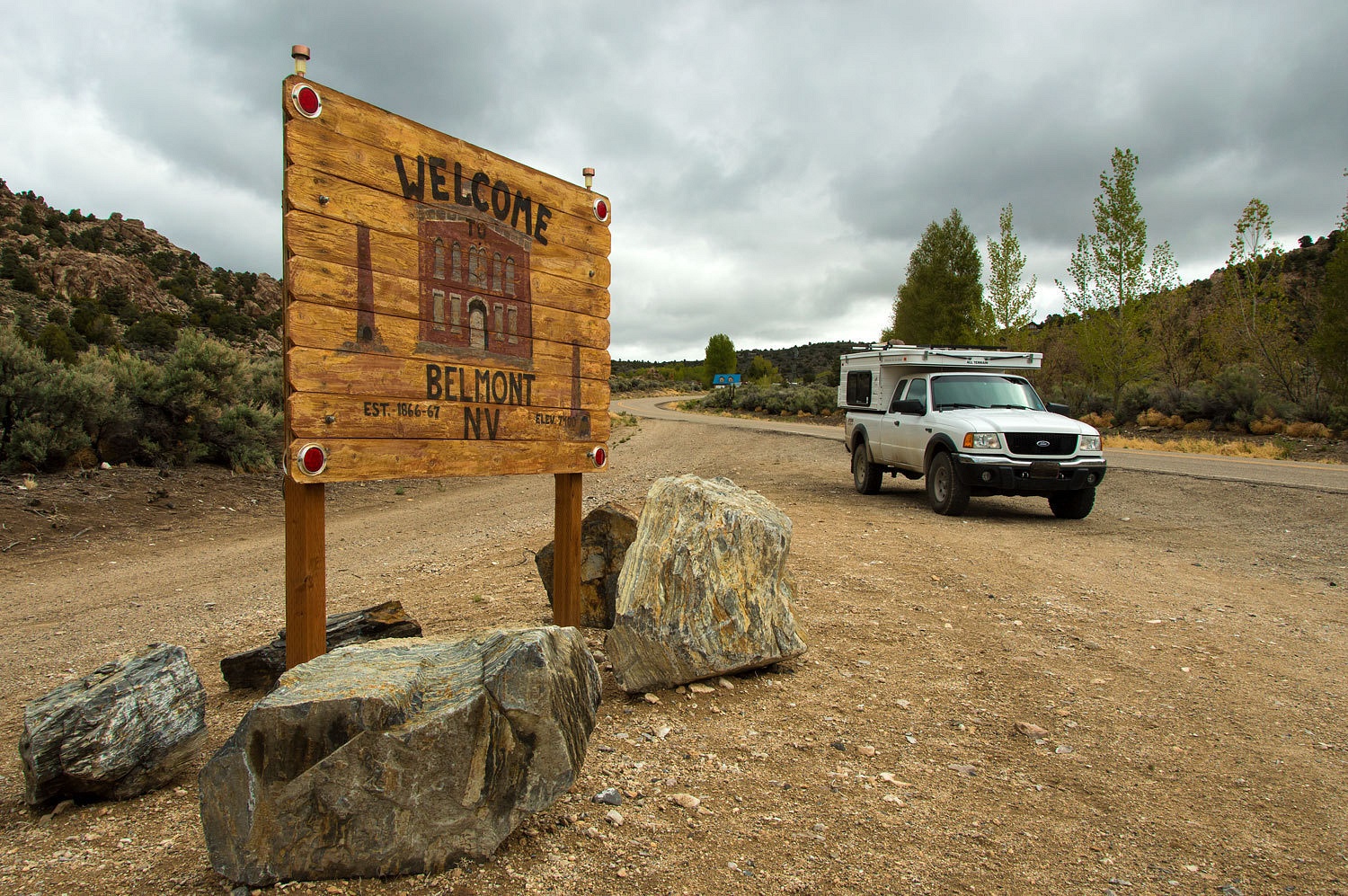
Everything
was soaked and sloppy wet from the storm. We made our way through town and
north into the Monitor Valley. I don't know what they use for road base on the
Monitor Valley Road but add a good dose of rain and it turns into gray goo. We
turned off into the Black Buttes and a favorite camp spot. We were alone.
The rain
stopped as we finished with set up. The dropping sun in the west started to
burn through the clouds.
We climbed
to a saddle in the buttes and watched the light and clouds play across the
broad Monitor Valley beyond.
We knew this
held the promise of beautiful evening light later.
It was
another night of off and on again rain on the roof. Nevada was being washed
clean. Broken clouds greeted us in the morning with a period of warm sunlight
for breakfast.
"Where
should we go this morning?" the Lady asked.
"We'll
let the road decide for us. If the road north has dried out some overnight,
let's go north up Monitor Valley. If it still looks like it did yesterday
afternoon, let's go south."
The road
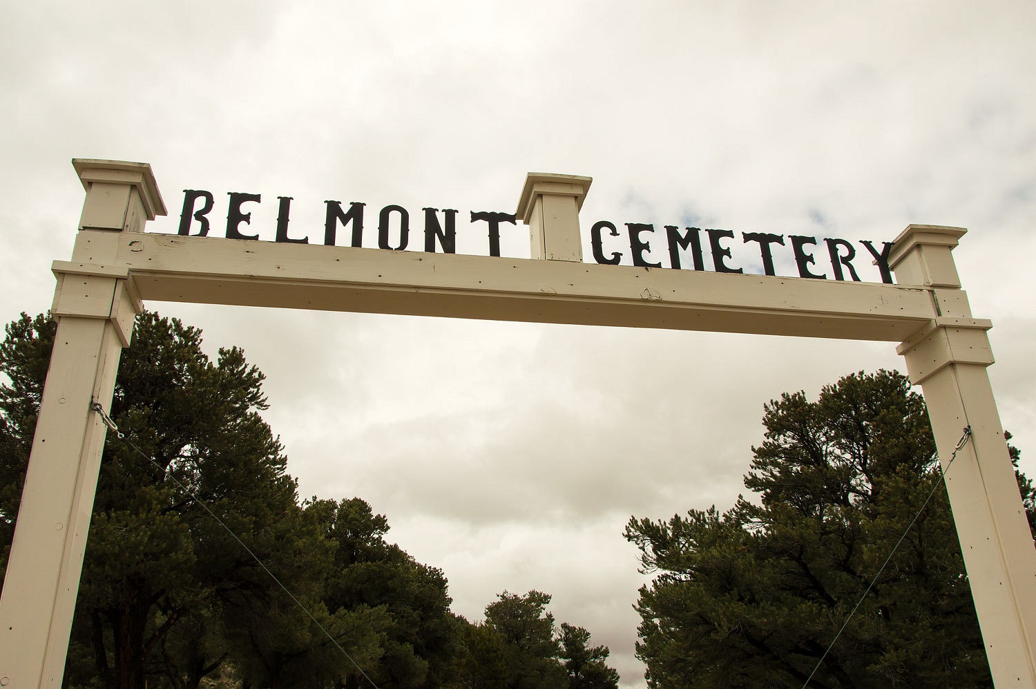
made the decision. We headed south back into Belmont.
Even if we
had headed north we would had detoured back to Belmont. We wanted to pay our
respects.
The little
bottle of whiskey was already there.
We headed
back to Tonopah and topped off the gas tank. We can always find something to
explore in Nevada.
We turned
off highway 95 on to Klondike Road. A flash flood had run through this area a
couple of days before. Numerous washouts crossed the road. We intersected with
the paved Alkali Springs Road and found it covered with debris and the edges
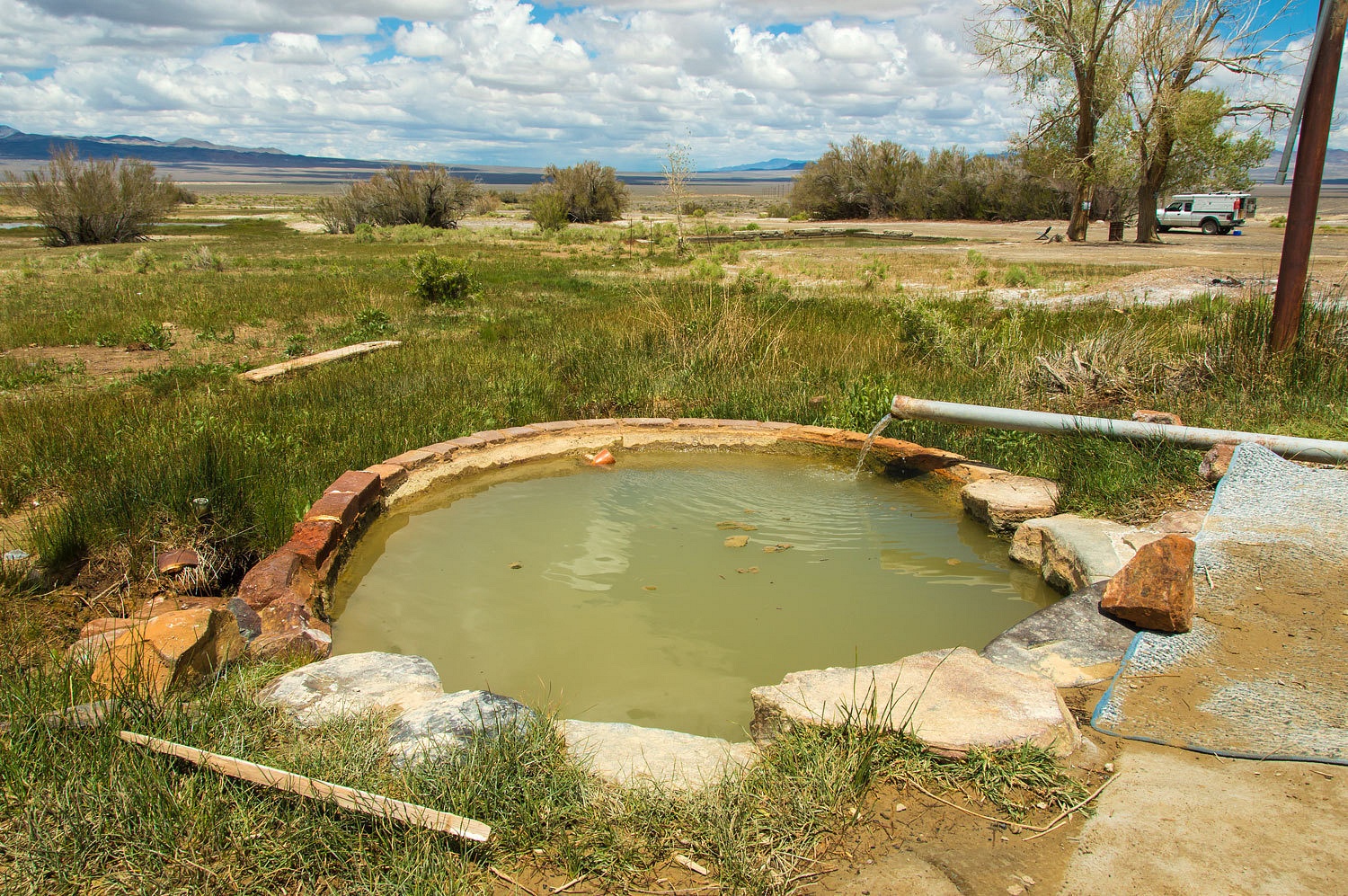
undercut in many areas. Some low spots still held standing water. We stopped at
Alkali Hot Springs. It was evident that a wave of runoff had ran directly
through this area.
At one time
this was a developed site with the large concrete pool and other ruins nearby.
We headed west
and dropped into the Clayton Valley, the site of North America's only lithium production plant near the old town of Silver Peak. It is eye opening to see the
extraction of lithium carbonate brines especially with lithium ion batteries
powering so much of our advancing technology.
Coyote Road took us up and over the Silver Peak Range. The top of Coyote Pass provided a splendid panorama to the southeast.
Down the
canyon on the west side we spotted an historic inscription in a bold hand. I
don't know any of the history here.
Further down
canyon we stopped at Cave Springs. This was a habitation site for ancient Native
Americans and more recently developed for cowboys and cattle.
We dropped
out of the Silver Peak Range into Fish Lake Valley up against the eastern face of
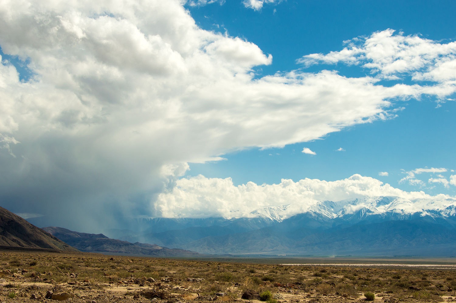
the White Mountains. A storm was pounding the area around Oasis to the south.
We headed
north in the opposite direction, some warm sun would sure feel good. We returned to
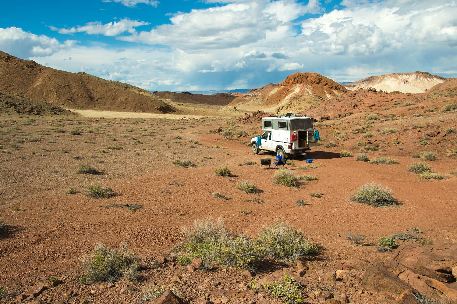
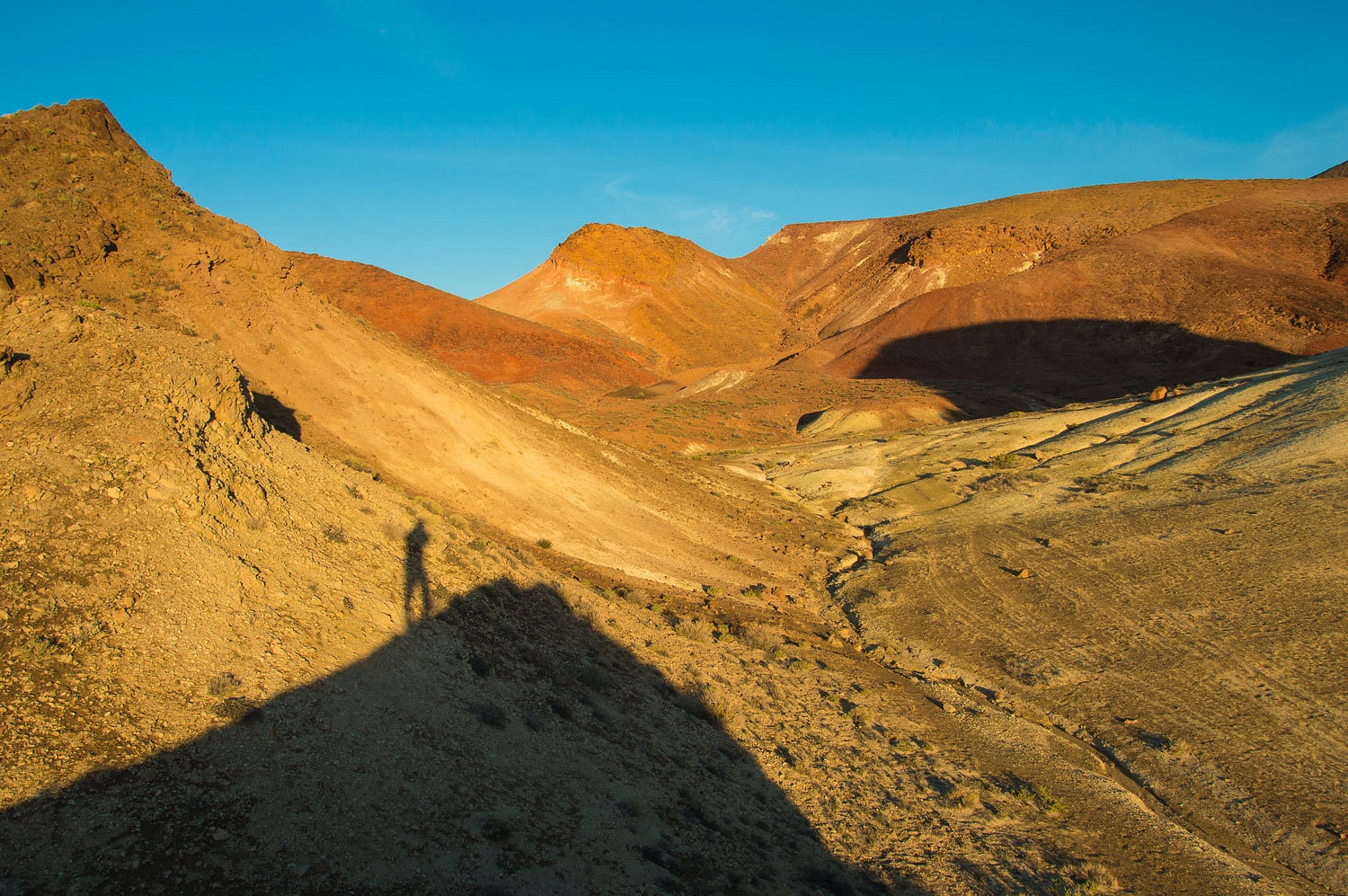
Gap Springs in the Volcanic Hills and found an out of way spot that suited us
just fine.
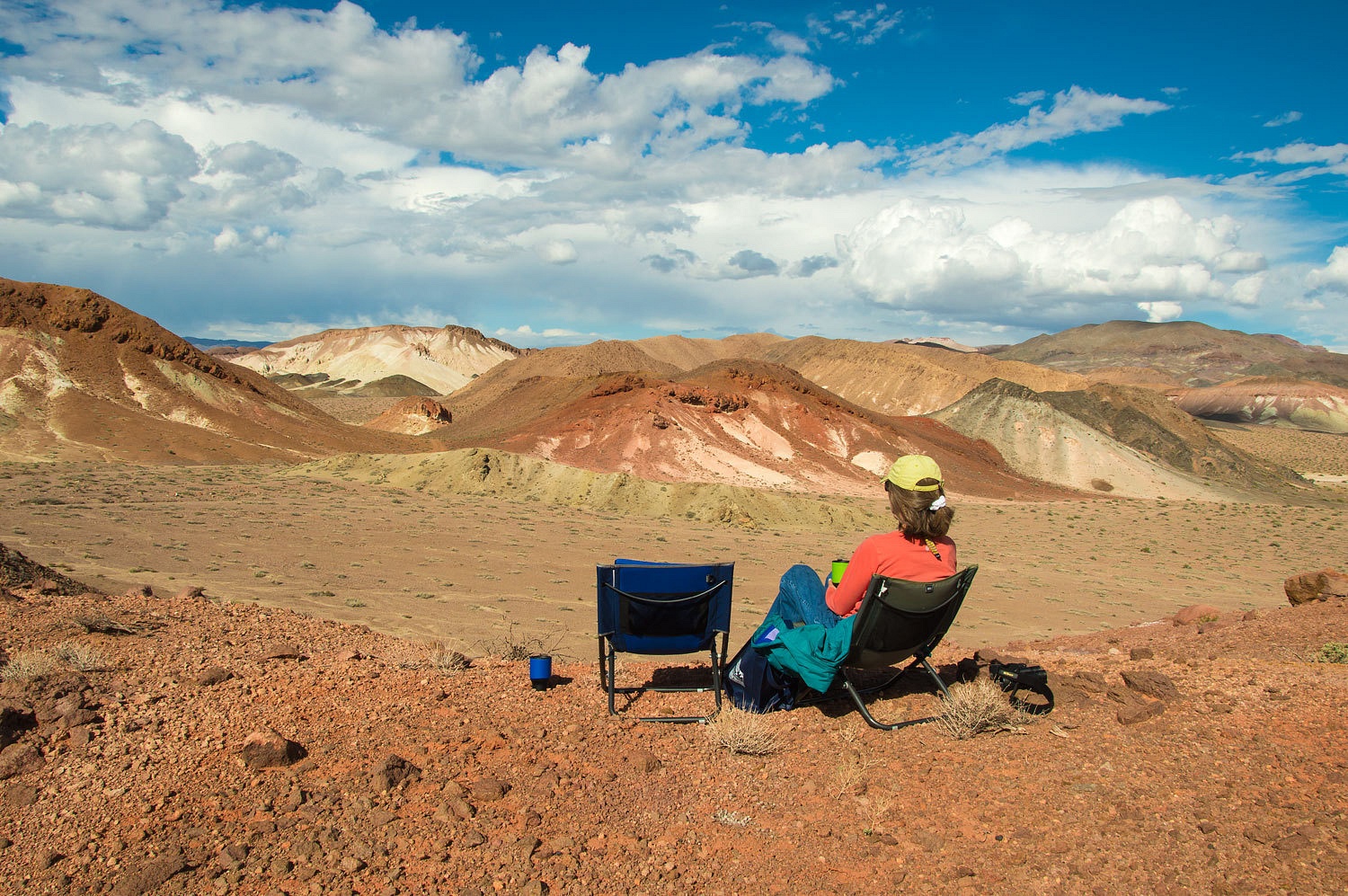
The sun felt wonderful and we took our chairs up to a view spot and thoroughly enjoyed the
light, warmth, and space.
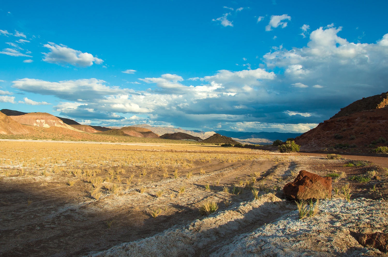
After dinner
we did a loop walk that included the edge of Gap Springs.
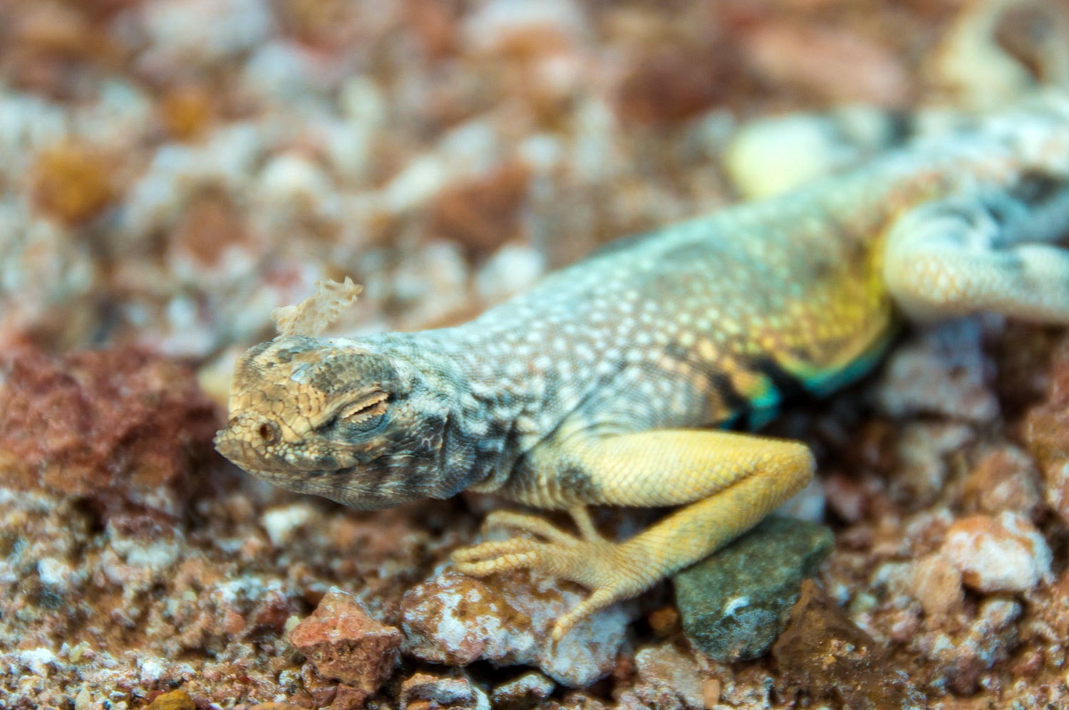
A zebra
tailed lizard was struggling with the last bit of skin shed around his face and
eyes.
It was
surprisingly warm, in the upper 60's as we sat and watched the day end with the
promise of no overnight rain on the roof.
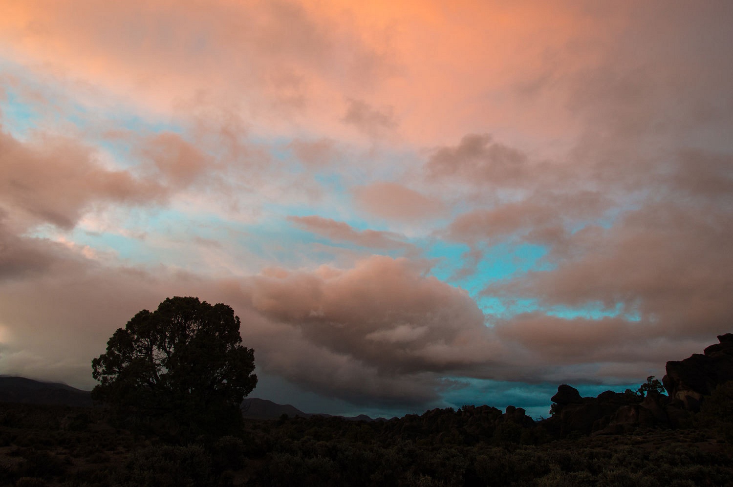
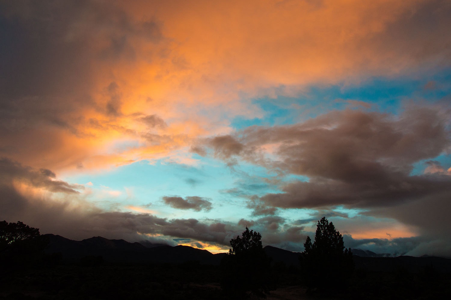
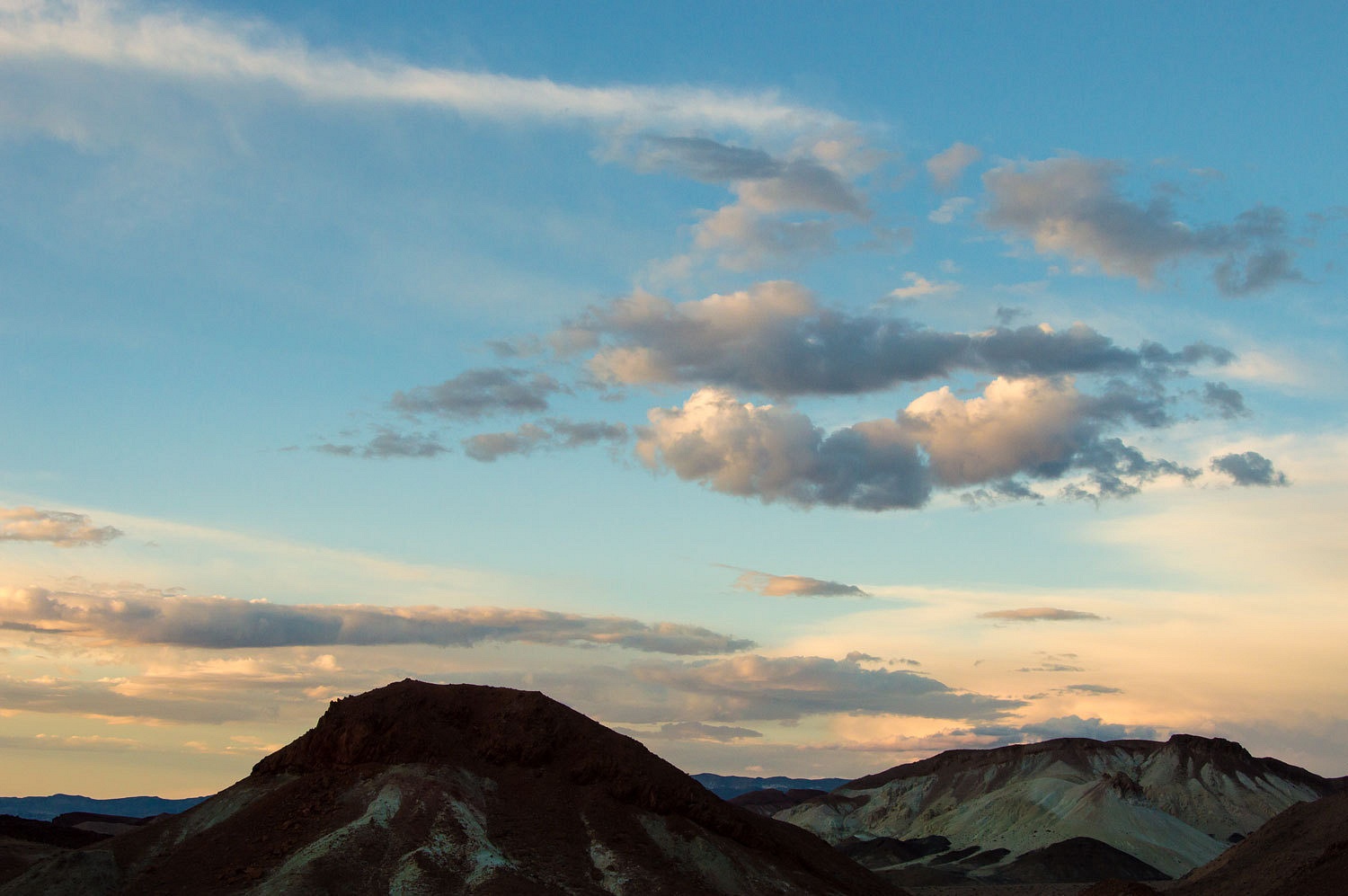
Beautiful
clear skies the next morning brought the colors of the area alive.
We slowly
made our way home. The clouds and rain squalls returned. We had touched the
places of ghosts and had let the scent of sage sink deeper into our souls.
Another great adventure to the wild -- miles of silence and wind. Thanks for posting this!!
ReplyDelete