
please remember you can click on a photo to see a larger version & highlighted text are links to additional information
Close to Home
All of us have been impacted by the
worldwide coronavirus pandemic. That's not news, is it? We, like most of you,
have been abiding by the Stay at Home orders to slow the spread of the disease,
not just to protect ourselves but to protect others. No non essential travel
was the rule to follow. We felt we were all in this together. How naive we
were.
We live on the edge of one of
California's busiest - recreation wise - National Forests. Our community was soon
inundated with tourists coming through, most disregarding face masks, social
distancing, and non essential travel. Yeah, we did our best to tone down our
outrage, be good neighbors, be good citizens. Most all the visitors we saw
streaming through were only out for themselves. Armed with rationalizations and
personal justifications and no concept of the greater good, the hordes rushed
in. And since many were not working, it was a daily event. Every day looked
like a weekend. El Dorado County closed the Lake Tahoe basin area of the county
to all non essential visitors. The rest of us El Dorado County residents felt
like we were thrown under the bus. We felt
like the lab rats, the canaries in the mines. As the restrictions began to be
lifted, what was expected in regards to travel became even less clear. I
jokingly considered creating and selling "2020 State of Confusion
Tour" t-shirts.
The only thing that was clear to us
was our need to double down on all the safety protocols to protect ourselves
and the ones we care about.
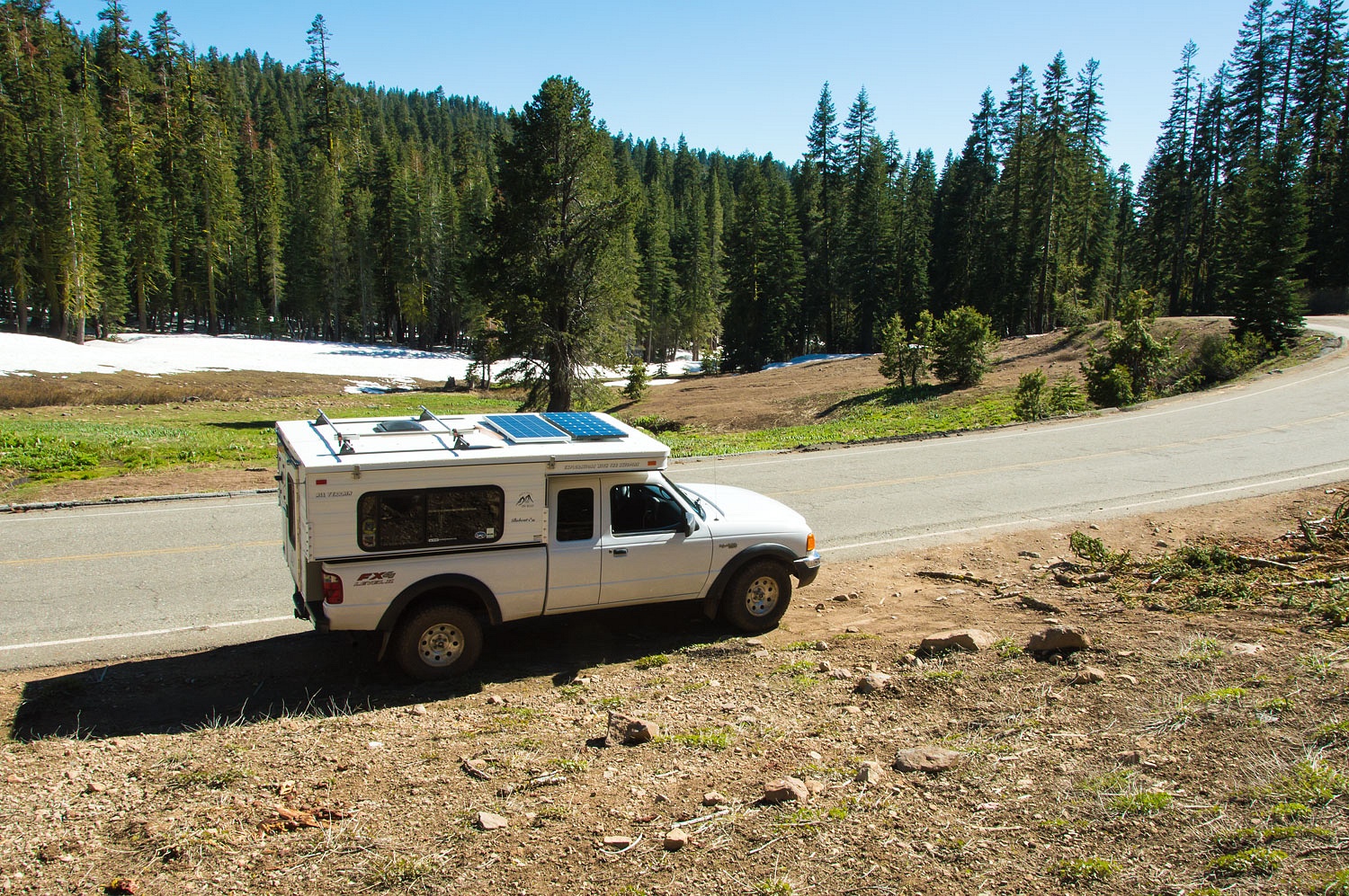
In late May, after Memorial Day we
took our first short drive away from home. With our knowledge of the area it's
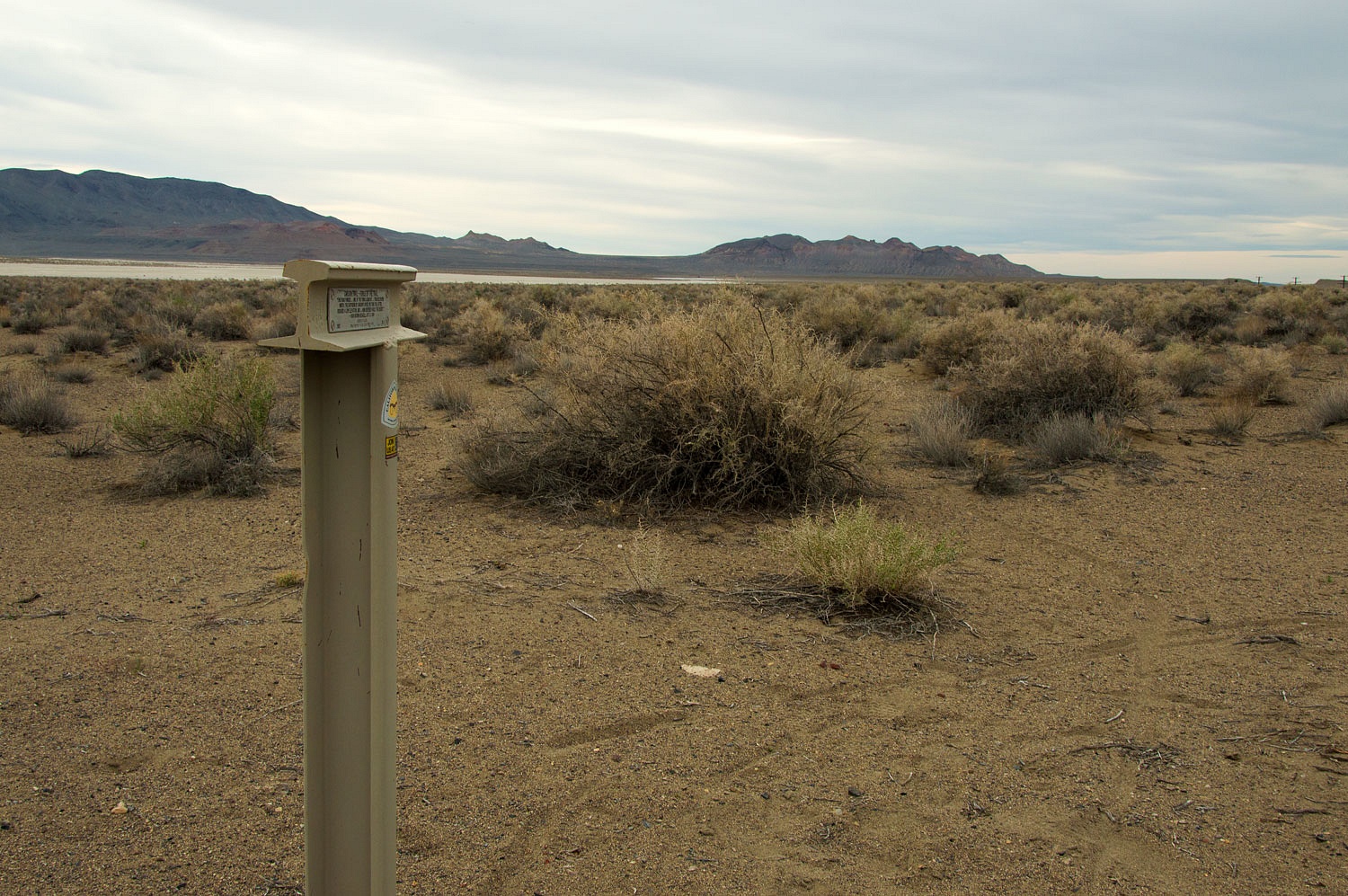
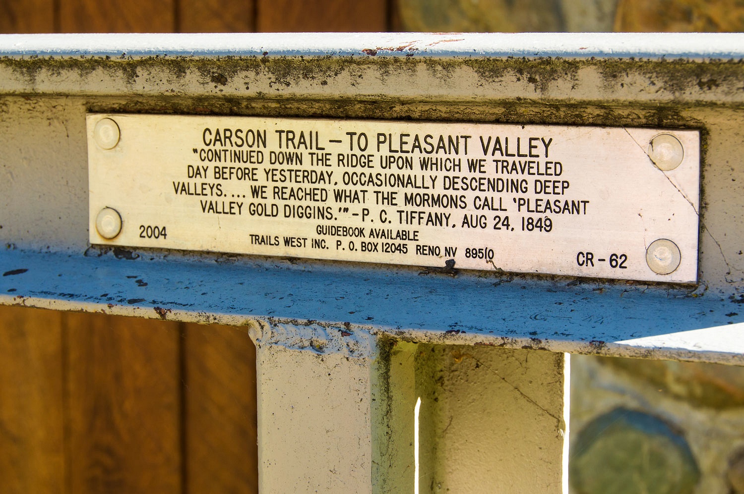
easy for us to leave the tourists. We live along the famed California Emigrant
Trail, the overland route into California's Gold Rush of 1849. A group - Trails West - has worked on erecting markers
along the historic route. What fun it would be for us to find several trail markers
close to home!
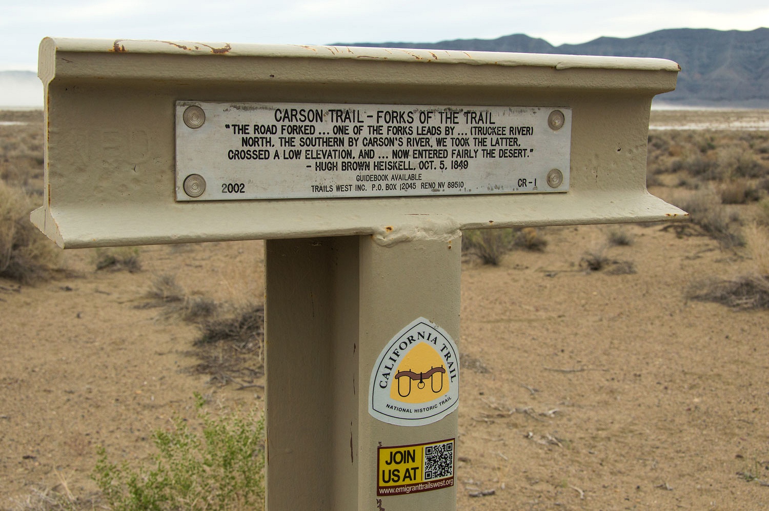
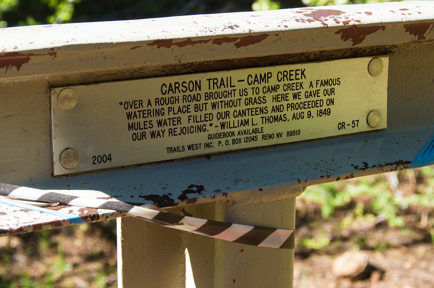
The Carson Route was by far the most
heavily traveled. It is so named because, after leaving the Humboldt River in
Nevada, it followed the Carson River into the Sierra Nevada Range. Several
years ago we visited the Carson Route's beginning at the Humboldt Sink.
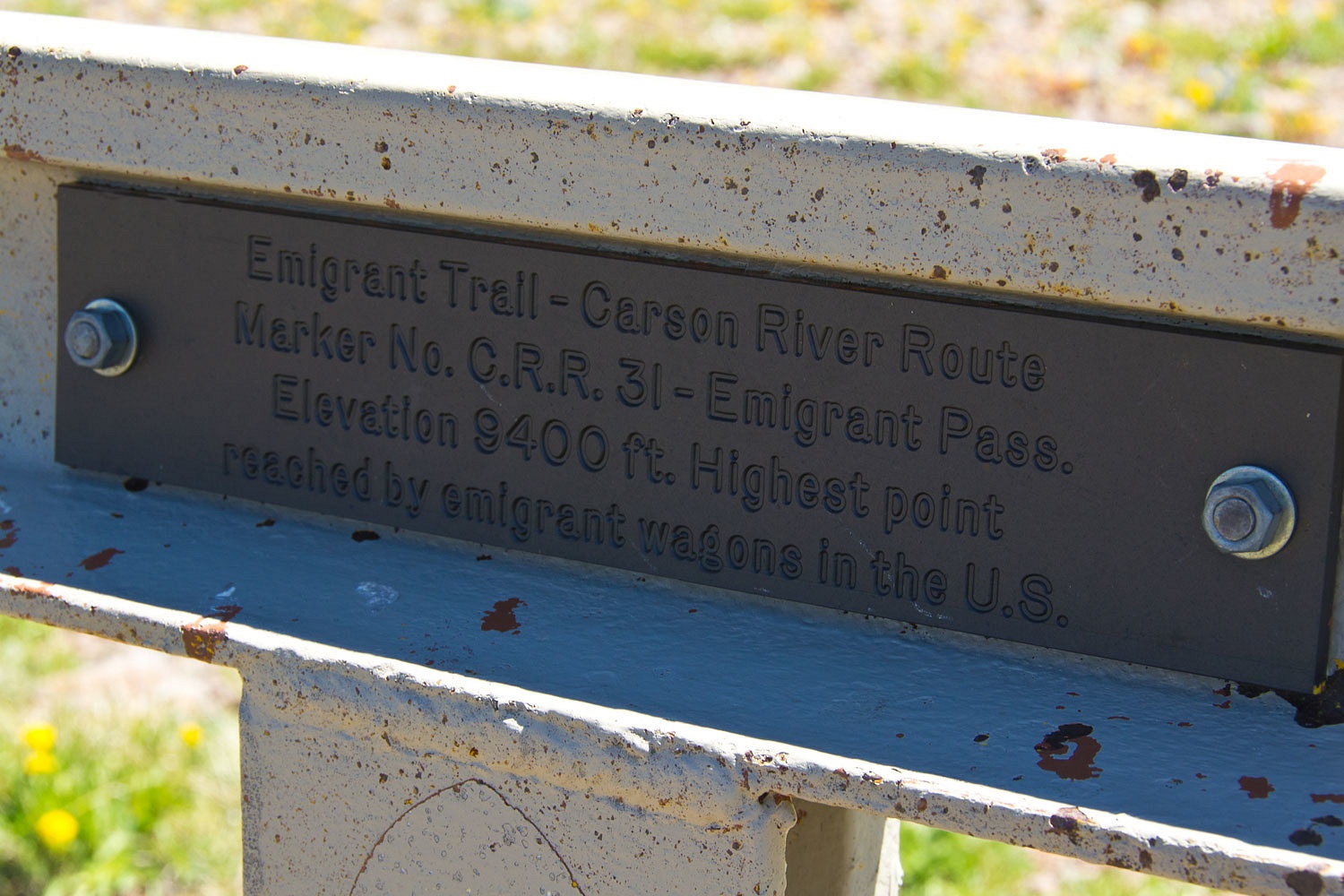
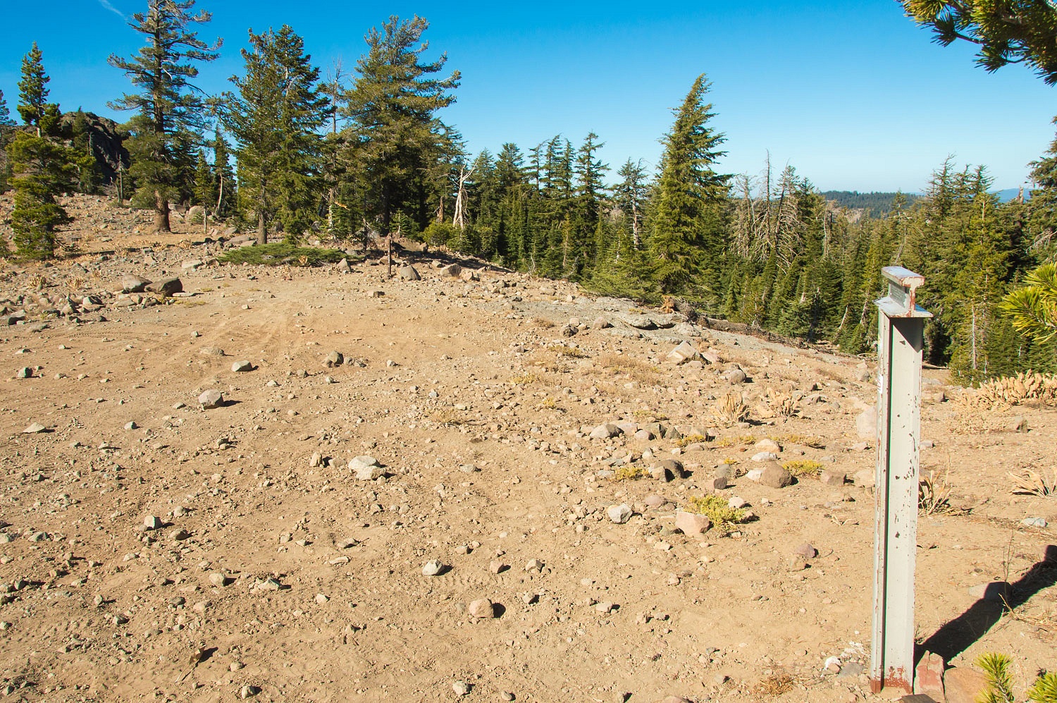
The Carson Route reached the highest
point of any emigrant wagon route in the United States - West Pass.
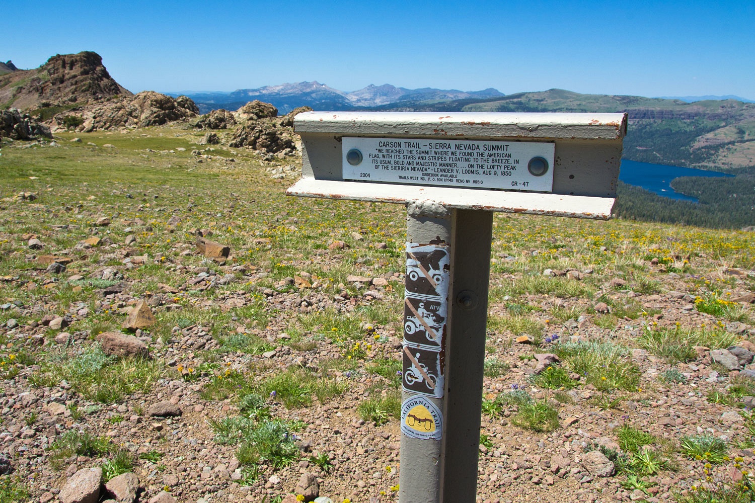
We have been up on West pass many times,
yup, even in winter on skis.
From West Pass the trail descends
Squaw Ridge. Last October we hiked and visited the site of an old trading post
and also two grave sites on Squaw Ridge.

The trail moves over onto Iron
Mountain Ridge west of Tragedy Spring.
For our late in May short afternoon
trip we drove out Iron Mountain Road and started our adventure with the marker
placed at Leek Springs.

Leek Springs is a beautiful small
valley.
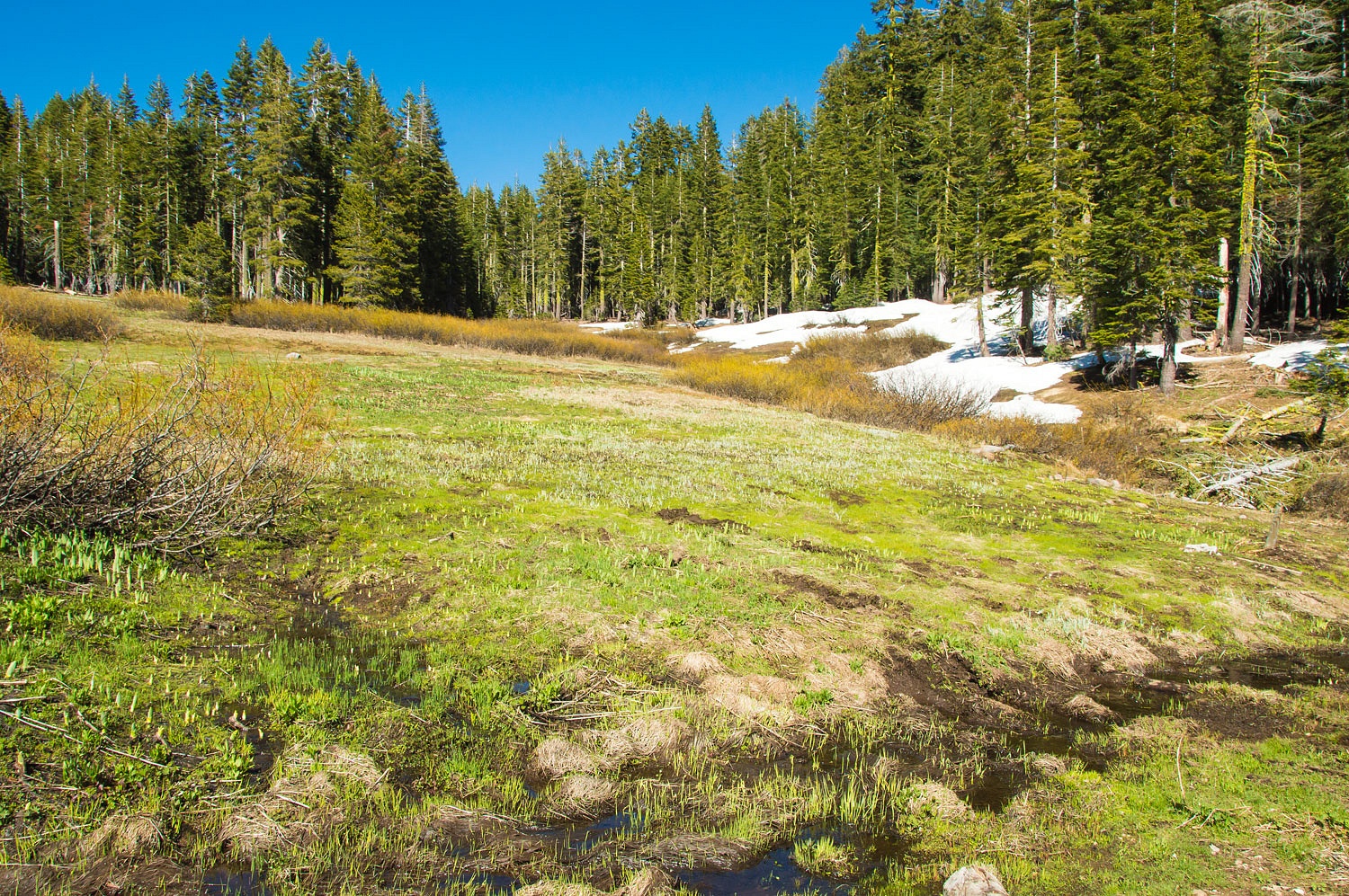
Leek Springs is also the beginning
of a later spur wagon road down to Grizzly Flats.

We turned around and found trail
markers on our downhill return to home.

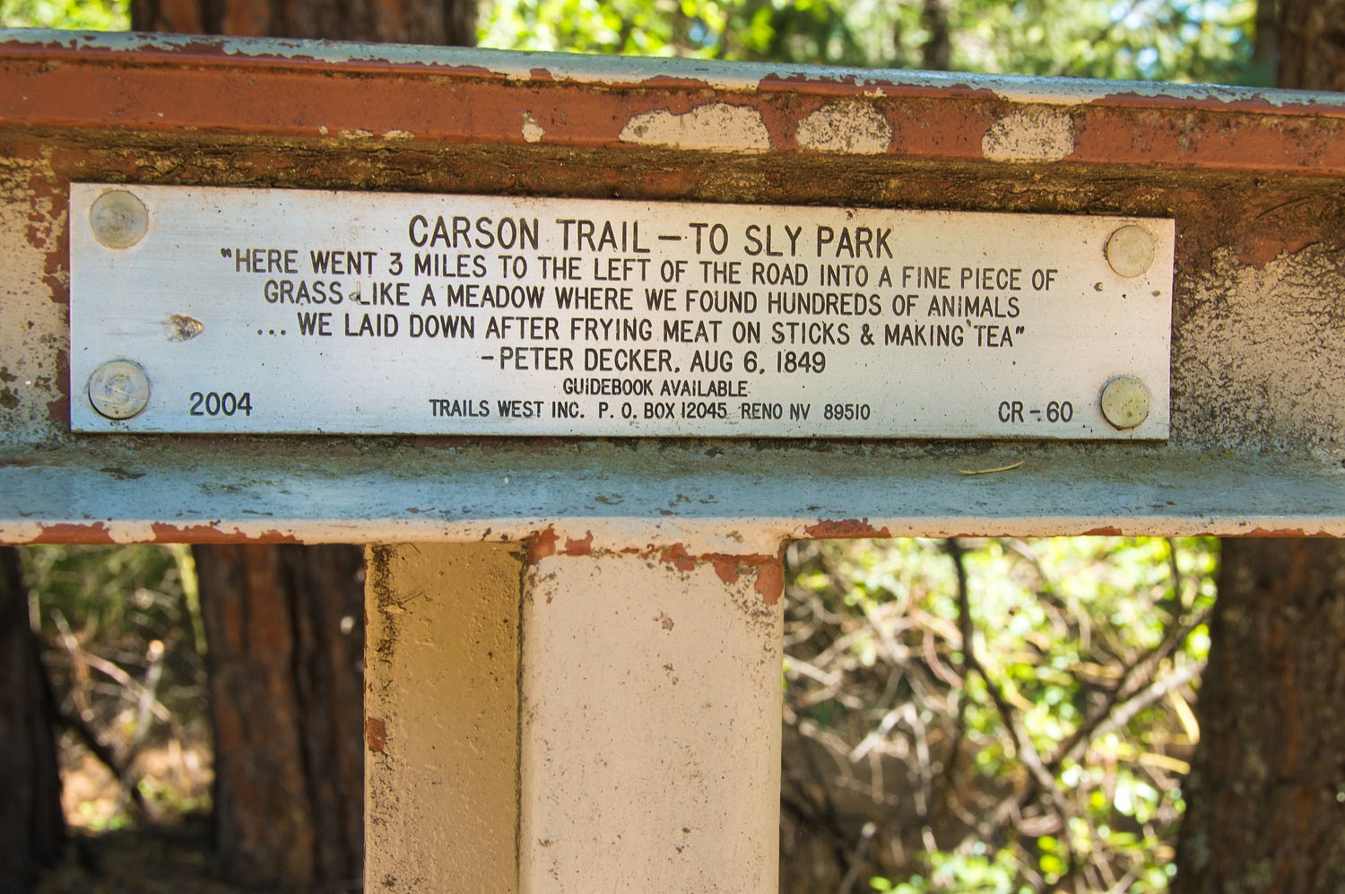
The Carson Route leaves the current
Iron Mountain Road/ Mormon Emigrant Trail at the ascent of Old Iron Mountain.
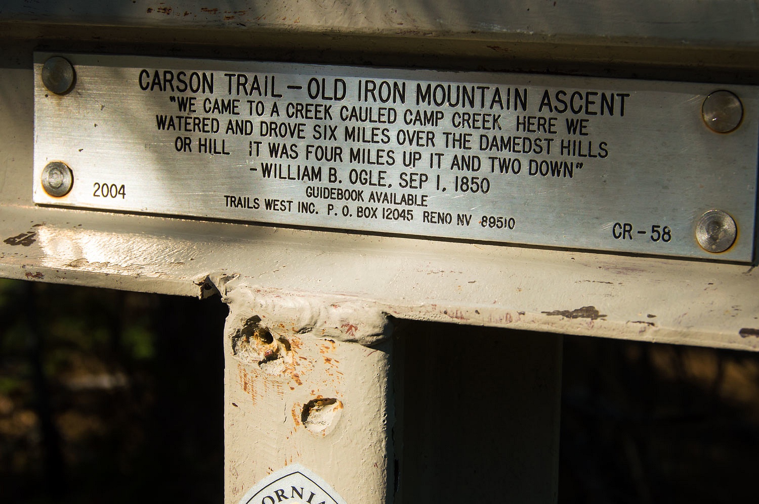
A large ponderosa pine stands at the
spot. It was called the 49er Tree.
There was an emigrant road inscription
carved into its base. In the late 1970's it was doused with gasoline and set on
fire, a senseless criminal act of vandalism. I remember reading of the
desecration in our local paper at the time. I have not, yet, been successful in
finding that old article. The fire scars are still visible and very few now
remember the 49er Tree.
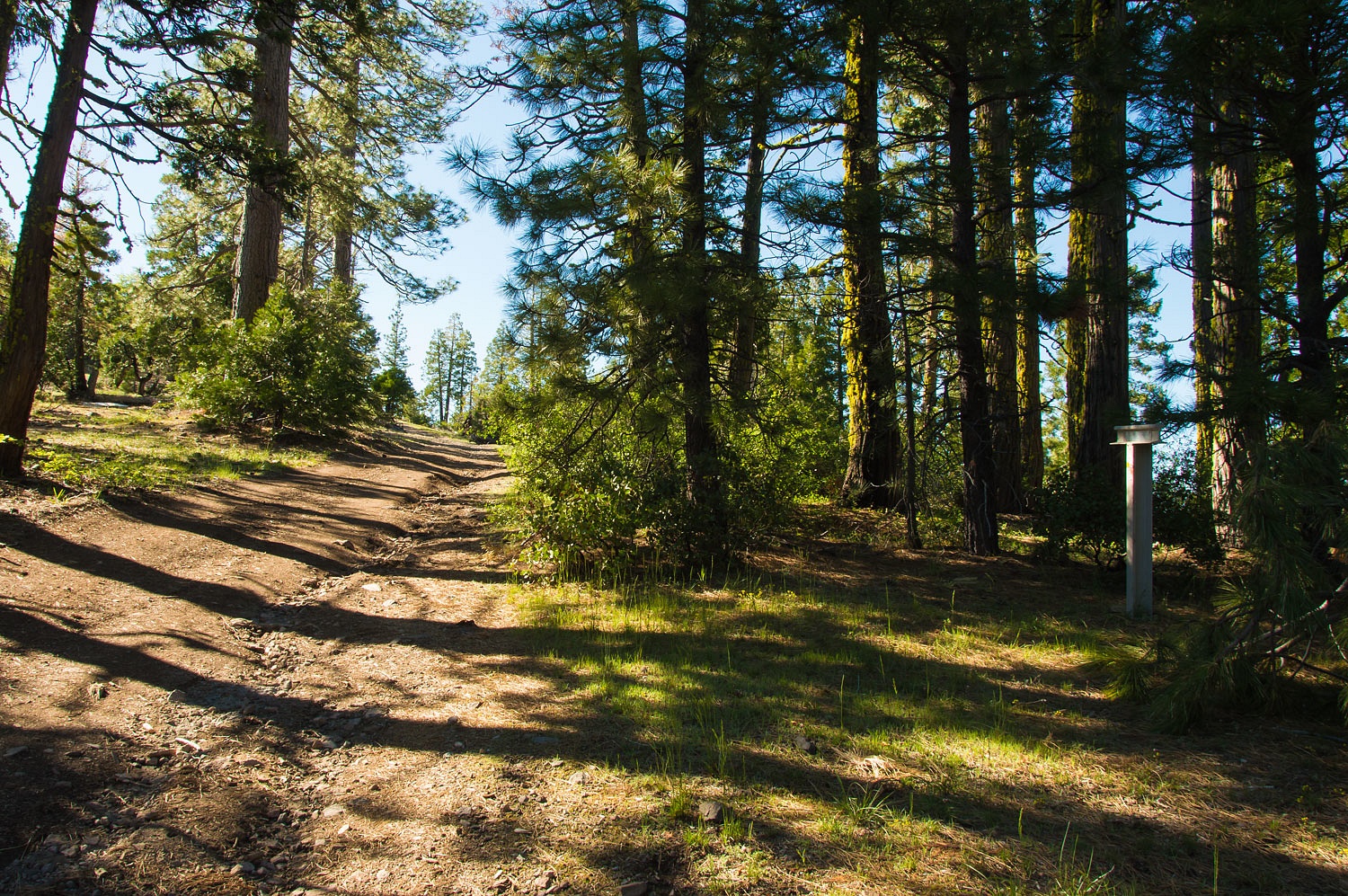
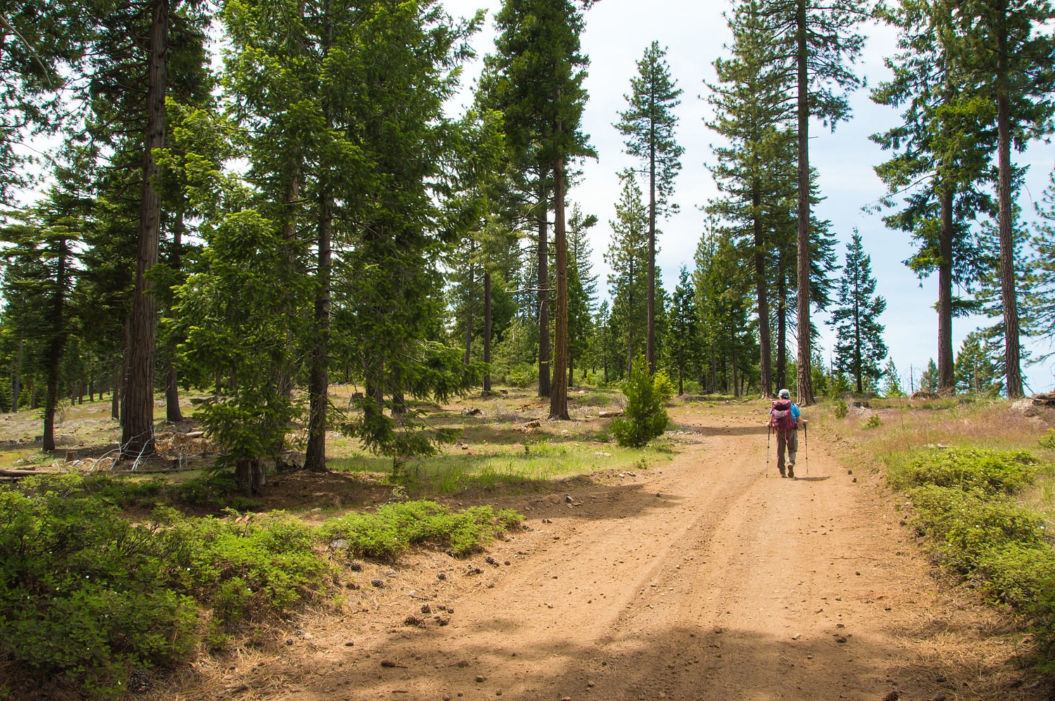
We needed to hike to reach the next trail
marker as we would cross private forest land with a locked gate. It was an easy
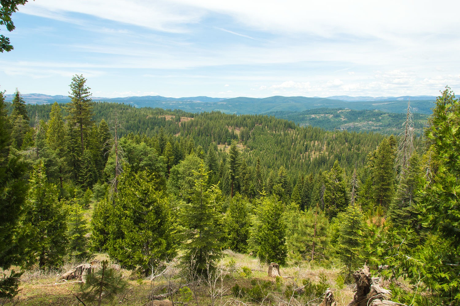
two miles one way. The private road we followed took us out to the north ridge
off of Old Iron Mountain - the long green timbered ridge that runs left to
right in the midsection of the photo below.
The Lady, with her sharp eyes
expertly spotted fresh bear tracks.

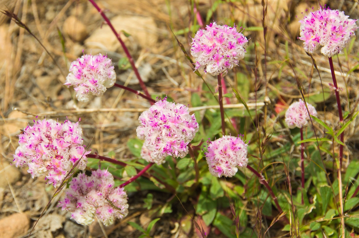
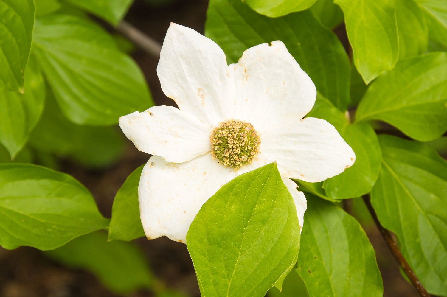
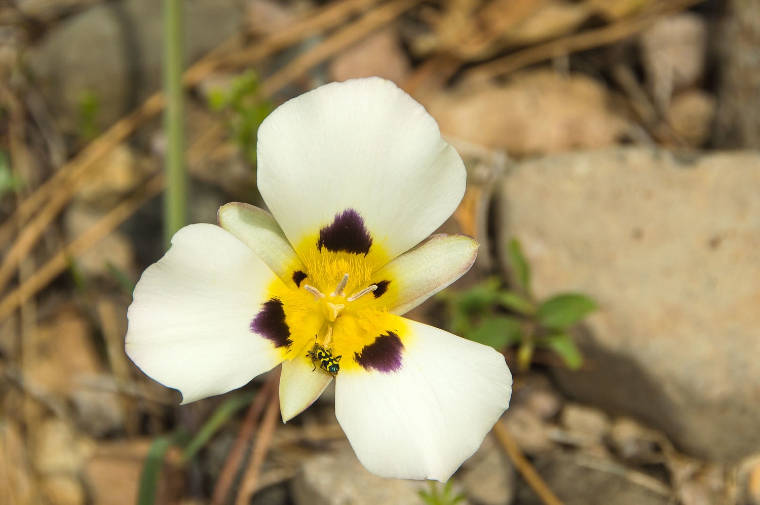
The flowers were beautiful along our
hike with pussy paws, the last of the dogwoods, and mariposa lilies.
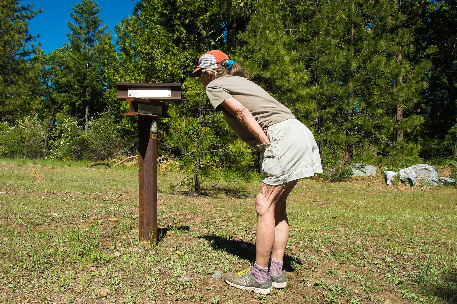
On a saddle in the ridge below Old
Iron Mountain, we found the marker.

This is the route continuing on the ridge
toward Placerville.
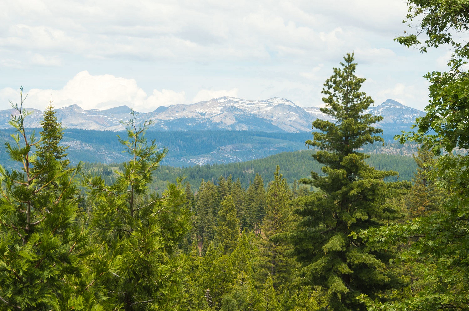
We enjoyed the few glimpses we got of
the Crystal Range.
We hiked back to our truck and
returned almost to home and drove out an old dirt road that is the remnant of
the old Carson Route.
Sly Park was a large meadow emigrants
would drop down to for water and forage. The area is now dammed and flooded by
Jenkinson Reservoir.
The next three markers are so close
to home we can walk to them.
The first is a trail junction on
Union Hill.
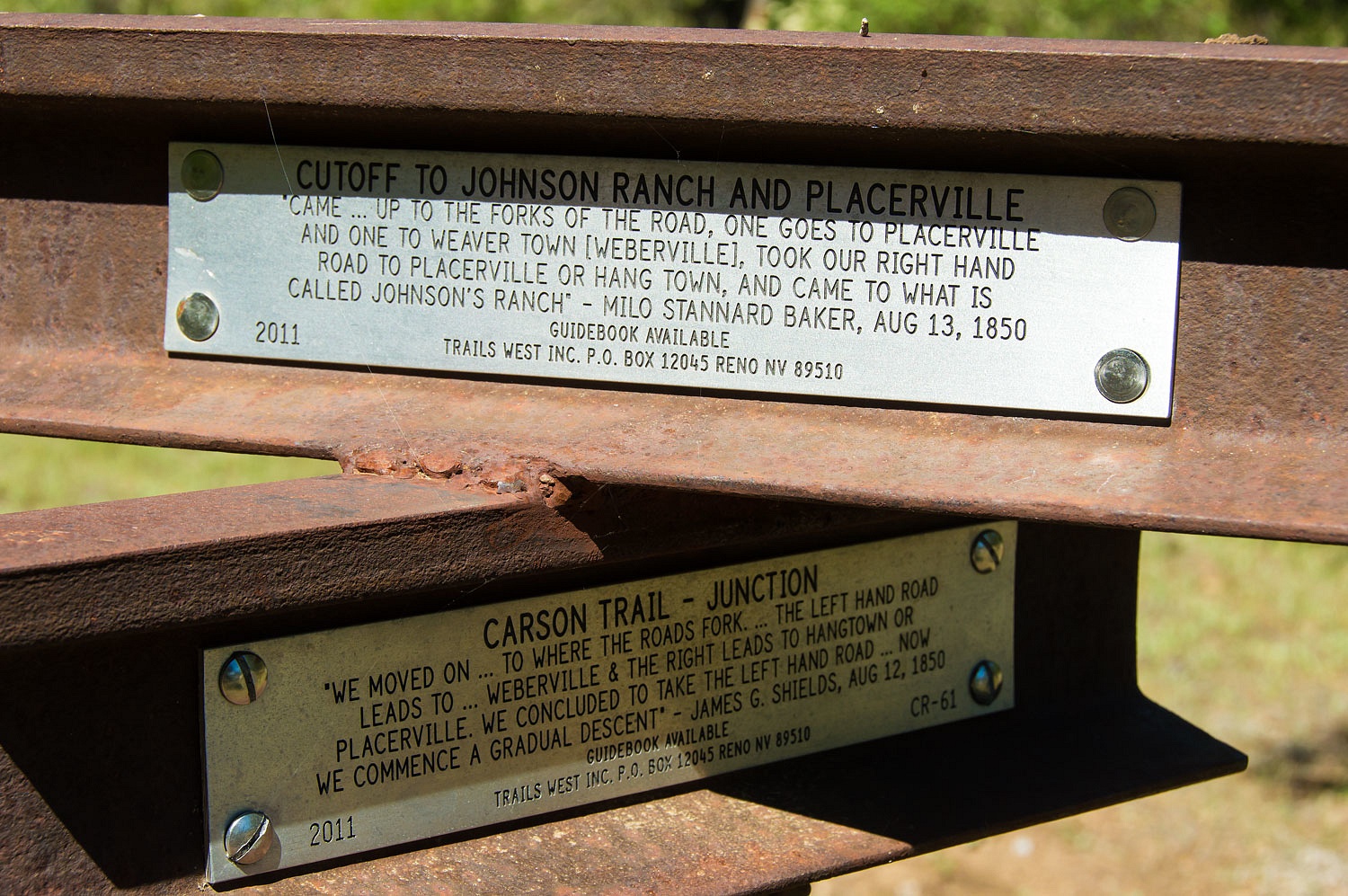
The left route was the original trail
down to Pleasant Valley and on to Placerville. The right route intersected with
the Johnson Cutoff which ran down Union Ridge to Placerville.
The Carson Route descended what is
now called Starkes Grade. A marker is placed at the top of Starkes Grade.
Just beyond our local Safeway market
on Pony Express Trail is the last marker we visited on our short afternoon
adventure.
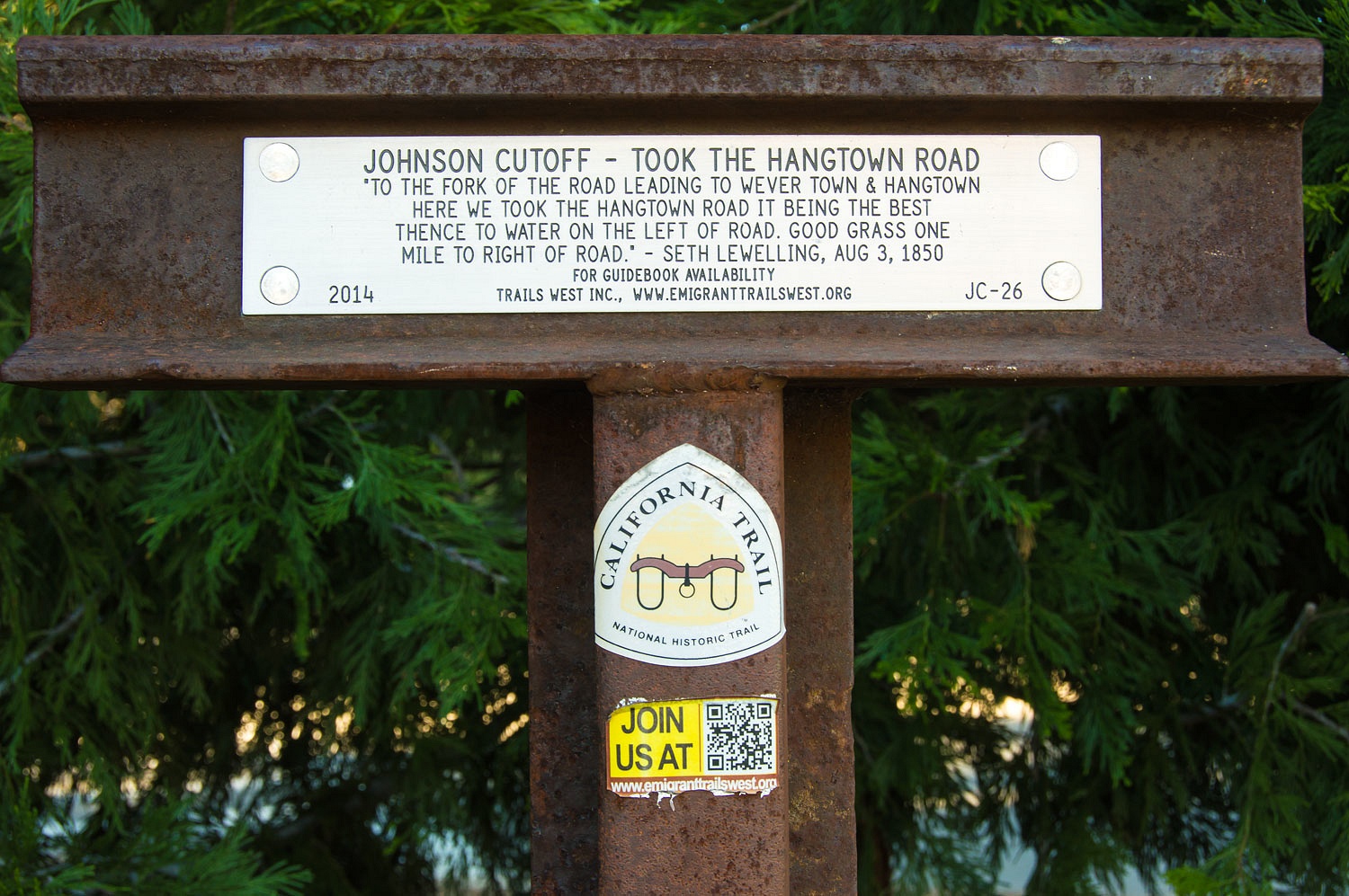
In the mid 1850's the Johnson Cutoff
became the most traveled route into California.
It left the Carson Route near Carson City, climbed up into the Lake Tahoe
Basin, and crossed the Sierra crest at Johnson Pass (modern day Echo Summit)
and descended to Placerville. Johnson Pass was 2000 feet lower than West Pass
on the Carson Route. The Johnson Cutoff became the major freight route to
Nevada's famous Comstock Lode and Virginia City. It also became the route of
the short lived Pony Express.
Near the last marker is the kiosk
commemorating the famous Bullion Bend Stage Robbery.
The actual site of the robbery is
about a half mile to the east. Confederate loyalists stole Comstock silver and
gold in a last ditch effort to save the Confederate States war efforts. The
first - and only until recent times - El Dorado County Deputy Sheriff was
killed in the line of duty at the subsequent shoot out at the Somerset House.
Many still believe buried loot from this robbery is still out there waiting to
be found. It's a fun thought, but if I believed that, I'd be looking for it.
We are blessed to have so much
history within a half hour drive from our home. So, this is how we spent our
first non essential travel. Stay safe, wear face masks, wash your hands, limit
contact with others. Look out for yourselves. Be diligent. We are not in this
together.
The group - Trails West, Inc. sells a
guide to finding all the Carson Route markers - Link Here.