
please remember you can click on a photo to see a larger version
Before dawn
Saturday morning the deep rumble of the approaching train moved me toward
consciousness. The wailing horn blast set off bands of coyotes howling and that
was it, it was time to get up. Overnight we had become accustomed to the more
distant sounds of 18 tires at a time droning down Interstate 80 in western
Nevada. Camped in a low point along the
Humboldt River, the morning low was 22°. The Lady likes me out of the way as
she fusses, so I joined the awakening world outside. The killdeer started
first. That got the crows going. The mallards did not want to be left out and
added quacking to the building chorus. The flocks of blackbirds joined in; maybe
they thought the robin section was too overpowering. A turkey walked out onto
the pavement. Its plumage did resemble a conductor's outfit and he had a beard.
This was a good way, a nice simple way to start the day. "Coffee's
ready," the Lady announced as the camper door swung open, the fact
verified by the strong scent of fresh brewed Peets. A cool Saturday morning, our
weekend getaway starting in the middle of nowhere, surrounded by the sounds of "outside"
- this is heaven.
A subtitle
for this adventure is "What you find in the middle of nowhere."
Although, it is quite a disservice to describe Nevada as nowhere.
A year ago
we took weekend trips to Nevada and explored the connecting valleys of Grass, Pleasant, and Dixie. This weekend we were poking around Buena Vista Valley to
the west of Grass and Pleasant.
We entered
the north end via SR 400. The Humboldt Range is to the west and its canyons
hold the ruins of small mining settlements.
This was our
first "what you find in the middle of nowhere" moment.
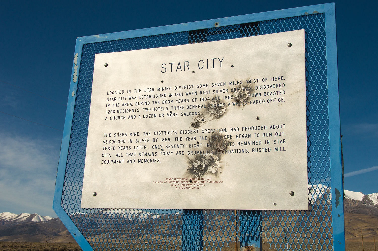
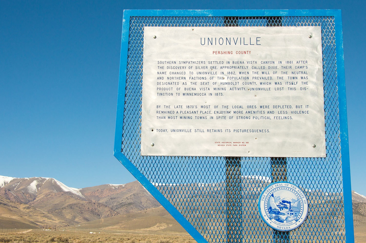
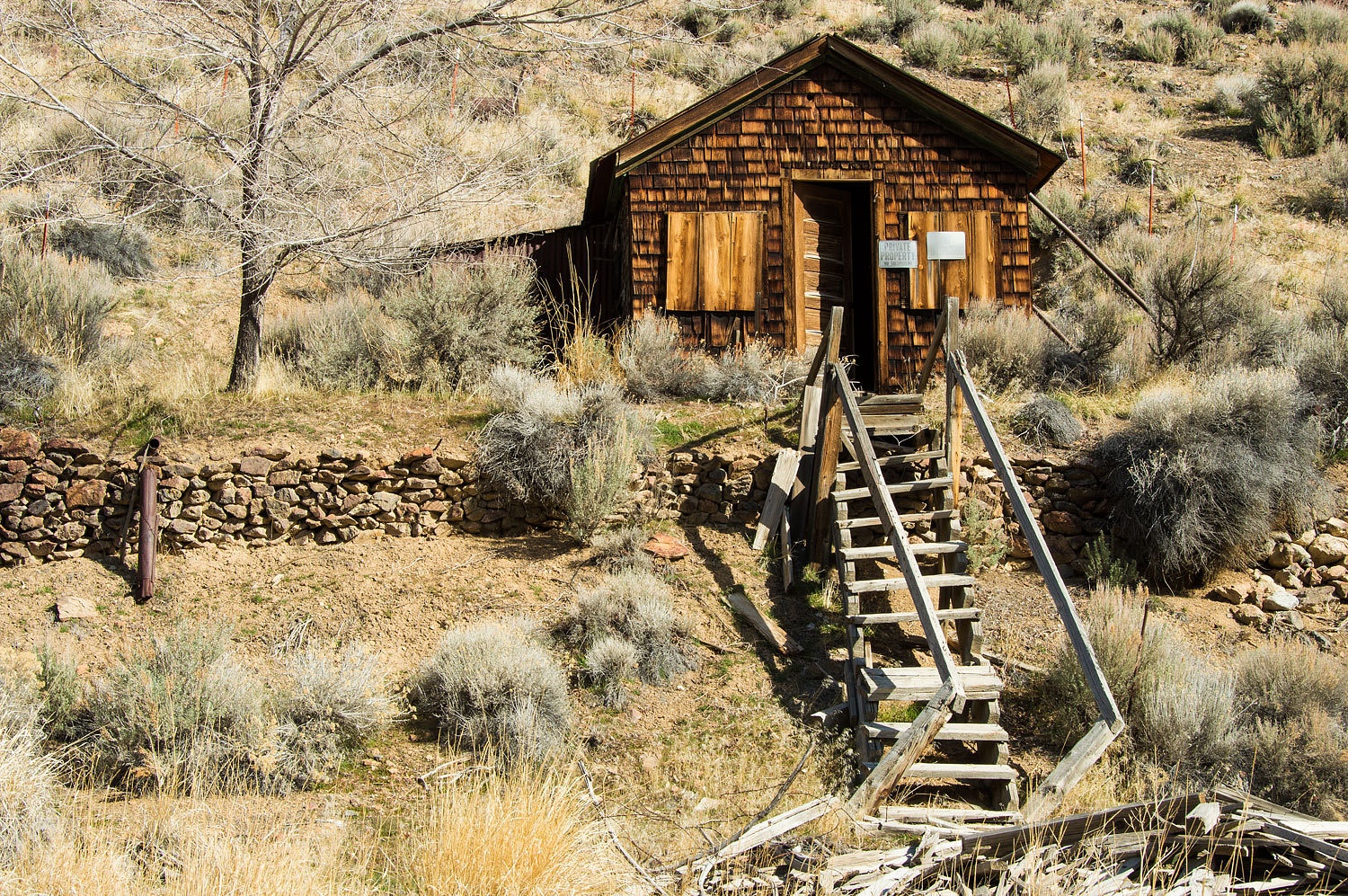
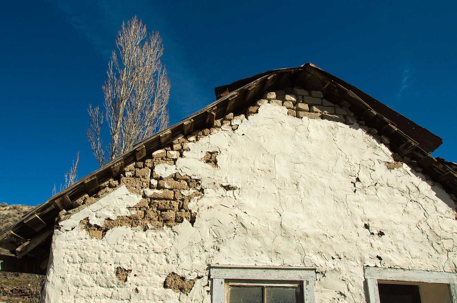
We had first
visited Unionville back in 2003.
Mark Twain,
in Roughing It, writes about his stay in Unionville. The Mark Twain Cabin is reverently
marked...........................

........................but
it doesn't quite match Twain's description. I expect it wouldn't matter much to
Mark, and if the locals were stretching the truth a bit, I'd expect he would
approve.
The town is
confined to a narrow canyon.
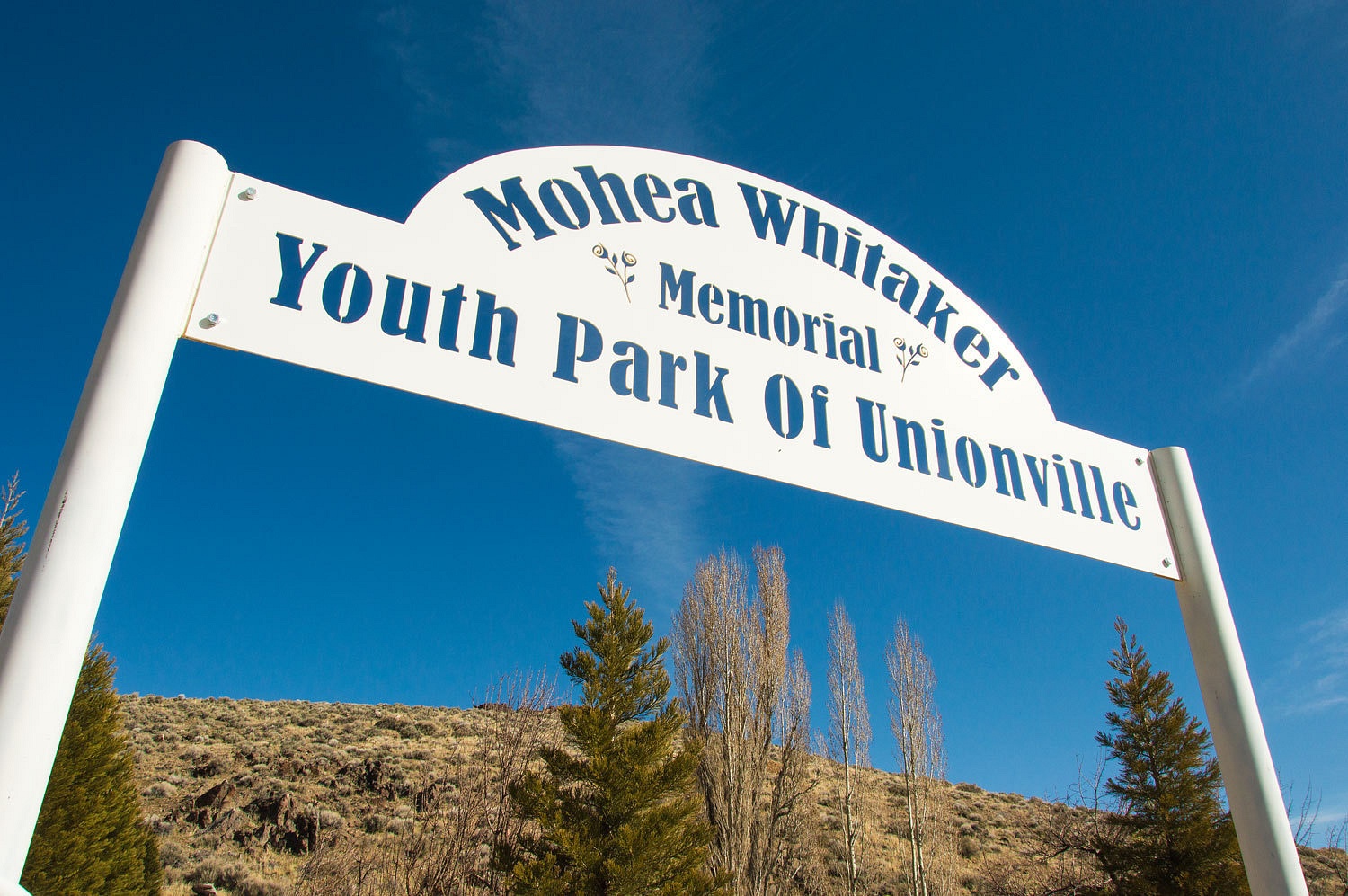
There is a
well cared for central park, which is pretty darn nice since the total
population is noted as 20.
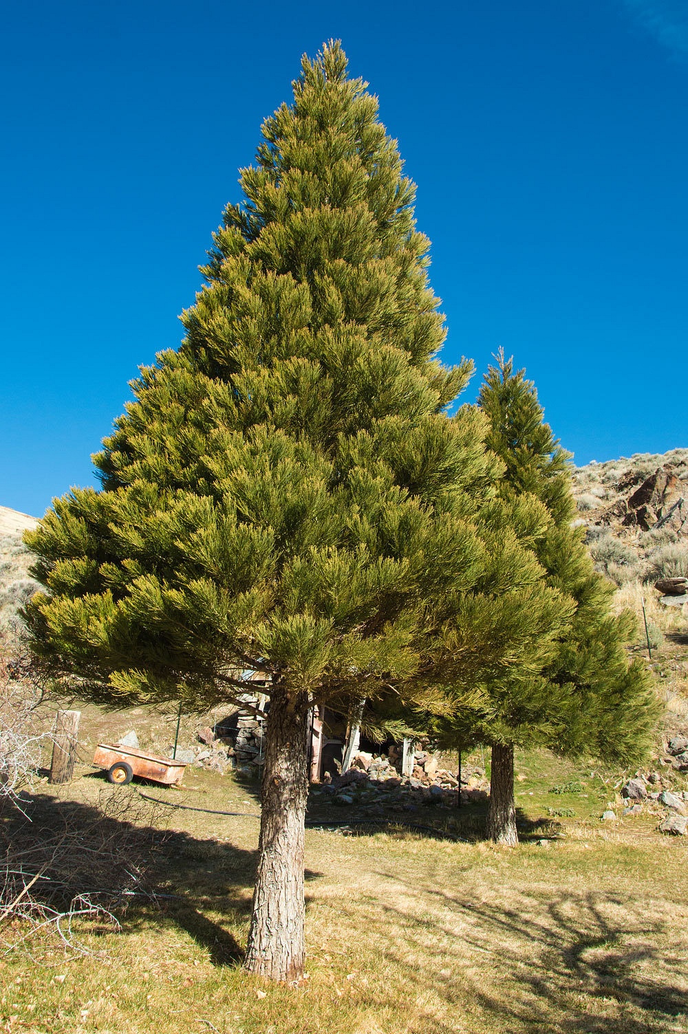
Our next
"what you find...................................." was Giant Sequoia
trees ringing the park, more than a bit out of place in this arid environment.
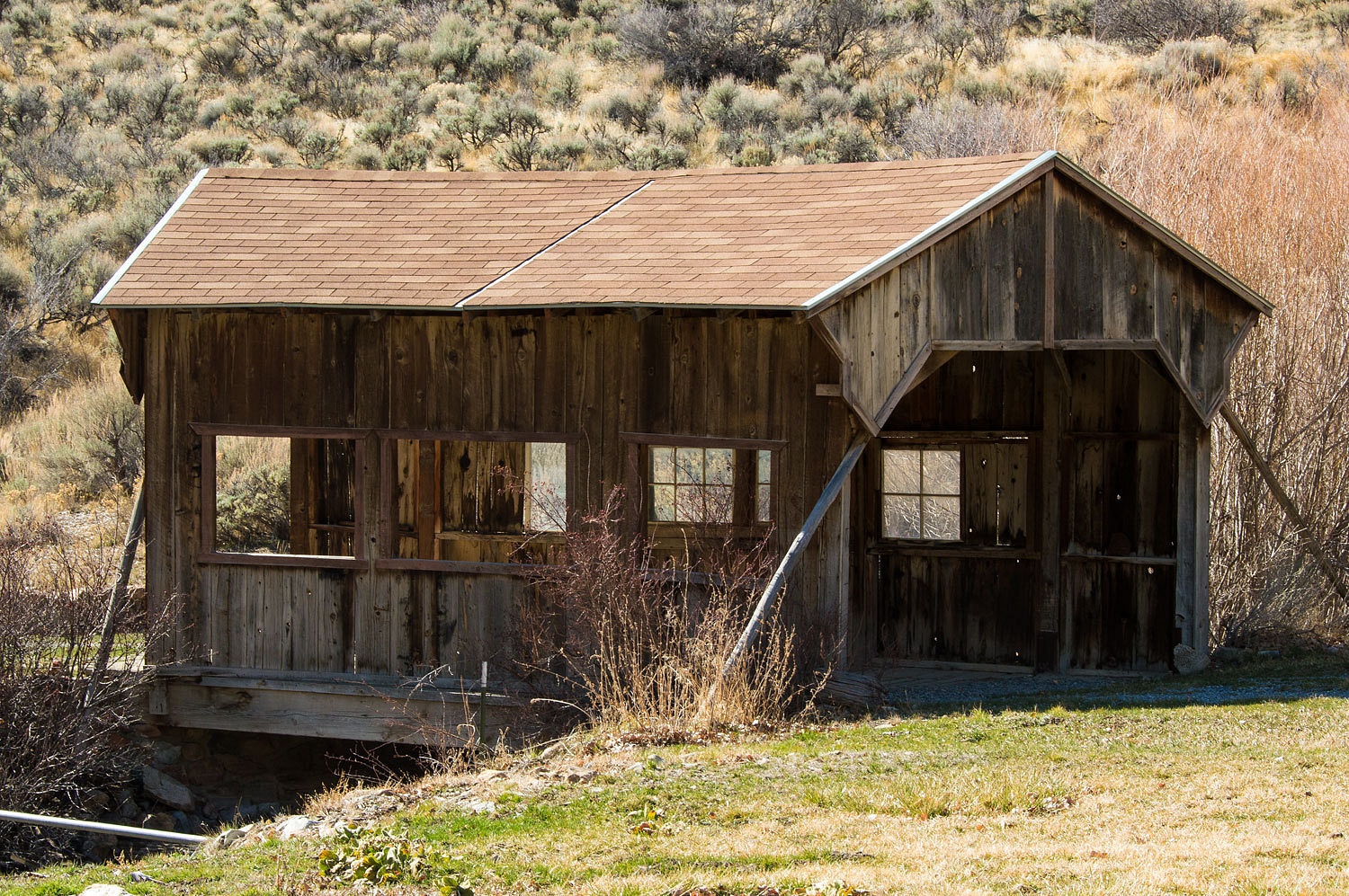
And what
next? A covered bridge.
There are a
few occupied homes and a Bed & Breakfast in a historic old hotel where Mark
Twain took his evening meals.
Leaving
Unionville, our explorations continued. Our next stop was Kyle Hot Springs on
the east side of Buena Vista Valley, tucked up against the East Range.
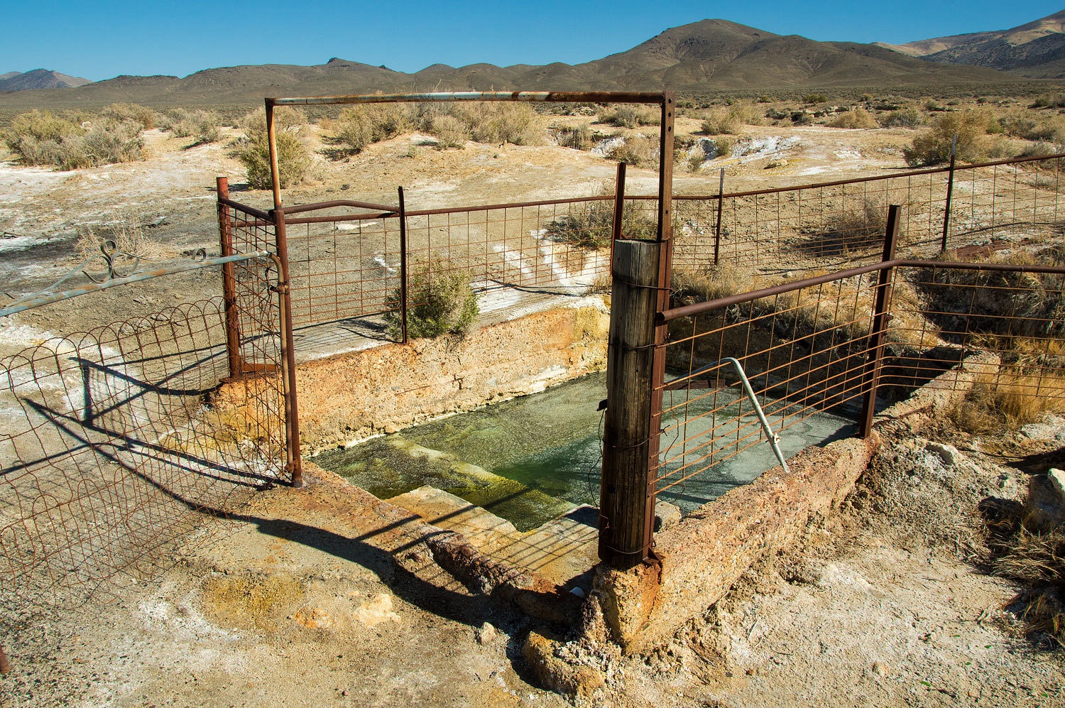
This
appeared to be a very old developed soaking pool. It is fed from a nearby open
source and the water is very warm, too warm to soak. There was a clean,
attractive, new pool below.
Unfortunately
the water was cool, much too cool on this morning. This could be because of low
volume of inflow - this water was pleasantly warm and would have been wonderful
- or because of the cold overnight temperatures. It sure looked inviting and we
were a bit disappointed, although the water had a strong smell of sulfur.
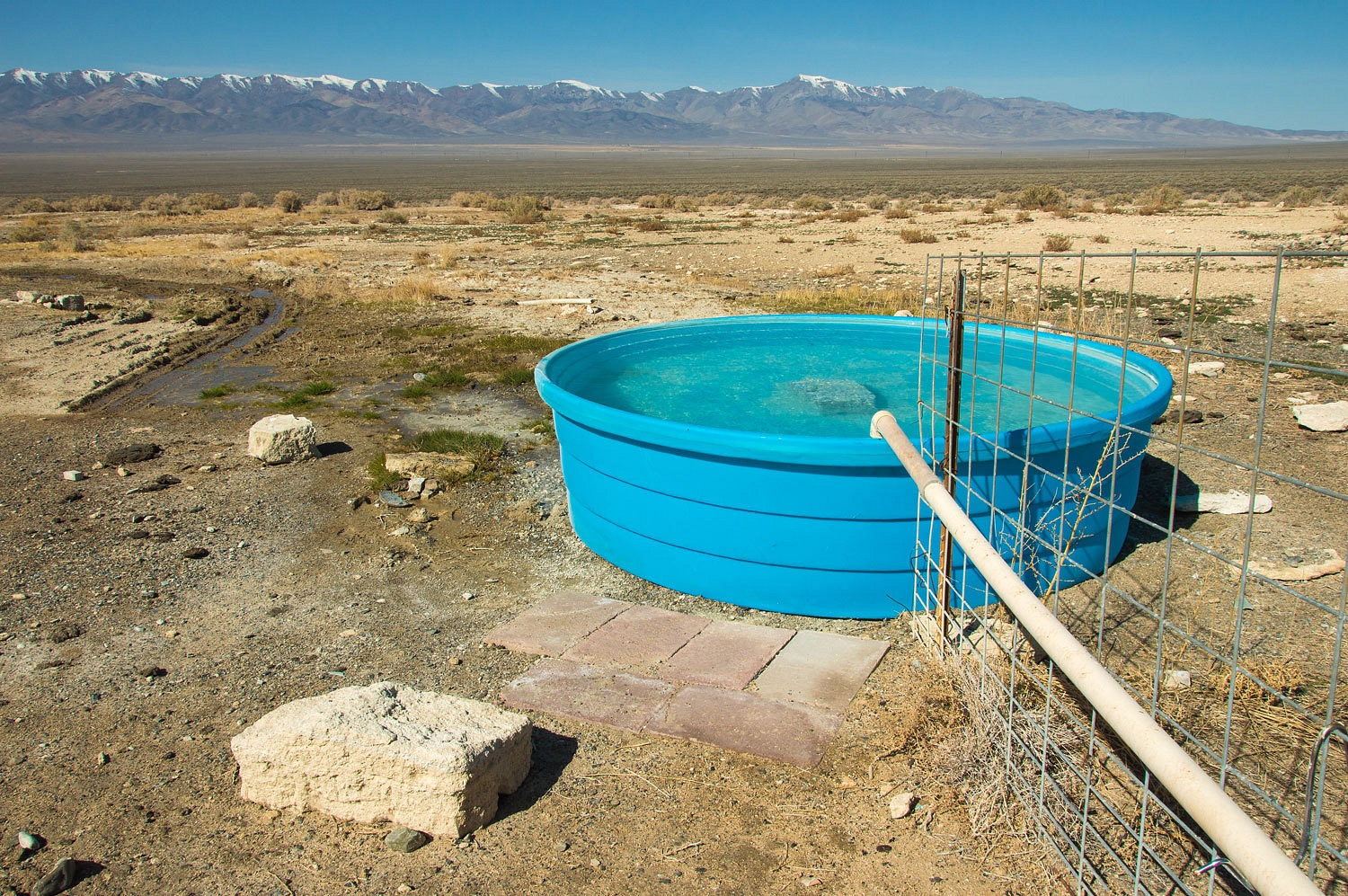
Since the
canyon above was labeled on our topo "Hot Springs Canyon" we drove
about three miles up the primitive road to its end at another spring.
The spring
was cold but still had a strong smell of sulfur.
Now we are
getting around to what we had really came out here to search for. Now if you
think the Pony Express is cool, we think this mostly forgotten piece of history
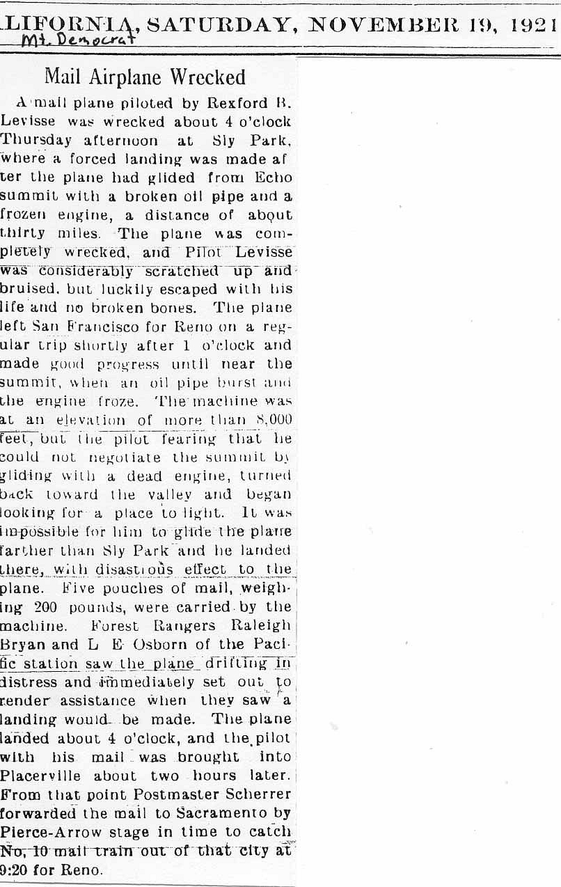
is equally exciting. I first became interested in the early Air Mail pilots
when I found a 1921 newspaper article about a wreck just a few miles from our
home.
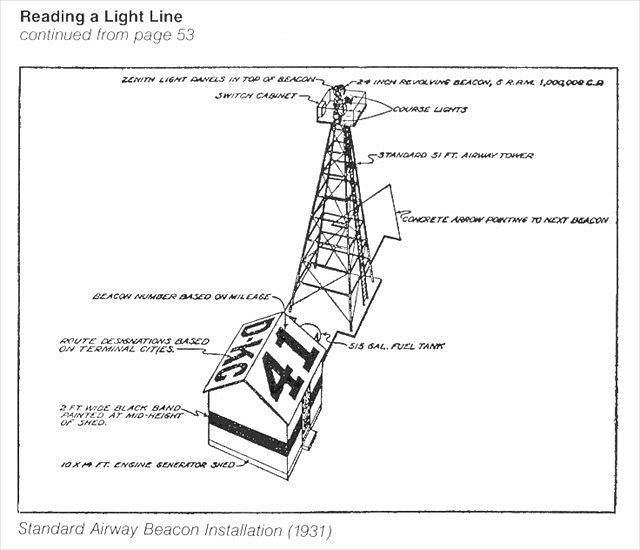
This was the
early years of aviation and these pilots were pioneers. The first scheduled Air Mail service began in 1918. The first Transcontinental Air Mail Route involving
both day and night flying opened July 1, 1924. To aid navigation across the vast unpopulated
areas of the west lighted beacons were placed approximately every 10 miles and
every 30 miles emergency landing fields were established.
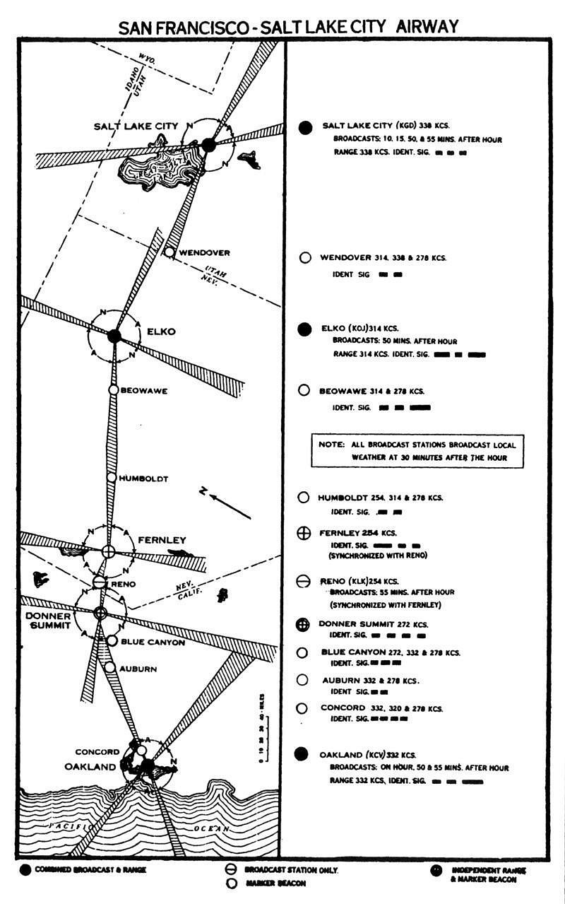
Here's a map
of the field and beacon sites between San Francisco, California and Elko,
Nevada.

So if you
were one of these early pilots flying across the "middle of nowhere" at
night you were literally leapfrogging from one lighted beacon to the next. We
were curious if any of this primitive navigation infrastructure still existed.
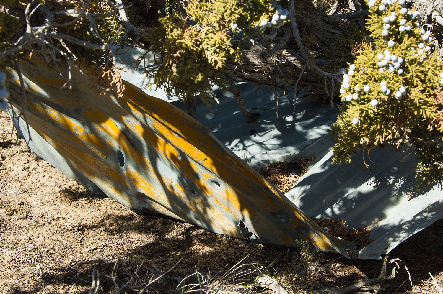
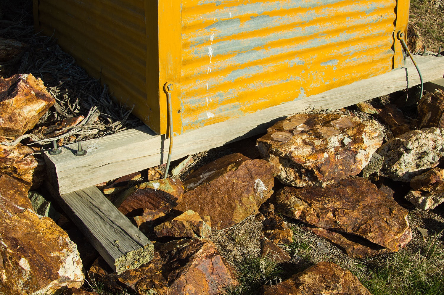
Our first
stop was at the site of the Dago Pass Beacon. I don't believe this was a
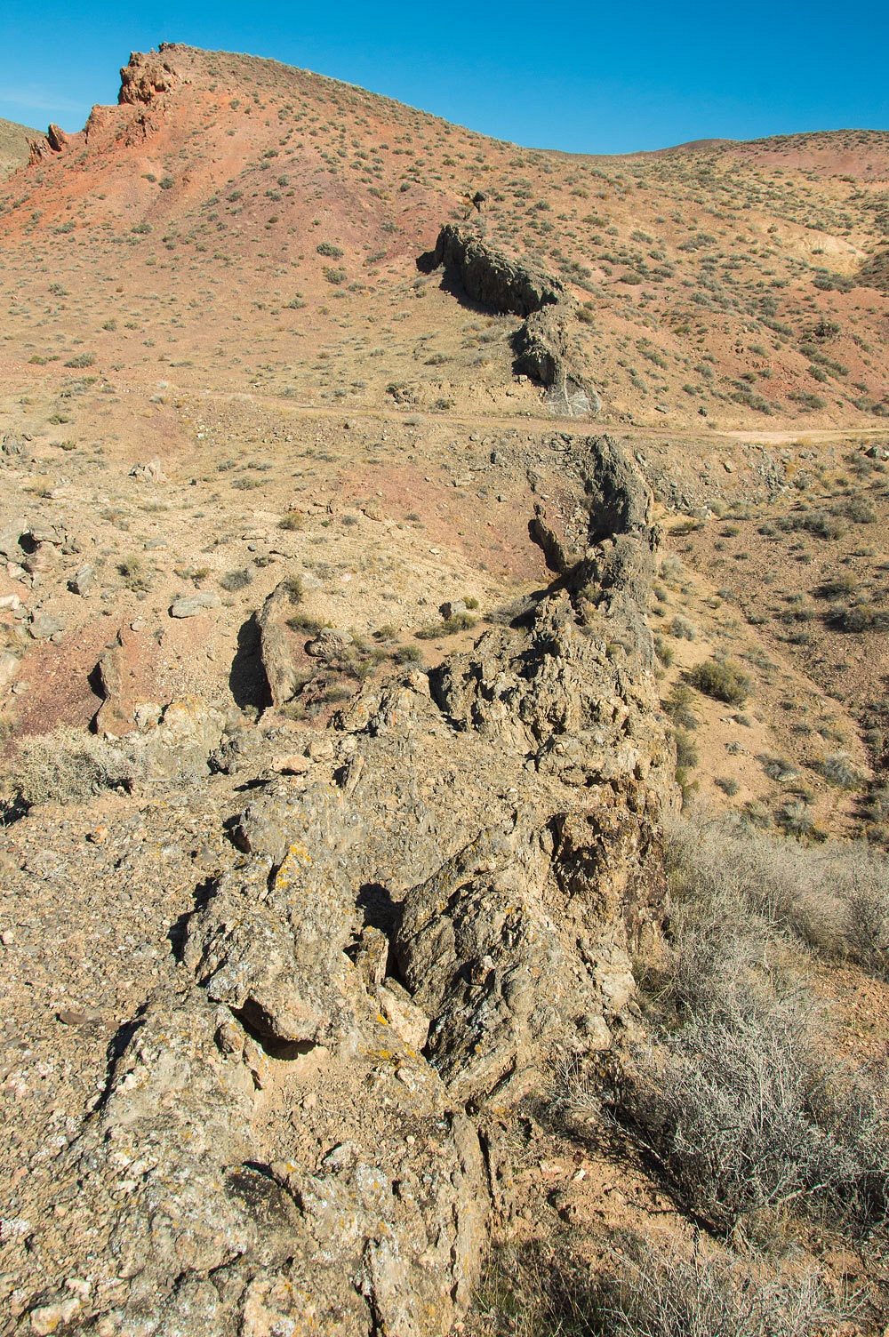
numbered beacon. It is a short ways up and to the east of what is now called McKinney Pass. A view of the top of the knoll.
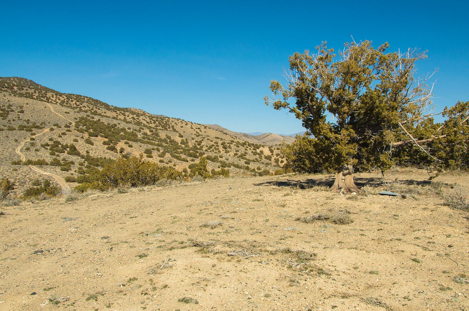
All we found
were pieces of corrugated metal with yellow paint.
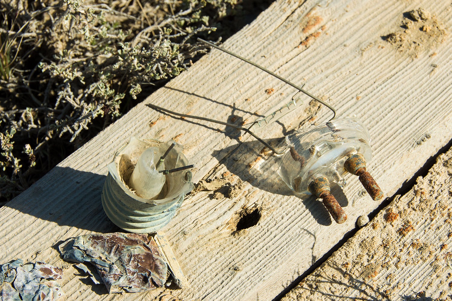
From here
we drove a 4x4 road up to a high point to the west. The 7.5 minute topo names
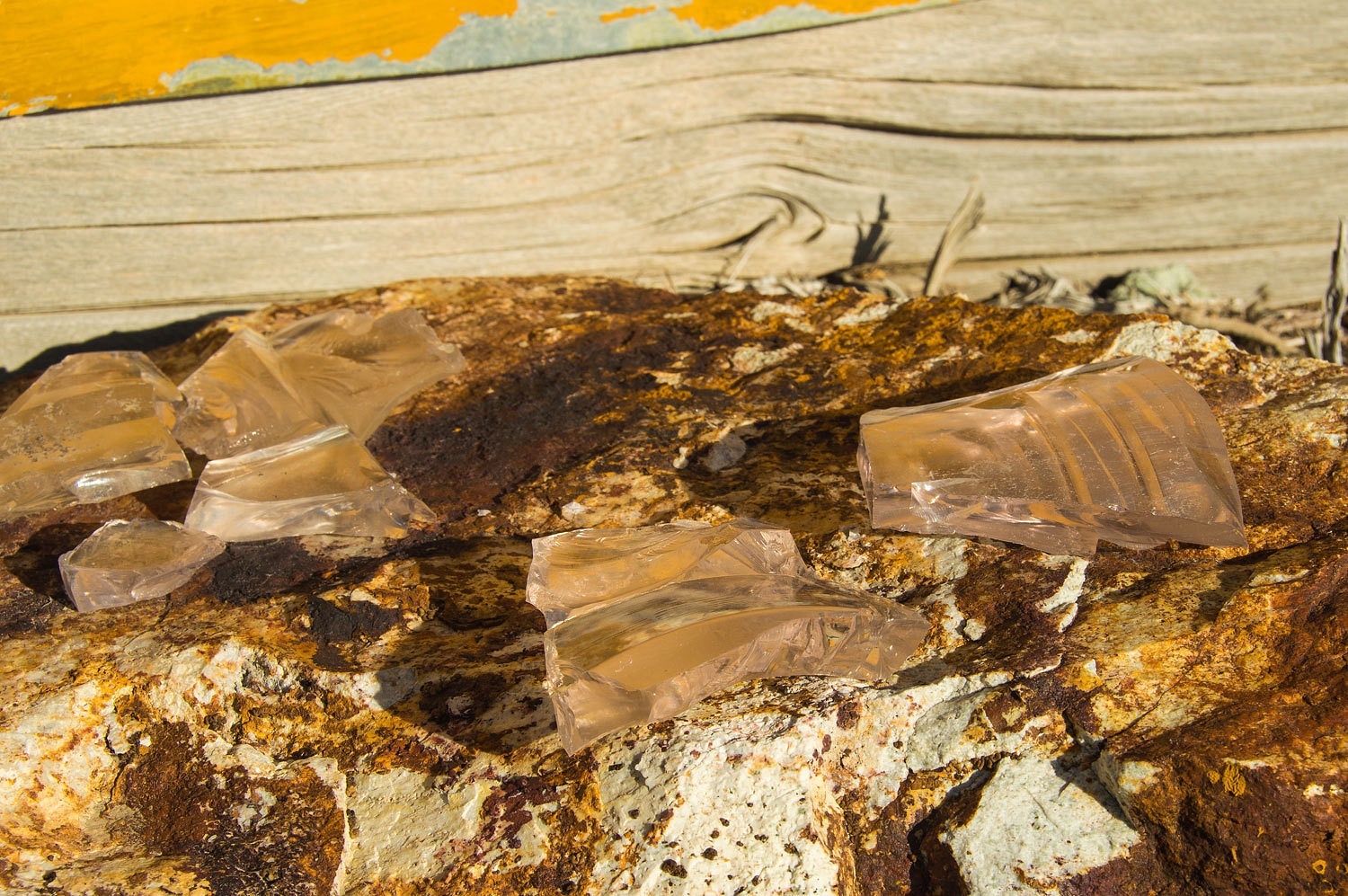
the point "Pleasant Valley Beacon" and was the site of Beacon 30.
This beacon used electric lights and about .25 miles below the peak (where we
parked) is the small foundation for the generator shed. On the summit we found
a simple wood foundation with anchor points. We also found remnants of old
electric light bulbs.

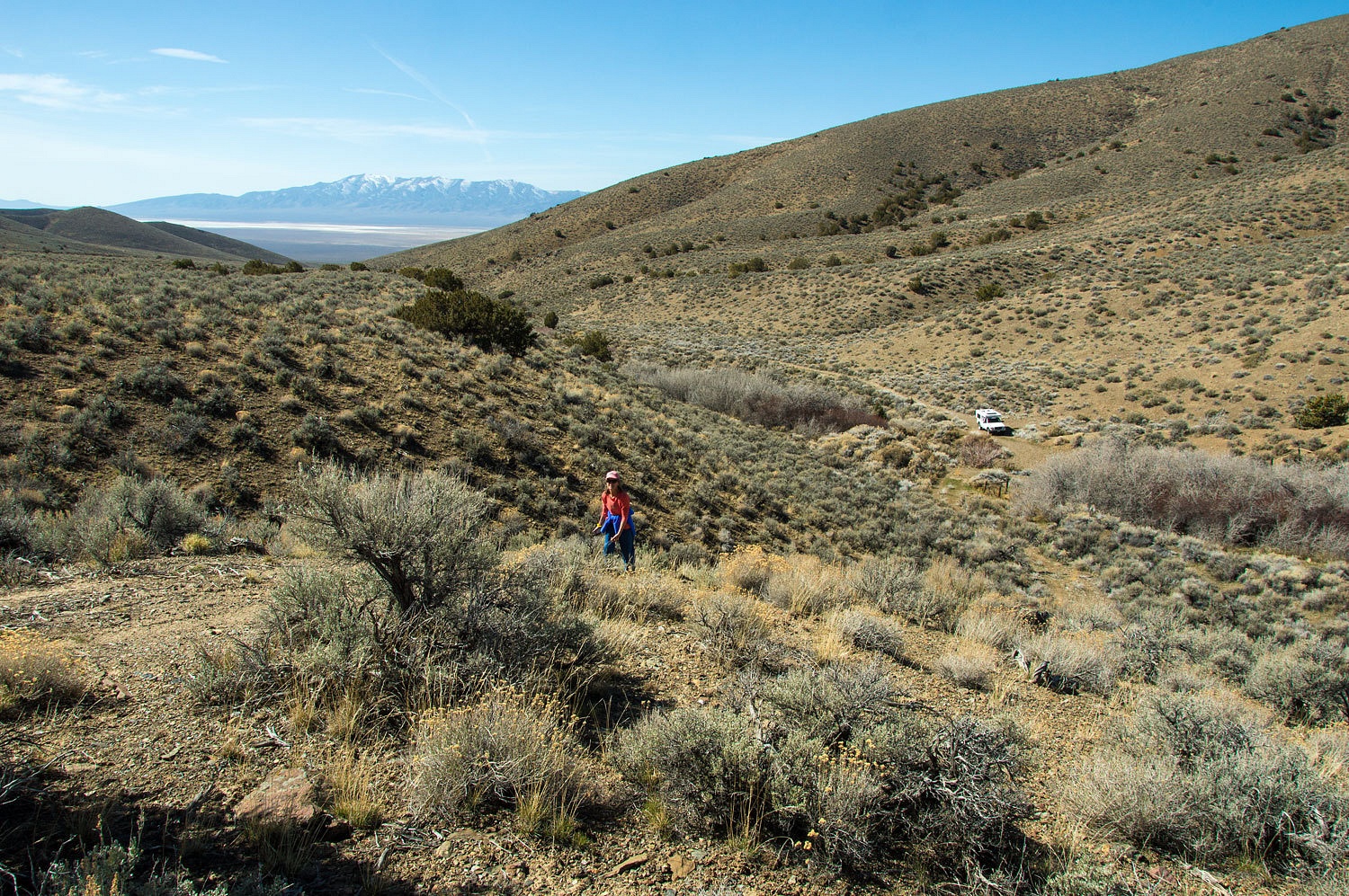
We traveled
east, down off of McKinney Pass to the southern end of Pleasant Valley. We left
the graded dirt and drove north on a primitive two track. This was the first of
three roads this weekend that earned the comment, "This road has deteriorated
markedly." We were looking for a high point to the east of Polkinghorne
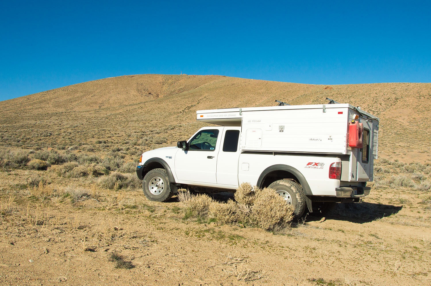
Spring. We parked the truck.
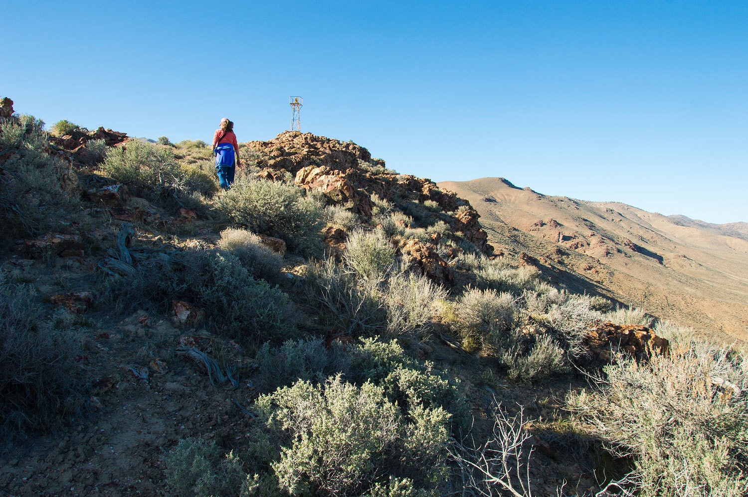
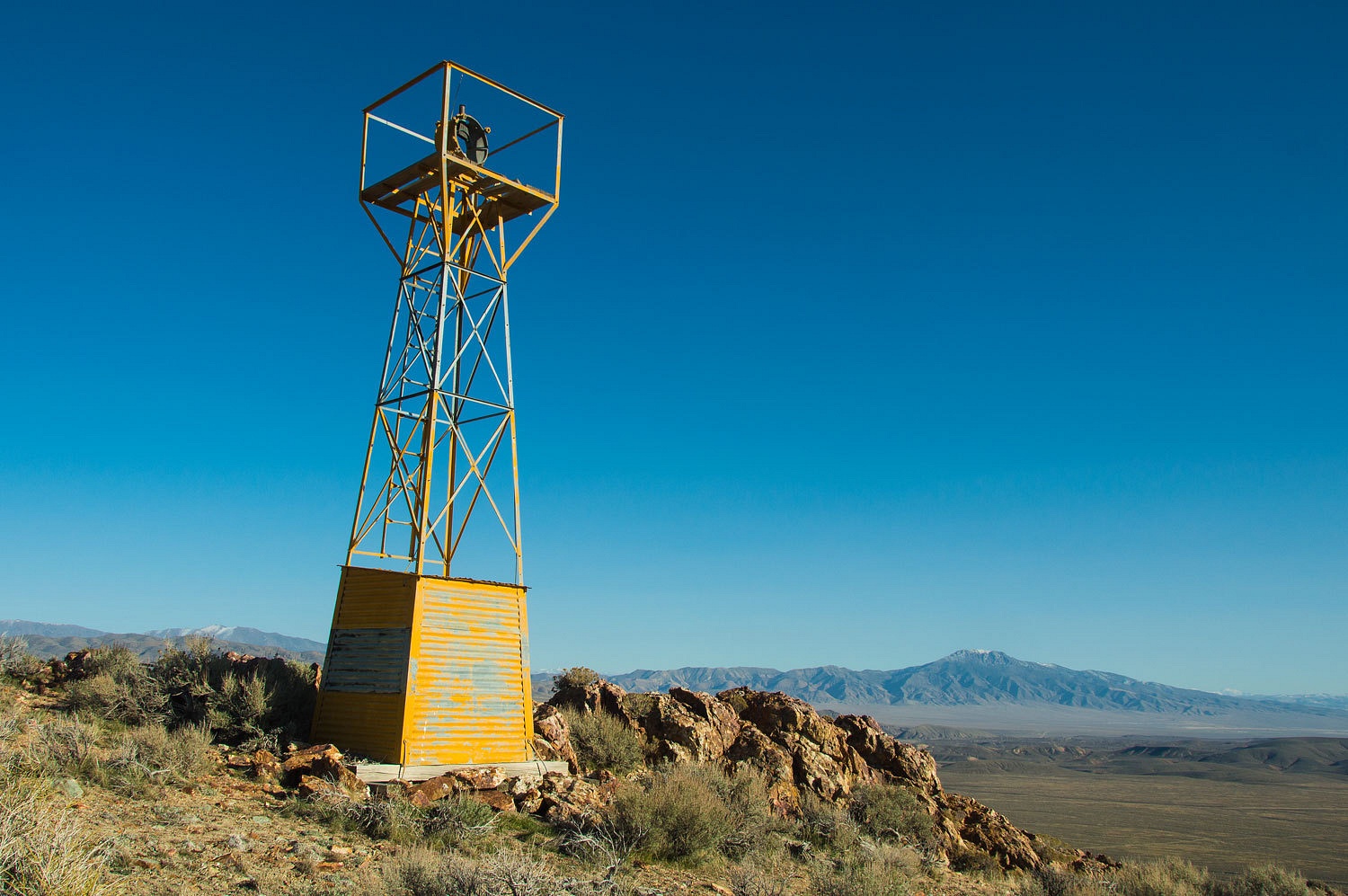
Wow! It
looked like this beacon tower was still standing! it was about a .75 mile climb
up to the point.
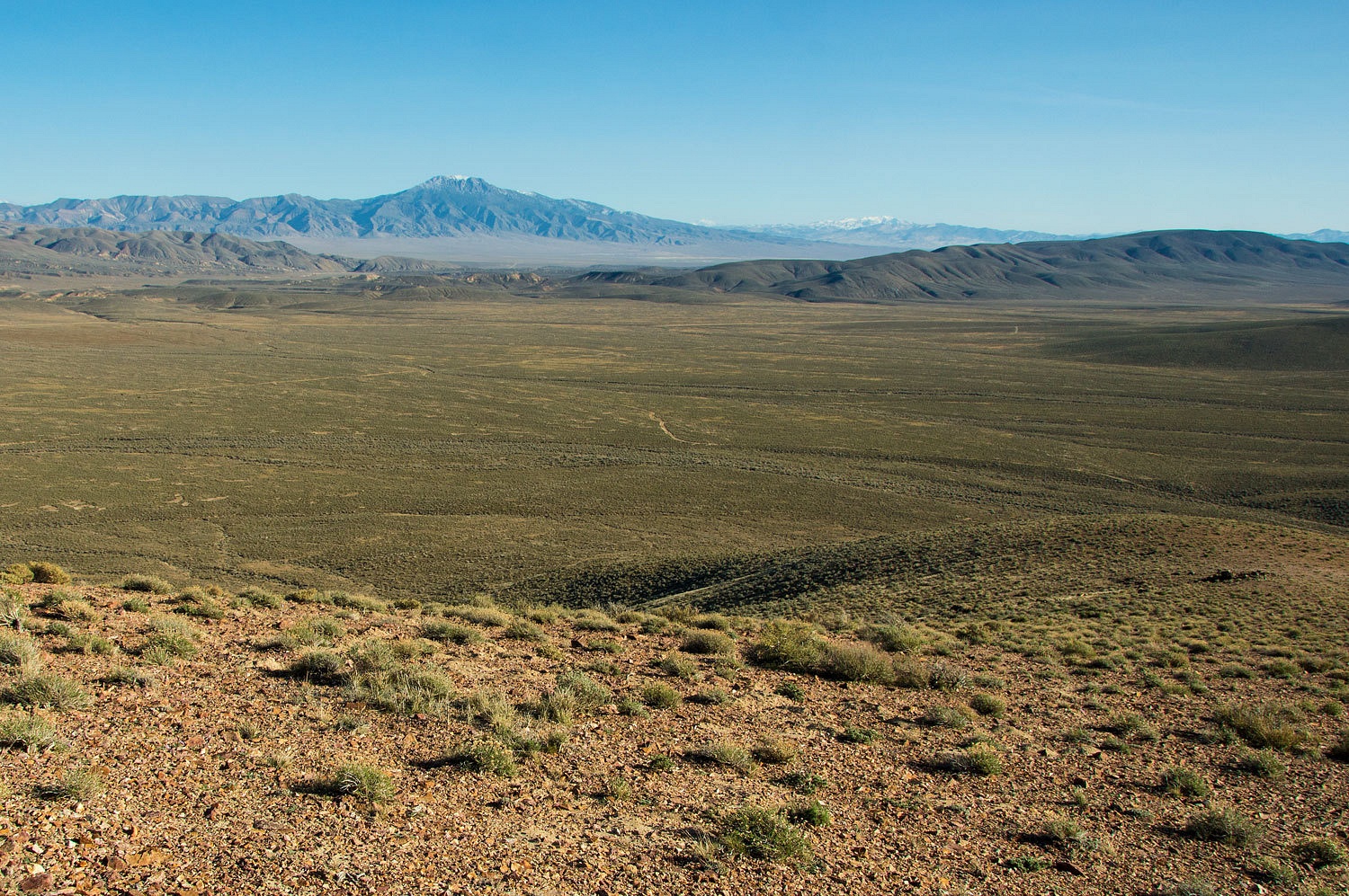
The views were great. Here is a shot to the southeast and Pleasant Valley and Dixie Valley beyond.
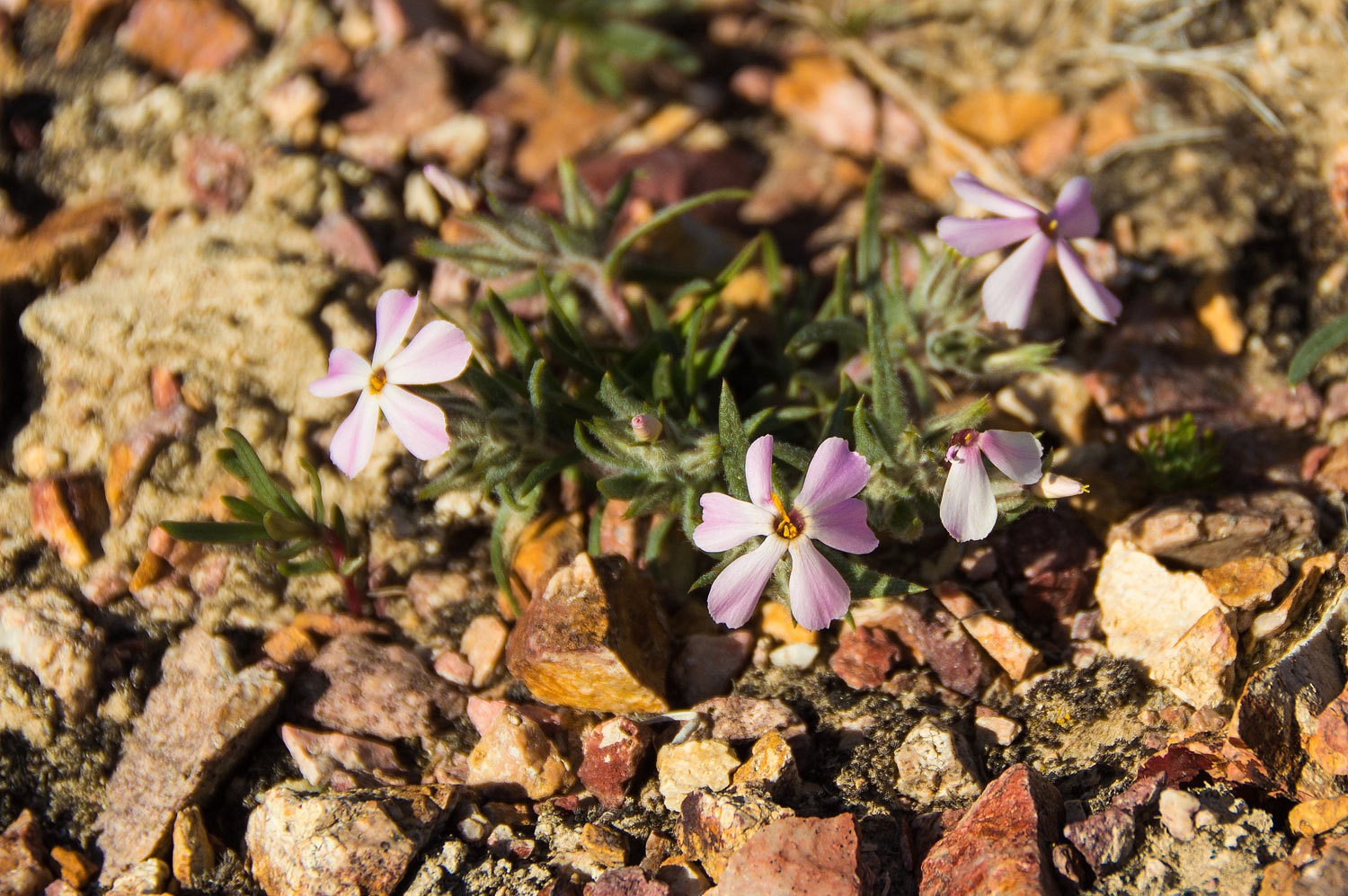
Spring is coming and we were surprised by some tiny wild flowers.
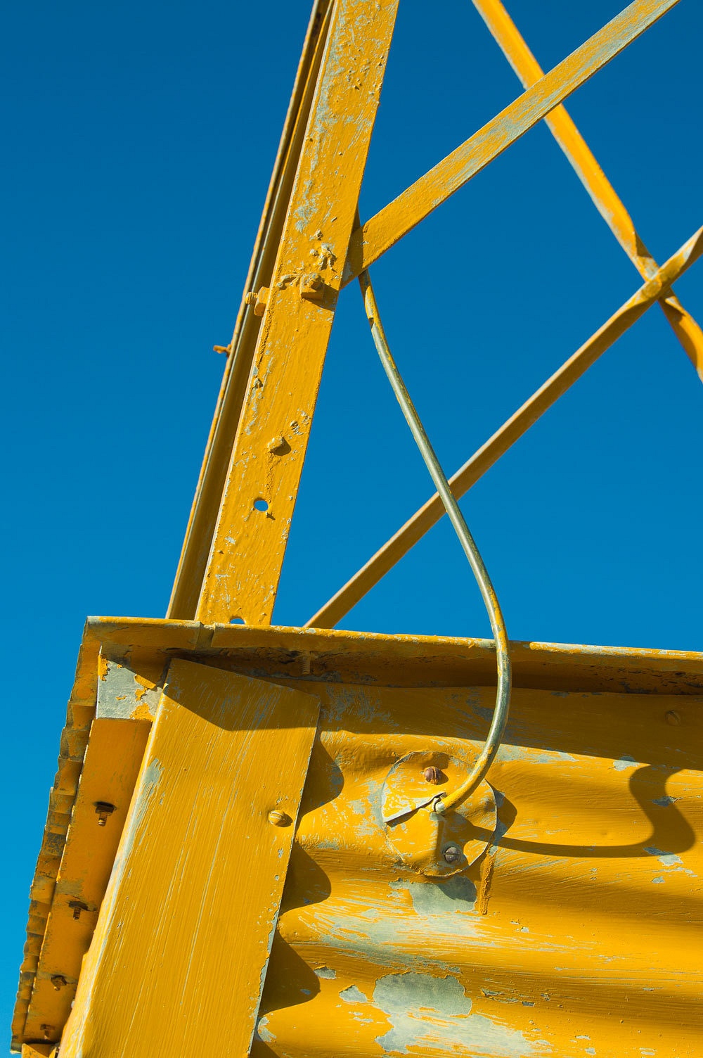
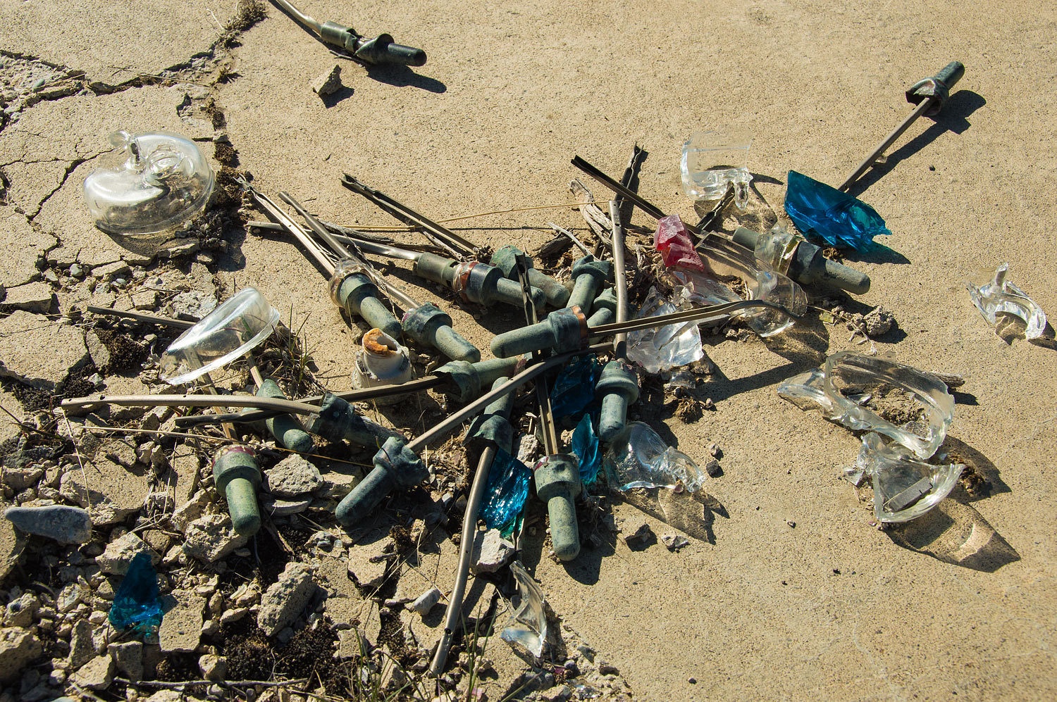
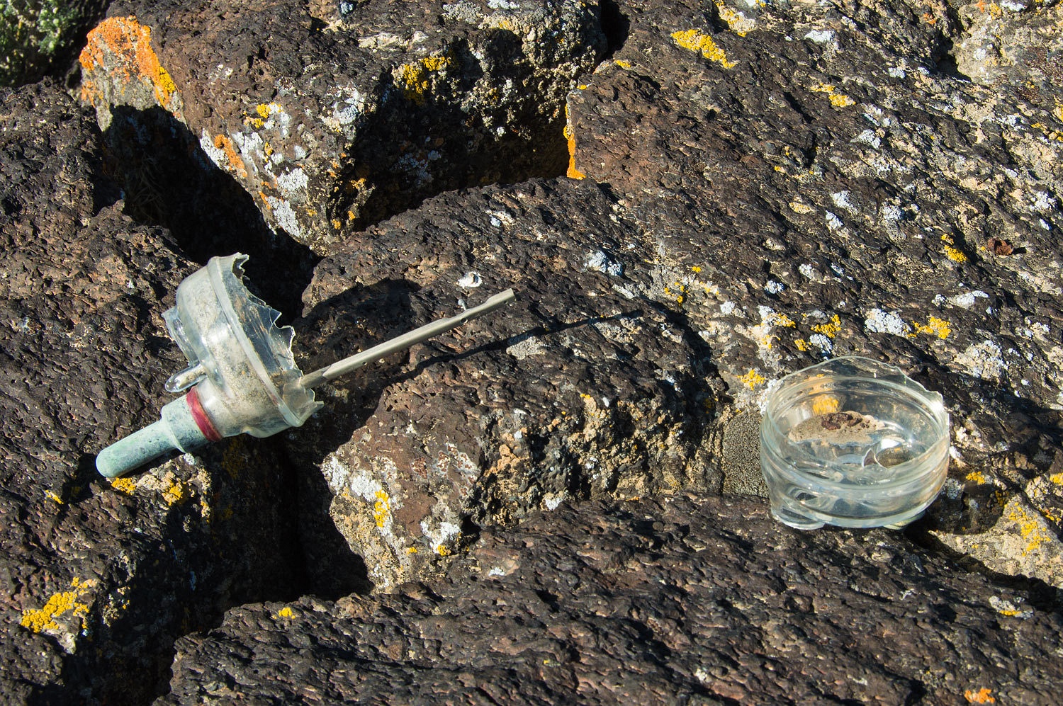
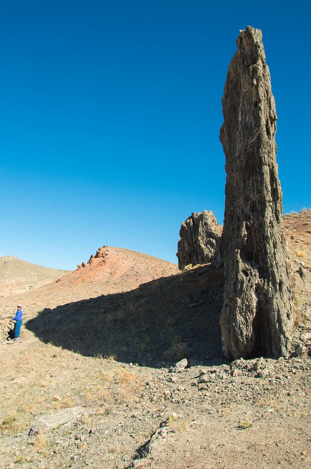
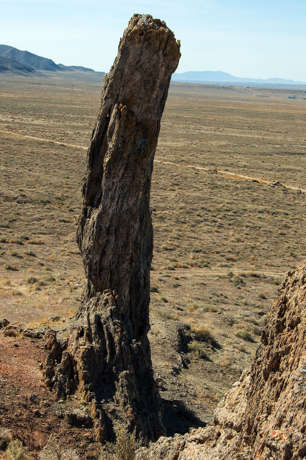
Far from any improved road and, thankfully without vehicle access, this beacon is almost completely intact.
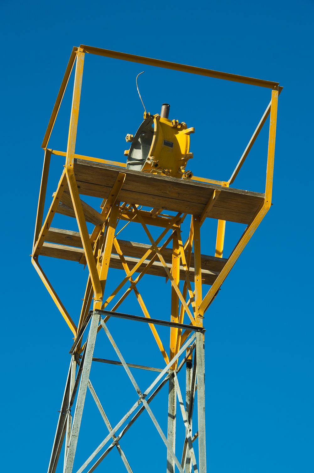

We found pieces of the lens from the acetylene lamp.
Inside the base were the gas connections.
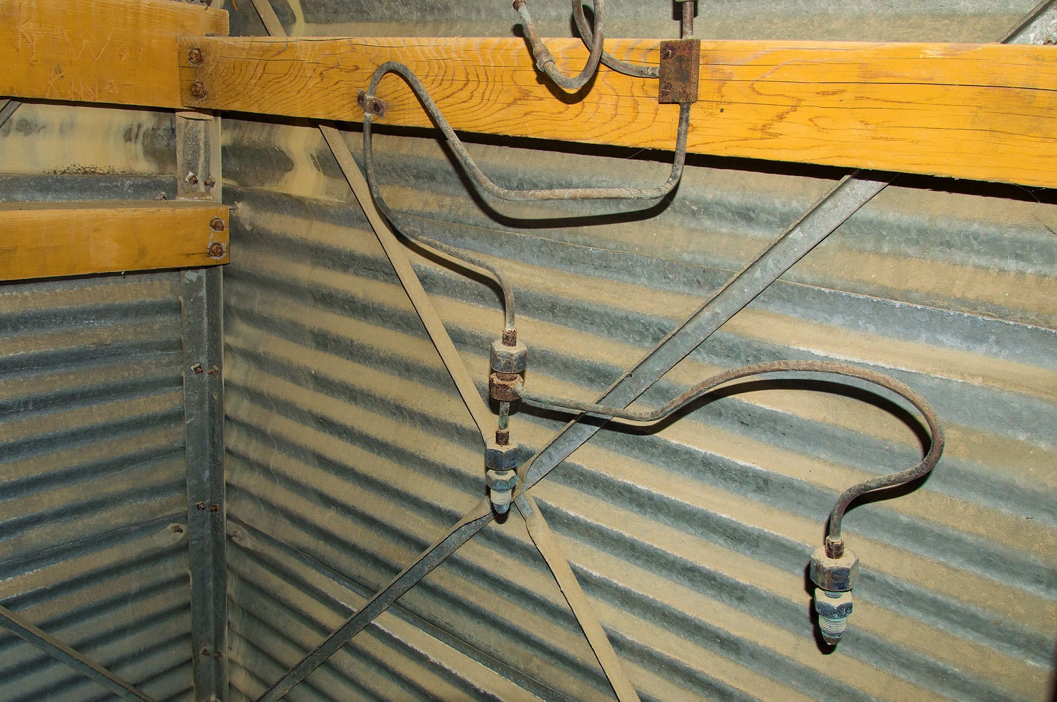
Finding an intact beacon tower, we were now able to understand the remains left at the previous two beacon sites.
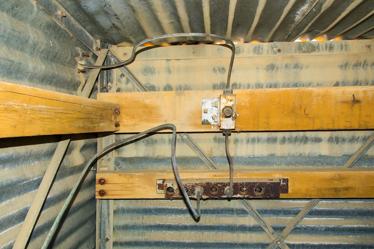
Here is the
gas line working its way up to the lamp.
This is a
remarkable historic site, out here "in the middle of nowhere."
We took our
time in the late afternoon coming down from the point and we continued to enjoy
the flowers.

On the peak at the site of Beacon 30, another couple followed us up. They were
the only two people we saw out in the backcountry this weekend. The man worked
at the large mine to the west in the Humboldt Range. They were also exploring
and suggested we visit Ladd Canyon, down the west side of McKinney Pass. We
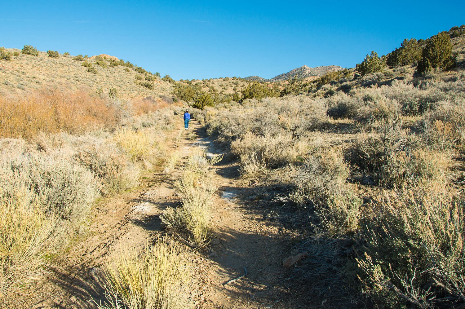
headed over to see if we could find a nice campsite for the night.
"This
road has deteriorated markedly." The Lady spotted us once as we straddled
a deep washout in 4 low. But the terrain and weather were wonderful. It was a
great place for settling up camp in the late afternoon.

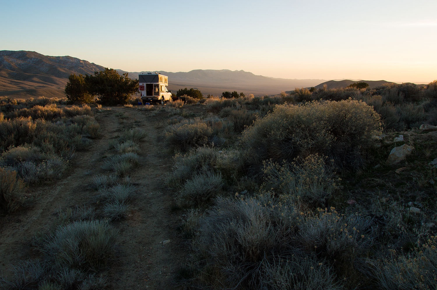
This was
another deliciously quiet night that brought deep and refreshing sleep. The
full moon was still up in the west before dawn.

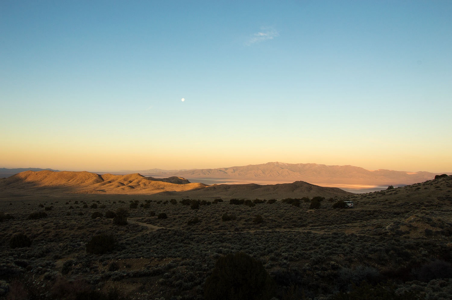
At this
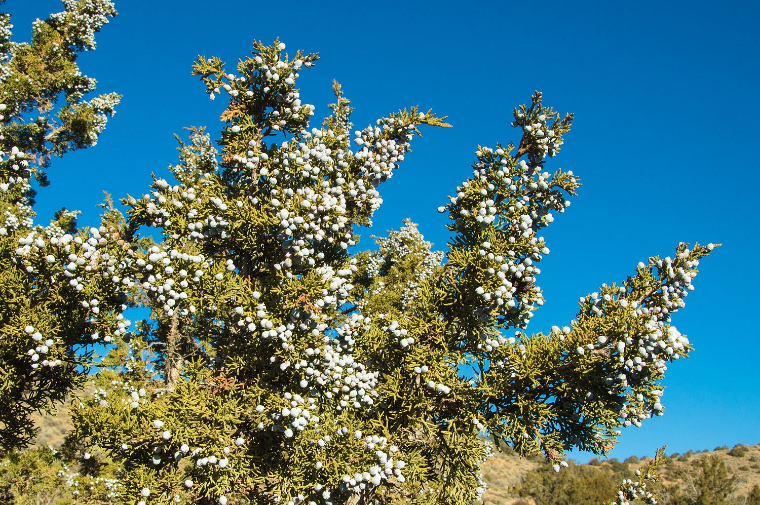
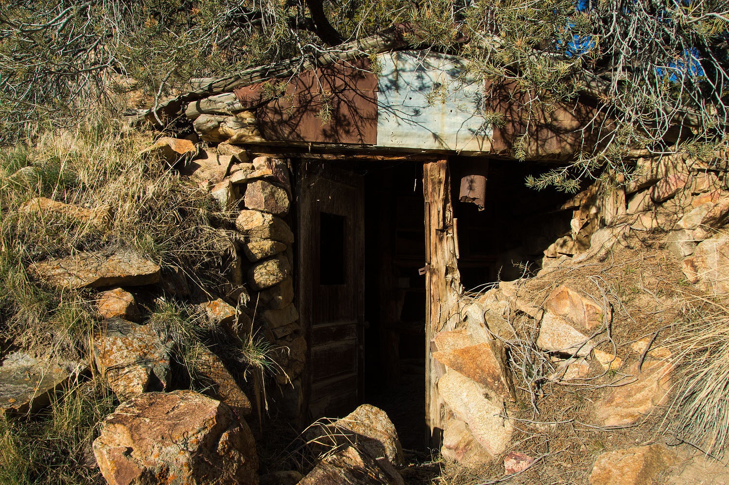
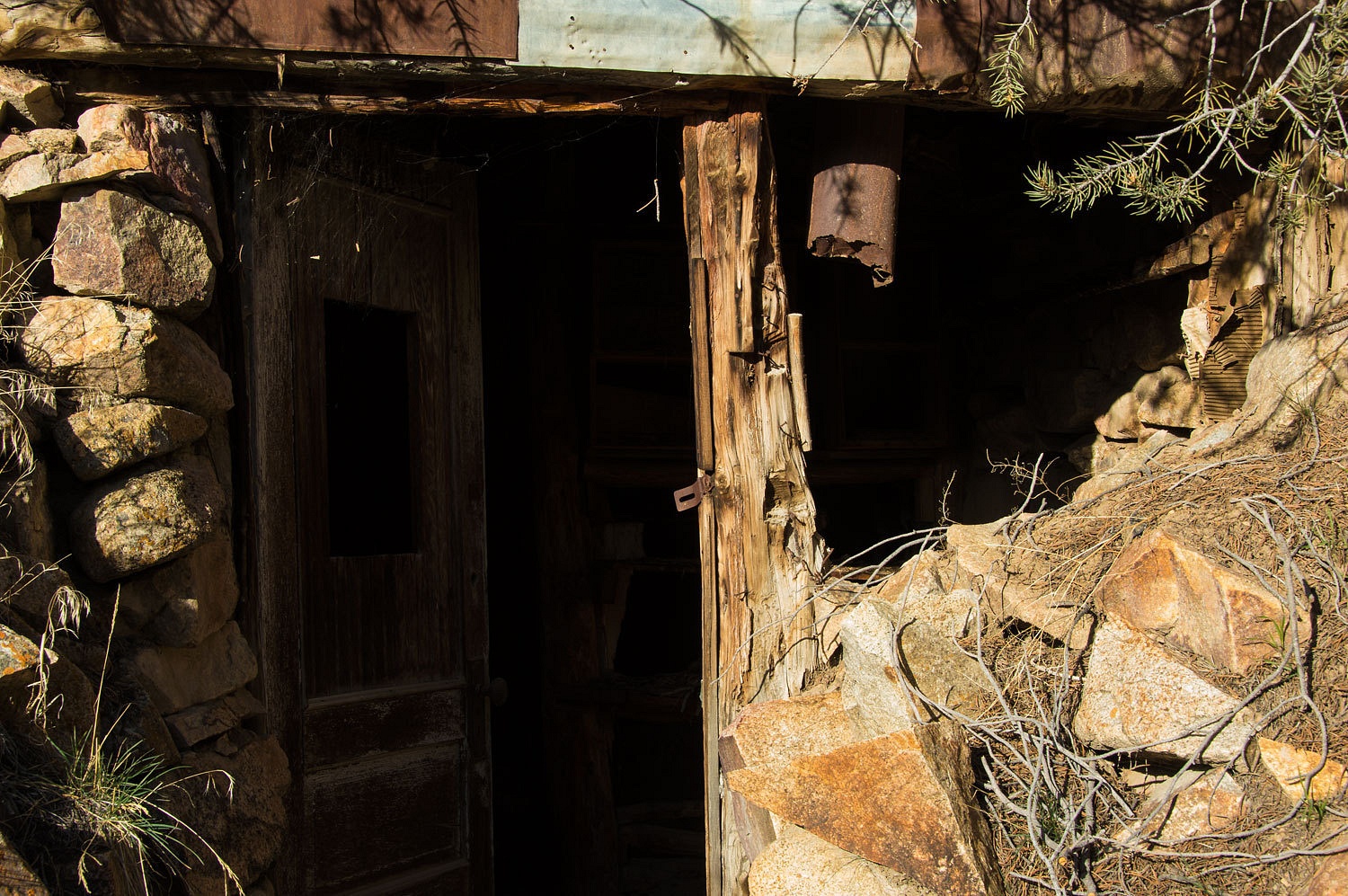
higher perch away from the valley bottom, the overnight low was only 34°. After breakfast we explored a short ways
up Ladd Canyon. The couple had told us of an interesting miner's dugout. The
Juniper berry crop is large this year.
Improvement in navigation
came quickly in the early days of aviation. The Radio Range Stations
were the first of the radio navigation aids and soon replaced the lighted beacons
on the Transcontinental Airmail Route.
From our overnight spot, way out
across the southern end of Buena Vista Valley is the site of the Humboldt Radio
Range Station.
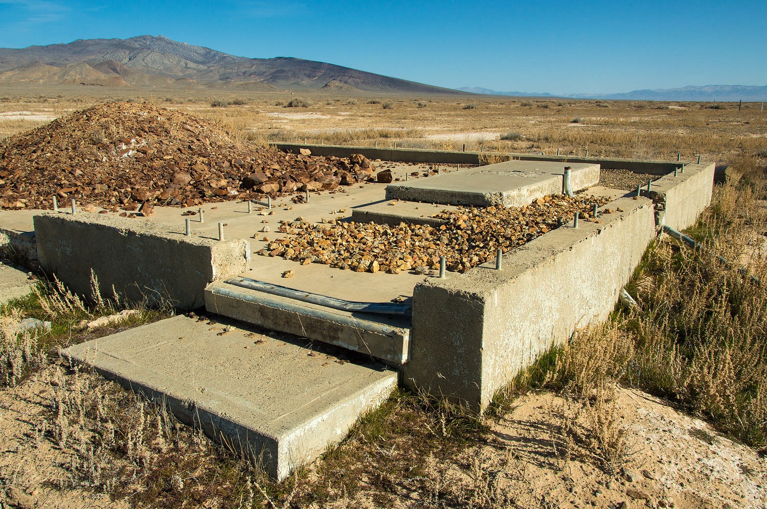
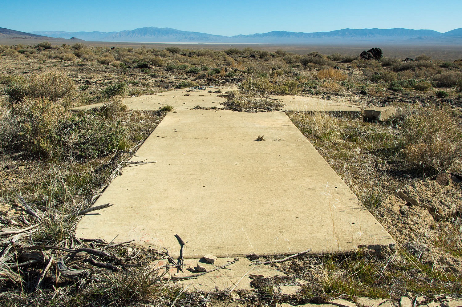
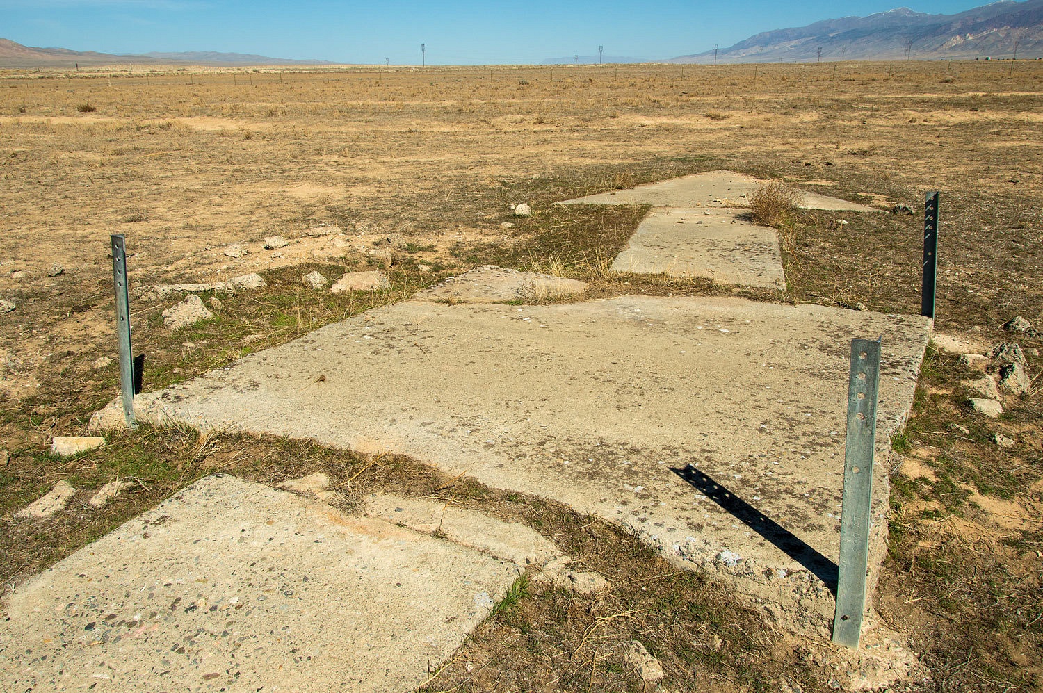
I expect
that few people passing by this foundation have any idea what this site was. All
that remains is the foundation, electrical debris, and the four corners of the
perimeter fence.

Our next
stop was a few miles to the west to a high spot in the Buena Vista Hills. This
was the site of Air Mail Beacon 28A.
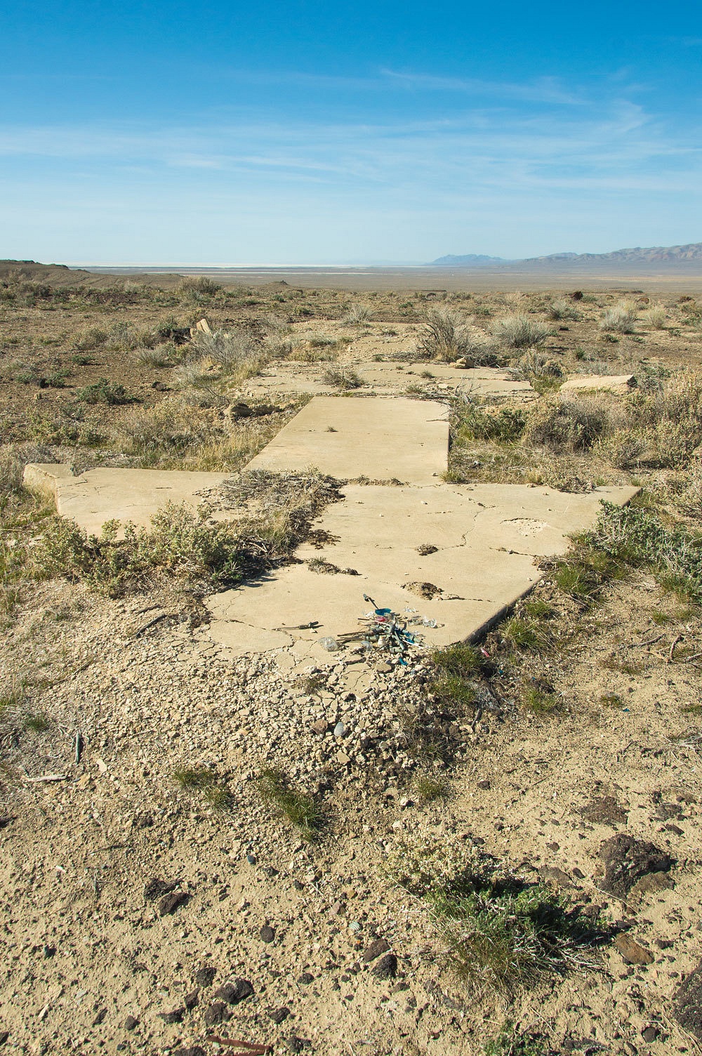
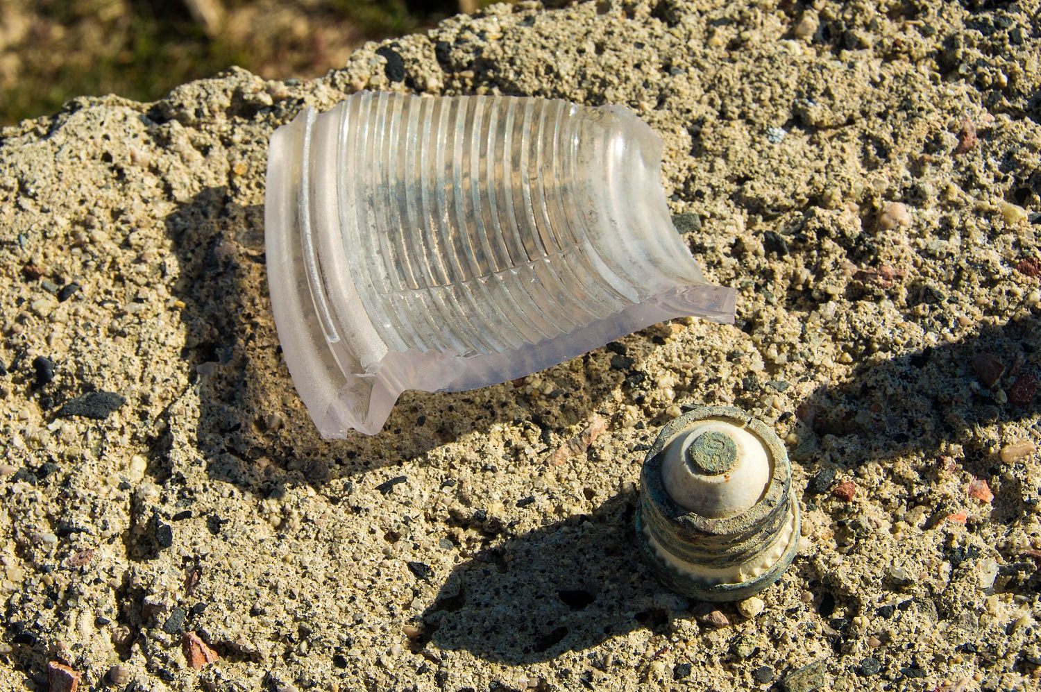
This was a
little more elaborate electric powered site
There were
broken pieces of electric light bulbs and screw in fuses.
The arrow
pointed directly at McKinney Pass (Dago Pass) and Beacon 30 (Pleasant Valley
Beacon).
I should
mention this about the road up to this site, "This road has deteriorated
markedly."
It was time
to head to the north and intersect with Interstate 80 outside of Lovelock. Just
before the Interstate we got distracted by a most interesting dike.
We had one
more airway beacon site to visit. The original transcontinental Air Mail Route followed the railroad and Humboldt River across Nevada. This was used for only one year until the infrastructure for the new route was established from Battle Mountain to Fernley. This route was 150 miles shorter. This beacon is easy to find if you are traveling
Interstate 80. Take the Coal Canyon Road
exit north of Lovelock. Go northwest, cross the railroad tracks, and turn
northeast (right) onto the frontage road (Upper Valley Road). Travel about
three miles. Where the road makes a 90° turn away from the Interstate, and
before you cross the railroad tracks again, you will see the Airway Beacon site
on your right.
If you are
interested, here are websites with more information on the Airway Beacons.
I expect we
will soon be out again to see "what you find in the middle of
nowhere."
Great to learn some local history I have 40 acres north of the slab you mention "few know what it was" well now I do. Thank you very much.
ReplyDeleteThank you for the nice comment. We are glad you enjoyed the history. There is so much to discover out in your area.
ReplyDeleteOn the east slope of the Humboldt Range, in the northern reaches of the range, is Santa Clara. A contemporary of Star City and Unionville. You have to hike the old stage road. Solitude, stone ruins, a couple of mines, an ore cart. On the topo map.
ReplyDeleteI like the old airway beacons. A bit of history I knew nothing about.
Great photos!
I own some acreage in this area. I haven't been out to visit yet, but the photographs are absolutely gorgeous. Thanks for sharing your trip.
ReplyDelete