
please remember you can click on a photo to see a larger version
It was just
getting dark. "Don't go any further. We don't want to ruin a tire,"
the Lady said to stop our forward progress. The remains of an assassinated
television lay before us. Off to our left was a gut-shot sofa; white bits of
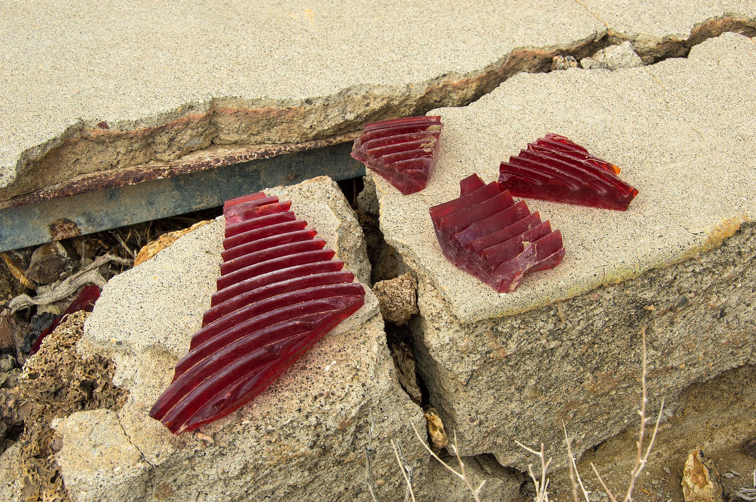
intestine were scattered and stuck to brush, covering an area of over a hundred square yards. It resembled a kill site before the predators and scavengers had completely picked it clean. Spent 12 gauge shell
casings littered the ground.
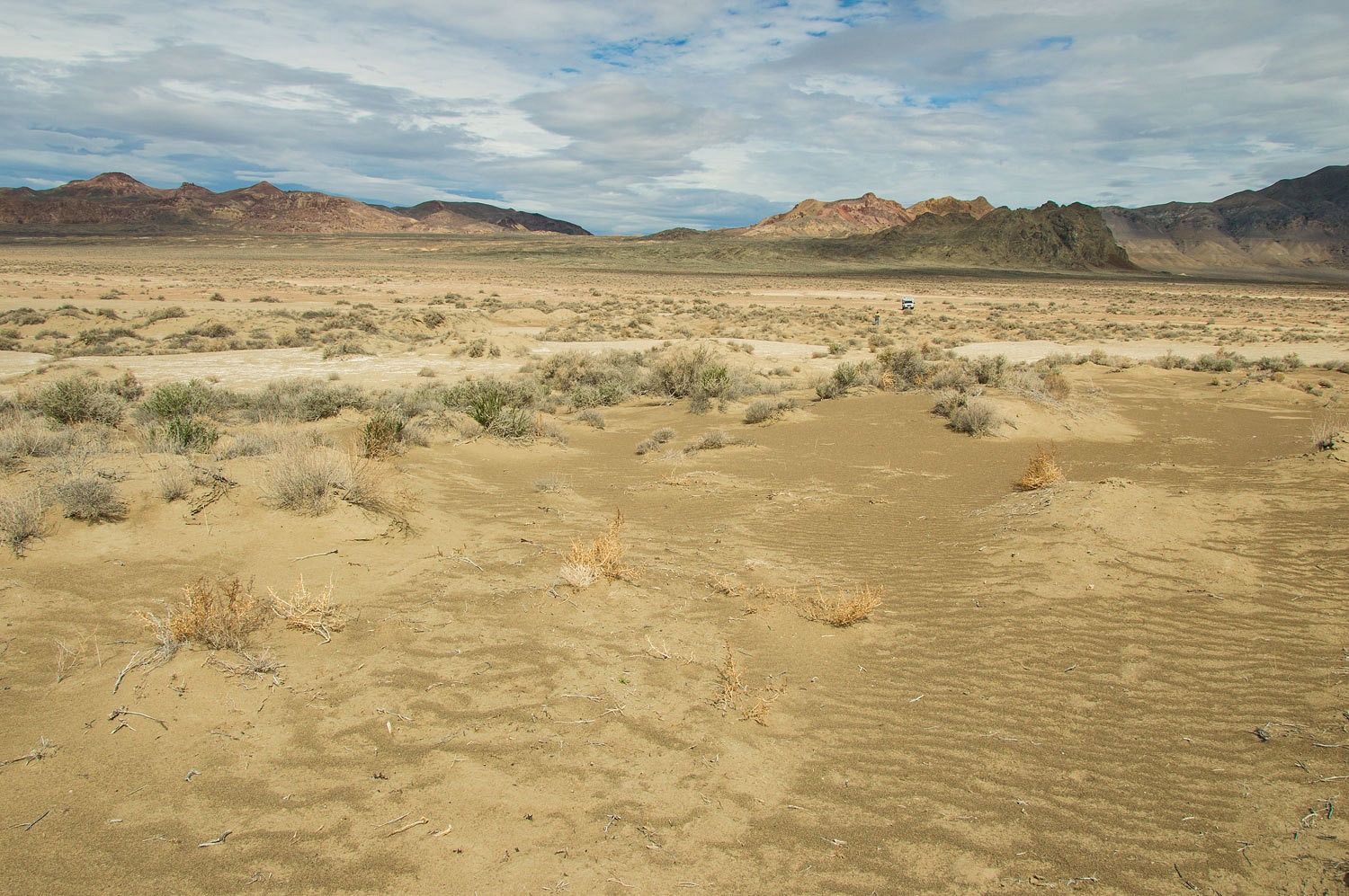
It was
Friday night. This campsite would do for a quick overnight. The vista was
grand, the kind of high point the Lady loves. But, it wore the abuse wrought by
being too close to town.
We left
home late Friday afternoon. As we dropped into Carson City, Nevada, the Lady responded to a text from Ted asking, "Looking for more air mail
beacons?" She answered, "Yes, beacons and arc sites!" Our plan
for the weekend was to travel from Fernley to Lovelock on dirt roads.
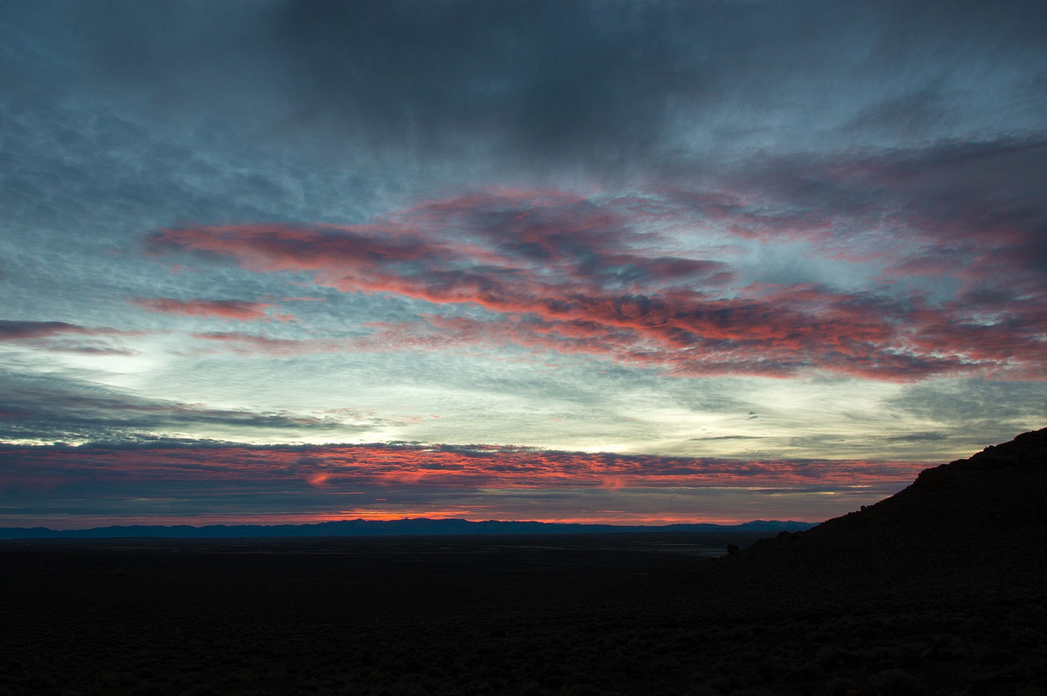
A storm was
passing to the north and brought warm temperatures and cloudy skies. Dawn greeted us with
a nice colorful sky.
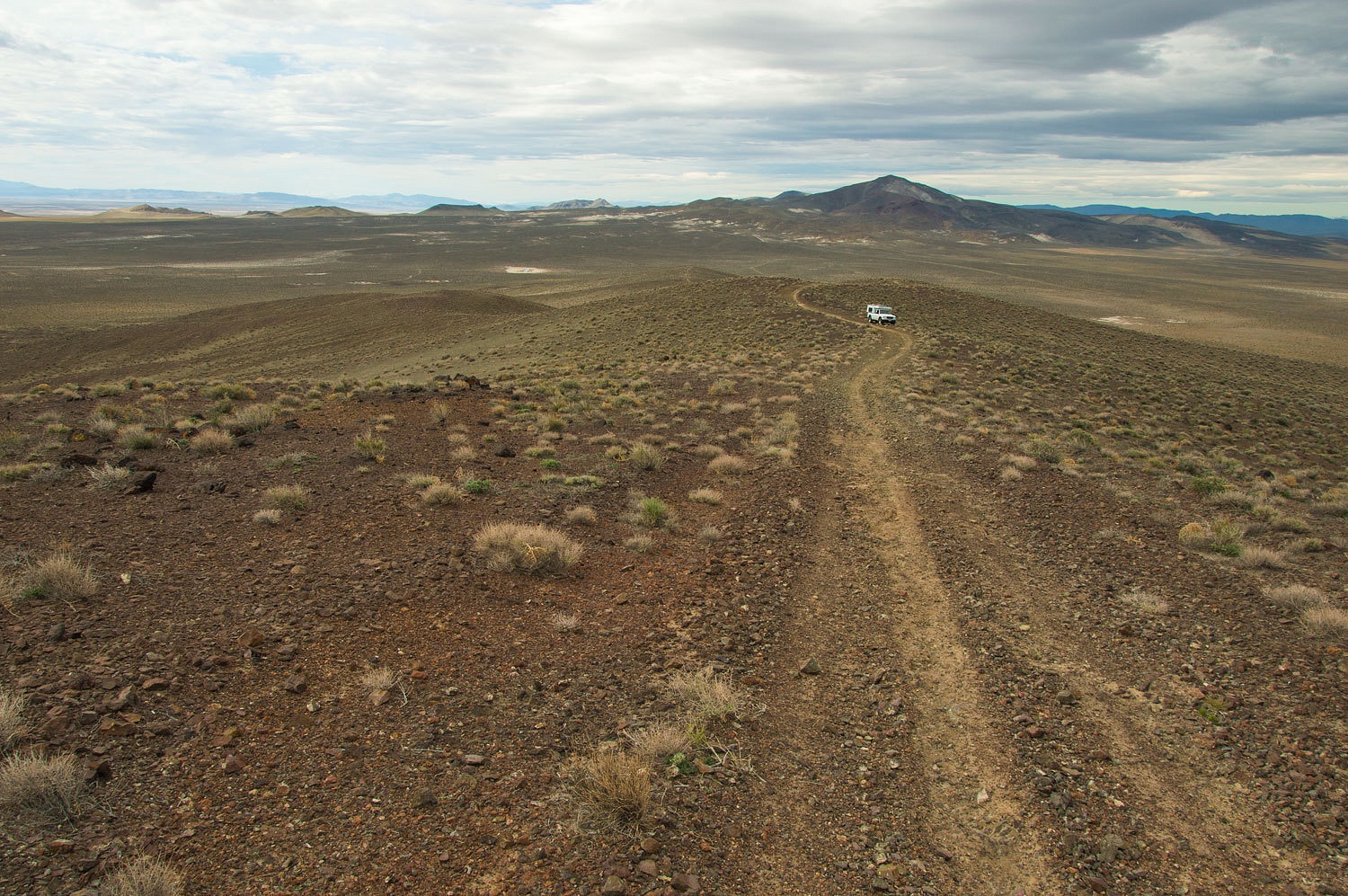
Our route
east took us into the Hot Spring Mountains. We were searching for the site of Beacon 23 on the Transcontinental Air Mail Route. We found a rough two track road that
led to a high point.
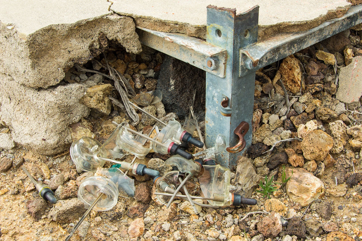
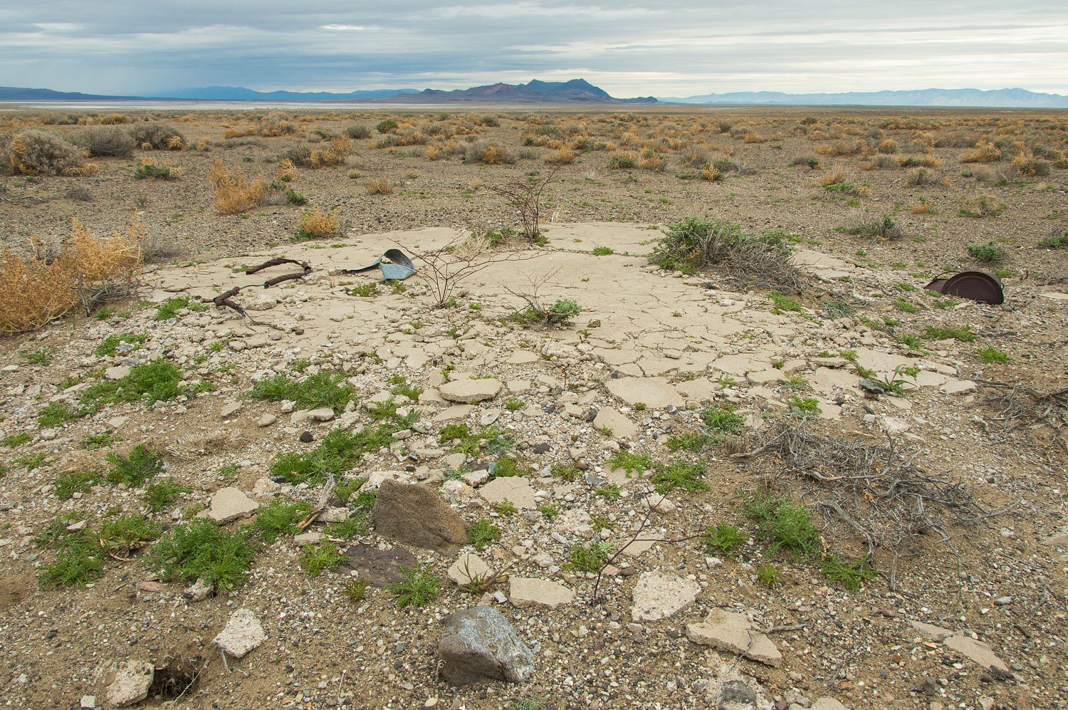
All that
remains at the site is a concrete pad and assorted debris.
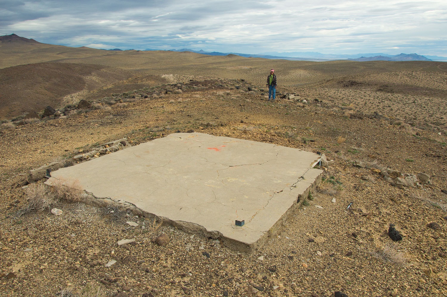
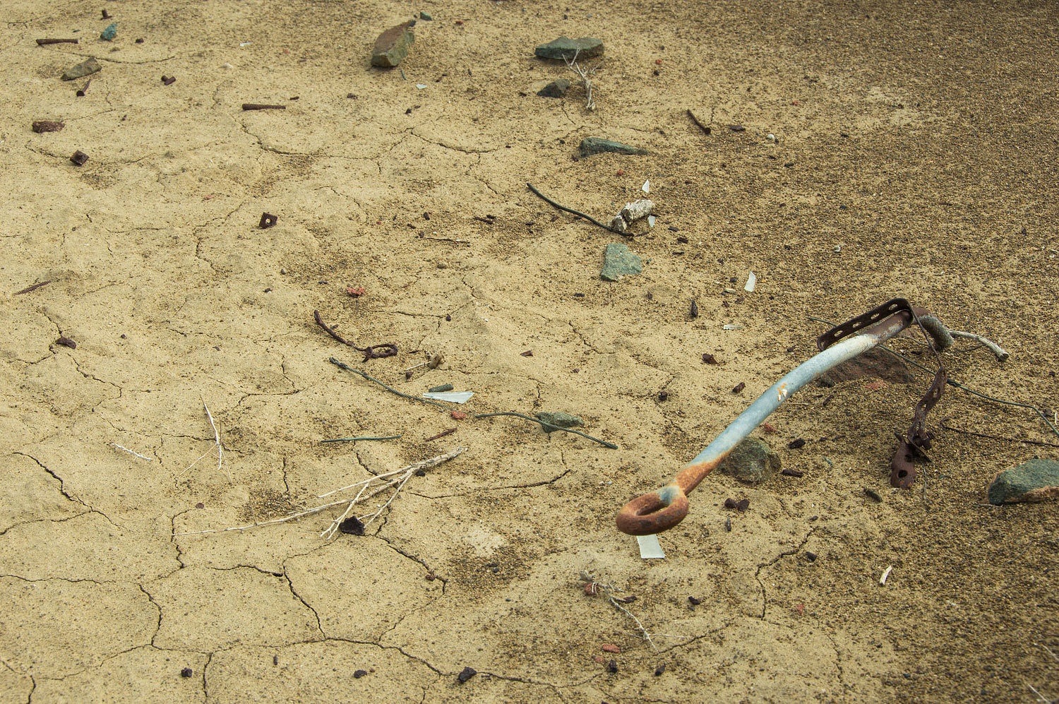
I was
surprised to see there were signs of demolition at this remote site. Evidence showed the
tower was cut from the pad with a torch. Broken pieces of other concrete pads
(possibly an arrow?) were pushed down the hill.
Our next
stop was the site of Beacon 24. This is in the northwest corner of the Carson
Sink, to the west of Highway 95. All we found was a badly crumbling concrete
pad.
We continued
east to the north end of the Carson Sink, south of the West Humboldt Range. On
the edge of the alkali flat we found the remains of Beacon 253.
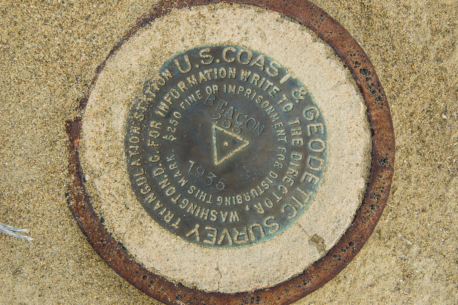
Approximately
a hundred feet to the west we found a benchmark anchored in a steel pipe and
concrete.
We enjoyed the vista to
the north, including the West Humboldt Range and Mopung Hills.
During the
nine years the Post Office Department operated the Air Mail Service, flying
open cockpit biplanes, the early air mail pilots dealt with every weather
condition thrown at them, flying around the clock, day and night. I've read
that 34 pilots died and statistics stated an Air Mail pilot's expected lifespan was 900 flying hours. These
pioneering aviators deserve to be remembered.
We chose these first
three beacon sites because they were on a line toward our primary
destination, a destination that had alluded us the last couple of years. We had
been close on several trips but it had somehow, always it seemed, fallen
through the cracks. Not this time; this time it was a priority - if the roads
would go, and that was a big "if" in this remote area.
Our USGS
quad showed an unimproved dirt road over the West Humboldt Range. The road worked out
well getting us up to the pass.
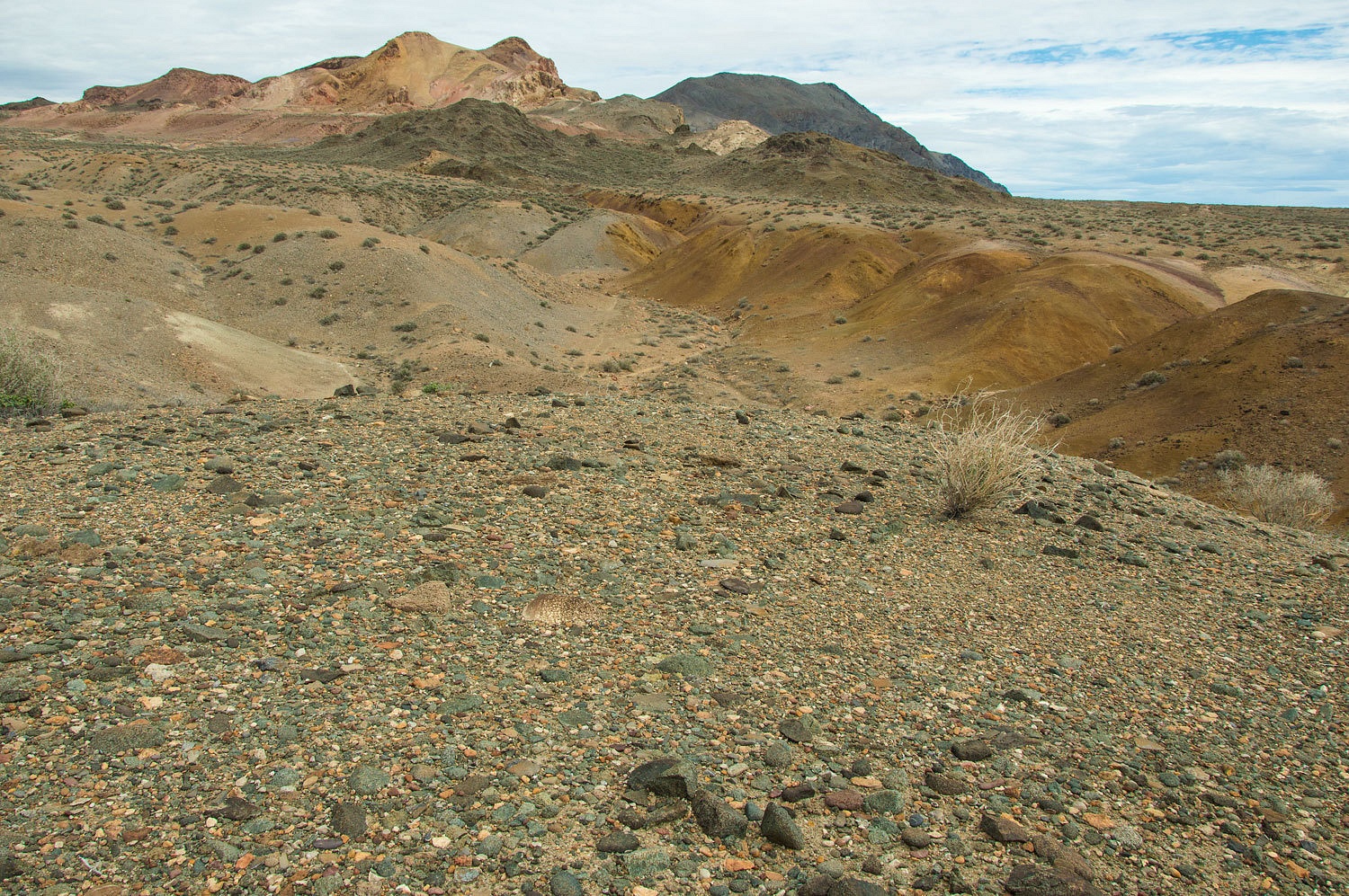
The vibrant colors
of the mountains kept reminding us we need to return here for more exploration. Excellent
desert pavement is in the foreground in the photo below.
Where man
has been, discarded alcohol containers are usually found. At least the colors
in the glass were nice and this bottle's probably now protected by the Antiquities Act.

One of my Dad's favorite comments was, "They sure must get heavier when they're empty!"
The map
indicated "Indian Cave" up a short spur road. We checked it out.

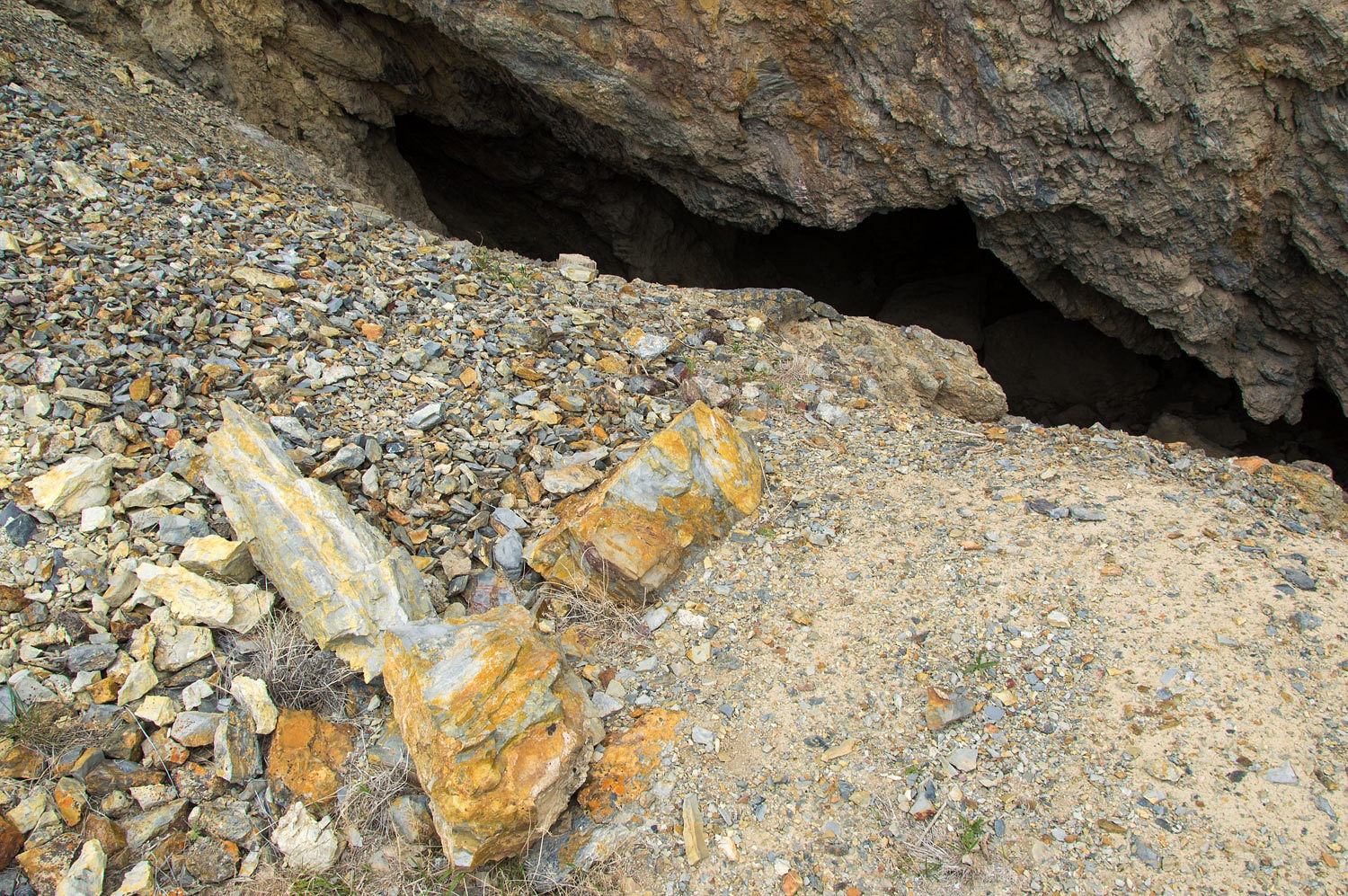
The ceiling was covered with a thick black coating from untold numbers of wood fires.
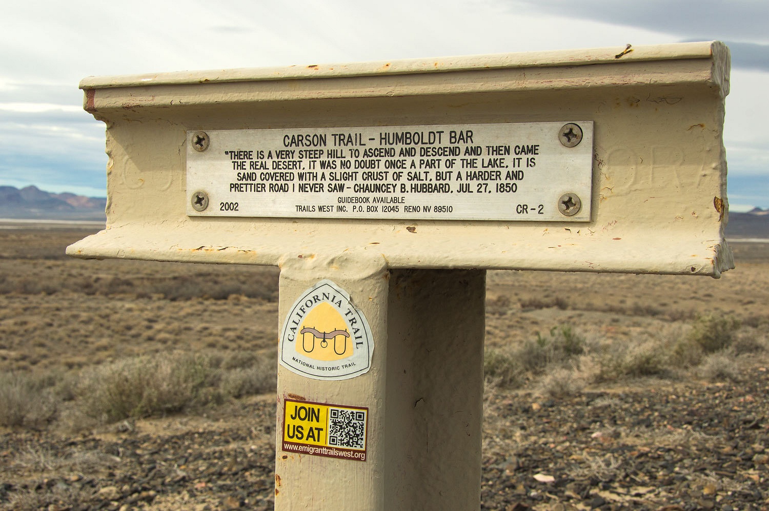
From the pass we
dropped down to the Humboldt Bar and the west end of the Humboldt Sink. This is near
where the Carson River Route of the California Trail separates from the Truckee
Route. We have a copy of the Carson Route Guide published by Emigrant Trails West and all of the markers' locations are loaded into our handheld GPS unit.
We were close to a marker so we sought it out.
We continued on a primitive two track heading east along the south edge of the Sink. Our
main concern was how close to the edge the road would get, increasing the possibility of
gumbo. We made our way always with the idea we may need to back out and turn
around......................................
Several
years ago we spent my birthday in Carson City. From that experience we highly recommend a trip to Carson City. Spend time at the Nevada State Museum and walk the Carson City Historic District. The old homes are wonderful. Imagine a cold November day at the tail end
of fall colors - it was a wonderful birthday. As a side note, the Historic District is where John
Wayne's final film, The Shootist, was filmed.
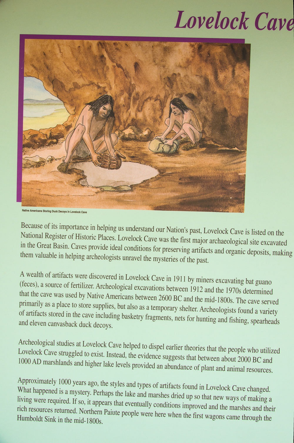
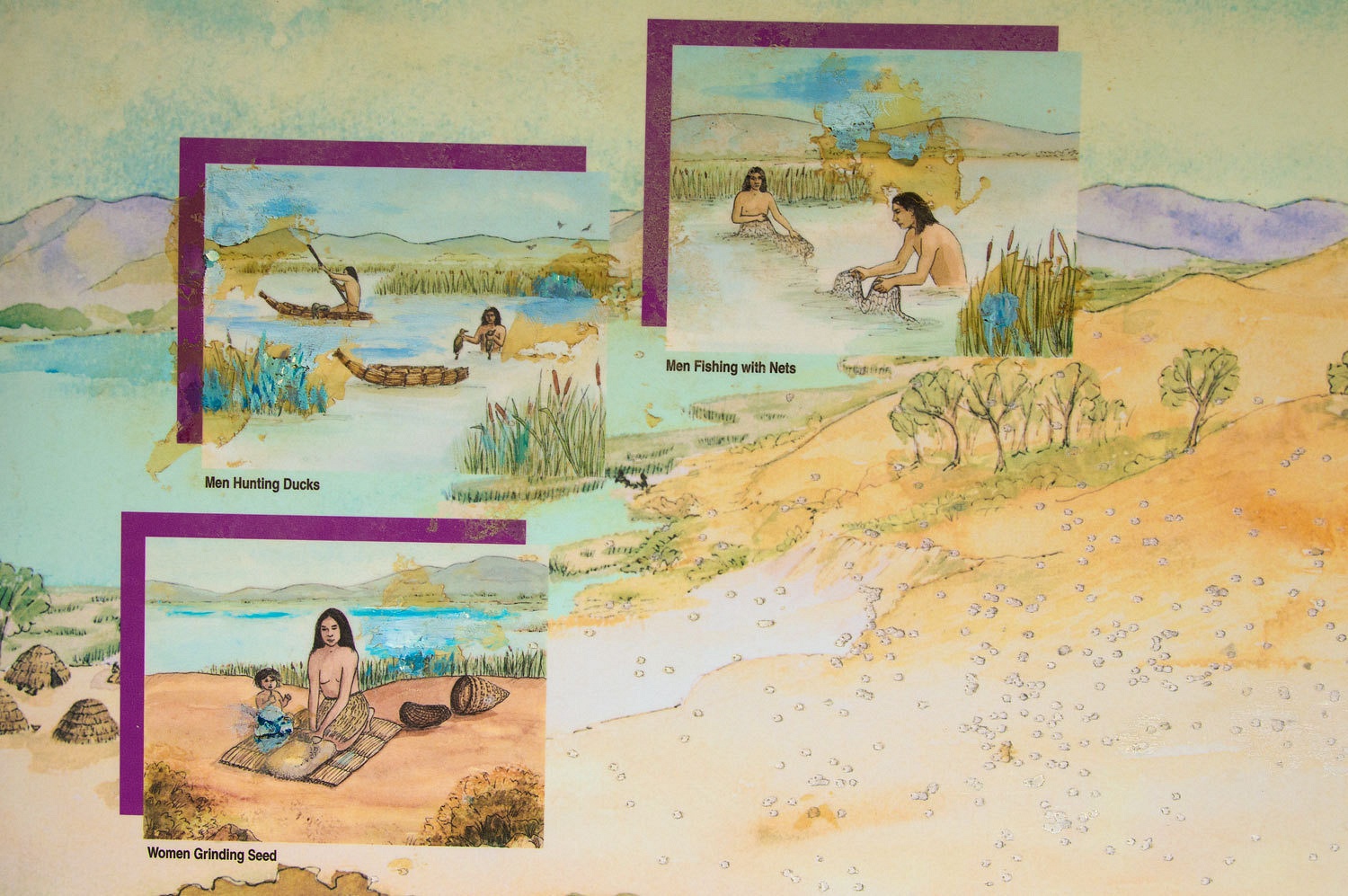
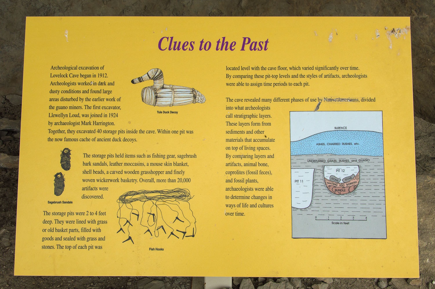
At the
museum I remember seeing an ancient duck decoy on display. It was hardly what you might think of as
primitive. It was discovered at a place called Lovelock Cave, one of the major
archeological sites in North America and the cave was our primary destination this trip.
The cave sits above the old shoreline of Humboldt Lake, a remnant of Lake Lahontan.
The cave sits above the old shoreline of Humboldt Lake, a remnant of Lake Lahontan.
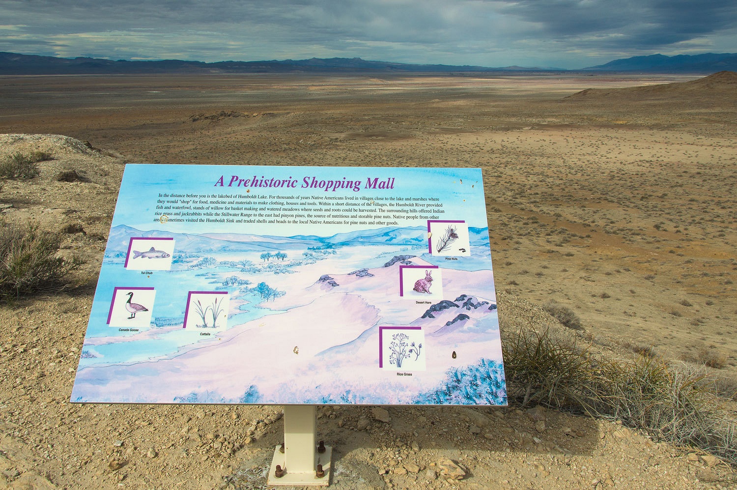
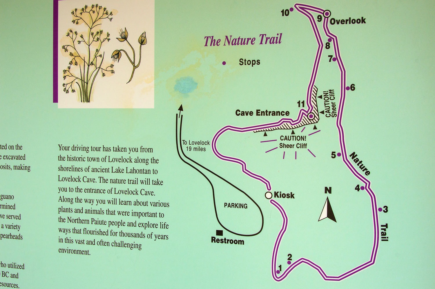
BLM has made improvements with a nice graded road in from Lovelock, a parking area with
bathroom, and interpretive signs. It is part of BLM's designated Lovelock Cave Byway.
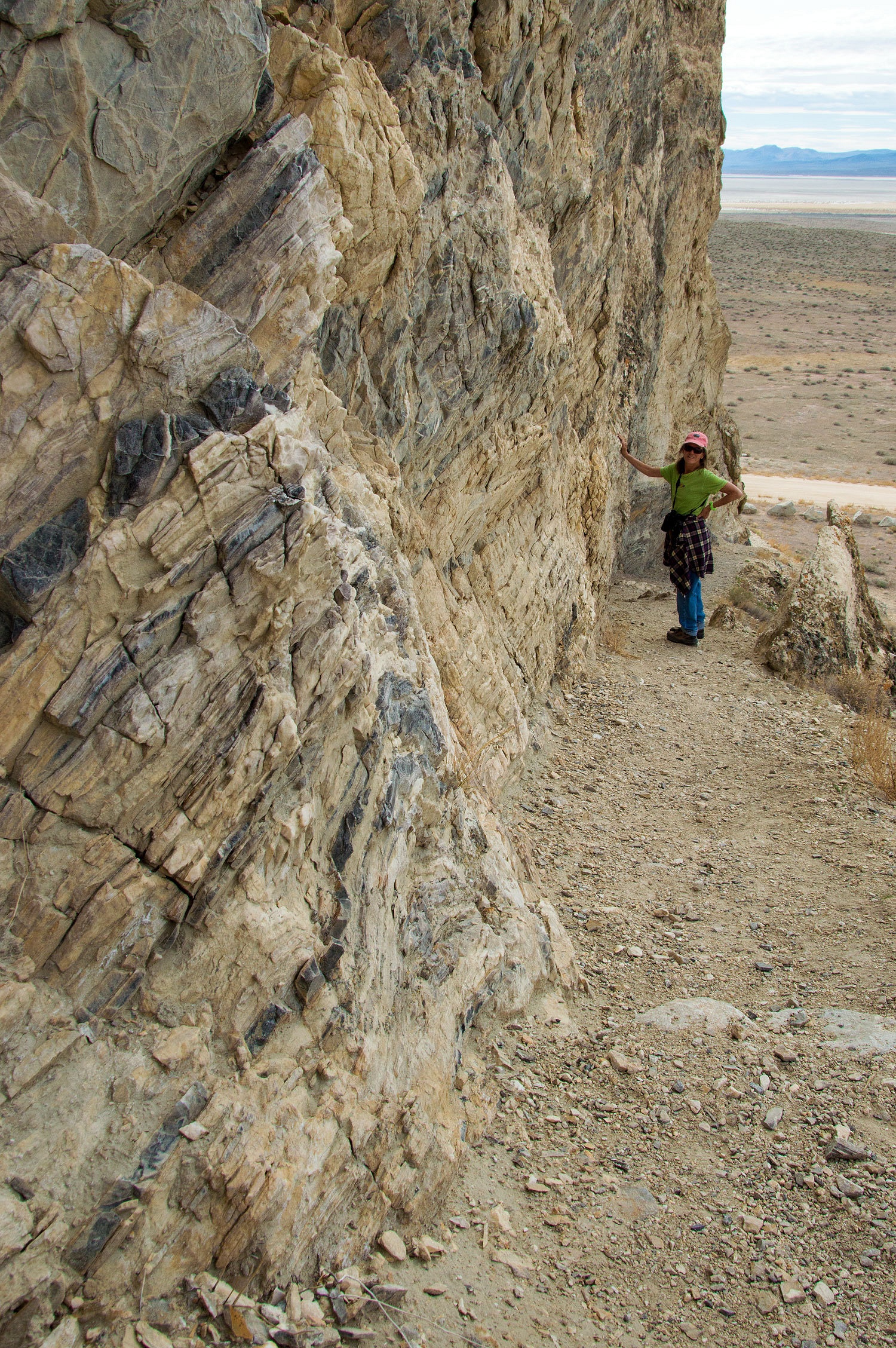
The cave is
in an outcropping of what appears to be limestone that has nice intrusions from
mineral rich waters.

The
entrance to the cave.
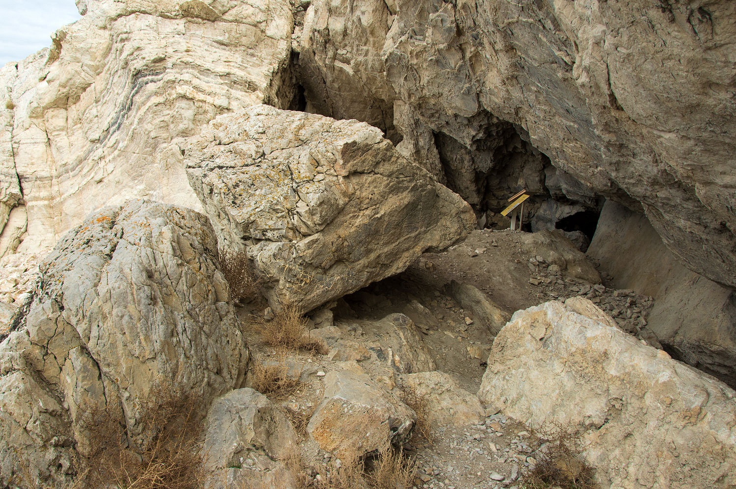
The alternate entrance.
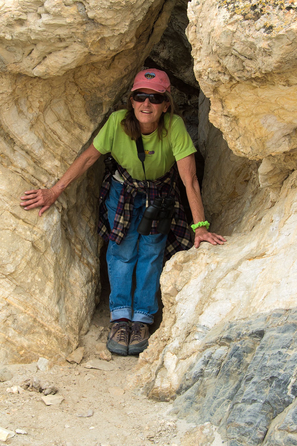
There is a viewing platform inside.
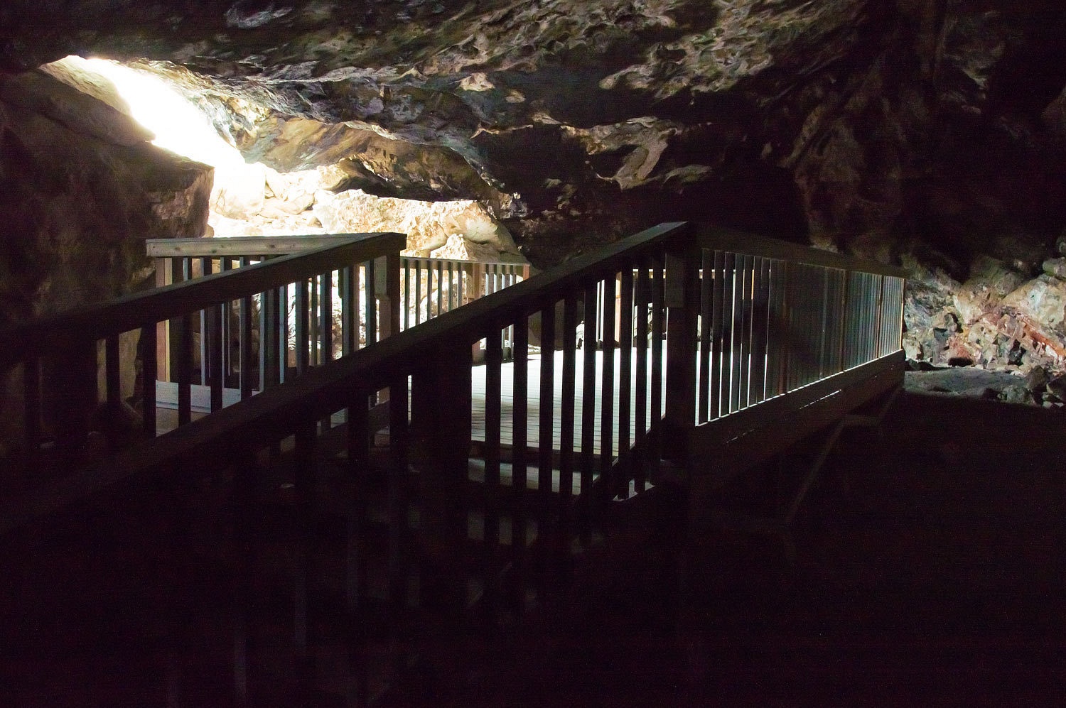
After time well spent, we headed
back to the truck.
Please pardon me as I back up a bit for a story. As we drove the road along the south edge of Humboldt Sink the Lady commented, "There are some things you only need to do once in life."
"And
what do you mean by that?" I asked.
"Driving
this road," she answered.
The Lady is
experienced, tough, and many times hops out of the truck before me, evaluates at an obstacle, and
says, "We can make this!" So, her appraisal of this road should give
you an idea of its condition.
The Lady is our navigator. We use a Google Nexus 10 pad with the Backcountry Navigator Pro app. We download the maps we need prior to the trip and the smallest scale map is the 1:24000 USGS quad we are so familiar with. The built in GPS puts our current position on the map in real time and the antenna works well inside the cab of our truck. This tool is convenient and works well for us. The Lady does an excellent job keeping us "found." As we approached Lovelock Cave, we turned onto a spur road that led directly to the cave. We soon came upon an area of small sand dunes covering the road. Walking it, we figured we could make it through but what if we encountered another obstacle? Could we make in back through the sand in the opposite direction? In the distance we saw a Dodge pickup leaving the cave area on a wide graded road that came in from the east, obviously improved since the date of our map. Consulting the map again, we saw a road closer to the Sink that should intersect the improved road to the east, beyond the cave. We decided trying to get through on that road was a better plan than crossing the sand. Although this road crossed a flat that would be impassable when wet, this day it was dry and doable and we reached the main road without problem. A newer car based black SUV with one soul aboard, a male, was returning to the east from the cave. This driver and SUV is the subject of this story. We were surprised the vehicle slowed as we intersected the main road. He clearly had the right of way. He motioned us to go first.
"I
don't think he understands we are turning toward the cave and not just pulling
in ahead of him," I told the Lady as I did a wide turn to head back past
the SUV. The driver did not open his window or make any sign he had any
questions or wanted to talk. There was just something odd that stuck with us
about this encounter. We headed up to the cave but the Lady watched the fellow
in her mirror.
"He's
turning onto the road we were on," the Lady said.
"He
shouldn't take that vehicle on that road," I responded and added, "I
hope he's not doing it because he saw us on that road." Not that we felt
responsibility but we do know how things can happen in the backcountry.
We enjoyed
our time at Lovelock Cave. The Lady had her "see mores" and
periodically checked on the dark SUV as we walked.
"His
coming back out," she announced at one point.
I took a
look with the binoculars and was pleased to see the man had turned around and
was heading back to the main road. I handed the see mores back to the Lady. She
took another look.
"He's
stopping now. It looks like he's parking."
"Well,
let's hope he's having a good day and enjoys poking around when he spots
something interesting as we do." I added.
The SUV and
the Dodge pickup were the only two vehicles we had seen all afternoon and we were alone at Lovelock Cave. As we left the cave and drove toward
Lovelock (approximately 20 miles away), the Lady made one more check on the SUV.
"He's
still parked," the Lady said, putting the binoculars back on her lap.
We headed a
few miles toward Lovelock on the main road until a promising looking rough two
track led off to the south. We ventured up it looking for a suitable high spot
with a view for a camp spot. We succeeded, although the Lady popped out of the
truck and headed up to a higher saddle in the ridge above. I followed.
"No way
we can get up here to camp," the Lady said, "But wouldn't this be a great spot!"
I took in
the view and as my eyes went west...................."Shit!" I
blurted out.
The Lady
followed my eyes. "Oh no!" she cried.
In the
distance a column of black smoke was quickly rising skyward.
"Let's
get back to the truck and see if there's cell service," I said.
We moved
carefully back down to the truck and the Lady got her phone. She turned it on and
said, "Two bars," as she handed it to me. I dialed 911.
"Lovelock
Fire Department." a woman's voice answered. I love rural Nevada. I explained
the situation.
"We
just had another report," the woman said. "We're on it. Stay off
the roads. The trucks are just heading out."
I handed the
Lady the phone.
"Do you
think its him?" the Lady asked.
"Nobody
else out here," I answered. "But we'll know its a vehicle if a flatbed tow is
called."
"We
can't do anything," the Lady said. It was both a question and a statement.
"By the
time it would take to drive out of here we would intersect with the
trucks."
"I hope
the guy's okay," the Lady continued.
I answered,
"We'll know if a medic unit responds."
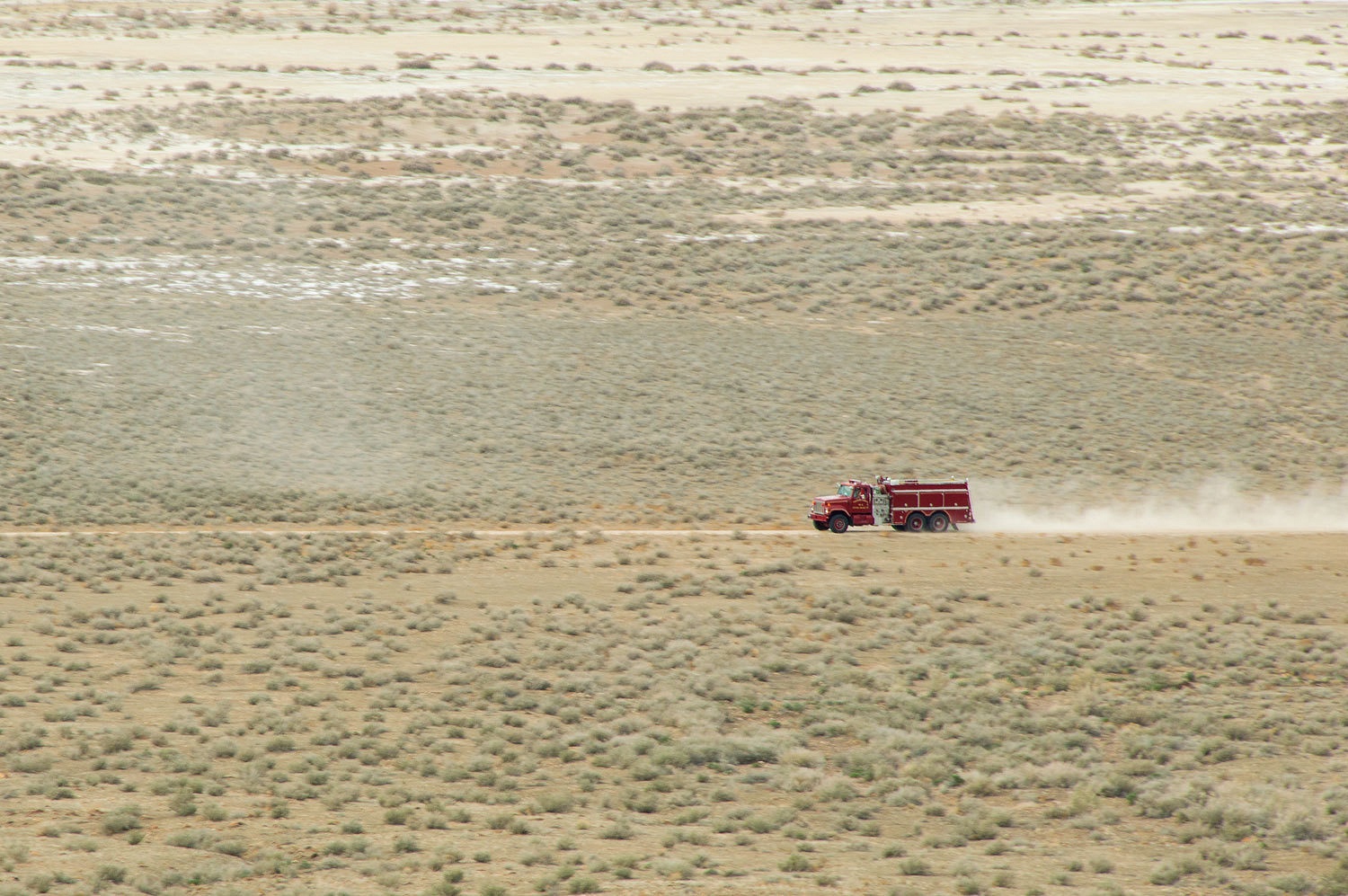
The smoke
was on the opposite side of the ridge and not visible from where we set up camp. It took driving up on rock piles with both driver's side tires to level the truck on the incline.
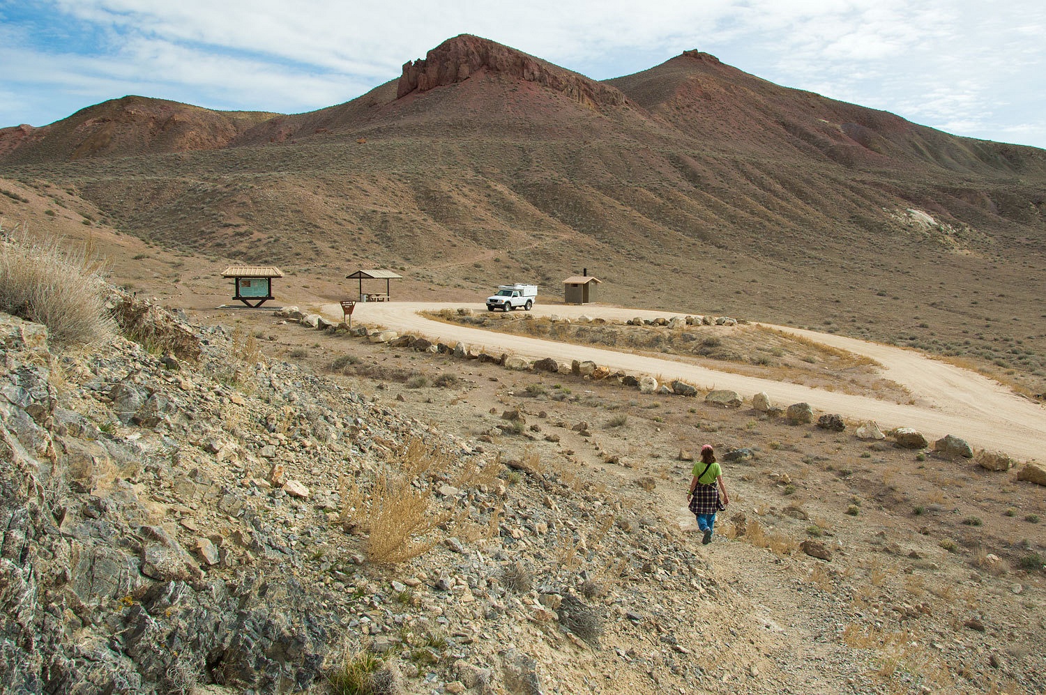
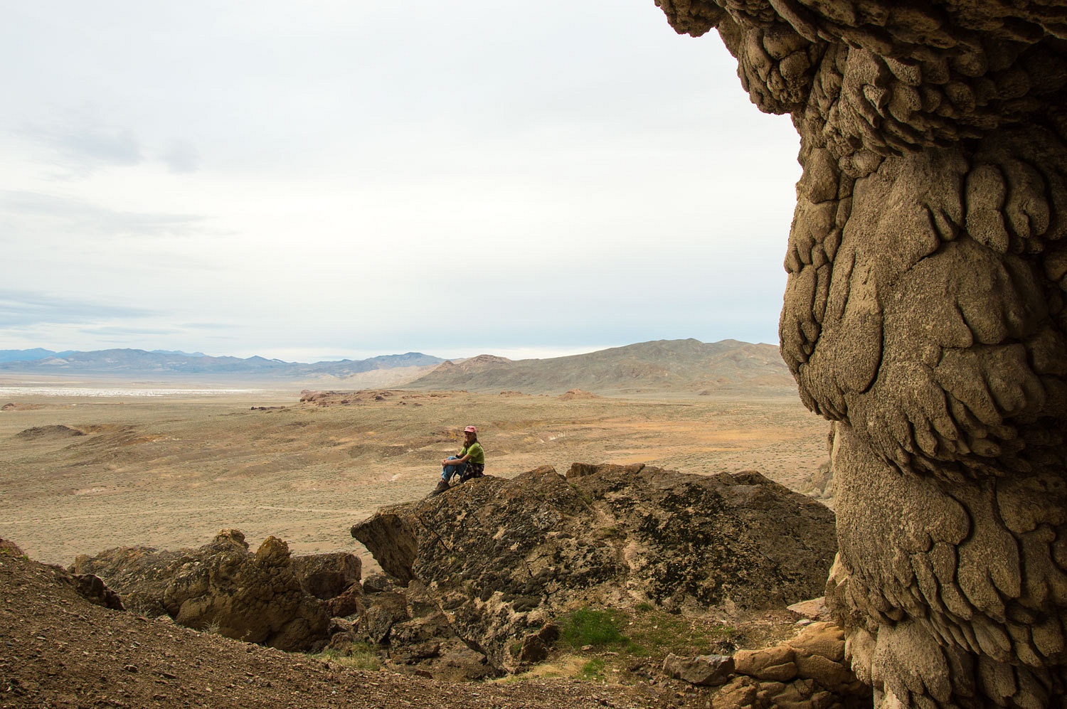
With camp set up chores completed, the Lady wanted to climb a nearby highpoint.
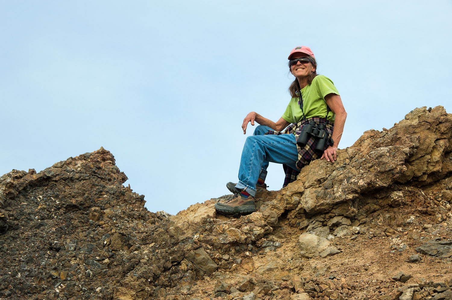
From her
perch she reported the engine and pump truck were returning. Two LEO
vehicles remained at the scene with lights flashing. No medic unit was called out.
Below the
high point was a large rock shelter I wanted to investigate. We climbed down to it.
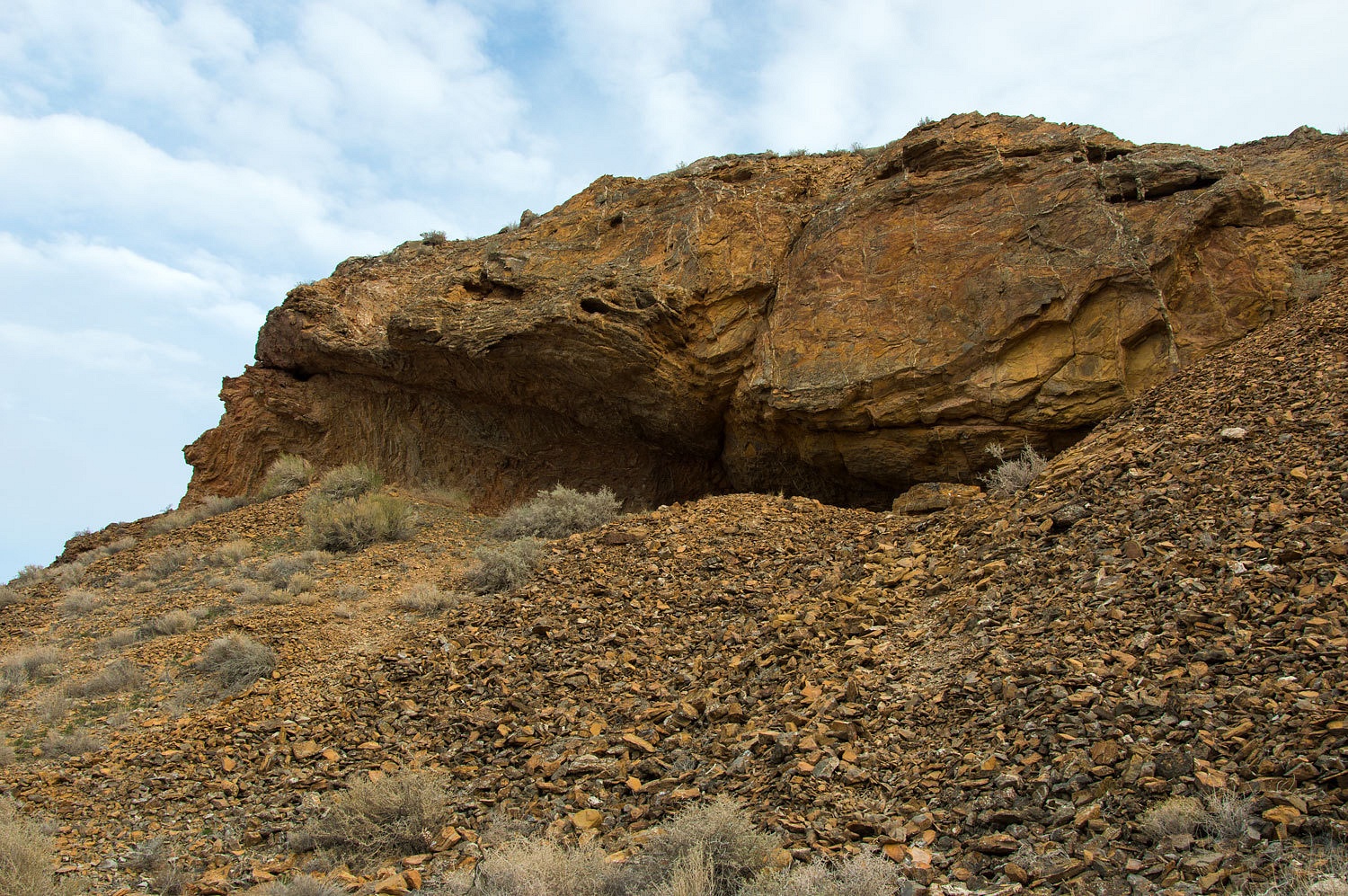
We found no evidence
of human habitation although it certainly had a commanding view of the area.

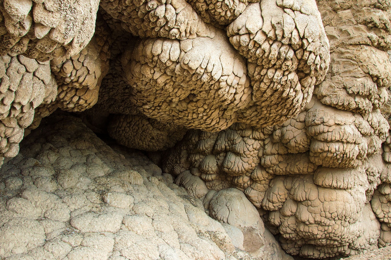
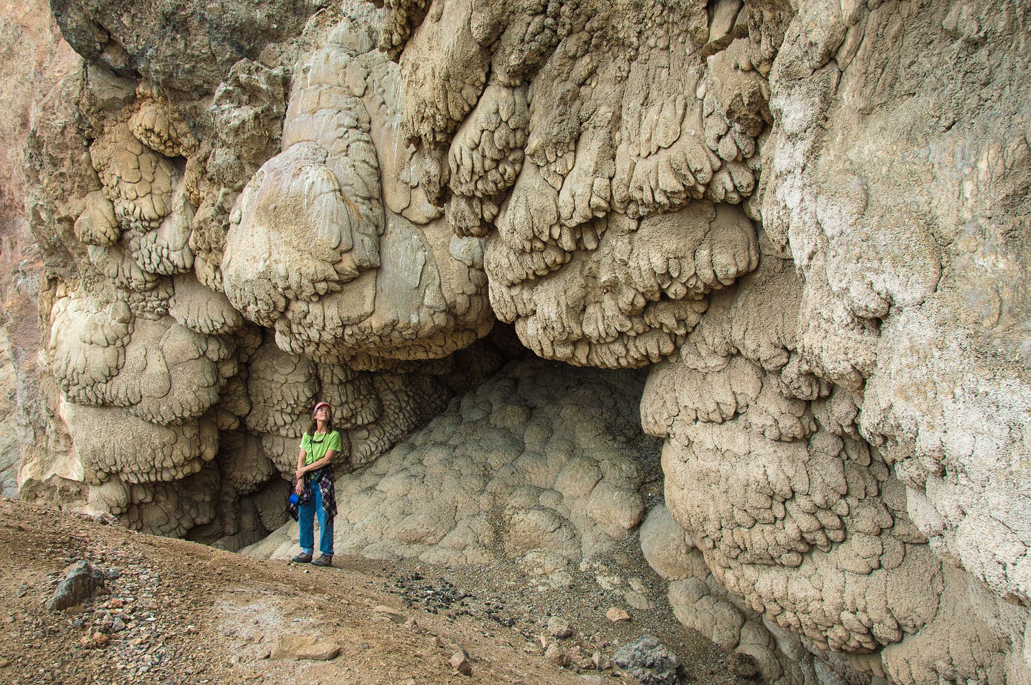
We climbed
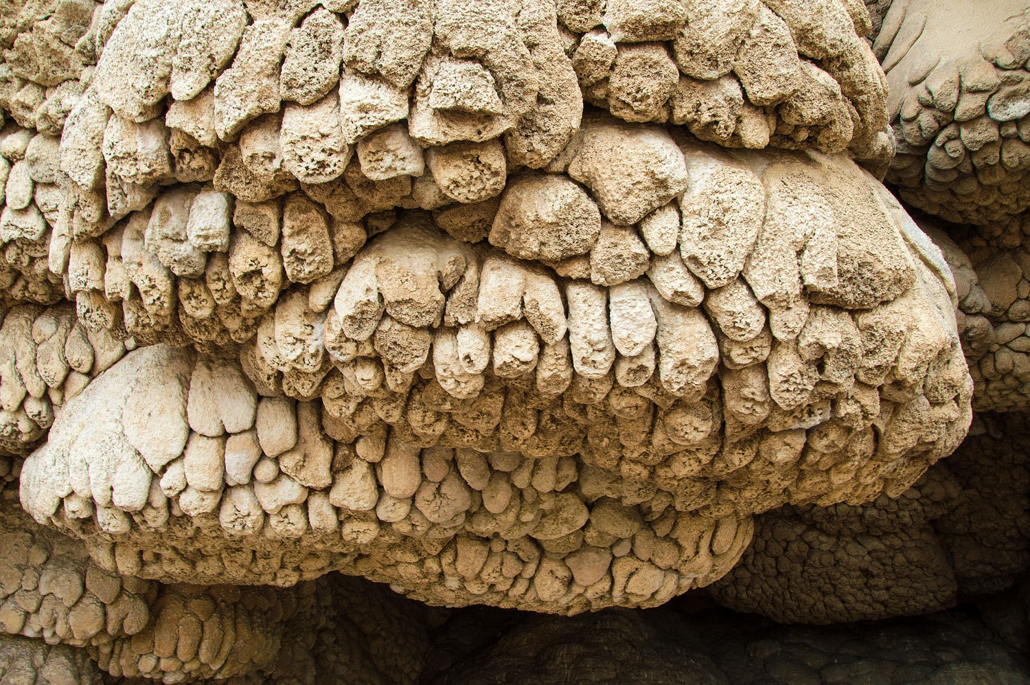
down to the cliffs to the west of camp. The vertical rock was encrusted in
tufa.
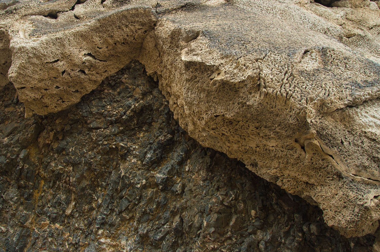
After returning
from a recent trip to Nevada, our friend Foy in North Carolina acquainted us
with wave deposition of tufa on the shorelines of ancient Lake Lahontan. The cliffs
were vertical walls facing to the northeast and would have been right in the
line of gales out of the north and east whipping the lake surface into a foaming froth. The tufa on these cliff faces must
be some of the most spectacular wave deposition tufa formations - formations that we managed to just
happen upon.
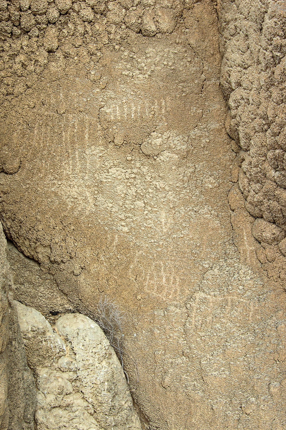
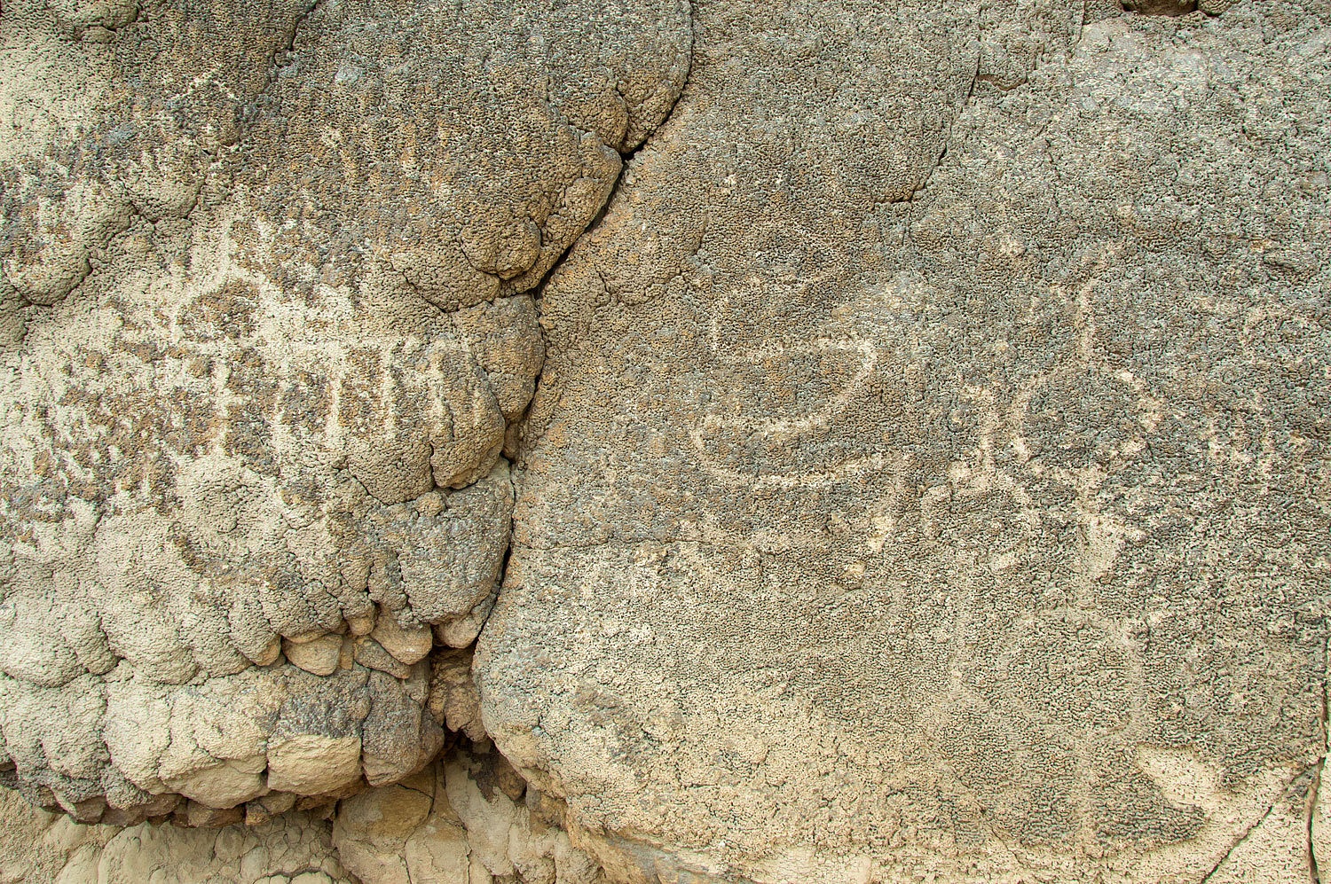
In addition to this amazing find, as we worked our way along the cliff face, we discovered
petroglyph panels.

What else
would we discover this evening?
The story continues. Please click for Part Two
Great blog, can you share co-ordinates of the tufas, they look beautiful. I hope to visit soon. Thank you
ReplyDelete