
"Oh, smell
the sage. I love sage!" the Lady said.
She was ecstatic and her reaction instant as she opened the
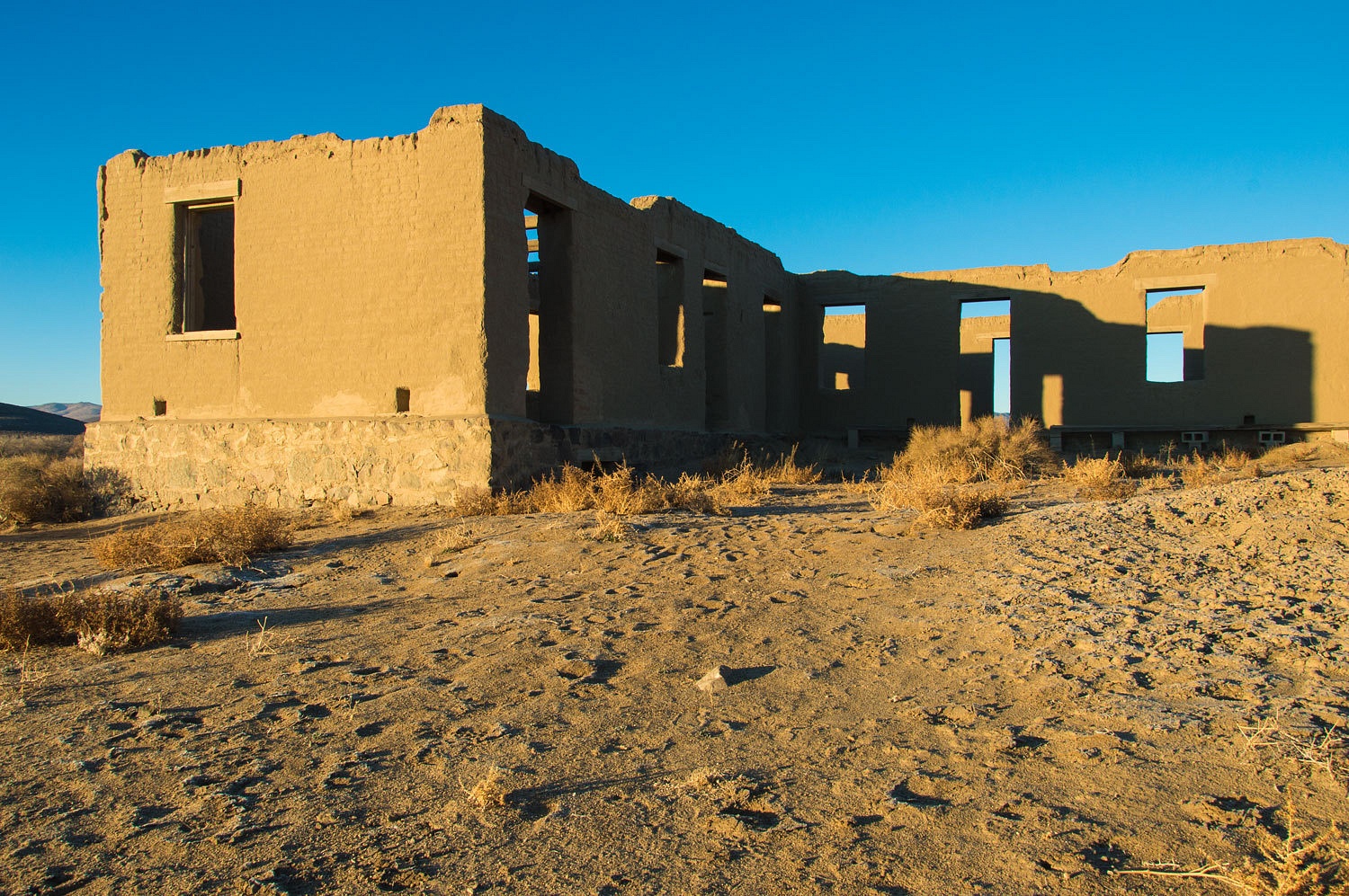
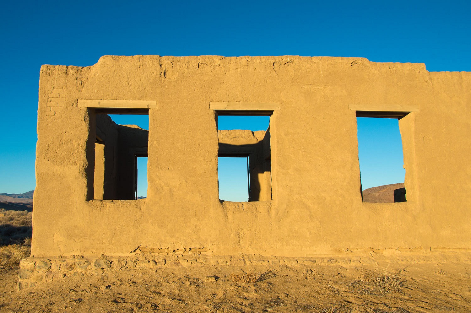
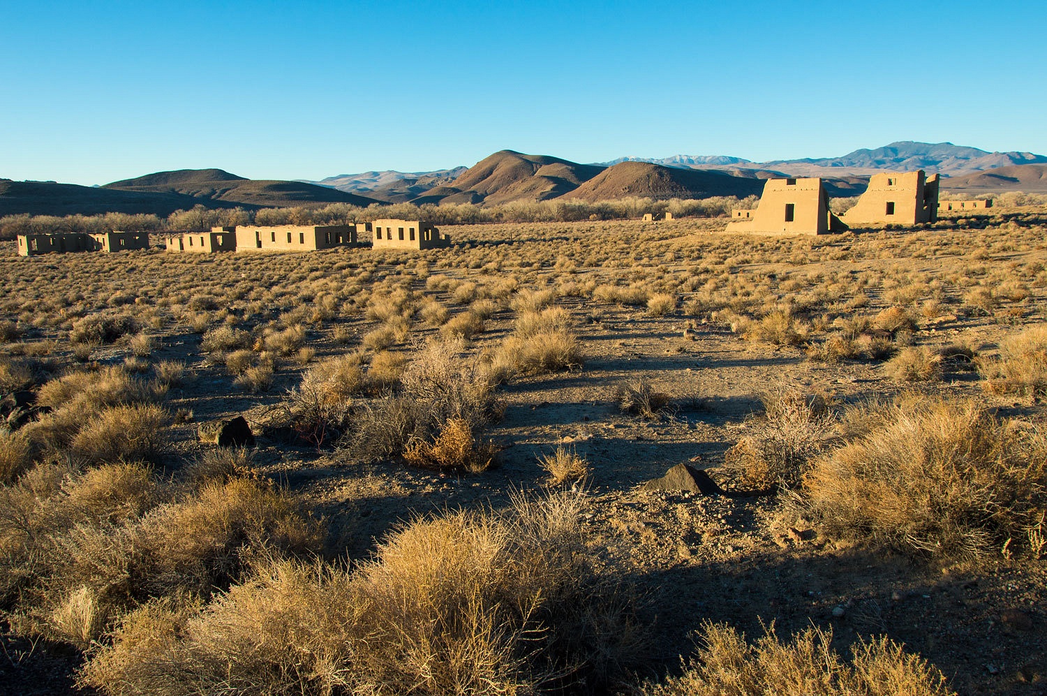
truck door and the scent hit her. We were at Fort Churchill State Park. The sun was already down. We like
this place and it is a good overnight spot with a late Friday afternoon launch
from home. Owls and coyotes serenade and the other campers are quiet,
especially on cold winter nights. Camp set up was quick. We changed into warmer
clothes and walked for about an hour through the ghost like ruins of this Civil
War era fort. We listened for spirits and voices from the past, but all was
quiet, quiet except for the incessant barking of a far distant pet dog. Sound
travels far in the quiet, still night. We should all keep that in mind.
It was
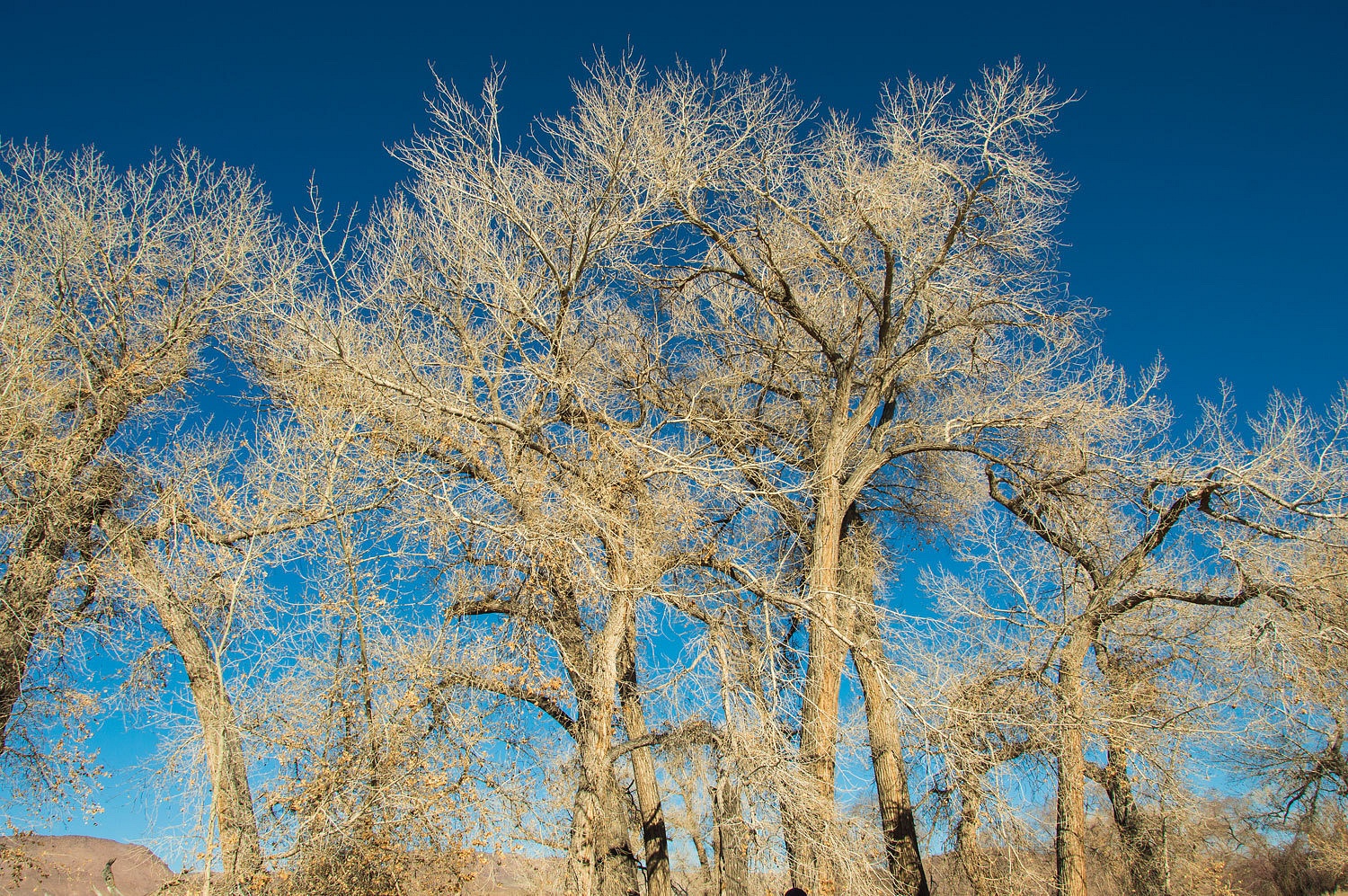
chilly the next morning, 23°. The campground is set in the cottonwood grove
along the Carson River.

We sought
the rising sun and wandered again among the ruins.
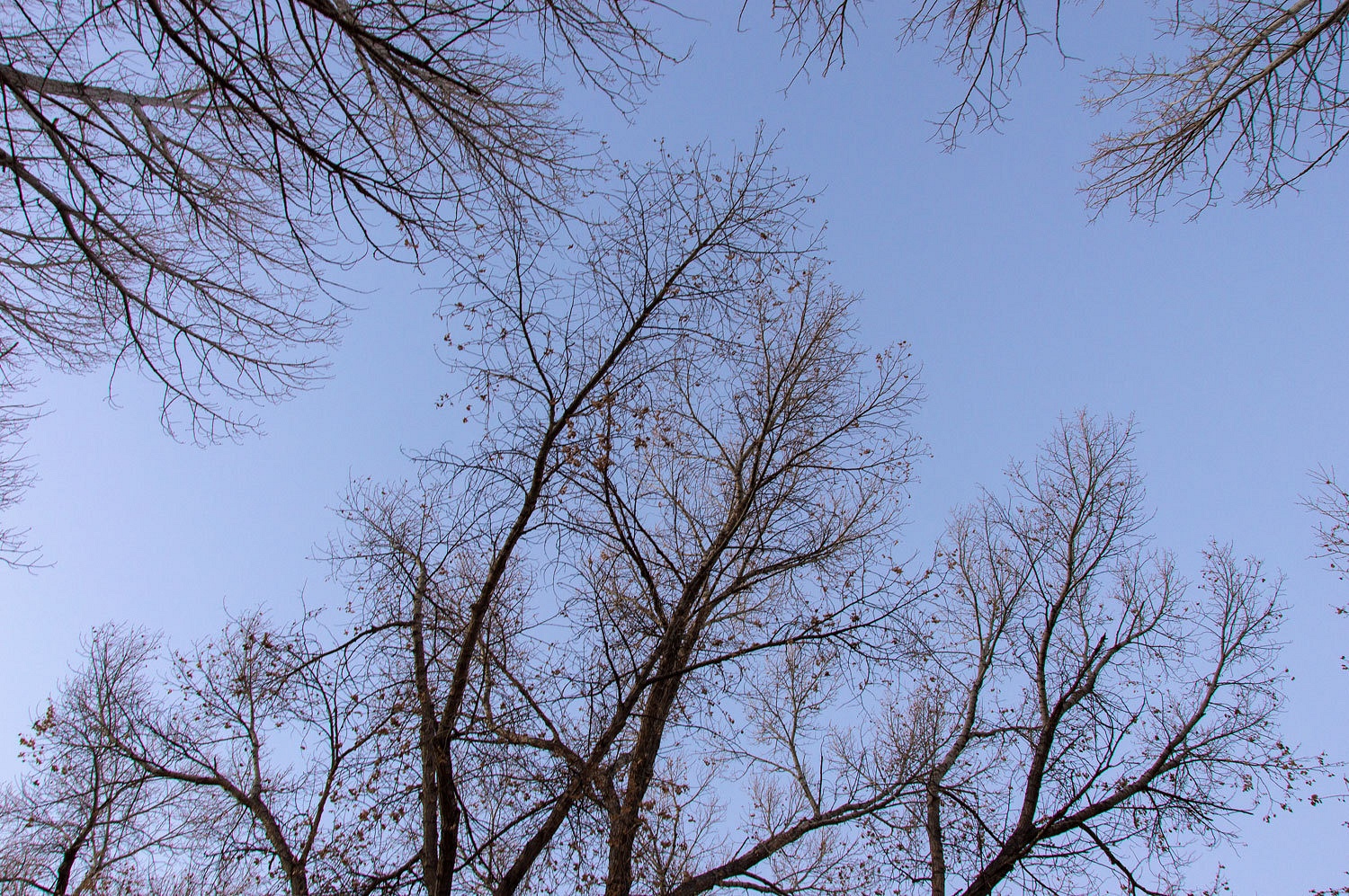
The cottonwoods along the Carson River are wonderful.
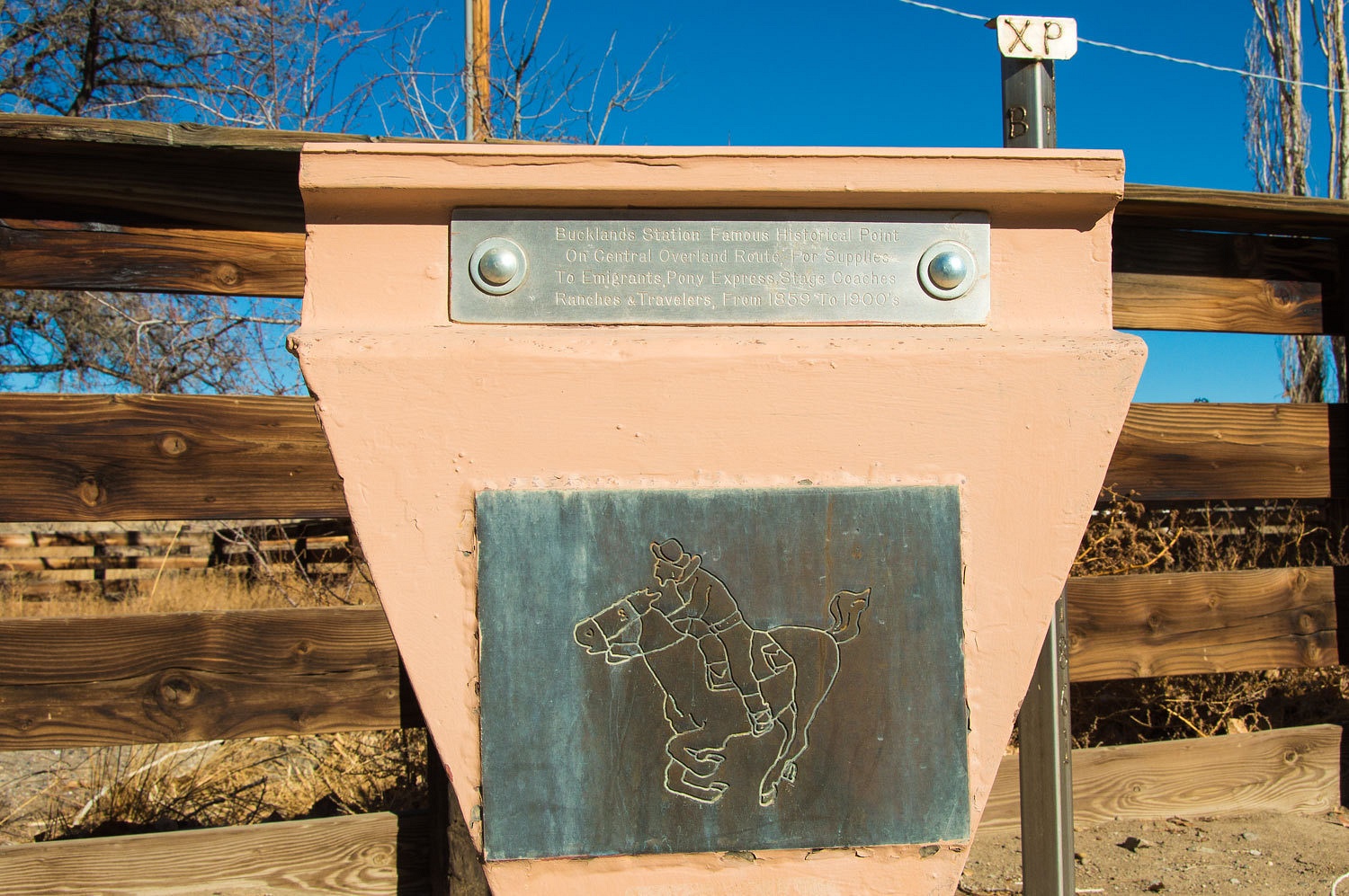
Our plans were
to explore sections of the Simpson Route and the Pony Express Trail. Buckland Station is along the Carson River and part of the State Park. This is an
important intersection of the Carson Route of the California Trail, the Central Overland Trail, and the Pony Express Trail.
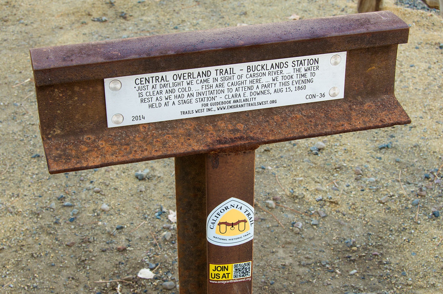
Although the
historic quote mentions "fish are caught here", these days, as a
legacy of the Comstock Boom and Virginia City mining, the Carson River, now a "Superfund" site is still
poisoned with mercury and current signs remind all to not eat the fish.
The original
trail to California was along the Humboldt River. Interstate 80 pretty much
follows that route today. James Simpson with the Army Topographical Engineers surveyed
the new Central Overland Route across Nevada in 1859. This route was 280 miles
shorter and could shorten immigrants' travel time by up to two weeks. The
overland stages, the telegraph, and the Pony Express followed this new
route. Highway 50 - The Loneliest Road in America - across Nevada is closely
aligned with this pioneer trail.
But, in
places Highway 50 deviates from the
historic route and these places, away from the pavement, draw the Lady's and my interest as places
to explore.
The historic
trails across North America fascinate me. It is in my blood. My Great
Grandfather Sam started for California in 1864. He left Iowa City, Iowa to
check on prospects for his family out west. He got diverted to Virginia City, Idaho Territory (now Montana) with news of the new gold strike there. Sam,
unfortunately, left no journals to help satisfy my deep curiously about his
adventure. Did he travel with the old mountain man, Jim Bridger with the first
group on the Bridger Trail? Did he meet the Earp family, also traveling from
Iowa to California in 1864? Did he meet Jeremiah Johnson, also in Virginia City
in the summer of 1864? If ever I retire, I have much research work lined out to
keep me inspired.
I wonder how
much Sam knew of his family history. His father died young when Sam was 15.
Sam's grandfather died 19 years before Sam was born, so he never knew him. But,
family ties were very strong back in those days and probably Sam heard a few
stories about his Great Grandfather, Samuel, more than likely his namesake.
As Sam (at
age 45) traveled the overland trail, I wonder if he knew anything about his
Great Great Grandfather, James, one of the first frontiersman of Pennsylvania
in the late 1600's? He was an Indian trader and carpenter, said to be the first
white man allowed by the Indians to settle on the west side of the Susquehanna
River. He spoke several Indian languages and acted as an interpreter. Research
(not detailed in the accompanying web link) by other family historians has turned up intriguing evidence that he may have designed
and built the first Conestoga Wagon, a symbol of westward migration.
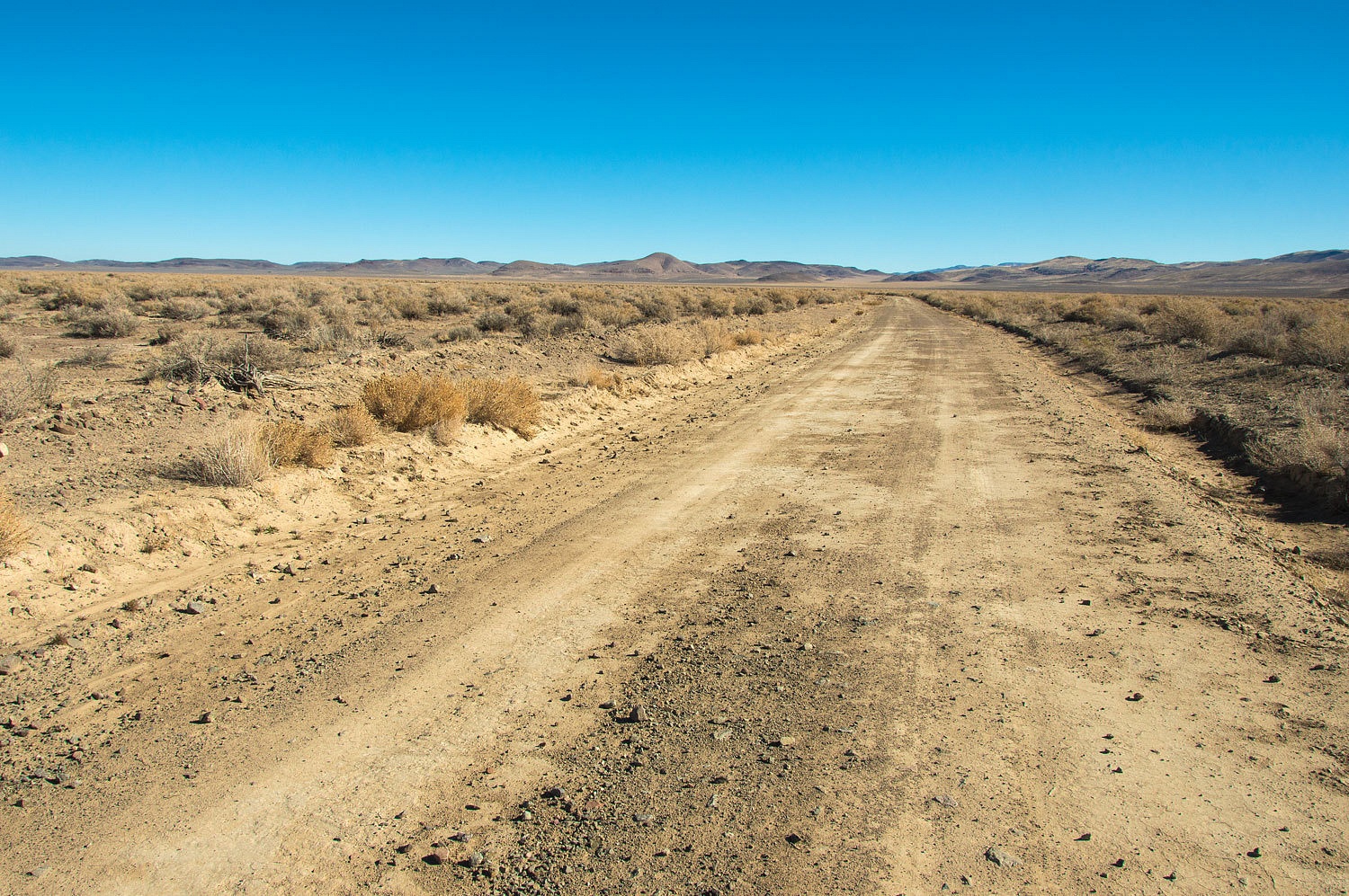
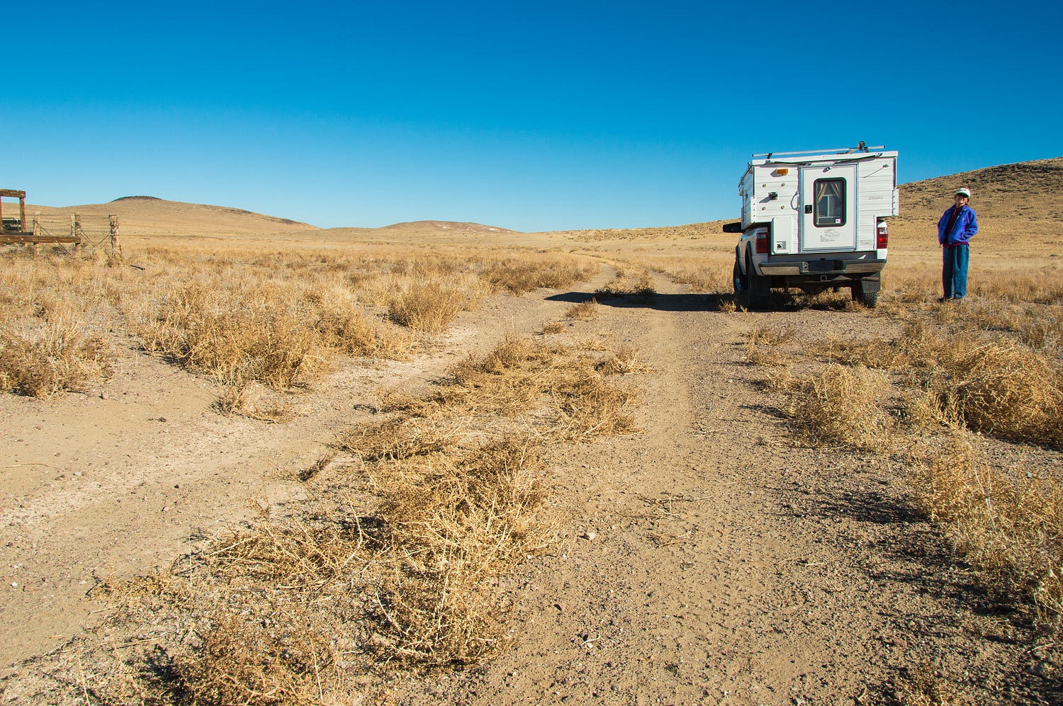
We used the
USGS 7.5 minute quads as our guide. The Simpson Route and the Pony Express
Trail are marked - sometimes as "approximate locations". We headed
east from Alternate 95 on the Simpson Route, here a graded road.
It is so sad
that many act like that our history, our stories, is only good for targets.
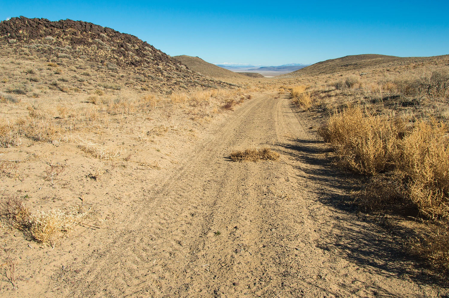
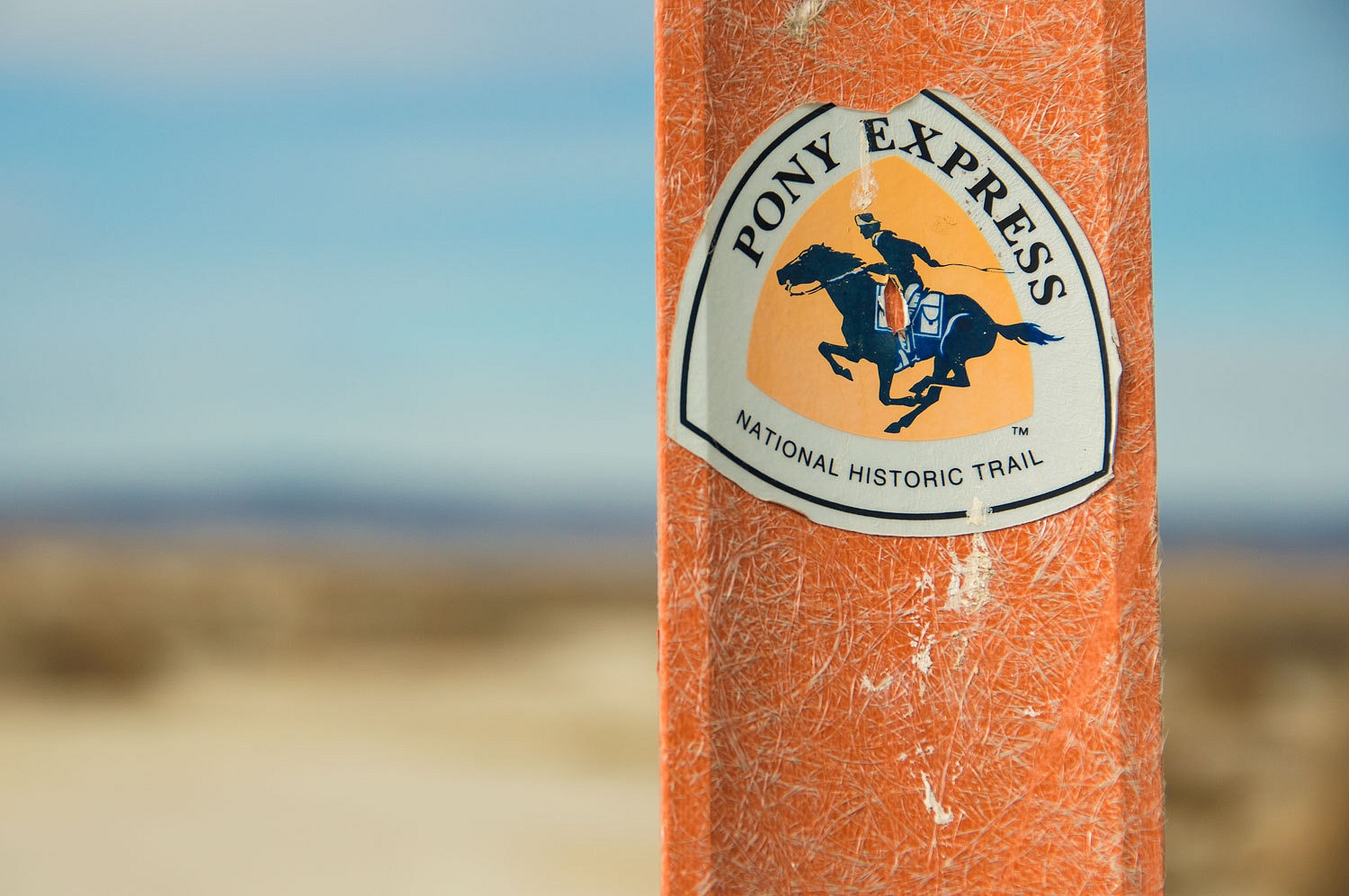
In the Dead Camel Mountains the Pony Express Trail branches off and runs a bit south of the
Central Overland Trail (Simpson Route). I suspect that these low mountains'
name is associated with the United States Camel Corps. The quality of dirt road
vary greatly in this area. East of Hooten Wells, we turned south off of the
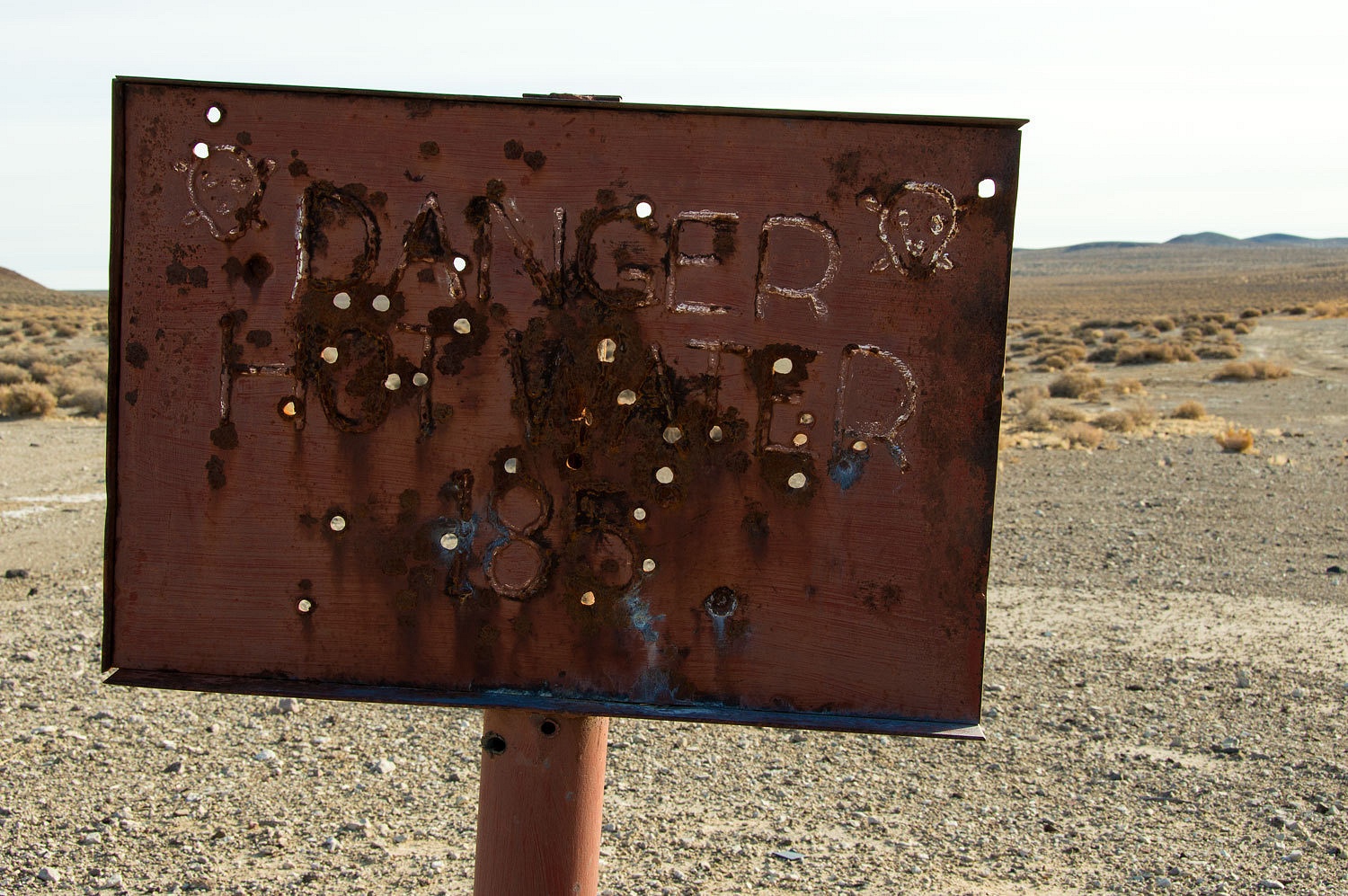
Simpson Route and rejoined the Pony Express Trail at Hot Well.
We did not find any hot water, only an unused cattle pen and watering station.
Further east
the Pony Express Trail drops down toward the Carson Sink.
We found
interesting geology in the Dead Camel Mountains that appeared to our very
amateur eyes to be igneous rock - basalt covered with more recent volcanic tuff.
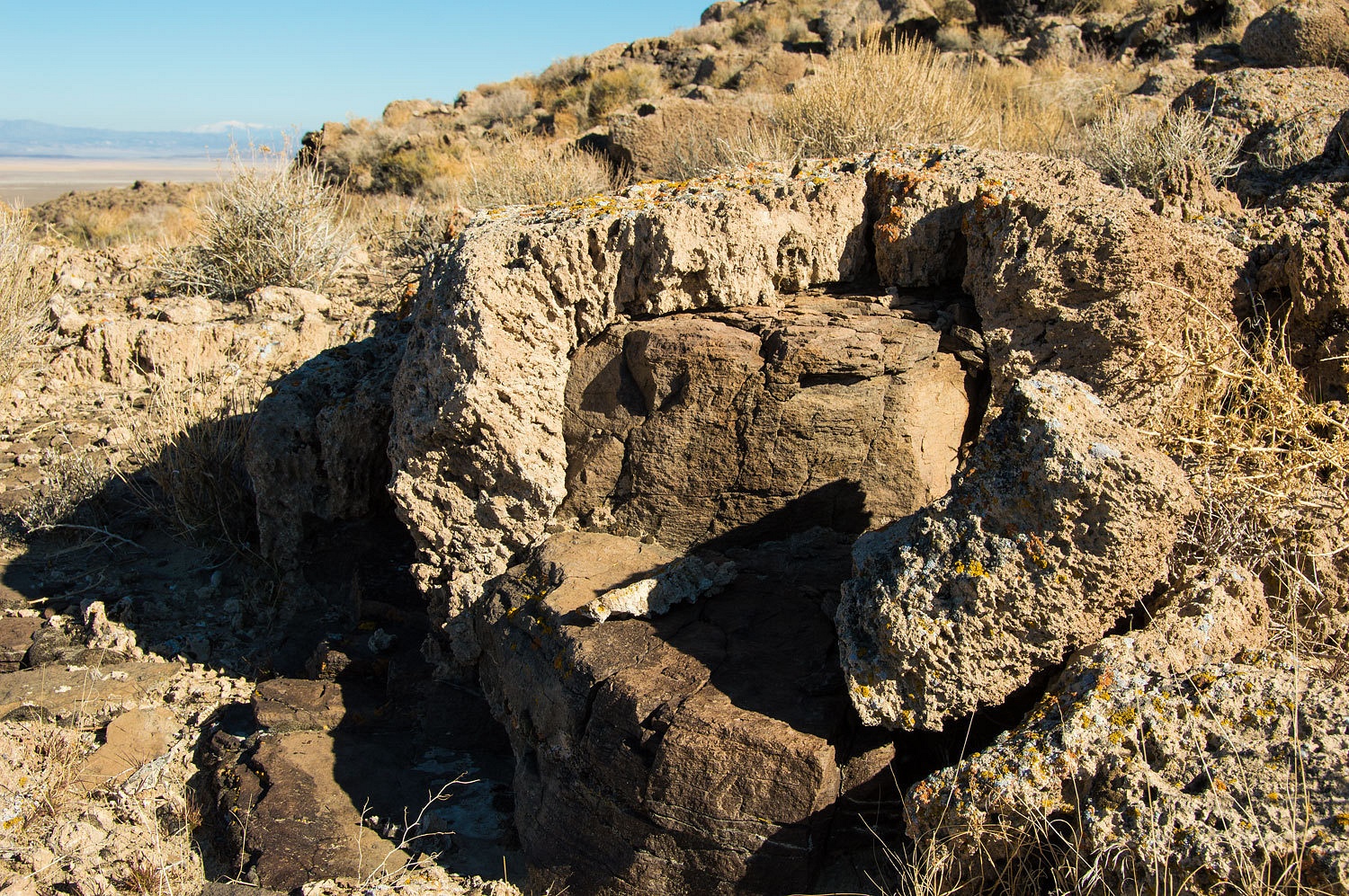
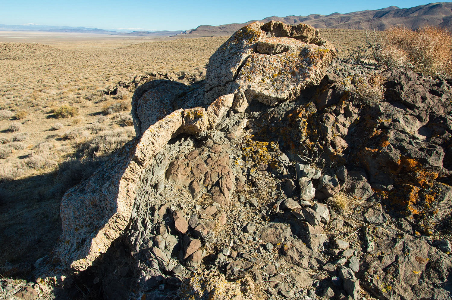
We are anxious
to be corrected and educated by folks with more knowledge. Edit - I've added a note below on what a friend provided in response to the question about the geology.
We ended our
day's travels in the vicinity of Allen's Springs (cold) and Lee Hot Springs, just to
the east of highway 95. We attempted to drive the back way (from the south)
down to Wildcat Station but found the road too wet.
Lee Hot
Springs is very hot.
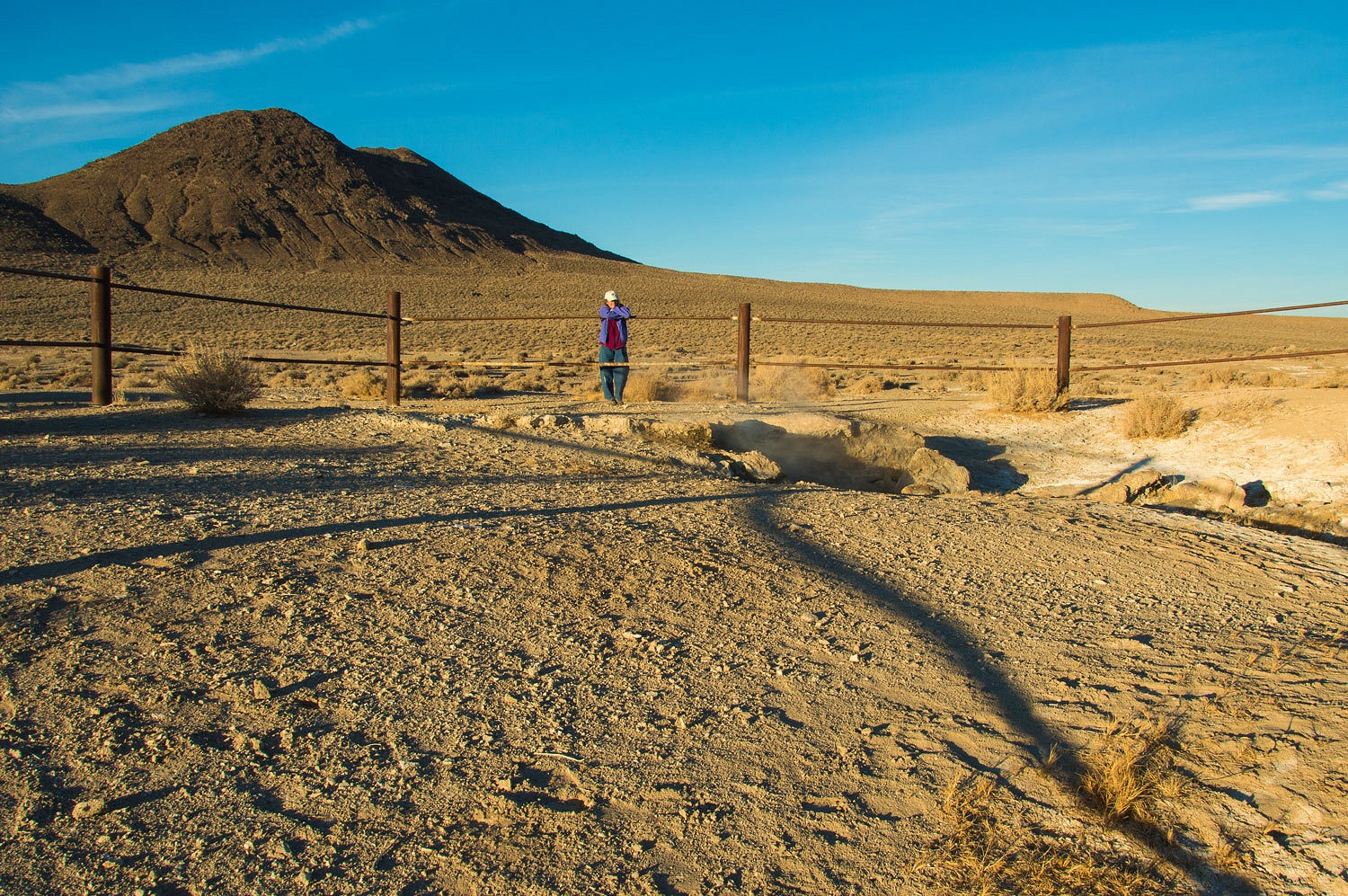
This area is
heavily used as a shooting gallery and is a sad example of trashed and abused public land.
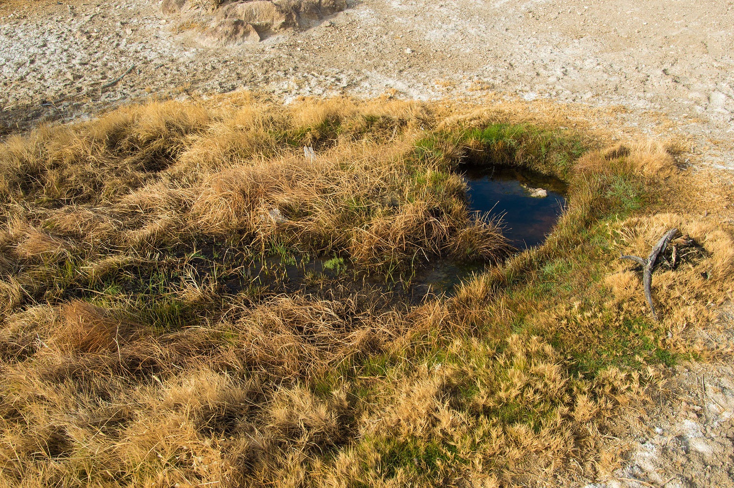
We found a
couple of other hot water seeps nearby.
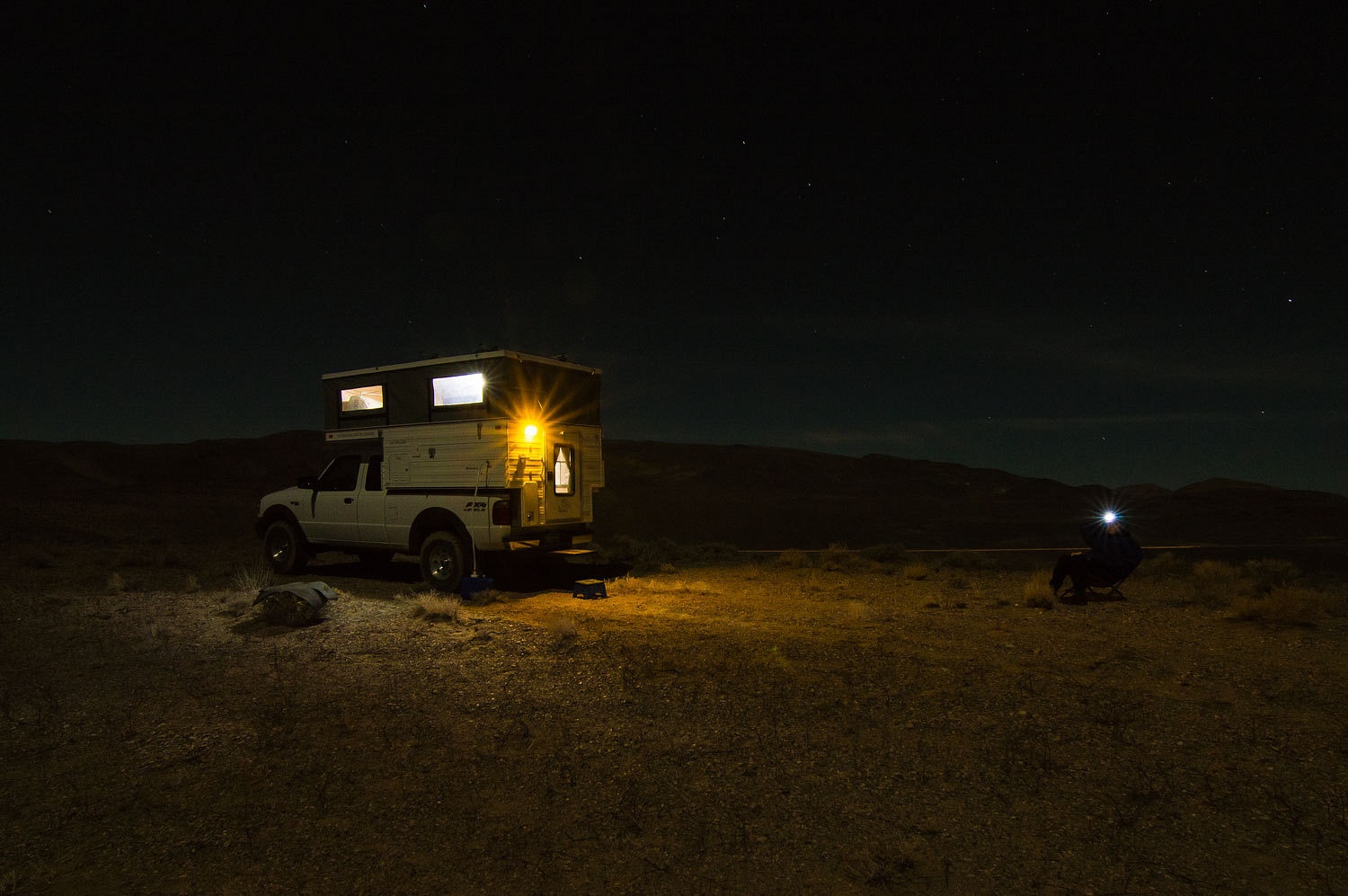
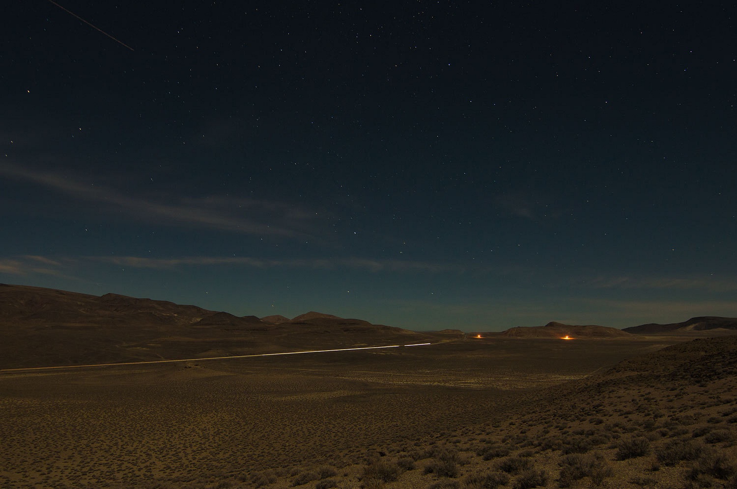
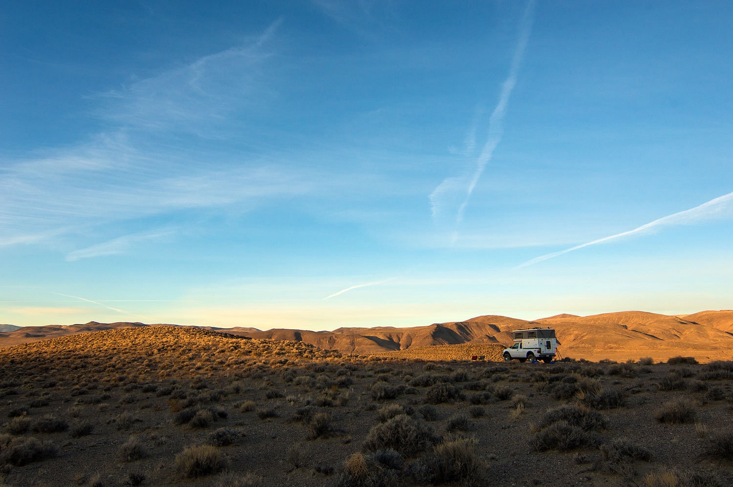
We traveled
a 4x4 road to the south to a high spot overlooking Rawhide Flats. A lonely high
spot was just our kind of place to spend the night.
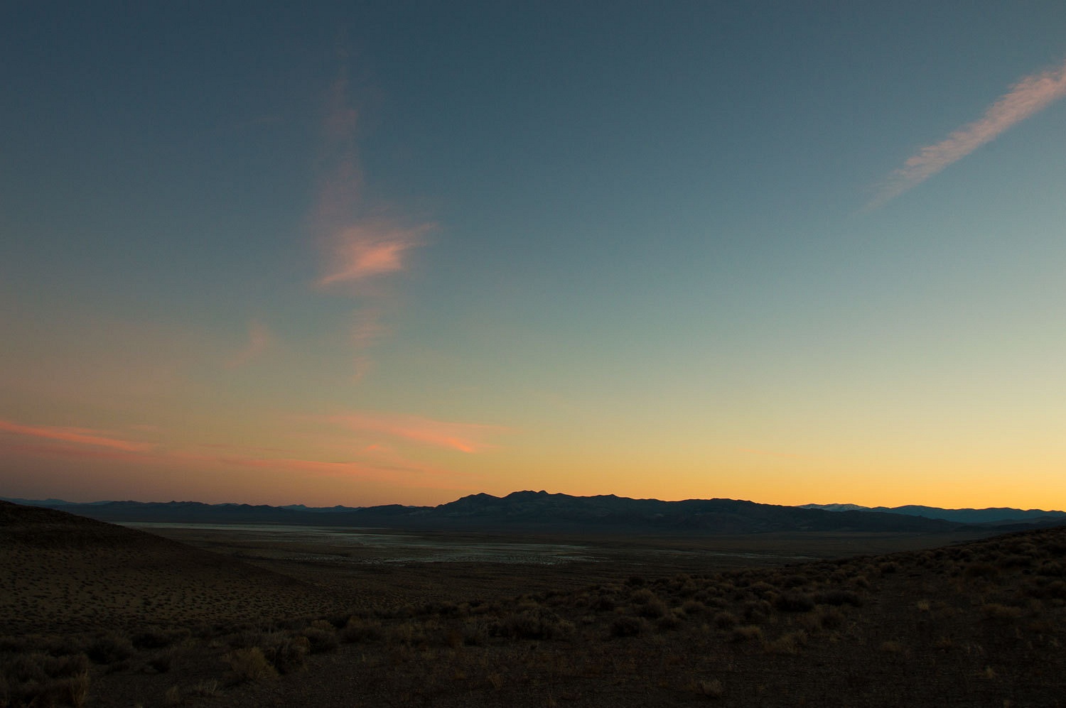
We also
looked down on highway 95 to the west.
Sunday
morning dawned cold and clear. This was a great place to wake up at.
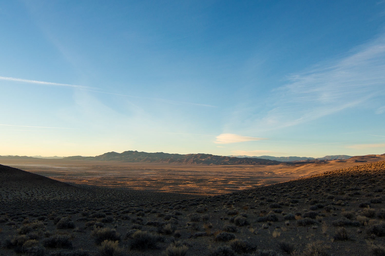
After a good
breakfast - I had chef duties - we rejoined highway 95 and drove to the north and intersected again
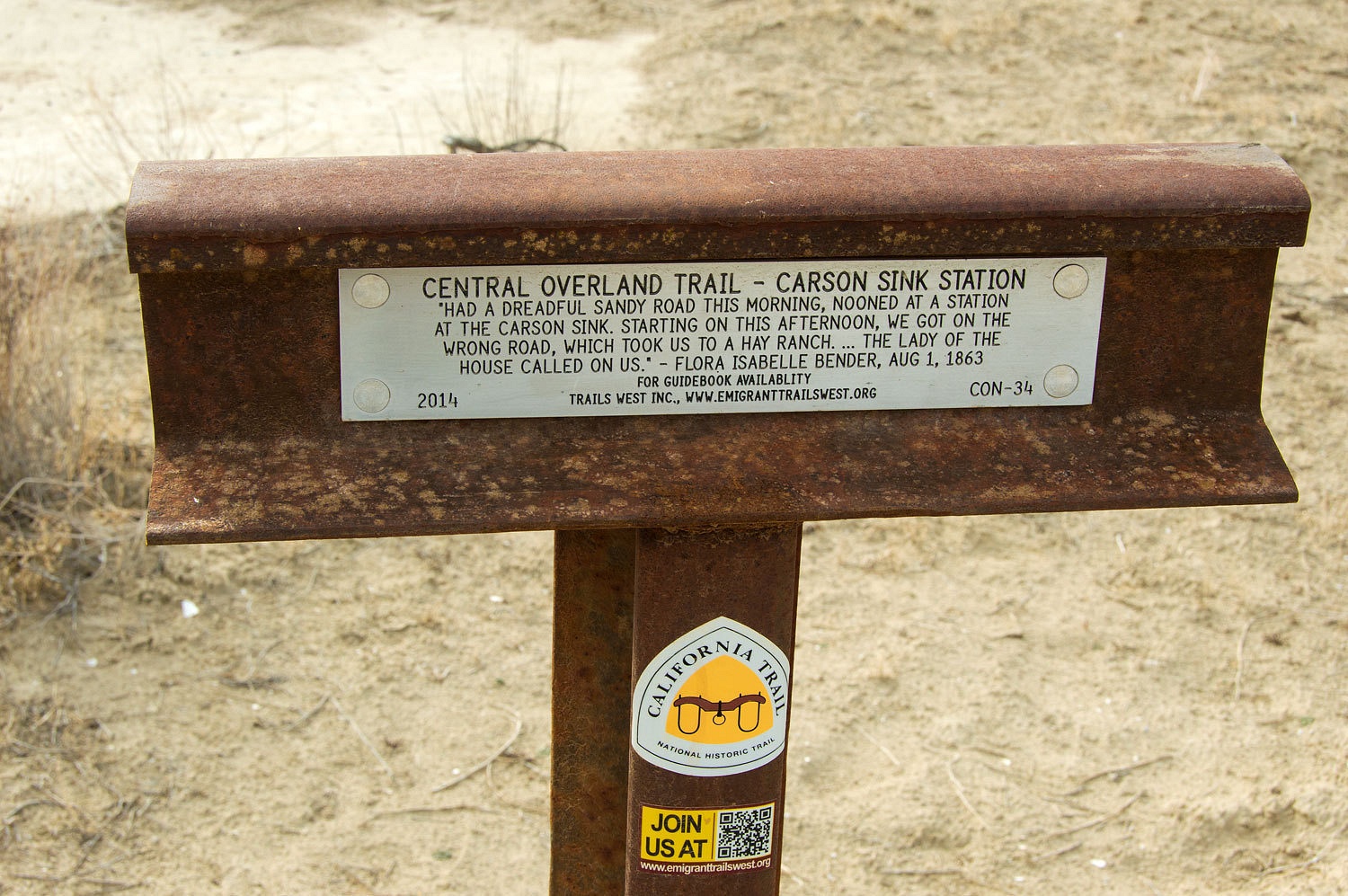
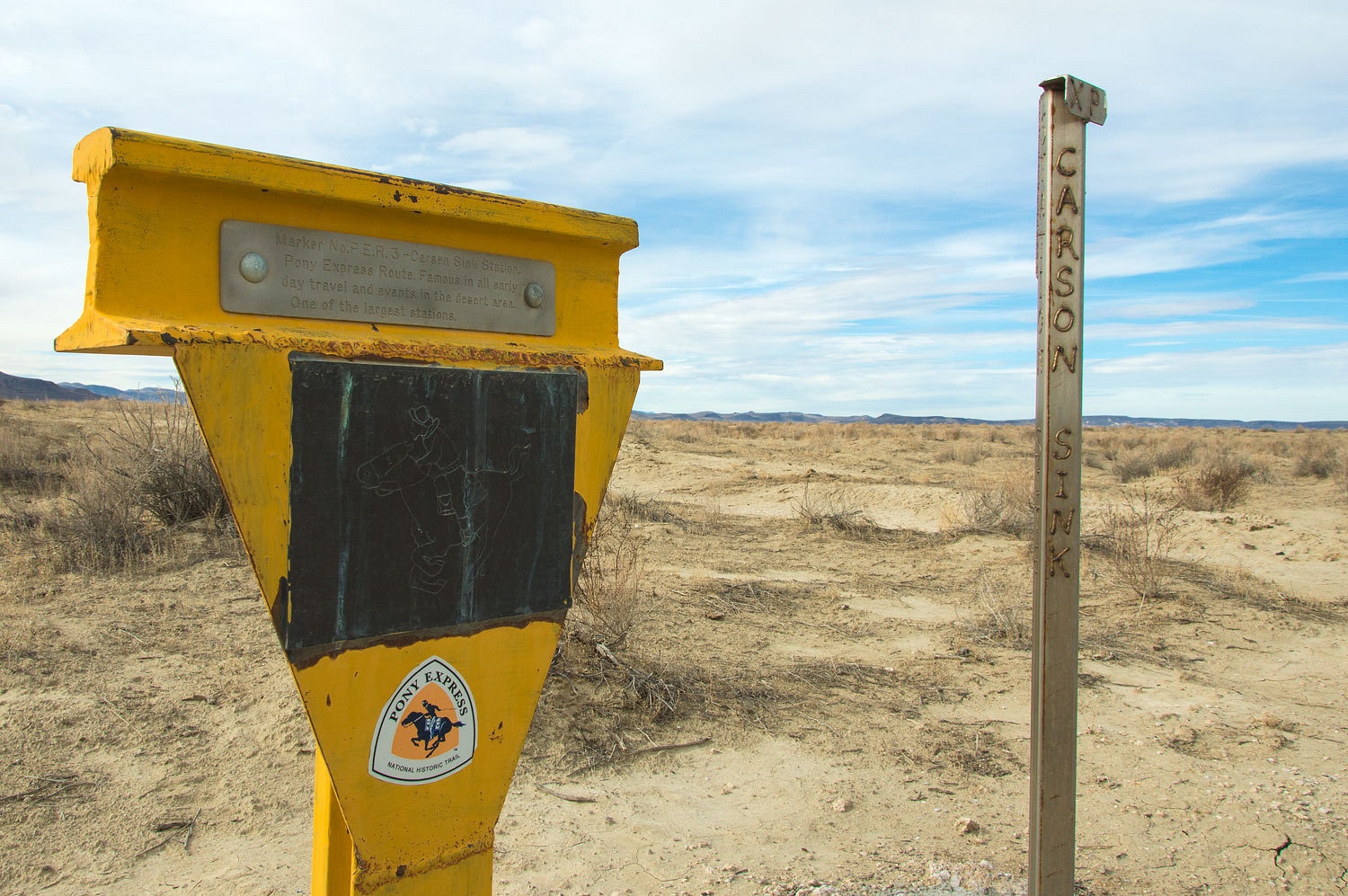
with the Pony Express Trail. We were at the Carson Sink, the end of the Carson
River, definitely a basin in the Basin and Range. It is a little over a mile
walk out across the playa to the west to the site of the Carson Sink Station.
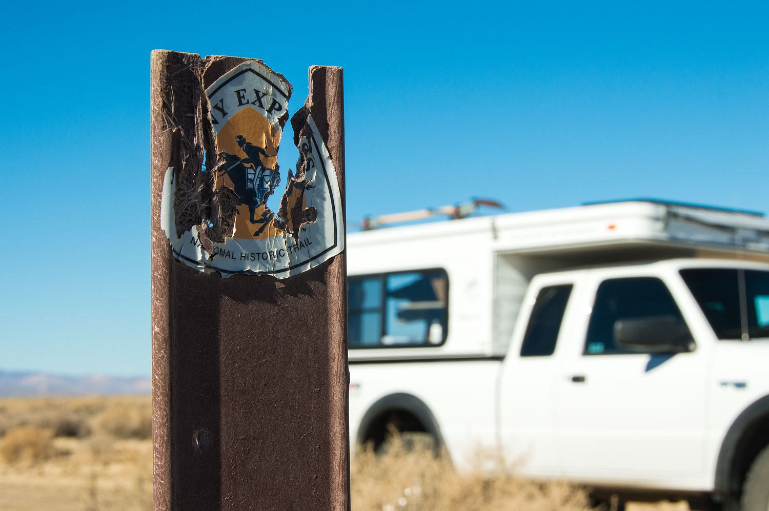
The
condition of the emblem reinforced the fact that we were out of range from a road in
Nevada.
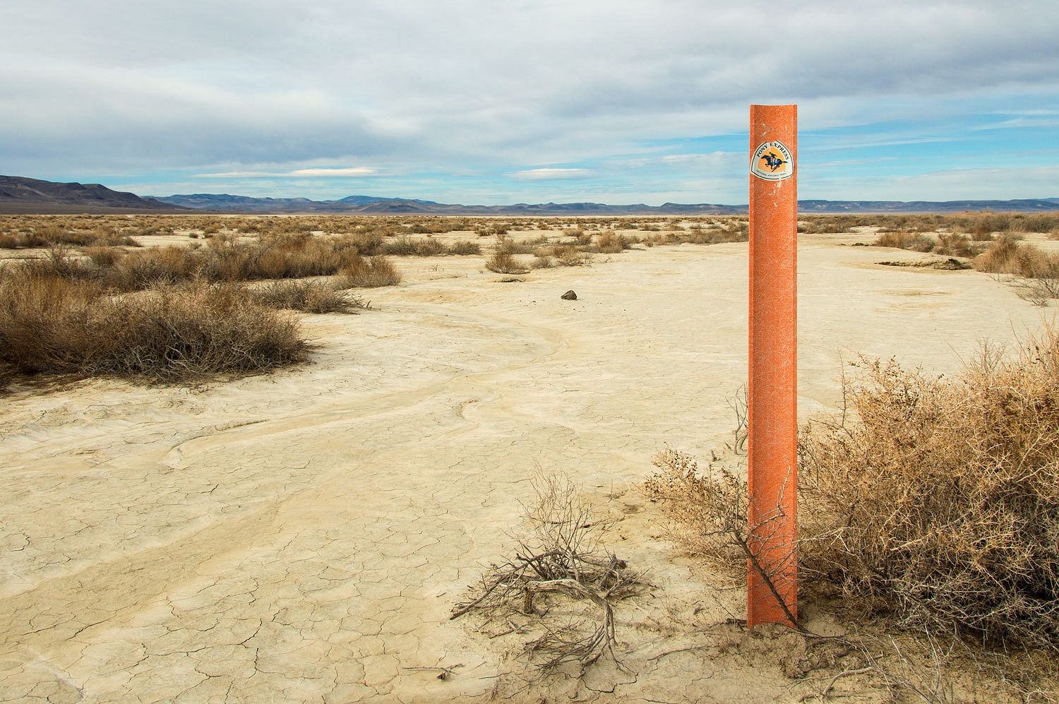
Nothing
remains of the station but the site is marked.

For us there
is no better way to touch history, to get a feel of the times, then to walk a
route and get as far away from modern civilization as possible. Only then can
we listen in the quiet for those voices, those spirits, those ghosts from the
past, those bits and pieces of our stories.
Addition :
Foy, also a member on the Wander the West Forum, provided the information below on what we originally thought could be a covering of volcanic tuff. Thank you Foy for your interest, research, and enthusiasm in sharing your knowledge in helping bring this landscape alive for all of us! Foy requested this disclaimer when I asked his permission -
"Of windward ice-age lake shorelines, geochemistry of deposition of calcium carbonate, dead camels, and now the oldest petroglyphs in North America:
I couldn't stand it. I had to spend a few minutes looking into the odd rock outcrop photos. OK, it was an hour, but my boss approved (I'm self-employed). Here's what I think Ski and The Lady saw:
The second picture is the beginning point. The picture and their text show they were on a Lahontan shoreline, a bench perched well above the bottom of the basin today. Some searching on Lahontan shorelines and Dead Camel Mountains brought me to several professional papers describing the geology of the Lake Lahonta region (ice age Lake Lahontan) and the Carson Desert. The seminal work was published in 1964 as Lake Lahonta: Geology of the Carson Desert, Nevada. USGS Professional Paper 401. Author Roger Morrison. Students of the history of science will be fascinated to know that the prior principal research was USGS Monograph 11, by IC Russell. Russell reported to GK Gilbert, then Geologist-in-Charge, Division of the Great Basin, US Geological Survey. Gilbert thus submitted Russell's work to the Honorable J W Powell, Director, USGS, in 1885. That would be John Wesley Powell, the first head of the USGS and "Wanderer of the West Extraordinaire", only by boat instead of truck.
Anyway, the gist is that over 120 years of geologic mapping has identified widespread deposits of tufa along ice age shorelines including Lake Lahonta and Lake Bonneville. Tufa is a form of limestone--calcium carbonate and is unrelated to a tuff, of volcanic ash origin. In other parts of the West, tufa forms in lacustrine environments where lake bottom springs provide the chemical environment favoring precipitation of tufa from calcium carbonate rich waters. The tufa towers at Mono Lake are prime examples. Elsewhere, including Lake Lahonta, its sub-basins (including Pyramid Lake), and Lake Bonneville, tufas form where heavy wave activity along windward shorelines aerates the water sufficiently to cause "de-gassing" and thus promotes precipitation of calcium carbonates due to declines in the partial pressure of CO2 gas within the waters. At Lake Bonneville, 400 miles east of the Dead Camels, a 2010 study noted the primary wind direction was from the northeast, so we might assume the same at Lahonta. The east slopes of the Dead Camel Mountains would then have been a windward shoreline facing northeast, having lots of "fetch" (open waters across which wave energy builds up" and then very favorable for precipitation and deposition of "encrusting tufa" upon whatever rock substrate was present within a few meters depth of the elevation of the shoreline. The first picture thus appears to be an encrusting tufa inasmuch as it's draped all over the bedrock's irregularities. The second picture also seems to depict an encrusting tufa, but this one is draped over a slightly older layer of Tertiary lacustrine sediments, mapped by geologists on the opposite side of Lahonta (at Grimes Point and the Lahontan Mountains) as green, gray, and red siltstones and shales. The second picture must be oriented to the southeast, with the Dead Camels on the right and the present-day Lahontan basin on the left.
A mere 5 minutes of work showed Ski's work as to the origin of "Dead Camel" as a place name may be right on target, where Fort Tejon, CA was the western terminus of the US Army Camel Corps operations which originated in West Texas, and where stray camels were spotted throughout the Southwest as recently as the middle of the 20th century. It's also possible that the Wisconsonian Ice Age, from about 26,000 to 12,000 years ago, during which the Lahontan and Bonneville lake elevations fluctuated considerably, left remains of the many mastodons, giant ground sloths, and yes, camels, as fossilized remains in soft sediments as the glacial lakes receded. Back here in the East, the Valley and Ridge of southwest Virginia includes extensive surficial salt deposits which were the death traps for mastodons and sloths, there just one to two hundred miles south of the ice sheets. Saltville, VA has some terrific museum displays of such fossils.
Lastly, Ski's post from today concerning the Pyramid Lake petroglyphs indicated dating of the limestones upon which the works were carved showed the rock was around 14,000 years old. Since Pyramid is a Lahontan sub-basin, the carvings were likely done on tufas on the Pyramid shoreline, then hundreds of feet higher than the remnants of Pyramid today.
A sardonic but good humored "gee, thanks buddy" to Ski, without whose inquisitiveness and photography skills I would have been able to reach my billable hours quota today. Keep 'em coming, Ski!
Foy"
Addition :
Foy, also a member on the Wander the West Forum, provided the information below on what we originally thought could be a covering of volcanic tuff. Thank you Foy for your interest, research, and enthusiasm in sharing your knowledge in helping bring this landscape alive for all of us! Foy requested this disclaimer when I asked his permission -
"......and thanks
for asking. Hopefully I didn't embarrass myself too badly in terms of
getting it right, or wrong...I did add the qualifier that I'm strictly an
amateur nowadays, to that should be included, in my opinion." Here we go -
"Of windward ice-age lake shorelines, geochemistry of deposition of calcium carbonate, dead camels, and now the oldest petroglyphs in North America:
I couldn't stand it. I had to spend a few minutes looking into the odd rock outcrop photos. OK, it was an hour, but my boss approved (I'm self-employed). Here's what I think Ski and The Lady saw:
The second picture is the beginning point. The picture and their text show they were on a Lahontan shoreline, a bench perched well above the bottom of the basin today. Some searching on Lahontan shorelines and Dead Camel Mountains brought me to several professional papers describing the geology of the Lake Lahonta region (ice age Lake Lahontan) and the Carson Desert. The seminal work was published in 1964 as Lake Lahonta: Geology of the Carson Desert, Nevada. USGS Professional Paper 401. Author Roger Morrison. Students of the history of science will be fascinated to know that the prior principal research was USGS Monograph 11, by IC Russell. Russell reported to GK Gilbert, then Geologist-in-Charge, Division of the Great Basin, US Geological Survey. Gilbert thus submitted Russell's work to the Honorable J W Powell, Director, USGS, in 1885. That would be John Wesley Powell, the first head of the USGS and "Wanderer of the West Extraordinaire", only by boat instead of truck.
Anyway, the gist is that over 120 years of geologic mapping has identified widespread deposits of tufa along ice age shorelines including Lake Lahonta and Lake Bonneville. Tufa is a form of limestone--calcium carbonate and is unrelated to a tuff, of volcanic ash origin. In other parts of the West, tufa forms in lacustrine environments where lake bottom springs provide the chemical environment favoring precipitation of tufa from calcium carbonate rich waters. The tufa towers at Mono Lake are prime examples. Elsewhere, including Lake Lahonta, its sub-basins (including Pyramid Lake), and Lake Bonneville, tufas form where heavy wave activity along windward shorelines aerates the water sufficiently to cause "de-gassing" and thus promotes precipitation of calcium carbonates due to declines in the partial pressure of CO2 gas within the waters. At Lake Bonneville, 400 miles east of the Dead Camels, a 2010 study noted the primary wind direction was from the northeast, so we might assume the same at Lahonta. The east slopes of the Dead Camel Mountains would then have been a windward shoreline facing northeast, having lots of "fetch" (open waters across which wave energy builds up" and then very favorable for precipitation and deposition of "encrusting tufa" upon whatever rock substrate was present within a few meters depth of the elevation of the shoreline. The first picture thus appears to be an encrusting tufa inasmuch as it's draped all over the bedrock's irregularities. The second picture also seems to depict an encrusting tufa, but this one is draped over a slightly older layer of Tertiary lacustrine sediments, mapped by geologists on the opposite side of Lahonta (at Grimes Point and the Lahontan Mountains) as green, gray, and red siltstones and shales. The second picture must be oriented to the southeast, with the Dead Camels on the right and the present-day Lahontan basin on the left.
A mere 5 minutes of work showed Ski's work as to the origin of "Dead Camel" as a place name may be right on target, where Fort Tejon, CA was the western terminus of the US Army Camel Corps operations which originated in West Texas, and where stray camels were spotted throughout the Southwest as recently as the middle of the 20th century. It's also possible that the Wisconsonian Ice Age, from about 26,000 to 12,000 years ago, during which the Lahontan and Bonneville lake elevations fluctuated considerably, left remains of the many mastodons, giant ground sloths, and yes, camels, as fossilized remains in soft sediments as the glacial lakes receded. Back here in the East, the Valley and Ridge of southwest Virginia includes extensive surficial salt deposits which were the death traps for mastodons and sloths, there just one to two hundred miles south of the ice sheets. Saltville, VA has some terrific museum displays of such fossils.
Lastly, Ski's post from today concerning the Pyramid Lake petroglyphs indicated dating of the limestones upon which the works were carved showed the rock was around 14,000 years old. Since Pyramid is a Lahontan sub-basin, the carvings were likely done on tufas on the Pyramid shoreline, then hundreds of feet higher than the remnants of Pyramid today.
A sardonic but good humored "gee, thanks buddy" to Ski, without whose inquisitiveness and photography skills I would have been able to reach my billable hours quota today. Keep 'em coming, Ski!
Foy"
Excellent, as always! I agree that this is tuff, not breccia, judging by the texture -- more ash than chunks of rocks. Tuff to tell the difference -- and you have to take my opinion with a grain of basalt, since I am not an expert.
ReplyDeleteDan, I have posted an addition to our story above about we were seeing. It was not volcanic tuff, so we have both been corrected and I know you, like us, don't mind that a bit!
DeleteAppears to me as tufa. Precipitated from an ancient hot spring, whilst underwater in a lake.
ReplyDeleteGood eye Guy! You were correct on tufa, but most interestingly not deposited by springs as we would have thought. Please check out the addition I have added to our story above. Thanks for the comment!
DeleteI've been to Ft. Churchill several times over the last decade -- but this was the first time I've seen photos in morning light. Very nice. Interesting about Foy.... There's a Foy who is very active on one of the road trip Forums I manage and he's also knowledgeable about geologic matters....
ReplyDelete