
please remember you can click on a photo to see a larger version & highlighted text are links to additional information
Independence
It was time for us to disappear. It was time
to be completely alone. It was Fourth of July weekend. Would we be up to the
challenge?
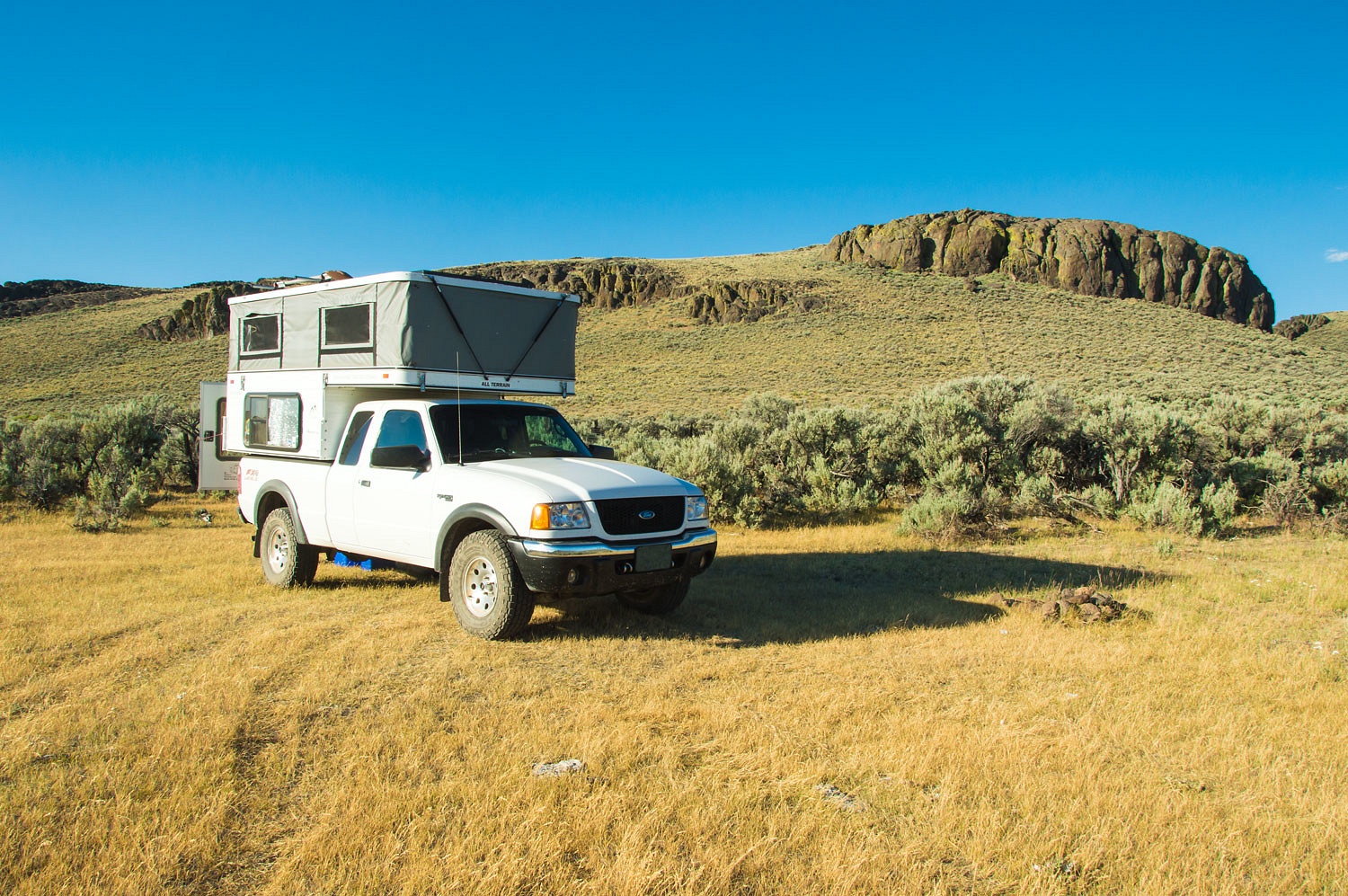
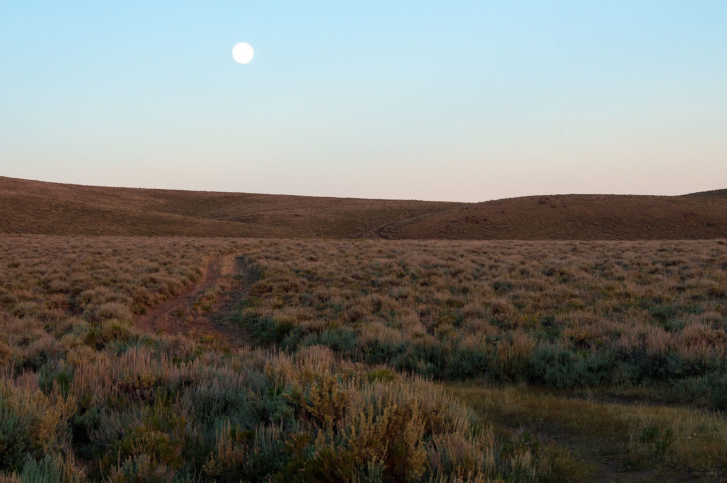
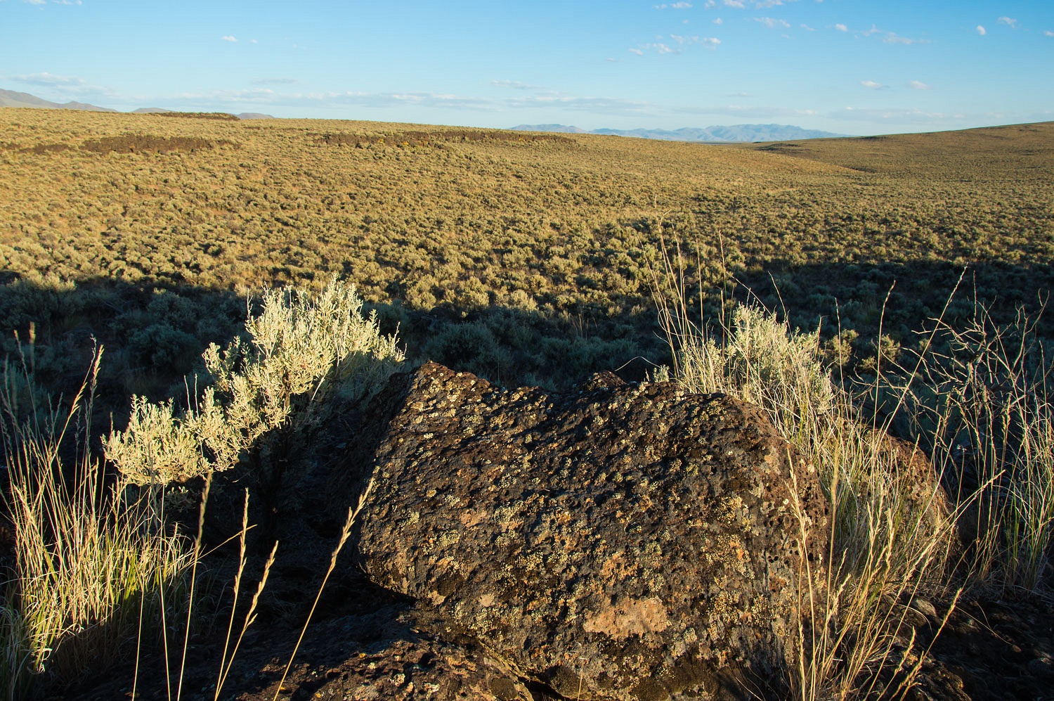
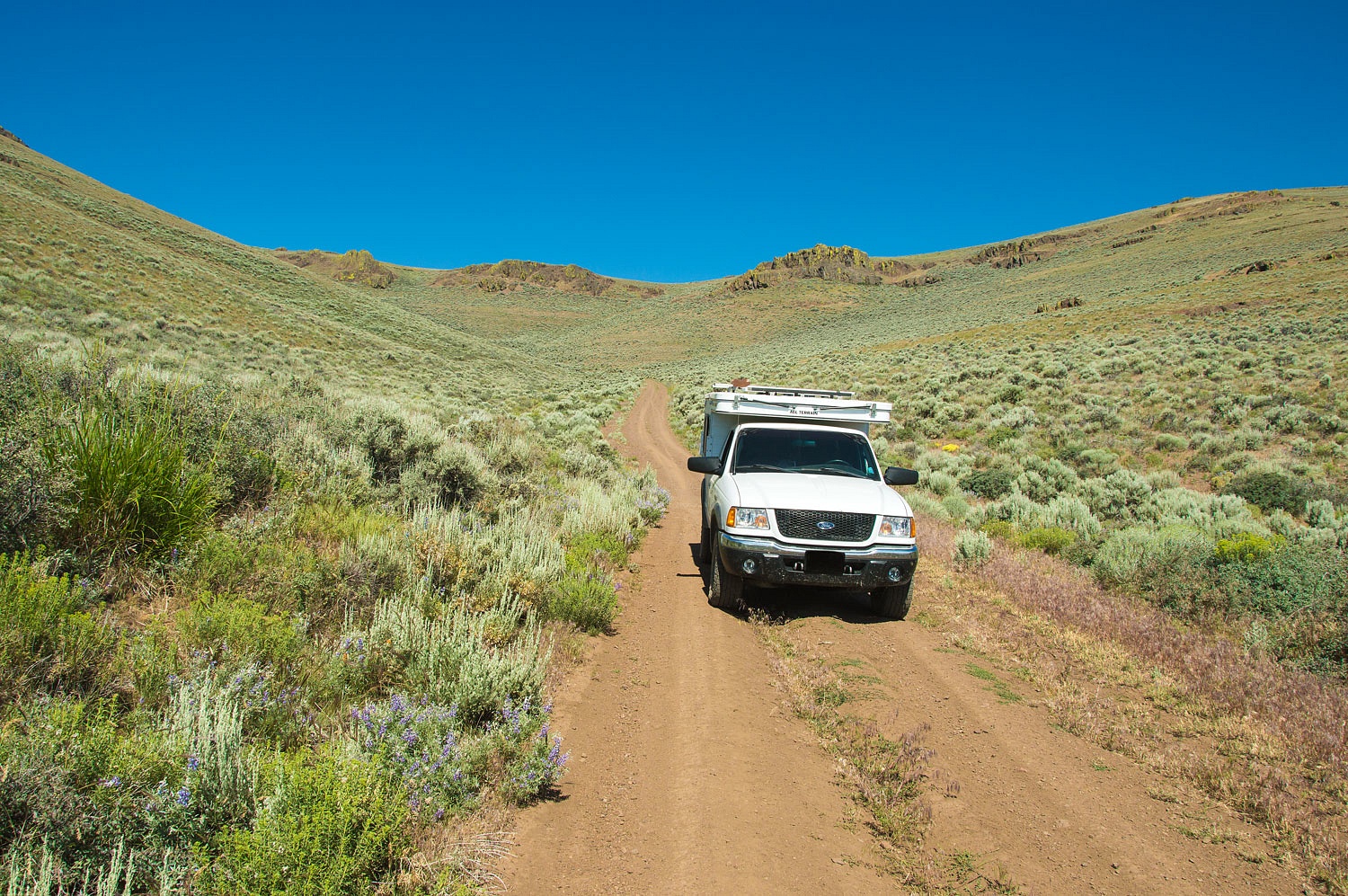
We turned off the pavement and headed
down a dirt road, surprised it had a name posted at the turn off. The Lady navigated and estimated we had around 30 miles before our turn onto a smaller primitive road. The topo indicated
"jeep trail" with a single dotted line.
"Our turn is coming up,"
the Lady announced. The two track headed up hill across broad open slopes. A
few miles later it entered a narrow gully with high rock walls that were hard
to see because of the big sage that was higher than our truck's cab
and scraped both sides of the truck as we squeezed through. The Lady was
ecstatic.
"I love the smell of sage!"
she beamed.
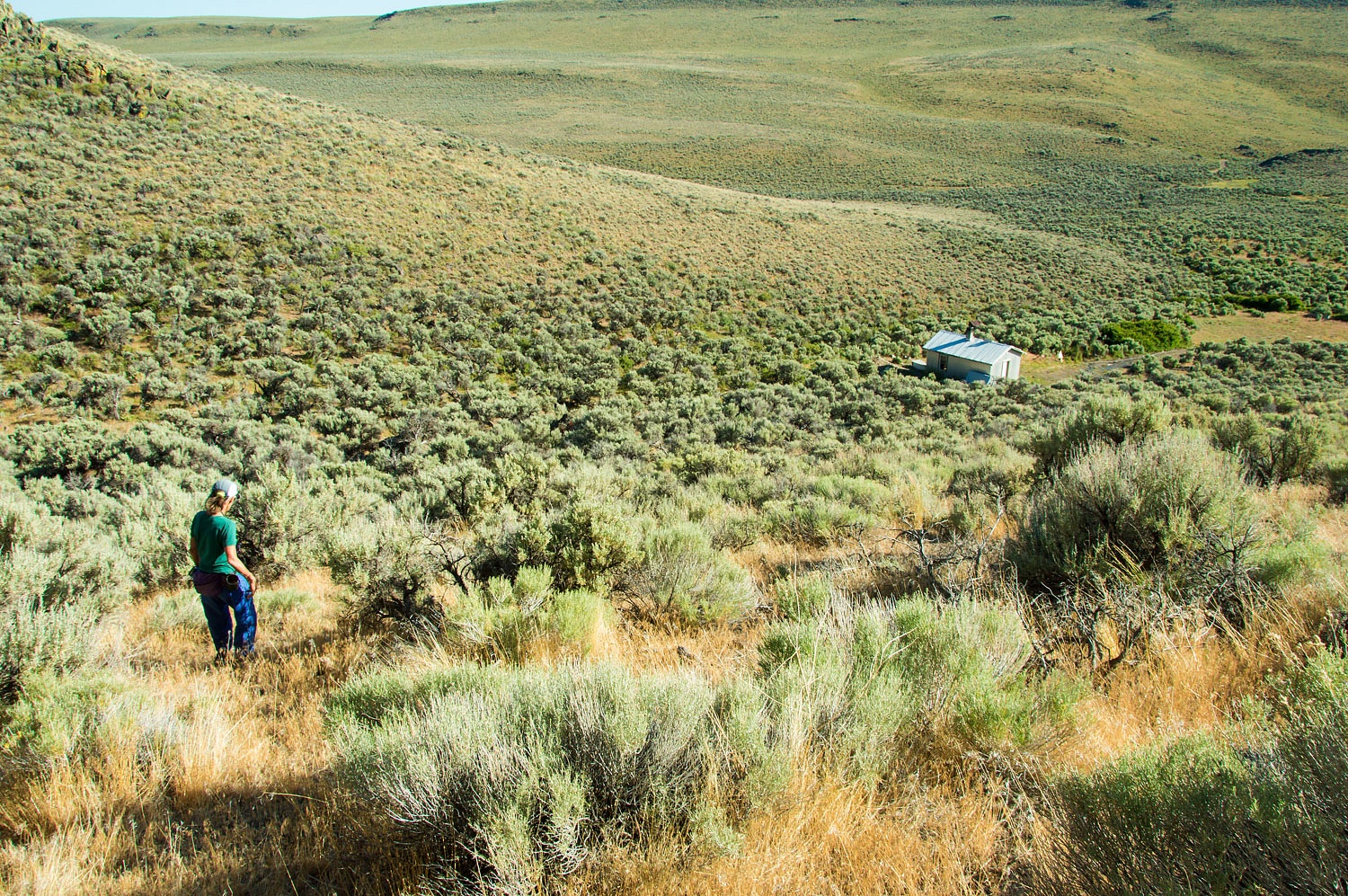
The land opened up after the rough gully
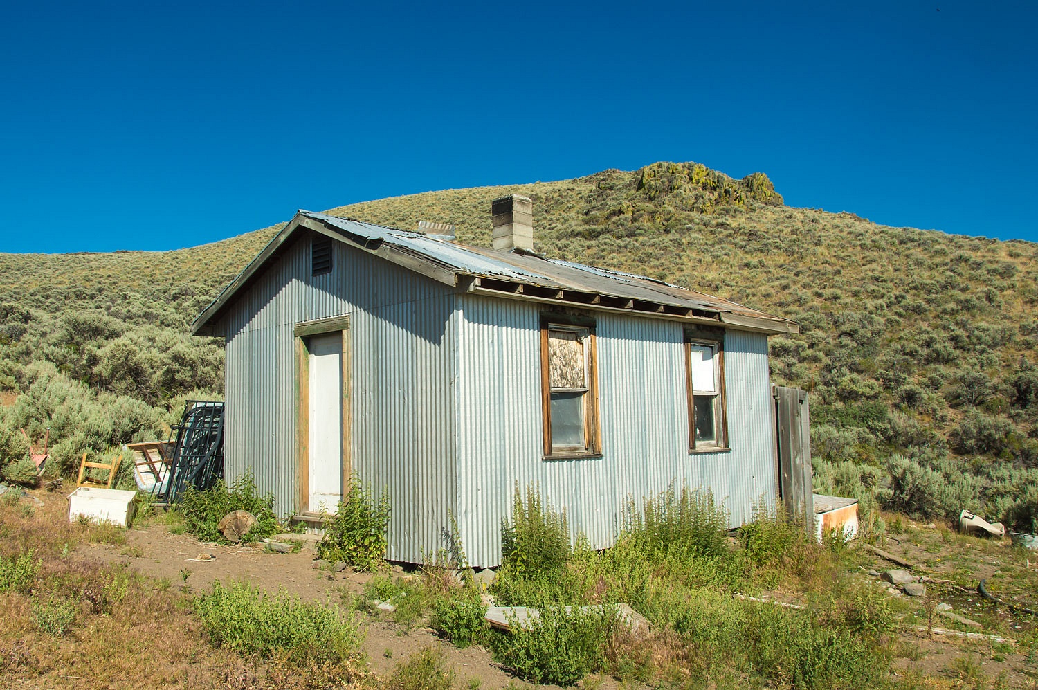
and we found our turn that climbed to the small cabin that sat below the
spring.
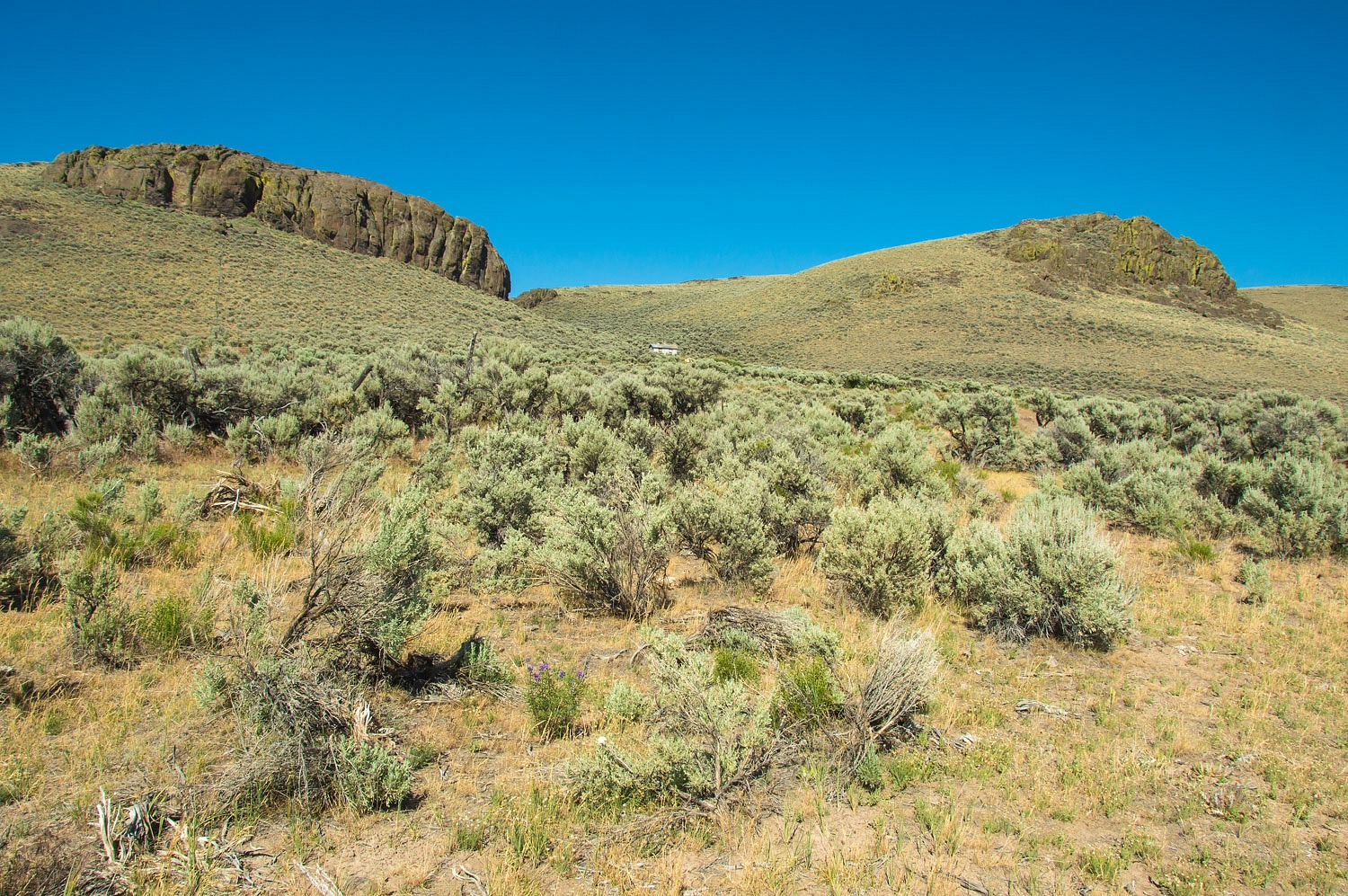
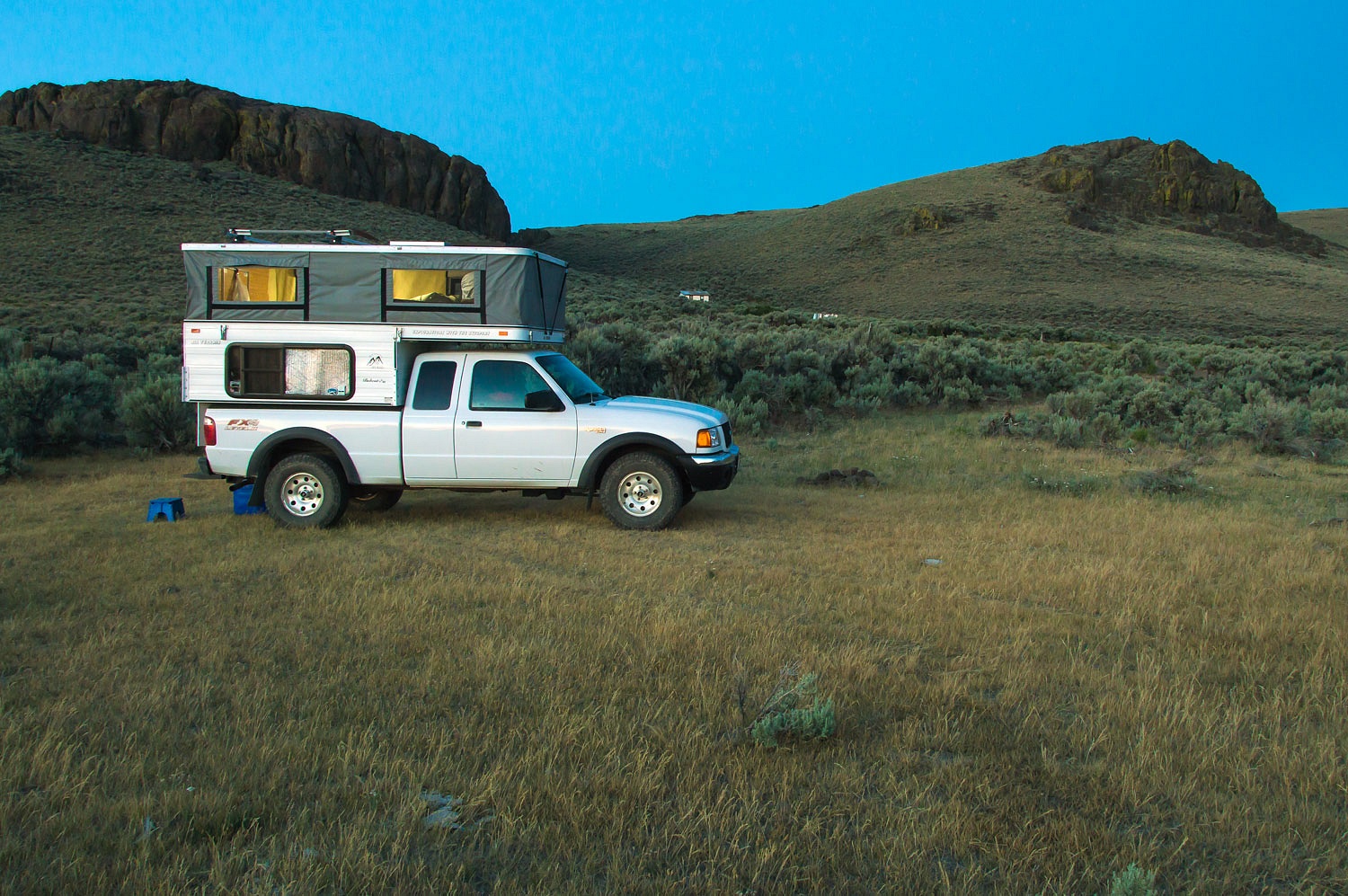
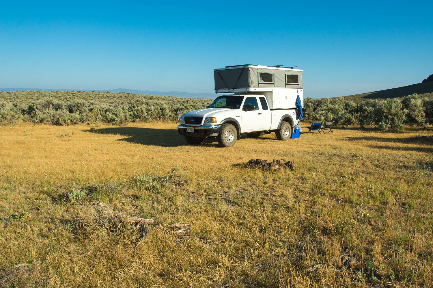
There was a nice flat area a few
hundred yards below the cabin where we set up camp.
This looked like a cattle operation,
an old line shack. The spring was used as a water source for cows but had
recently been fenced off to protect it. The water was clear and cold.
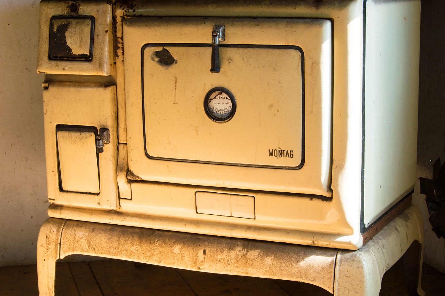
The cabin was open.
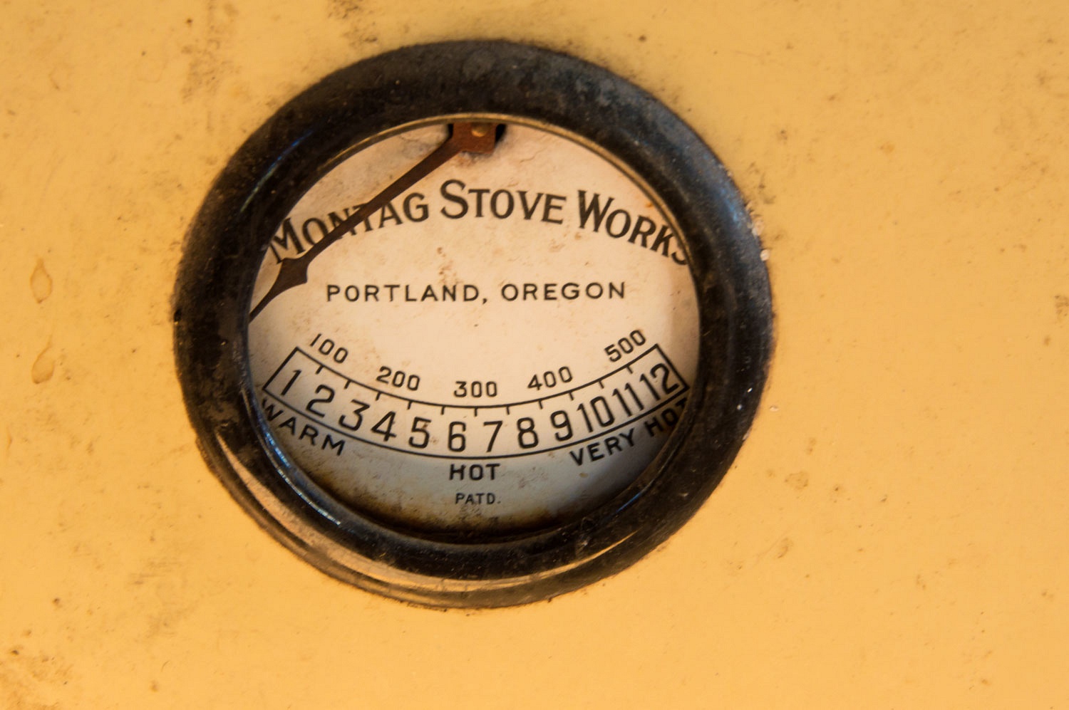
The woodstove in the corner of the kitchen
was an exceptional surprise.
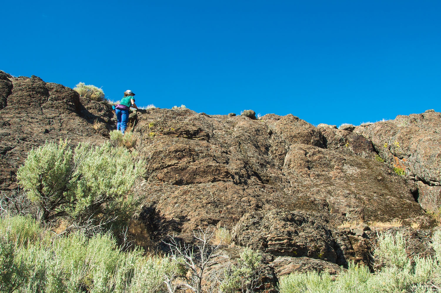
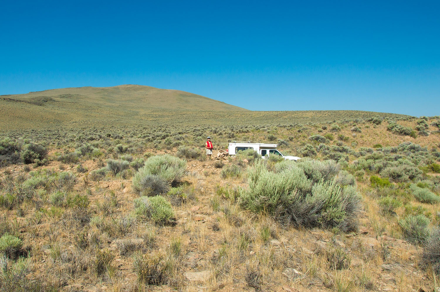
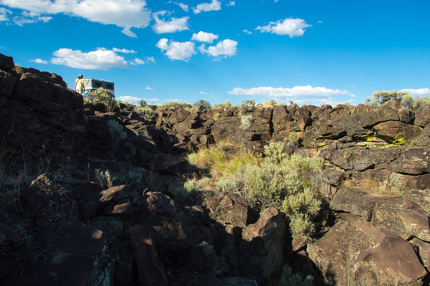
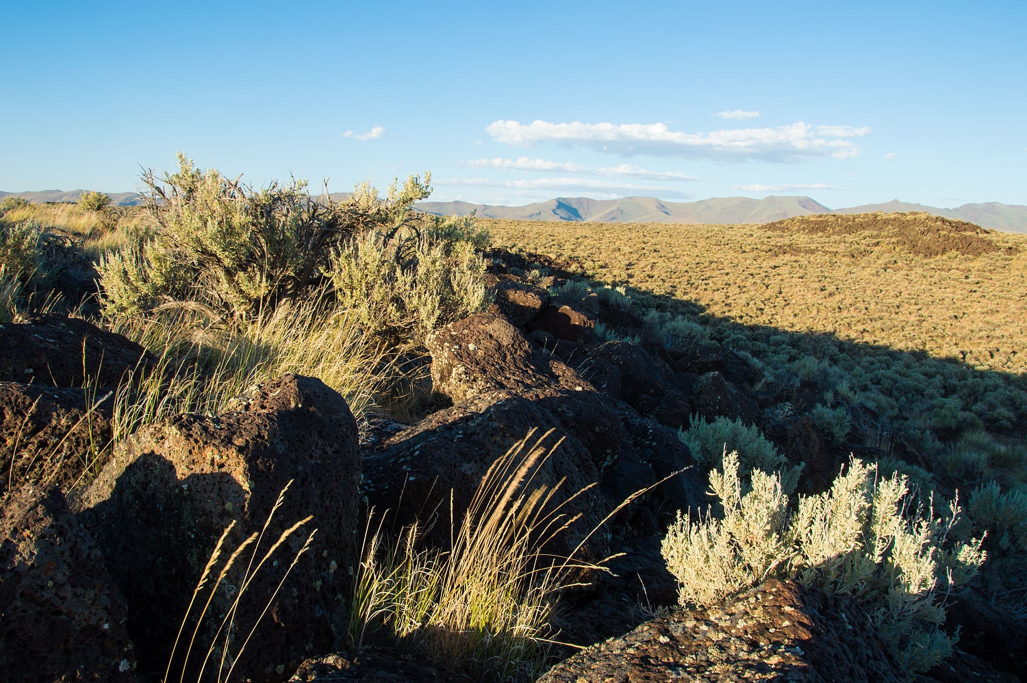
We climbed behind the cabin up to the
spring. The Lady wanted to continue.
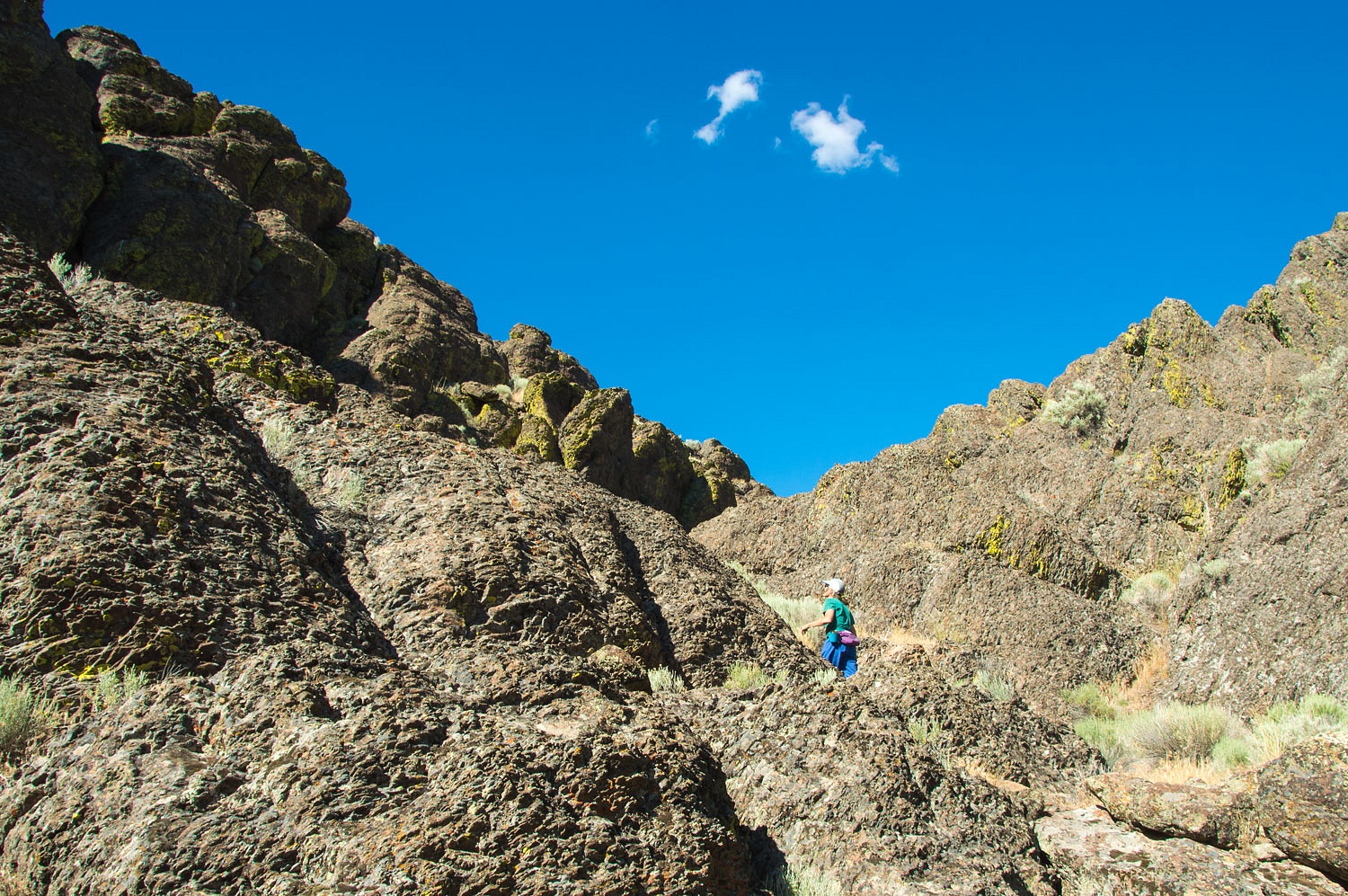
A great Horned Owl flew from its nest
and landed across the narrow canyon to watch us. We quickly moved past to disturb
it as little as possible.
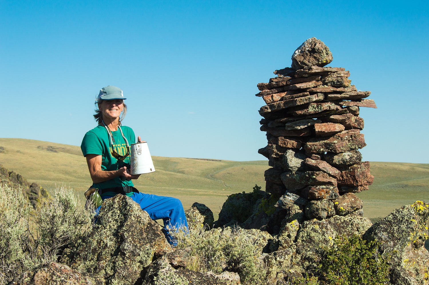
We reached the crest of the ridge. A
large stacked rock monument marked a high point.
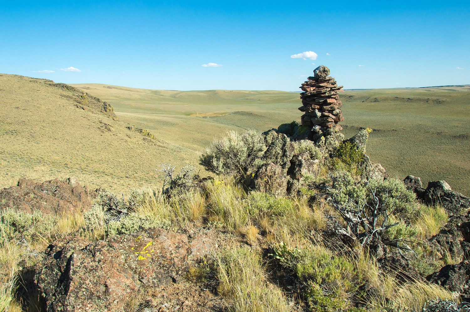
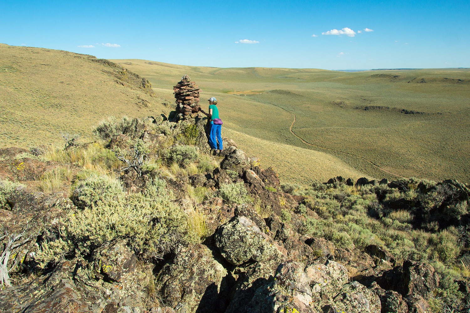
The Lady discovered an old coffee pot and
announced, "This is Coffee Pot Point!"
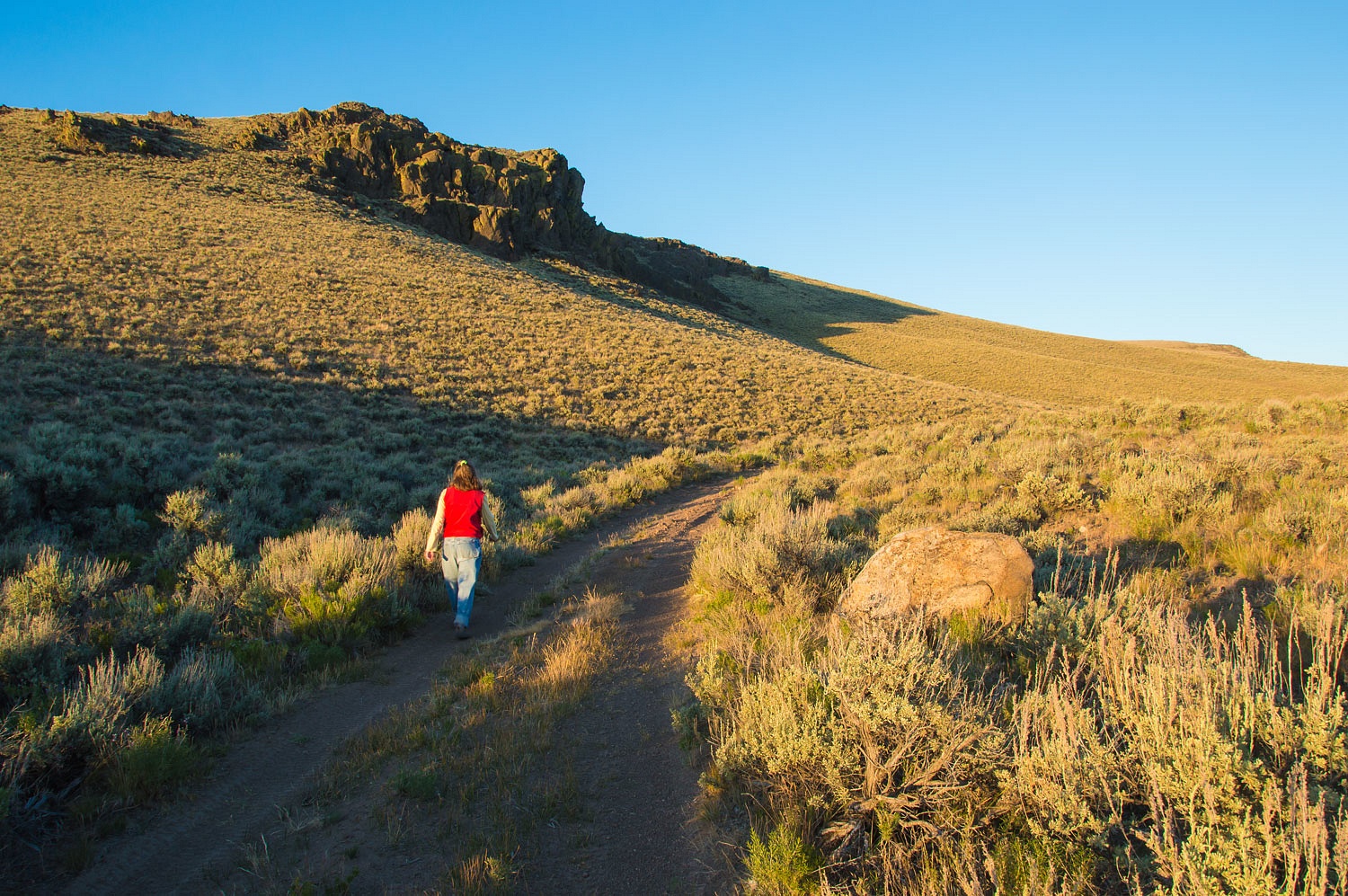
The road in the distance would be our
evening walk.
We retraced our climb up but
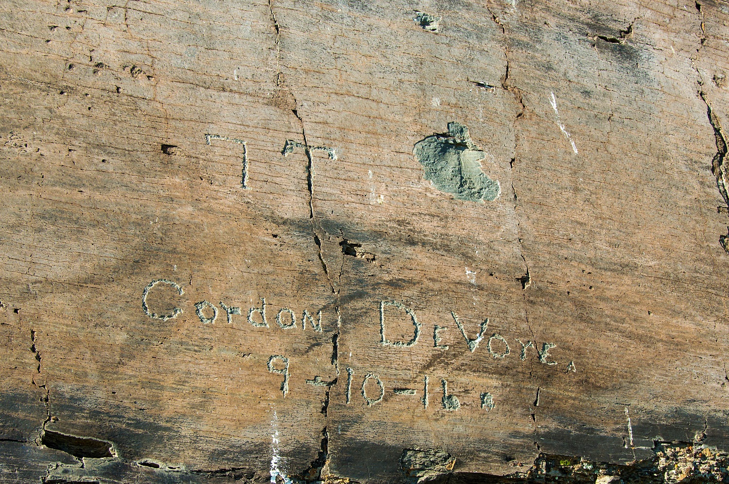
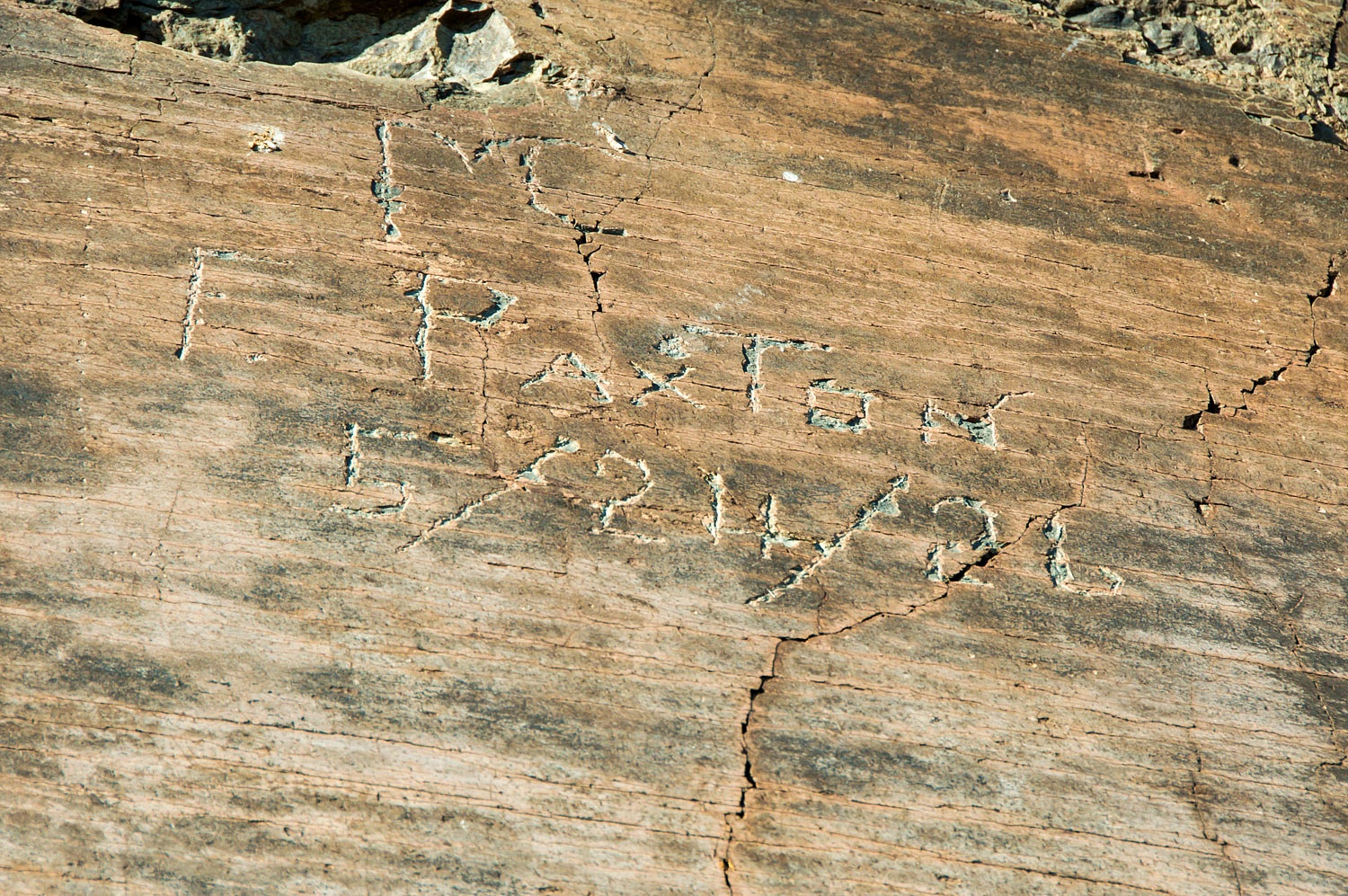
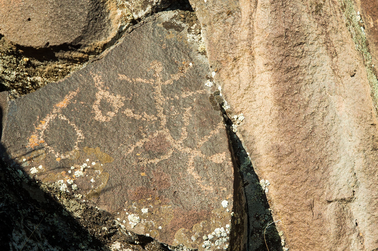
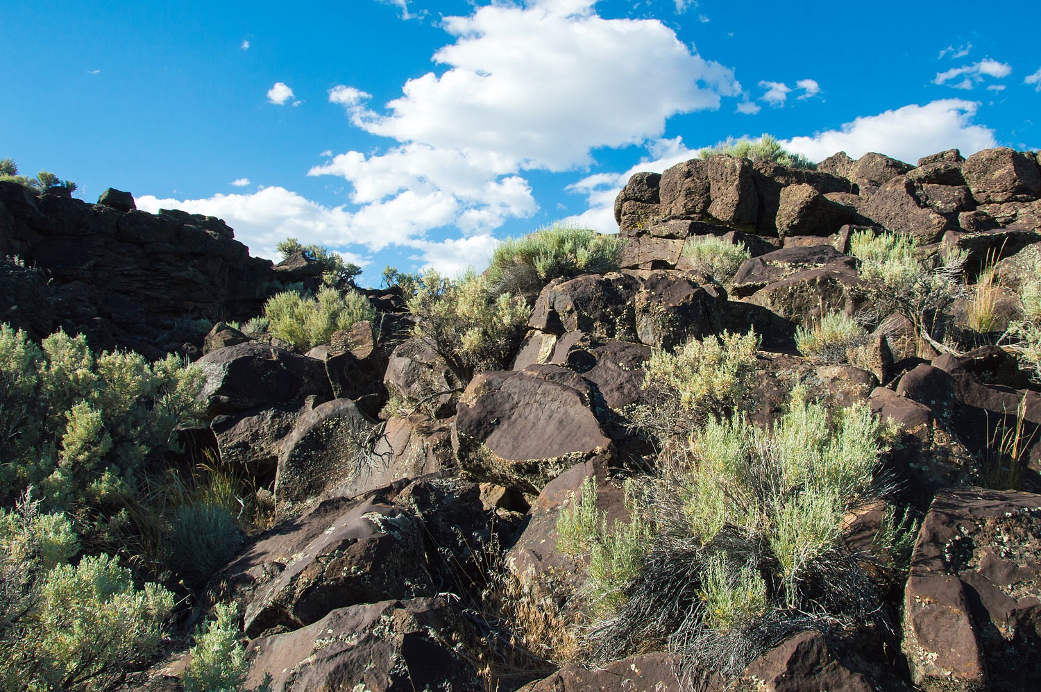
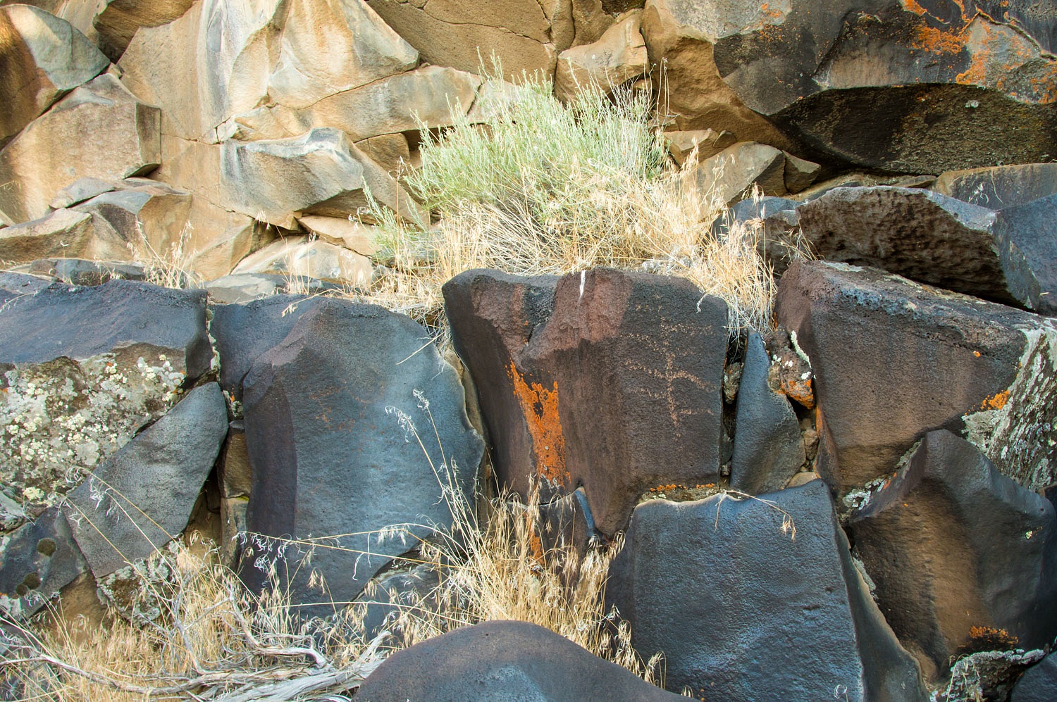
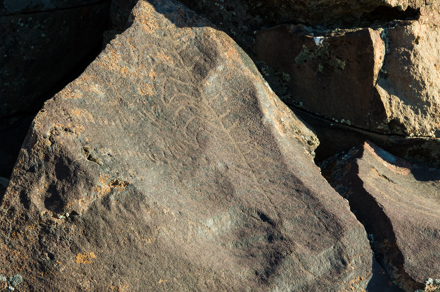
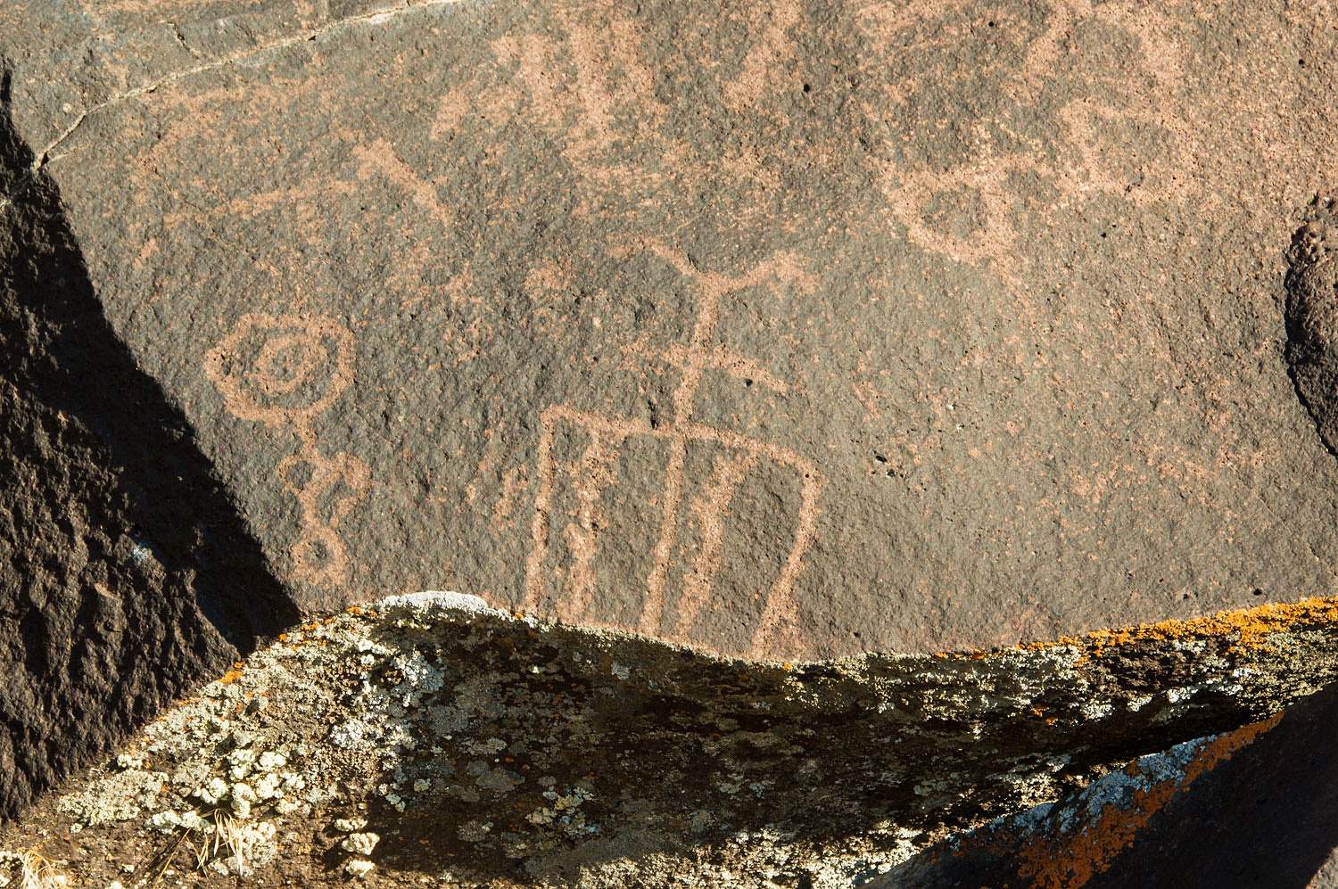
traversed over to look at a smooth panel of rock on the cliff above the cabin.
We found cowboy glyphs from 1916 and 1926. Mr. Paxton must have had a ladder.
Thanks to geologyjohn for this information -
"I believe that your cowboys were most likely:
Franklin Davis “Frank” Paxton, born March 15, 1879 in Oregon.
Died June 18, 1955.
Buried in Lakeview, Oregon.
Gordon Seth DeVore, born October 12, 1888 in Higginsport, Ohio.
Died February 3, 1969 and buried in Portland, Oregon."
We worked our way down from the panel.
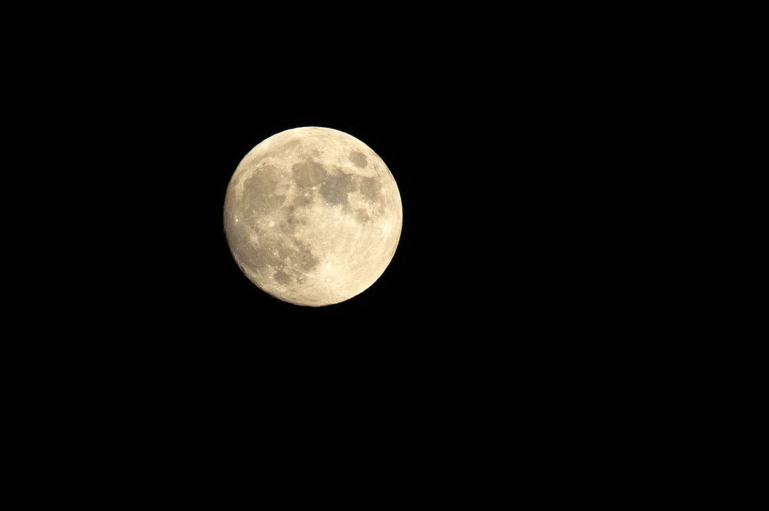
The full moon rose as we walked after
dinner and into the night.
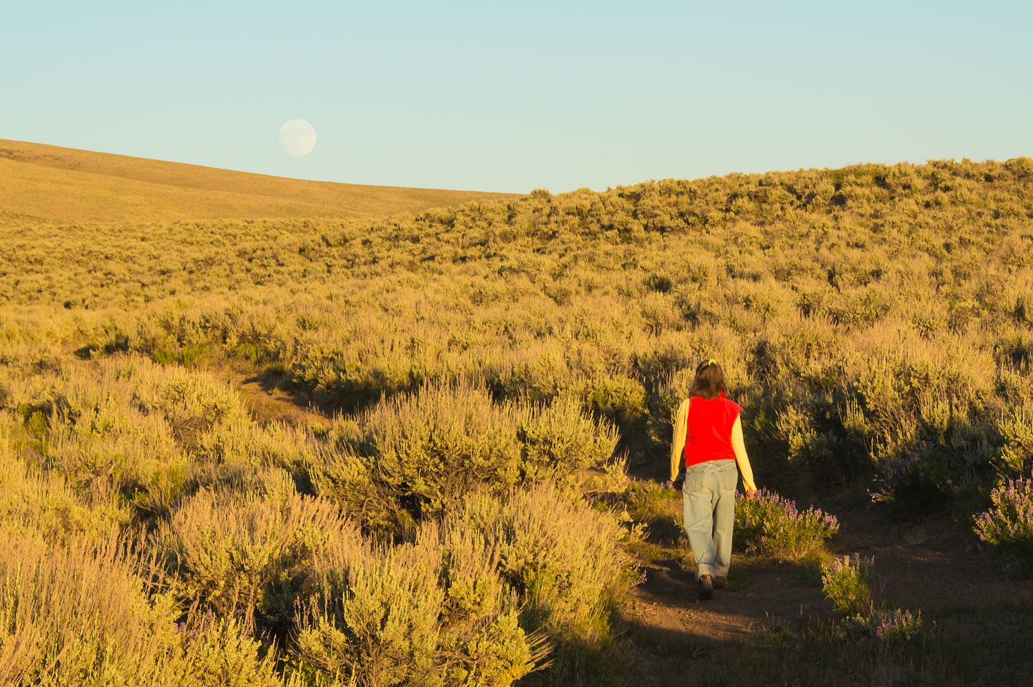
This was one of the best nights of
our trip. We returned to camp and sat out as darkness settled over us. Well, as
dark as a full moon in the backcountry would allow.
We joked about how we would react if
a ghost turned on a light in the cabin above us. The joke carried us into a
restful night's sleep.
The Fourth of July dawned clear and
cool and without another soul within miles. Could we keep that up through
another day and night?
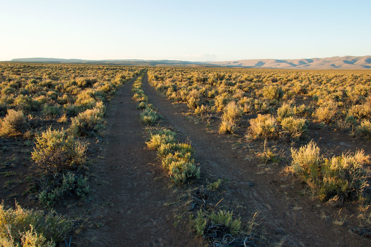
We had three possible routes into our
next destination. It would be a long drive and success would depend on how the
roads worked out and how many times we'd need to back track.
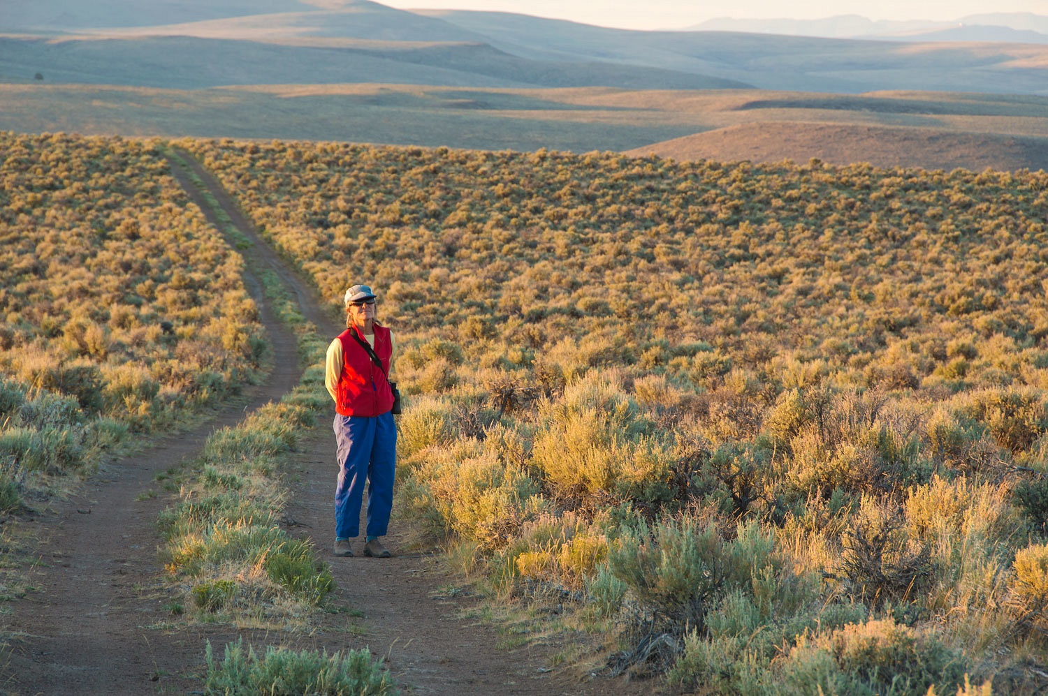
The Lady navigated and kept us found.
"Look here!" The Lady's
eyes were glued to the map program. I stopped the truck so she could show me.
"A few hundred yards off the road ahead the map has a tiny cross and the
word grave. Let's see if we can find it!" The search was on. Who is buried
out here in a lonely grave?
We found not a trace of a grave - no
headstone, no cross, no rock mound - and felt bad that this person's final rest
is now long forgotten except for a small mark on a map.
Hours later we reached the
destination for our Independence Day celebration. The last three miles of road
had not a hint of tire tracks except ours. It was very possible it was a long long time since anyone had ventured out here.
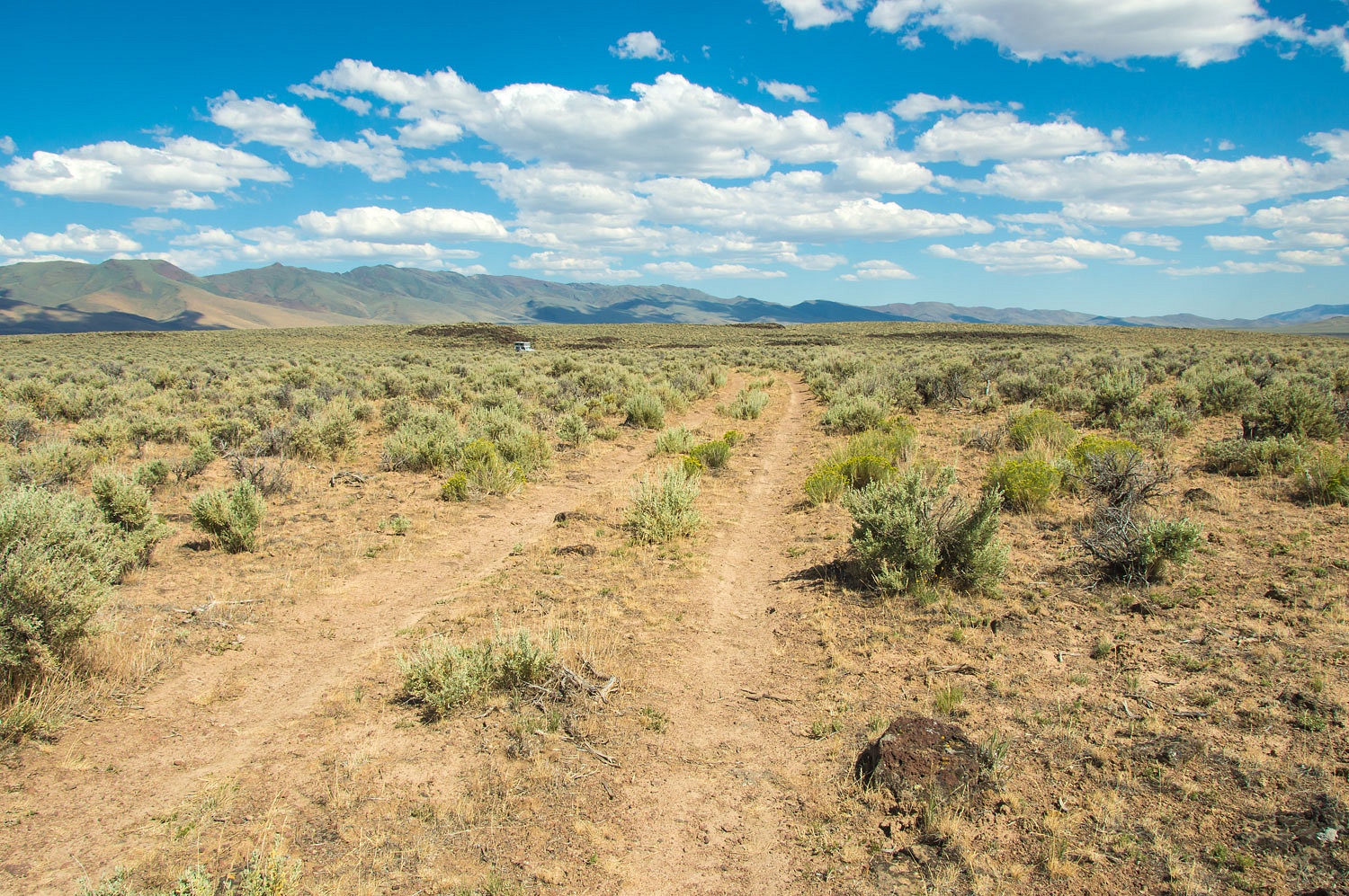
This was the kind of place worth
hours of research and driving to finally find. This was our kind of special place.
The site is hidden down slope.
After dinner and showers, the Lady relaxed and put
her see mores to work.
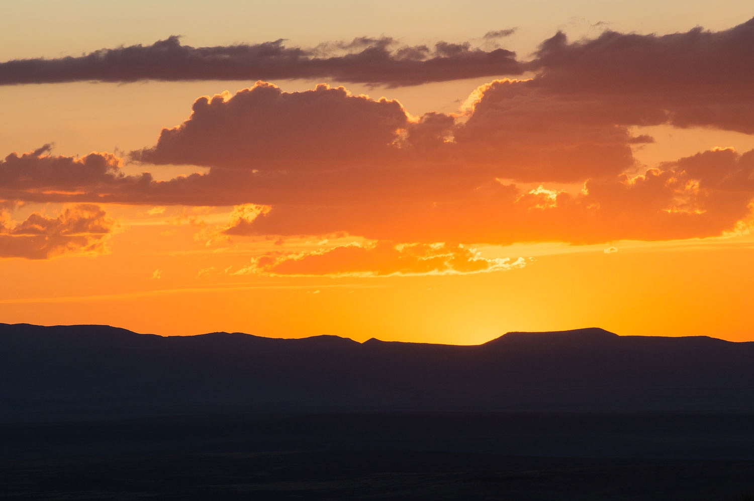
The evening light was fantastic
across this vast open landscape.
We walked well into the night.
Coyotes erupted in song all around us. The Lady tried to spot them with her see
mores with no success.
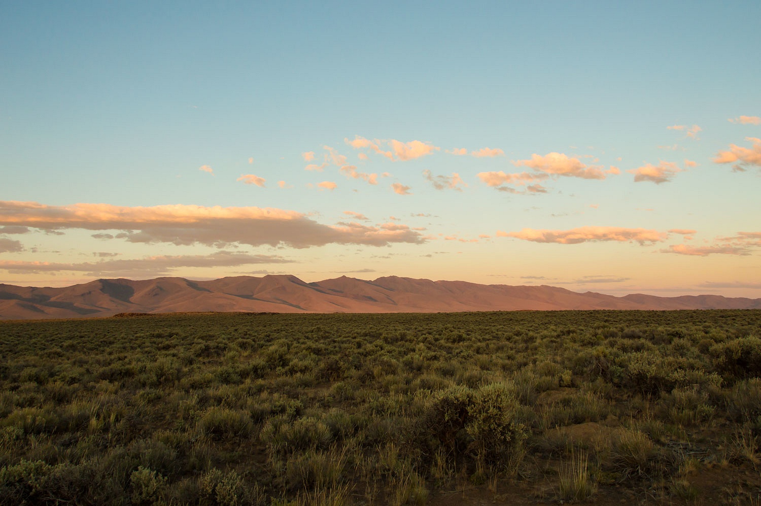
It was an extraordinary night in a
very special place.
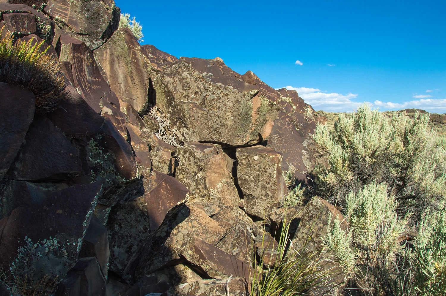
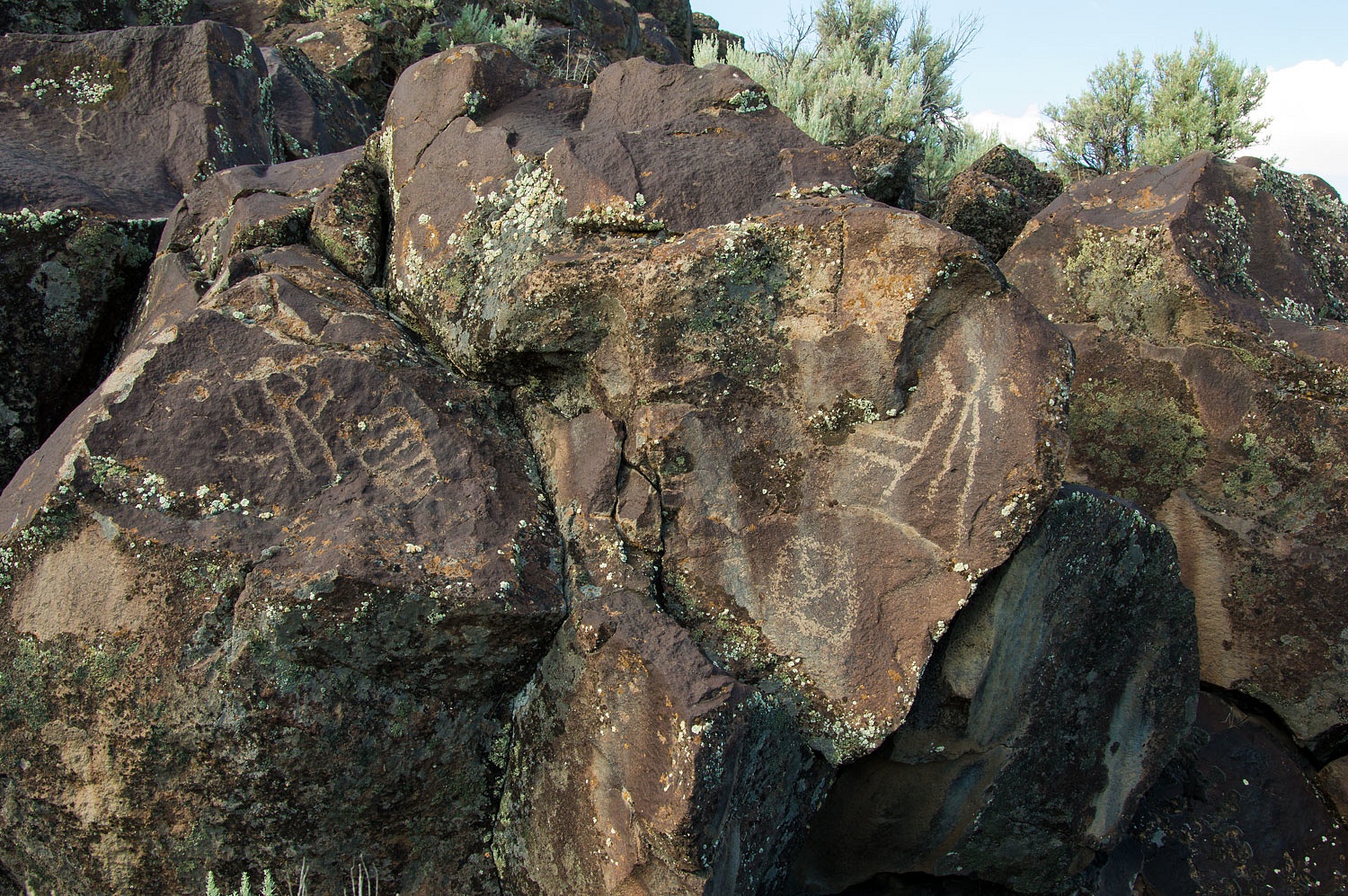
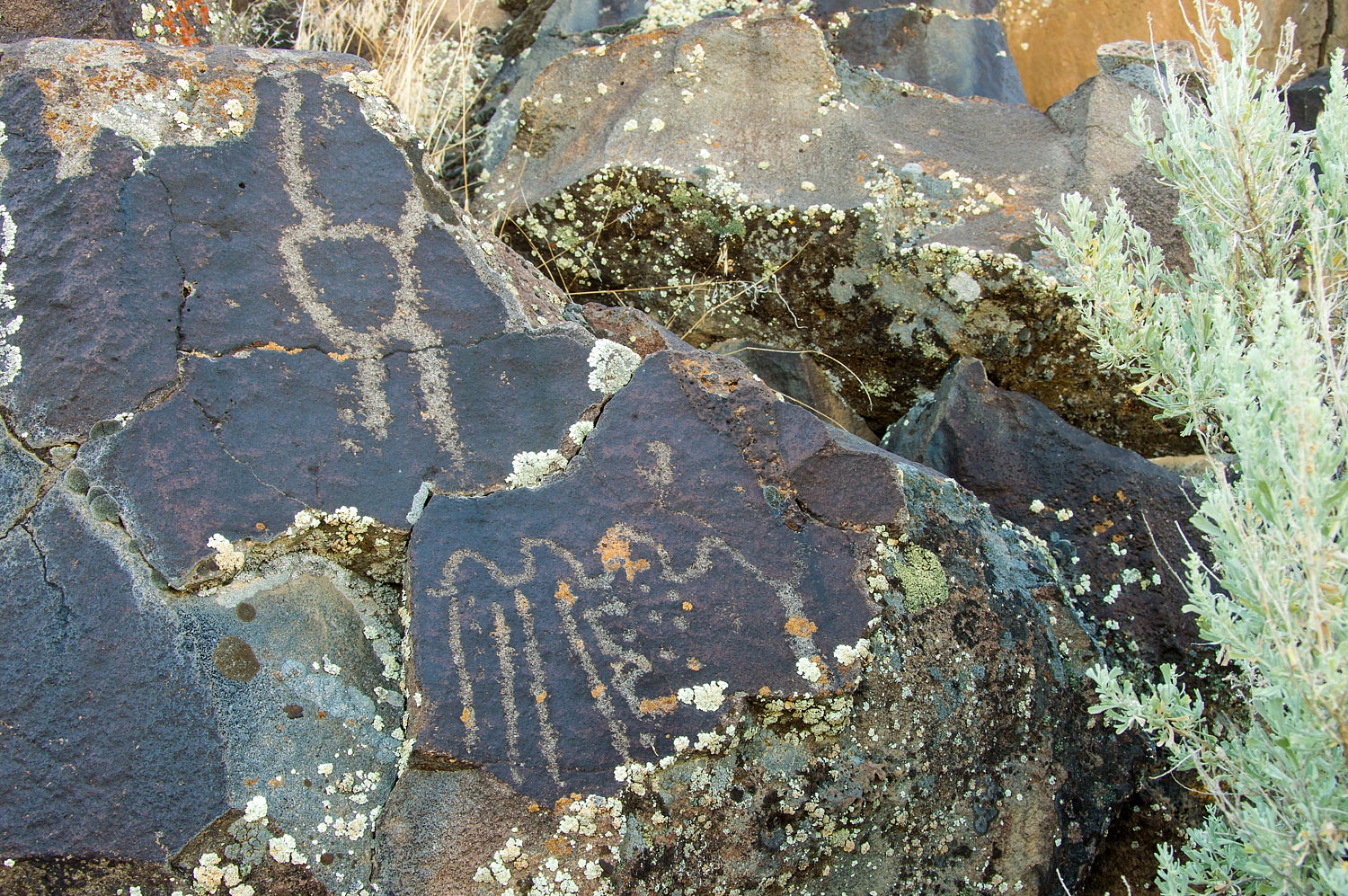
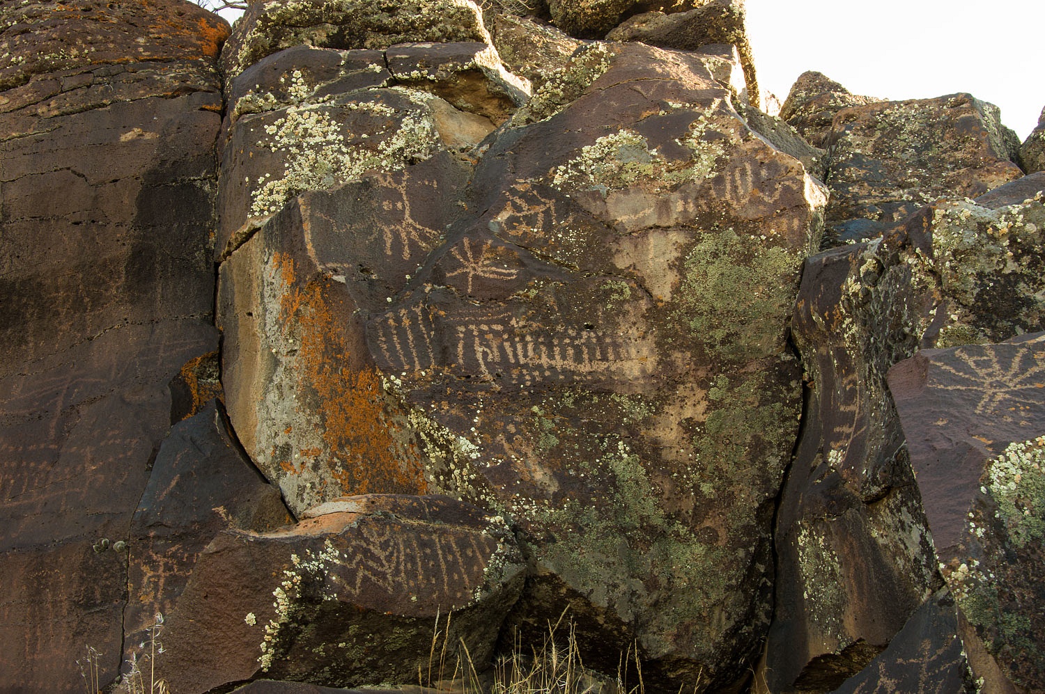
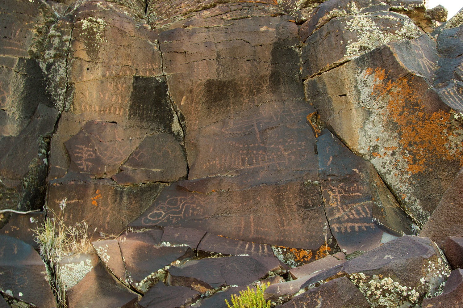
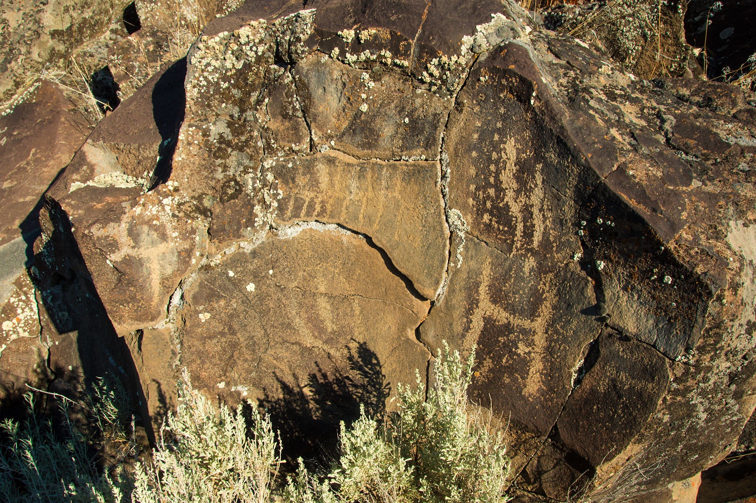
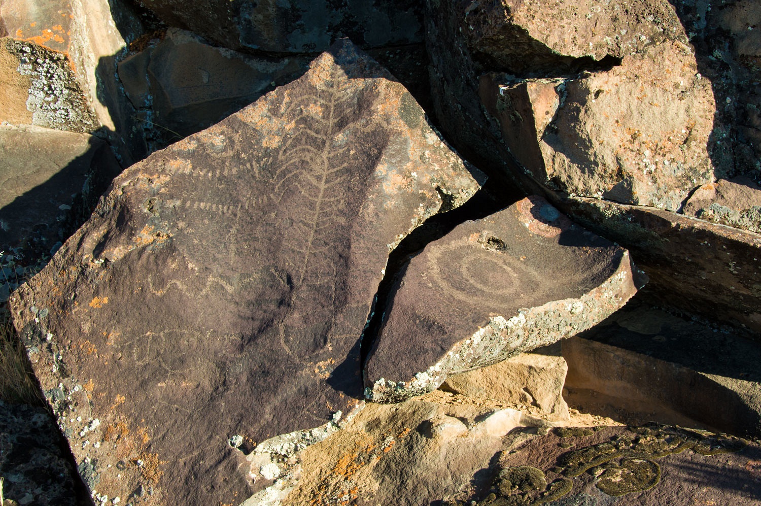
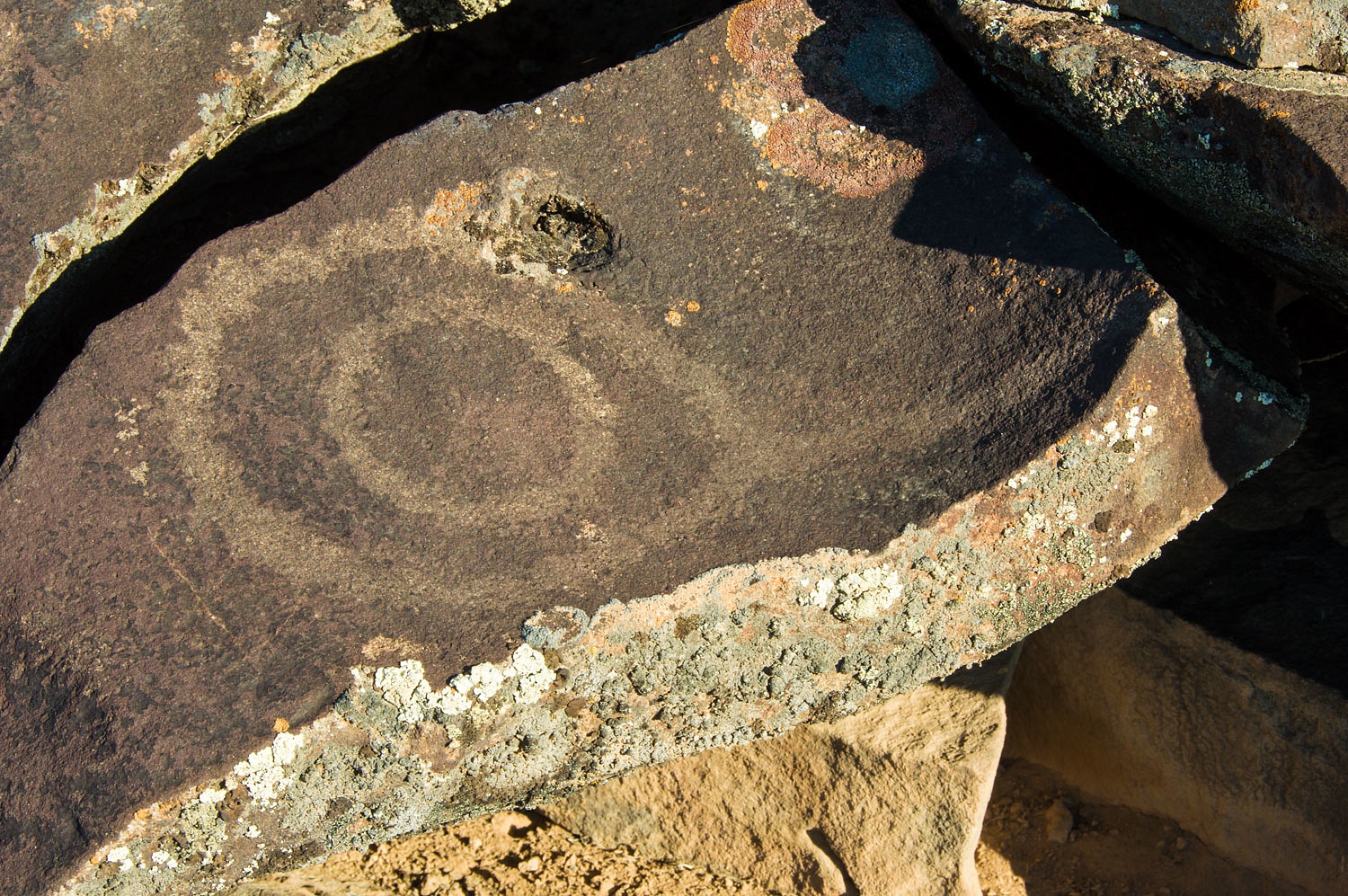
First light was a great time to
capture more detail of the petroglyph panels. We tried to come up with an idea
as to what made this a special place for the ancient ones. Depictions of the sun were predominate.
Perhaps dawn was a sacred time. It felt so and we were humbled to be here among
all these stories on the rock.
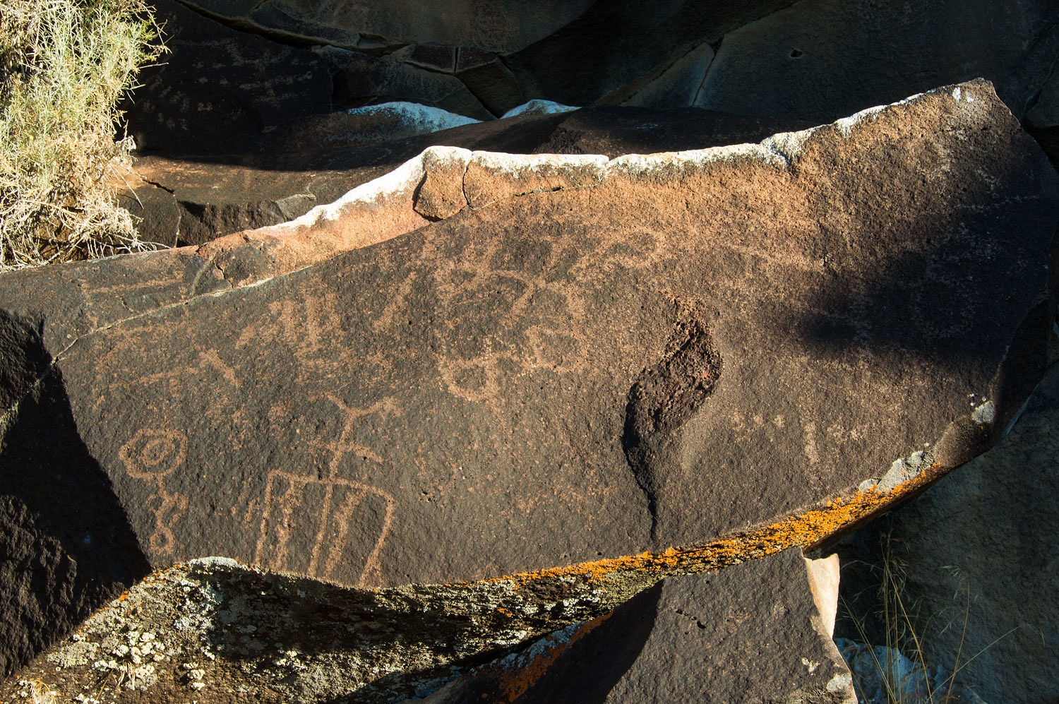
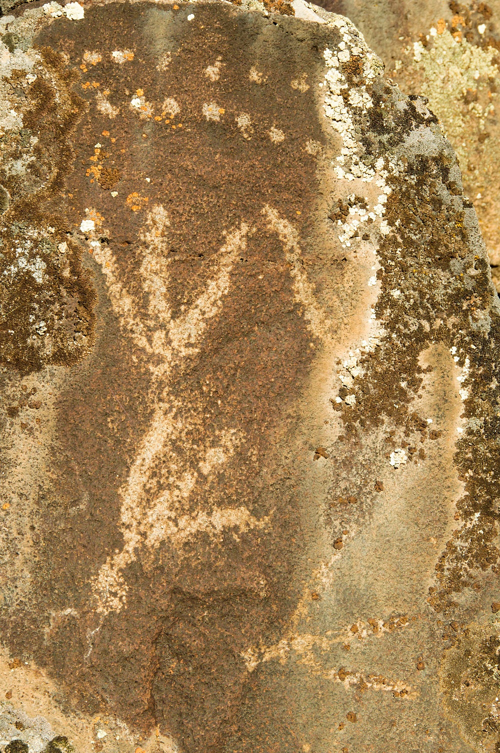
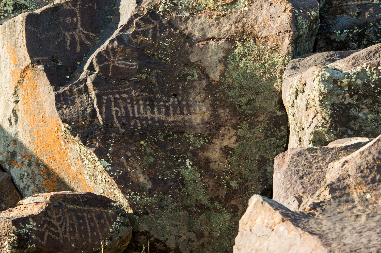
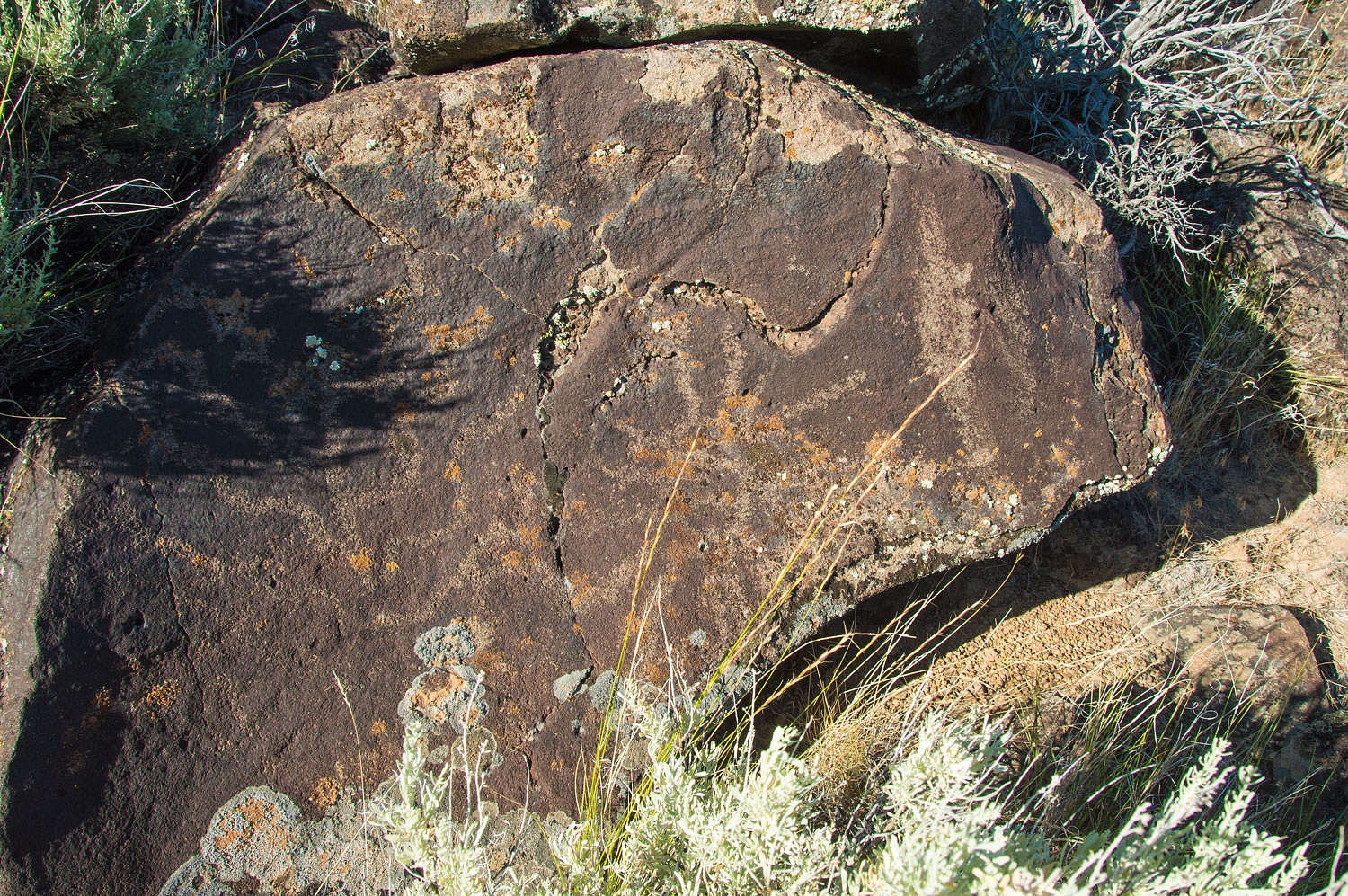
This petroglyph was by far our
favorite. It was so old the desert varnish had reclaimed it. It was only
visible with the low sun angle of early morning.
This place had been a center for ancient
artists for centuries.
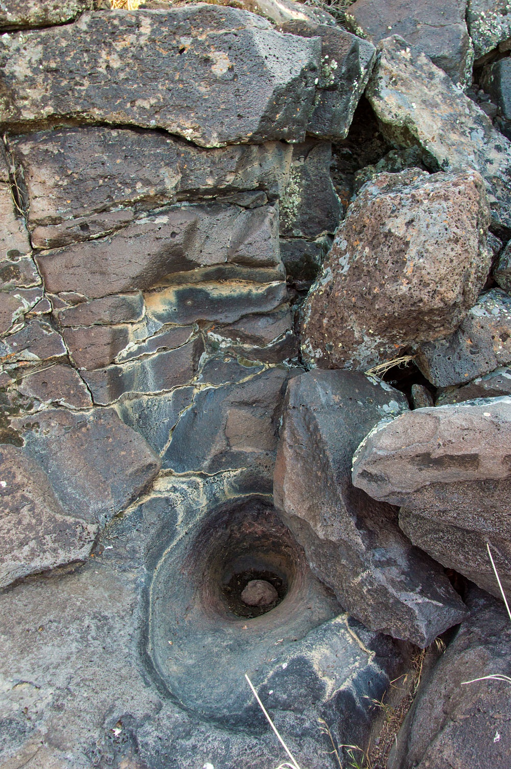
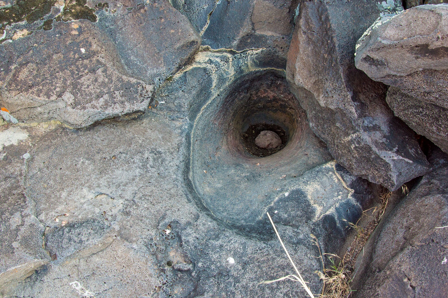
In this arid land there was also sign
of water here in the past. This tiny drainage was shaped by flowing water.
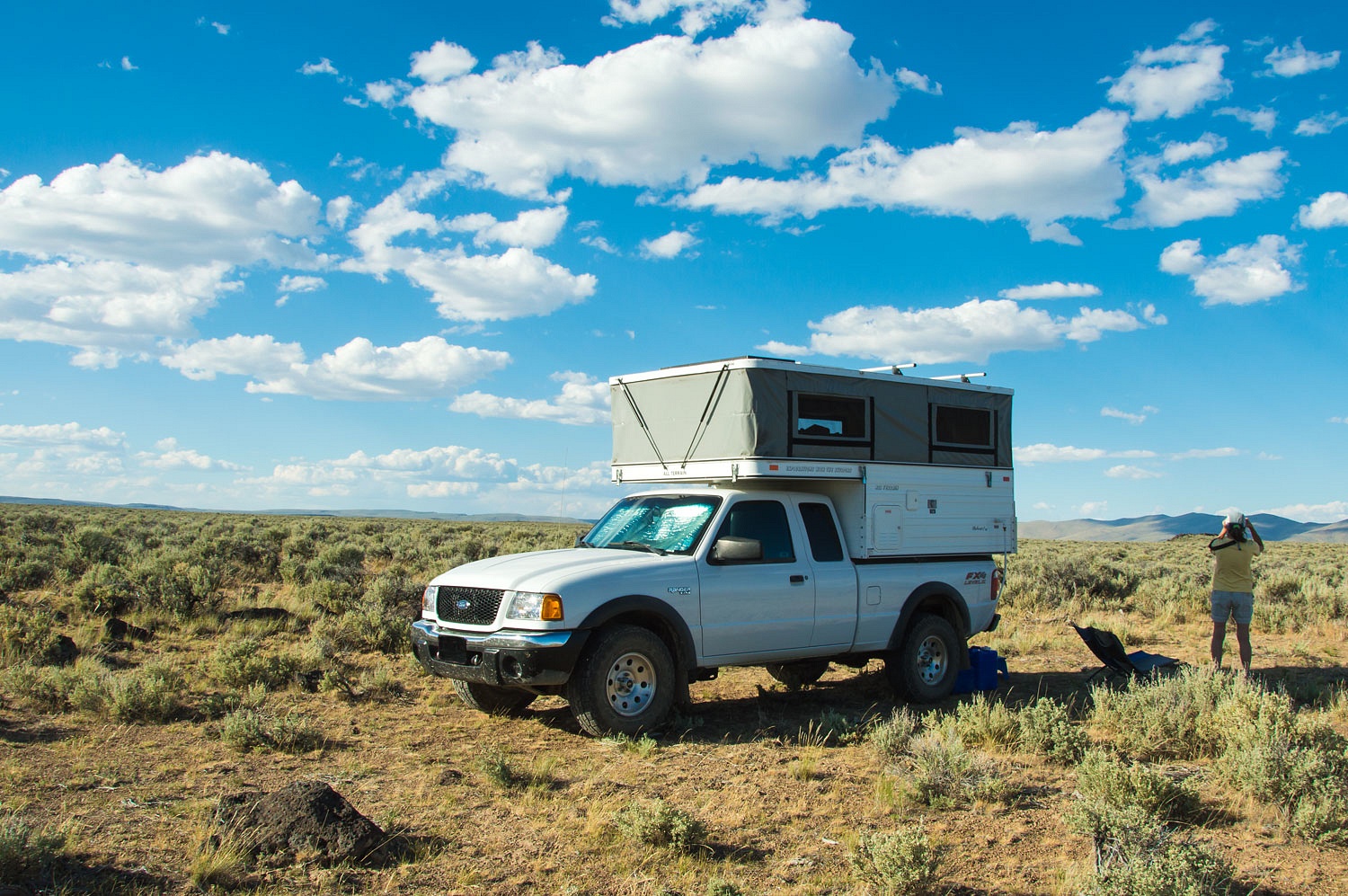
We packed up and dropped the top of
the camper, it was time to move on. We consulted our map to decide on a route.
If we didn't need to backtrack, it would help with our desired direction of
travel for our next adventure. But would it go? Only one way to find out. After
passing over one mountain range and crossing another broad valley, the map
indicated a high pass over the next range. The roads improved markedly and the
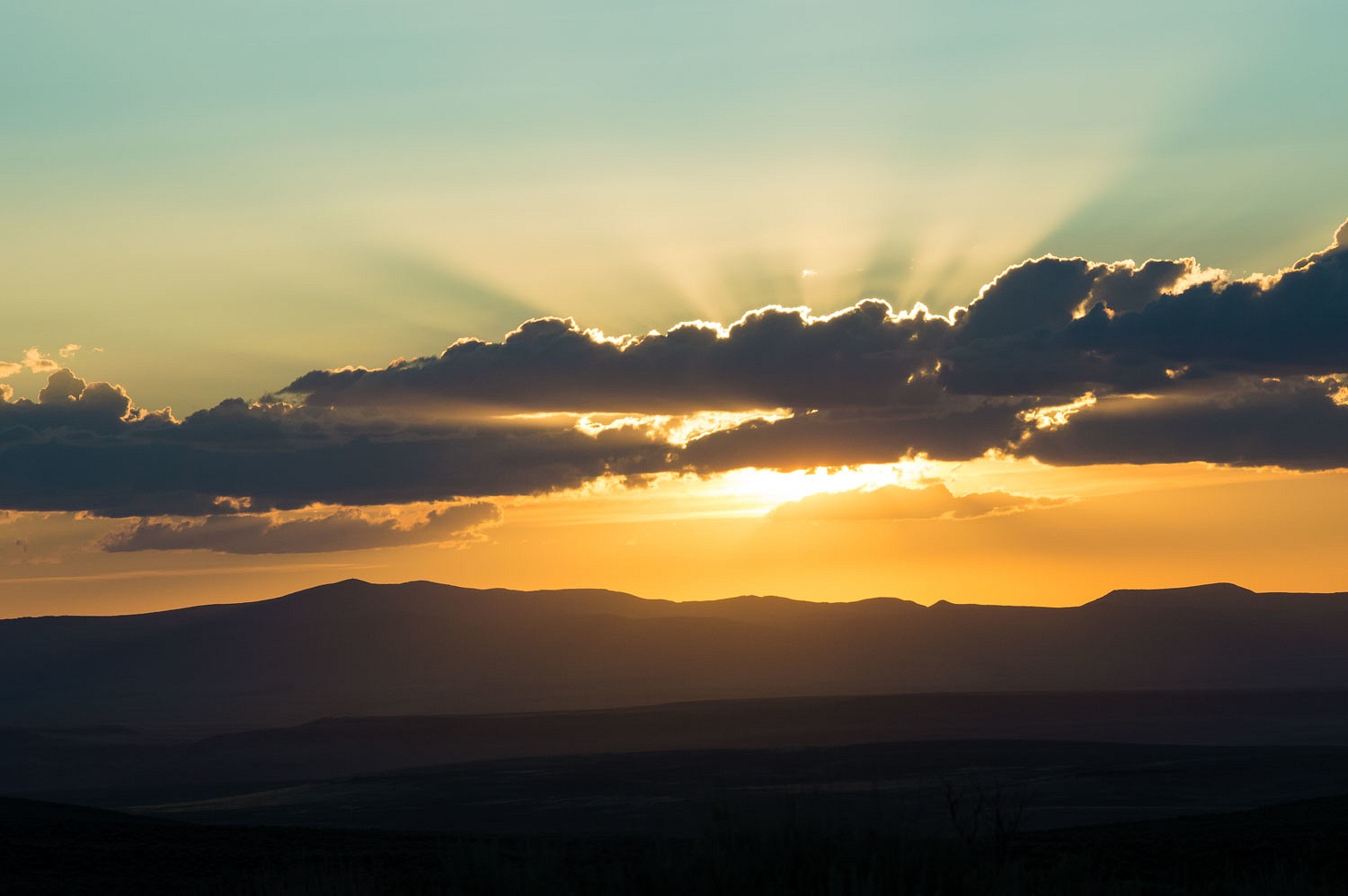
pass was fine for our small truck. We stopped for a break after the descent of
the east side of Domingo Pass.
What was next for us on this
continuing adventure? A milkshake of course.
Monte,thanks for the first of this trip.
ReplyDeleteWith all the rock art you post,did the "old ones"
have a sorta easy life that gave them time to do so much art?
Also where did they go,what were their names and did they have
contact with European explorers?
On another note.I would like to respond to Teledorks post about her harassment
but don't want to get into a political theme.
A lot of what she wrote has been around forever but seems like the last 3 1/2 years
of "agent Orange" have really brought out the worse of humans.
I feel really bad for her experience.
Enough of the soap box.
Thanks for taking us on your special trips.
Frank
Thanks Frank!
DeleteGreat glyphs! Some of the clearest ever. And if you want to see what that stove looked like new, check this out: https://oregondigital.org/catalog/oregondigital:df70dh36k
ReplyDeleteKeep on going!
Dan, thanks for the link on the woodstove. Pretty darn cool. Thanks for the nice comment!
DeleteAgain a most excellent report. Thank you!
ReplyDeleteYou are most welcome!
DeleteThanks for your blog, Ski3pin. My wife and I like to travel the west in our four wheel pop-up camper. your blog gives us encouragement to keep traveling and exploring. Is it possible to give us more of a hint to where the cabin is located? I deduced that it is somewhere in the vicinity of Domingo Pass in southeast Or. Thanks again for your writing. Mike Stewart
ReplyDeleteThanks for following along and the kind comment. All the breadcrumbs are in the blog post ;)
Deleteexcellent glyphs !!! i am envious!! a couple years ago we were down in that area, near the nevada/oregon border. there was a place called hawk valley - and there were LOTS. it appeared that they dine on the rabbits, which were also numerous.
ReplyDeleteThanks you the nice comment!
Delete