
A different
kind of trip story, a day trip told mostly with short videos.
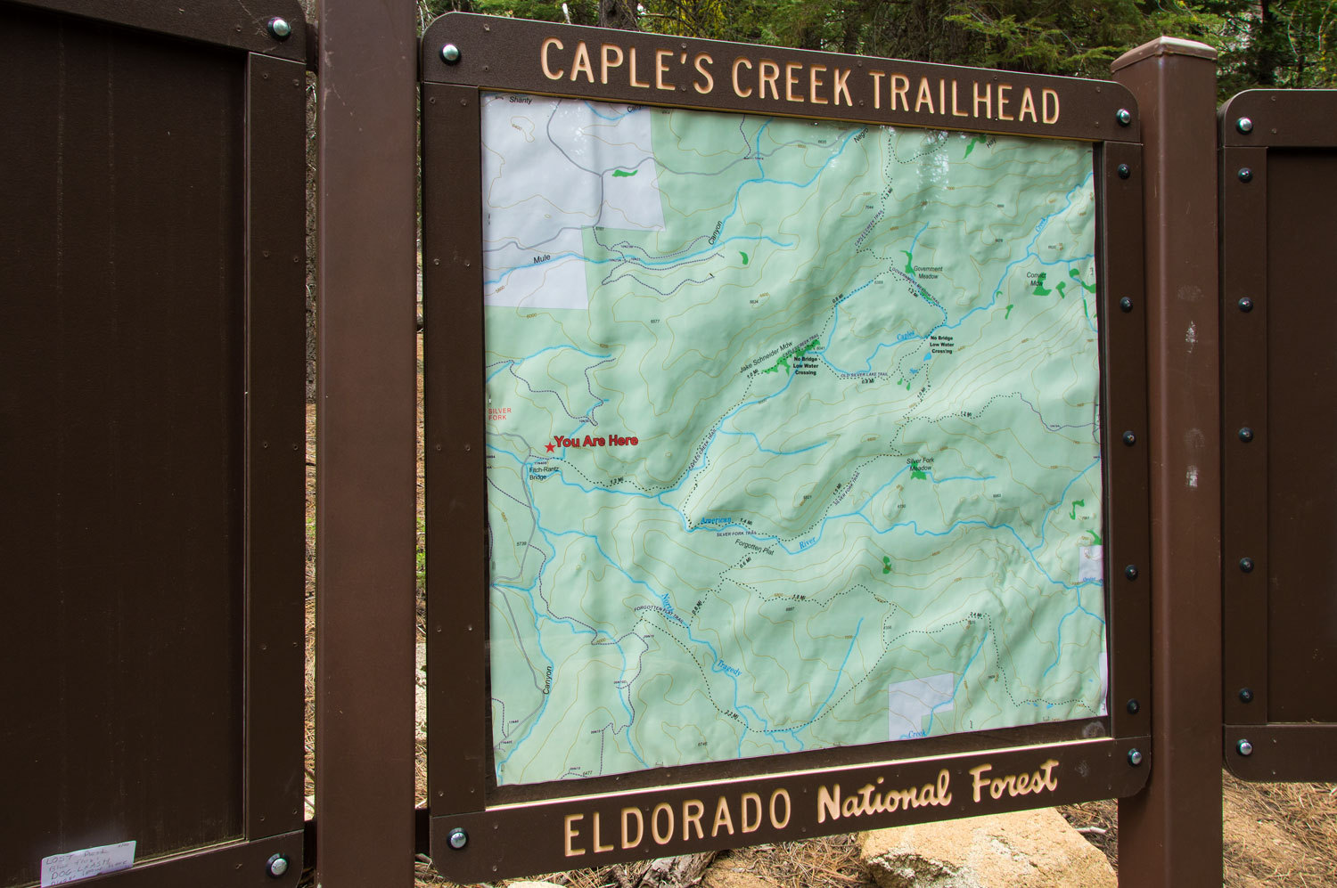
Caples Creek
is up the road from our home and makes for a excellent destination for a quick
getaway. The area is proposed Wilderness and has two main creeks, Caples Creek
and the Silver Fork of the American River. Both are tailwater fisheries. The
creeks flow from the upstream dams impounding Caples Lake and Silver Lake on
highway 88 west of Carson Pass. Caples Creek is the second California
Department of Fish & Wildlife Designated Wild Trout Stream in the Eldorado
National Forest.
Information
on the Caples Creek Trail Area is found on the Eldorado National Forest's
website - Here
A map of the
area can be found - Here
A map of the
Wild Trout Designation can be found - Here
A vimeo
video of fly fishing Caples Creek (with some nice twin fiddling on a Bill Monroe tune) can be found - Here
We had the
mid day of Sunday June 5th available for a quick hike.
There have
been recent excellent improvements to the trailhead area.
A mile up from the trailhead is the confluence of Caples Creek (left) and the
steeper gradient of Silver Fork on the right.
The water
was at a normal late spring snow melt high, that was delightful to see after
our many years of drought. Wildflowers are always a treat along this trail.
Caples
Creek Trail meanders through tall trees and a series of meadows. Jake Schneider
Meadow is named after one of the early ranching families. The remains of the old Schneider Cow Camp
(summer range) is just west of Carson Pass.
The meadow
was wet. The creatures darting in front of the lens are mosquitoes, not birds,
although some were the size of small hummingbirds. The trail is being rerouted
to the north along the edge of the meadow so it will no longer impact this
area. This will be a nice change.
The next,
higher meadow is Government Meadow.
It has been
years since the grazing allotment was closed here so it is wonderful to see the
change and growth of the flora. The California Native Plant Society does an
annual trip through this alpine area.
The trail
ends at Caples Creek. A route crosses here and loops back down Caples Creek
on the south side but this crossing is impassable during high water.
We continued
up onto the glaciated granite dotted with glacial erratics.
A highlight of the Caples Creek trail are the old growth trees. There are several
pockets of magnificent Sugar Pines.
We snacked
and wandered along Caples Creek and dreamed of fly fishing when the water drops.
It was
time to return back to our packs.
We watched
the clouds build into thunderstorm above us.
It rained
on us as we returned down the trail to the truck but the thunder and lightning
stayed up near the Sierra crest.
We met several groups out enjoying the area and the trailhead was near full. If you live in the Sacramento area or the Mother Lode foothills, Caples Creek
should be on your list of hikes. It would be hard to find a more beautiful
place to spend a day. We are so lucky to live close by.
We found four logs down across the trail so on our drive home we stopped at a friend's place who is a member of the mule club that volunteers to care for this trail. They launched a string of mules up the trail on Wednesday (quite a group of energetic people) so you should find the trail clear.
Mosquitos the size of hummingbirds, no thanks.
ReplyDeleteWonderful that you knew who to talk to about clearing the trail.
I don't know how you keep up with the Lady, especially if you stop to document.
Once again, a wonderful TR of your adventures.