
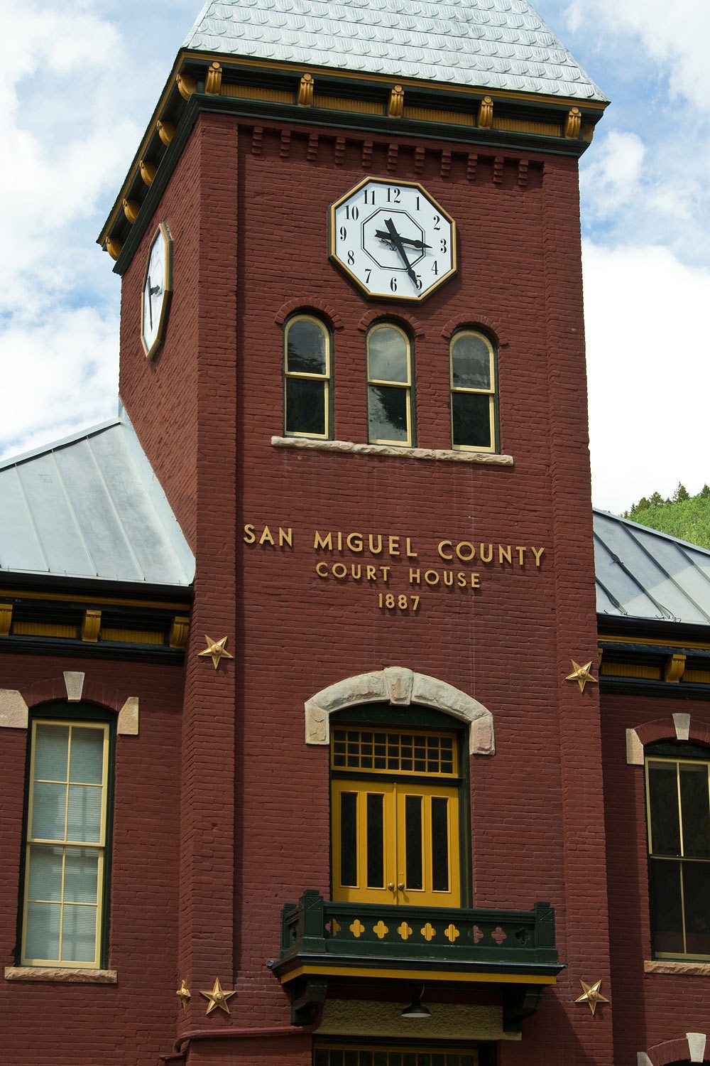
On to Colorado!
At the legendary
Border Inn we passed out of Nevada and into Utah. Besides that, we also lost an
hour of time moving into Mountain Daylight Time. Mid morning we were in Delta,
another Brigham Young town with a very wide main street, wide enough to turn a
team of horses and a wagon around. We took a break and walked through the
central park, lush and green with turf. A water feature gushed water to the
surface, over a waterfall, and down a man made concrete stream bed. We tried to
walk across the park. It was a swamp; wet enough to keep grass green in this
parched land. It seemed strange, almost make believe – a community flaunting,
squandering their most precious resource - water - for the appearance of prosperity. But
I like Delta. I enjoy stopping here; talking with the people we meet. Each time
I see something new.
The heat of
the day was on as we filled the gas tank in Green River. We turned off the
Interstate (a section we could not avoid) and headed down to our first visit to
Moab. Moab is a sad town seemingly filled with macho testosterone driven
expedition tourism madness. To us who have lived most our lives in the
outdoors, this sense that the outdoors has to be conquered, challenged, seems immature
and childish. The outdoors is our home, refuge, our friend. We have no need to
conquer it.
Moab has
lost its soul. All the specialized eating and drinking establishments are theme
driven, easily lifted out of one tourist town, tweaked a bit, and transplanted
to another. It is a shame to see this in such striking terrain.
But I can’t
complain too much. Moab did have a nice new supermarket that made it easy for
us to stock up, but a little Mom & Pop on the corner would have been a lot
more fun and certainly more real.
We holed up
in the La Sal Mountains for the night. We got acquainted with gambel oak
thickets and an overnight thunderstorm lulled us to sleep.
Our plans
for the remainder of our trip were loose. We were heading for Colorado and the
San Juan Mountains. There are beautiful mountains there. We have climbed a few
and wanted to go back. My brother, Fastshot and his wife live in Colorado
Springs. Our friend Stew, who we had met on our last trip to Colorado, lives in
Pueblo. We had let them know we were heading their way, with an offer to join
up with us.


We had
decided on Ouray as our first stop. We had never been in this area and needed
to get oriented. We had read that, because of heavy use, dispersed camping was
not allowed up the Camp Bird and Yankee Boy Basin area. We wanted ample time to
evaluate options so we arrived mid morning. We headed up to the USFS Amphitheatre Campground above Ouray.
Many of the
sites were just too close to other sites. It was also very busy with only a few
sites open. We lucked out that there was one site pretty separated from the
others giving a lot of privacy. “Folks don’t like that site because it’s a long walk to the bathroom
and water,” the host told us. A bit of a walk has never bothered us. This site
made Ouray livable for us. We ended up staying 4 nights as our adventure
unfolded.
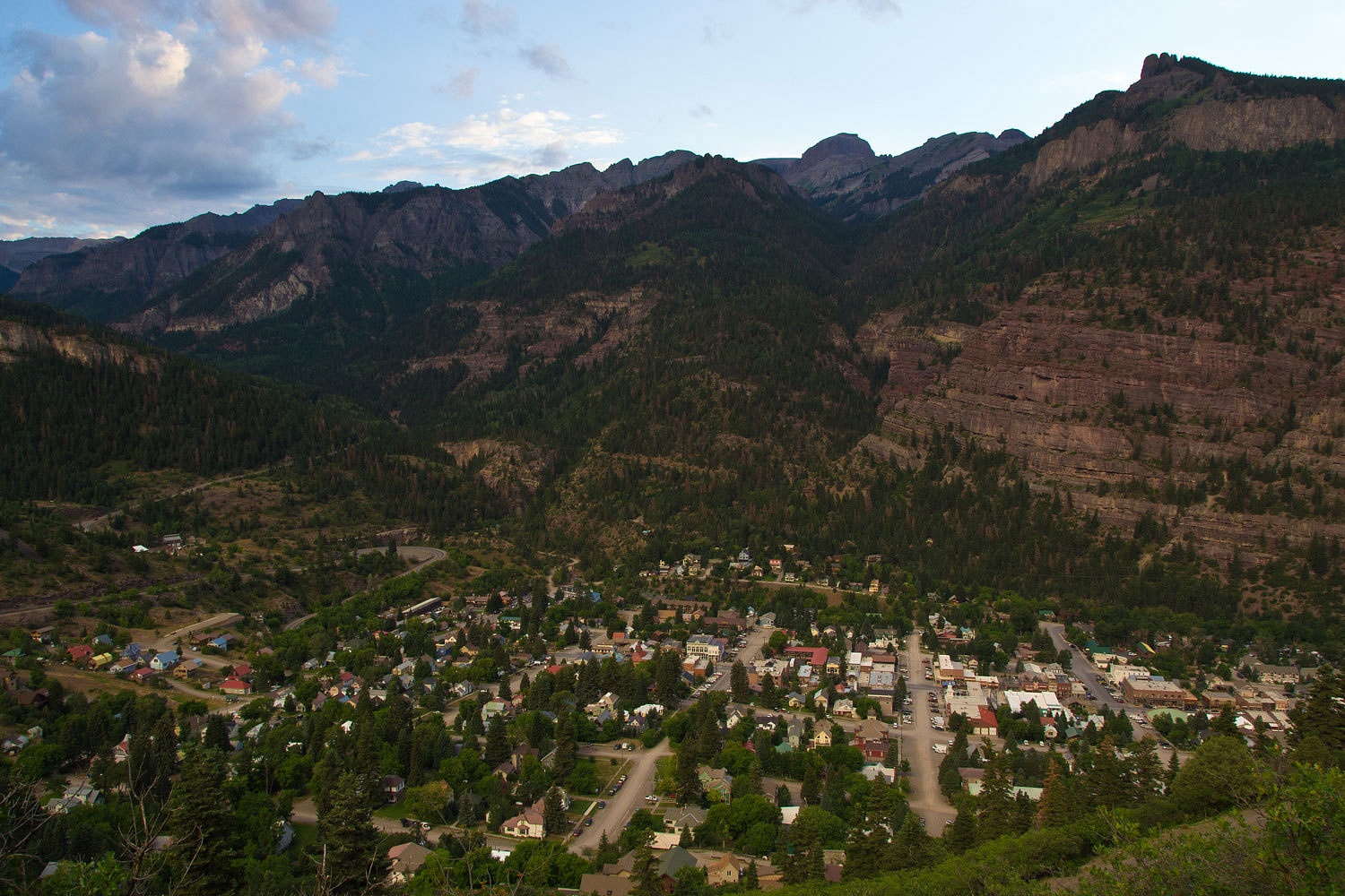
The “amphitheatre”
is a basin hanging above Ouray, an ancient volcanic caldera that was
subsequently scooped out by glaciers. Downtown Ouray is assessable and only a
half mile away, if you like very steep trails.
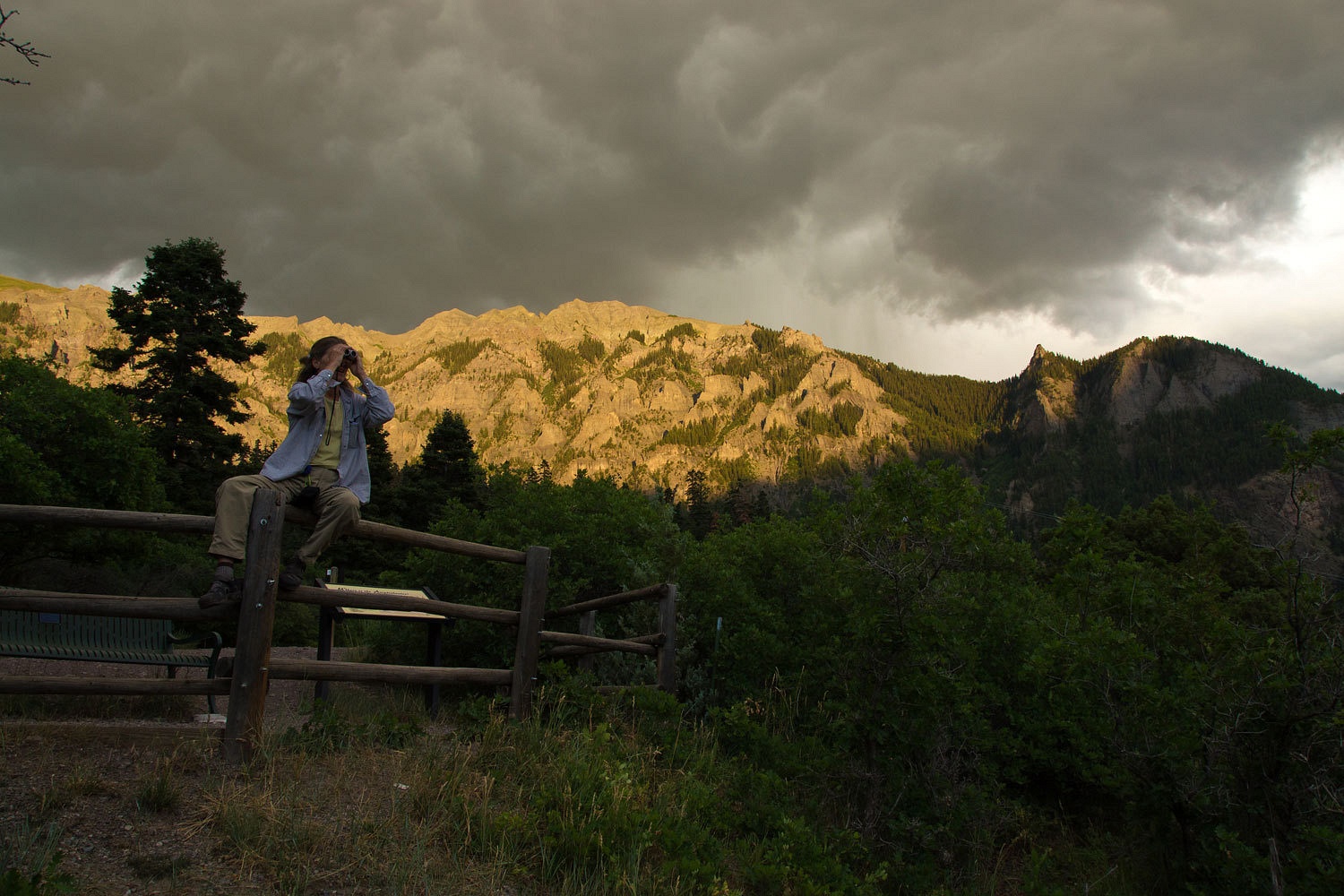
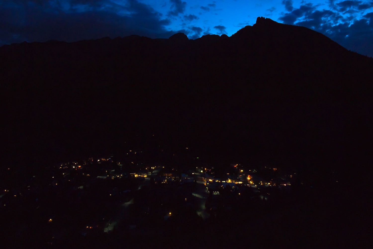
Each night,
when it wasn’t raining, we hung out at the overlook area.
This first
day we headed down to Ridgeway for some laundry. The Lady also scored a great
pair of pants and shirt at the humane society thrift store. We heard from both
Fastshot and Stew. They would be rolling into town on Friday about noon. Stew
would be in his pop up rig and Fastshot and his bride would be moteling up for
the weekend.
Plans were
shaping up. Thursday would be a day of exploration for us, getting the lay of
the land.
We have been
to Colorado’s high country several times. We are well aware of the weather
trends, the so called monsoon season this time of year. Much of what you can do
will be weather dependent and if you are going high you better pay attention. Patience will be needed.
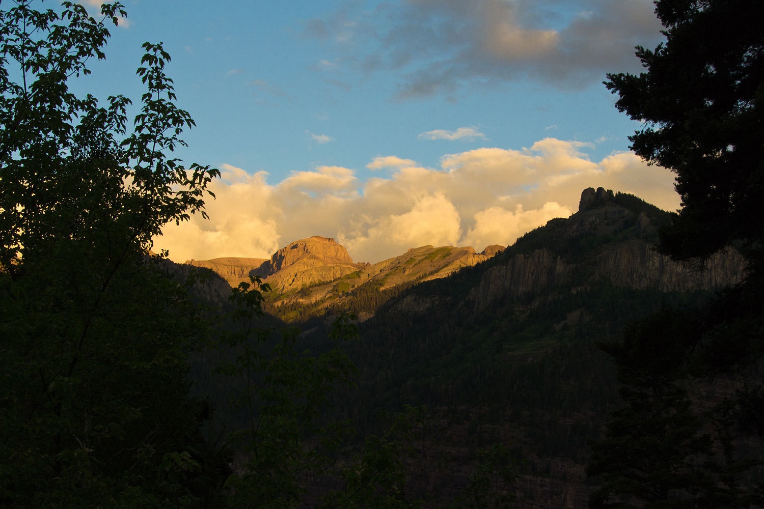
Thursday
started out………………………………….well there were some glorious shafts of sunlight.
Prior to our
trip the Lady spent a couple of lazy afternoons on our deck with our two
Colorado 14ers books. She was getting excited, “How ‘bout Sneffels? And
Handies? And Redcloud? And Sunshine? The Wilson Group is close by! Look at
Windom and Eolus out of Chicago Basin; we need to ride the train to Needleton
and backpack into there sometime! I’d like to go back and get Harvard and Columbia
but let’s backpack into Bear Lake to make getting both of them an easy day. Oh,
the Wetterhorn is north of Handies. You really liked the climb on the Wetterhorn.
If time and the weather work, we could run up the Wetterhorn again!” As I said,
she was excited. So was I. Sneffels was the 14er I wanted to top out on.
Thursday and
the Texicans……………………………………………
Many people driving the backroads in this area use the Funtreks Guide Book. Although very
well done, I’d recommend having the USGS topos along for greater detail and
confirming your location. We got an early start and headed up Camp Bird Road.
It is spectacular terrain and the light of early morning does wonders accenting
the details. We were also well ahead of the masses, our intent. Our first
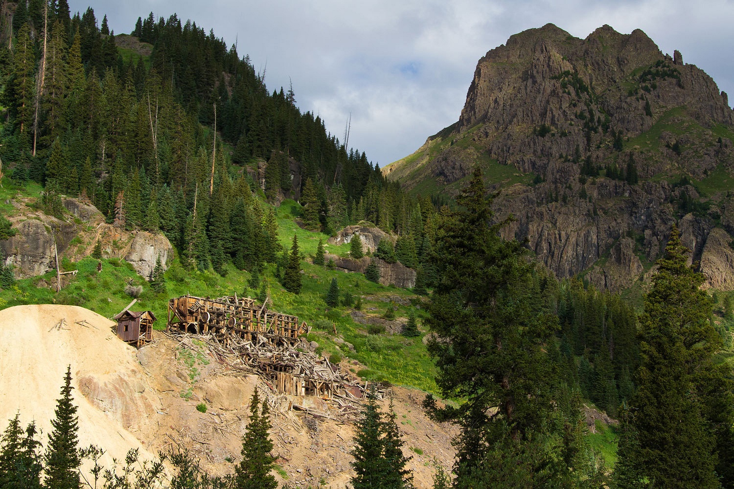
objective was Yankee Boy Basin and looking at the routes up Sneffels. Rounding the first switchback we encountered a large black bear. It trotted up the road ahead of us. It pays to be the early one up these roads. The place
is littered with ruins from past and ongoing mining operations. We stopped at
the old site of Sneffels with the large mill ruins above.
We missed
one turn and found ourselves on a steep, narrow shelf road with out sloping rocky
steps. A Volvo SUV was tucked into the only wide spot. “Red road, this is a red
road,” I said. The funtrek guide uses a color code to quickly rate difficulty - green, blue, and red. “We are heading up into Governor Basin.” We are fairly
comfortable with having our truck on these roads but are most concerned with
the other folks we may meet. “Time to walk to check this out and find a turn
around point. If need be, we can carefully back down to the bottom.” A short
walk around the corner and we found a very steep but usable spur to turn
around. The views from this corner were stunning. As I walked back to drive the truck up I found much new black rubber marks on the rock, indicating the stopping point of the Volvo's ascent. I still haven't figured out how they got it turned around and tucked into its tiny resting spot. That took some work. I hoped they were up enjoying Governor Basin and didn't think this was the way to Sneffels.
Side note: As
per a recommendation from our friends the Lighthawks, we bought a Google Nexus Tablet. This thing allows us, with free wifi access, to check home phone
messages, emails, etc. With the Backcountry Navigator Pro application, this
thing makes a great map companion. The built in GPS accesses satellites faster
and easier than our handheld Garmin. Prior to the trip I download the needed USGS
topo maps so our location is pinpointed on our familiar reference material.
Just to
confirm our location, we powered up the tablet and very quickly had a mark for
our location, right where we thought we were. We left it on and the Lady was
able, in real time, to watch our route and progress as we returned down and then
found the folded up sign that said Yankee Boy Basin.
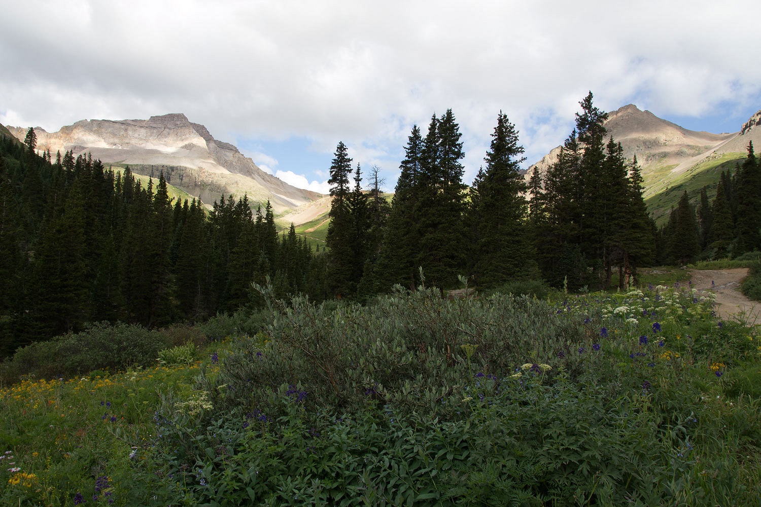
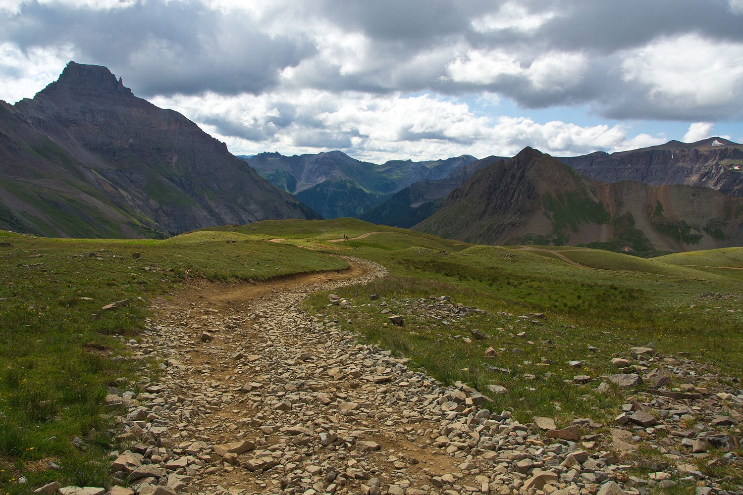
We climbed
past Twin Falls and entered Yankee Boy Basin. Sneffels in on the right.
There are
three trailheads up here; one is a wide parking area with an outhouse, further
up is the lower trailhead for Blue Lakes, a short distance above is the end of
the road and the short route to Sneffels. We parked at the Blue Lakes
trailhead. That’s the summit of Sneffels on the left that the clouds are
lowering onto.
We walked up
to the upper trailhead. It is so nice to stretch the legs and it took less time
than driving. We talked with a young couple from Crested Butte who were coming
down from Sneffels. They gave us current route information - a long steep gully
scramble to the ridge and then a shorter, steeper gully to the top, lots of loose
rock. Although steep, with this very high access point, it is a mile and only a
couple thousand vertical feet to the top. We walked with them back down to our
vehicle. They had parked at the outhouse lower down.
Now comes
the Texicans……………………………………….
We
positioned ourselves to get a view down the steep side hill above the outhouse.
One vehicle was slowly working its way up. Another was further down. We’d be
able to slip in and get this down section done between them. The outhouse
parking area was full now. The crowd was catching up with us. The number of
rental jeeps – Farabees, Switzerland of America, others – was surprising to us.
We worked our way between the vehicles past the Twin Falls. There was a sharp
corner in a side gully and then the road swung out closer to the main creek.
Ahead, around the furthest corner, I saw an uphill bound pickup stopped in the
road. People were out on the road. Other vehicles were behind the pickup. I
pulled over in the next wide spot and asked the Lady to walk down to the corner
and give me signals when I could proceed. There was no view from my stopping
place. The Lady had almost reached the corner when a vehicle came up behind me,
passed, and continued down the road. They were so happy. Everybody waved. Too
bad they weren’t in the habit of looking ahead and figuring out what was going
on. I saw the Lady put both hands in the air and roll her eyes. Three vehicles
came uphill past her. She made sure I saw her closed fist for me to stay put.
The four vehicles now between us jostled and maneuvered by each other. I still didn’t know
what was going on around the corner. In short order she signaled me to come on
down. She moved out of sight around the corner. I pulled off in the wide spot
where she had been standing. A large crew cab GMC issue ¾ ton pickup with Texas
plates was in the road below, below a steep rock step. I got out of the truck.
The Lady was bent over with an older gentleman at the right rear tire, up against the bank. I can’t
remember when I last saw a fellow in a dress shirt and pressed Levis out in the
woods. I moved to the back of the truck. A well dressed woman was standing
there. The other vehicles I had seen were not with this guy, they did not stop
to even ask what the problem was, just drove around. The woman revved into
action as I approached. “I told him we shouldn’t have gone any farther. We
shouldn’t have come up this road! I told him!”
“I bet you
did ma’am, Let me just take a look at what’s going on.” She quieted down.
I could hear
air being released. “I’ve got these tires inflated to 80 pounds for towing our
fifth wheel,” the man was telling the Lady. She was helping him air down. I
went to the front of the truck. Another woman was standing there. She looked
afraid. “Things are probably going to be just fine here,” I said.
She relaxed.
“We couldn’t make it over this steep place,” was all she said.
I took a
look under the front bumper. There was very little space between it and the
rocks. I was surprised and thought, “My god, somebody removed the entire front
axle and differential from this truck!” Then I realized it never had one. The
man was over at the left rear now, releasing air from that tire.
“The guide
in the jeep said I’d have no problem making it up this road.” The man said and looked
at me with wonder.
I figured
this was one of the attractions the guide would point out to his clients as
they drove by. To be fair, I have no idea how that conversation actually went.
Perhaps after an insistent attitude from the Texican, the guide just agreed,
“Sure, you can make it.”
The tires
were ready. “May I make a suggestion?” I asked.
“Please,
please do!”
“We’ll guide
you. Back into the center of the road right there.” I pointed. “That should
line you up well going up the road. With not much gas, just carefully drive up
and over. I bet you’ll make it. When you do, keep going up to where all the
vehicles are parked by the waterfall. It’s big and wide there. Turn your truck
around. Now if you don’t make it up there, we’ll get you turned around right
here,” I pointed again. “It’ll be a lot more work but we can get it done.”
The Texican
climbed in. The women folk didn’t. Up and over he went and up to the parking
area.
We climbed
back in our rig and started down. I leaned out the window to the two women and with my best humorous tone said, “Maybe
hold down on the ‘I told you so stuff’ for awhile or he might regret picking
you two back up.”
They smiled.
The line of
vehicles, atv’s, jeeps, suv’s, tour vehicles (flat bed Ram 2500’s with three
rows of seats on the flat bed seating 4 passengers across – I told the Lady at
an average of 200 pounds apiece, that was 2400 pounds of cargo), was
incredible. I pulled over one last time as a sparkling Lexus suv with street
tires approached. I rolled down the window in anticipation.
“How’s the
road ahead,” the man asked. The woman passenger was leaning toward me also.
“If you
drive it slow and careful, watch where you’re putting the tires, you will make
it up to the outhouse. Do not drive past the outhouse.”
In unison
they repeated my last sentence twice. “’Do not drive past the outhouse. Do not
drive past the outhouse’. That’s good information. Thanks, thanks so much!”
Our plan had
been to drive over Imogene Pass to Telluride and return over Ophir Pass.
The Lady had
had enough. “I want out of here! I don’t want to deal with any more of these people!”
I felt
exactly the same way.

We returned
to Ouray and headed south on 550. We easily found the Ophir Pass Road. We were
the only vehicle going up the east side and met only one vehicle coming down.
A rental
jeep came up from the west side just as we parked. It was a retired couple from southern California. They were having a great time. “This is the best thing I’ve
done renting this jeep. I’ve tried to four wheel in my ¾ ton tow rig for years.
This is the way to go!” the man announced. The Lady and the woman were quickly
into a conversation. “We’re doing all the roads and having a blast!” she said.
“Where have
you been today?”
“We came
over Imogene from the east and are now going back over Ophir.”
“How was
Imogene?” the Lady asked.
“It was
busy!”
I asked the
fellow if anyone was coming up as we were heading down and knew it was a narrow
shelf road. He said he saw three jeeps coming up. They soon arrived and upon
reaching the summit the lead driver climbed out of his rig and kissed the ground. His buddies
hopped out and photo documented the occasion.
I asked if
the road was clear as far as they could see.
“Didn’t see anybody behind us. You going down
that way?’
Yup,
heading down to Ophir." I answered.
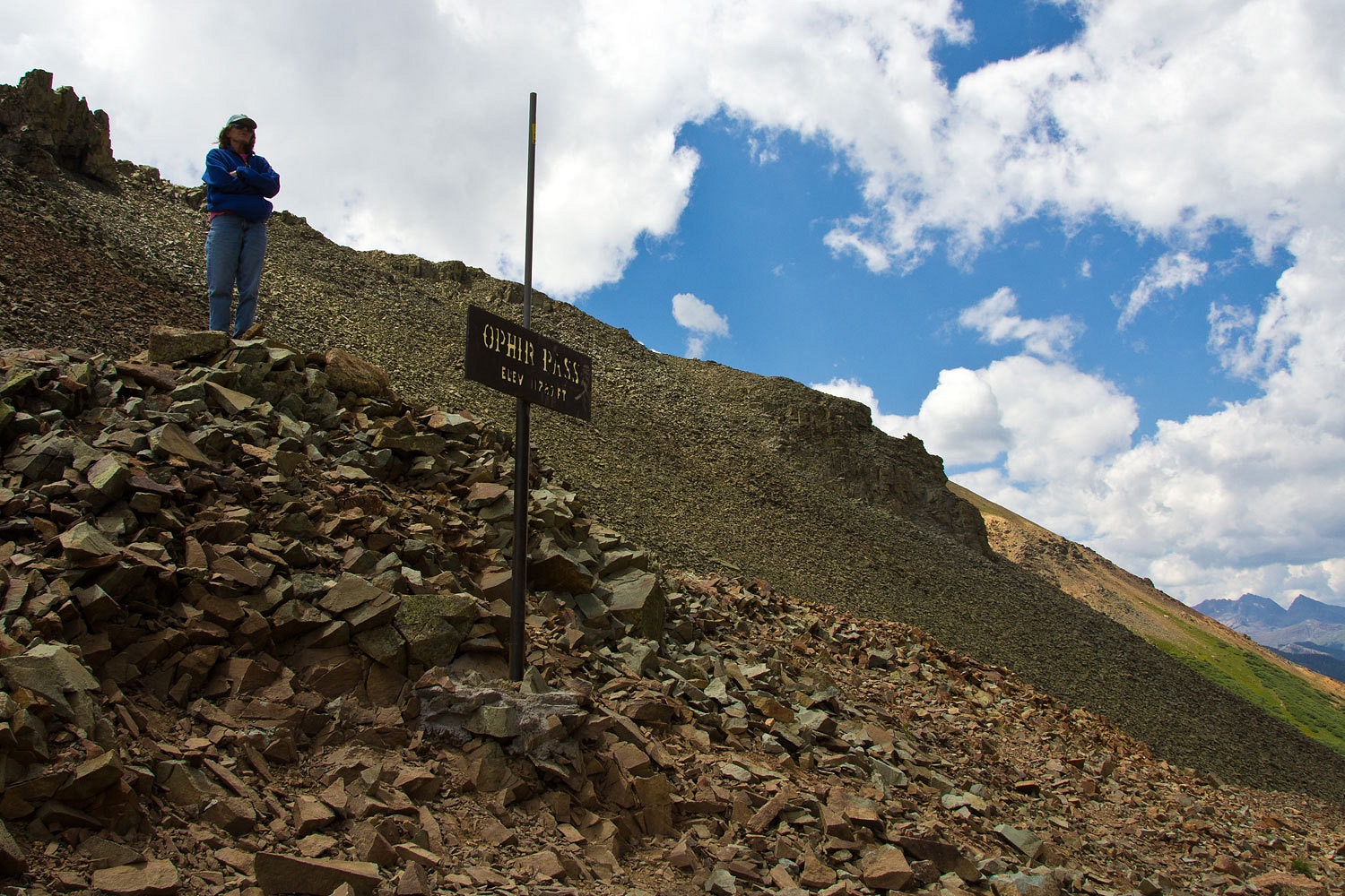
The east
side of Ophir.
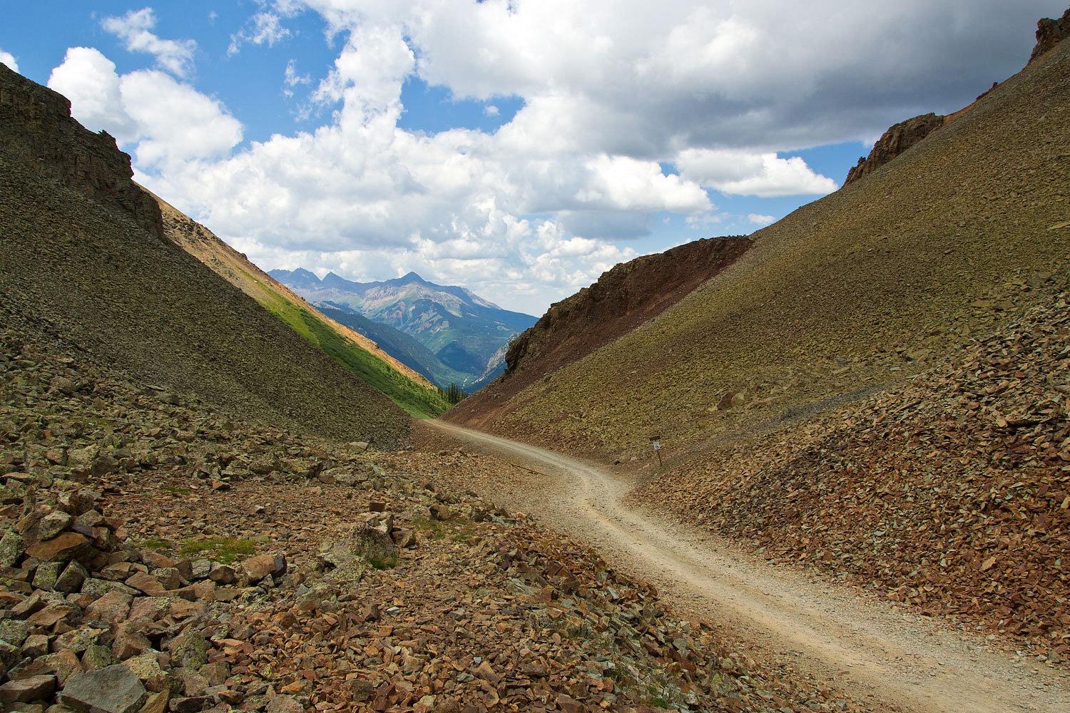
And the west
side through the notch.
Stopping after
the shelf road, Ophir down below.
As a note,
we know nothing about it but we did see there is a backcountry hut at the top
of Ophir Pass – OPUS Hut.
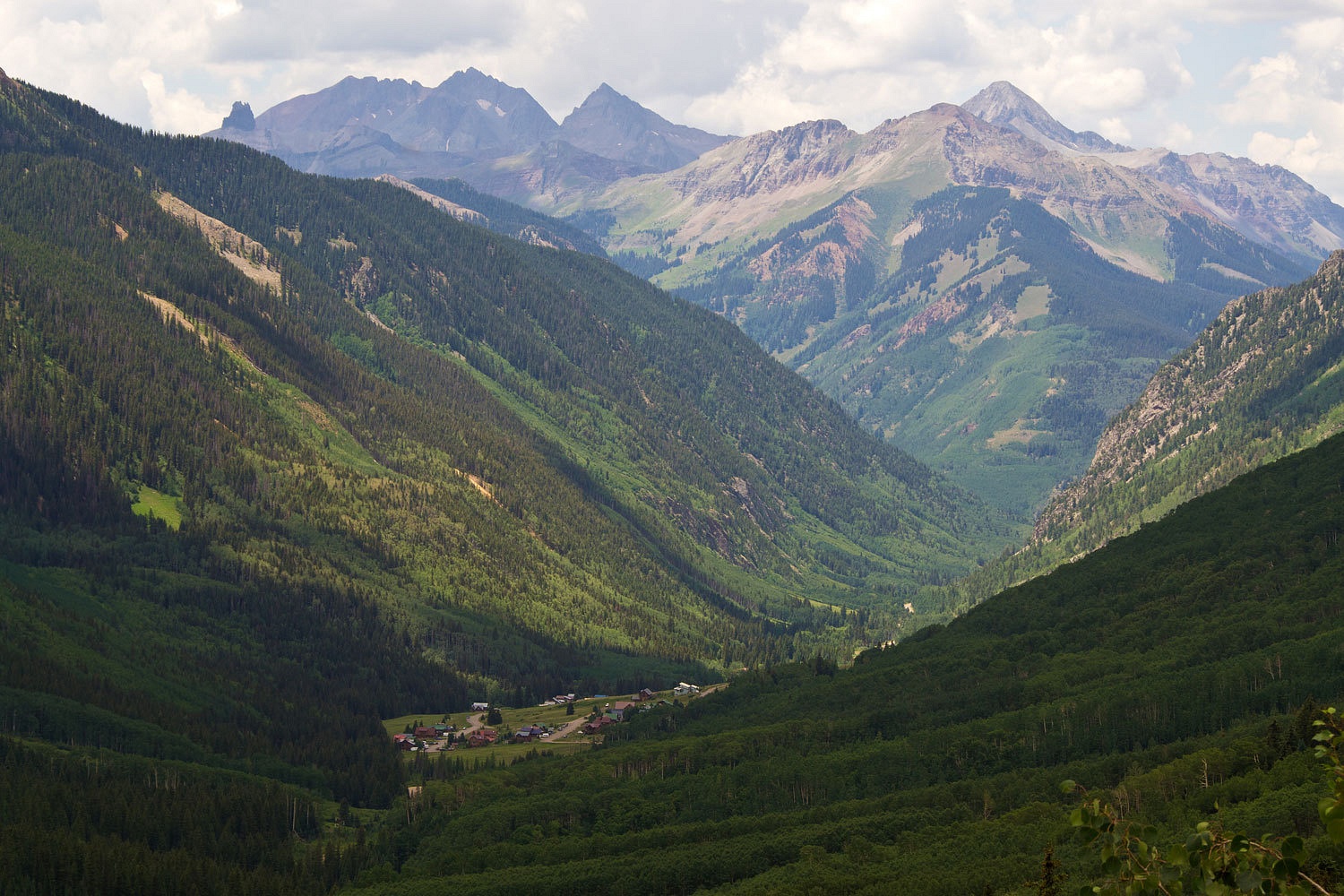
We wandered
down to Ophir and on out to highway 145. We headed north toward Telluride.
“Here’s the
road to Alta Lakes in the book,” the Lady said. “It says there are great camp
spots up at the lakes. Let’s check it out for future reference!”
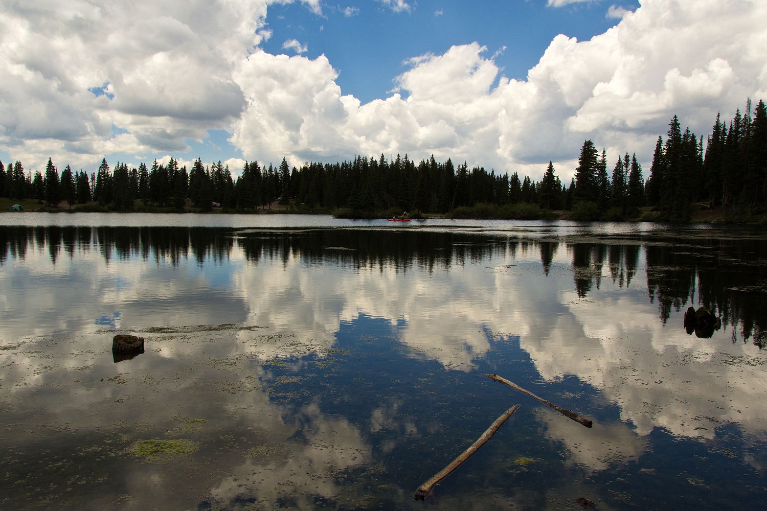
We headed
in. Although the lake was in a wonderful setting…………………………
……………………….and
the one fly fisher we stopped to talk to reported brookies and rainbows, it was
a bit disappointing. The lake shore was completely denuded of vegetation because
of vehicles driving indiscriminately around the lake. The place had an utterly hammered look
to it and is in need of some aggressive management tactics. We would not camp
here.
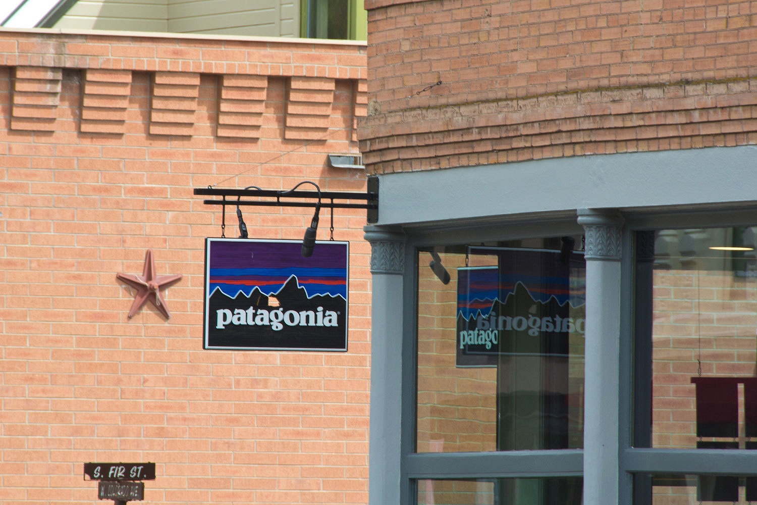
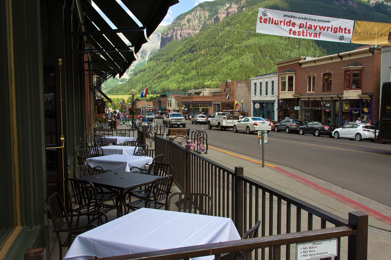
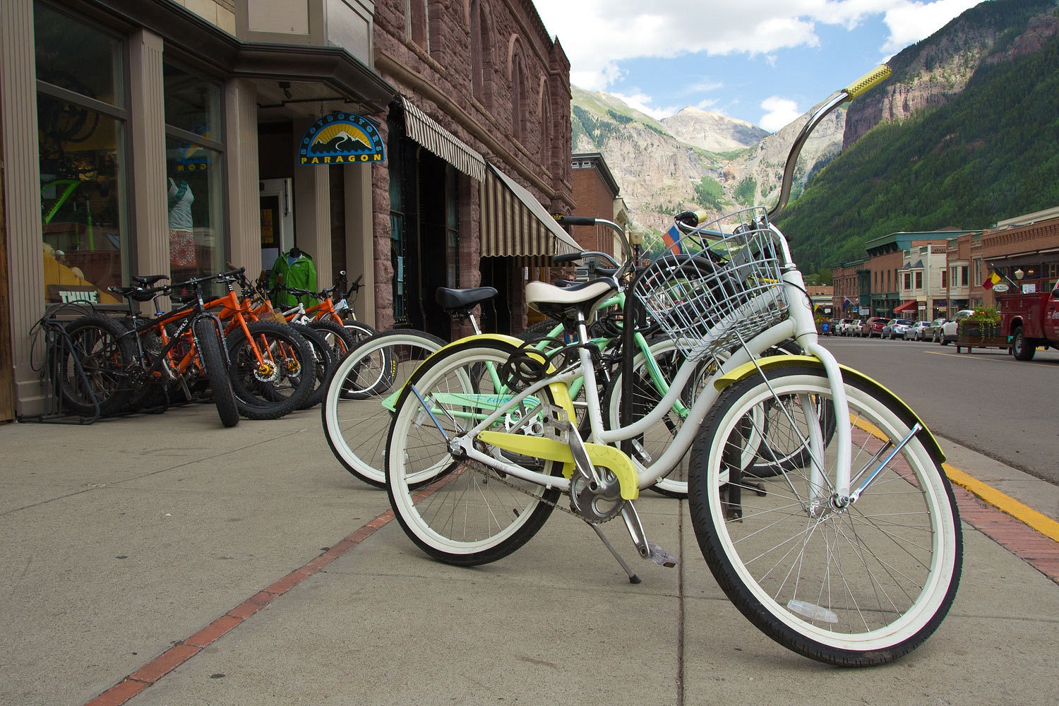
We continued
on to Telluride. They had to have a good spot for a strong afternoon cup of
coffee and maybe a good thrift shop or two?
Someone told
us Telluride is the festival capital of Colorado, maybe the world.
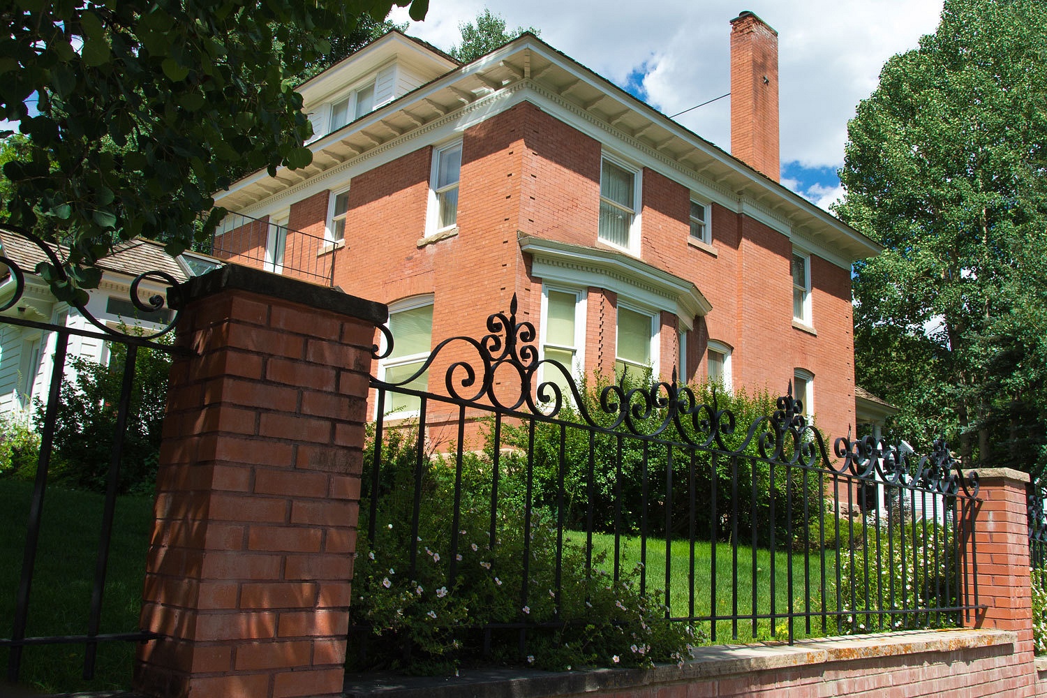
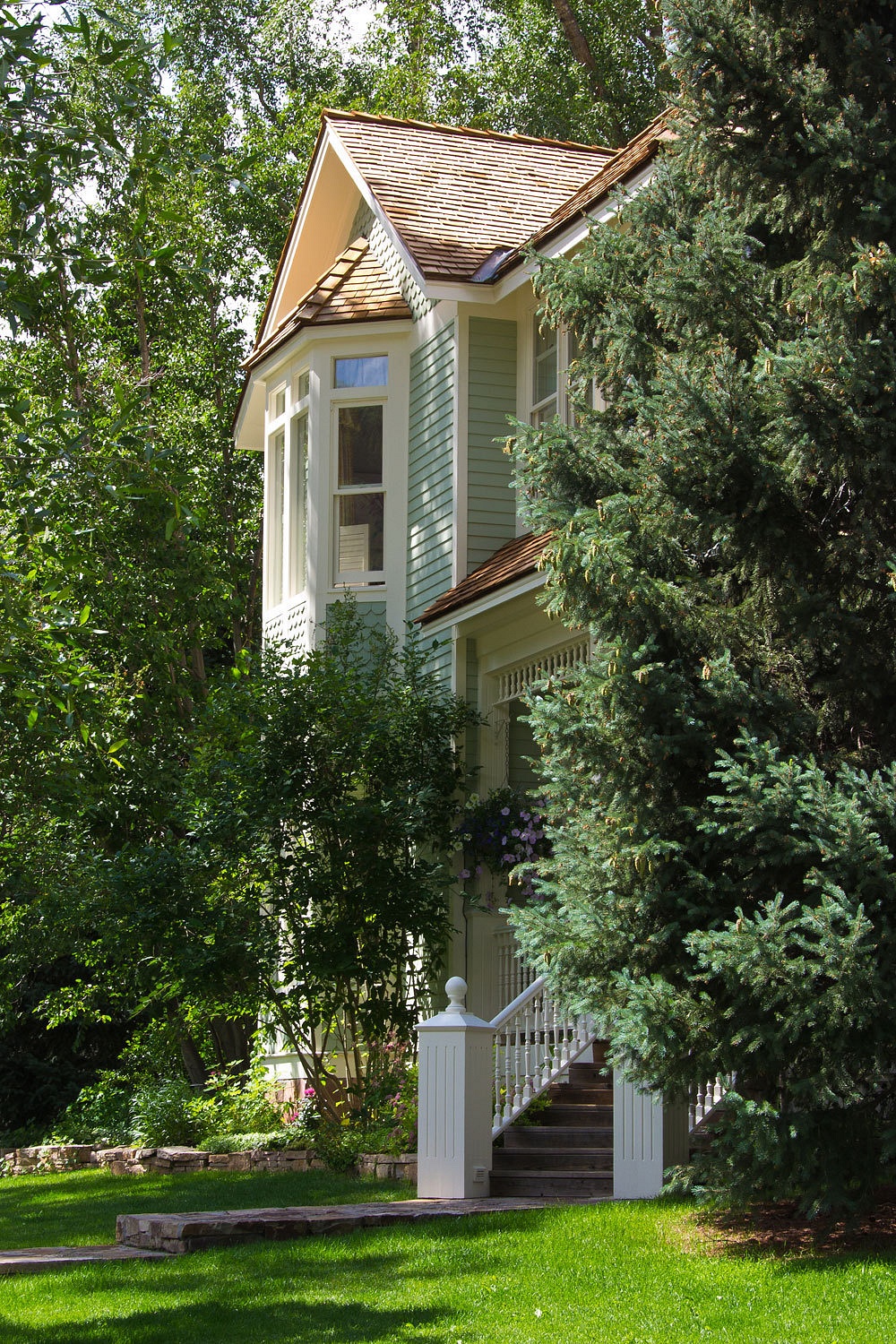
The Lady
more enjoyed the side streets and homes.
We found a coffee
house on the main street. You are not surprised are you?
Telluride
inspired me to try a self portrait.
We didn’t
stay long, shared a coffee and checked out the thrift store - no scores. On the way out of town we decided to take The Last Dollar Road back
to Ridgeway.
As this road
climbs north out of the Telluride area, the views are incredible and lots of
people in a different tax bracket than us are putting houses up here. The
airport is also out here. Check it out on google earth. The north end of the
runway is pretty special.
In the late
afternoon, after we left the caravans of construction workers returning to
Telluride behind, this road was quiet. The upper portion is in thick aspens and
not much of a view but this must be spectacular in fall colors. The country
opens up dramatically as you drop in elevation on the north end. “This is
perfect country for wapiti,” I told the Lady.
“I’m
looking. I got my hawk eyes on and can’t you just call ‘em elk?”
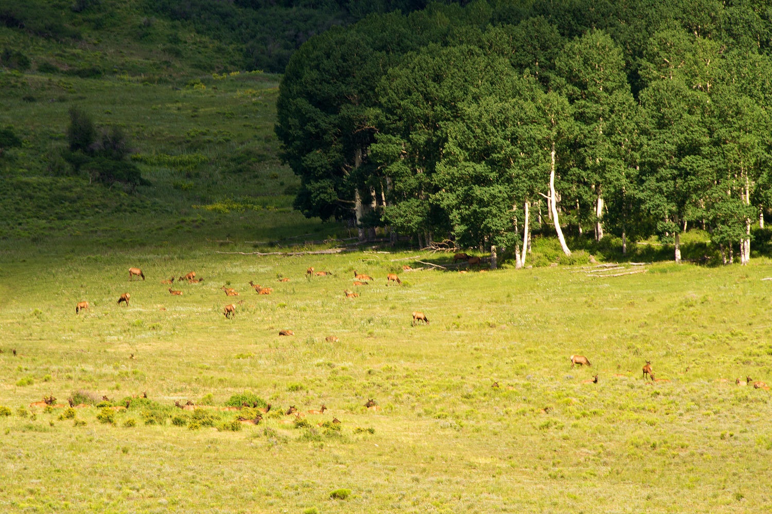
And then we
saw them, over a hundred cows and calves.
We pulled
over and the Lady got out her “see mores.” She was in heaven. “This is perfect
for ‘Big Park’!” she said.
“Big Park”
is our habit, in the early evening, of finding a spot with a view. Seeing large
mammals is always a plus.
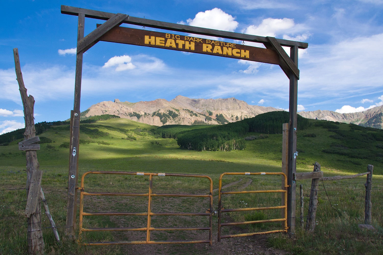
“I’m going
to walk down the road to that sign over the gate. That might make a nice photo
with all the wa………………………….elk in the background. Why don’t you drive the truck
down?”
The Lady
nodded yes, still glued to her binoculars.
I was laughing
so hard, almost in tears when I reached the gate and read the sign above. I couldn’t wait for the Lady
to join me. We were indeed, at “Big Park.”
Evening was
coming on as we pulled into Ridgeway. “Want to just get some dinner out after
our long day?” I asked the Lady. “That way we can just pop the top and relax
tonight when we get back to Ouray.”
Ridgeway was
our favorite town of the three, Telluride, Ouray, and Ridgeway. It’s small and
it sits at a highway crossroads. The Colorado high country views are to die
for. We spotted a small Costa Rican restaurant. It was quiet; most folks were
heading up to the free concert in the central park. We really liked the food.
Relaxed,
refreshed, we wandered back the 10 miles up to Ouray. We had done a lot, seen a
lot. All in all it had been a pretty neat day.
Click here for Part Three – Looking for John Wayne
No comments:
Post a Comment