
please remember you can click on a photo to see a larger version & highlighted text are links to additional information
Please click here for - Part Three
Wandering in Wyoming
We found a text message from Ted when we hit cell service
north of Pinedale. Mrs. Ted’s illness was ongoing and they decided to pull the
plug on their travels. They had left that morning and were driving home. Oh
boy, what a way to end a trip. We continued to get messages from them so we could
track their progress and how the both of them were holding up. It took them
four days to return home. Mrs. Ted was ill for weeks.
We arrived in Pinedale mid to late morning and took care of chores, groceries, and laundry. I also received a phone call from the USFS district’s law enforcement officer on an incident I had witnessed and documented so I was able to meet with him in person. After the chores and good deed were done - and a store-bought sandwich for lunch - the Lady and I discussed our options. We decided to give Boulder Lake a try and look at the small USFS campground at the upper end. If it looked nice, we’d stay put for a few days and make hikes up Boulder Creek into the Bridger Wilderness and explore the area.
The campsites were close to one another and packed into a dense aspen grove. The road was almost continuous pools of water and mud. And more thunderstorms were building. There was no way we would stay. We checked a couple dispersed sites that also did not work out.
Our decision was to continue south on the Lander Cutoff Road. We’ve driven this road many times and it is a favorite. There are few dispersed camping opportunities but we’d see what we could find. The Lander Cutoff of the Oregon/California Trail was the first federally funded road project west of the Mississippi. I enjoyed reading this account of its history – The Lander Trail.
We found a nice spot to our liking up against Prospector Ridge.
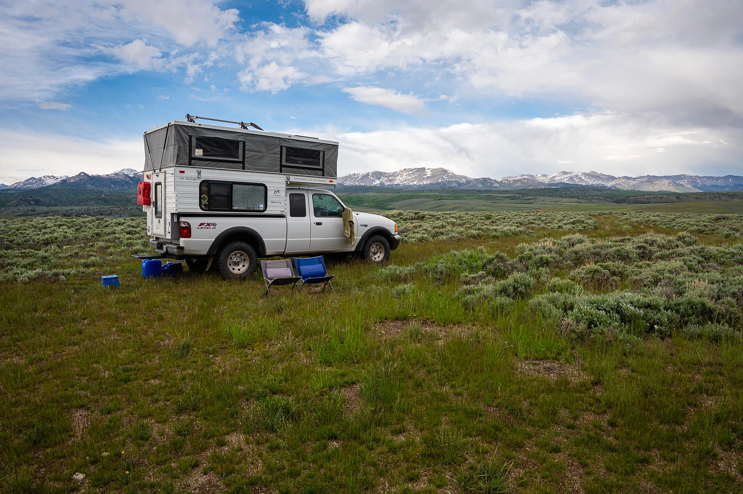
The views of the southern Wind River Range were outstanding.

But storms were building in the southwest and moving toward us.

We finished our evening chores just before big splats of rain hit.

The brunt of the storm passed to our south. We wandered the area during a very short break. Another, more rambunctious storm was following on the tracks of the first.


Like the first storm, it quickly passed, and we were able to walk afterward and take in one of the most colorful evenings of our trip.


It was at this camp that we learned that speed goats (pronghorn) bark when alarmed. It very much sounds like a single dog bark. Numerous goats passed by us here and when they saw us, they gave an alarm bark. We’ve been barked at by deer and elk. Now we’ve added speed goats to the list.
Another storm hit us during the night and another right before first light. After packing up in the morning, it was an exciting, but uneventful drive on the slime covered Landers Cutoff as we continued south to the California Trail and the actual crossing of South Pass.
We intersected with the California/Oregon Trail and parked.
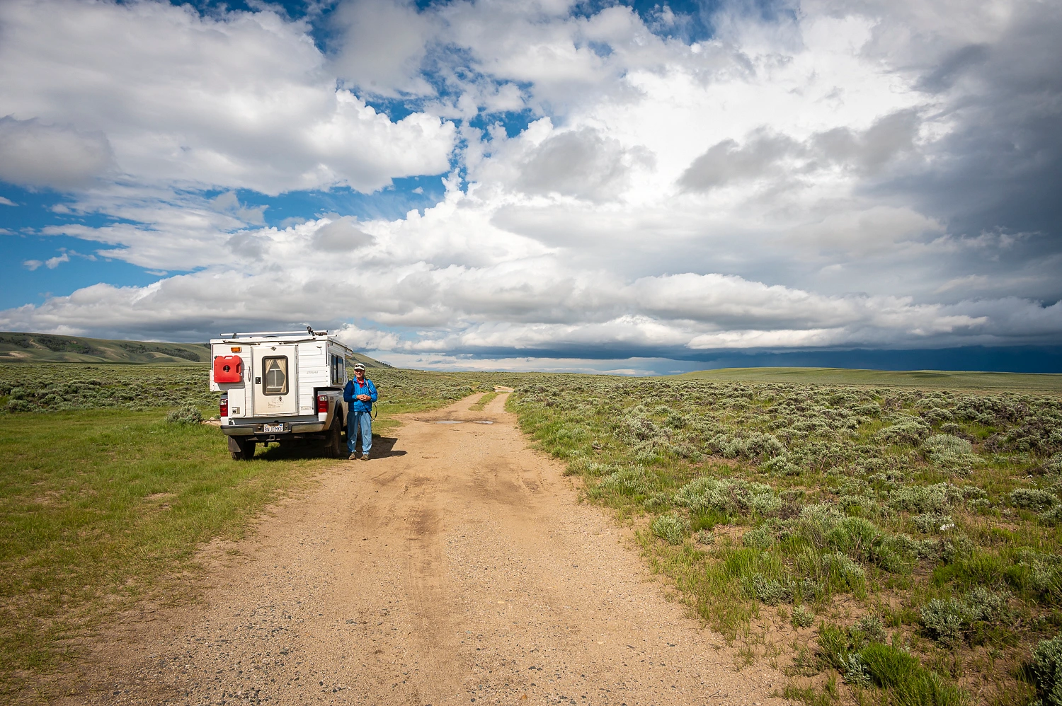
Numerous water pools and sections of mud covered the road ahead, but also, we’d enjoy walking the mile and a quarter west out to the pass far more than driving.


Concrete posts are placed along the Trail marking its route.


I had fun with the above photos because our home is just off of the Carson Route of the California Trail and the main street in our small town is Pony Express Trail. Both these trails lead to our house. And we were approaching the spot where these trails crossed the Continental Divide and the Rocky Mountains.


A lone speed goat buck guarded south pass and kept an eye on us.


Ezra Meeker placed this marker at South Pass in 1906. Meeker traveled the Oregon Trail as a young man and later in life worked tirelessly to keep the story of the Trail remembered.

We returned to the truck and headed south to get closer to the Oregon Buttes, a noted landmark along the Trail.


Our plan was to continue south on backroads, especially since a huge storm was building to the north that erased the Wind River Range from view.

The road topped out above Edmund Springs. It then dropped down into the draw cut by Bear Creek. The road narrowed and ahead, about a quarter mile out, we saw that the road was blocked by Bubba – a big pickup towing a way too large camp trailer. It was parked in the middle of the road and, it appeared, the occupants were walking ahead to see if they could continue. If they decided not to proceed, with the narrow road and steep grade, we had no idea how they would get turned around or back up the steep narrow road. It, for sure, was nothing we wanted to get involved in. We turned around and backtracked.
After a brief time driving south on highway 191, we made our
way on dirt roads out to the broad Killpecker Valley. The distinctive remains of
a dormant volcano lay at the northern end of the valley – The Boars Tusk.

Also, as the photo shows, storms were building all around us now. With the eminent storm, we did not take the primitive road out to the base of Boars Tusk.
Our stop at the White Mountain Petroglyph Site was a highlight of our trip. Very different from most of the rock art we have seen, these petroglyphs were carved or gouged into the sandstone rock face rather that pecked, the style we are most familiar with. There is also openings in the rock face and many native people's creation stories have them coming out of the earth. Accorded to the linked webpage, “Some believe this was a birthing place for Plains and Great Basin tribes.” This is a very sacred place.
Here are several photos of the rock face and amazing petroglyphs.


Elk


Bison


Older ‘glyphs show how they erode and fade.

Horses and riders.


More rock art


I am sure curious, how in the world were these hand prints carved out of the rock?


We had our raingear with us as it was a bit over a half mile walk out to the site from the new parking area that includes a new CXT toilet. We ended our visit as the sky darkened to an angry black and big splats of rain began to pelt us. You bet we put on the raingear. A large family group, kids to grandma, was coming up the trail beginning their visit dressed in flipflops, t-shirts and shorts, and carrying nothing else with them. Could anyone be so clueless about the weather?
The storm unleashed its fury just as we arrived at our truck
with lightning, thunder, fierce downdrafts, and marble size hail that quickly
turned the ground white. There was sunshine to the south. We headed toward the
sunshine. How did the pilgrims fare with their completely unprepared up close
and personal lesson with violent weather? I'm clueless.
This storm changed our plans. There was another petroglyph site several miles to the east we wanted to visit and hoped to camp nearby. It was under the heart of the storm.
We put our hope into that sunshine to the south, in the vicinity of Rock Springs. As soon as we started to see the urban sprawl, we turned away to the west and up onto the broad plateau that lies above and to the north of Rock Springs. A narrow two track took us to what we were looking for.
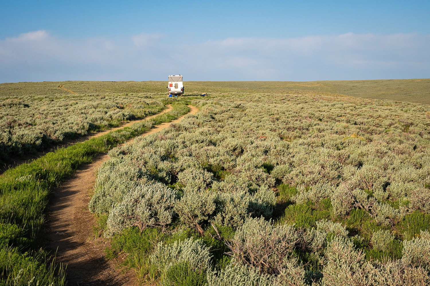
The above photo was taken in the late evening after another storm passed. We popped the camper top just before the storm’s onslaught began. Warm and dry, we stayed inside, made and ate dinner, and did other chores. Two hours later the storm cleared. We wandered and speed goats barked at us in the welcome sunlight.

There were many pounds of mud plastered onto the undercarriage of our truck.
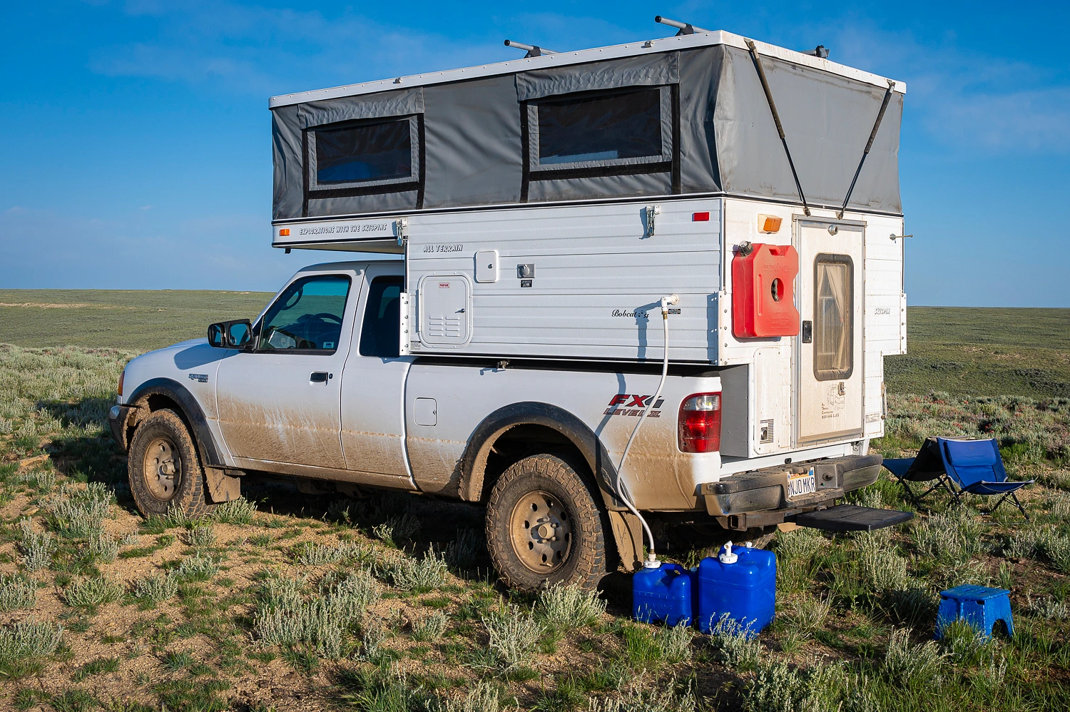
We’d drop into Rock Springs in the early morning and find a coin operated carwash. Next, we’d take a look around and see what direction looked the sunniest. We would head that way.
Our adventure continues. Please click here for - Part Five.
No comments:
Post a Comment