
please remember you can click on a photo to see a larger version
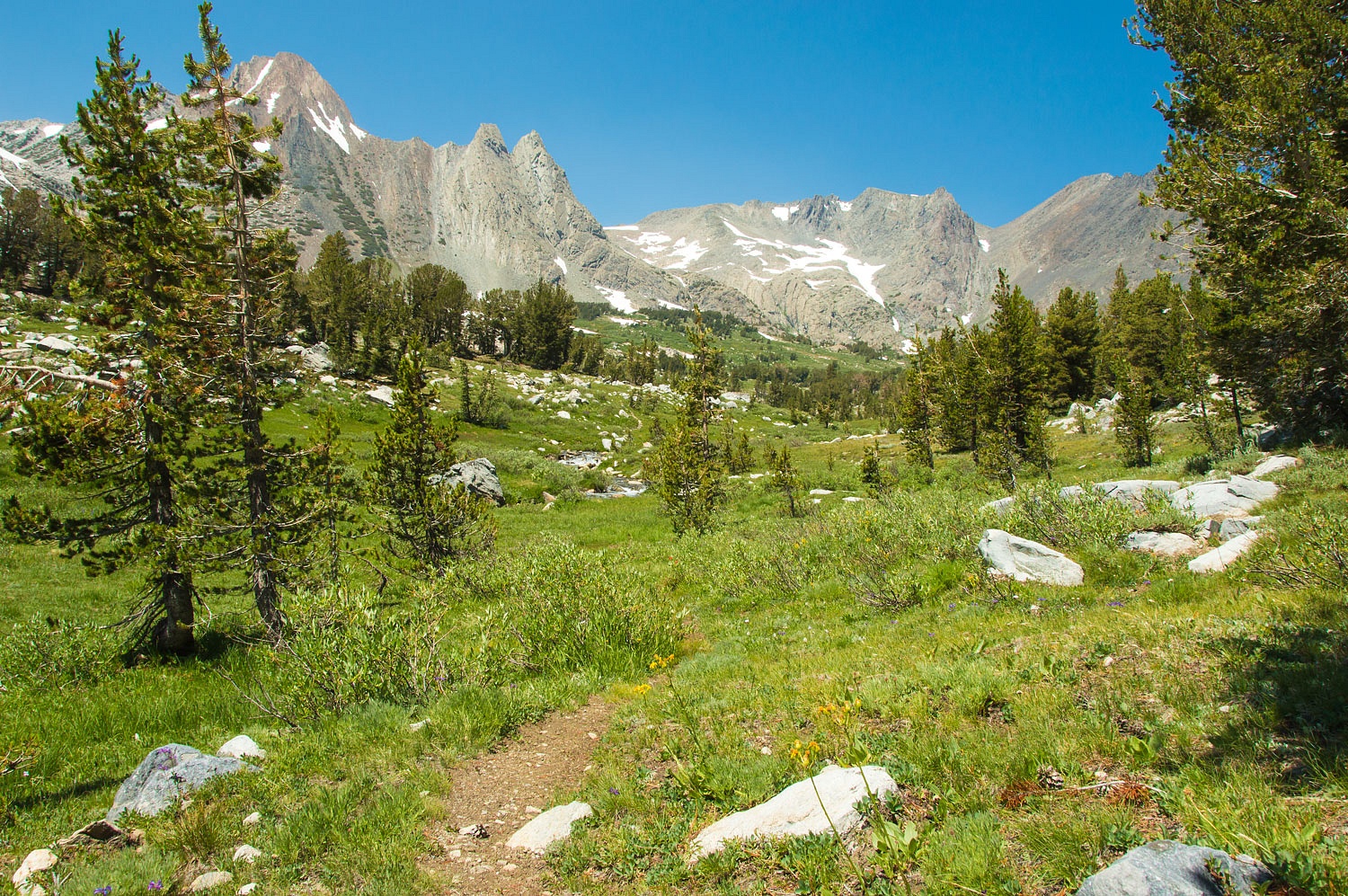
A forgotten
trail
"Close
the windows now!" The Lady's voice was adamant. She was directing me as I
backed the truck and camper into position for three nights at this dispersed
camping site. She abandoned her job to run up to my open window. Mosquitoes have to be bad for her to notice. I
quickly closed both windows. The Lady grabbed the Cutters and dosed herself. We
resumed positioning the truck and I got out. I was soon convinced that high
pitched buzzing was shouting, "Feed me! Feed me!"
"Do we
even want to stay here?" I asked.
"Let's
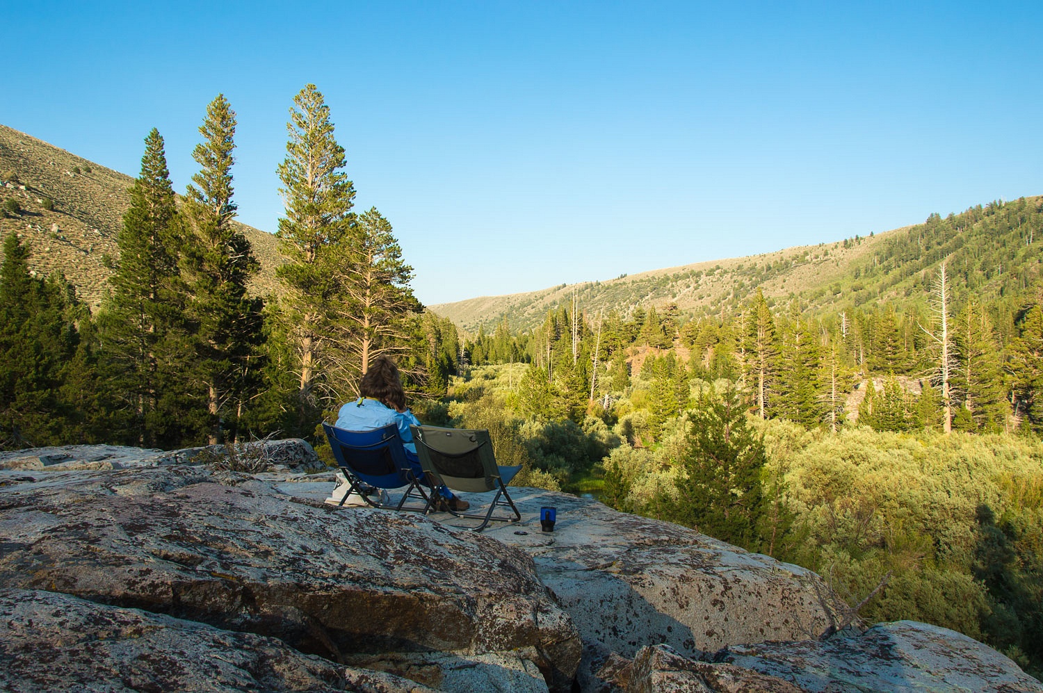
see what it's like up on the rock," the Lady answered and took off. We
have a quick climbing route from this spot to the top of the thirty foot high remnant
block of granite, scarred but unmoved by the glacier that carved this
magnificent valley. We both made it up in record time. We stood in the wind and
accessed the little bastards.
"If we
eat and do most everything up here, it's not too bad," the Lady said.
"Let's stay."
Mosquitoes
were bad but not intolerable. They will not be the theme of this story; only occasionally
take a bite out of the narrative.
We took our
place up on the rock.
We arrived
Friday afternoon and were surprised to see most of the usually filled dispersed
sites along Green Creek Road empty. Mosquitoes? Our favorite spot was waiting for
us, a pleasant surprise.
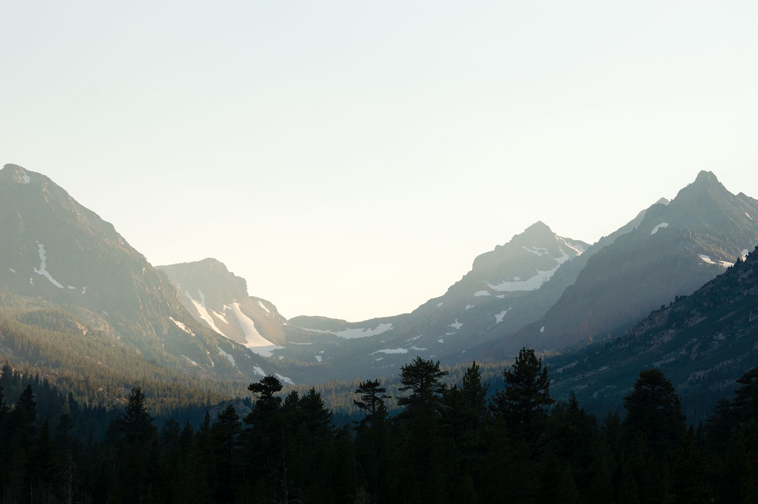
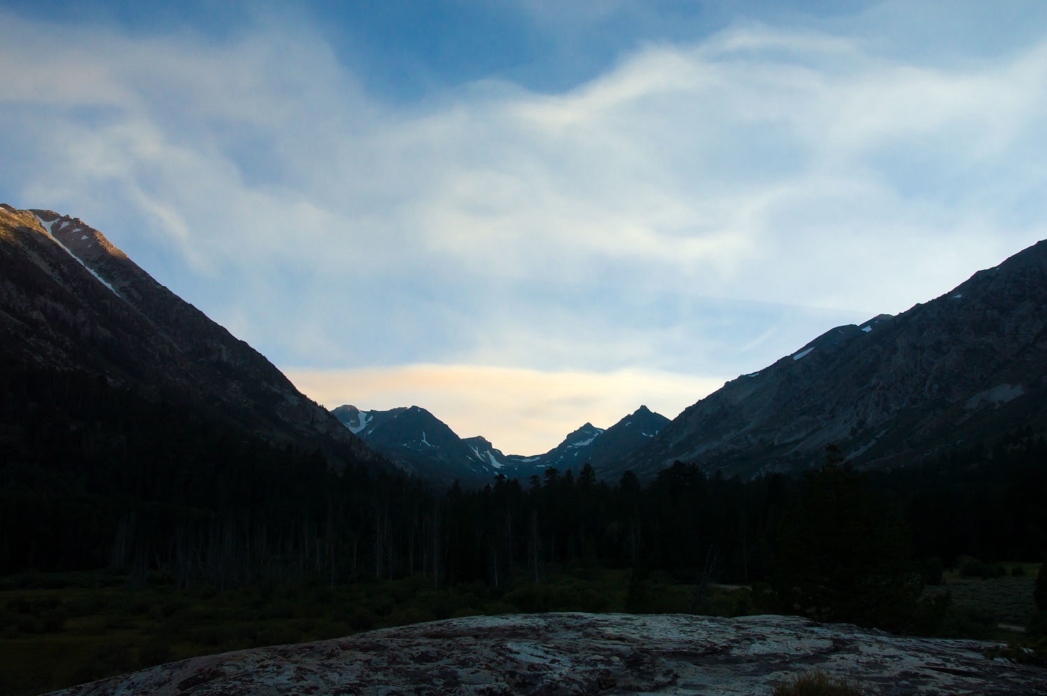
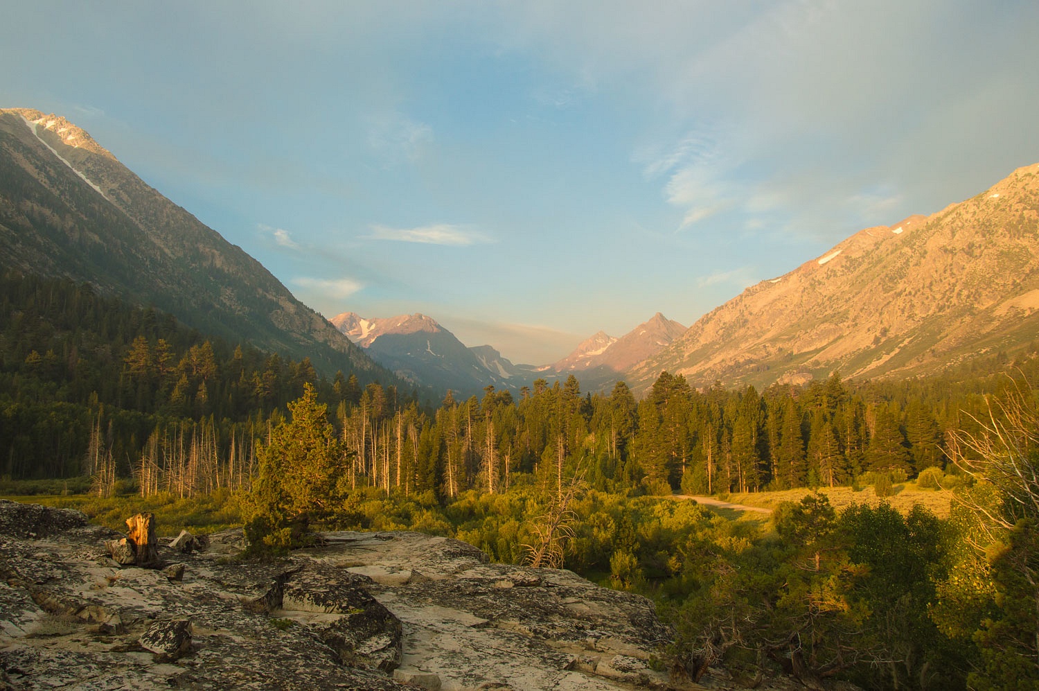
We walked in
the evening and caught the last rays of the sun dancing across the Sierra crest.
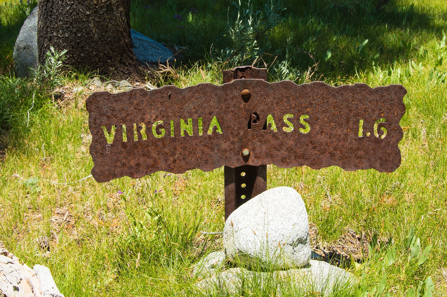
We had come
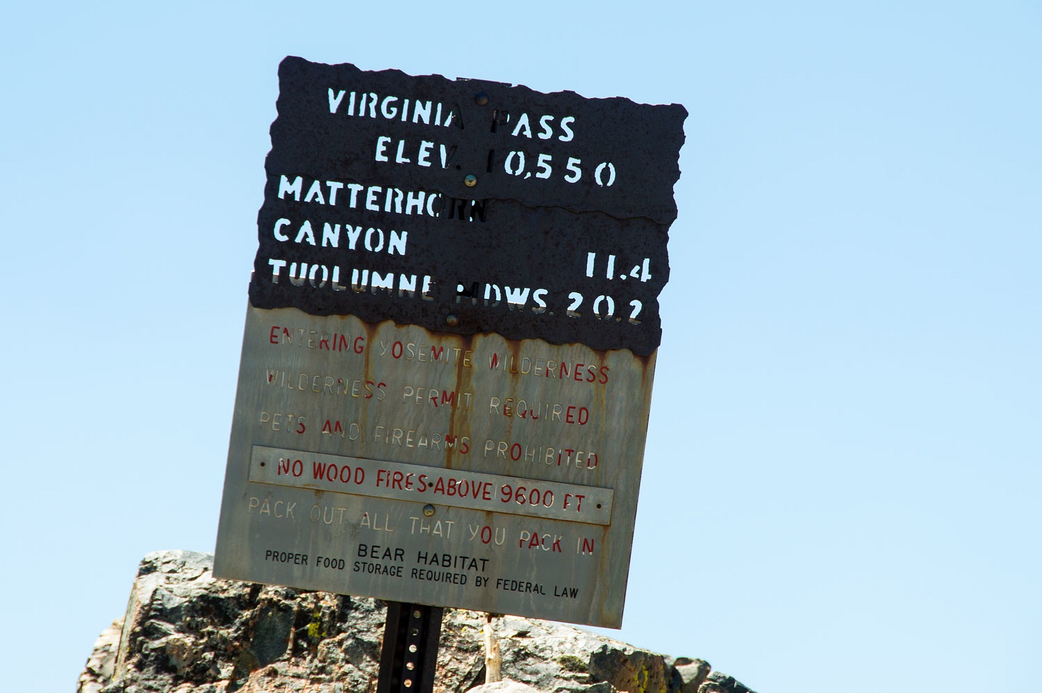
here to explore an old trail. Several years back I had seen a photo of a
classic Yosemite National Park trail sign that read, "Virginia Pass."
The pass is named on the 7.5 topo but there is no trail up the east side shown
on the same map. We explored up Glines Canyon back in late October. Early season
snow turned us around. We were anxious to complete the climb to the top.
With the
welcome cold overnight, our sunrise viewing from the rock top perch was bug
free.
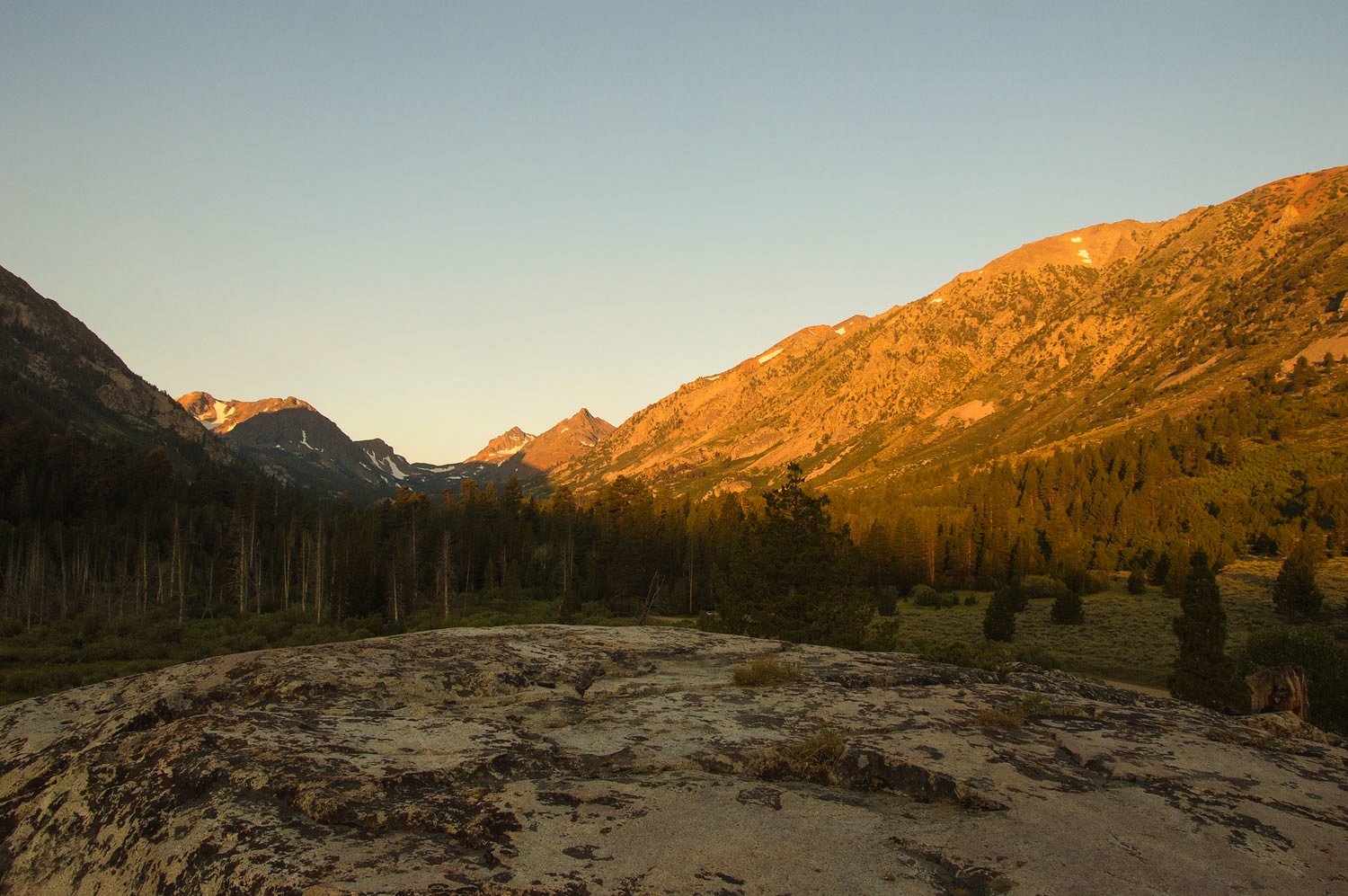
And, we got
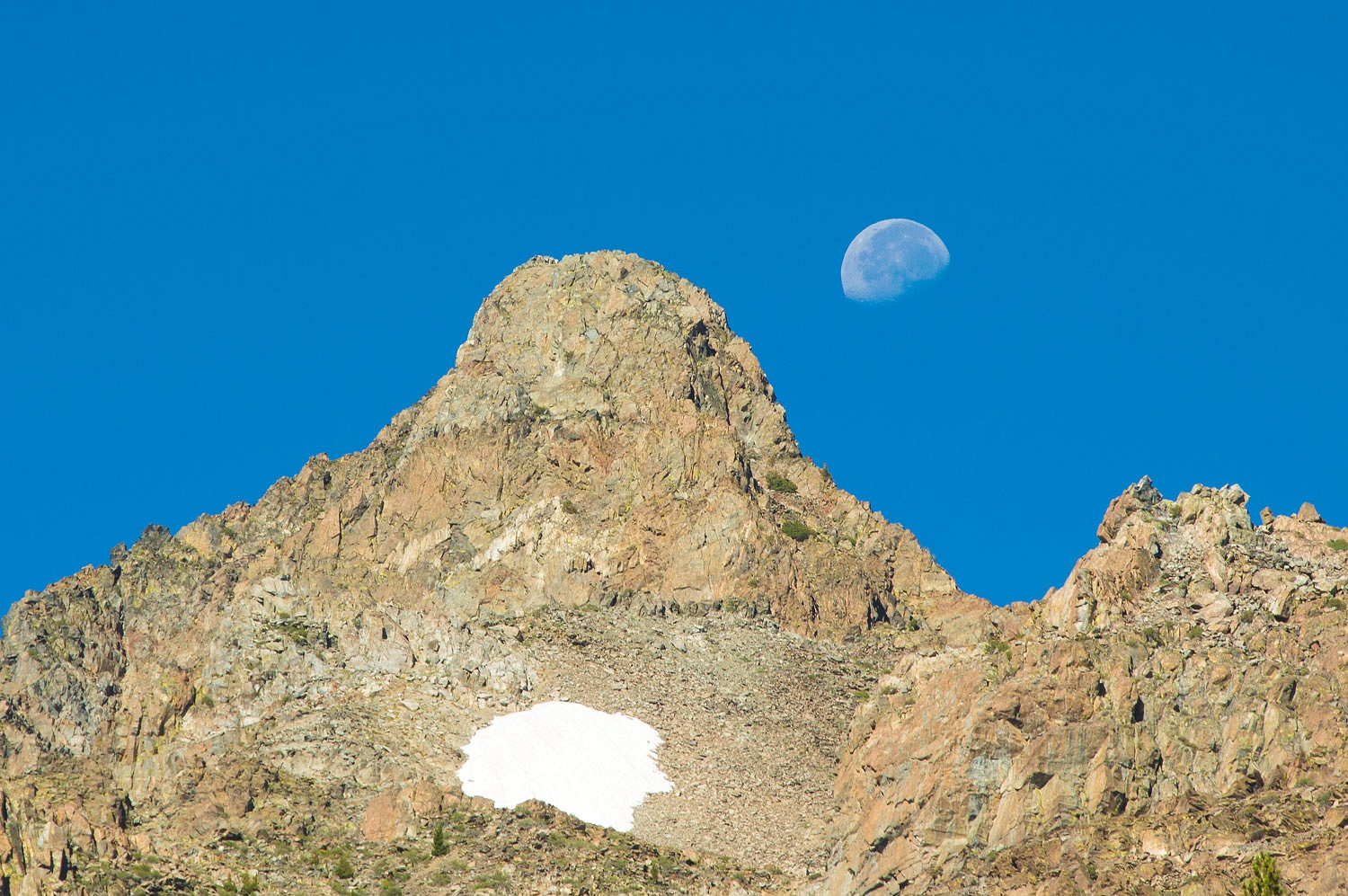
an early start.
The moon was
beautiful on its way to the much anticipated collision with the sun on Monday 21
August.
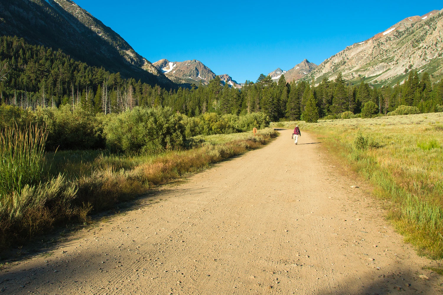
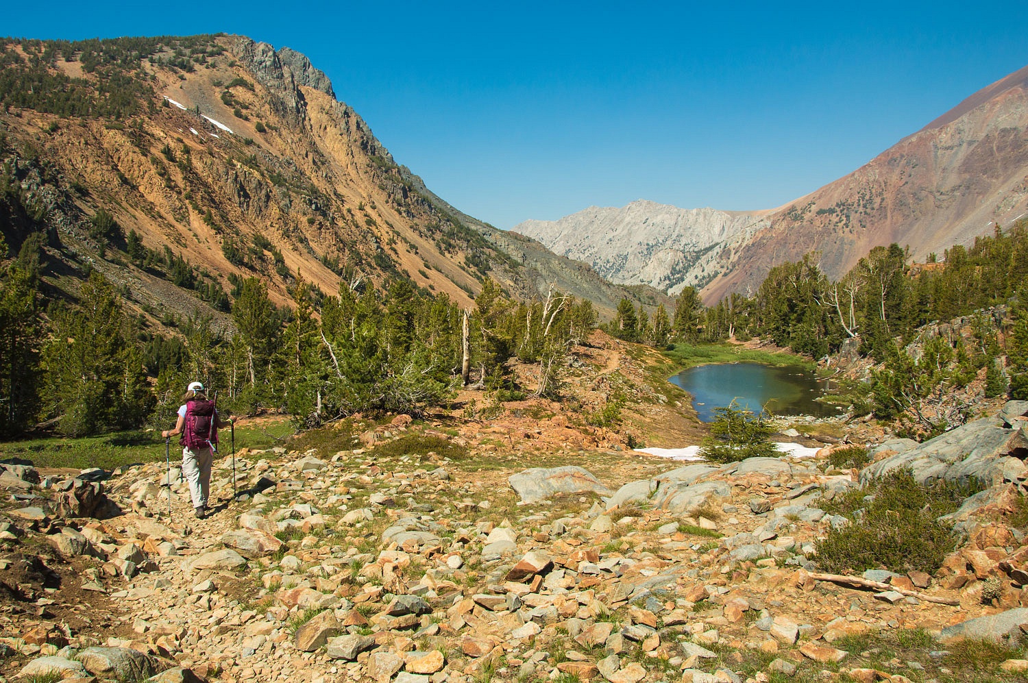
Our route
was up the trail to Green Lake.......................
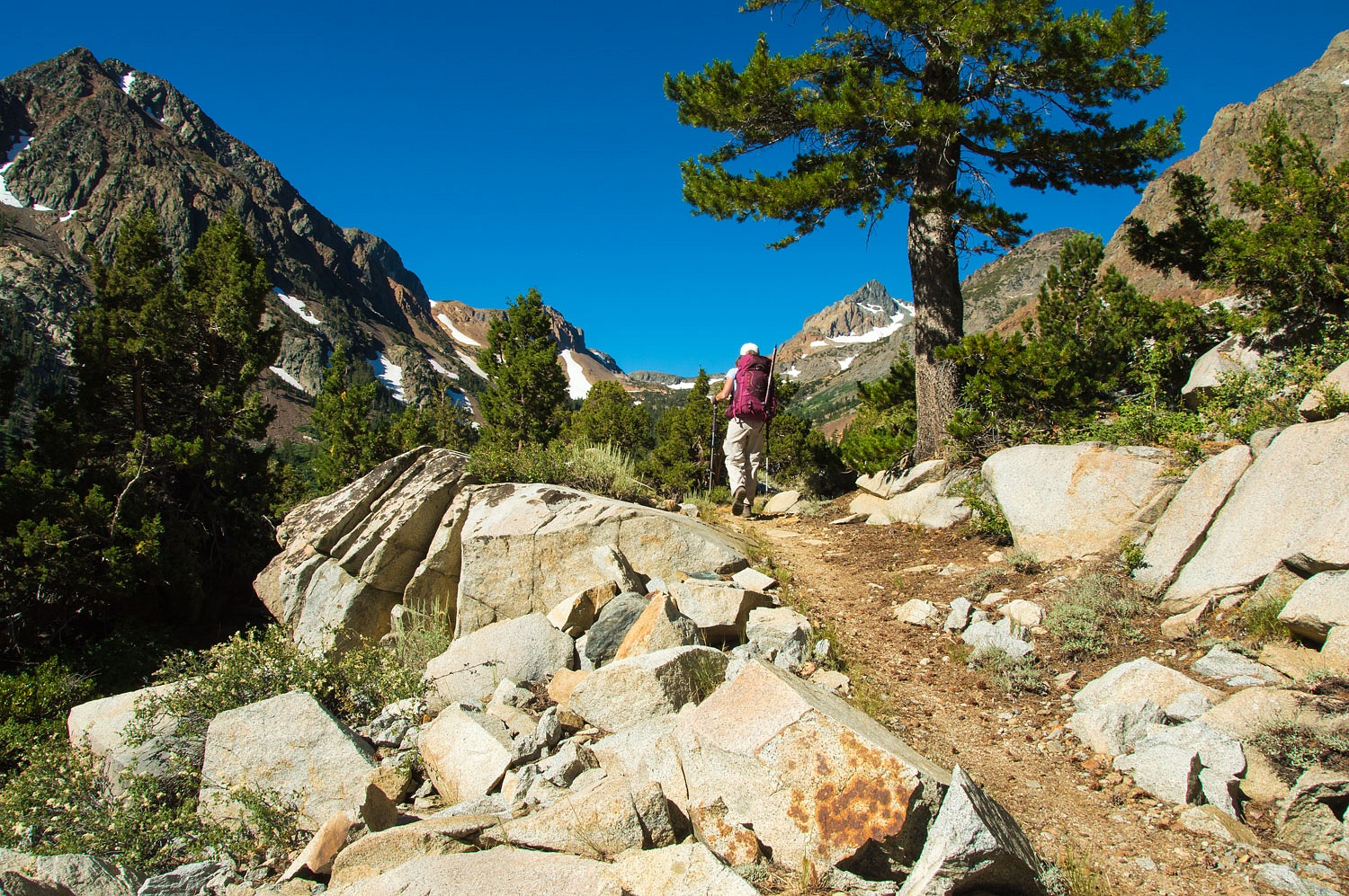
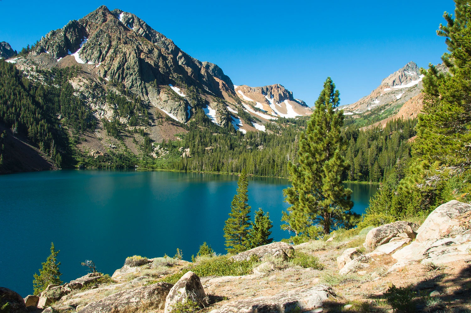
............................and
then along the difficult to follow old trail along the north side that
leads to the far west end of Green Lake.
The old
route up this canyon was to the Par Value Mine.
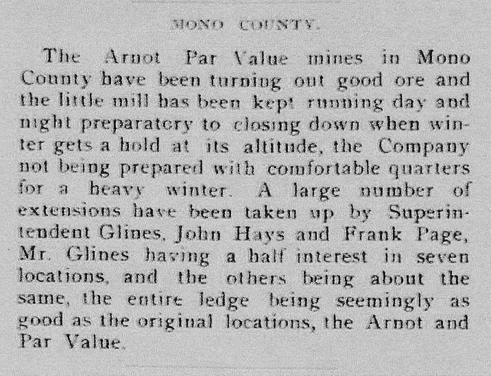
Below Green
Lake, if you look closely when hiking the trail, you can see where sections of the
old road ran. The difficult terrain around Green Lake makes me wonder if
transportation on this section was by boat. A small section that looks like
road remains just west of Green Lake.
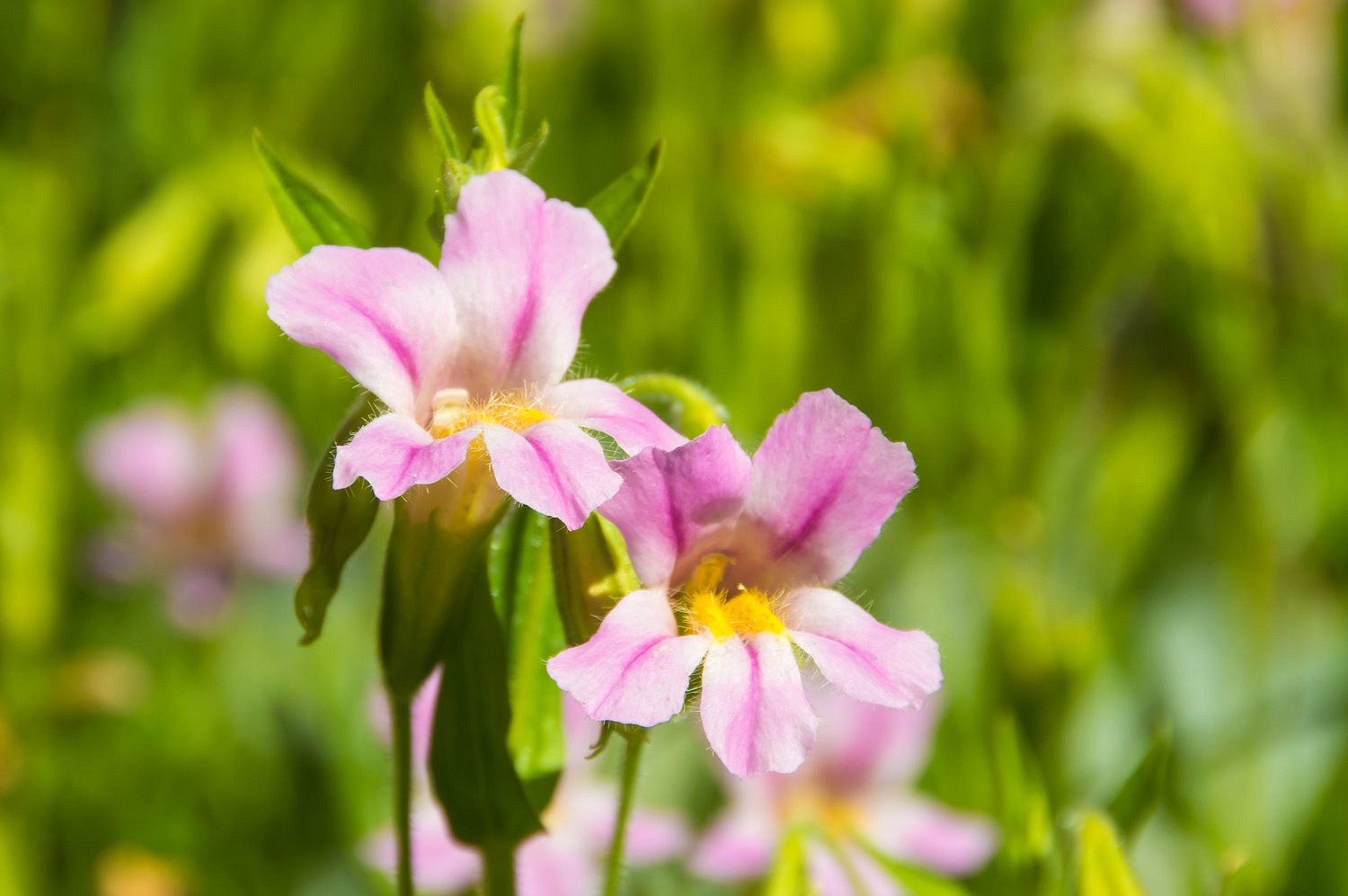
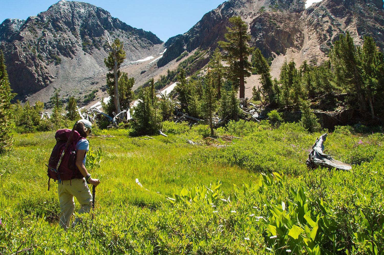
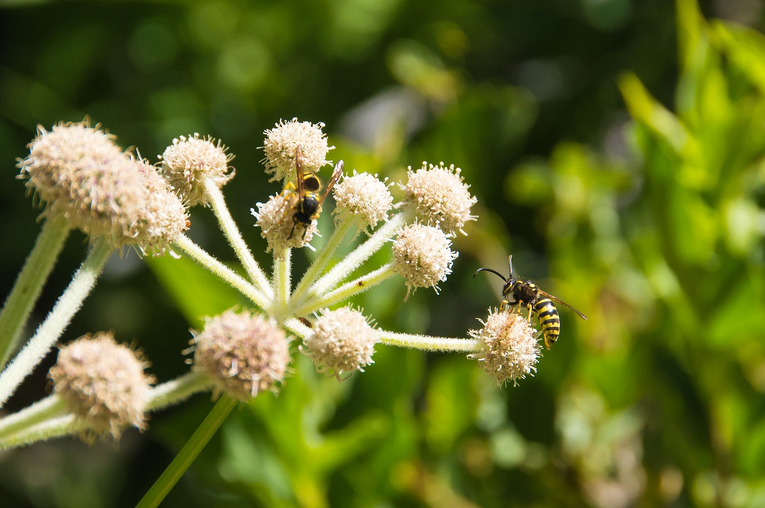
We were
alone among large clusters of Monkey Flowers.
The main
mill site for the mine was along the creek that rushes down from the Par Value
Lakes.
Evidence of broken trees and debris from this winter's avalanches reinforced the history of this mine being abandoned after being swept by an avalanche early in its history.
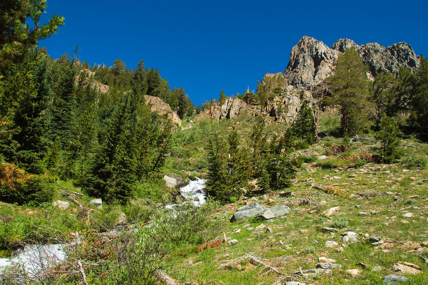
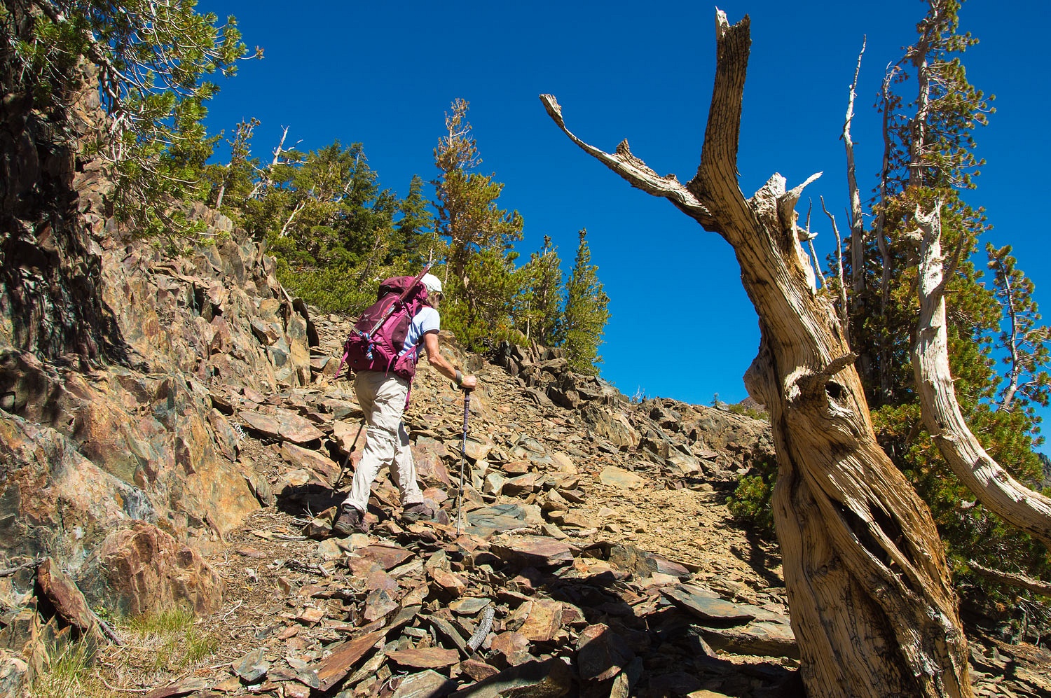
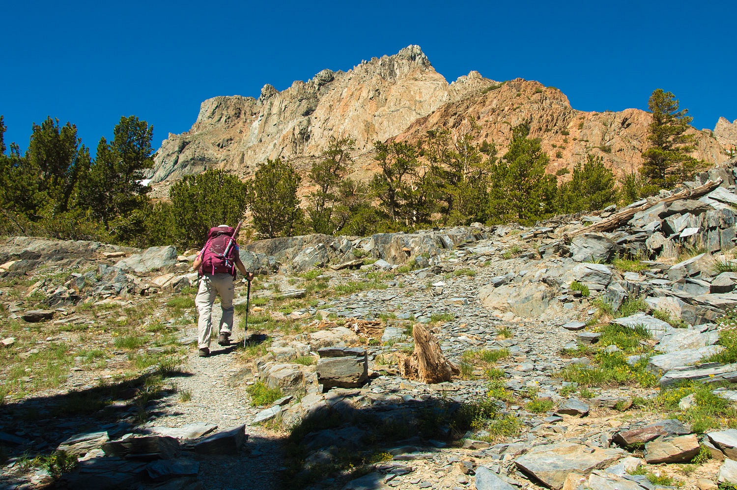
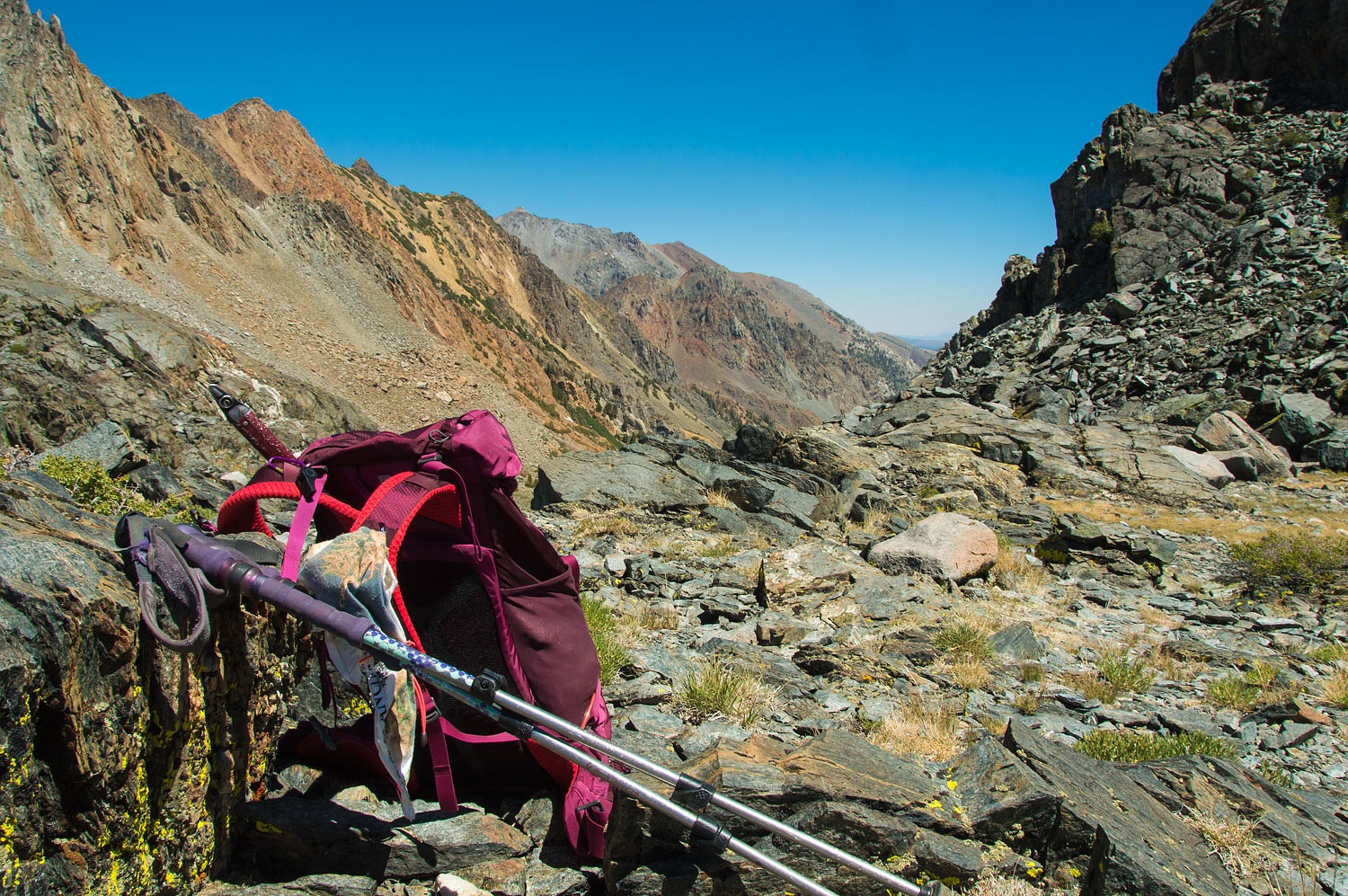
Following
the faint trail we had used back in October, we again reached the remains of
the cabin. We soon lost the trail again but worked the south side of the canyon
as we moved up toward the high pass, with an eye out for evidence of the old
trail further up.
From a high
point I spotted a faint section of trail through wetlands below us. I searched
the slopes up ahead for it and saw a worn path we could intersect if we
moved further south. The Lady led the way.
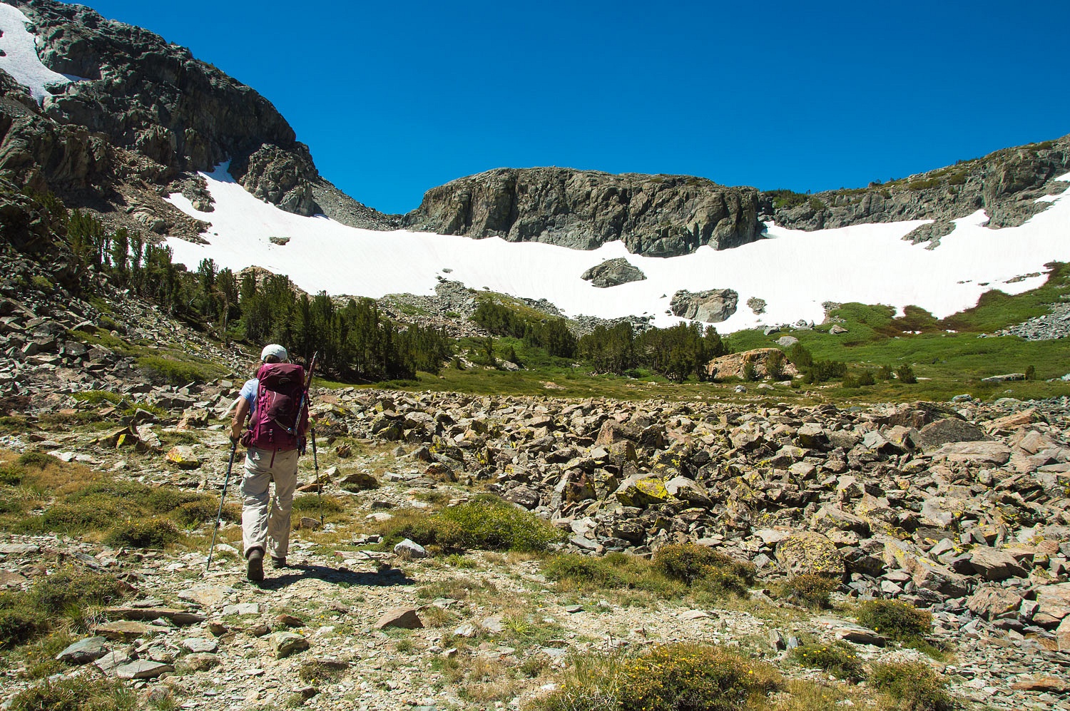
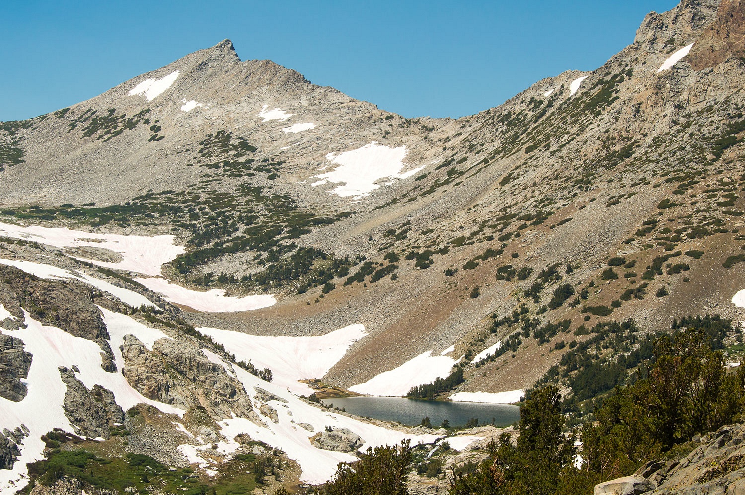
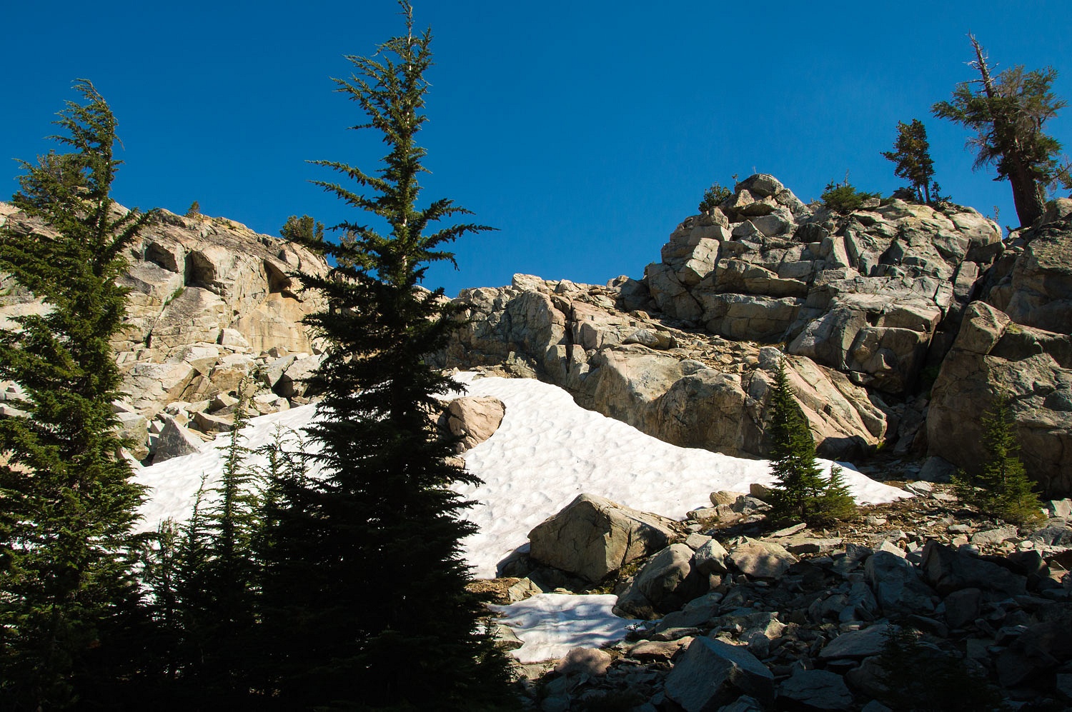
The views
were phenomenal in this majestic high country basin. We fell in love with
this place.
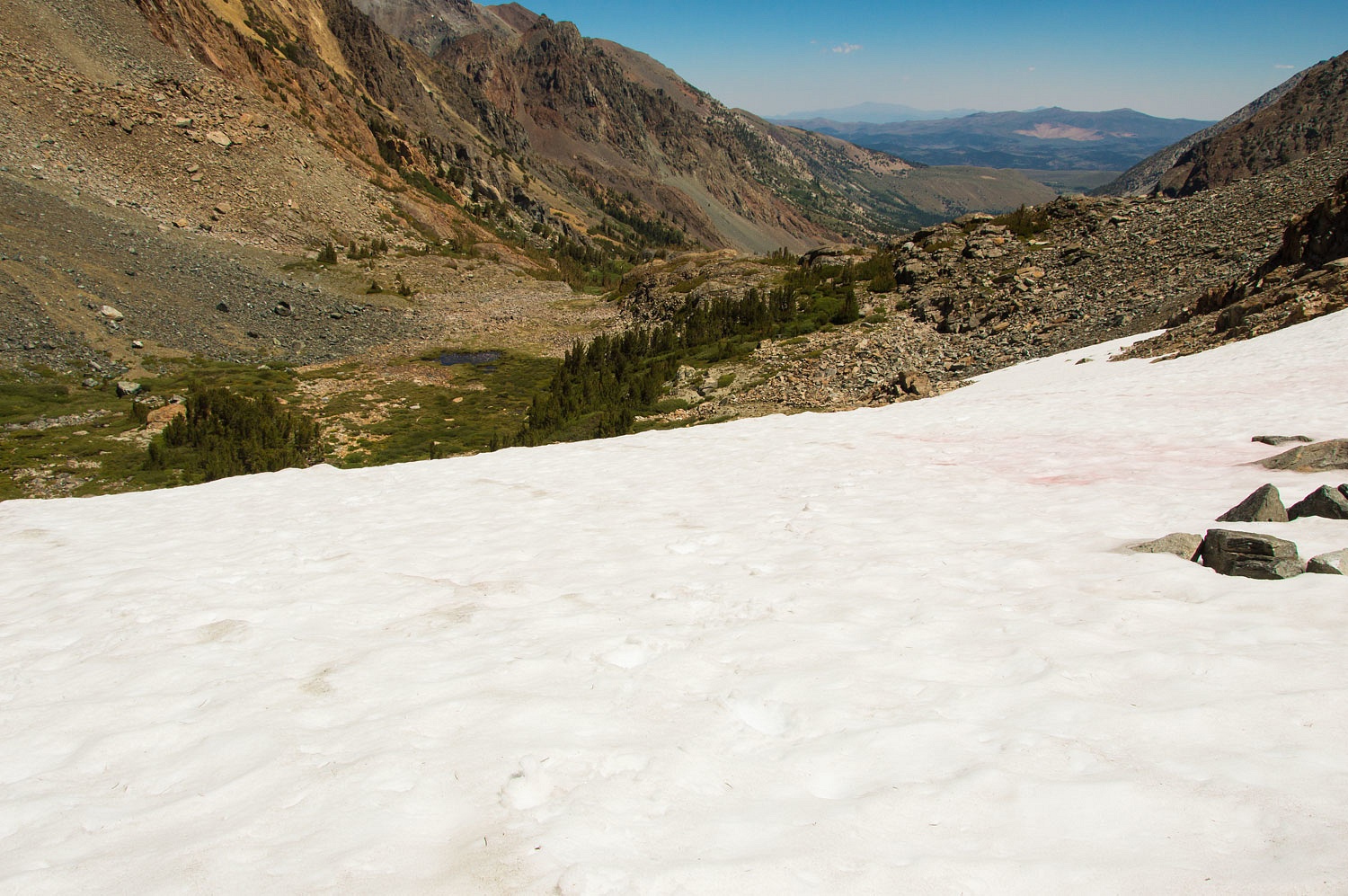
After so
many years of drought, it was a treat to be on hard summer snow.
The Lady
reached the old forgotten trail and we continued up.
In many
places the trail bed no longer exists.
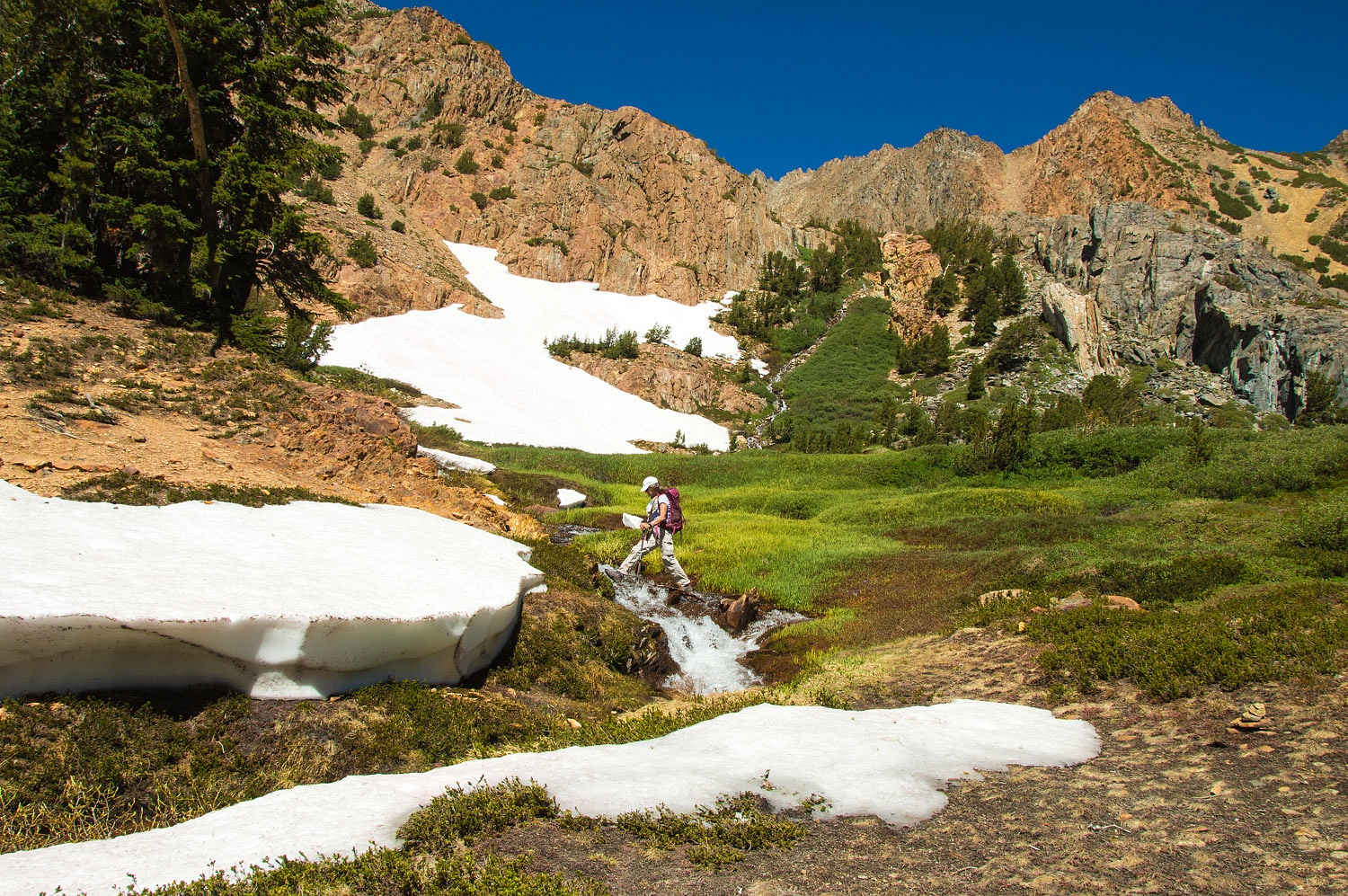
We scanned
ahead to spot remaining pieces of trail that crossed harder ground.
We ventured
a guess that this trail was abandoned because most years its run is hidden under
summer snow.
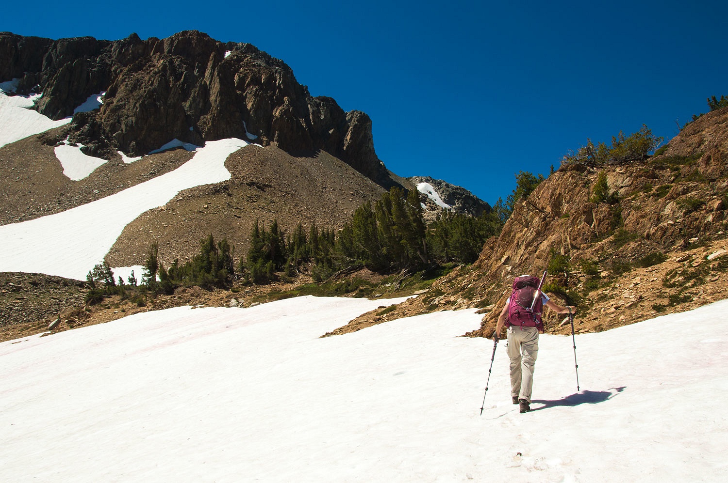
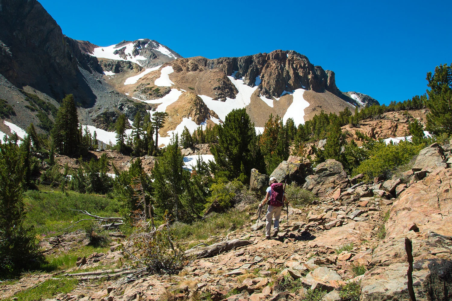
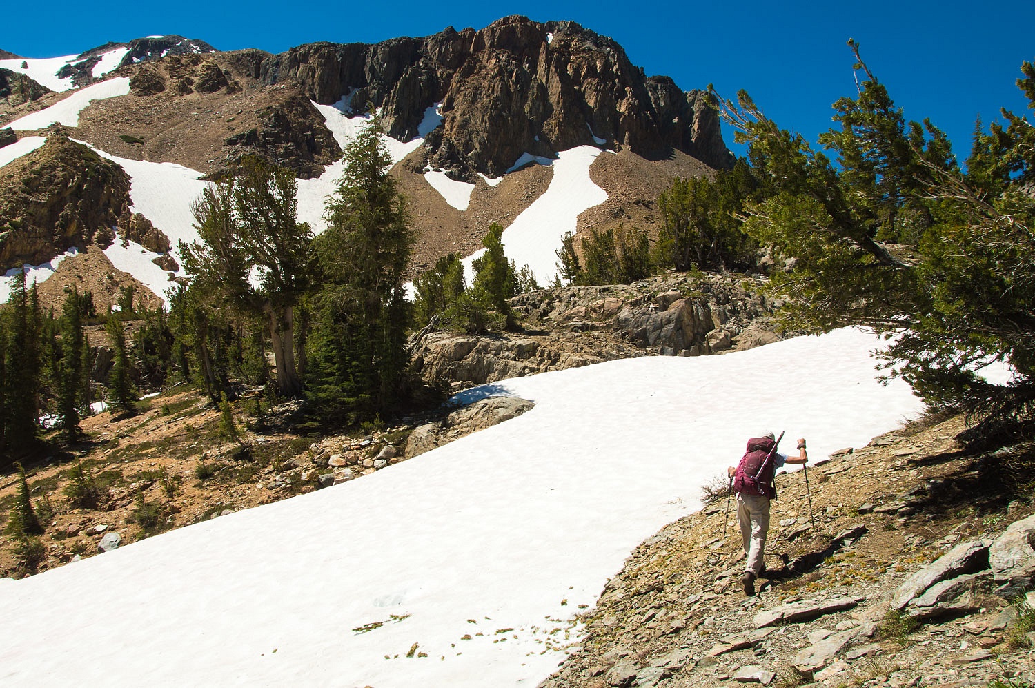
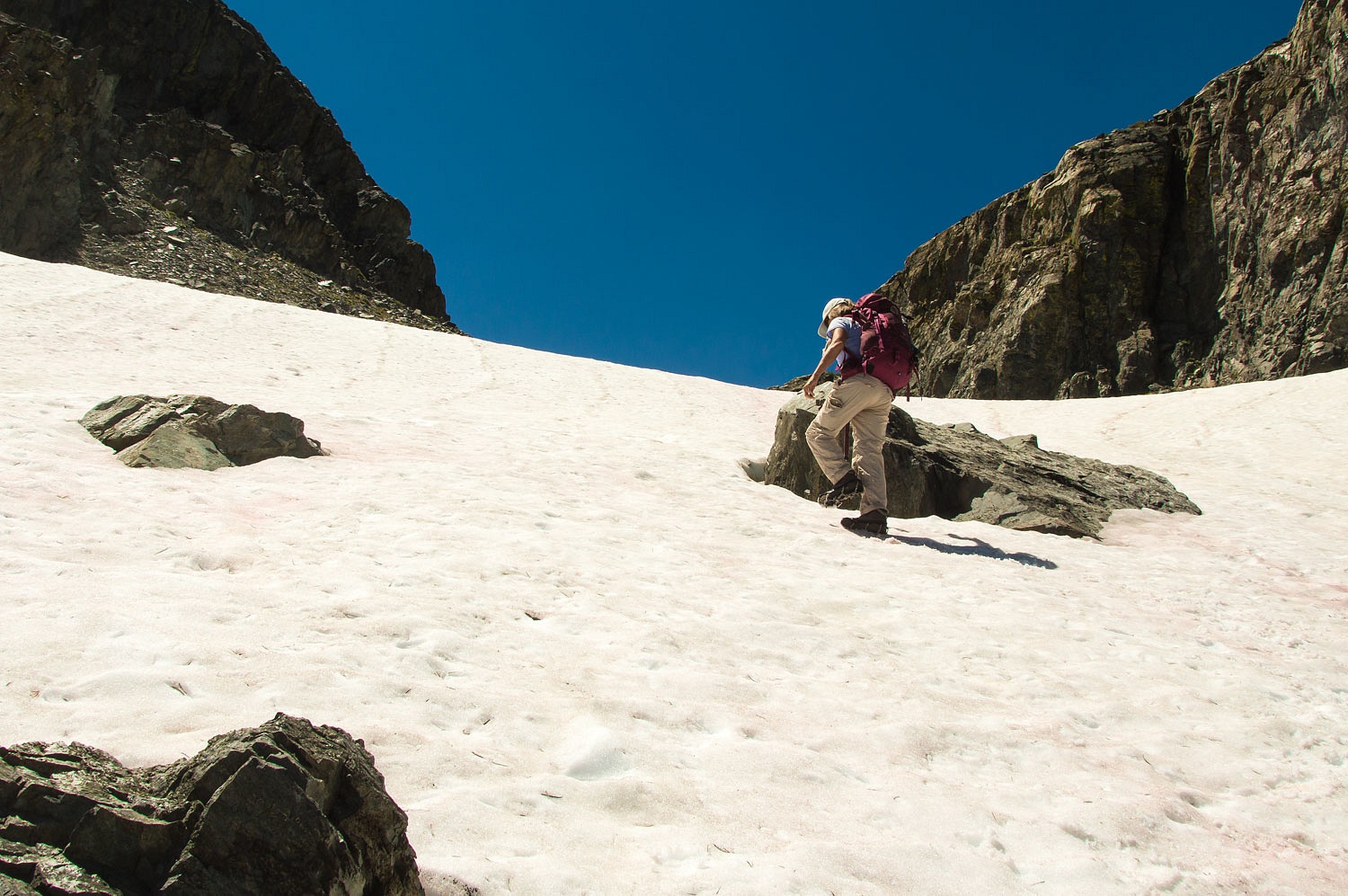
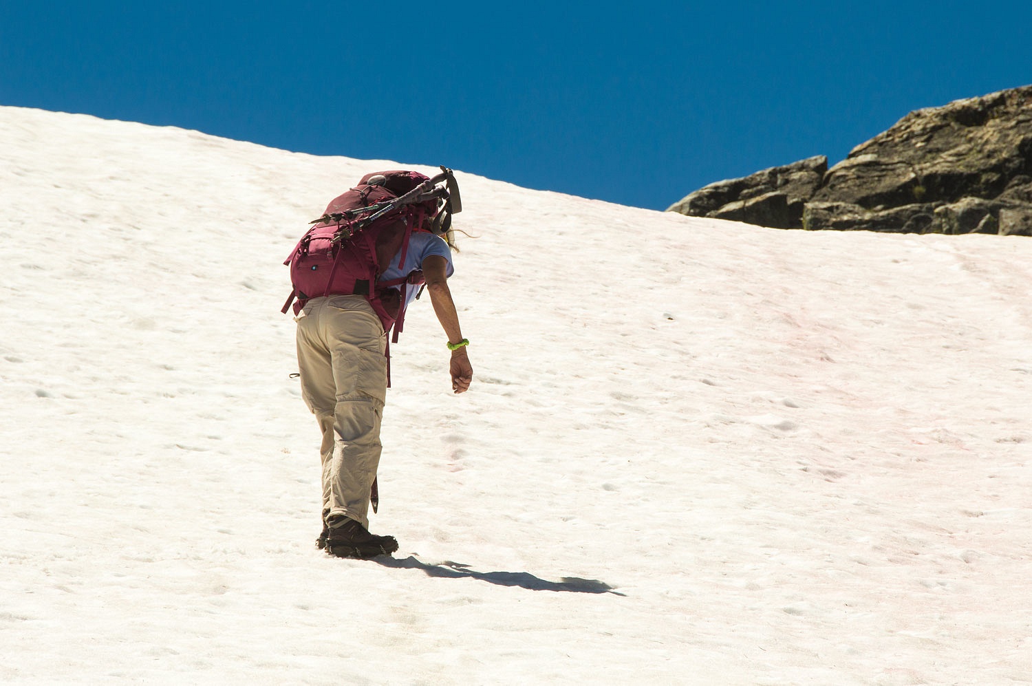
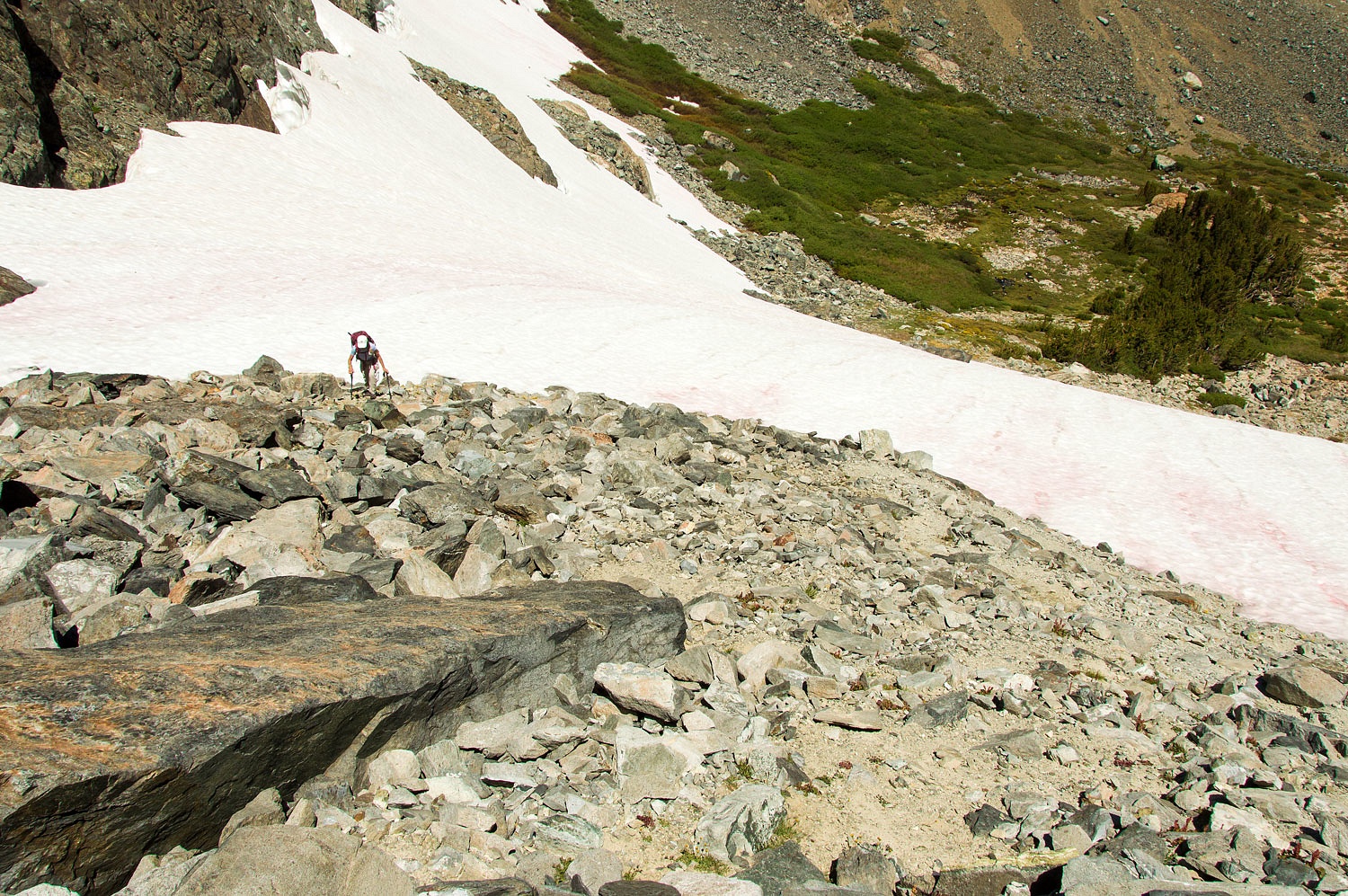
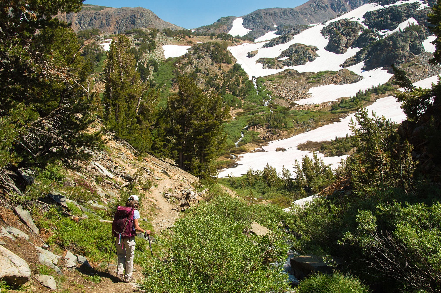
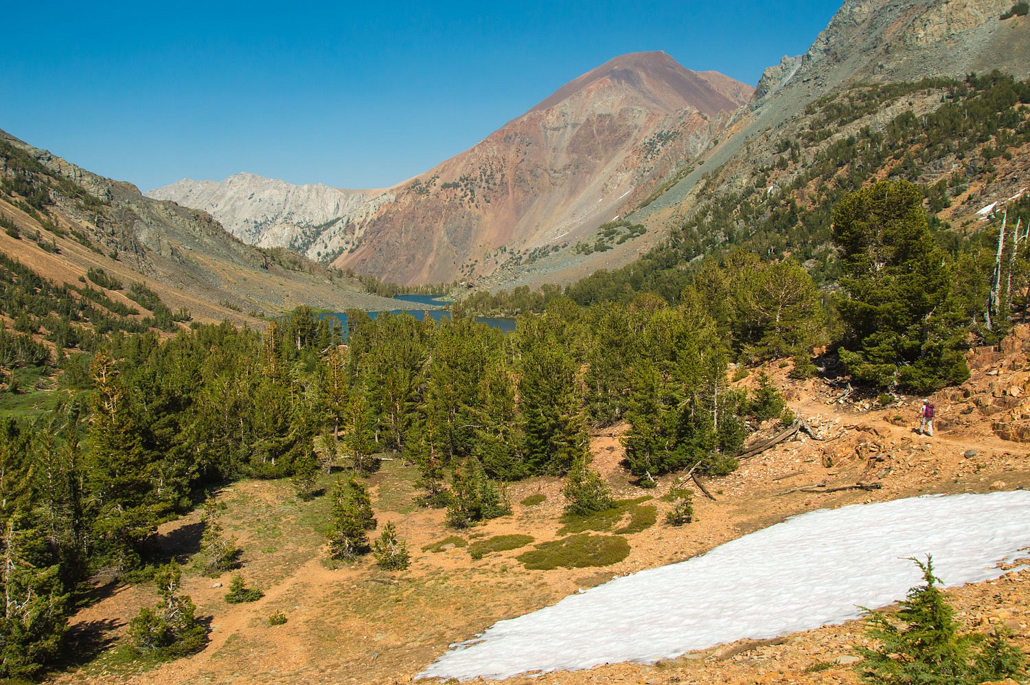
We reached
the top bowl of the cirque. The high pass loomed above, blocked by what we knew
would be the crux of the climb - a high steep snowfield.
We love
these days when we can put our skills and tools to work.
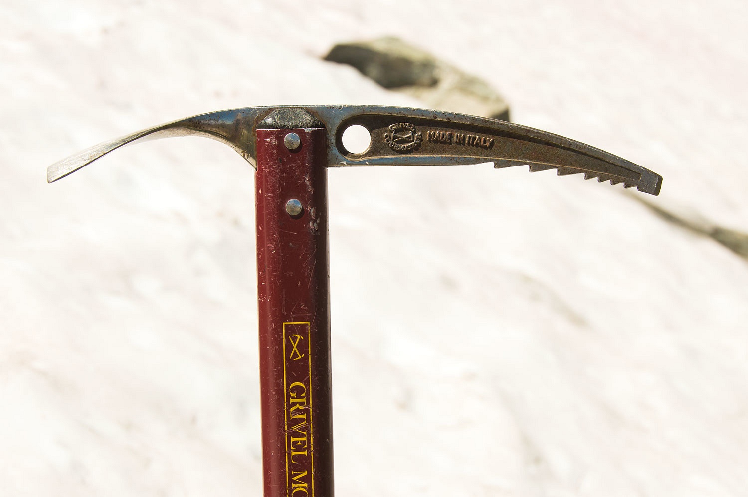
We recently
bought microspikes, lighter and easier to carry then our full on crampons. We found
them quite serviceable on this steep but non technical terrain.
The route to
the pass is a steep scramble to the notch above the snowfield.
Here was the
sign I'd seen in a photo years ago.
The fabulous
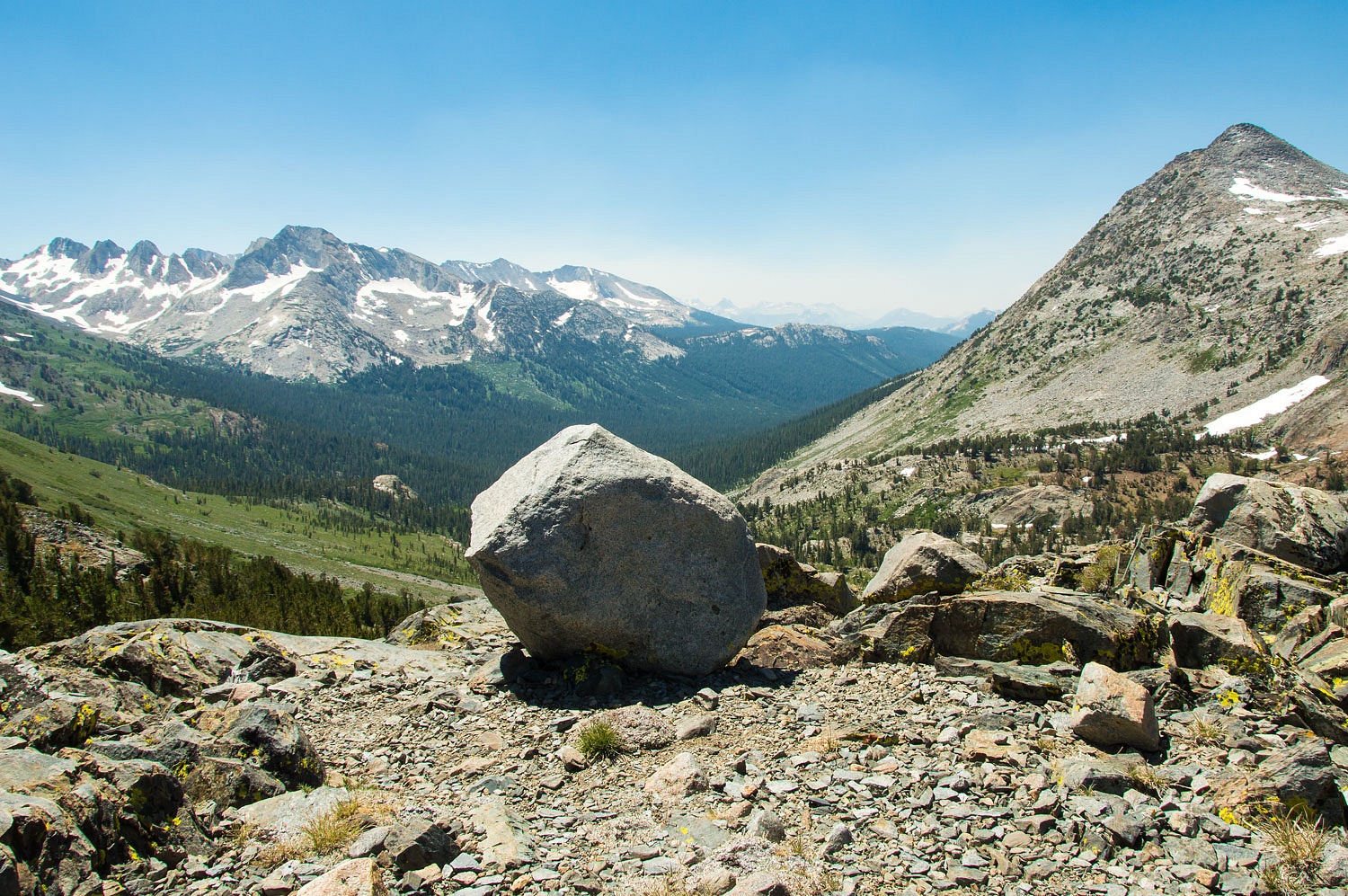
Yosemite high country opened up to our west.
We could
make out the peaks around Tuolumne Meadows to the southwest although smoke from
recent lightning strike fires were moving toward us and obscuring the vista.
The wind was
roaring through the pass. We hunkered down for a quick break and to take a
video.
Our trip
plan was if we reached Virginia Pass by noon we would continue down into Return
Canyon and intersect the main trail into Yosemite from Summit Lake and do a
loop hike of over 20 miles with an elevation gain and loss of 4400 feet vertical.
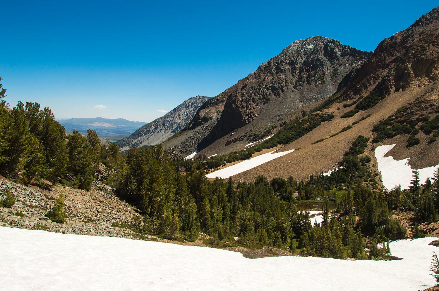
We reached the pass at 12:09.
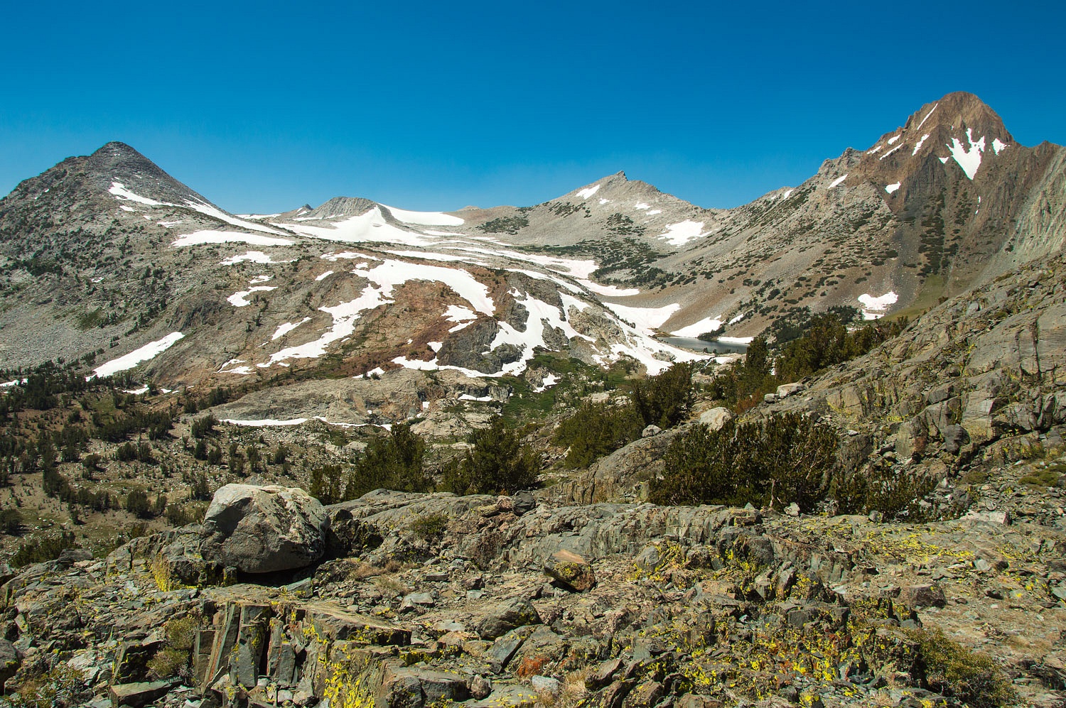
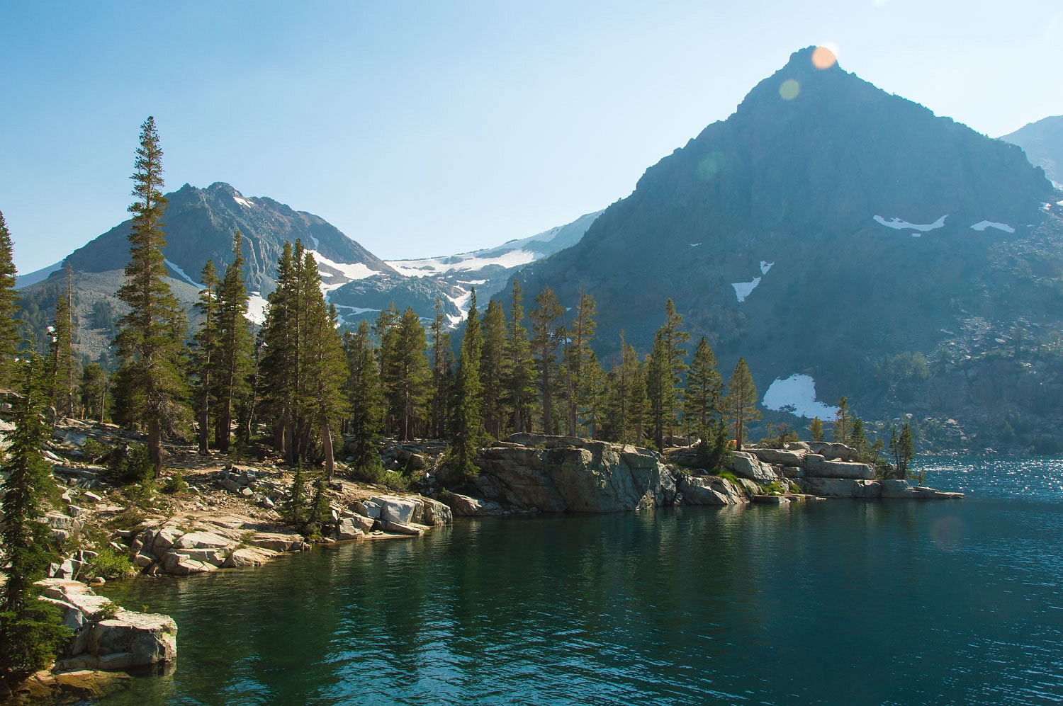
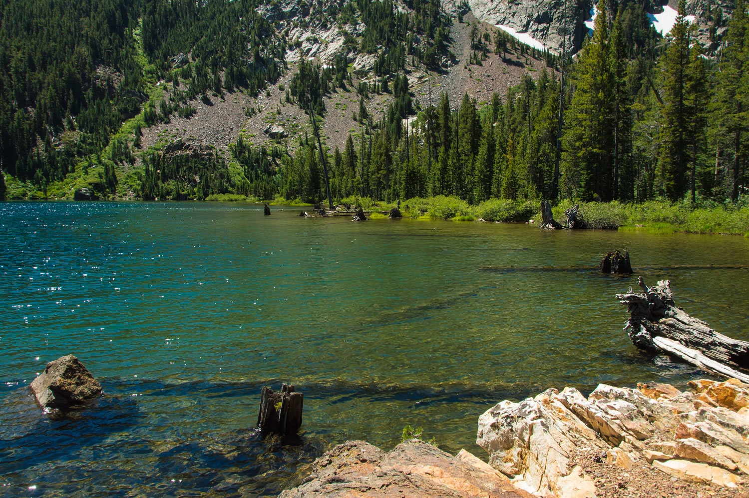
It is a
thousand foot drop down to Return Creek. Return Lake across from us, nestled in
its granite basin, constantly drew our eyes.
This basin
below Virginia Peak is spectacular.
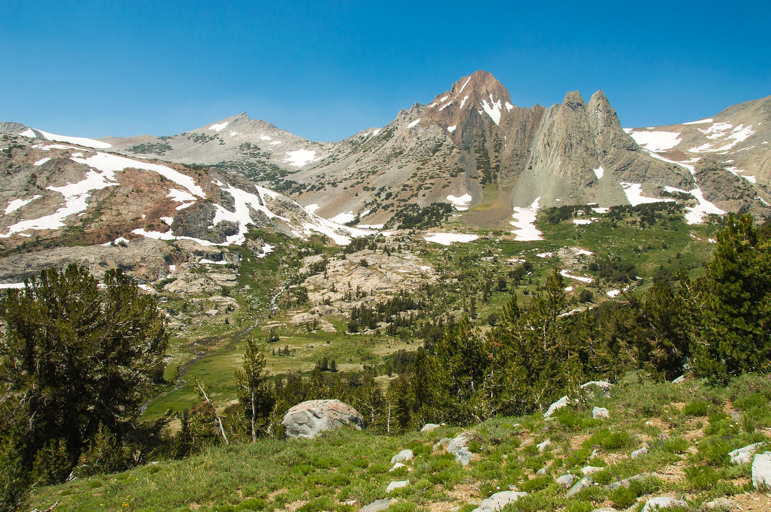
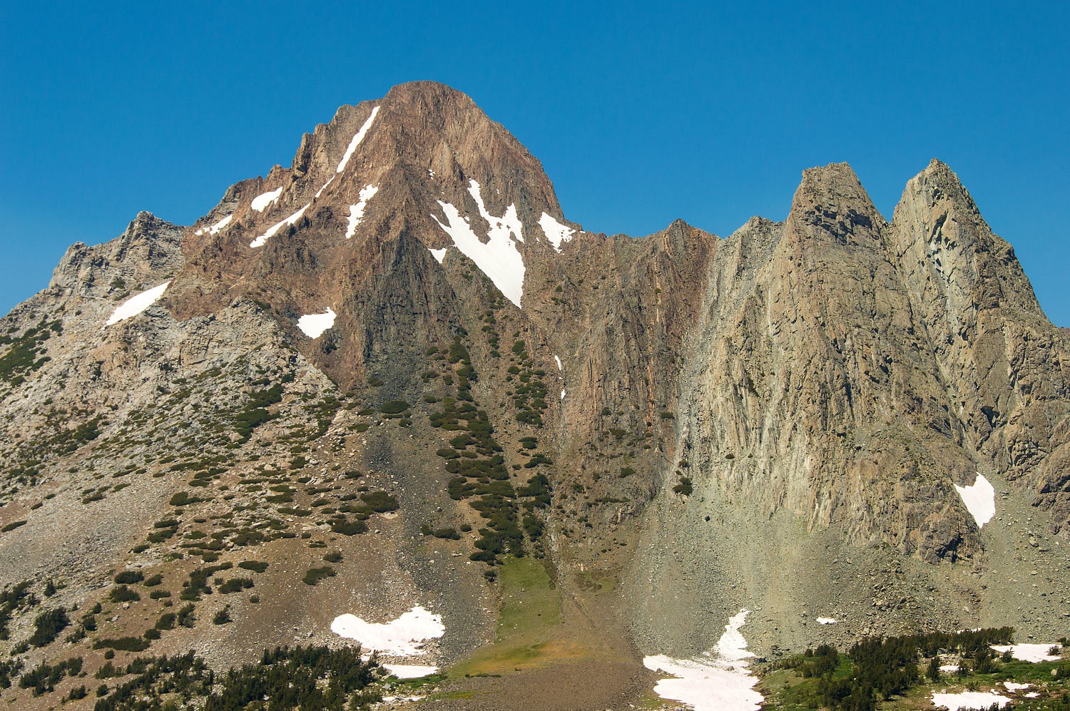
Virginia
Peak is a remnant hunk of older metamorphic rock surrounded by the younger,
classic Sierra Nevada granite batholith; a classic peak.
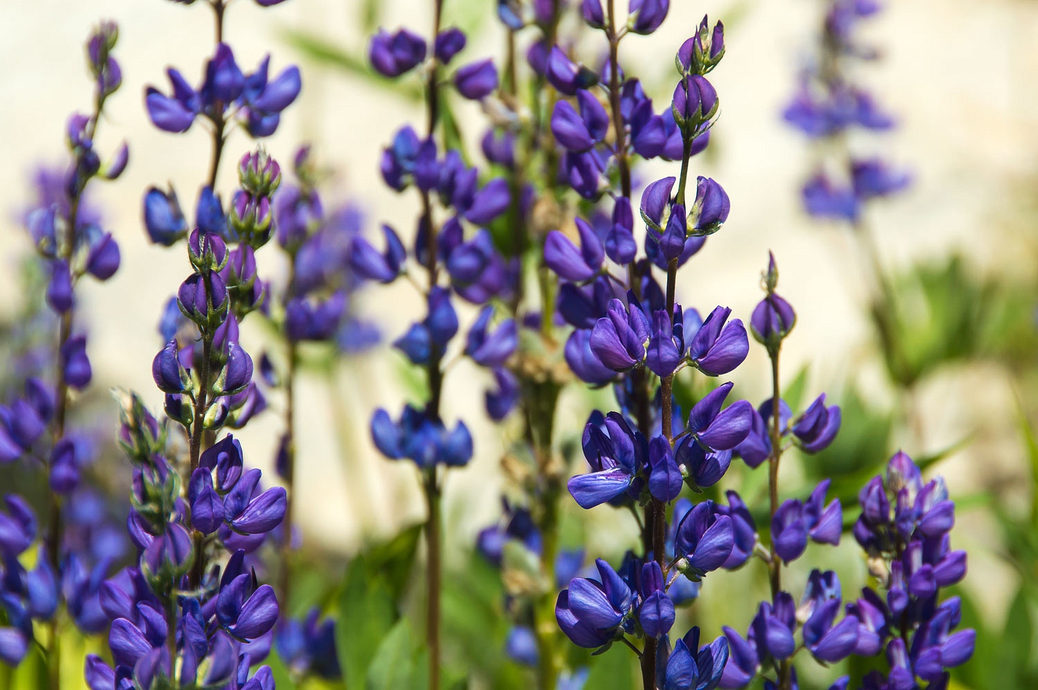
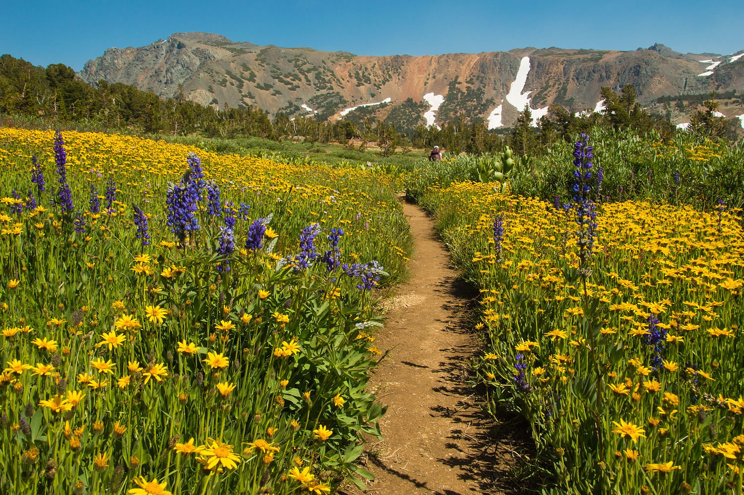
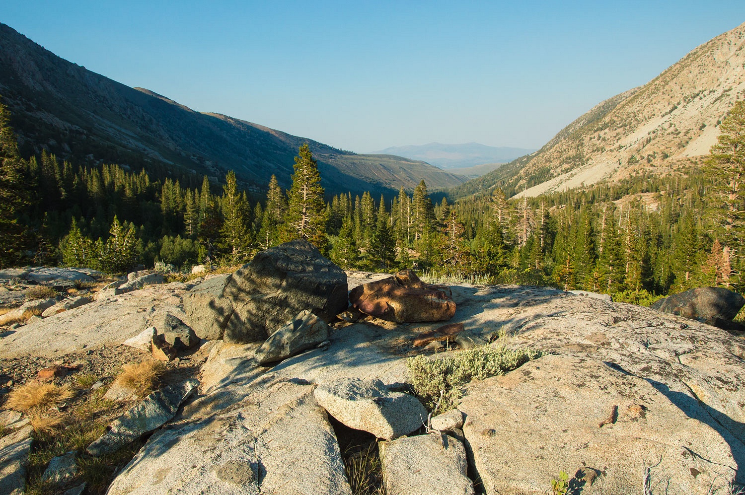
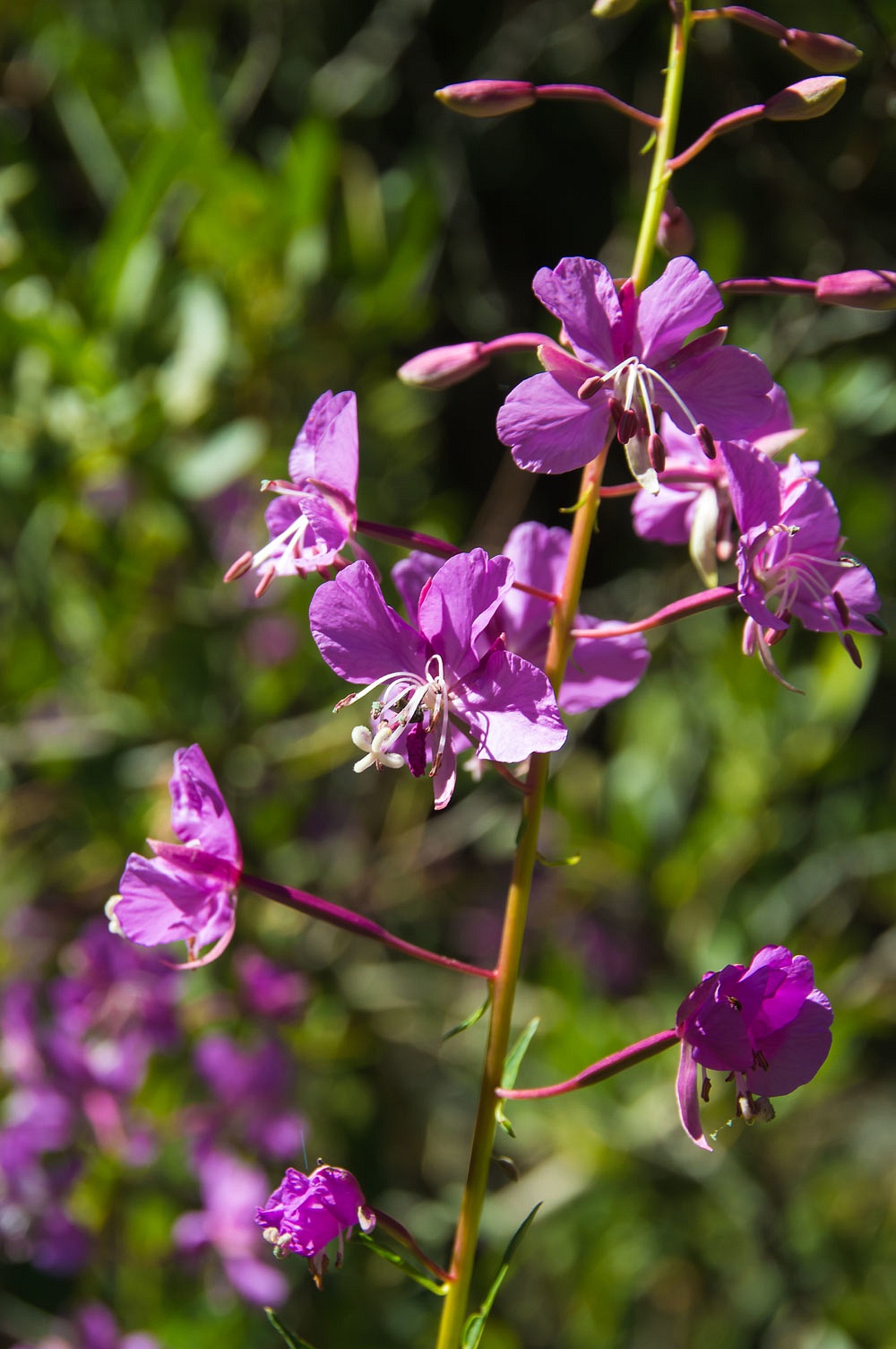
We reached
the meadows below and their blooms of deep purple lupine.
Our drop in
elevation was far from over as we followed the faint trail over a mile down
Return Creek. We took off our boots and waded barefoot at one creek crossing,
the safest option.
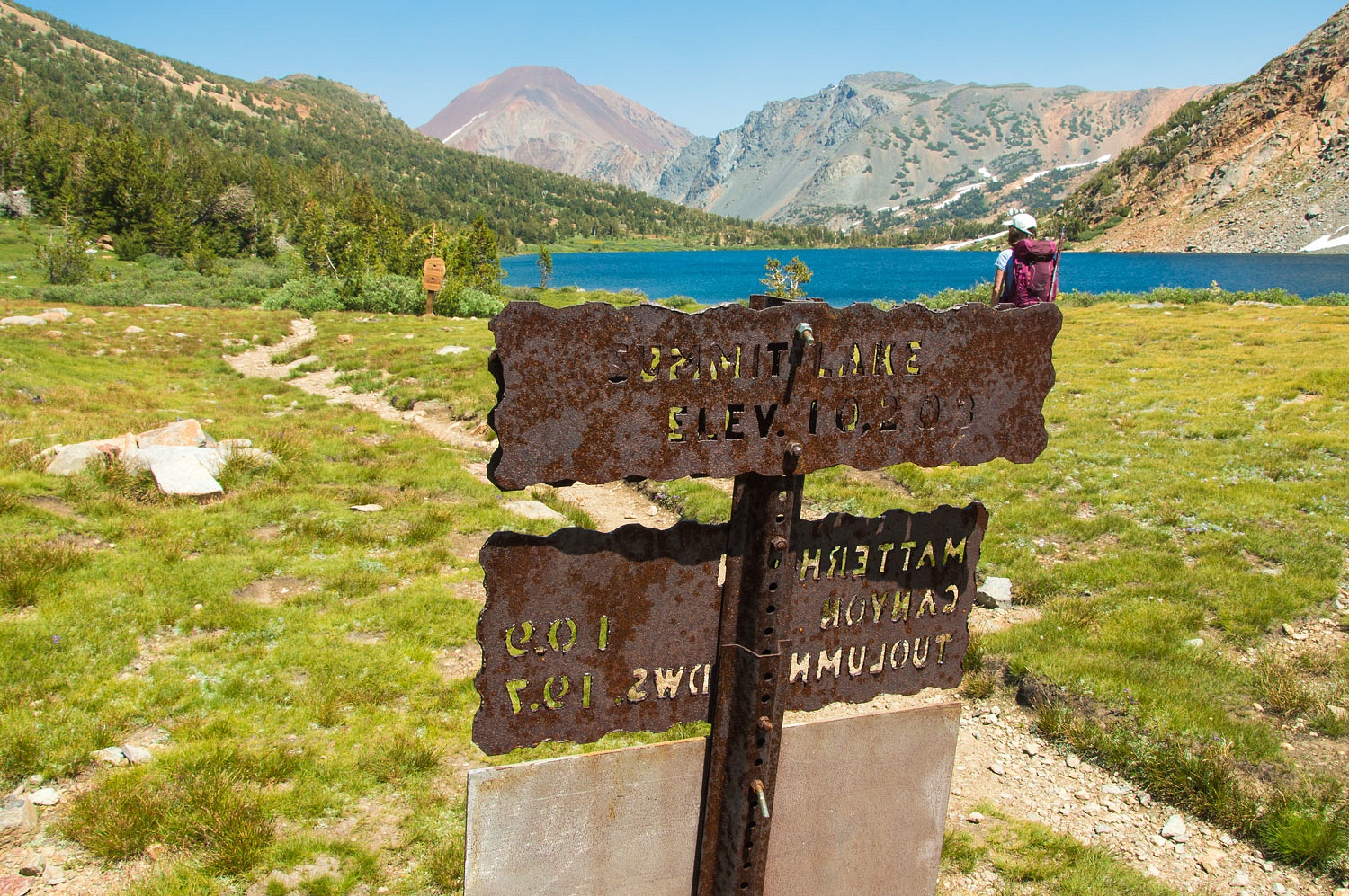
We
intersected the main trail with its classic signage, built to last.
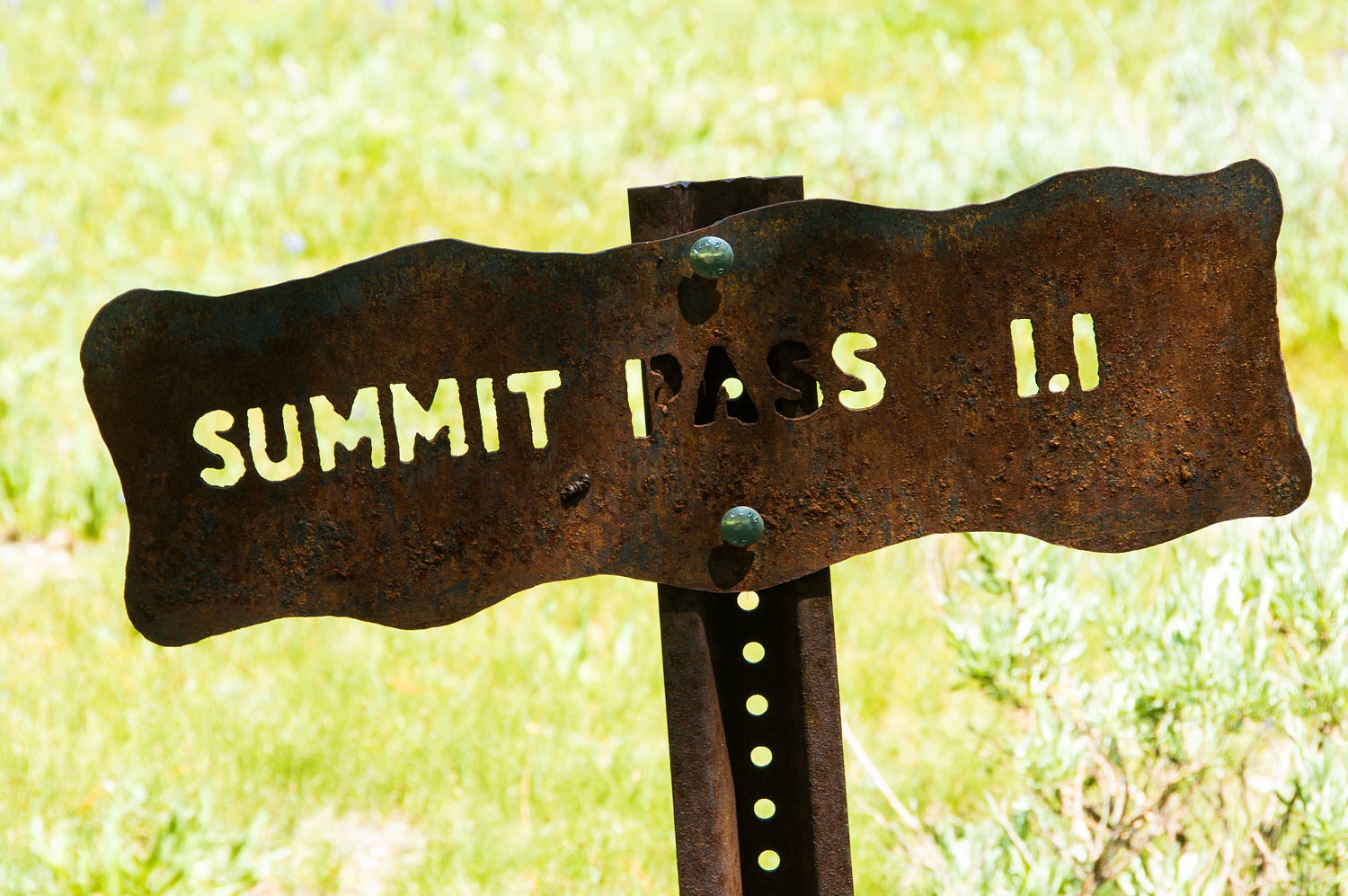
The 1200 feet vertical climb up to Summit Lake was along a well laid out
trail with a comfortable grade.
We exited
the National Park and reentered Hoover Wilderness.
We took a break, ate, drank, and refilled our water bottles. A couple came down
from their backpacking camp - the first people we had seen - to the nearby lake
shore and went for a quick skinny dip. They did not stay in very long but both
committed to the challenge by diving in - the only way to do it. The woman took
a bit of time to ratchet up her courage after hearing the stunned gasp from her
man, but in she went.
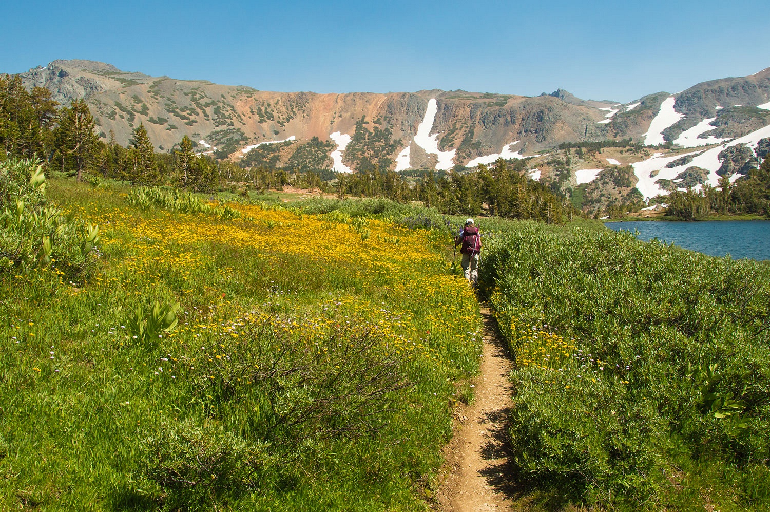
We began our long drop back down the Green Creek drainage and past the string of alpine lakes along the way.
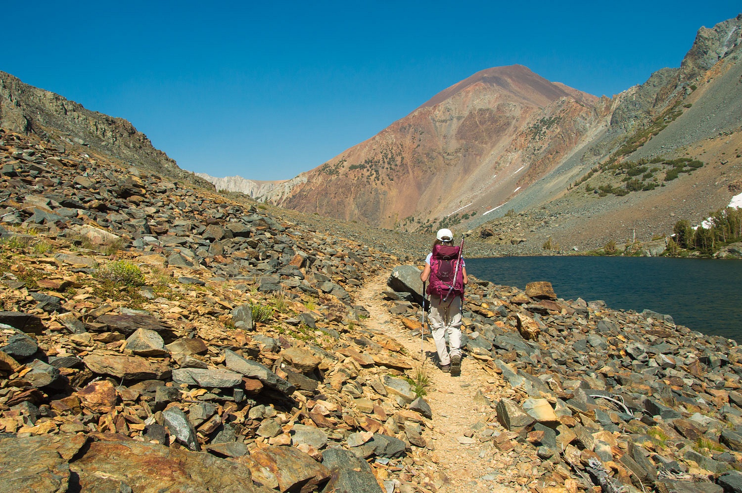
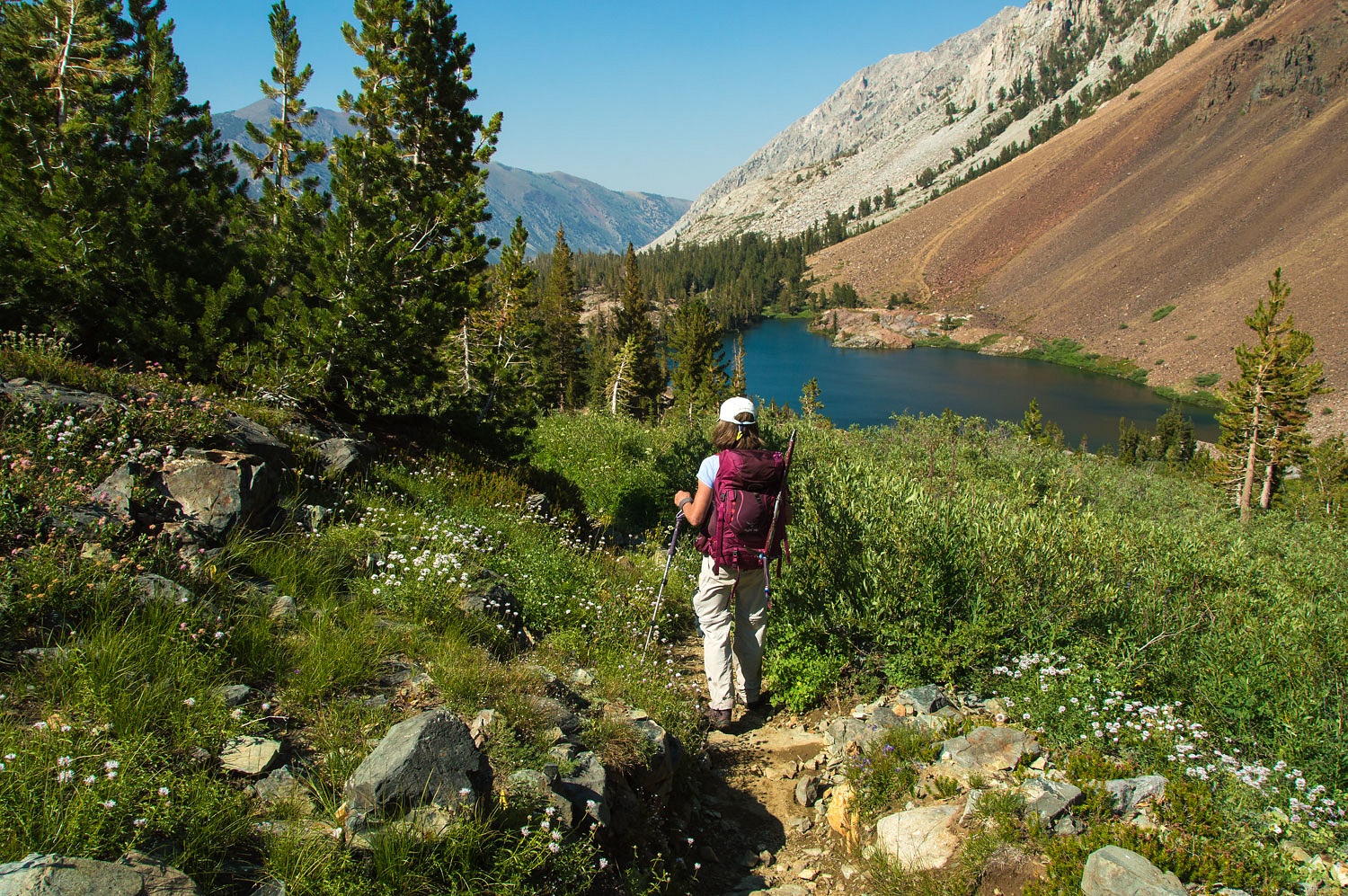
Below Green Lake we intersected back with our route up in the morning and all that remained was the final hike down Green Creek Valley.
Note: the eastern shore of Green Lake was filled with Saturday night backpackers. This was the area most groups dropped anchor.
The mosquitoes welcomed us back to camp with a vengeance. It was still. Whether it was due to our tiredness or the pesky winged creatures, we did not stay up to watch for the Perseid Meteor Shower.
The morning temperature, because of the stillness, was 39°. We enjoyed a quiet morning up on our rocky knob.
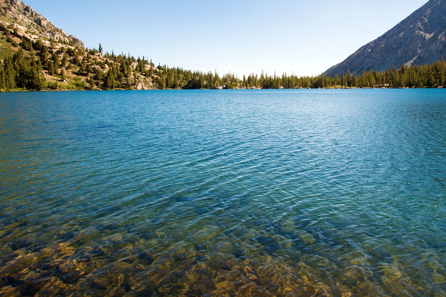
Sunday was a day to take the fly rod and ghost net up to Green Lake. Both of us felt as good as new. Surrounded by the wonderful vistas, our eyes still got pulled to the little wonders at our feet. Ranger Buttons are one of the Lady's favorites.
The eastern end of Green Lake was still absent of visitors. We spent the day there.
It was chilly and the wind kept us from our skinny dip. We stayed until late afternoon and then wandered the four miles or so back to camp. The wind built throughout the day. We climbed back up to the top of the rock for dinner and worked on ways of keeping dinner from blowing away.
A long walk down the road in the evening light was a great way to end our day. Back on the rock before turning in, we watched smoke stream over the crest.
We slept with all the windows open. We woke around 3 am with a choking smell of smoke. It had settled thick into Green Creek. The Lady went out for a bathroom break in the predawn and reported she could not see across the creek.
A breeze came up, still down slope, and cleared a bit of the smoke out as we watched with our morning coffee.
It was Monday morning, the first day back to school for all of the Lady's teaching buddies. Today the Lady felt officially retired.
We decided to celebrate with a store bought breakfast at Nicely's down in Lee Vining. Driving out from Green Creek, Bridgeport Valley was completely obscured with smoke. Mono Lake was the same. We checked in with a buddy at home to see if another fire had started. No, this was still from the Empire Fire in Yosemite.
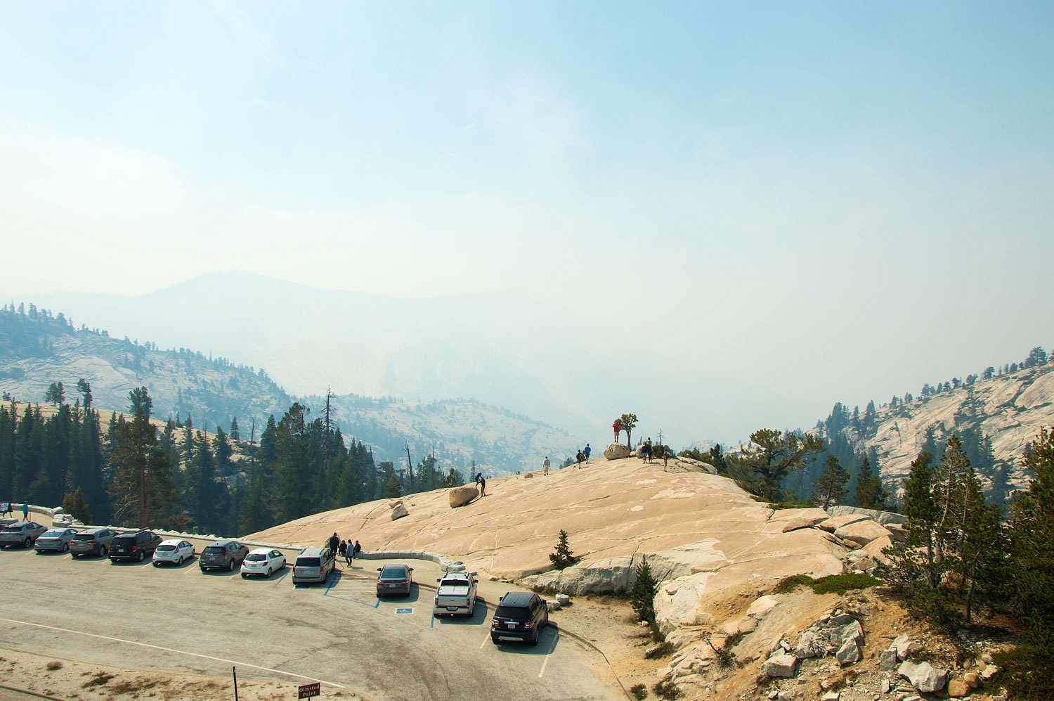
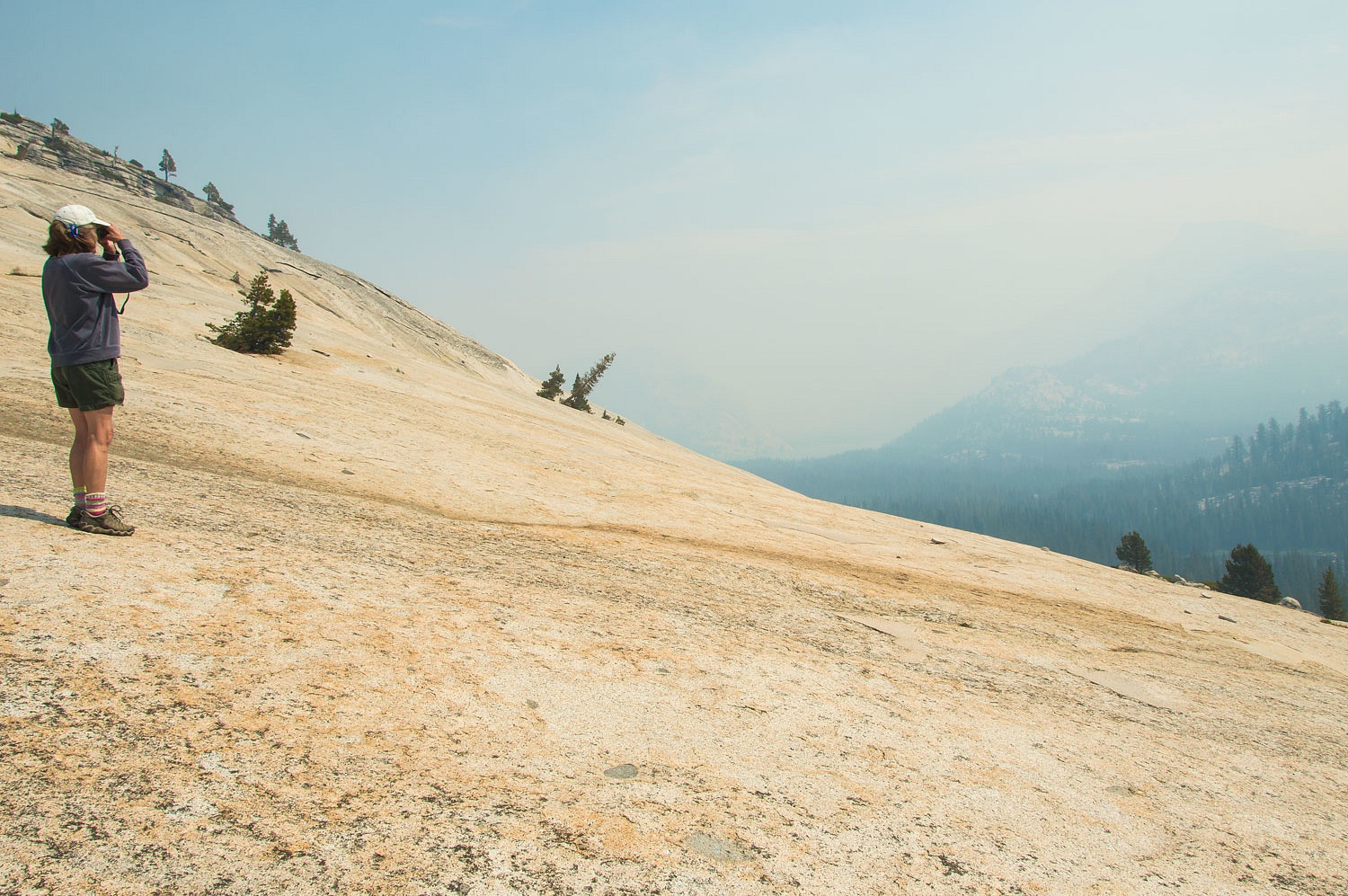
We drove as far as Olmsted Point with its glorious view of Clouds Rest and Half Dome.
We are not complaining about the smoke. Fire is a natural part of the Sierra Nevada ecosystem. We would much rather see lots of small fires clearing out the understory and fuel load then the catastrophic huge fires that are becoming the new normal.
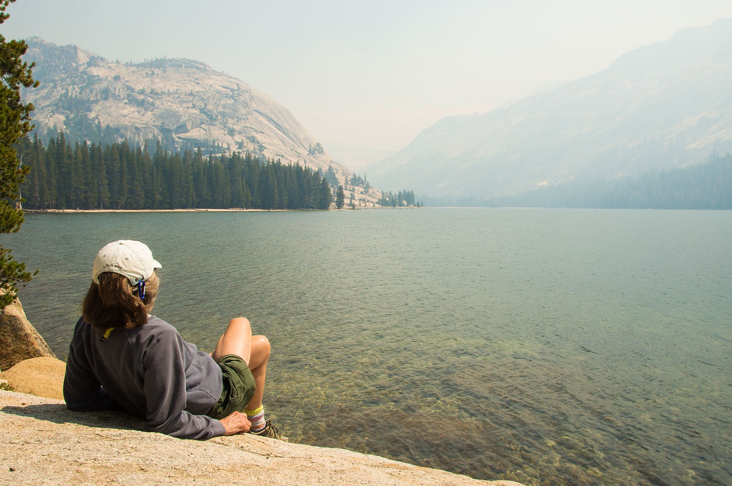
We turned around and made a stop at Tenaya Lake.
The Lady said, "I don't miss school one bit!"
The drive home was quiet and uneventful after leaving the Park. One of us still works.
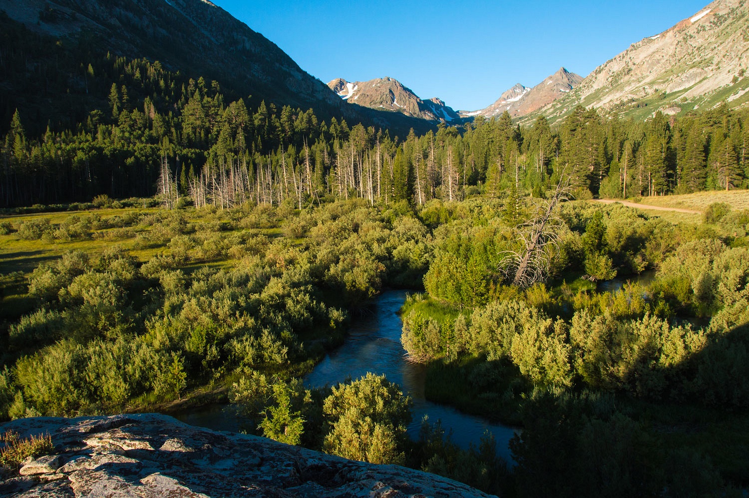
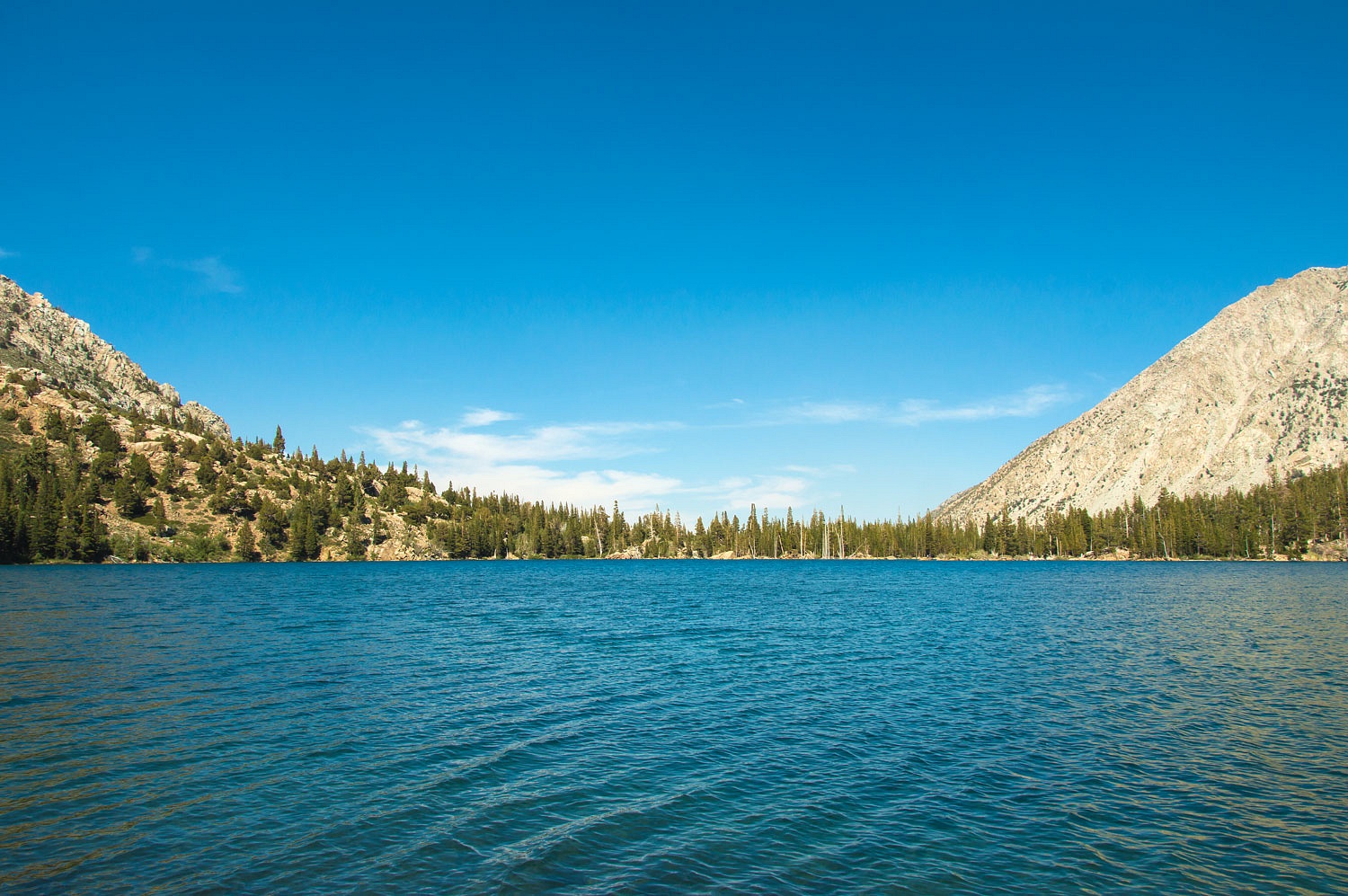
Summit Lake
sits right in the saddle although it does drain down the Green Creek side. It
was in its full springtime splendor.
We began our long drop back down the Green Creek drainage and past the string of alpine lakes along the way.
Below Green Lake we intersected back with our route up in the morning and all that remained was the final hike down Green Creek Valley.
Note: the eastern shore of Green Lake was filled with Saturday night backpackers. This was the area most groups dropped anchor.
The mosquitoes welcomed us back to camp with a vengeance. It was still. Whether it was due to our tiredness or the pesky winged creatures, we did not stay up to watch for the Perseid Meteor Shower.
The morning temperature, because of the stillness, was 39°. We enjoyed a quiet morning up on our rocky knob.
Sunday was a day to take the fly rod and ghost net up to Green Lake. Both of us felt as good as new. Surrounded by the wonderful vistas, our eyes still got pulled to the little wonders at our feet. Ranger Buttons are one of the Lady's favorites.
The eastern end of Green Lake was still absent of visitors. We spent the day there.
It was chilly and the wind kept us from our skinny dip. We stayed until late afternoon and then wandered the four miles or so back to camp. The wind built throughout the day. We climbed back up to the top of the rock for dinner and worked on ways of keeping dinner from blowing away.
A long walk down the road in the evening light was a great way to end our day. Back on the rock before turning in, we watched smoke stream over the crest.
We slept with all the windows open. We woke around 3 am with a choking smell of smoke. It had settled thick into Green Creek. The Lady went out for a bathroom break in the predawn and reported she could not see across the creek.
A breeze came up, still down slope, and cleared a bit of the smoke out as we watched with our morning coffee.
It was Monday morning, the first day back to school for all of the Lady's teaching buddies. Today the Lady felt officially retired.
We decided to celebrate with a store bought breakfast at Nicely's down in Lee Vining. Driving out from Green Creek, Bridgeport Valley was completely obscured with smoke. Mono Lake was the same. We checked in with a buddy at home to see if another fire had started. No, this was still from the Empire Fire in Yosemite.
We thought,
it being a Monday, we'd drive through Yosemite National Park. The line of
vehicles at the east entrance at Tioga Pass was backed up a quarter mile or so.
We could hardly fathom what this must be like on weekends. A critter jam
stopped all traffic at Tuolumne Meadows. Two ranger vehicles with red and blues
flashing, out of their trucks and staying between the crowd and the cinnamon
sow with two cubs, repeated over and over, "Take your photo and move on,
now! Thank you for visiting Yosemite."
This
reminded me of the unofficial mission statement of the National Park Service -
"To
save the Park from the people, the people from the Park, and the people from
each other."
A woman was
along the Tuolumne River with her easel and paints. She must have been painting
the landscape from memory. She was a trooper with the sky line obscured by smoke.
We drove as far as Olmsted Point with its glorious view of Clouds Rest and Half Dome.
We are not complaining about the smoke. Fire is a natural part of the Sierra Nevada ecosystem. We would much rather see lots of small fires clearing out the understory and fuel load then the catastrophic huge fires that are becoming the new normal.
We turned around and made a stop at Tenaya Lake.
The Lady said, "I don't miss school one bit!"
The drive home was quiet and uneventful after leaving the Park. One of us still works.
Another wonderful trip with the Ski3Pins. Except for the smoke, what a fantastic place! Thanks for sharing!!!
ReplyDeleteAnother amazing adventure. Happy retirement indeed. I wanna be like you when I grow up. What am I waiting for? :-) Thank you for sharing. Awesome!
ReplyDeleteThanks Monte.Wonderful trip.
ReplyDeleteFrank
Great storyline, and exploration as advertised!
ReplyDeleteMy son and I have fly fished Par Value lakes back when he was young.
Thanks for the memories and congrats to the Lady on her official retirement.
That was some hike to Virginia Pass -- 20 miles and thousands of feet in elevation gain and loss, all in one day. Wow! Aren't those microspikes great? Easy on, easy off. Like 4WD for your feet.
ReplyDelete