
please remember you can click on a photo to see a larger version
Our current
love affair is with state route 120 on its run east from Tioga Pass to its terminus
at the junction with US Highway 6 at Benton Station. Its climb to the sky up
Lee Vining Canyon to Yosemite National Park make it one of the most spectacular
mountain highways. And, because of this it can be notoriously crowded. The eastern
section between 395 and Benton is a relatively undiscovered paradise. Each
exploration we have made into this area has brought us back, drawn us in deeper, captured our
attention, and has amazed us with its beauty and wonders.
Kuna Glacier
"That was one big ice cube!" The Lady was still in awe as we lay in our
bunk Saturday evening talking about the day's adventure after tackling one of
our toughest hikes. This was Saturday of the long Labor Day Weekend and we had
decided to visit Yosemite National Park. Were we crazy, showing up on a holiday
weekend? We knew chances were nil we would encounter another person
where we were headed. We needed long daylight and we needed late season where
remnant snow from last winter would be minimal. Labor Day Weekend fit our needs.
We figured all
campgrounds would be full and the roads busy. Our necessary early start
Saturday morning would take care of the busy road issue and we knew of one
sure thing dispersed camping spot we'd have all to ourselves.
We set up
camp Friday evening and then wandered and relaxed in one of the most beautiful
places on earth.
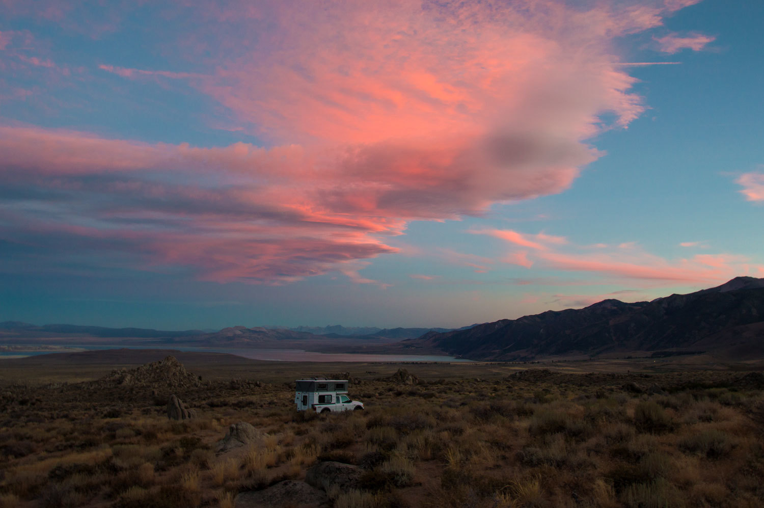
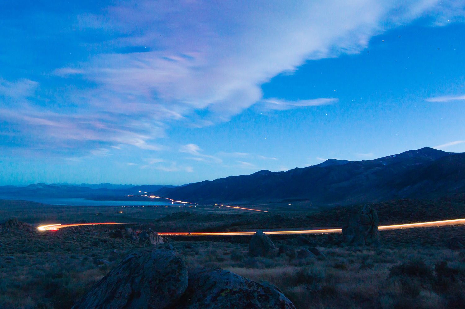
We walked to a high spot and took long exposures of the vehicles on highway
395 working their way along the western shore of Mono Lake.
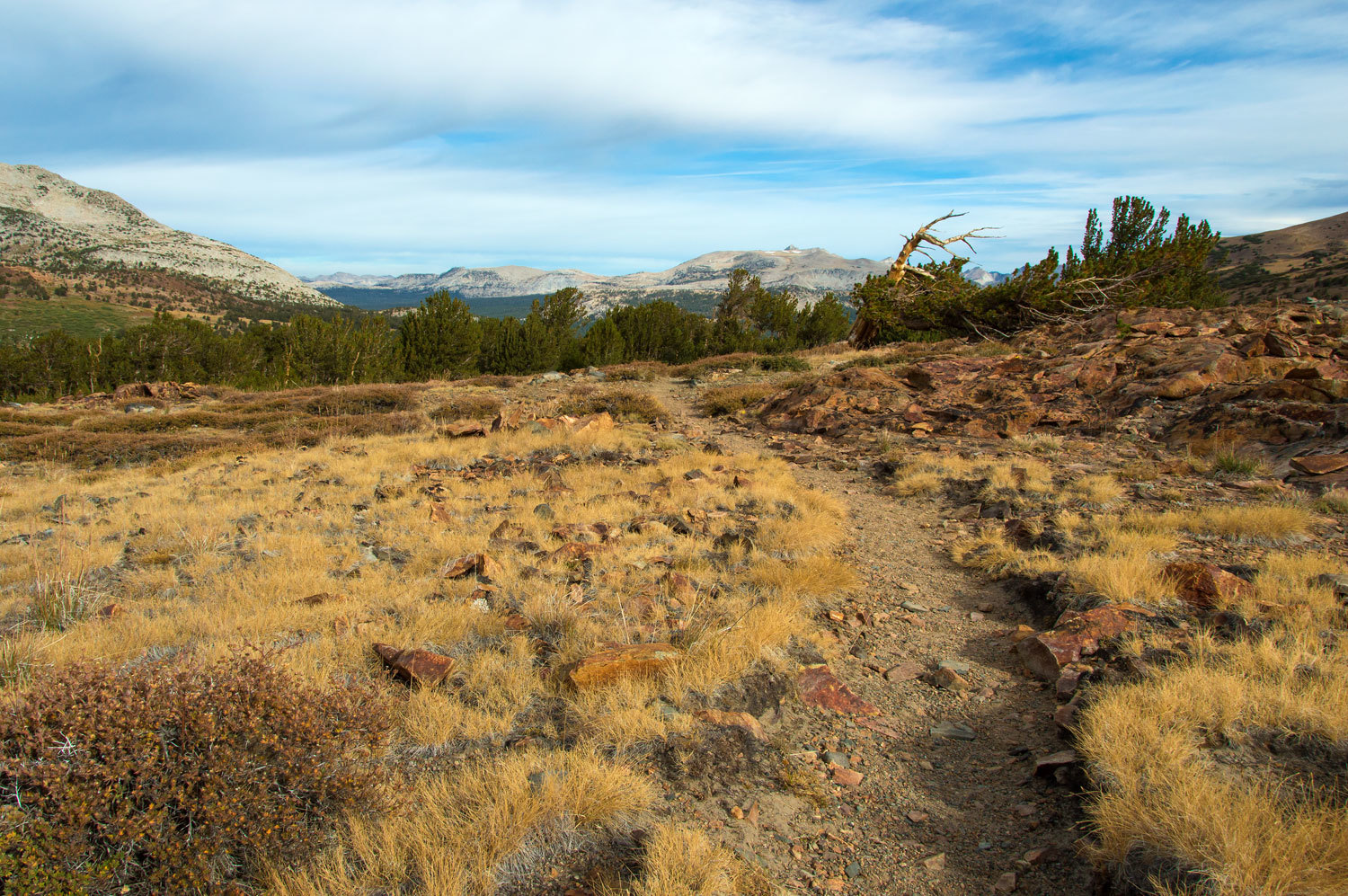
We pulled into the Mono Pass trailhead just inside Yosemite National Park at sunrise
Saturday morning. We doubled checked food and gear - that included ice axes and
crampons - donned our packs and hit the trail to Parker Pass, five and a half
miles out. It was a cold glorious morning. We both soon changed out our wool
fingerless gloves for fleece mittens. But the cold invigorated us as we
hiked through this world class scenery.
We moved at
a good pace but still paid attention to the small things at our feet. The Lady
loved seeing these beautiful Amanita muscaria mushrooms.

Reaching Mono
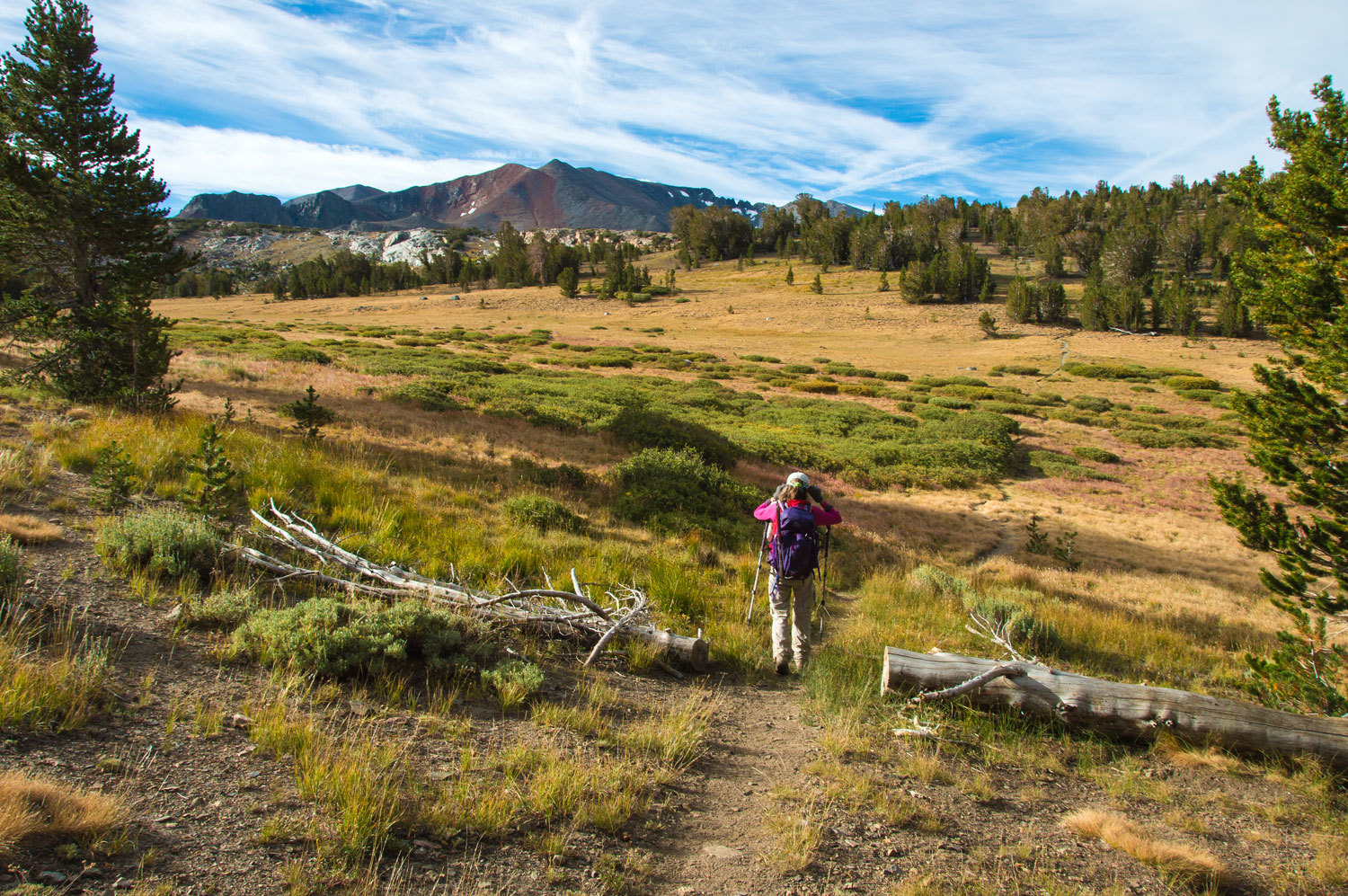
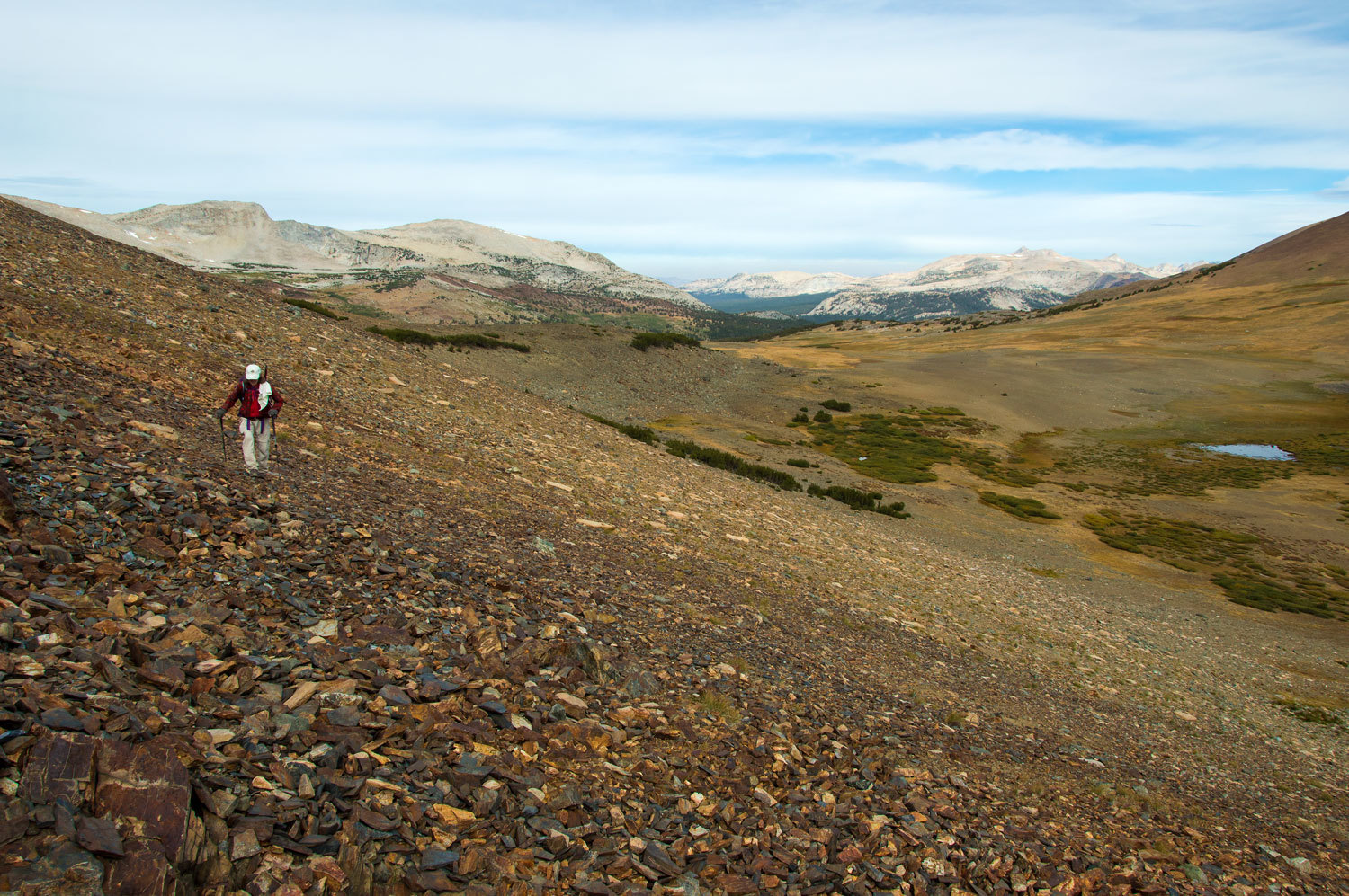
Pass we were nearing tree line and the vistas opened up around us.

We continued
south on the climb toward Parker Pass.
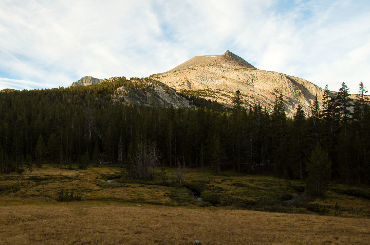
We stopped several times to look back westward at Yosemite's wonderful granite.
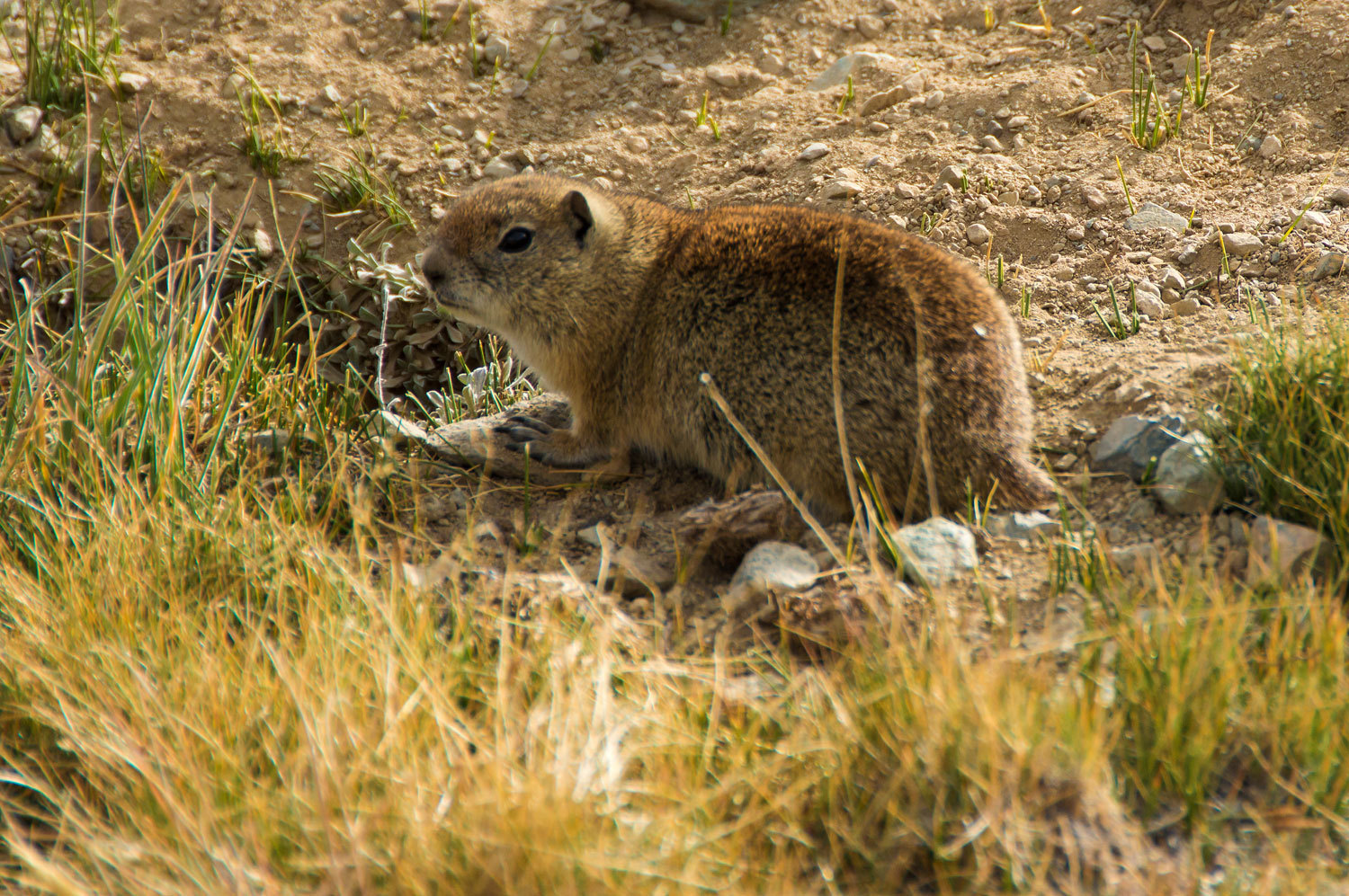
It is well into Fall in the high country. The grasses are yellow, scrubs leaves are brown, it is
dropping below freezing at night, and the Belding's Ground Squirrels have
packed on weight, ready for winter.
We reached
Parker Pass in two hours. The Lady got low to get out of the
wind and checked our maps. Our route forward was now cross country.
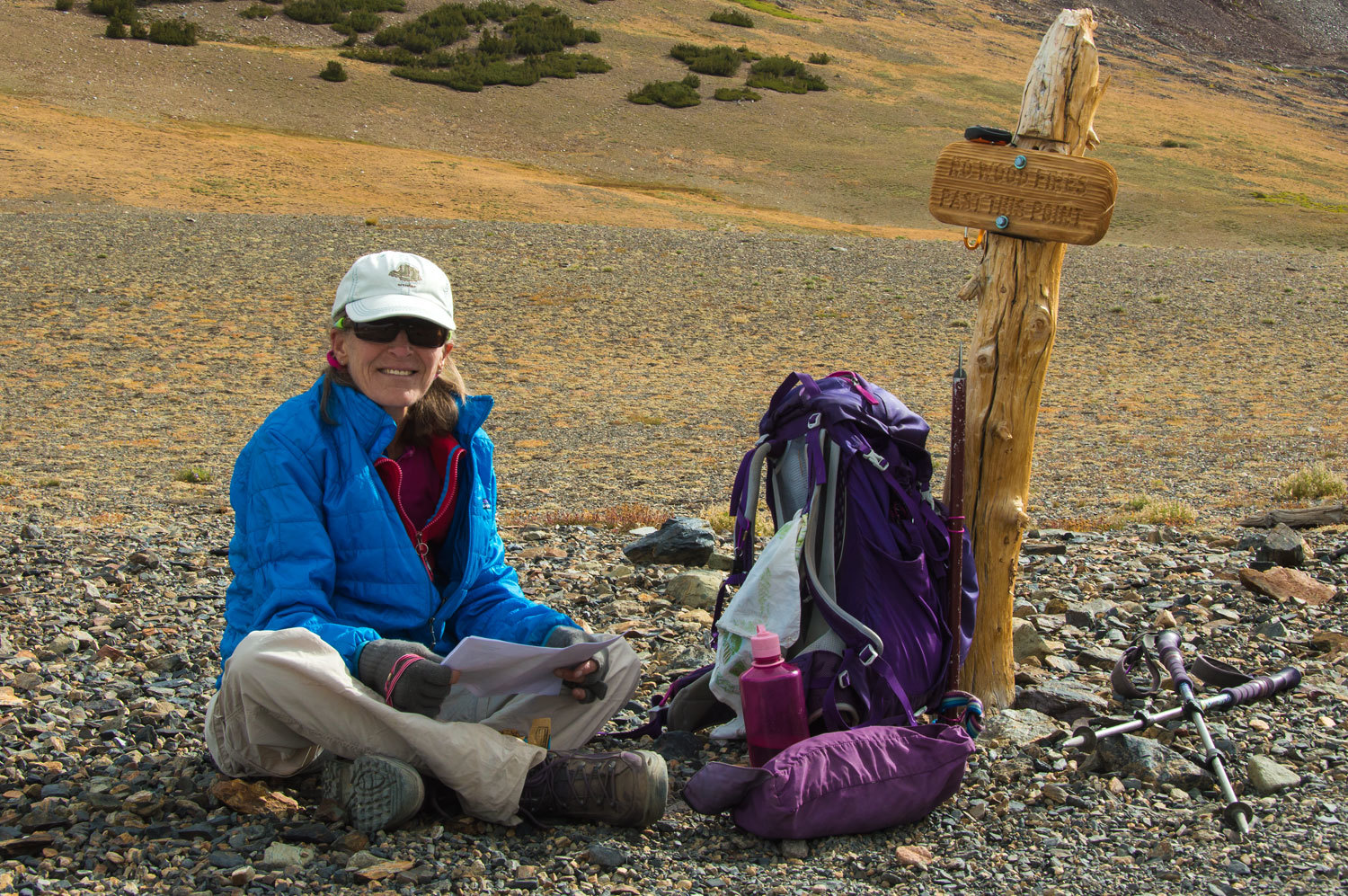
It made me
remember what my Dad told me many times as I was growing up, "Son, find
yourself a woman who loves USGS topographic maps and you will have a happy
life."
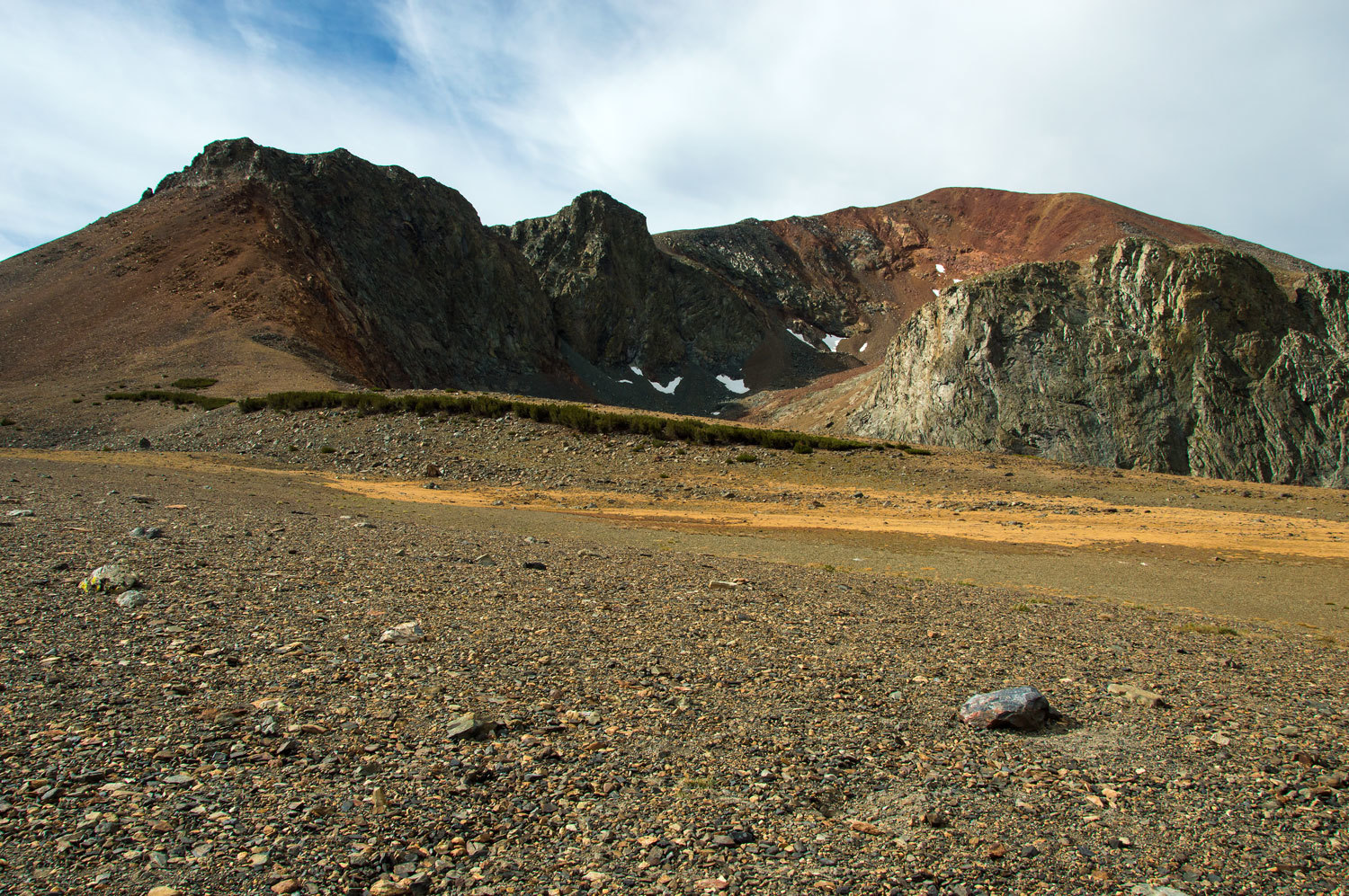
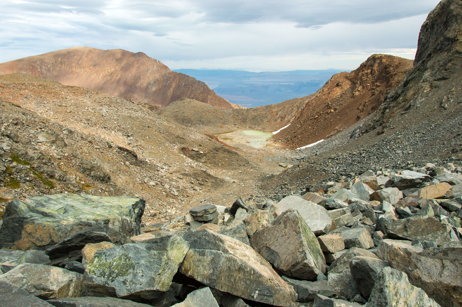
To our
south, carved out of the Kuna Crest, was the cirque that holds Parker Pass
Lake. Our objective was a much larger and higher cirque around the corner to
the southeast.
Here is a
video panorama of the view west from Parker Pass.
We made a
long climbing traverse to a bench on the ridgeline.
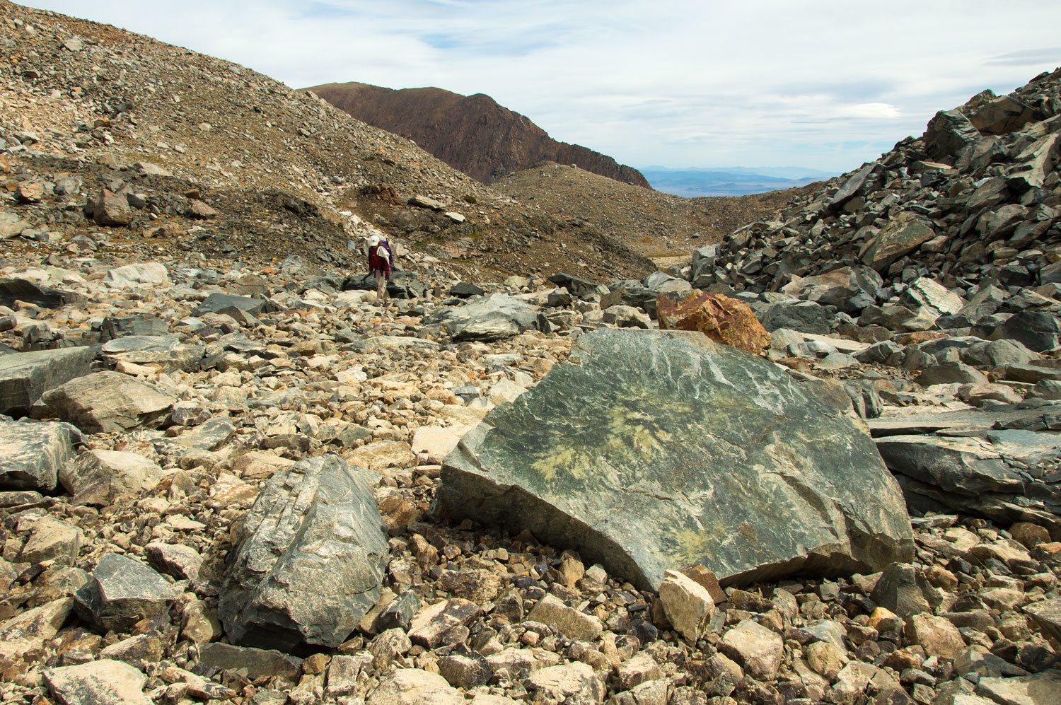
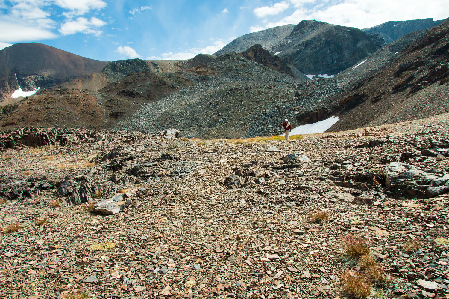
Our challenge
was now a mile and a half of climbing loose glacial till, a series of
recessional moraines left behind with Kuna Glacier's retreat.
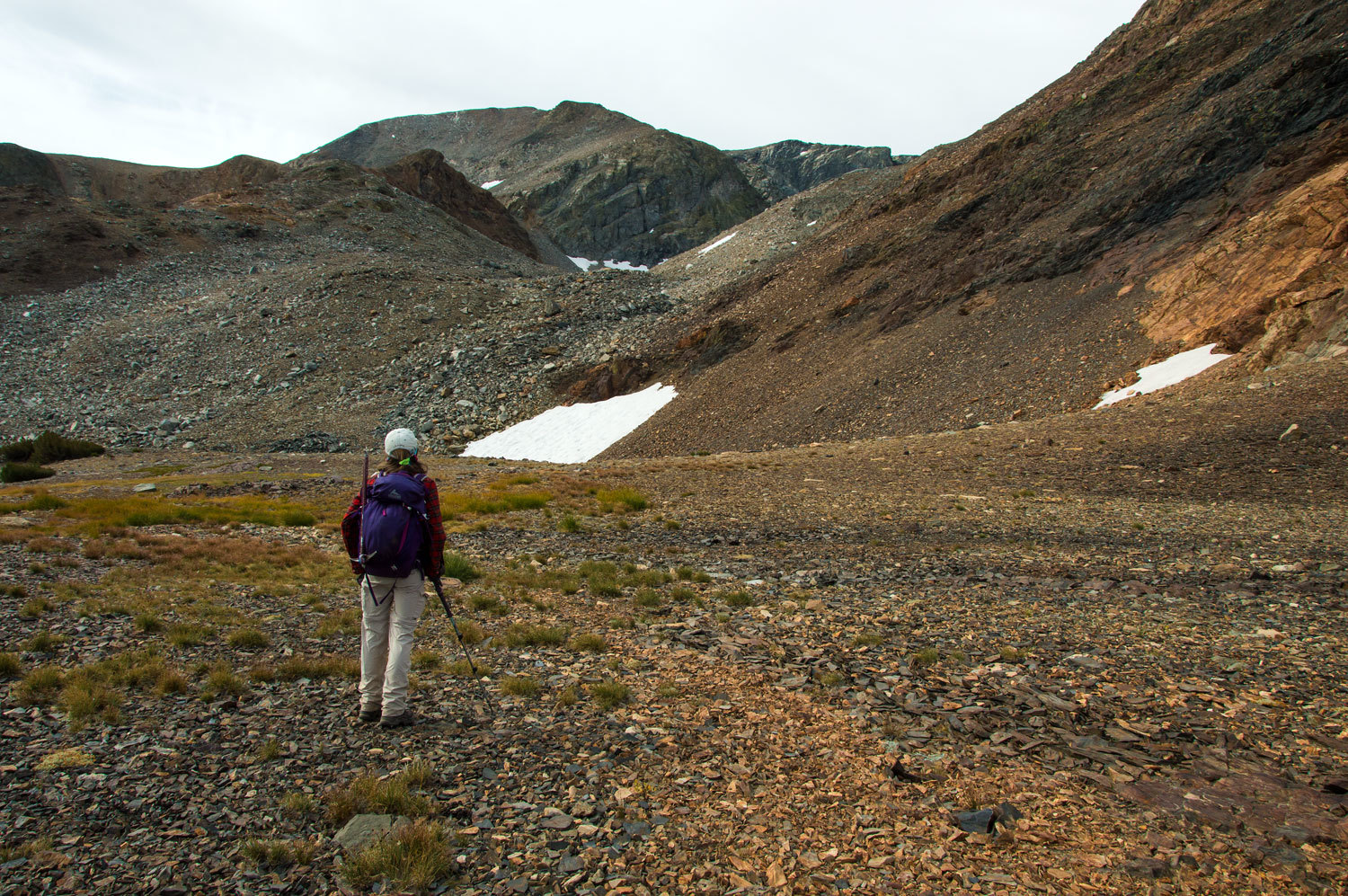
It seemed
never ending as we climbed higher and higher.
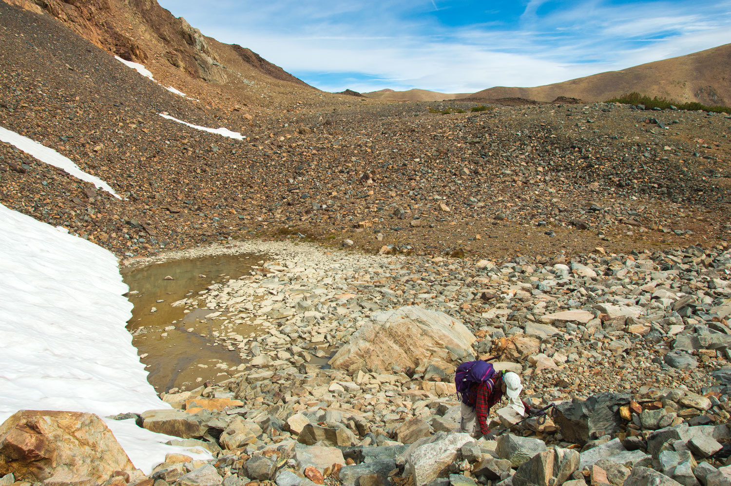
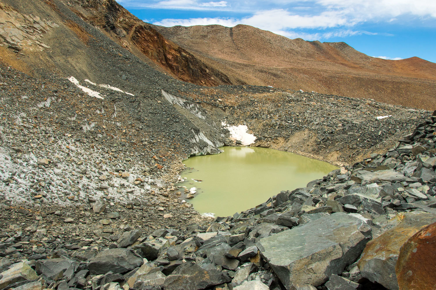
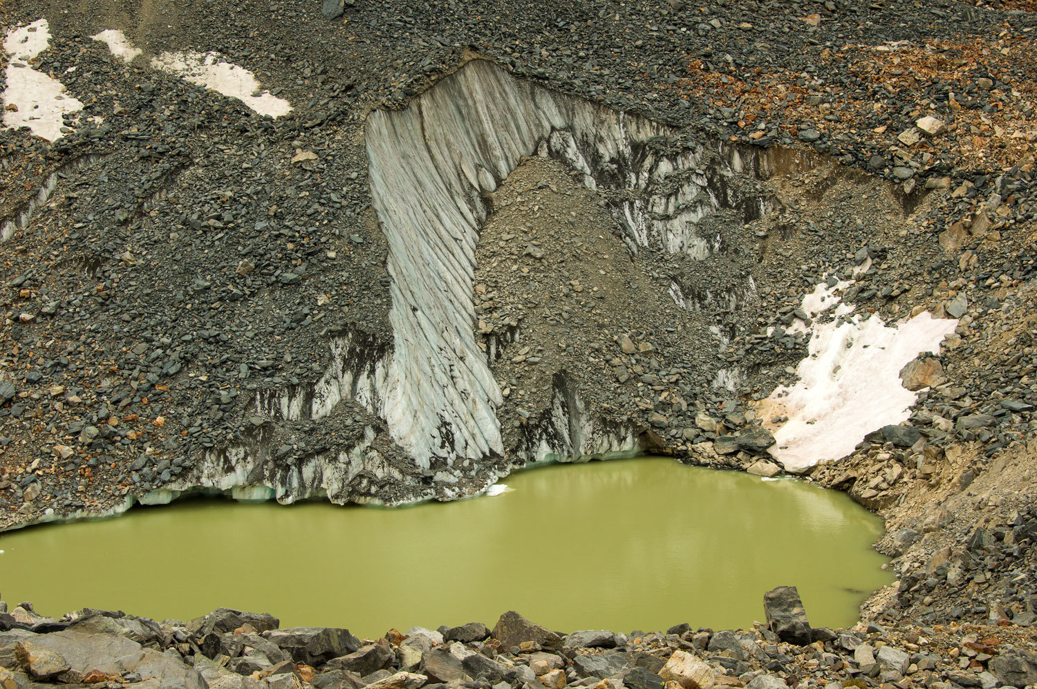
The streams
and tarns were colored with glacial flour.

Glacial till
is unsorted material of all sizes. In this area it was fairly settled but we still encountered loose material, booby traps waiting for one misstep.
Here is a
short video view of the easy part of the climb.
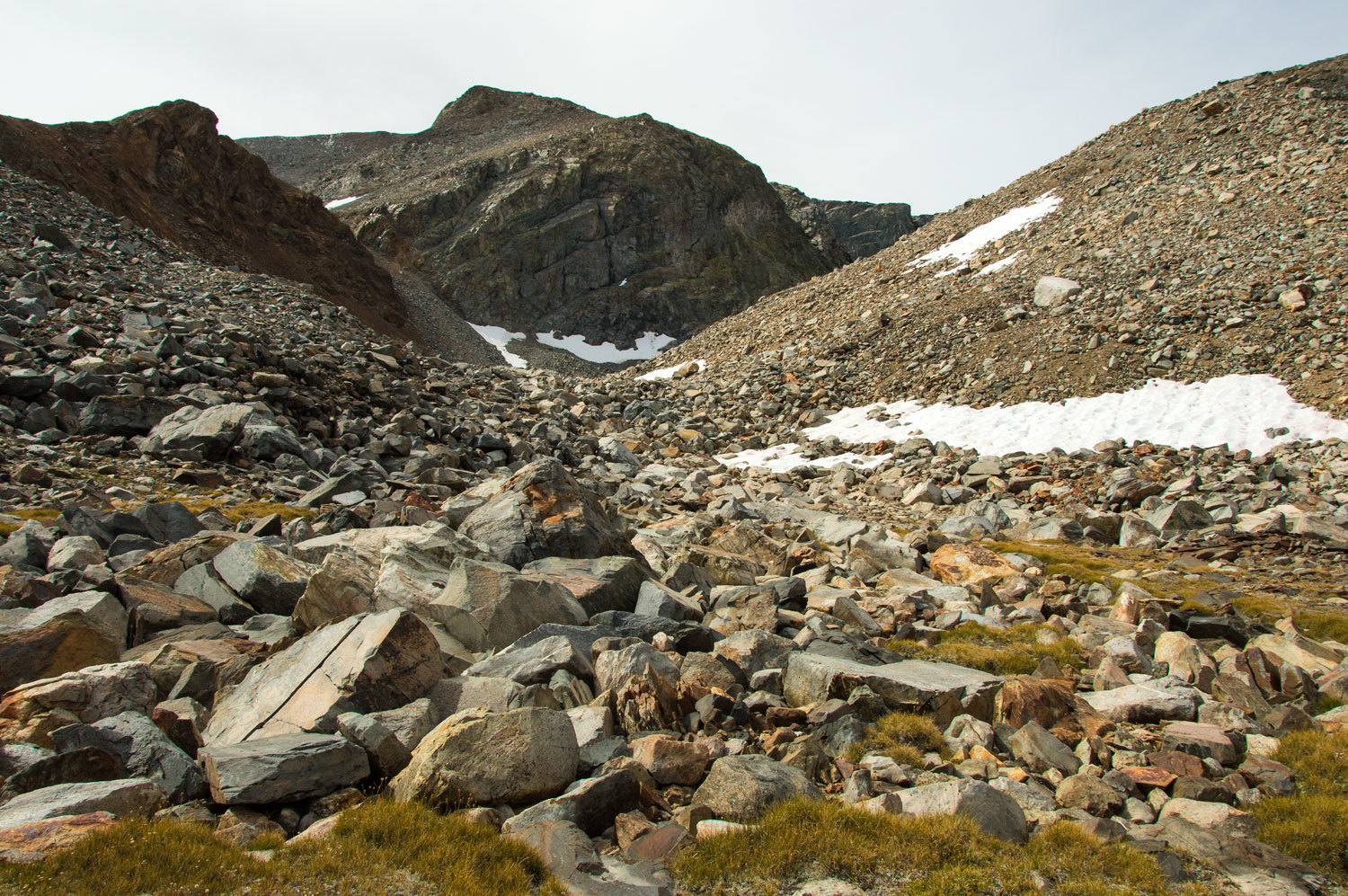
Just above
this point we climbed a steep snowfield. The moraine just below
Kuna Glacier was very unsettled, all of it was loose rock. It was best to stay
on top the huge piles. We were extremely careful on steep slopes to not be
below rocks, that if became dislodged, could kill us. As it was, rock was moving
everywhere. The scramble was a combination of walking a tightrope and negotiating
a mine field.
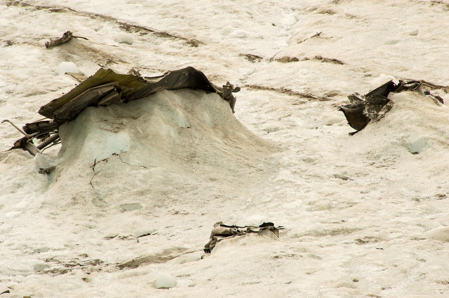
When we
crested the final moraine, Kuna Glacier - that "One big ice cube" -
finally came into view.

The far left
flank and, especially, the right flank were covered with rock fall
from above.

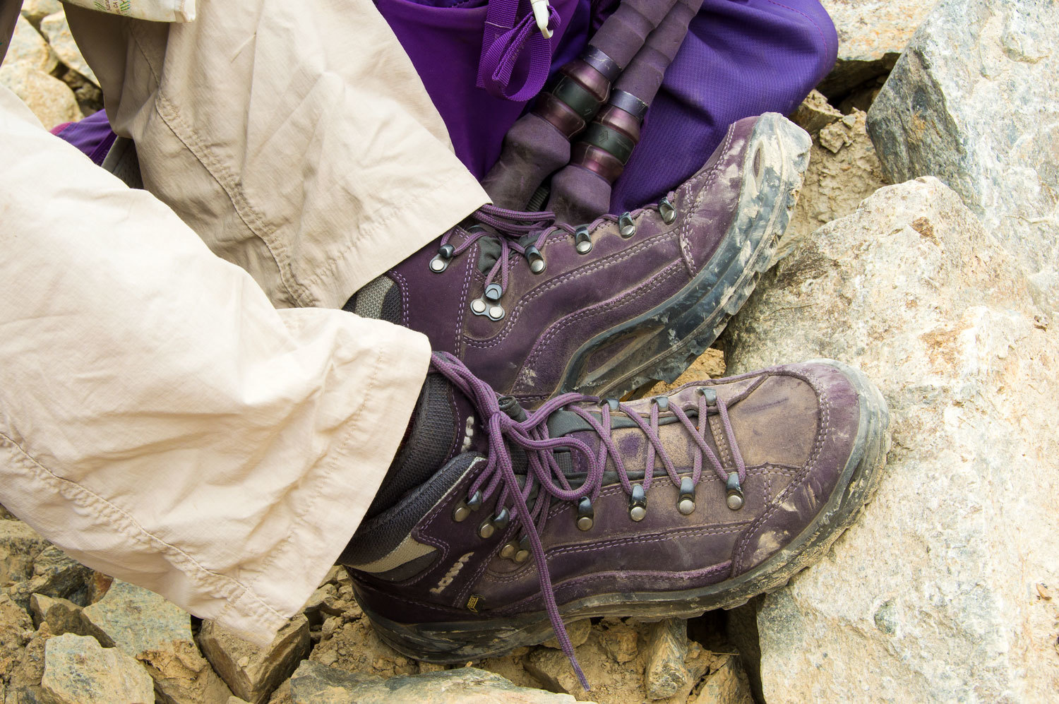
This hike
was a good break in for the Lady's new Lowa boots. She gets two years of use
out of a pair and yes, purple is her favorite color.
Even with
all the work it took to get here, we considered ourselves very lucky. It was so
cool (sorry for the pun) to visit a living glacier high in the Sierra Nevada!
This was a special and humbling experience. I found this website - Kuna Glacier - that has several historical photos that document the retreat or
recession of this glacier.
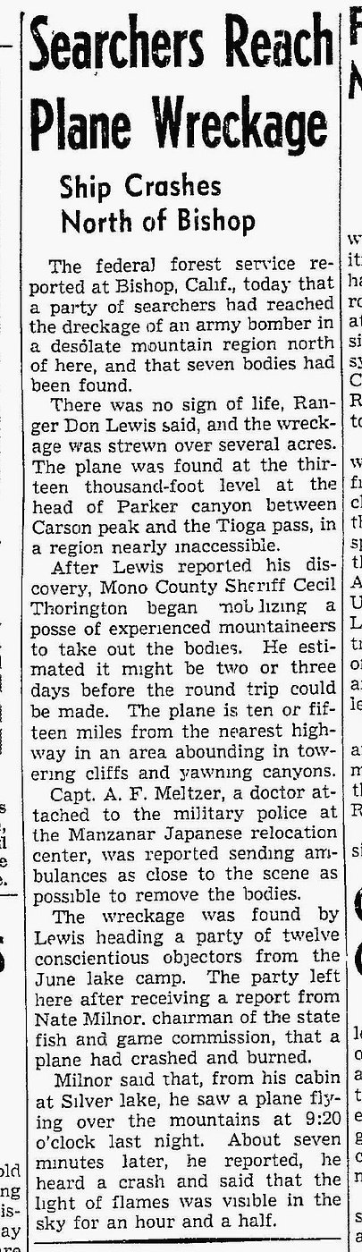
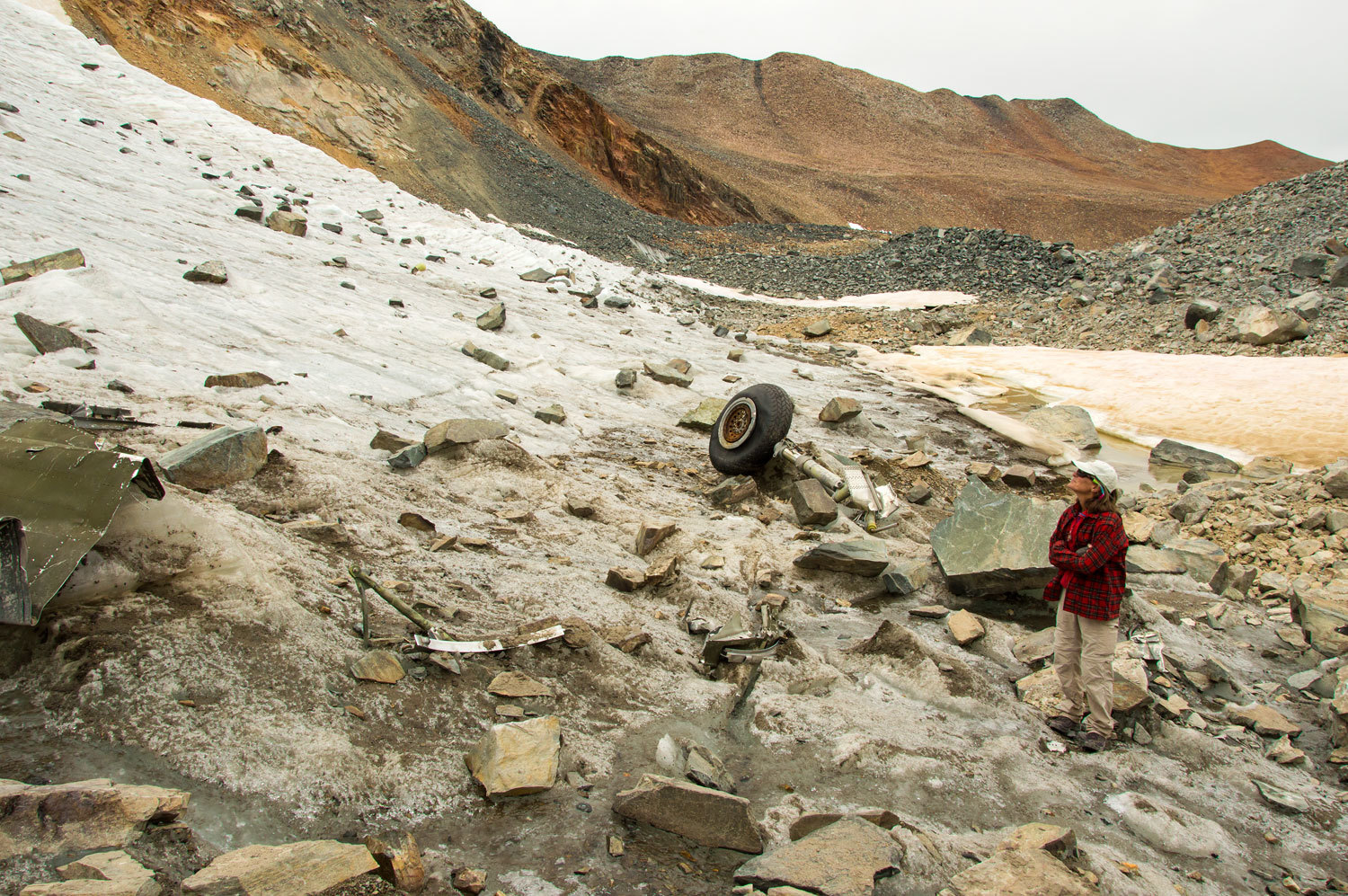
There is
tragic history here also, another reason for our journey up to this glacier. On
the summer solstice (June 21st) in 1943 a large World War Two bomber with seven
souls aboard slammed into the mountainside just above Kuna Glacier. These young men training for war along with
their B-24 bomber disappeared that day on a flight that was to take them from
the airfield outside Tonopah, Nevada to Salinas, California. Their fate was confirmed when a cabin owner At Silver Lake reported to the Forest Service he had seen a large plane fly over at 9:20 pm and then heard a crash. The USFS Ranger led a team up and discovered the wreckage.
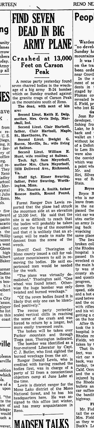
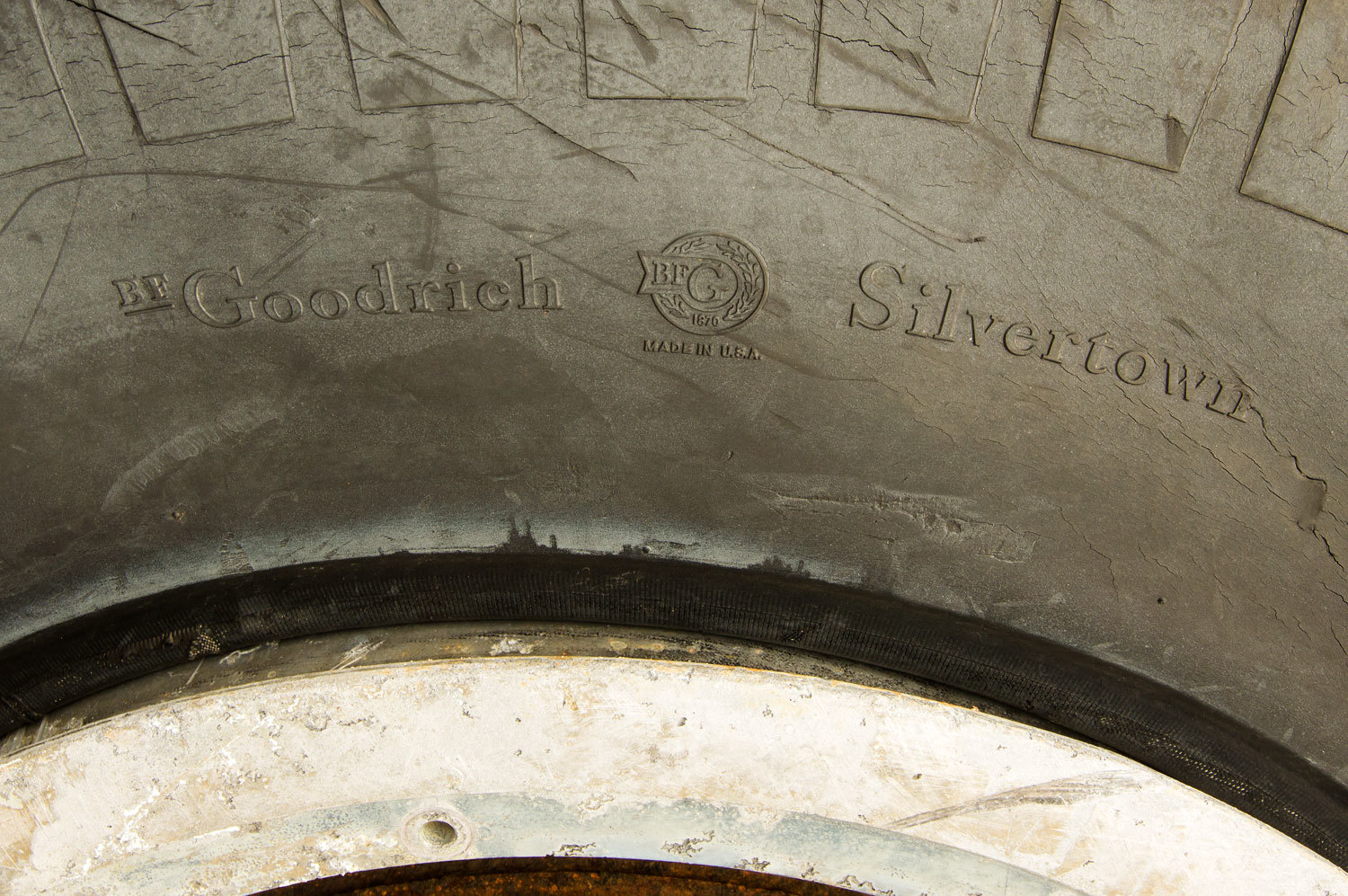
Hikers climbing to Kuna Peak from Koip Peak encounter pieces of wreckage - especially the propellers - on the steep slope below the saddle between the two peaks. When the plane ripped apart on impact, much of the wreckage fell onto the glacier below. With our warming climate and retreating glaciers - and then add on to that our current five years of drought with pitiful snowfall - this World War Two wreckage is now emerging from the glacial ice. I have watched this unfold on Google Earth over the last several years. Planning for this trip of ours started when an obvious piece of wing became visible on updated imagery.
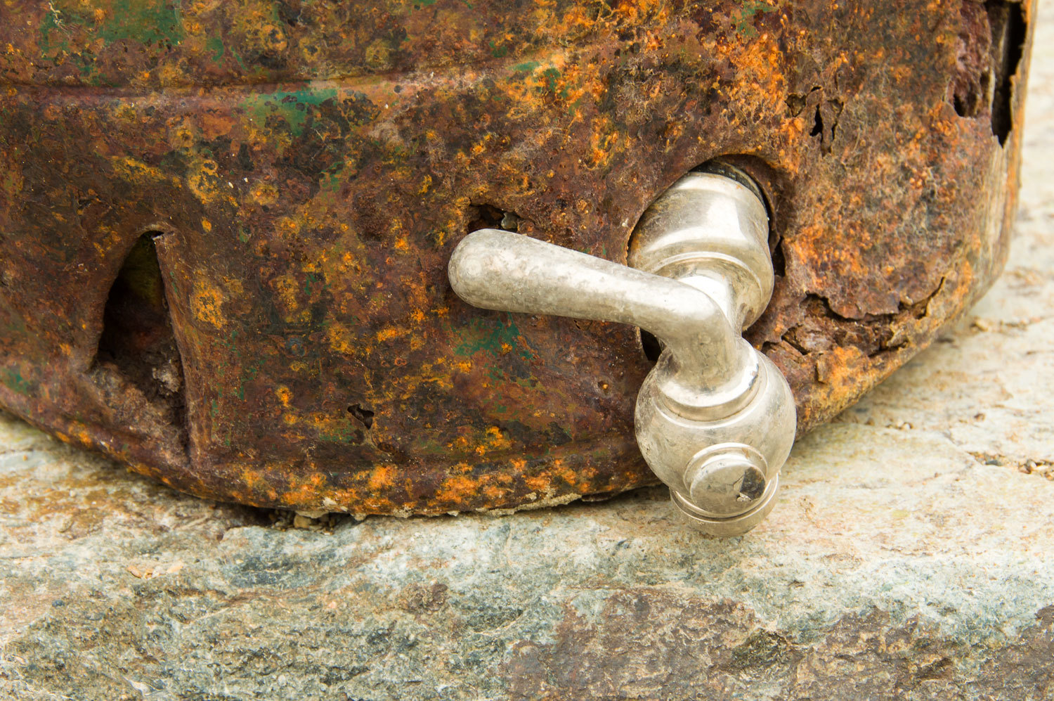
All four of
the 14 cylinder radial engines rest within feet of one another.

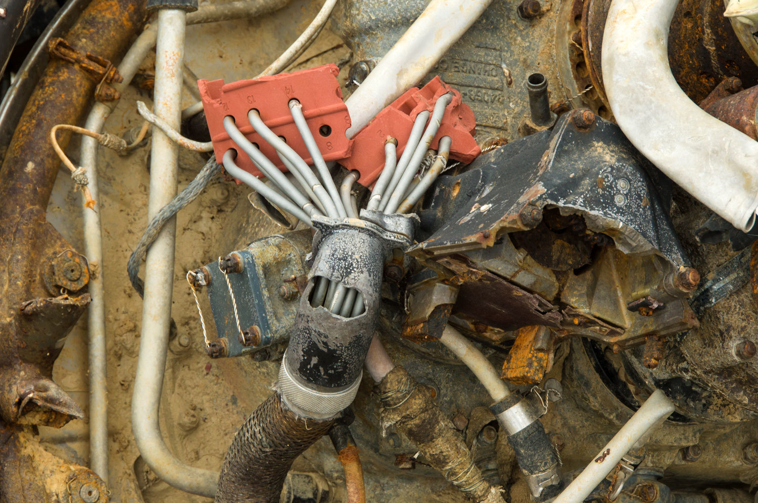
We shared a deep feeling that this is
hallowed ground where seven young men died for their country and never returned
to their family and friends. It is hard to describe the haunted nature of this
place and the profound sense of reverence and humility that we felt. Personal
items such as the radio receiver the crew used for communication and, especially, a large
thermos for hot coffee brought these feelings home.

Debris is
pretty much confined to the fall line from the point of impact above - not
visible at all to us as we stood at the base of the glacier.

I found this
page on our friend Pat Macha's website with photos of this area taken in 2014.
This shows the change that has taken place here in just the last two years -
A video view of the wreckage and glacier.
It was time
to start the careful climb down and out of the cirque.
The glacier and
terrain were fascinating.

We took a break
at the top of the last drop out of the cirque.
After the
drop, we climbed up and over the ridge.
that huge
rock pile behind the Lady is the mentioned final drop out of the cirque and I believe this
photo helps put the enormity of the glacial rubble into perspective.
We then had the final traverse back down to the trail at Parker Pass.....................
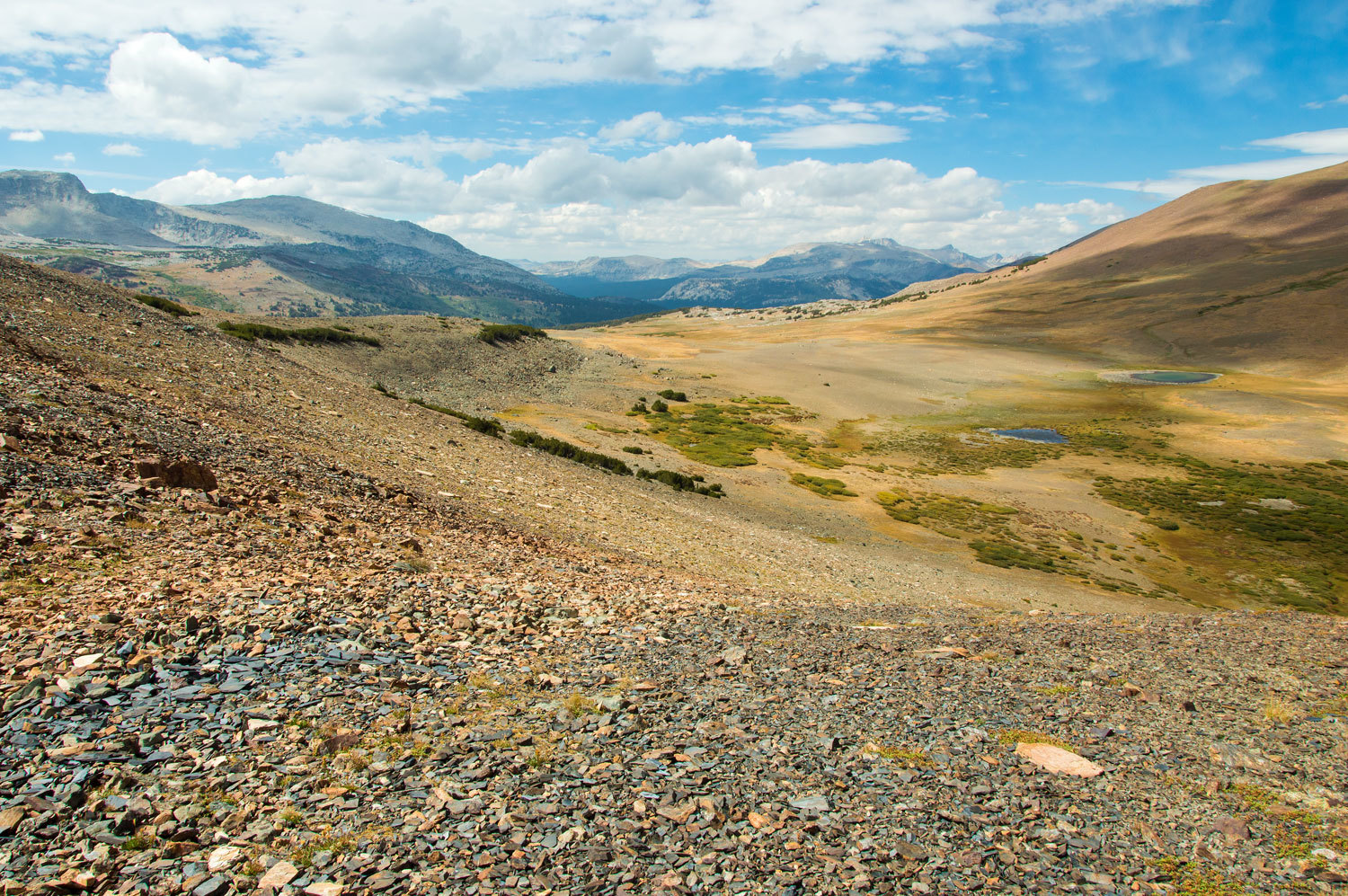
.................................and
began the trail journey back to highway 120 and Tioga Pass.

With the
afternoon light, the view back toward Parker Pass was breathtaking.
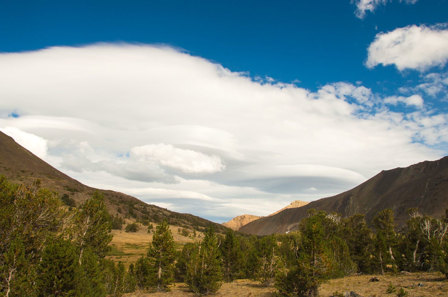
At Mono Pass
we were treated to a wonderful view of lenticulars to the east.
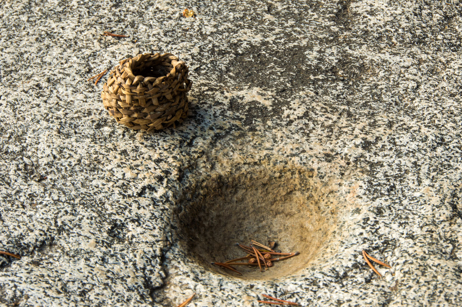
The trail
descended along creeks, mostly in timber, but in places it opened up along
small meadows. Across one meadow I spotted a large granite boulder. We walked
over to investigate and were not surprised to find it covered with Native American grinding
mortars. We were surprised and humbled to find someone's offering of a small
woven basket to this archeological site.
It was late
afternoon and we thought it too late to meet people heading into the back
country. We were wrong. Two young women approached and things looked odd. The
woman leading was carrying a bear canister in her arms. The second woman was
wearing two small daypacks, one on her back with the second on her chest. A
bedroll was lashed to the bottom of the pack behind. The Lady was ahead,
"That won't fit in your pack?" the Lady asked the woman with the bear
canister.
Now I cannot
vouch for the accuracy of my account of their conversation. I was distracted,
distracted by their wonderful German accents and their sparkling blue eyes.
They could not
stay somewhere because everything was full for the holiday weekend. They had
decided to backpack and had spent most of the day getting the required bear
canister. And yes, it would not fit into the simple cylindrical backpack she
carried that was decorated with "Guinness" up the side and then again around the
top.
"Should
we go to Mono Pass or to Parker Pass?" they asked me. "What one would
be most beautiful?"
"Both
are equally beautiful," I answered, "But I would go to Mono Pass. It
has a few more trees for shelter from the wind and you have a view all the way
down to Mono Lake. It's only about a mile and half further up the trail from
here."
"So we
will get a beautiful sunrise? What time does the sun rise here?" they
asked.
With asking
that question, the two of them had won our hearts.
"Six-thirty the sun comes up.
It will start getting light at five-thirty. If there are clouds, they will turn
pink around six," I explained. "You should have a great sunrise. We
hope you do."
These two
were a picture; undaunted and taking on the challenge, seeking out a beautiful high
country sunrise.
We returned
to the trailhead at around 5:30, tired after a good long day. Our distance had not
been far, 15 miles or so round trip, but tackling the route up the cirque, working our
way up and over the moraines, was a real work out. We'd sleep well this night.
And we did.
Our
adventure continues in Part Two - Please CLICK HERE
Congratulations on documenting the wreckage of the B-24 crash and reverence given.
ReplyDeleteMonte, a wonderful trip report and beautiful country. Like Andy said, thank you for your reverence for the souls onboard the B 24. There is another near Denio, up in the Pueblo Mts.
ReplyDelete