
please remember you can click on a photo to see a larger version
Many times in our busy lives it’s the quick, short getaways that are needed to refresh our spirits. It’s also one of the reasons to have a small camper on the truck, at the ready.
The Lady and
I are active, you may have picked up on that. The outdoors always beckons;
calling us home.
Here is a
short story about our last two weekends. We would have probably gone hiking
anyway, why not take the truck and camper?
The first
Friday afternoon we both had an appointment with our eye doc in South Lake
Tahoe. He and his wife are close friends so we make our visits include dinner
after. This adventure was the Lady’s idea.
“Why don’t
we take the camper, find a spot to camp and go for a good hike on Saturday
since we’re going up?” she suggested and then asked. “Where should we go?”
I offered,
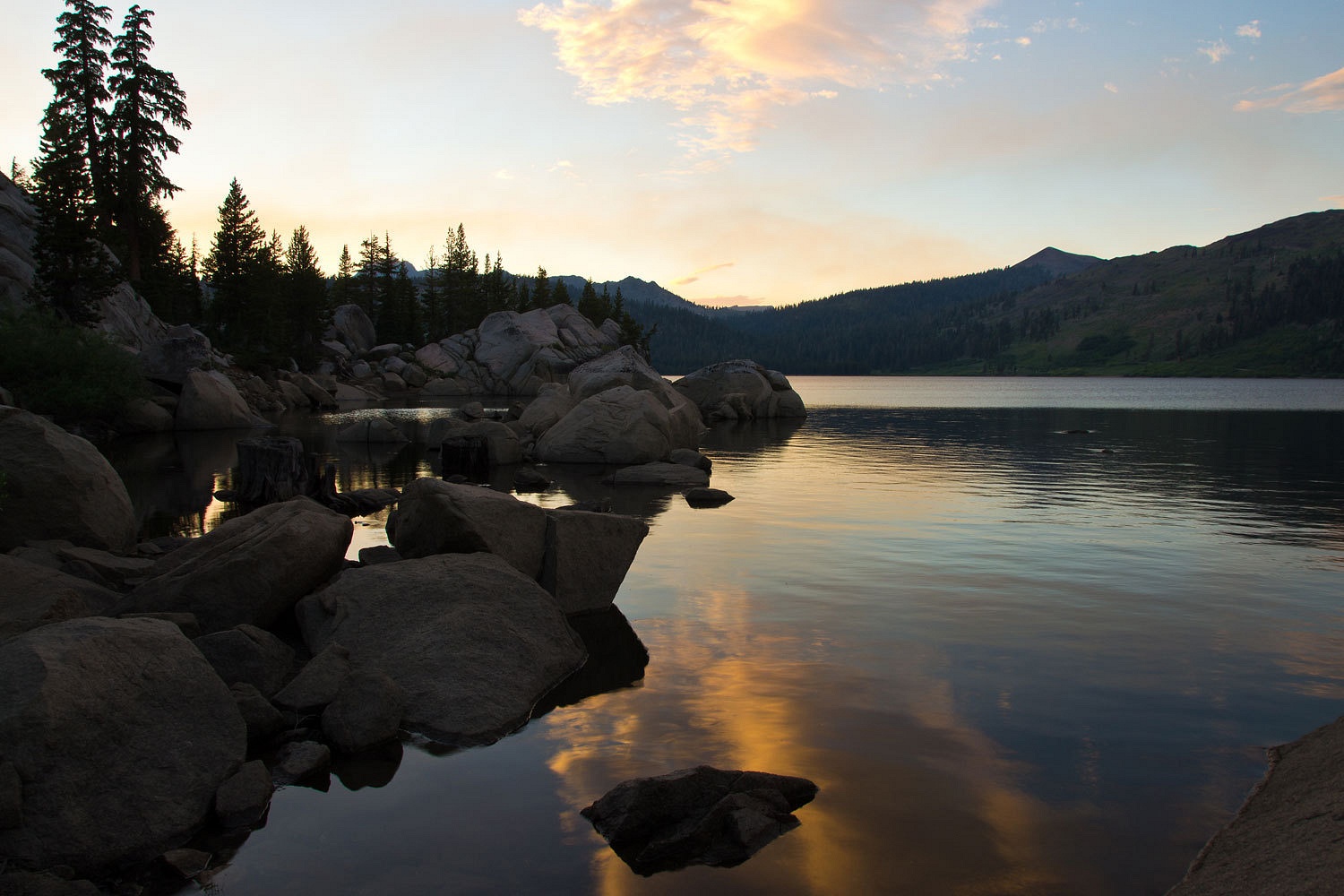
“Remember hiking into Raymond Lake a cold November day a few years ago?
Everything was ice with the last of the leaves coming off the aspen. After we
got back we heard a story that there are cutthroat and golden trout in that
lake. The trailhead’s a bit south of Hope Valley off the Blue Lakes Road and
it’s only a five miles or so hike in to Raymond. With an early start, we can
spend most of the day at the lake seeing if the story is true.”
Saying good
bye to our friends after dinner we headed south on 89 over Luther Pass and down
into Hope Valley. A right on 88, then a left on Blue Lakes Road took us up the
West Fork of the Carson River drainage and over a pass into the Blue Lakes
area. The road is paved, easy driving, and beautiful country, accented for us
with evening light and long shadows. Shortly before Blue Lake we took a left on
the dirt Tamarack Lake Road. It quickly takes you past Tamarack Lake and then
out to an intersection – Sunset Lakes to the left and Wet Meadows Reservoir to
the right. All of these are small impoundments at the head of Pleasant Valley
Creek, above Markleeville, for irrigation water for the Garnerville area. The
left into Sunset Lakes is the better road and also gives access to the Pacific
Crest Trail. Wet Meadows Road is rough and very narrow with a short steep
section climbing over rock ledges a short ways in that tends to turn folks
around. We went right and found a spot just off the road to spend the night.
You could
hear them as soon as we turned off the truck’s engine, mosquitoes, hordes of
them, awful hordes of them. I did the outside chores and felt like running and
screaming. It was all I could do to stay calm, finish the chores, and dive for
cover inside. We went to bed.
Frost
covered the ground at dawn, far too cold outside for the little blood suckers.
We had coffee and breakfast outside, a pleasant reprieve from the welcoming
committee of the night before. The trailhead was in about a half mile from our
spot. No way were we spending another night here.
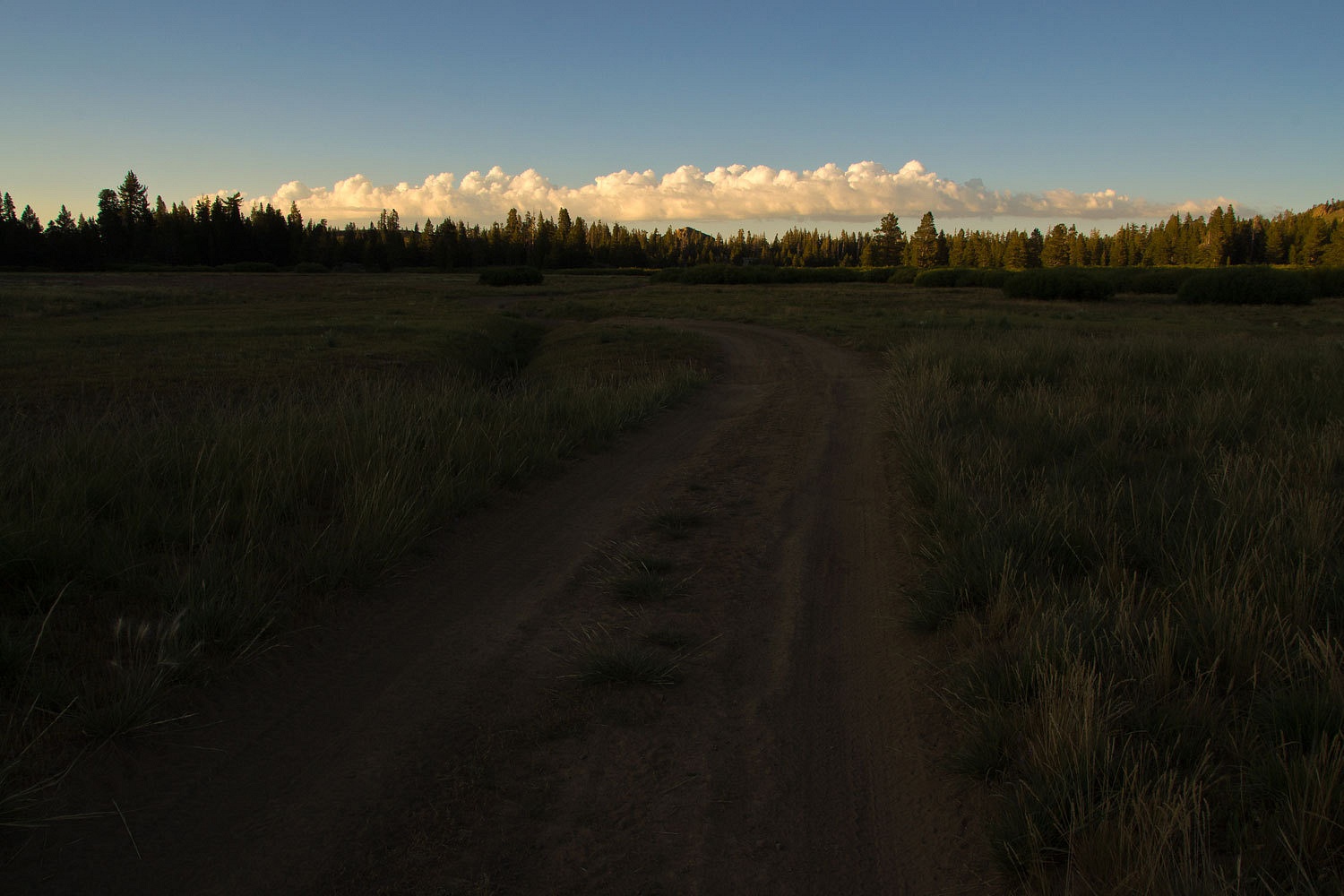
We drove in
to the trailhead. It is a rough road along the edge of the reservoir and very
narrow as it winds sharply around trees with overhanging branches that we carefully
skimmed under, watching out for the camper roof. I would not take a larger
truck into this trailhead.
We took the
last available spot at the unmarked trailhead (there aren’t many). People know
about this place and all these folks were backpacking.
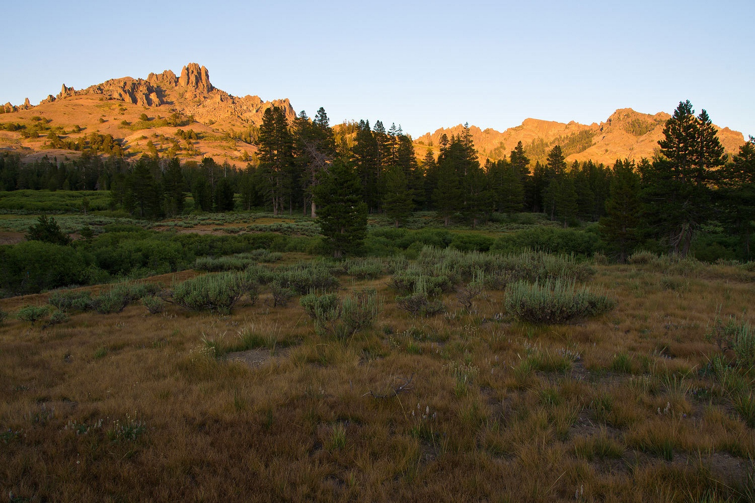
The morning
light was streaming through the aspens as we put on our boots and readied the
packs. The sun was also warming up the little mookies. We took off up the
trail, the Pacific Crest Trail heading south toward Ebbetts Pass on Highway 4.
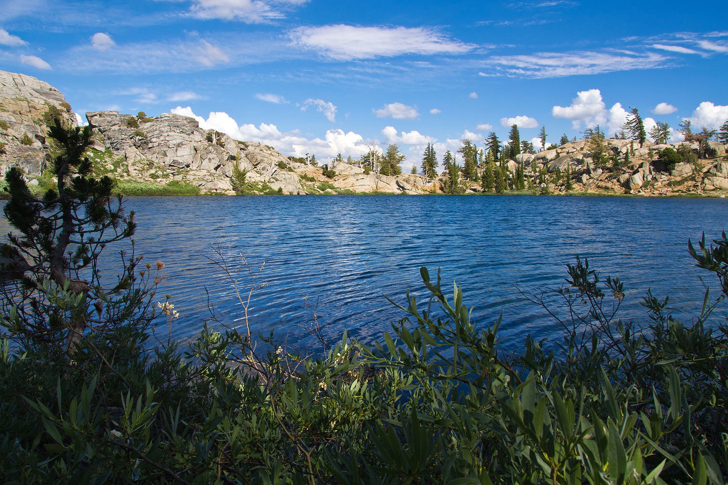
We reached
the high small pocket at around 9000 feet that holds small Raymond Lake below
the gnarly volcanic crest of Raymond Peak.
Everybody
parked at the trailhead was here.
The day had
warmed into a nice morning and the Lady found a spot to relax with her book. I
got my fly rod rigged, first trying a variety of terrestrials, wading out to
thigh depth in the ice cold water. No luck. I switched to a scud pattern under a
strike indicator and immediately the indictor dropped under and I raised my
rod. A good solid hook up and a nice heavy feeling trout.
“This is a
good fish!” I called to the Lady and then my line snapped back toward me, now
limp. It was gone.
“Damn!”
And so went
my day. I lost six more as my scud pattern got hammered, actually never hooked
up with another fish. I sharpened the hook, tried another fly, nothing worked.
I never figured out what was wrong.
Coming back
out of the lake, hoping that feeling would return to my legs before we hiked
out, I said “Let’s head over to that big flat rock, soak up some warmth, and
I’ll fish from there for awhile.”
We relaxed,
had snacks and drinks, and I noticed a 16 inch and an 18 inch long trout in the
shadows under the edge of the rock right below us. Nice big trout for this
small lake. I relaxed and planned my tactics. Making sure my rod did not put a
shadow on the water; I worked a small nymph just above the lake bottom along
the edge of the rock right at my feet. The larger trout came out like a freight
train and nailed it, a solid hook up that put a satisfying bend in the rod.
“That’s a
big fish!” the Lady was on her feet and excited and by my side as the big
fellow did a 180 and immediately ran back under the rock and broke off my 6X
tippet.
“Damn!” All
I could do was laugh. It really had been a good day. I found out the stories
about this lake were true and it will always make a nice day trip as it had
today.
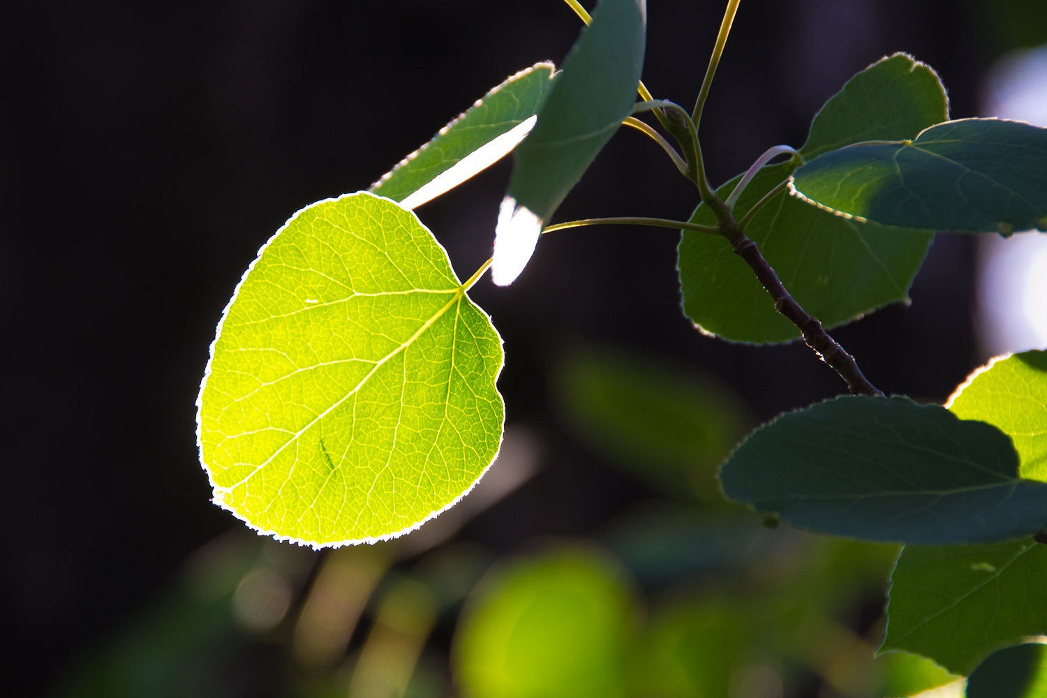
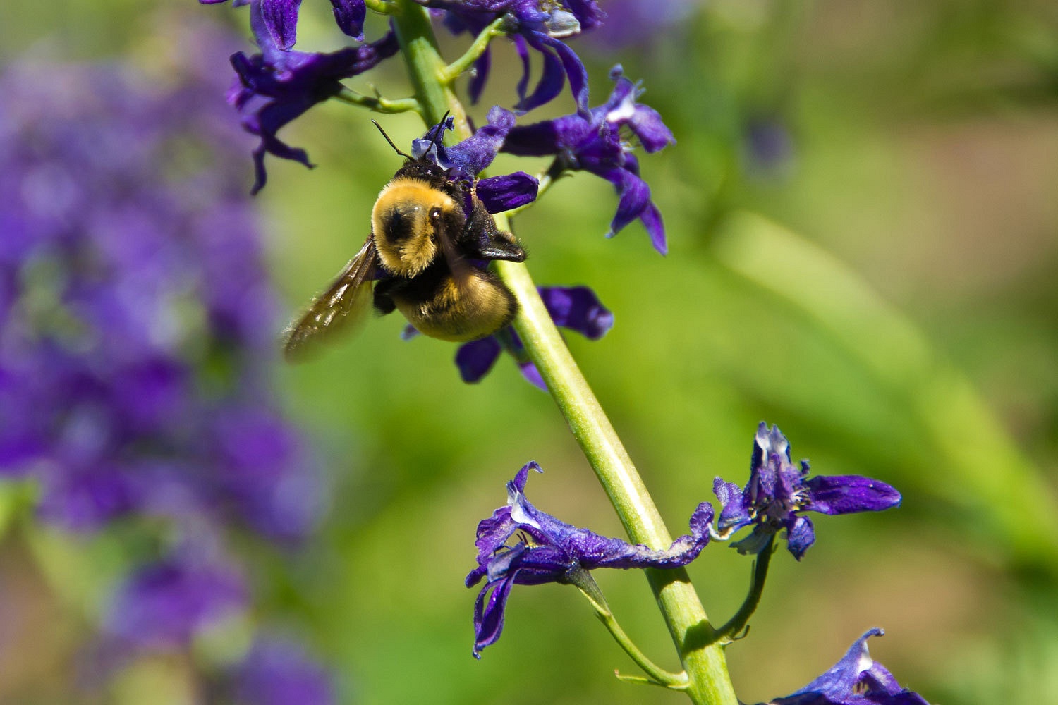
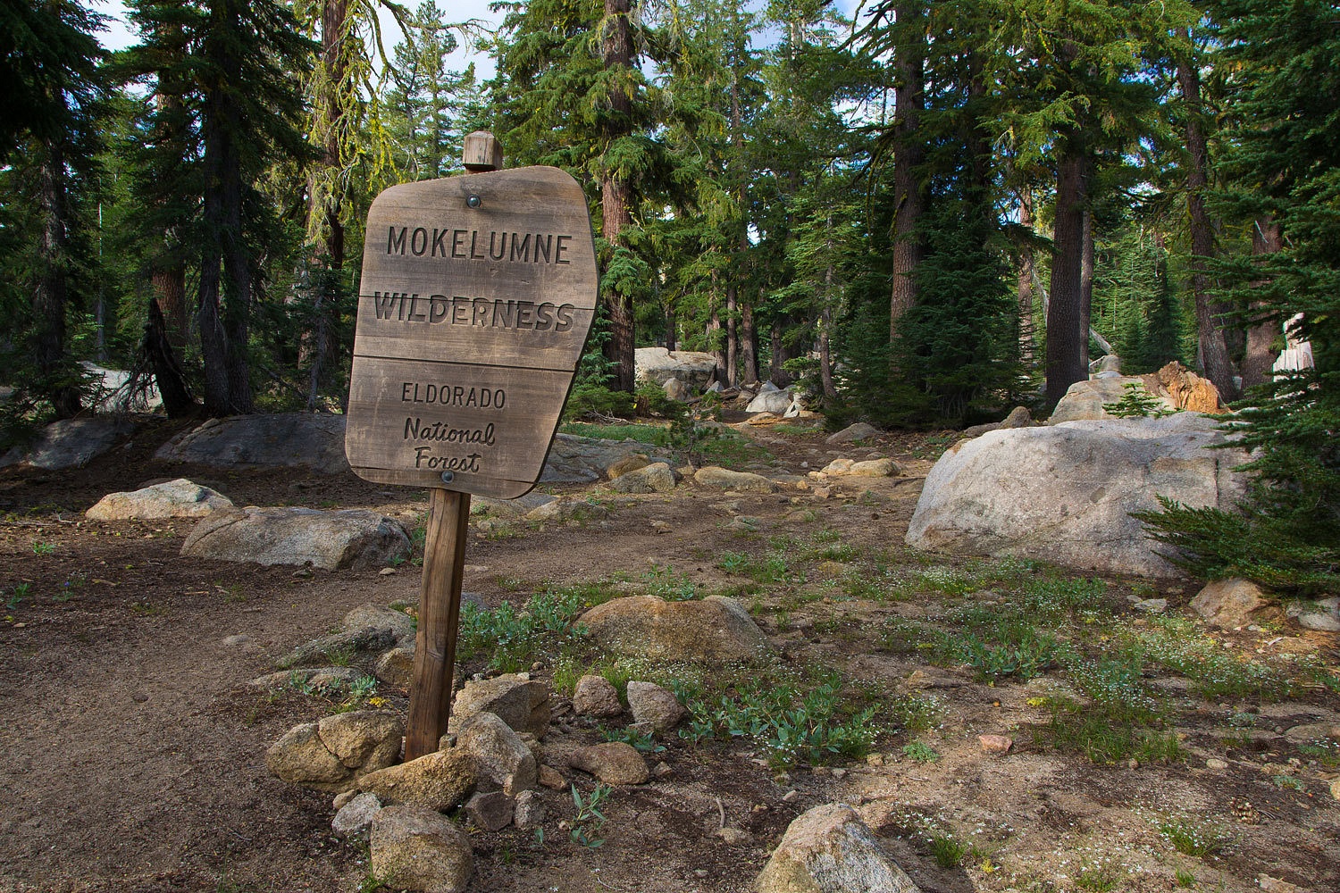
The volcanic
soils of the Mokelumne Wilderness are rich and the area is noted for wonderful
wildflower displays. Our afternoon hike back to the trailhead was a delight.
In the wet
drainages on the steep sides of Raymond Peak, the larkspur were tall and in
their prime.
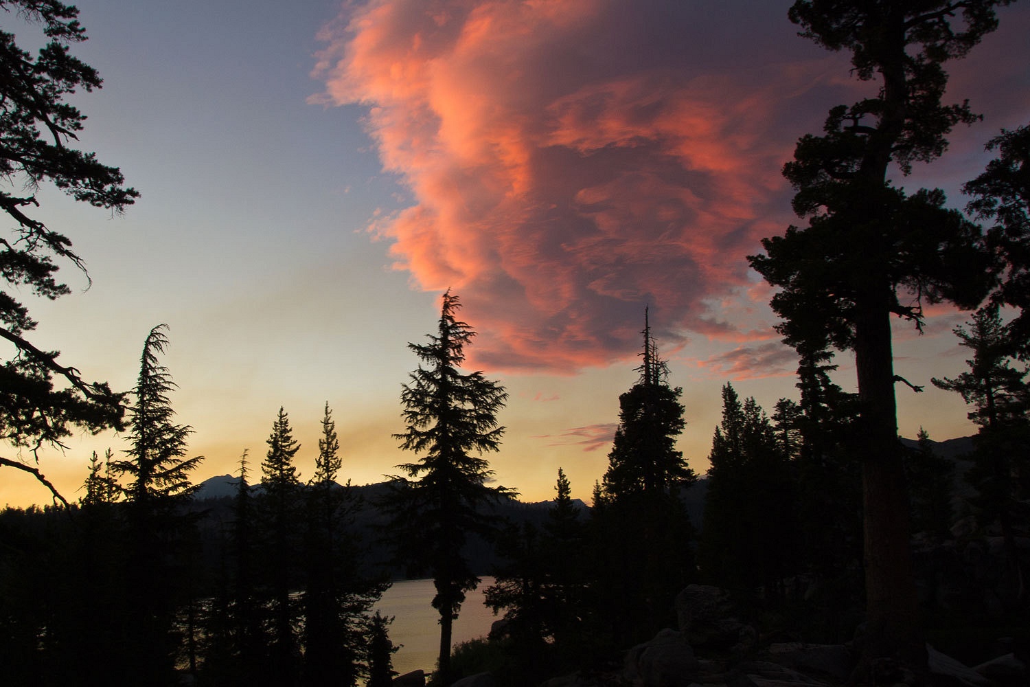
That late
afternoon we found a spot up on a small knob on the north end of Indian Valley,
a broad alpine valley. There was enough of a wind to drive away the mosquitoes.
After dinner we wandered the length of this special place, taking the camera
and tripod for a walk.

The next
morning frost again covered the ground.
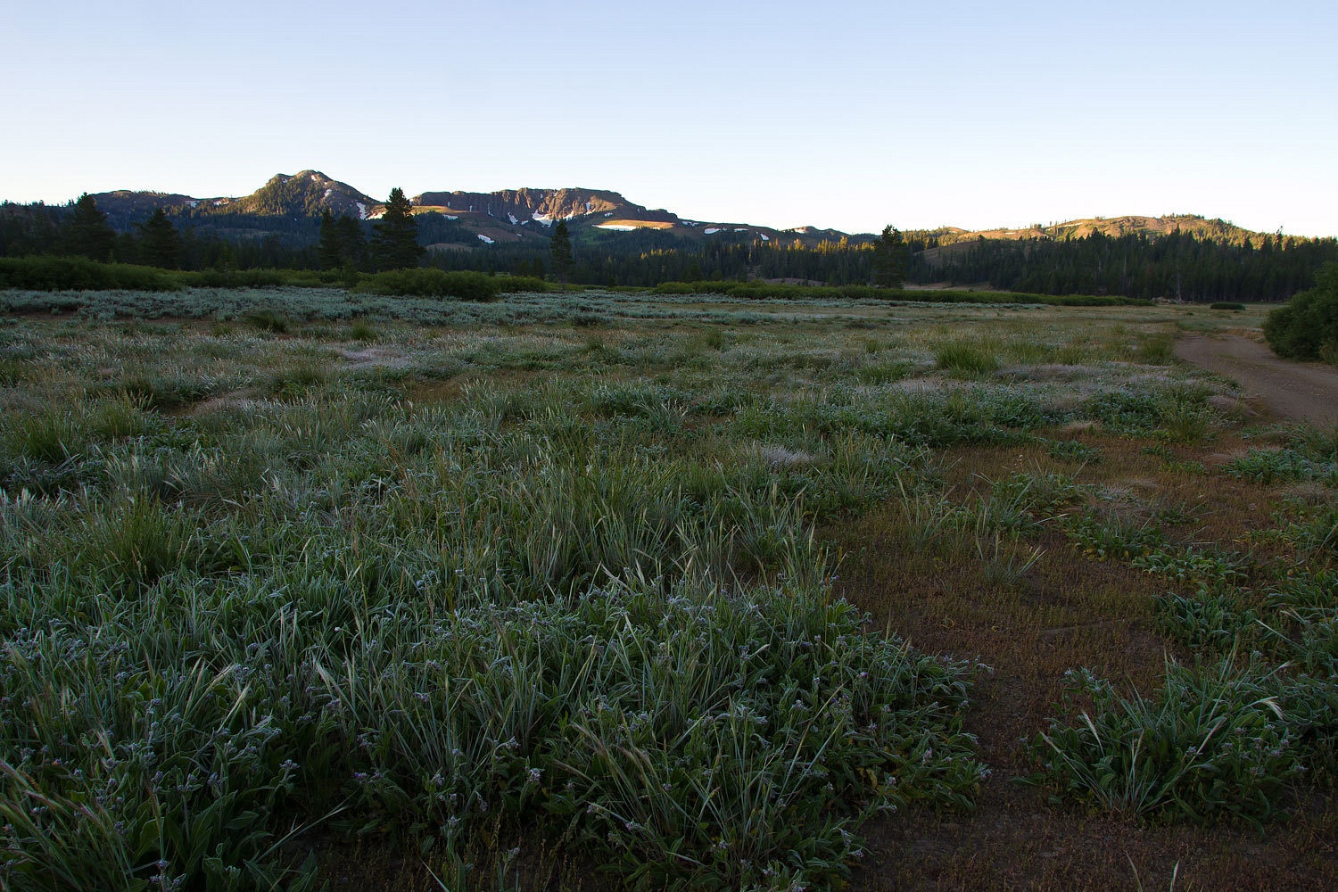
We relaxed
with our coffee, had an unhurried breakfast, and decided to explore the Blue
Lakes area. It had been several years since our last visit. Blue Lakes is a
PG&E project of impoundments for their Mokelumne River hydro electric
generation down lower on the Mokelumne. The area is a special recreation area,
no dispersed camping; you need to stay in a campground. The campgrounds are
PG&E facilities managed by a concessionaire, American Land & Leisure
based in Salt Lake City. I consider the $23 a night fairly expensive. But, the
place is really pretty and worth spending time here. We spotted the trailhead
for Granite and Grouse Lakes into the Mokelumne Wilderness.
“I want to
hike up there next Saturday and check out that trail!” the Lady had her mind
made up. “We can camp in this campground right across from the trailhead.”
After an
hour and a half drive from home the next Friday evening after work, we were at
site 39 in the Middle Creek Expansion Campground across from the dam on Upper
Blue Lake. The campground was less than half full, not bad at all.
We
acquainted ourselves with the area with a sunset walk along Upper Blue Lake. We
stopped to see that the mosquitoes were well fed and took a few photos.
The
campground sits higher than the reservoir in an open area so the bugs really
weren’t bad at camp.
Staying in
campgrounds does have its challenges. There is a high granite outcrop right at
our site. That’s why we picked it. It was great to see kids want to run up it
to the top, although it was right through our camp. For the most part they were respectful. It is
good to see kids outside. After crawling up into the bunk and preparing for
sleep, we heard an adult male howl from the other end of the campground. Howled
a couple of times, and then was quiet. It had a strange eerie quality to it
that strongly suggested drugs and alcohol. It went on all night, one or two
howls every half hour or so. I was considering options that could have gotten
me severely injured if plans did not go right as they tend to do with impulsive
actions.
“Can you
believe this?” I said as I rolled over again in reaction to a howl.
“I think
he’s just afraid of the dark,” was the Lady’s reply.
That made it
tolerable and humorous. The poor sucker was just afraid of the dark. I did
expect all hell to break loose sometime during the night when some other camper
much closer to it reached a breaking point. No fireworks during the night.
We woke to
rain; a surprise. It cleared as we had breakfast and we took off up the trail.
In many
places the trail traverses the contact zone between the Sierra granite and the
overtopping of the more recent volcanic. It is really a nice hike out here.
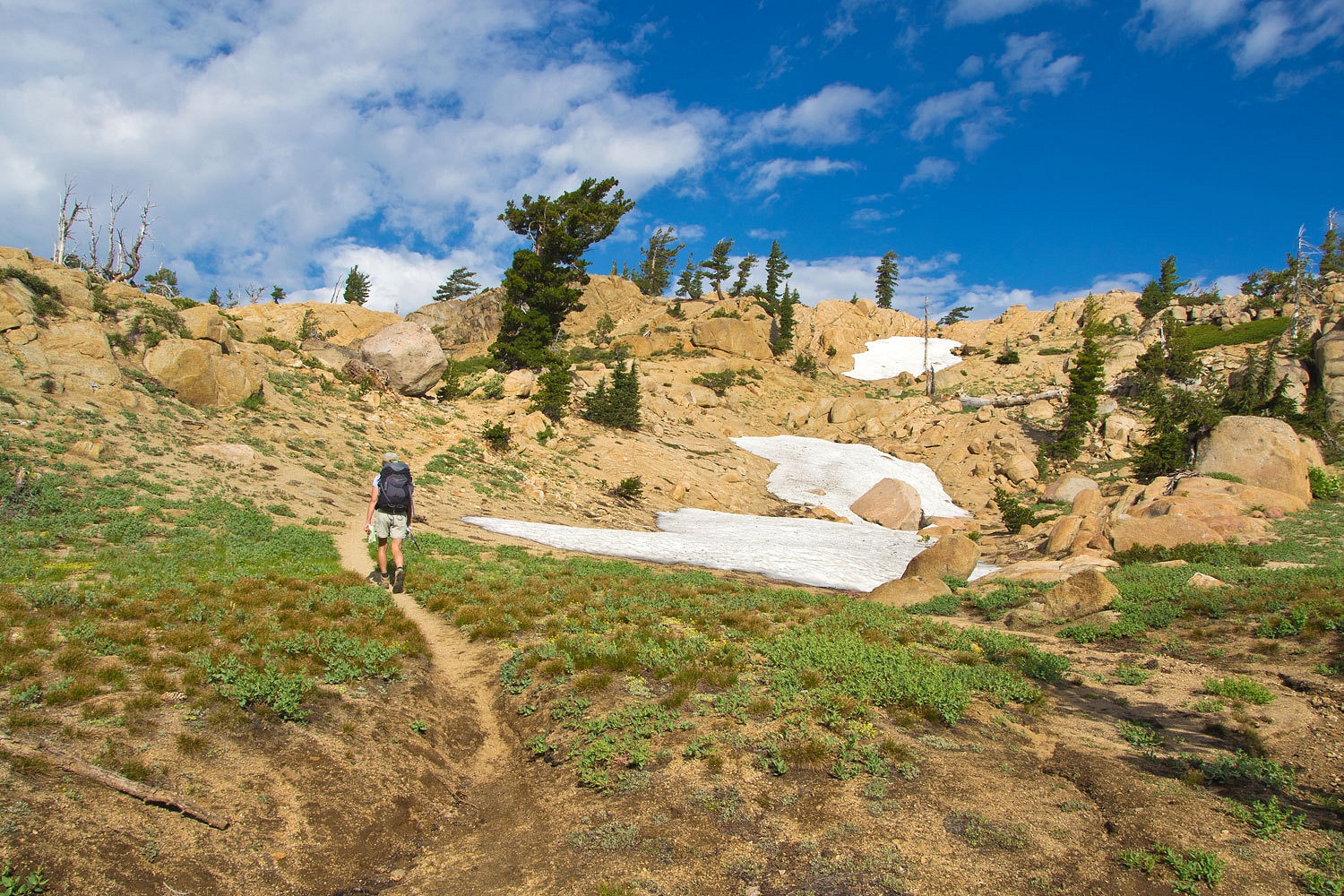
Granite Lake
sits in a granite bowl, aptly named.
We had a
great day hiking.
Things were
quiet back at the campground. The kids were fairly quiet, probably from burning
up all their energy playing at the reservoir. Good for them. We decided to take
the camera and tripod for an evening walk for the sunset. We found two camp
ground managers’ trucks parked outside the campsite where I believed the howls
had come from the previous night.
“You have 45
minutes to clear out of here. 45 minutes. I will call the deputies if needed.”
The manager
was also on his hand held radio. We walked past as the campground employees
were returning to their vehicles. We continued up the road along the edge of
Upper Blue Lake looking for an open spot. The manager’s truck pulled up
alongside us and he rolled down the window.
“I’m really
sorry about those people you are sharing the campground with.” He motioned
toward the woman sitting next to him. “I didn’t want her touching or dealing
with any of the blood.”
“That’s
right, you can’t be too careful with blood these days with all the blood borne
pathogens around. Awful stuff!” the Lady added.
We were
getting away from the important topic.
“What
happened there?” I asked.
“Oh, the
group got in a fight among themselves. They didn’t like one guy and one of them
hit him over the head with a club.” He continued, “I’ll get them out of there.
They don’t know it but I do have deputies waiting for them down at the main
intersection. They will take care of it and I don’t want those kinds of
confrontations with law enforcement taking place in our campgrounds, if
possible.” This guy was experienced. He had been down this road before; the
kind of person you wanted watching over the campgrounds.
We continued
our walk and found some interesting light and the Lady said, “You know, there
hasn’t been any more howling.” She was right.
Last light
over Upper Blue Lake with kayakers on the water.

We walked
down to the stream between the two Blue Lakes to see if I could get an
interesting water shot. We did battle with the mosquitoes. We lost, but the
photo was pretty good.

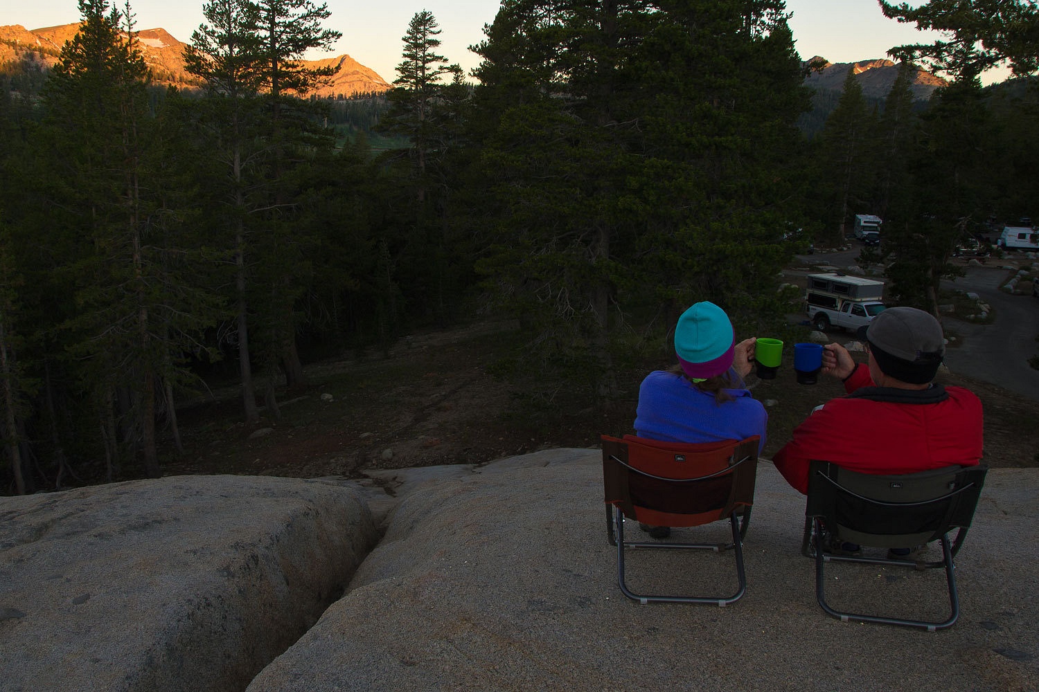
The next
morning was clear after a very quiet night. From atop the granite rock we
watched first light and enjoyed our coffee.
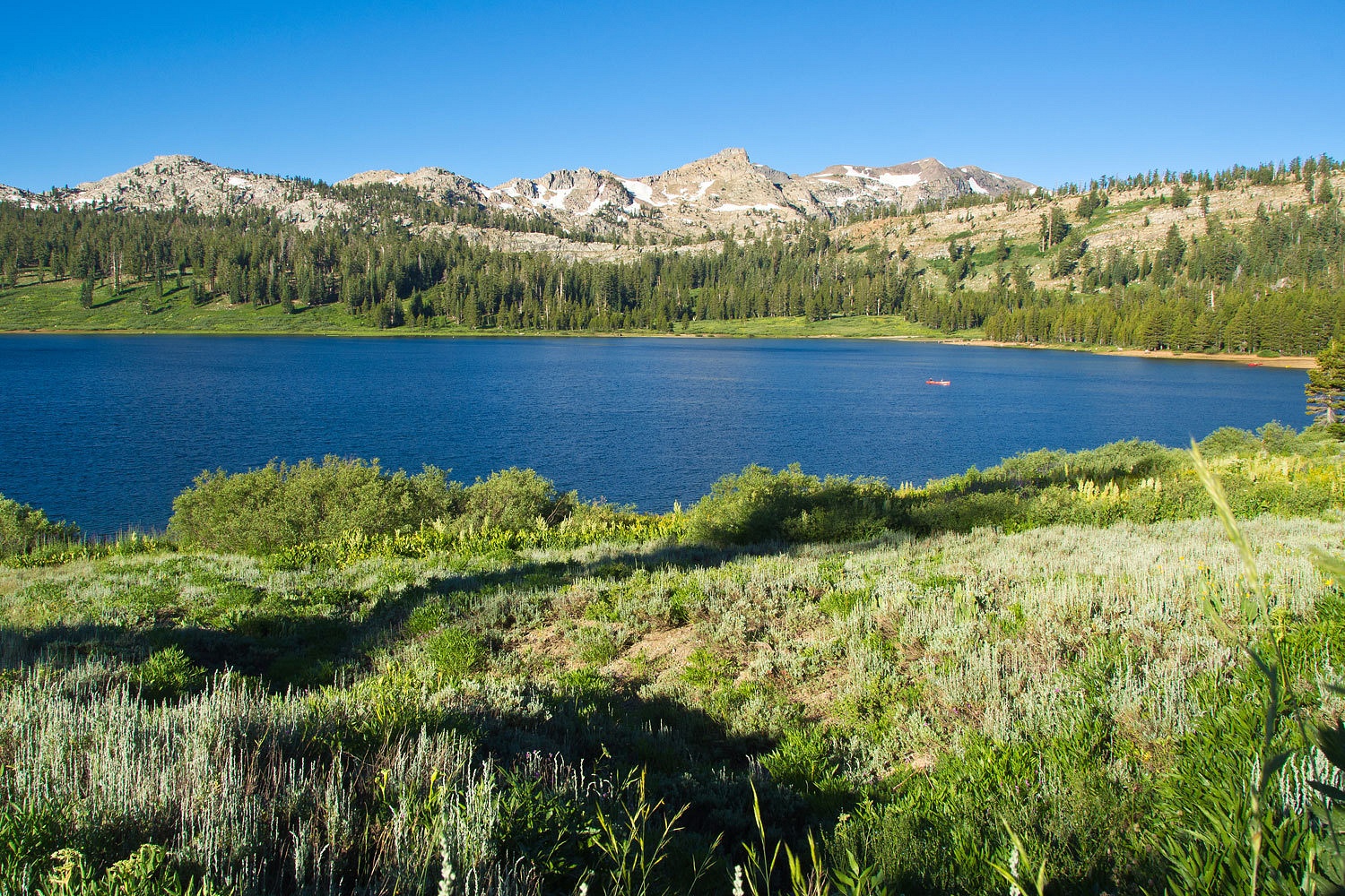
Consider
Blue Lakes for a getaway. We saw many people enjoying hiking, fishing,
canoeing, paddling kayaks, just happy being in this area.
We decided
to head home via the Forestdale Divide Road that runs north from Upper Blue
Lake, over the Forestdale Divide, and out to highway 88 at Red Lake at the base
of Carson Pass. It is a 4x4 road. Our interest was seeing the top and checking
out access to the Pacific Crest Trail. The high crest up here is wonderful,
high, and open.
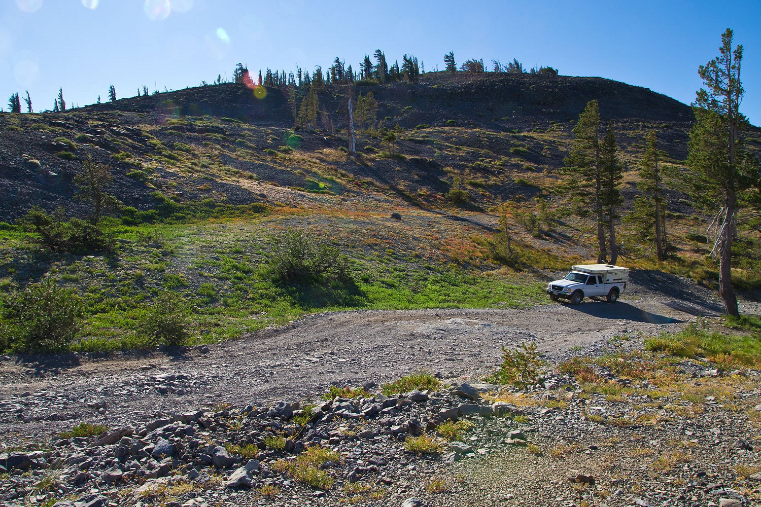

At the top
of Forestdale Divide, we were surprised to see the uphill on the other side
still blocked with snow. The steep snow bank covered about 50 yards of the
road. No one had climbed up it coming from the opposite direction. Parked at
the bottom of the snow in the only pull out was a Tundra pickup. The snow had
stopped it.
Decision
time. We were unfamiliar with this road. If that Tundra pickup was not there,
showing that it had made it up from the opposite side, no way would we have thought
about continuing. We figured we could go anywhere a 4x4 Tundra could. Were we
being suckered? There was the real possibility this had stupid written all over
it. There was no way we could climb back up that snow bank if we needed to turn
around. We would be committed.
The snow was
a real sled ride. The road below the Tundra was awful, a steep edge of the
mountain road for about a mile further down. The scenery was wonderful as we
crawled down, our tires straddling a deep gully cut by this year’s runoff. In
places it was up to three feet deep. If we met another vehicle or an obstacle,
there was no way to get off the road.
We will go
back up and explore the trails and ridges off from the top of Forestdale
Divide. We will access it and go back out via Upper Blue Lake. The road in from
Red Lake to the crossing on Forestdale Creek is in good shape. The piece in
between, unless it is improved, we do not need to drive again.
It was an
adventure. We were challenged and refreshed.
No comments:
Post a Comment