please remember you can click on a photo to see a larger version
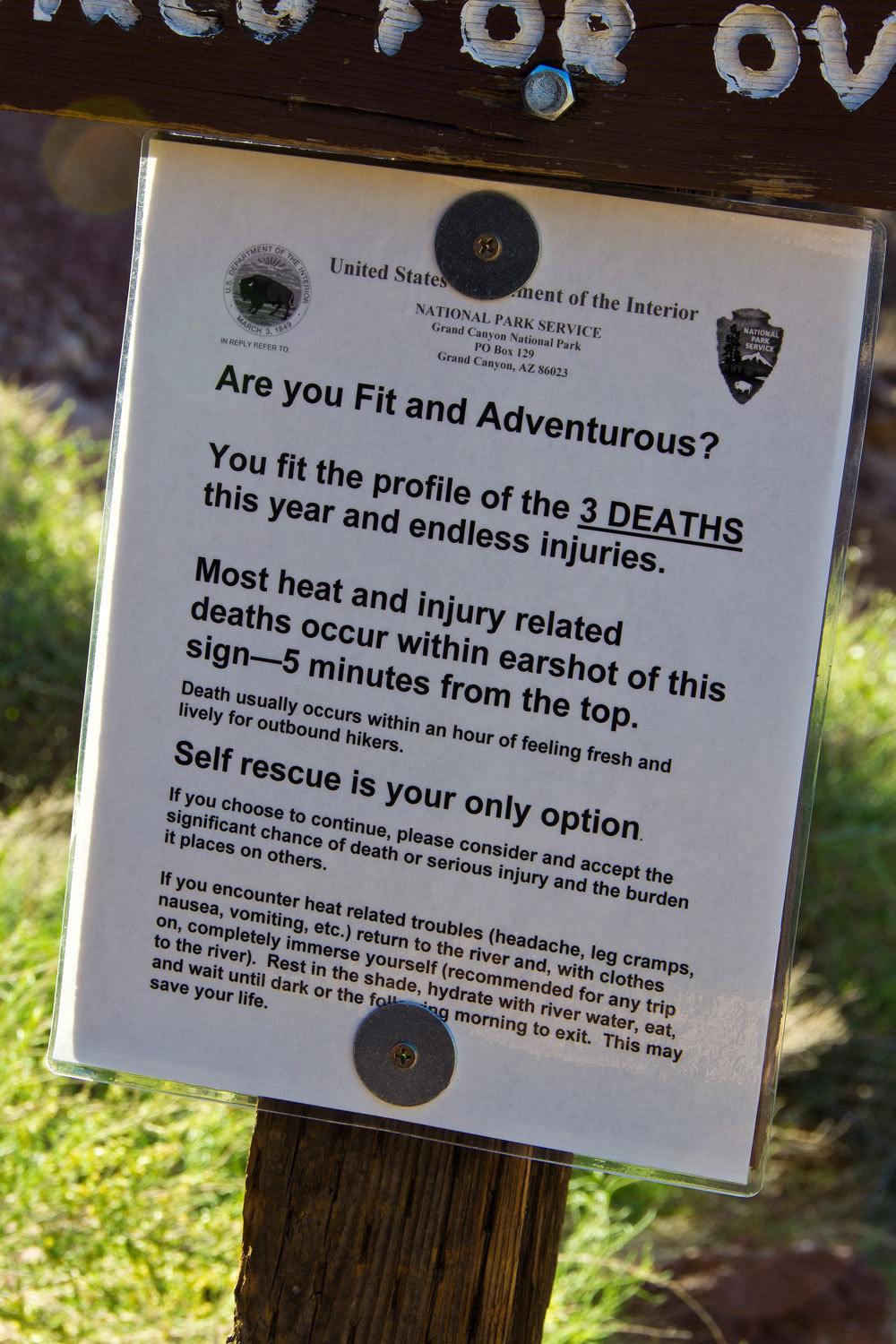
The trailhead at Vulcan’s Throne is a several mile drive and takes a bit of time. We were out there around 7:30 am. The Park Service does its best to discourage use of the lava falls route. The trailhead is not signed and it is not listed in Park information. We traveled about a third of a mile down, well away from the trailhead and came upon this sign.
The trailhead at Vulcan’s Throne is a several mile drive and takes a bit of time. We were out there around 7:30 am. The Park Service does its best to discourage use of the lava falls route. The trailhead is not signed and it is not listed in Park information. We traveled about a third of a mile down, well away from the trailhead and came upon this sign.
Heed this
sign. Take it very seriously. This is not a trail. This is a route. Many of the
cairns you will find may not be on route. This is a treacherous and dangerous climb.
It is a scramble the entire 2600 feet down on loose awful rock. There are
places where rock climbing moves are necessary. If you are not completely
confident in your ability to tackle this undertaking, do not attempt this
route. Understand the risks and have experience in the desert environment? It
is still a lot of work.
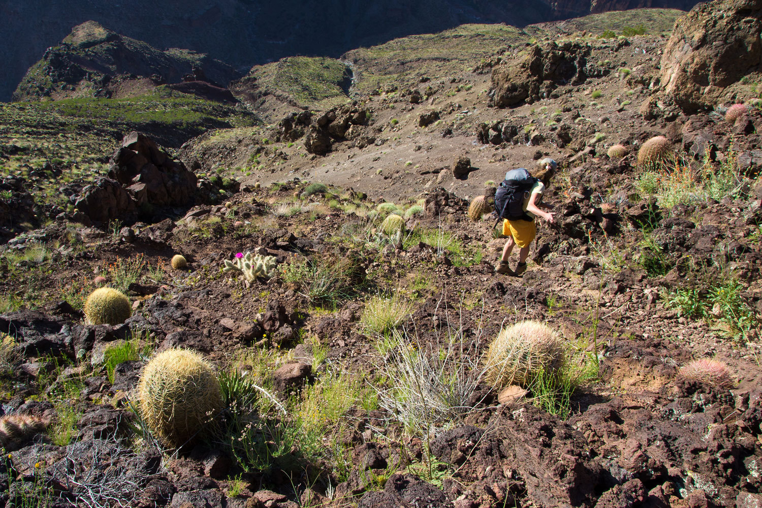
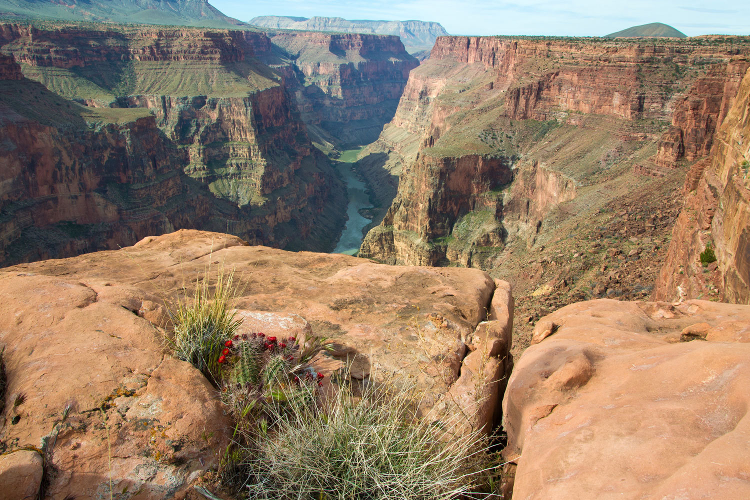
As you drop
into the Canyon you pass through different life zones. About two thirds of the
way down, you reach the ocotillos. They were just starting their bloom. This
was incredible in the morning light.

“This is intense! You cannot relax for even a second. Every step needs to be carefully
placed. This is intense!” The lady was leading the way. Just when you thought
the grade just may lessen, it got steeper.

The last
section was on awful gravel along a basalt cliff. As least there were lots of
handholds. The Lady hit the bottom first and moved behind a screen of
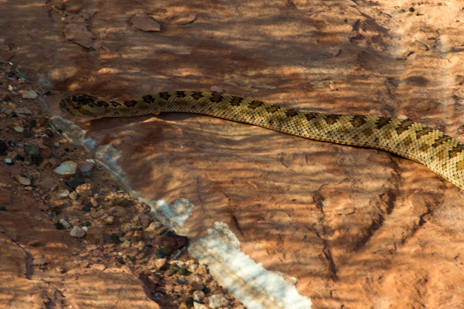
vegetation. I was making my last few moves when I heard the Lady say, “He’s
buzzing at me. He’s giving me a warning. Oh, he’s beautiful! He is beautiful!
He’s pink! I hope you can get a picture of this rattler!”
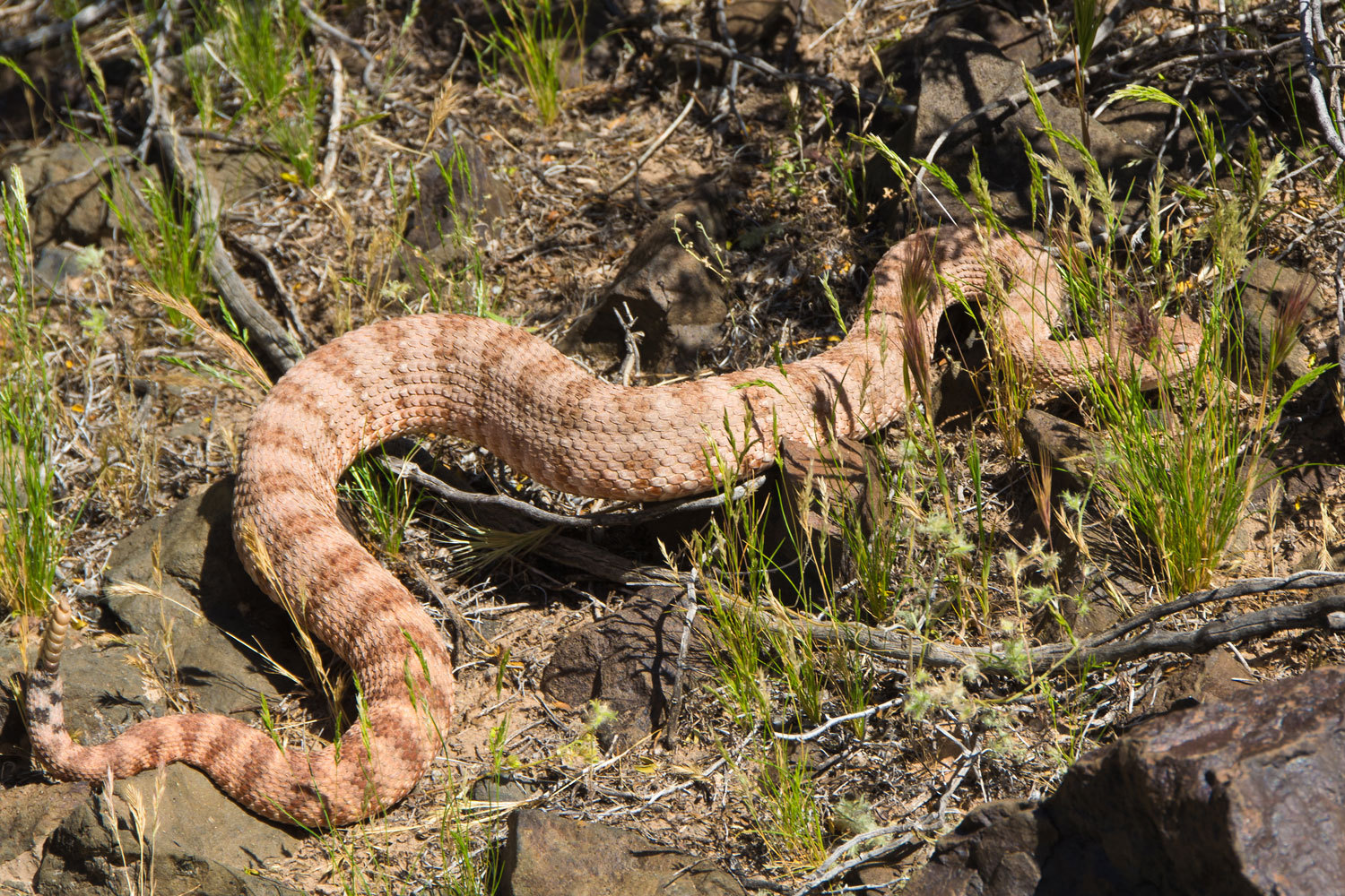
It was another
Grand Canyon Rattlesnake. They come in different color phases and this
coloration looks about perfect for red sandstone. Nature’s adaptations are just
incredible. We watched our new friend as he moved under shelter and then we
worked our way through the boulders and found a sandy beach at river’s edge.

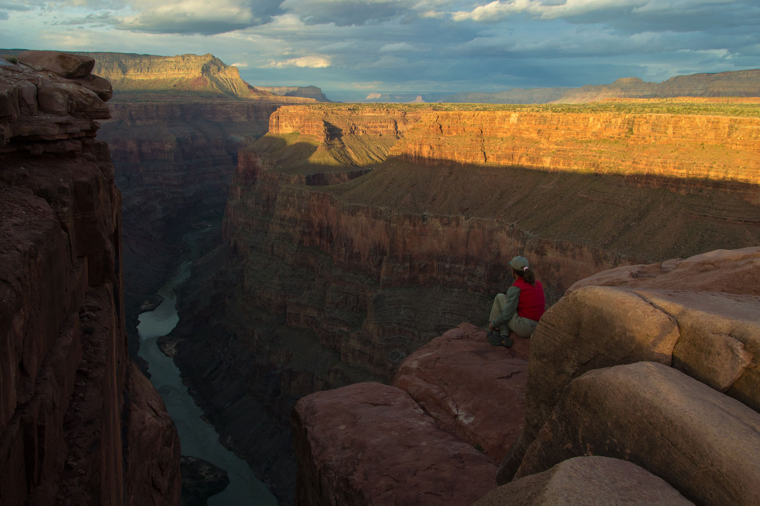
We snacked,
cooled our feet in the river, relaxed. The Colorado is cold. The route hits
just upstream from the famed Lava Falls Rapids. Several boats had floated by as
we clung to the cliffs, making our way down. The non-commercial boats had
eddied out to scout the rapids. “Let’s head down to the rapids and see if we
can watch the boaters run it,” I suggested. “Fun!” she replied.

Three boats
were tied off on the beach on river right. The three gentlemen were returning
from scouting. I think we shocked the hell out of them. They never asked, but
their faces said, “Where in the world did you two come from?”
“How does it
look? You going to run it now?” The Lady was grinning from ear to ear.
“Yup, we’re
getting in the boats right now!” One of the gentlemen replied.
“Oh boy, we’re
going to climb down and watch you go through!” She was heading down the trail
before they could reply.
This was a working
out to be a great trip.
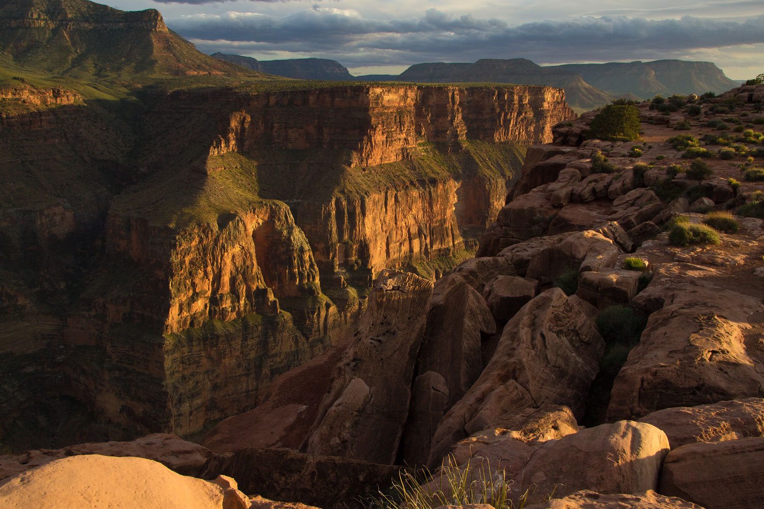
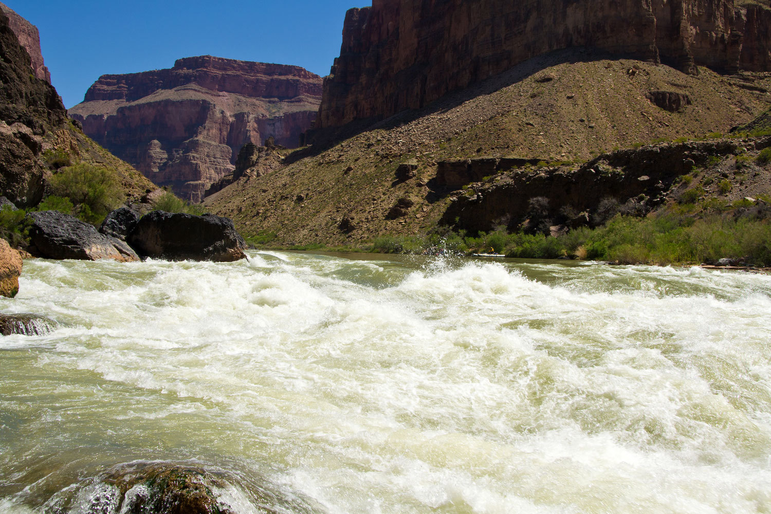
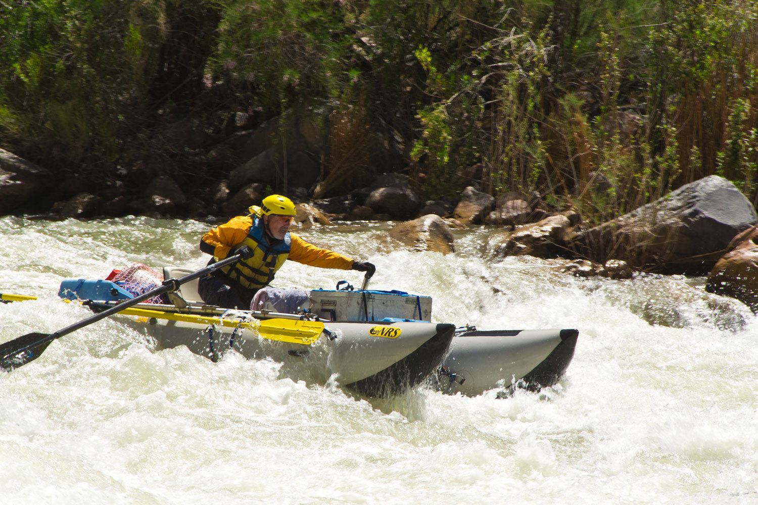
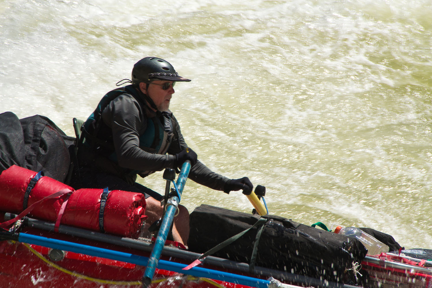
From a
distance it looks like a typical rapid. Stand beside it at river’s edge, this
thing is big. It is powerful.
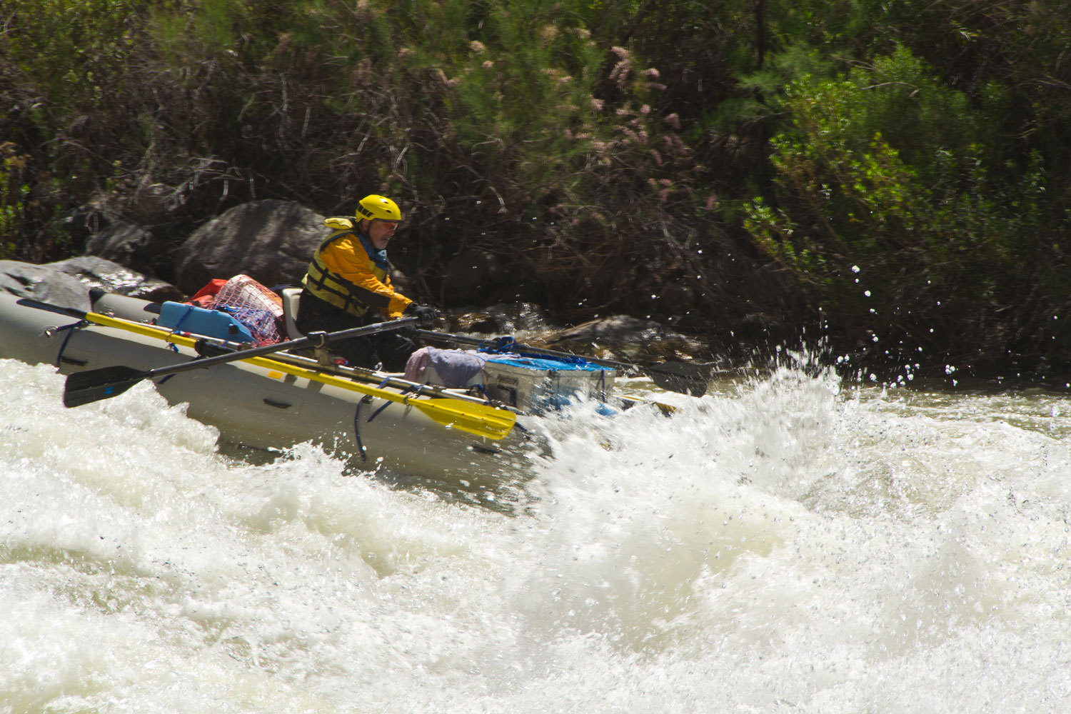
The grey cataraft
moved into position first. He paused, holding back with the oars. And then he
entered.

He took a
conservative line on river left. He stair stepped down the drops catching every
eddy and perfectly setting up for the next drop. He had complete control of his
boat. It was a masterful run.
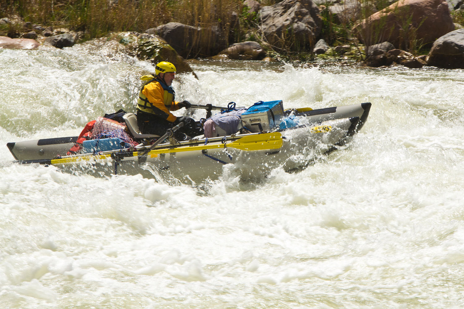
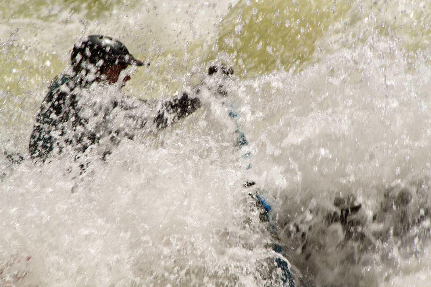
The red cataraft
was next. He set up for the same line. Entering the first drop he lost control
on an oar. It went vertical in the water, blade down, immediately ruddering the
boat around 180 degrees. He ran Lava Falls Rapids backward as he continued to
struggle with the oar. He was tossed out safely at the bottom, a lucky boater.

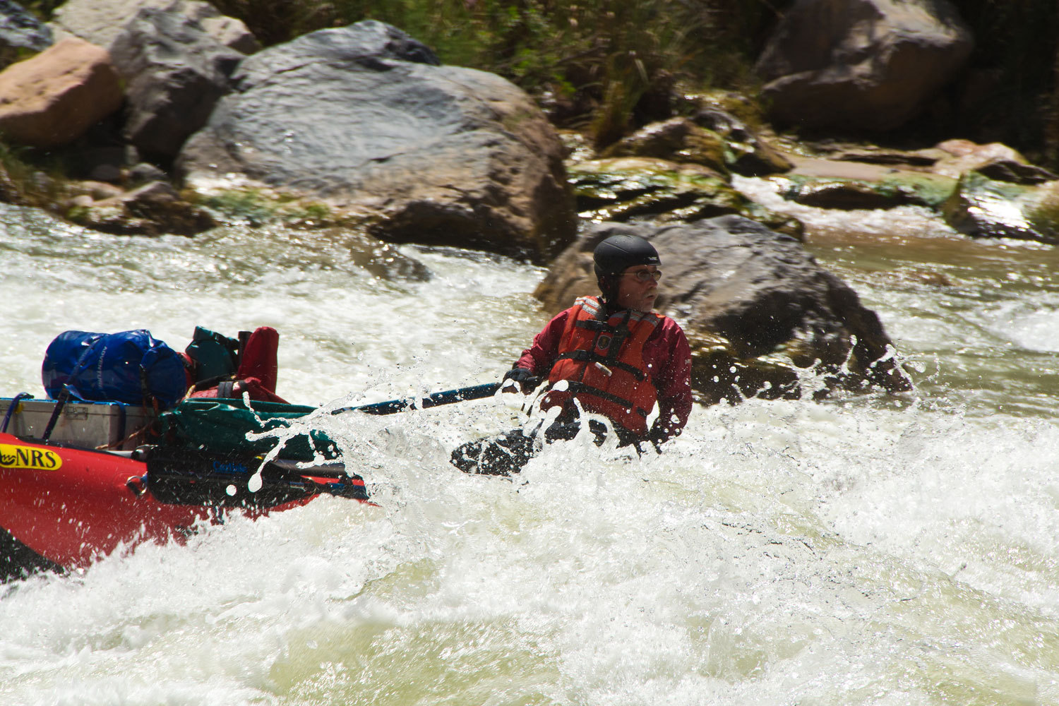
When the
gentleman in the oar boat pulled back on the oars at the top to set up his
line, we could see this was going to be different. He had come to Lava Falls to
raft.
His was a
line on river right, just off from the main tongue down the center. It was well
done, our friend, very well done!
Could this
have been any better of a day? Temps in the low 80’s, cold water to dangle the
feet, sandy beach to lie back on, excitement of watching boaters match their
skill against the Colorado, this was a great day!
We just had
to get our butts back out of this canyon.
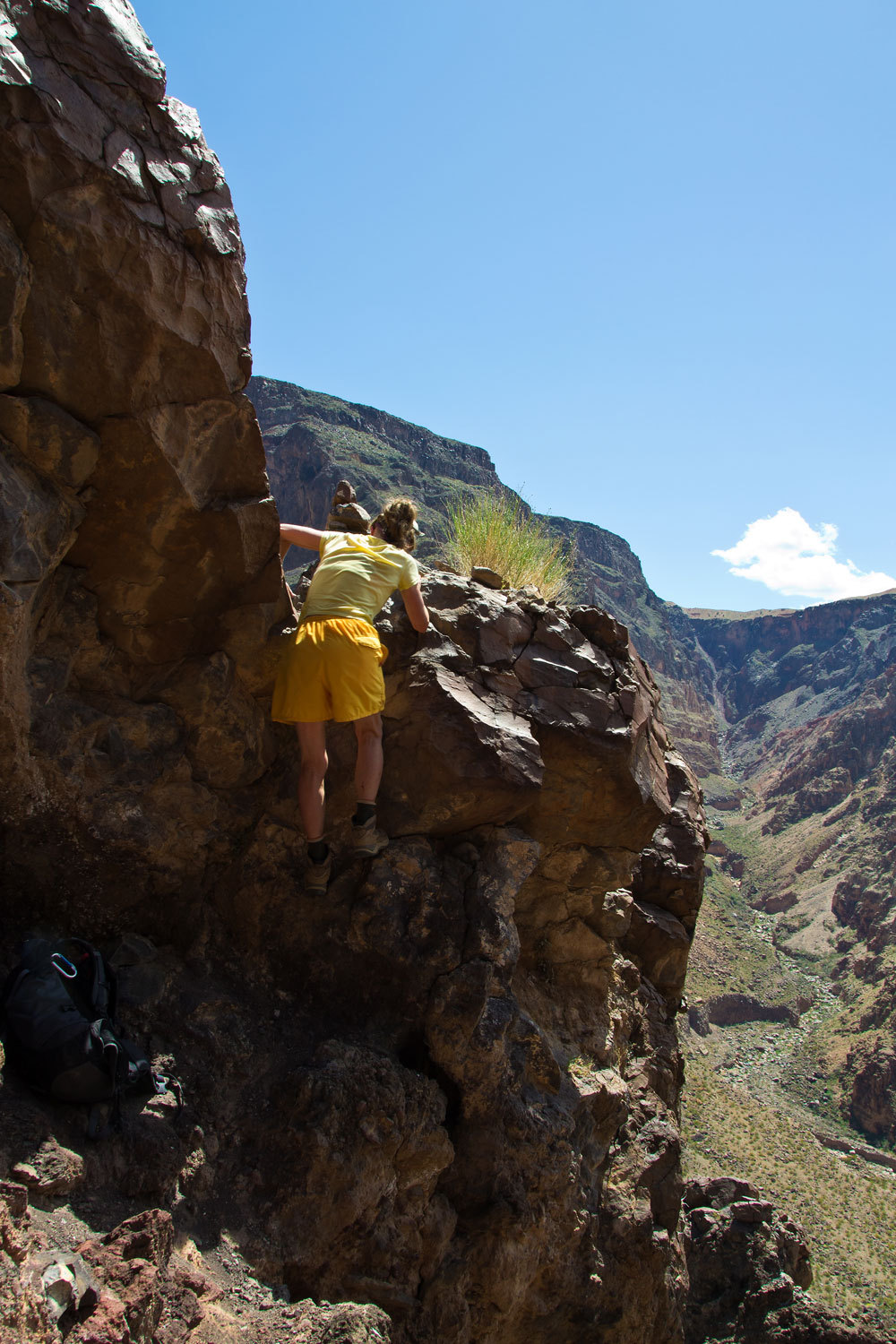
There was
one spot on the descent where the route intersected a steep ridge. There were
cairns below which led in to a steep gully that soon cliffed out. Not the way
to go. There was a notch in the ridge to the right and a vertical drop of about
12 feet with an overhang. This led to a wider gully, could this be the way? Yes
it was. On the way back up I took a few photos of the Lady handling this
obstacle.
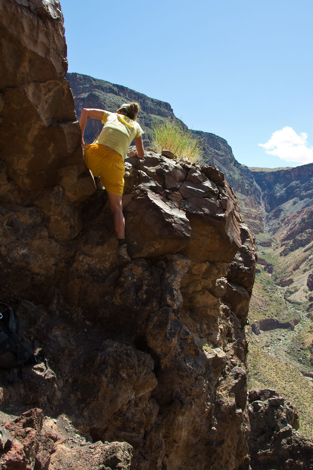
I hoisted
the packs up after her and then it was my turn. Actually the rock here was
pretty solid with strong hand and foot holds. Going up was much easier, we knew
the route, set a comfortable pace, stopped for some water every half hour, and
we were up.
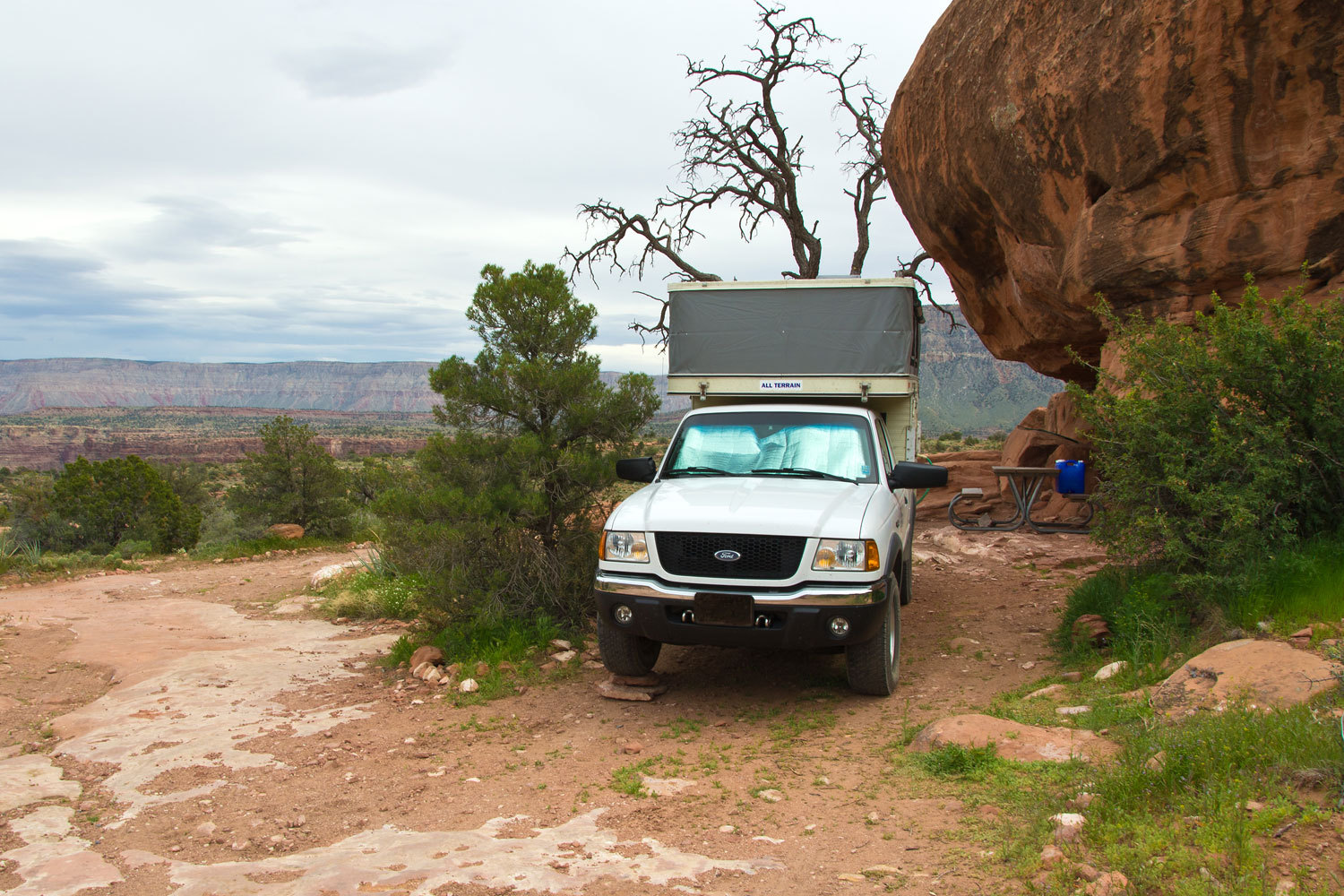
We reached
the truck, changed out of our boots and hiking clothes, and headed out.
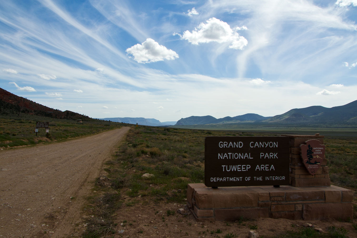
The BLM’s
Arizona Strip map is a must to have if you are traveling out in this huge area.
But, still you will find roads that are not signed or that no longer exist.
Venturing off of the main road, you need to be up on your navigation skills.
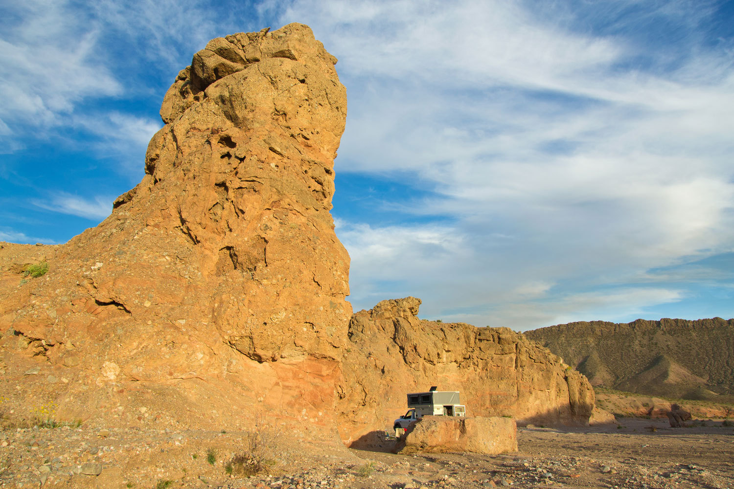
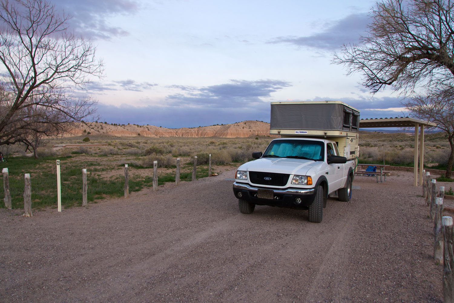
By late
afternoon we were set up for the night, all by ourselves, right on the Park
boundary, in a nice dispersed camping spot among the junipers and pinyon pines.
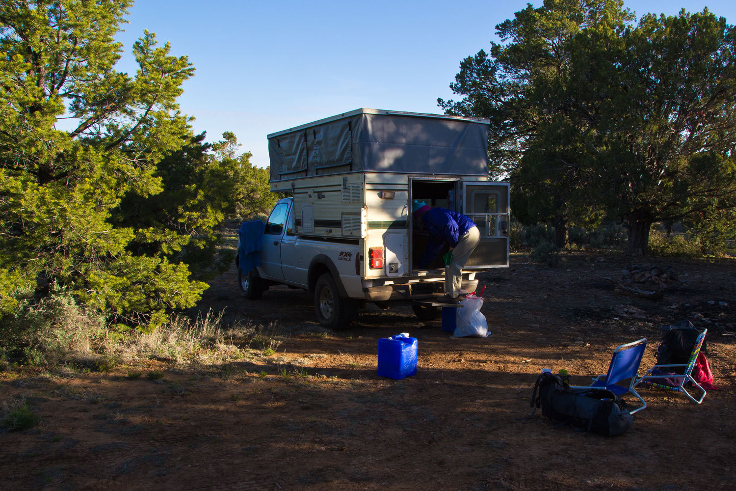
This was
also at 6000 feet at the top of the plateau. Those 1700 feet above Tuweep’s
elevation made a difference. This was a cold night, but the coyotes sang us to
sleep.
What would
be in store for the ski3piners for Wednesday?
Would they take a day off for rest?
"There's
a large animal in the road ahead," the Lady said.
"Is it
a cat?" I asked quick as I looked up from driving - negotiating the ruts,
rocks, and tree limbs. We figured the 5 or 6 mile drive in to this remote trail
head on the North Rim of the Grand Canyon would take us a bit over an hour.
This was proving about right as we traveled along the plateau riddled with
pinyons, junipers, and sage in the early morning light. We were searching for our
own private piece of Grand Canyon National Park.
"No,
it's a bear. It moves like a bear. It's a bear". The Lady knows animals.
I saw the
rump about 20 yards ahead. He glanced over his shoulder and looked at us and
stepped off the road into the sage and completely disappeared. It was a bear.
Bears are incredible creatures.
I won’t give
you specific details on where we went. Wouldn’t want to spoil your fun and with
a map this should be easy to figure out. Figuring stuff out, that’s part of the
trip, right?
We had
greatly enjoyed the Tuckup Trail along the plateau. Grab your Vulcans Throne
and Fern Glen Canyon quads and take a look at the trail as it continues along
the inner plateau to the east. We didn’t see anyone on the trail out from
Tuweep, head out further and the odds for solitude would be even better. It
winds around long side canyons, there are springs to find, and it even takes
you in the vicinity of the dome. We were
heading to a trailhead for a trail that dropped from the high plateau down to
the inner plateau and intersected with the Tuckup Trail. Yup, we were heading
back down.
After
dropping down a couple of short steep sections the trail took a gentler grade
and dropped into a wide open canyon with cliffs above. It was big country.

And like
other spots in the Grand Canyon, everything was so fascinating.
In such a
broad piece of the inner canyon, we figured this area had to have signs of
recent human use. We soon found evidence.

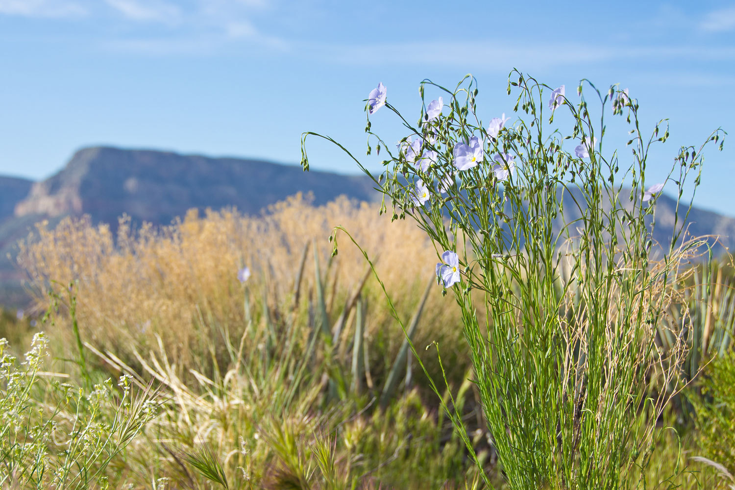
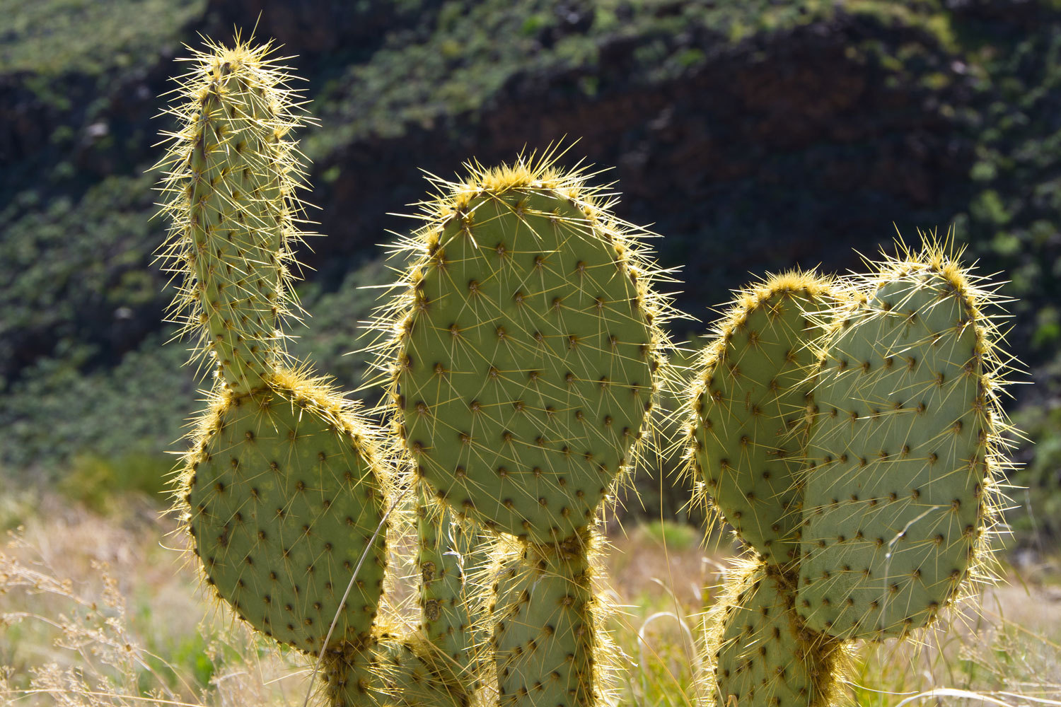
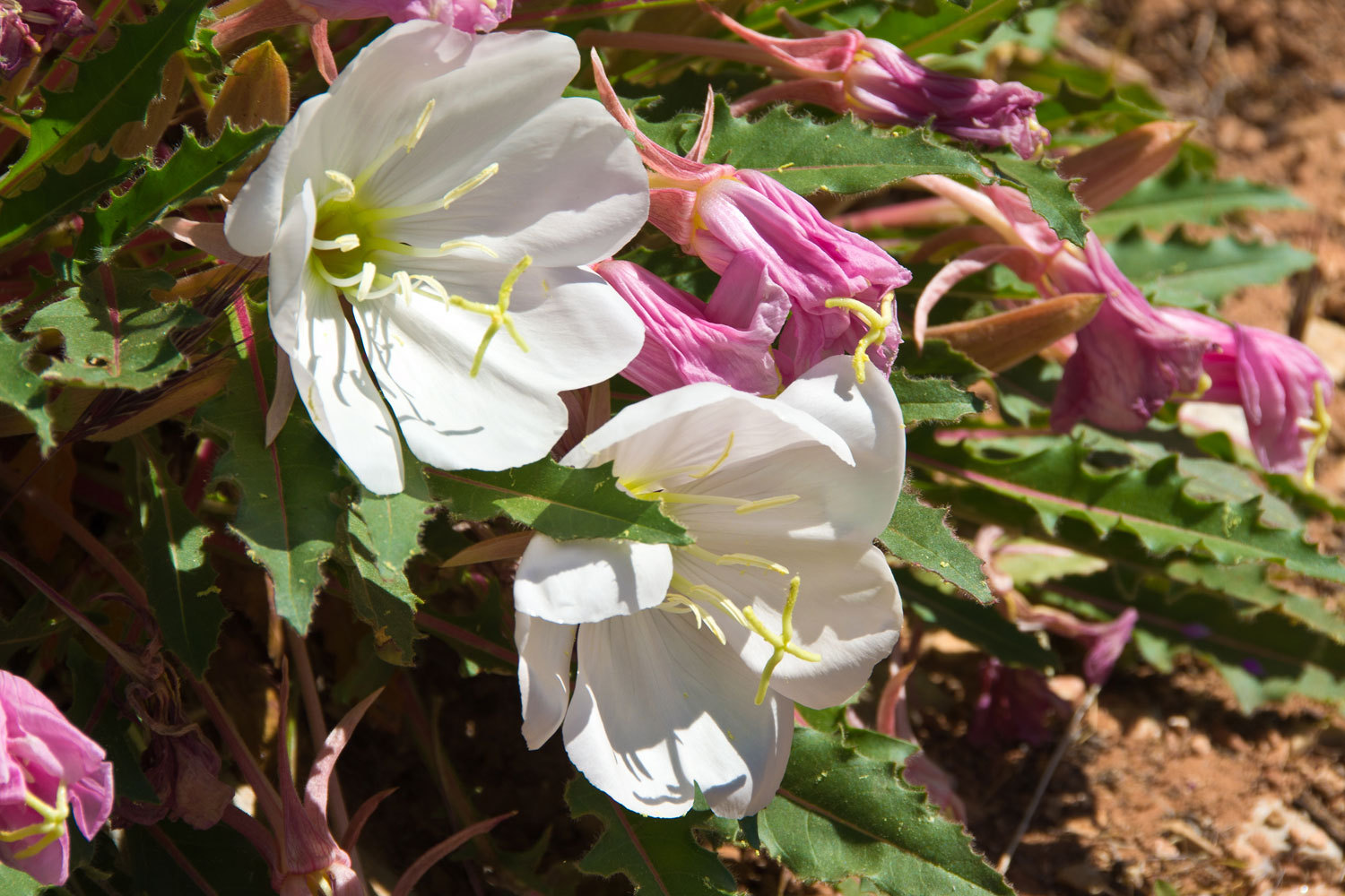
Wildflowers
were all around. As we got back down in the red sandstone belt, we came upon
these beauties.
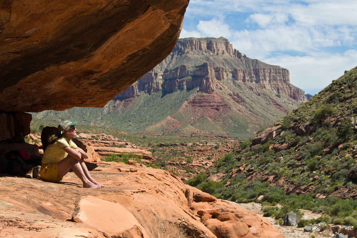
After about
3 or 4 miles we reached the red sandstone with overhangs and ledges and found
this area mesmerizing. We explored around and then just found a nice place to
sit.

We snacked
and napped and the Lady put in some time with her book. But mostly we just sat
and watched the world and listened to the sounds, the wind, the birds. We
watched the shadows move across the rocks.
On our way
back out there was a spot I wanted to check out that we had seen in the
distance. It just looked like a great place for someone to live. My hunch was
right. There was evidence of the remains of an old wall and the kitchen was
still intact in the middle, left untouched for who knows how many years.
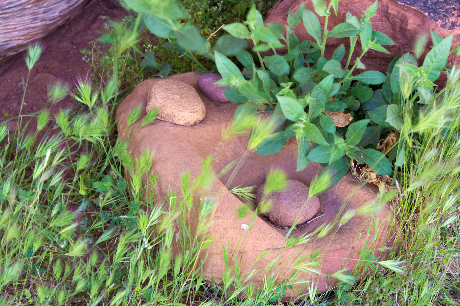
I am giving
no information about the location or further photos. These are extremely
special archeological treasures. When we come upon arc sites, it is my habit to
treat these sites the same as if I had come upon a crime scene. Stop, don’t
touch anything, record the location, take notes, take pictures – remember you
stopped, you are not moving, so only from your initial vantage point – and back
out exactly the way you came in. I will send a note to the Park archeology
department along with copies of all the photos I took here. It is likely this
is a known site but perhaps the photos can help with a date reference and help
document any change. Bottom line, these sites are so special and to find one
completely untouched is a special occurrence. It was left exactly the way we
found it.
This had
been another exceptional day in Grand Canyon. We were having incredible
adventures with wonderful surprises around every corner.
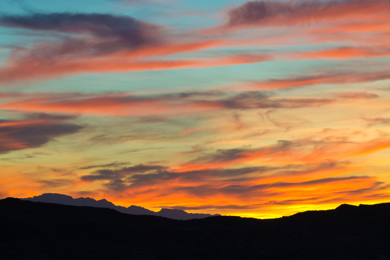
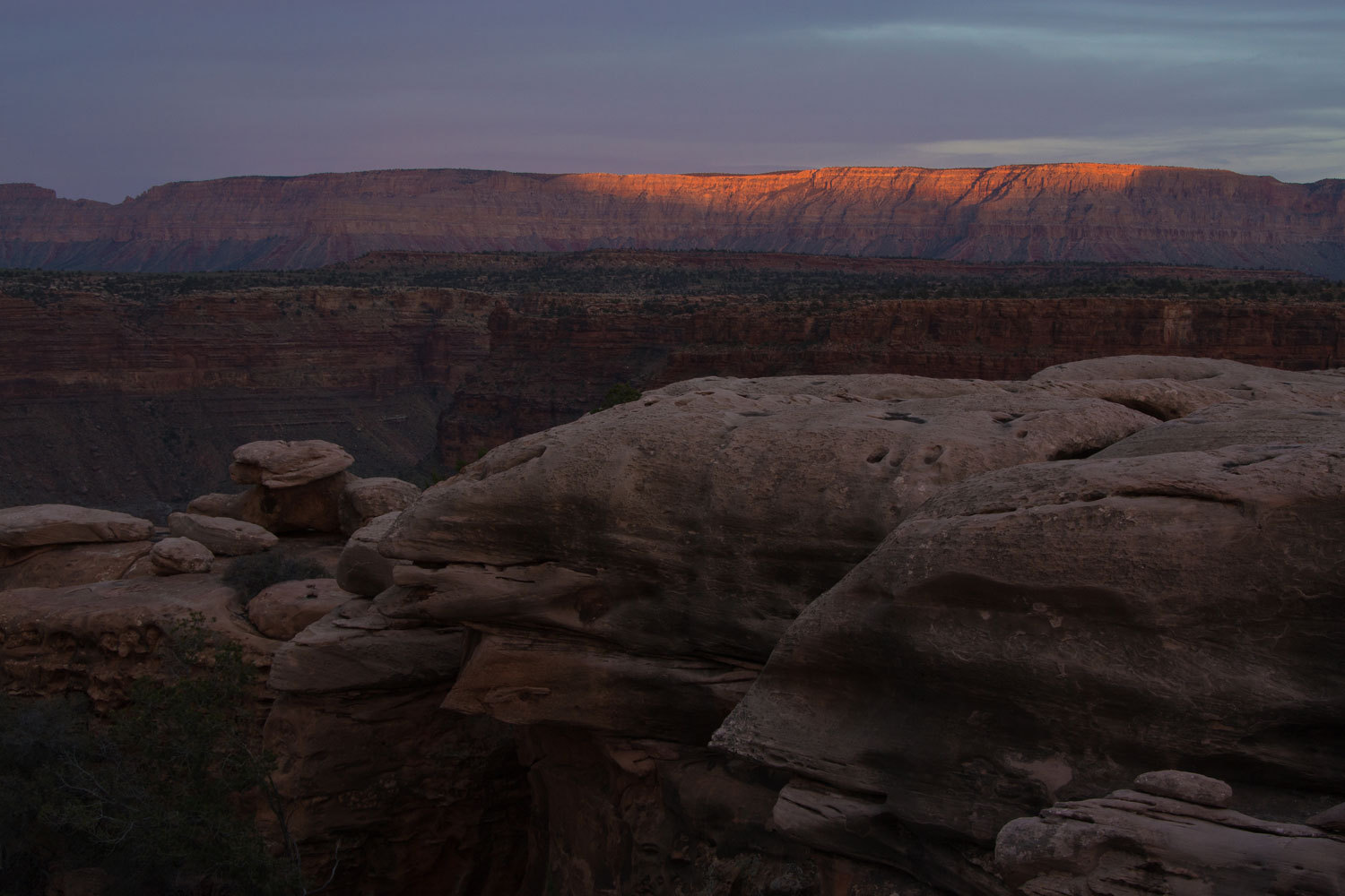
The angle of
the afternoon sun told us it was time to head back up.
Back at the
truck we decided we’d have dinner on the rim and watch the sunset. We were
completely alone.

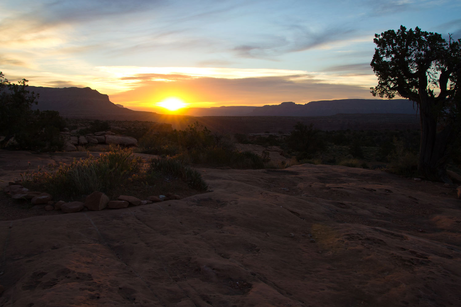
And for our
last morning at Grand Canyon, Thursday, it just was so fitting to have
breakfast at sunrise on the edge.

As we were
packing up, preparing to end our visit to Grand Canyon, the Lady’s eyes
sparkled as she said, “This was such a great time and it was wonderful to learn
there is so much more to the Grand Canyon than just the ‘big ditch’!”
We had a few
days of travel ahead to get back home. Thursday was to be a day of exploring
western history.
After so
many days, when we hit the pavement back on Highway 389, it felt so strange and
smooth. We headed back through Hurricane and then on through Saint George. We
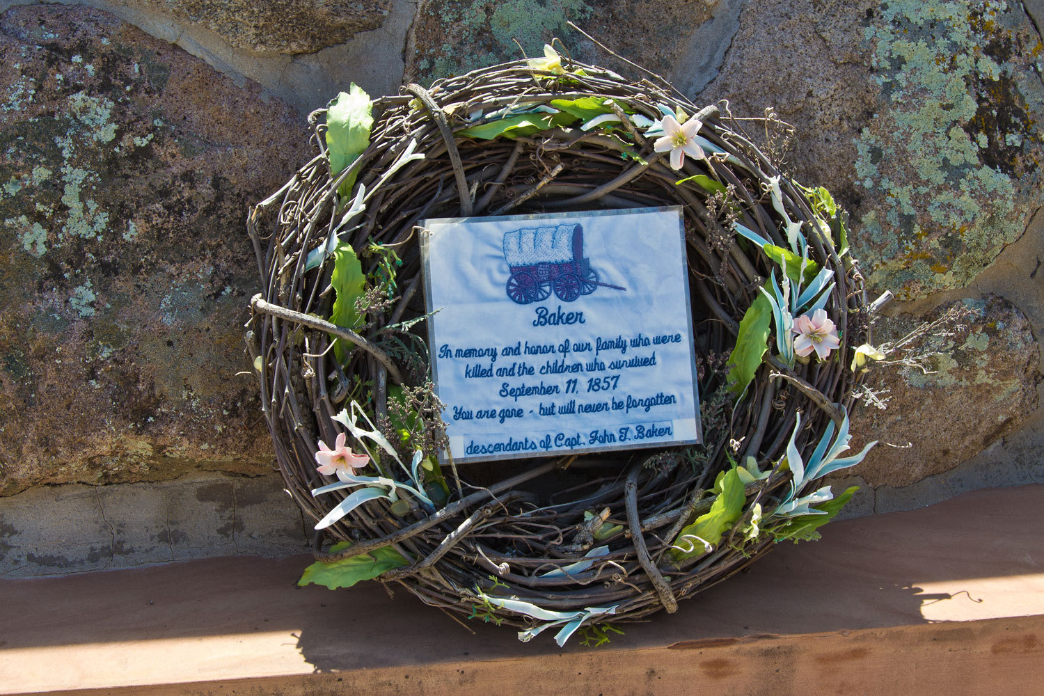
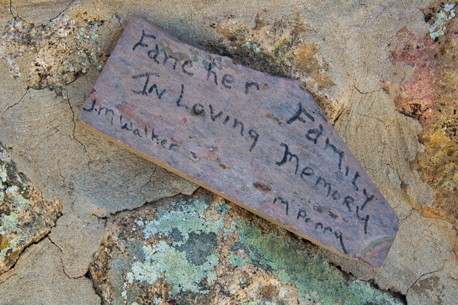
headed up Highway 18 toward Enterprise, Utah. Our first stop was Mountain Meadows Massacre site. Lots of new memorials have gone up here since the late
1990’s.
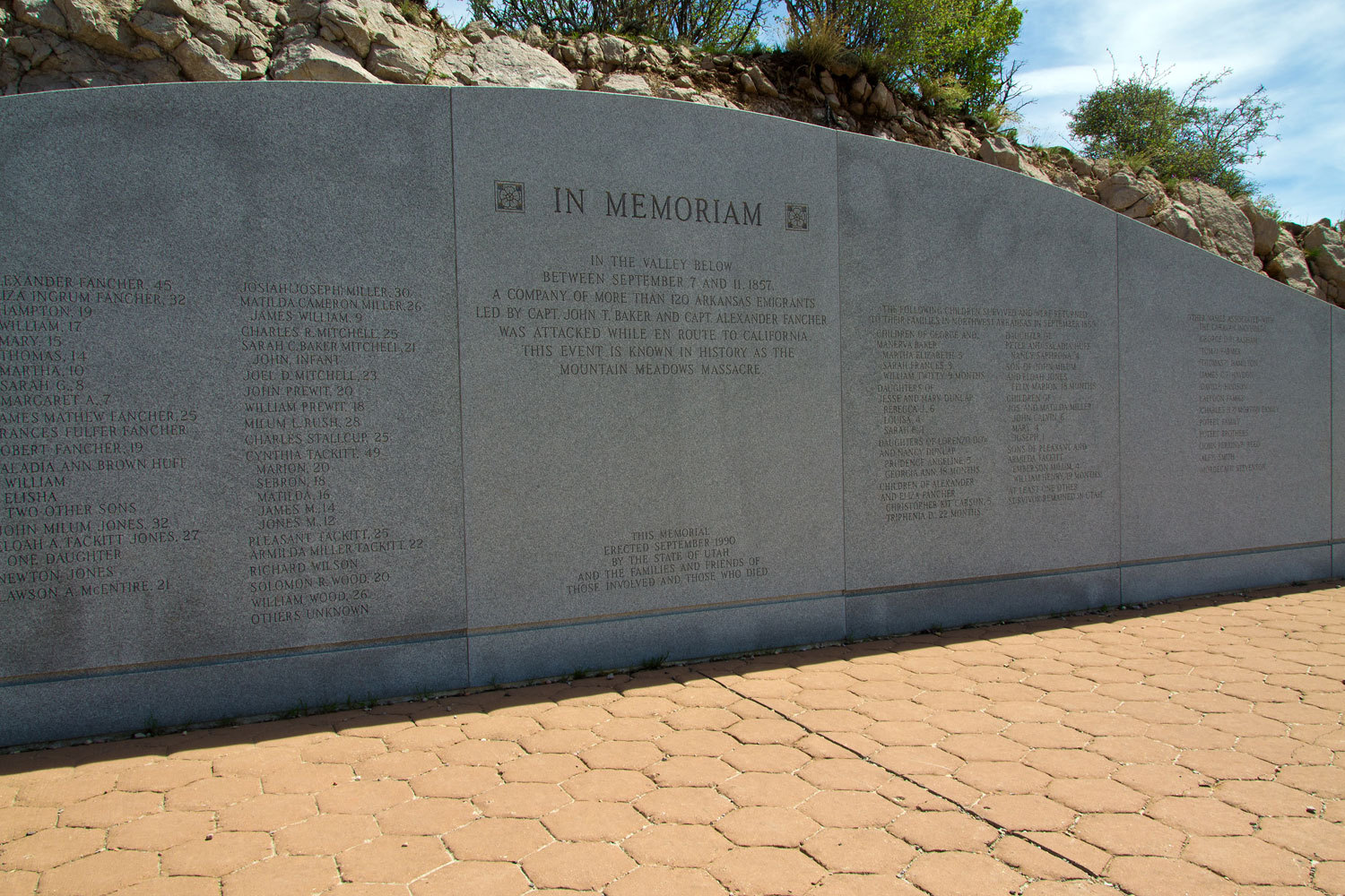
For us the
most thought provoking and humbling were the small personal memorials placed by
relatives of the two slain leaders of the doomed emigrant party.
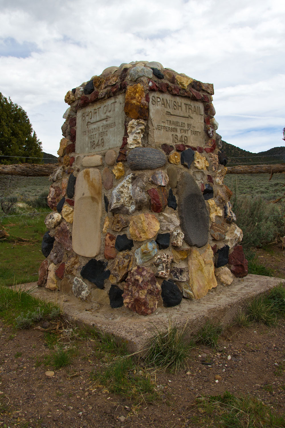
From here we
headed to find a very special spot along the historic “Old Spanish Trail” that
ran from Santa Fe to Los Angeles. The spot we were looking for lies between
Enterprise and Newcastle, Utah.
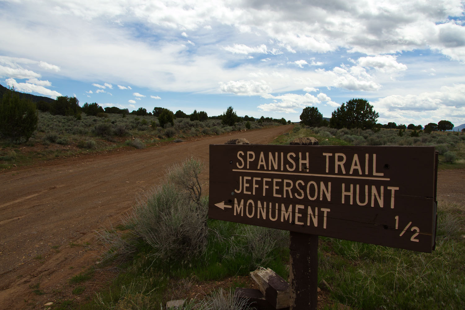
This was
where the lost 49ers including Manly & Rogers, the Bennett & Arcan
Party, and the Jayhawkers, left the wagon train led by Jefferson Hunt, a Mormon
who had been hired by the group to lead them from Salt Lake to Southern
California. This was the start of the infamous shortcut that ultimately led
them into Death Valley.
From here we
went west into Nevada and to find a spot to spend the night. We thought we’d
check out Cathedral Gorge, a Nevada State Park.
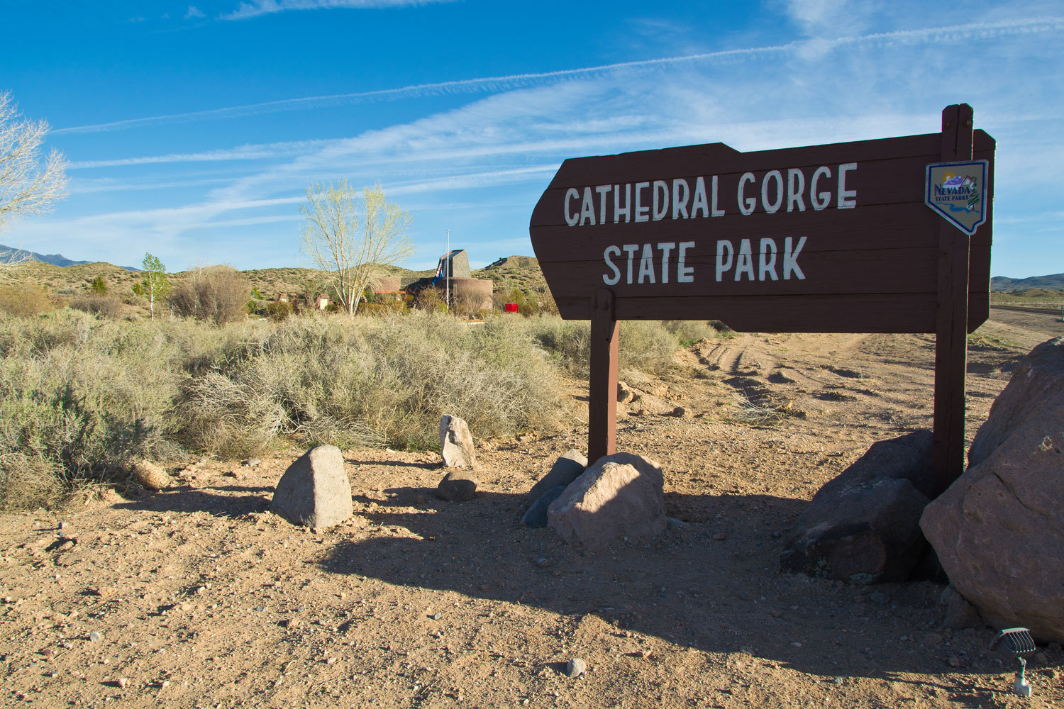
We were
unsure about campground living after our last experience. We pulled into the
visitor center and the very helpfully woman said, “Go in, check it out, I think
only a few sites are taken. If you want to stay, just pick a site and you pay
there.” We thanked her and the Lady read the brochure as we drove in. “It says
here there are showers at the campground.” “Really,” I replied. “We’ll have to
check that out.”
The
campground was quiet, the restroom was heated and the showers were free; hot
showers and hot water in the sinks. Seven bucks to enter the park and seventeen
to camp. The empty sites were all freshly raked. The gravel had been raked
smooth. This place is well cared for.
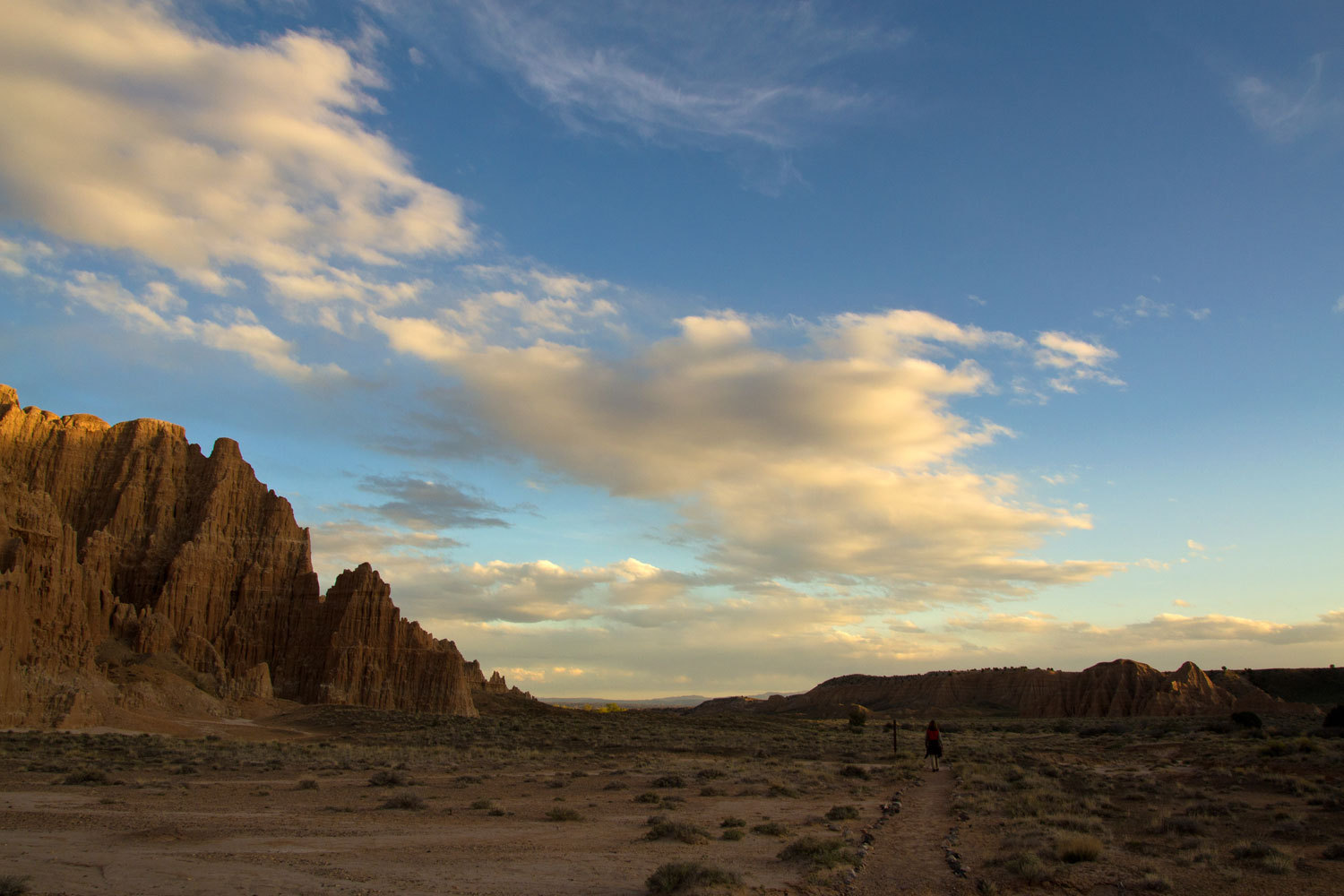
We enjoyed
our showers, had supper, grabbed the camera and did the four mile loop trail up
the canyon in the evening light.
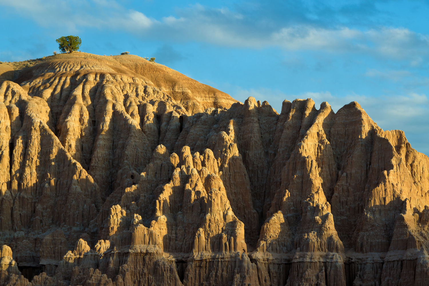
Cathedral
Gorge is just east of what people like to call Area 51. One of the state
highways that runs up to Highway 6 is called the extraterrestrial highway.
People see strange lights in the sky around these parts. Watch the skies when
you stay here. Trust me.
The next
morning, after wiggling out of the sleeping bags, we headed for the restrooms.
It was cold, in the thirties. The Lady said she’d meet me back at the camper.
When I got back, she was busy at the stove.
“I’m making
them hot chocolate.”
“Making who
hot chocolate?” I asked.
“The site
with the minivan and tent across the way. They came in after dark. As I was
coming back the man asked if I could give him a sauce pan to heat water. He
wanted to make hot chocolate for his kids. He was to meet a friend who didn’t
show. The friend was to bring the cooking pots. He has a son about 8 and
triplets that look to be about 3. He has his hands full. I told him I’d be
happy to make chocolate for him."
She picked
up a box of Quik and showed it to me.
“He gave me
this, looks like he just grabbed stuff at the grocery store. He must not know
this mixes with milk. I’m making them all hot chocolate from our stuff.”
The four
cups were soon steaming and the Lady said, “You’re going to help me carry all
this over to them.”
We are going
to remember this place as a good overnight stop.
Our
destination for today was the middle of Nevada. We needed a hot spring soak.
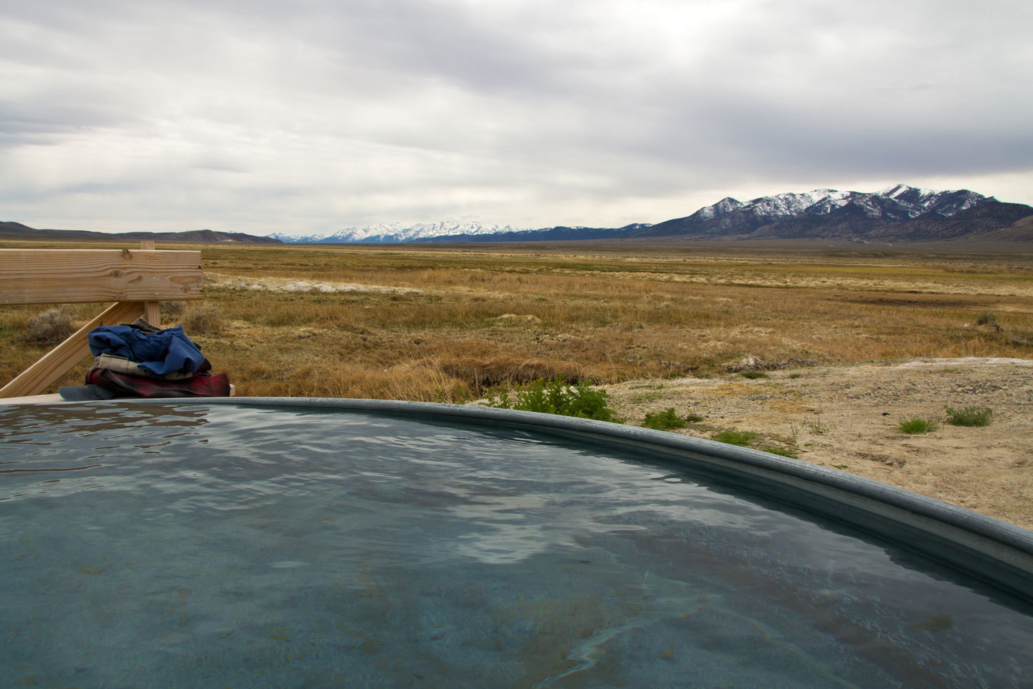
When the air
temperature is 40, this sure feels good.
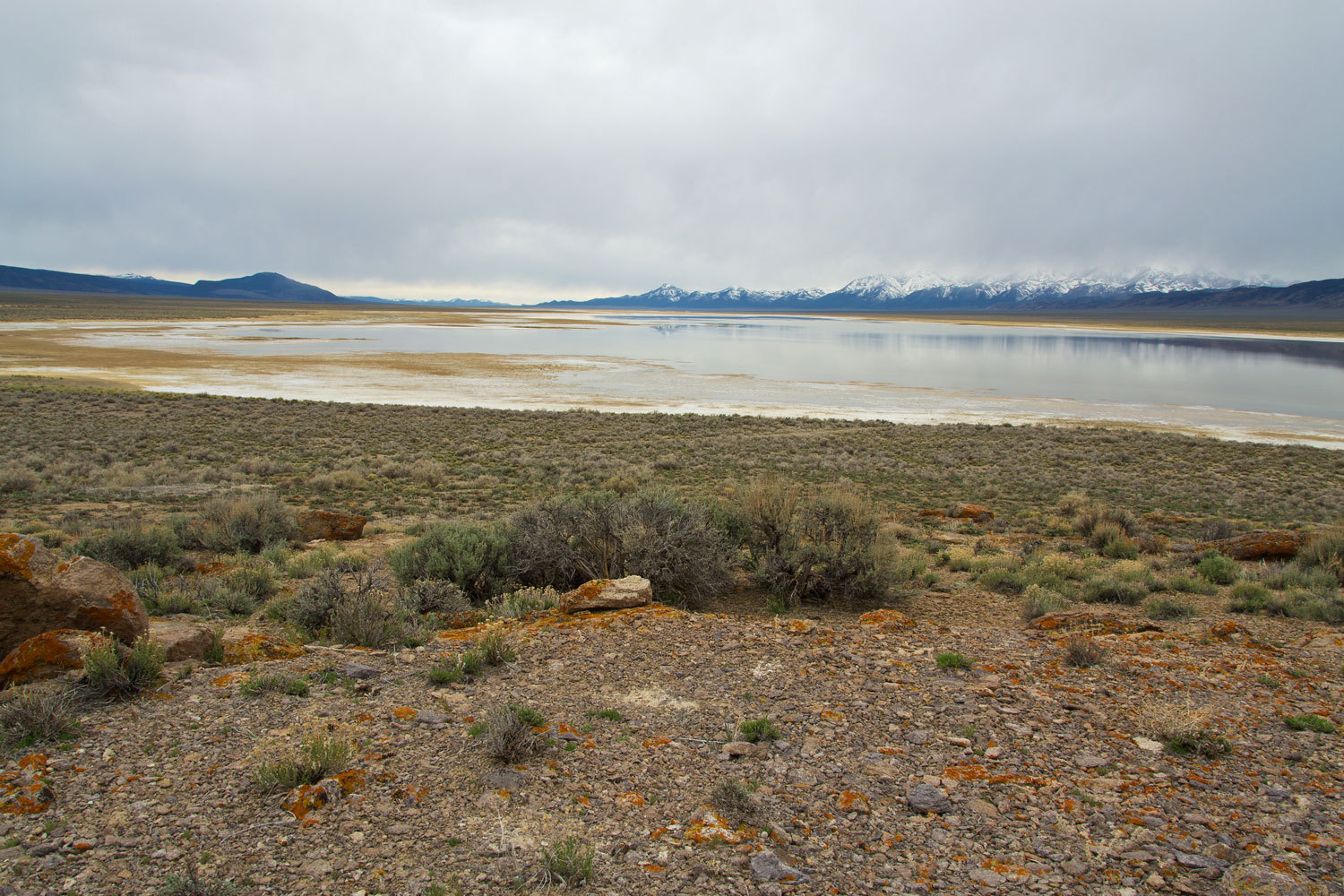
From here we
headed to the sink in the Monitor Valley basin. We enjoy the Basin and Range.
Finding the sink filling with water from winter run off along with waterfowl and
with the striking mountain ranges on both sides, we figured if the clouds
cleared some overnight this would be a spectacular place to watch the sunrise.
We had
dinner and the wind increased. “Do you think it is blowing a storm in or a
storm out?” I asked.
“We’ll
probably find out,” she answered.
With snow
coming down in the morning, the question was answered.
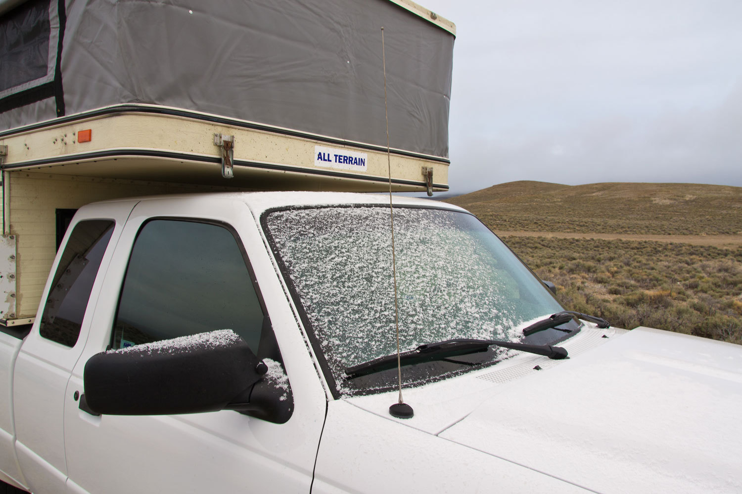
Our drive
home was uneventful through snow and rain.
We traveled
1743 miles. We averaged 17.04 mpg. We paid $400 for gas. With breakfast in
Bridgeport, a couple of blocks of ice and fresh vegetables from the market in
Hurricane, and the Cathedral Gorge fee, this vacation cost around $500.
It was one
of our best trips. We are rested. We are happy. Travel safe and we hope you've
enjoyed our story.