please remember you can click on a photo to see a larger version & highlighted text are links to additional information
Nevada & Utah
We both, of course, knew it was on the horizon, a milestone wedding anniversary, our 40th. As we were just about to depart on our flyfishing adventure in August, I made this suggestion to the Lady, “Let’s go to Colorado for our 40th and ride the narrow gauge railroad.” You should have seen her face. “You know I’ve wanted to do that! Let’s do it! That would make me happy!” she exclaimed. We were quickly on the computer and made online reservations. We were set and, best of all, the Lady was thrilled.
Our route to Colorado is just a short jaunt from our front door here at home, Highway 50. In Nevada it is known at the Loneliest Road in America. Thirty years ago, it was lonely. Those days are long gone. The landscape and vistas still stir the soul, but you are no longer lonely and you do not have it all to yourself.
We left at noon after the Lady’s check up with Doc. He refilled her prescription to travel. Evening found us in a secluded spot near the center of Nevada. The storms clouds were clearing and it was a quiet, spectacular start to our trip.
The next day we finished off Nevada and took care of half of Utah before we decided to stop midafternoon and find a spot to spent the night. On the section of highway 50 east of Scipio we learned a valuable lesson about Utah drivers. Their driving mindset out on the open road is, “What the hell are you doing in my way?” as they seem genuinely surprised to be suddenly on our bumper, jerk their vehicle into the left lane (sometimes they take the time to look for oncoming traffic), and roar by. Speed limits are only a suggestion and, obviously, a real nuisance. On the bright side, it was entertaining.
Maple Grove Campground is a few miles off of 50 up against the eastern flank of the Pavant Range. The campground was almost empty and we selected a nice private site.
Maple Grove Campground is where we met “Bud.” You know the routine, find an empty (and/or non-reserved) site in a USFS campground, get an envelope at the sign at the entrance, pay the fee, and put a tag on the numbered post at your campsite. At the entrance sign at Maple Grove Campground the envelope container was wrapped in red duct tape. So was the “iron ranger,” the tube with the slot to drop the payment envelope into. A handwritten sign alleviated our confusion – “See ‘Bud’ at site 16.”
Site 16 was crowded. There was a camp trailer, across from it was a large easy up with a screened enclosure. There were 2 trucks, a car, and an electric cart adorned with cleaning supplies. A US flag and a USMC flag flew over everything on two separate poles. “Hello!” the Lady cried as we squeezed between the vehicles.
We all make assumptions; we can’t help it. With that proud red Marine Corps flag overhead, I expected spit and polish, rigid straight spine, and a snappy, “Yes, ma’am. United States Marine Corps, ma’am. How may I help you ma’am?” That was not Bud. Bud was thin, average height, and wore a well-worn loose fitting colorful shirt, not tucked in. He had long, thin, scraggly blonde hair. His chin whiskers were done up with two short braids hanging down. I was convinced we had found Johnny Depp’s Captain Jack Sparrow's blonde headed second cousin.
“Have you stayed here before?” he asked.
“No.”
“Oh, then you are in for a treat. This place is a little slice of heaven. A little slice of heaven, oh my. And the water. They put in a well here. Now, they didn’t go down into the ground. They when straight into the mountain, horizontal I guess you’d call it. And they hit glacial water. Oh my, it’s the best water in the whole world. Wait till you try it. People drive here just to get the water. You just need to open one of them spickets. There’s one near your site. It’s the good water that comes out.”
Bud took a breath and the Lady seized the chance.
“We’re here early and there’s still daylight.” She asked, “Any place to hike?”
“Oh, you want to hike? There’s hikes here. There’s the train stop. Did you see site 10?”
“Yes, we saw site 10 and know where it is,” I quietly answered.
“Good! Walk through site 10 and look on the left. There’s a board walk. That takes you to the trail for the train stop. There used to be a train that ran up through here. The workers would wait for the train at the train stop. There’s a little shelter there now that they put in. It doesn’t say anything about the train, but that’s where the train stop was. My wife, now she died three years ago, but that was a favorite place of hers. She’d go there to meditate.”
“Other hikes?” the Lady prompted.
“Oh yeah. This stream here, it comes right out of the mountain. Did you see the three group areas?”
“Yes,” I tossed out the right answer.
“Good. Now A & B are the usual group sites, like for groups. But C is still a group site but it has individual camping sites.”
“Yes, we saw that,” I noted.
“And they’re numbered. To see the stream come out of the mountain you go to C1. Walk right by the tables. To the right there’s a little bridge, look for the bridge. Cross that and the trail takes you to the place the stream comes out. Now if you go to C5, there’s a trail that almost takes you to the top of the mountain. It is steep though. There’s a waterfall. It might be a couple of miles.”
“Where the stream comes out of the mountain sounds interesting,” I said. “To confirm, you access the trail for that through C1 and C5 takes you to a longer trail up a steep canyon?”
“Yup! But don’t go to C4. If you go to C4 you get blowed up.” Bud chuckled. “That’s a good one. Not a lot of people get that one!”
“I do.” I finished the conversation and we thanked Bud for the information. Insofar as campground hosts go, Bud was one of the most colorful we’ve met.
We settled into our campsite. We were curious about the species of maple trees that gave the campground its name. The Lady went to work with her Seek app – Bigtooth Maple (Acer grandidentatum) They were just beginning the change to their fall colors.
Before dinner, we walked up to C1, quickly found the bridge, and, about 50 yards further, the stream poured out of two 18” diameter white PVC pipes set side by side. Not much of a hike. We still had energy so we walked over to site 10 to find the train stop. That hike was about 100 yards in length. We wisely decided to avoid C4.
The group areas – above our campsite – were empty. We walked up and set our chairs in the open and spent the evening well into dark. Great horned owls called from the cliffs. One, on silent wings, flew to a tree top near us and watched for prey. With a sudden dive to the ground, dinner was served. Storm clouds surrounded us and, as darkness fell, the sky was lit up with flashes of lightning. We took in the show.
The bright flash and then deafening crack of thunder woke us both at four in the morning. A storm was on us. Rain pounded the roof, but it passed quickly. The lingering storm clouds provided a vibrant sunrise.
We continued our drive to Colorado. This was an easy day; we didn’t need to make much distance. It gave us the chance to visit several spots that have been on our “list.”
There is an interesting feature, the Crystal Geyser, on the bank of the Green River, a few miles south of Green River, Utah. John Westley Powell first made reference to the mineral spring in 1869 but an exploratory oil well in 1935 hit a large pocket of carbon dioxide gas. The result was a rare cold water geyser, very similar to shaking up a container of carbonated beverage and quickly opening it. It is amazingly colorful with terraces of travertine.
The eruptions are erratic and one did not occur during our visit. There was a large group of side by side riders (swarm of insects) parked at the geyser. I believe they were conducting an experiment to see what happened first – the geyser erupted or they ran out of beer.
Moab is a place that has overdosed on testosterone and tourism. Large billboards seem to plead for compliance. One reads, “Recreate Responsibly in Moab. Respect, Protect, Preserve.” Another – “Please Stay on Trails. Drive Slow in Town.” This is in stark contrast to the key catch words used to attract customers to local businesses – “Extreme” and “Outlaw.” The place was packed with people; far, far too many for us. But there were two spots close by that were on “the list.” We persevered. Both sites are along the north bank of the Colorado River, just outside of the little city.
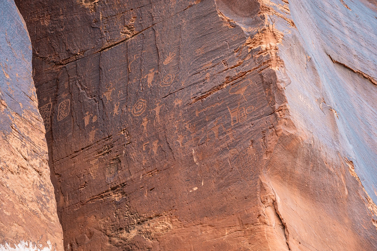
The first is a large petroglyph panel. The glyphs are very high up on the rock and they are all small in size. Were there once boulders – since washed away by the river – the artists could stand on? Were there shelters here along the cliff face where the artists could stand on roofs?
Many were pecked into rock that did not have desert varnish. These were delicate, hard to see, and of a different style.
A short distance down the road is another site, fairly high above the river with both petroglyph panels and dinosaur tracks.
Large blocks of sandstone have fallen from high up on the cliffs. Two rotated 90° when they fell and show fossil dinosaur tracks on, now, close to vertical rock faces.
It was a scramble to get up onto the ledges, but was well worth the effort.
There were several hunting scenes.
My favorite was this depiction of an archer disguised as a sheep ewe to get close to a full curl bighorn ram.
This one we found quite curious. Any ideas as to what it is? A camel with a waddle?
We continued south and then turned west and crossed the boundary into Bears Ears National Monument.
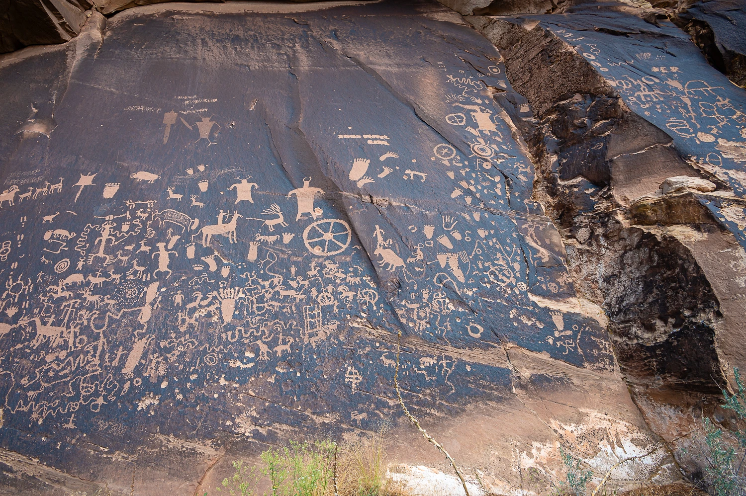
Our destination was Newspaper Rock.
Several small elements caught my eye. In the photo below are newer (brighter) petroglyphs among older (faded) glyphs. In the upper right a mountain lion was put on the back of a bighorn sheep.
Six toed human footprints (along with a specularly big foot). And, unfortunately, more modern bullet holes.
Hunting scenes with many riders on horse back.
Bighorn, bison, deer, elk, flying squirrels, and also classic bear prints.
Three vehicles pulled into the parking lot right after we did. Three men from the east coast – Florida, Virginia, Georgia – were enjoying their trip of a lifetime adventure in Utah with their expedition vehicles. The Lady has a wonderful and easy, natural, knack of engaging people in conversation. All three men were soon regaling her with stories of their trip, reliving the adventures, as if they had known the Lady all their lives. It made for a fun background as I studied and photographed Newspaper Rock. A highlight of their adventure was a particularly difficult section of road, “Honest to god, it took us two days to go three and half miles.” The classic country tale popped into my head about the old farmer, after hearing a similar story, commented, “Yup, I owned a truck like that once, myself.” The four of them never inquired why I was chuckling.
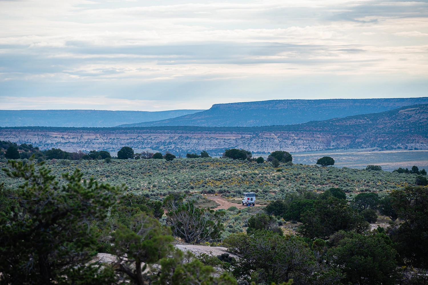
It was now late afternoon and time to find a dispersed site to spend the night. Storm was building all around us so it sure would be nice to get settled before the excitement began. We found a wonderful spot up a series of dirt roads. The La Sal Mountains to the northeast were enshrouded in storm. A bit of sunlight highlighted the canyonlands at its flanks.
Another storm was just to our south and soon stretched from the Henry Mountains all the way to the La Sals. We were hit with wind driven rain, but were spared the brunt of the storm as we ate dinner. Right at sundown, the last rays of sunlight gave us a stunning display, the best evening light of our trip. Here is the changing light we experienced during our evening walk.
We again set out our chairs and sat out into the night. We were spared – at least for now – from a direct hit, but the light show encircled us. It was spectacular. Storm on top of us again woke us in the early morning hours, lightning, thunder, rain, and wind. Our morning coffee walk was under dreary skies with subdued light. We wandered and climbed a white sandstone bluff immediately to our west. Simple things, like an early morning walk, are among life’s best treasures.
We returned to our secluded campsite.
It was time to get to Colorado and catch that train ride.
Our adventure continues. Please click here for - Part Two.


No comments:
Post a Comment